The Flatts

Settlement in Staffordshire

England

The Flatts

Walsall Canal towards Pagett's Bridge
Walsall Canal towards Pagett's Bridge Credit: Ian S

The Flatts is a quaint village located in the county of Staffordshire, England. Situated amidst rolling hills and picturesque landscapes, it is renowned for its natural beauty and tranquil atmosphere. With a population of around 500 residents, The Flatts offers a close-knit community feel where neighbors are friendly and welcoming.

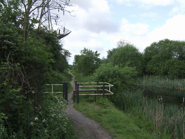
The village is characterized by its charming cottages made of local stone, giving it a distinct rural English charm. The Flatts is surrounded by lush green fields dotted with grazing sheep and cows, creating a scenic countryside setting. The nearby woods and meandering streams provide ample opportunities for outdoor activities such as hiking, cycling, and fishing.

Despite its small size, The Flatts boasts a few essential amenities to cater to its residents. There is a cozy village pub, The Flatts Inn, which is a popular gathering spot for locals and visitors alike. It serves a range of traditional English dishes and locally brewed ales. Additionally, the village has a small convenience store that caters to everyday needs.

The Flatts is also conveniently located near larger towns and cities, with Stafford being the closest urban center just five miles away. This proximity allows residents to access a wider range of services, including schools, healthcare facilities, and shopping centers.

Overall, The Flatts is an idyllic village that offers a serene and peaceful lifestyle amidst stunning natural surroundings. It is a perfect destination for those seeking a retreat from the hustle and bustle of city life.

If you have any feedback on the listing, please let us know in the comments section below.

The Flatts Images

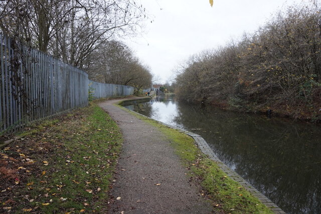
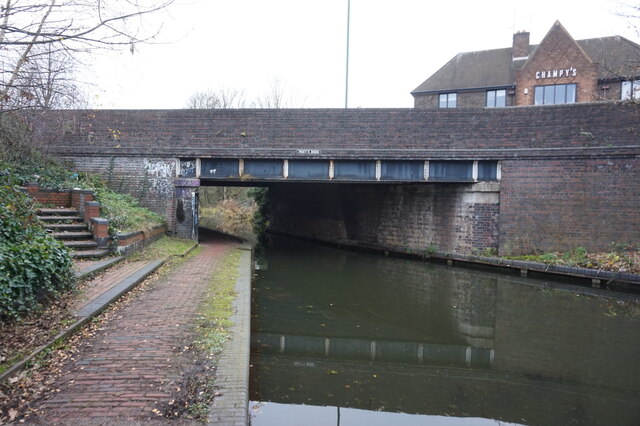
Images are sourced within 2km of 52.574695/-2.0238168 or Grid Reference SO9897. Thanks to Geograph Open Source API. All images are credited.

Walsall Canal towards Pagett's Bridge
Walsall Canal at Pagett's Bridge
Fellows Park The modern face of Pleck, seen from the railway bridge. The supermarket stands on the former site of Walsall FC's stadium.
Fellows Park
The modern face of Pleck, seen from the railway bridge. The supermarket stands on the former site of Walsall FC's stadium.
The changing face of Pleck The towerblocks alongside the Walsall Ring Road are soon to be demolished to be replaced by a Bovis Homes development. This will change the view <a href="https://www.geograph.org.uk/photo/20055">SP0097 : Fellows Park</a>.
The changing face of Pleck
The towerblocks alongside the Walsall Ring Road are soon to be demolished to be replaced by a Bovis Homes development. This will change the view SP0097 : Fellows Park.
The long reach of the demolition contractor The tower blocks on the Walsall Ring Road are disappearing quickly.
The long reach of the demolition contractor
The tower blocks on the Walsall Ring Road are disappearing quickly.
Demolishing Pleck Demolition in progress of the tower blocks next to the Walsall Ring Road. As with other tower blocks in Walsall this seems to be the preferred method of demolition instead of explosives.
Demolishing Pleck
Demolition in progress of the tower blocks next to the Walsall Ring Road. As with other tower blocks in Walsall this seems to be the preferred method of demolition instead of explosives.
Canalside Warehouse, Pleck - Walsall Canal I'm unsure of its original purpose but it's certainly no longer to do with the canals.
Canalside Warehouse, Pleck - Walsall Canal
I'm unsure of its original purpose but it's certainly no longer to do with the canals.
Pedestrians Only Public footpath between Bescot Road (M6 J9) and Bescot Crescent.
Pedestrians Only
Public footpath between Bescot Road (M6 J9) and Bescot Crescent.
The Brown Lion pub The facade of this old pub is wonderful with its tiles, it is sad that it is run down and looking shabby.  In another location with a bit of TLC it would be a busy place.
The Brown Lion pub
The facade of this old pub is wonderful with its tiles, it is sad that it is run down and looking shabby. In another location with a bit of TLC it would be a busy place.
The Brown Lion pub This old, but sadly neglected pub, has a wonderful tiled frontage.
The Brown Lion pub
This old, but sadly neglected pub, has a wonderful tiled frontage.
Brown Lion A Pub on Wednesbury Road, Pleck.
Brown Lion
A Pub on Wednesbury Road, Pleck.
Old Pleck Road Junction The junction with Darlaston Road.
Old Pleck Road Junction
The junction with Darlaston Road.
Pleck Methodist Church The church on Old Pleck Road.
Pleck Methodist Church
The church on Old Pleck Road.
Queen St Cemetery: Sister Dora Gate
Fellows Park in Walsall Walsall F.C. played at Fellows Park until May 1990.
Fellows Park in Walsall
Walsall F.C. played at Fellows Park until May 1990.
The Hillary Street End of Fellows Park
Fellows Park from the railway A Morrisons supermarket now stands on the site of Fellows Park.
Fellows Park from the railway
A Morrisons supermarket now stands on the site of Fellows Park.
Show me another place!

The Flatts is located at Grid Ref: SO9897 (Lat: 52.574695, Lng: -2.0238168)

Unitary Authority: Walsall

Police Authority: West Midlands

What 3 Words

///agenda.simple.ballots. Near Darlaston, West Midlands

Nearby Locations

The Flatts Darlaston Green

Related Wikis

Anson Branch

The Anson Branch is a short canal in the West Midlands, England. It runs for just over one mile from its junction with the Walsall Canal near Forster's...

Darlaston James Bridge railway station

Darlaston James Bridge railway station was a station built on the Grand Junction Railway in 1837, serving the James Bridge area east of the town centre...

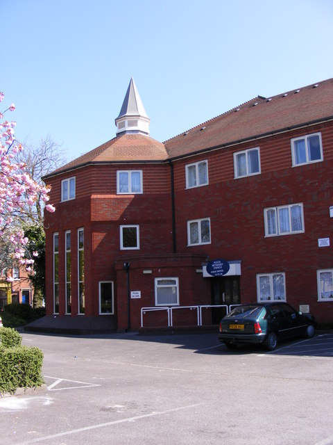
All Saints' Church, Darlaston

All Saints’ Church, Darlaston is a parish church in the Church of England in Darlaston, West Midlands County, England. == History == The first church by...

Darlaston Town (1874) F.C.

Darlaston Town (1874) Football Club is an English association football club that represents the town of Darlaston, West Midlands. They are currently members...

Bentley Canal

The Bentley Canal is an abandoned canal that was part of the Birmingham Canal Navigations. A very short section still exists where it joins the Wyrley...

James Bridge Copper Works

The James Bridge Copper Works was a copper refining plant in Walsall, Staffordshire, England. It was established as a smelting plant in 1917 on a site...

Darlaston railway station (1863–1887)

Darlaston railway station was a station built on the South Staffordshire Line in 1863. It served the town of Darlaston, and was located to the east of...

Darlaston Loop

The Darlaston Loop was a railway which connected the towns of Walsall, Darlaston and Wednesbury in the West Midlands of England. It was so named because...

Nearby Amenities

Located within 500m of 52.574695,-2.0238168
Waterway: turning_point
Lat/Long: 52.5765208/-2.0273255
Mini Roundabout
Direction: clockwise
Lat/Long: 52.5717651/-2.019805
Bus Stop
Walsall Rd / Station St
NaPTANAreaCode: 43000680601
Bus: yes
Naptan AtcoCode: 43000680601
Naptan Bearing: NE
Naptan BusStopType: MKD
Naptan CommonName: Station St
Naptan Indicator: adj
Naptan NaptanCode: nwmjdmgd
Naptan PlusbusZoneRef: BHAMNWS
Naptan Status: ACT
Naptan StopType: BCT
Naptan Street: WALSALL RD
Naptan Towards: Walsall
Public Transport: platform
Route Ref: 34;37;39;334
Shelter: yes
Shelter Ref: 203241
Source: WMCA
Lat/Long: 52.5729918/-2.0197293
Bus Stop
Walsall Rd / Station St
NaPTANAreaCode: 43000680602
Bus: yes
Naptan AtcoCode: 43000680602
Naptan Bearing: SW
Naptan BusStopType: MKD
Naptan CommonName: Station St
Naptan Indicator: opp
Naptan NaptanCode: nwmjdmgj
Naptan PlusbusZoneRef: BHAMNWS
Naptan Status: ACT
Naptan StopType: BCT
Naptan Street: WALSALL RD
Naptan Towards: Darlaston
Public Transport: platform
Route Ref: 34;37;39;334
Shelter: yes
Shelter Ref: 203238
Source: WMCA
Lat/Long: 52.5727928/-2.0196447
Bus Stop
Walsall Rd / Park Lane
Bus: yes
Naptan AtcoCode: 43006150001
Naptan Bearing: SW
Naptan BusStopType: MKD
Naptan CommonName: Park Lane
Naptan Indicator: after
Naptan Landmark: Riva Bingo
Naptan NaptanCode: nwmpmdam
Naptan PlusbusZoneRef: BHAMNWS
Naptan Status: ACT
Naptan StopType: BCT
Naptan Street: WALSALL RD
Naptan Towards: Darlaston
Naptan Verified: no
Public Transport: platform
Route Ref: 34;37;39;334
Source: WMCA
Lat/Long: 52.5712751/-2.020362
Mini Roundabout
Direction: clockwise
Lat/Long: 52.5722124/-2.0196534
Cafe
Busters
Smoking: no
Lat/Long: 52.5703039/-2.0226612
Traffic Signals
Source: bing
Traffic Signals Direction: backward
Lat/Long: 52.5752905/-2.0176325
Turning Circle
Source: bing
Lat/Long: 52.572299/-2.0286541
The Flatts
Place: suburb
Source: OS_OpenData_StreetView
Lat/Long: 52.5744782/-2.0270784
Mini Roundabout
Lat/Long: 52.5722652/-2.0186372
Addr Housenumber: 10
Lat/Long: 52.5715525/-2.0197205
Addr Housenumber: 12
Lat/Long: 52.5715536/-2.0197764
Addr Housenumber: 14
Lat/Long: 52.5715315/-2.0198048
Addr Housenumber: 16
Lat/Long: 52.5715108/-2.0198354
Addr Housenumber: 18
Lat/Long: 52.5714887/-2.0198661
Addr Housenumber: 2
Lat/Long: 52.571464/-2.0195623
Addr Housenumber: 20
Lat/Long: 52.5714611/-2.0199014
Addr Housenumber: 4
Lat/Long: 52.5714816/-2.0195987
Addr Housenumber: 6
Lat/Long: 52.5715026/-2.0196345
Addr Housenumber: 8
Lat/Long: 52.5715229/-2.0196732
Traffic Signals
Source: bing
Lat/Long: 52.5751721/-2.0172707
Cafe
The Breakfast Bar
Addr Postcode: WS10 8XB
Cuisine: breakfast
Fhrs Id: 1194299
Internet Access: no
Opening Hours: Mo-Sa 07:30-13:00
Smoking: no
Source Addr: FHRS Open Data
Lat/Long: 52.5714119/-2.0242847
Shop: convenience
Lat/Long: 52.5725617/-2.0202651
Darlaston Rd / Railway Bridge
Naptan AtcoCode: 43000680201
Naptan Bearing: NE
Naptan BusStopType: CUS
Naptan CommonName: Railway Bridge
Naptan NaptanCode: nwmtatwg
Naptan Status: ACT
Naptan StopType: BCT
Naptan Street: DARLASTON RD
Naptan Towards: Pleck
Public Transport: platform
Route Ref: 334
Source: WMCA
Lat/Long: 52.5746349/-2.0183128
Give Way
Direction: forward
Source: bing
Lat/Long: 52.5753515/-2.0181077
Traffic Signals
Source: bing
Lat/Long: 52.5749392/-2.0178245
Noexit: yes
Lat/Long: 52.5752367/-2.0178698
Give Way
Direction: forward
Source: bing
Lat/Long: 52.5754945/-2.0181647
Give Way
Direction: backward
Source: bing
Lat/Long: 52.5755863/-2.0177133
Crossing
Crossing: unmarked
Crossing Island: yes
Tactile Paving: yes
Lat/Long: 52.5757932/-2.0175987
Crossing
Crossing: unmarked
Crossing Island: yes
Tactile Paving: yes
Lat/Long: 52.57521/-2.0176256
Cycleway: asl
Lat/Long: 52.5751805/-2.0172432
Cycleway: asl
Direction: backward
Lat/Long: 52.5752501/-2.0176304
Cycleway: asl
Lat/Long: 52.5749199/-2.0178532
Barrier: lift_gate
Lat/Long: 52.5747593/-2.0223143
Darlaston
Construction Railway: station
Lat/Long: 52.5754343/-2.0199324
The data included in this document is from www.openstreetmap.org. The data is made available under ODbL.

Have you been to The Flatts?

Leave your review of The Flatts below (or comments, questions and feedback).