Sutton cum Lound

Settlement in Nottinghamshire Bassetlaw

England

Sutton cum Lound

The River Idle. A walk from the Idle valley visitors centre.
The River Idle. Credit: steven ruffles

Sutton cum Lound is a small village located in the county of Nottinghamshire, England. Situated approximately 6 miles east of Retford, the village is nestled in the Bassetlaw district. With a population of around 200 residents, Sutton cum Lound is known for its peaceful and rural setting.

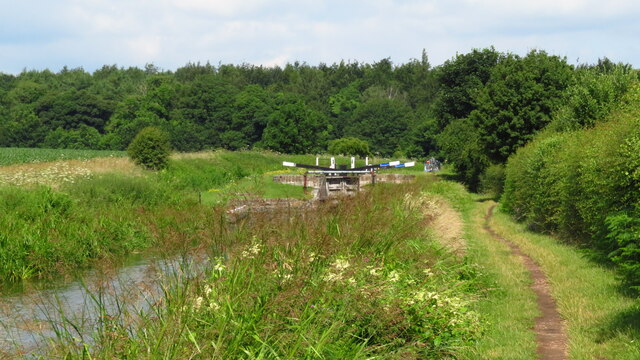
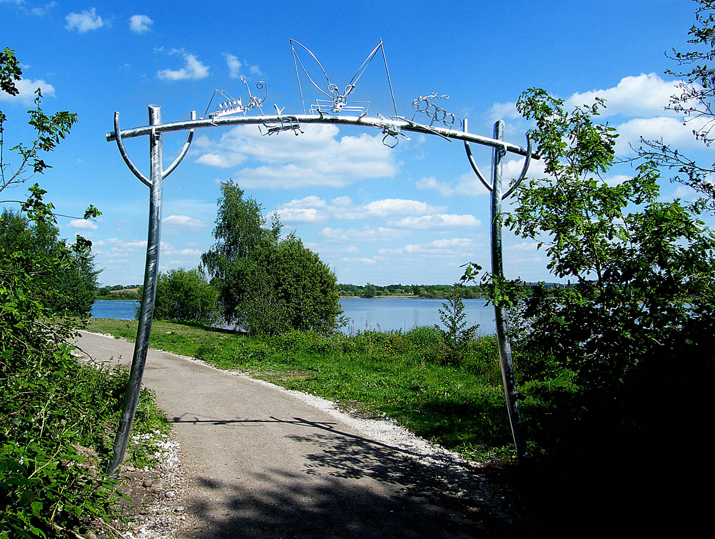
The village is surrounded by picturesque countryside, characterized by rolling green fields and charming woodlands. It is a popular destination for those seeking a tranquil retreat from the busyness of urban life. The landscape also offers various walking and cycling routes, attracting outdoor enthusiasts and nature lovers.

Sutton cum Lound boasts a rich history, with evidence of settlement dating back to the Roman era. The village is home to St. Bartholomew's Church, a Grade II listed building that stands as a testament to its heritage. The church is a focal point for the community and hosts regular services and events.

Although small in size, Sutton cum Lound has a strong sense of community spirit. The village has a local pub, The Gate Inn, which serves as a social hub for residents and visitors alike. The pub offers a warm and friendly atmosphere and features a traditional menu showcasing local produce.

Overall, Sutton cum Lound offers a tranquil and idyllic setting for those seeking a peaceful retreat. Its rich history, stunning countryside, and strong community spirit make it a charming destination worth exploring.

If you have any feedback on the listing, please let us know in the comments section below.

Sutton cum Lound Images

Images are sourced within 2km of 53.35427/-0.9817626 or Grid Reference SK6784. Thanks to Geograph Open Source API. All images are credited.

The River Idle. A walk from the Idle valley visitors centre.
The River Idle.
A walk from the Idle valley visitors centre.
The River Idle. A walk in the Idle valley.
The River Idle.
A walk in the Idle valley.
Crossroads west of Lound Here Daneshill Road crosses Mattersey Road
Crossroads west of Lound
Here Daneshill Road crosses Mattersey Road
Forest Bottom Lock, Chesterfield Canal
Forest Middle Bottom Lock, Chesterfield Canal
Pond Farm Trig Point Flush Bracket S4896
Entrance to Works
Entrance to Works
Bullrushes and Idle Valley Rural Training Centre Part of the Idle Valley Nature Reserve.
Bullrushes and Idle Valley Rural Training Centre
Part of the Idle Valley Nature Reserve.
Boardwalk, Idle Valley Nature Reserve
Footbridge over a drain Idle valley Nature Reserve.
Footbridge over a drain
Idle valley Nature Reserve.
Reedbed, Idle Valley Nature Reserve A former sand and gravel pit.
Reedbed, Idle Valley Nature Reserve
A former sand and gravel pit.
Footpath alongside the River Idle
Gates and path, Idle Vallay Nature Reserve
Footpath alongside the River Idle The river is just to the right of the path.
Footpath alongside the River Idle
The river is just to the right of the path.
Scrub, Idle Valley Nature Reserve
Reedbed, Idle Valley Nature Reserve
Footpath through trees
Show me another place!

Sutton cum Lound is located at Grid Ref: SK6784 (Lat: 53.35427, Lng: -0.9817626)

Administrative County: Nottinghamshire

District: Bassetlaw

Police Authority: Nottinghamshire

What 3 Words

///twist.hushed.activates. Near Ranskill, Nottinghamshire

Nearby Locations

Sutton Sutton cum Lound

Related Wikis

St Bartholomew's Church, Sutton-cum-Lound

St Bartholomew's Church, Sutton cum Lound is a Grade I listed parish church in the Church of England in Sutton cum Lound. == History == The church dates...

Sutton cum Lound

Sutton Cum Lound is a village located in Bassetlaw, north Nottinghamshire. It is located 3 miles from Retford. The civil parish is called Sutton. According...

Barnby Moor and Sutton railway station

Barnby Moor and Sutton railway station served the village of Barnby Moor and Sutton cum Lound, Nottinghamshire, England from 1850 to 1949 on the East Coast...

Barnby Moor

Barnby Moor is a village and civil parish in the Bassetlaw district of Nottinghamshire, England, with a population of 257 (2001 census), increasing to...

Idle Valley Nature Reserve

The Idle Valley Nature Reserve, also known as Lound Gravel Pits or Sutton and Lound Gravel Pits, is a wetland Site of Special Scientific Interest (SSSI...

Tiln

Tiln is a hamlet in the civil parish of Hayton, in the Bassetlaw district, in the county of Nottinghamshire, England. It is located on the River Idle,...

Lound, Nottinghamshire

Lound is a village in Nottinghamshire, England, four miles north of Retford. It has a population of 493, reducing to 471 at the 2011 census. The village...

The Elizabethan Academy

The Elizabethan Academy is a secondary school with academy status located in the Nottinghamshire market town of Retford, England. It is situated to the...

Nearby Amenities

Located within 500m of 53.35427,-0.9817626
Sutton
Place: village
Lat/Long: 53.3548082/-0.979961
Bus Stop
Sutton Lane
Naptan AtcoCode: 3300BA0203
Naptan Bearing: N
Naptan CommonName: Sutton Lane
Naptan Indicator: N-bound
Naptan NaptanCode: ntsdgpwt
Naptan Notes: BW--3300BA0819
Naptan Street: Sutton Lane
Naptan Verified: no
Source: naptan_import
Lat/Long: 53.3504921/-0.9817729
Bus Stop
Station Road
Naptan AtcoCode: 3300BA0286
Naptan Bearing: NE
Naptan CommonName: Station Road
Naptan Crossing: Station Road
Naptan Indicator: adj
Naptan NaptanCode: ntsdptgp
Naptan Notes: none
Naptan Street: Town Street
Naptan Verified: no
Source: naptan_import
Lat/Long: 53.3537345/-0.982507
Bus Stop
Station Road
Naptan AtcoCode: 3300BA0410
Naptan Bearing: SW
Naptan CommonName: Station Road
Naptan Crossing: Station Road
Naptan Indicator: opp
Naptan NaptanCode: ntsdtgpm
Naptan Notes: none
Naptan Street: Town Street
Naptan Verified: no
Source: naptan_import
Lat/Long: 53.3533492/-0.9826514
Bus Stop
Town Street
Naptan AtcoCode: 3300BA0412
Naptan Bearing: SW
Naptan CommonName: Town Street
Naptan Crossing: Portland Place
Naptan Indicator: SW-bound
Naptan NaptanCode: ntsdtgpw
Naptan Notes: BW--3300BA0661
Naptan Street: Town Street
Naptan Verified: no
Source: naptan_import
Lat/Long: 53.3557938/-0.9783861
Town Street
Naptan AtcoCode: 3300BA0661
Naptan Bearing: NE
Naptan BusStopType: CUS
Naptan CommonName: Town Street
Naptan Crossing: Portland Place
Naptan Indicator: NE-bound
Naptan NaptanCode: ntsdmgmj
Naptan Notes: CUS--3300BA0412
Naptan Street: Town Street
Naptan Verified: no
Source: naptan_import
Lat/Long: 53.355858/-0.9785348
Sutton Lane
Naptan AtcoCode: 3300BA0819
Naptan Bearing: S
Naptan BusStopType: CUS
Naptan CommonName: Sutton Lane
Naptan Indicator: S-bound
Naptan NaptanCode: ntsgjpjd
Naptan Notes: CUS--3300BA0203
Naptan Street: Sutton Lane
Naptan Verified: no
Source: naptan_import
Lat/Long: 53.3504185/-0.9815794
Power: pole
Lat/Long: 53.3509449/-0.9865932
Power: pole
Lat/Long: 53.3514297/-0.9873121
Power: pole
Lat/Long: 53.3519489/-0.9880309
Generator Method: photovoltaic
Generator Output Electricity: yes
Generator Source: solar
Generator Type: solar_photovoltaic_panel
Location: roof
Power: generator
Lat/Long: 53.3563684/-0.9751895
Generator Method: photovoltaic
Generator Output Electricity: yes
Generator Source: solar
Generator Type: solar_photovoltaic_panel
Location: roof
Power: generator
Lat/Long: 53.3563812/-0.9751533
Generator Method: photovoltaic
Generator Output Electricity: yes
Generator Source: solar
Generator Type: solar_photovoltaic_panel
Location: roof
Power: generator
Lat/Long: 53.3563692/-0.9751198
Generator Method: photovoltaic
Generator Output Electricity: yes
Generator Source: solar
Generator Type: solar_photovoltaic_panel
Location: roof
Power: generator
Lat/Long: 53.3542688/-0.9790438
Generator Method: photovoltaic
Generator Output Electricity: yes
Generator Source: solar
Generator Type: solar_photovoltaic_panel
Location: roof
Power: generator
Lat/Long: 53.354256/-0.9789446
Generator Method: photovoltaic
Generator Output Electricity: yes
Generator Source: solar
Generator Type: solar_photovoltaic_panel
Location: roof
Power: generator
Lat/Long: 53.3537597/-0.9753799
Generator Method: photovoltaic
Generator Output Electricity: yes
Generator Source: solar
Generator Type: solar_photovoltaic_panel
Location: roof
Power: generator
Lat/Long: 53.3537037/-0.9765548
Generator Method: photovoltaic
Generator Output Electricity: yes
Generator Source: solar
Generator Type: solar_photovoltaic_panel
Location: roof
Power: generator
Lat/Long: 53.3533083/-0.976949
Generator Method: photovoltaic
Generator Output Electricity: yes
Generator Source: solar
Generator Type: solar_photovoltaic_panel
Location: roof
Power: generator
Lat/Long: 53.3532794/-0.9772092
Generator Method: photovoltaic
Generator Output Electricity: yes
Generator Source: solar
Generator Type: solar_photovoltaic_panel
Location: roof
Power: generator
Lat/Long: 53.3532666/-0.9773567
Generator Method: photovoltaic
Generator Output Electricity: yes
Generator Source: solar
Generator Type: solar_photovoltaic_panel
Location: roof
Power: generator
Lat/Long: 53.3536204/-0.9791055
Generator Method: photovoltaic
Generator Output Electricity: yes
Generator Source: solar
Generator Type: solar_photovoltaic_panel
Location: roof
Power: generator
Lat/Long: 53.3534619/-0.9790975
Generator Method: photovoltaic
Generator Output Electricity: yes
Generator Source: solar
Generator Type: solar_photovoltaic_panel
Location: roof
Power: generator
Lat/Long: 53.3534459/-0.9796929
Generator Method: photovoltaic
Generator Output Electricity: yes
Generator Source: solar
Generator Type: solar_photovoltaic_panel
Location: roof
Power: generator
Lat/Long: 53.3531482/-0.9794837
Generator Method: photovoltaic
Generator Output Electricity: yes
Generator Source: solar
Generator Type: solar_photovoltaic_panel
Location: roof
Power: generator
Lat/Long: 53.3537237/-0.9808758
Generator Method: photovoltaic
Generator Output Electricity: yes
Generator Source: solar
Generator Type: solar_photovoltaic_panel
Location: roof
Power: generator
Lat/Long: 53.3526358/-0.9825549
Generator Method: photovoltaic
Generator Output Electricity: yes
Generator Source: solar
Generator Type: solar_photovoltaic_panel
Location: roof
Power: generator
Lat/Long: 53.351624/-0.9820881
Generator Method: photovoltaic
Generator Output Electricity: yes
Generator Source: solar
Generator Type: solar_photovoltaic_panel
Location: roof
Power: generator
Lat/Long: 53.3516504/-0.9819688
Generator Method: photovoltaic
Generator Output Electricity: yes
Generator Source: solar
Generator Type: solar_photovoltaic_panel
Location: roof
Power: generator
Lat/Long: 53.3522964/-0.9833139
Generator Method: photovoltaic
Generator Output Electricity: yes
Generator Source: solar
Generator Type: solar_photovoltaic_panel
Location: roof
Power: generator
Lat/Long: 53.3522468/-0.9833474
Generator Method: photovoltaic
Generator Output Electricity: yes
Generator Source: solar
Generator Type: solar_photovoltaic_panel
Location: roof
Power: generator
Lat/Long: 53.3536012/-0.9833716
Generator Method: photovoltaic
Generator Output Electricity: yes
Generator Source: solar
Generator Type: solar_photovoltaic_panel
Location: roof
Power: generator
Lat/Long: 53.353606/-0.983448
Generator Method: photovoltaic
Generator Output Electricity: yes
Generator Source: solar
Generator Type: solar_photovoltaic_panel
Location: roof
Power: generator
Lat/Long: 53.3529256/-0.9852907
Generator Method: photovoltaic
Generator Output Electricity: yes
Generator Source: solar
Generator Type: solar_photovoltaic_panel
Location: roof
Power: generator
Lat/Long: 53.3520955/-0.9882599
Post Office
Sutton Cum Lound Post Office
Addr City: Retford
Addr Country: GB
Addr Housename: The Village Hall
Addr Postcode: DN22 8PP
Addr Street: Portland Place
Addr Village: Sutton Cum Lound
Brand: Post Office
Brand Wikidata: Q1783168
Check Date: 2022-05-27
Contact Website: https://www.postoffice.co.uk/branch-finder/3284719/sutton-cum-lound
Opening Hours: Tu 13:00-16:30; We 09:00-12:30
Ref Pol Id: 131138
Lat/Long: 53.3553144/-0.9797376
Defibrillator
Access: yes
Defibrillator Location: outside Sutton cum Lound Village Hall
Emergency: defibrillator
Indoor: no
Lat/Long: 53.3555373/-0.9796078
The data included in this document is from www.openstreetmap.org. The data is made available under ODbL.

Have you been to Sutton cum Lound?

Leave your review of Sutton cum Lound below (or comments, questions and feedback).