Sunny Bank

Settlement in Lancashire South Lakeland

England

Sunny Bank

The Cumbria Way, Torver Back Common The Cumbria Way follows the public footpath from Delicars to Coniston above the shore of Coniston Water (next photograph <a href="https://www.geograph.org.uk/photo/7003403">SD2993 : The Cumbria Way near Bellman’s Hole</a>).
The Cumbria Way, Torver Back Common Credit: Adrian Taylor

Sunny Bank is a small village located in the county of Lancashire, England. Situated in the picturesque countryside, it is surrounded by rolling hills and lush green fields. The village is known for its tranquil and idyllic atmosphere, making it a popular destination for those seeking a peaceful retreat.

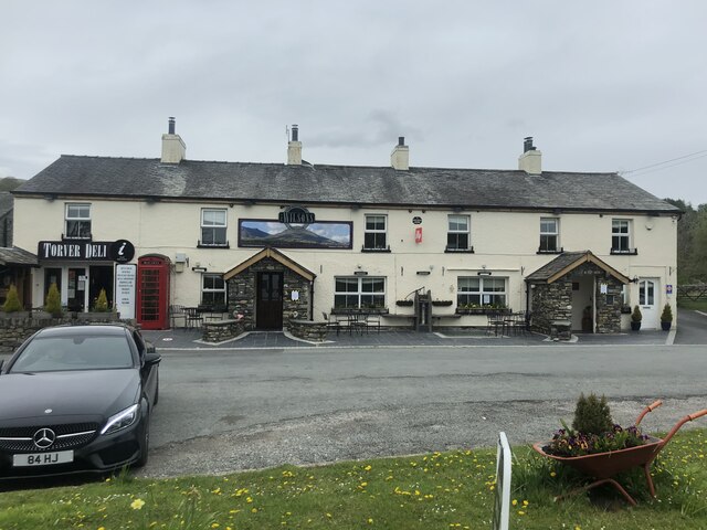
Sunny Bank is home to a close-knit community, with a population of approximately 500 residents. The village boasts a range of amenities, including a primary school, village hall, and a local pub. The primary school provides education for children up to the age of 11, ensuring that families with young children are well catered for.

Despite its small size, Sunny Bank offers a surprising number of recreational activities. The village is well-equipped with a playground and sports field, providing opportunities for outdoor leisure and exercise. Additionally, the surrounding countryside offers an array of walking and hiking trails, allowing residents and visitors to explore the natural beauty of the area.

In terms of transportation, Sunny Bank is conveniently located near major road networks, allowing for easy access to nearby towns and cities. The village is also served by a bus service, providing connections to the wider region.

Overall, Sunny Bank is a charming and peaceful village, offering a serene lifestyle in the heart of Lancashire. Its scenic surroundings and close-knit community make it an appealing place to live for those seeking a rural escape.

If you have any feedback on the listing, please let us know in the comments section below.
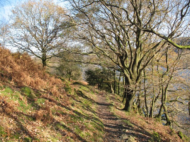
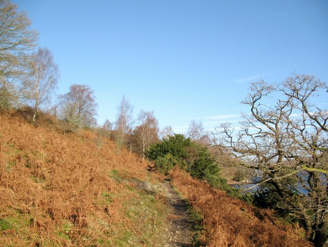
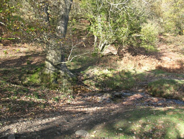
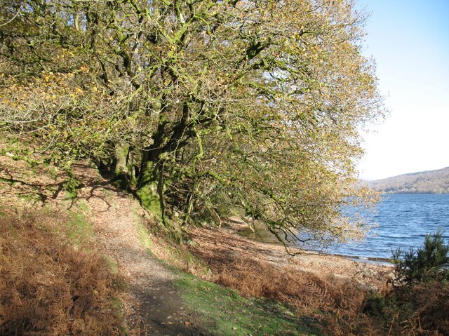
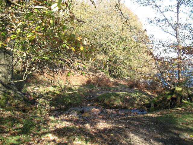
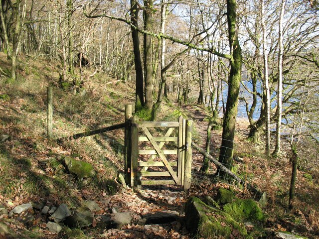
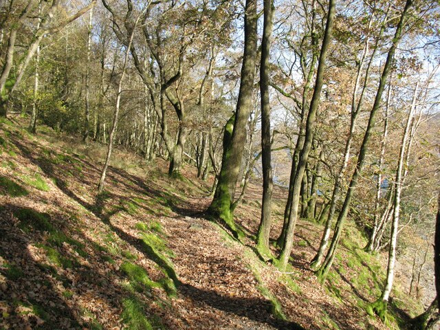
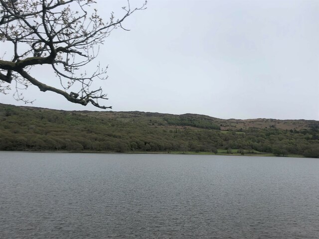
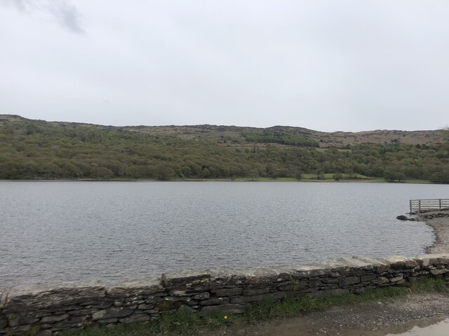
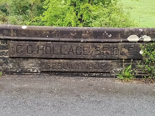
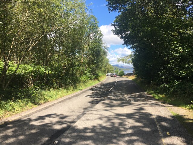
Sunny Bank Images

Images are sourced within 2km of 54.321875/-3.0933879 or Grid Reference SD2892. Thanks to Geograph Open Source API. All images are credited.

The Cumbria Way, Torver Back Common The Cumbria Way follows the public footpath from Delicars to Coniston above the shore of Coniston Water (next photograph <a href="https://www.geograph.org.uk/photo/7003403">SD2993 : The Cumbria Way near Bellman’s Hole</a>).
The Cumbria Way, Torver Back Common
The Cumbria Way follows the public footpath from Delicars to Coniston above the shore of Coniston Water (next photograph SD2993 : The Cumbria Way near Bellman’s Hole).
The Cumbria Way near Bellman’s Hole This path above the shore of Coniston Water is the public footpath from Delicars to Coniston. It is the route of The Cumbria Way long distance path from Ulverston to Carlisle (next photograph <a href="https://www.geograph.org.uk/photo/7003650">SD2993 : Moor Gill Foot Ford</a>).
The Cumbria Way near Bellman’s Hole
This path above the shore of Coniston Water is the public footpath from Delicars to Coniston. It is the route of The Cumbria Way long distance path from Ulverston to Carlisle (next photograph SD2993 : Moor Gill Foot Ford).
Moor Gill Foot Ford Moor Gill rises on Torver Back Common and drains into Coniston Water just below this small ford.  The public footpath from Delicars to Coniston which is also the route of The Cumbria Way crosses the ford.
Moor Gill Foot Ford
Moor Gill rises on Torver Back Common and drains into Coniston Water just below this small ford. The public footpath from Delicars to Coniston which is also the route of The Cumbria Way crosses the ford.
The Cumbria Way, Moor Gill Foot The Cumbria Way follows the western shore of Coniston Water through woodland below Torver Back Common (next photograph <a href="https://www.geograph.org.uk/photo/7004202">SD2993 : The Cumbria Way in Torver Common Wood</a>).
The Cumbria Way, Moor Gill Foot
The Cumbria Way follows the western shore of Coniston Water through woodland below Torver Back Common (next photograph SD2993 : The Cumbria Way in Torver Common Wood).
Moor Gill Foot Ford Moor Gill rises on Torver Back Common and drains into Coniston Water just below this small ford.  The public footpath from Delicars to Coniston crosses the ford; it  is the route of The Cumbria Way long distance path (next photograph <a href="https://www.geograph.org.uk/photo/7003649">SD2993 : The Cumbria Way, Moor Gill Foot</a>).
Moor Gill Foot Ford
Moor Gill rises on Torver Back Common and drains into Coniston Water just below this small ford. The public footpath from Delicars to Coniston crosses the ford; it is the route of The Cumbria Way long distance path (next photograph SD2993 : The Cumbria Way, Moor Gill Foot).
Gate in Torver Common Wood The gate crosses a public footpath from Delicars to Coniston which is also the route of The Cumbria Way long distance trail.
Coniston Water can be glimpsed through the trees (next photograph <a href="https://www.geograph.org.uk/photo/7004844">SD2994 : Rocky path in Torver Common Wood</a>).
Gate in Torver Common Wood
The gate crosses a public footpath from Delicars to Coniston which is also the route of The Cumbria Way long distance trail. Coniston Water can be glimpsed through the trees (next photograph SD2994 : Rocky path in Torver Common Wood).
The Cumbria Way in Torver Common Wood The Cumbria Way follows a public footpath along the western shore of Coniston Water through Torver Common Wood (next photograph <a href="https://www.geograph.org.uk/photo/7004120">SD2994 : Gate in Torver Common Wood</a>).
The Cumbria Way in Torver Common Wood
The Cumbria Way follows a public footpath along the western shore of Coniston Water through Torver Common Wood (next photograph SD2994 : Gate in Torver Common Wood).
The Wilsons Arms, Torver Public House with attached Deli
The Wilsons Arms, Torver
Public House with attached Deli
Coniston Water from the A5084 At last a view of the lake - the A593 does not run alongside and it is not until you head south of Torver on the A5084 that the lake comes into view.
Coniston Water from the A5084
At last a view of the lake - the A593 does not run alongside and it is not until you head south of Torver on the A5084 that the lake comes into view.
Coniston Water Coniston Water is the fifth largest of the lakes, at five miles long, and with a maximum depth of 184 feet. It provided an important fish source for the monks of Furness Abbey who owned the lake and much of the surrounding land in the 13th and 14th Centuries.
Coniston Water
Coniston Water is the fifth largest of the lakes, at five miles long, and with a maximum depth of 184 feet. It provided an important fish source for the monks of Furness Abbey who owned the lake and much of the surrounding land in the 13th and 14th Centuries.
Old Bridge Marker on Hollage Bridge, Torver Bridge Marker cut in the north parapet of Hollage Bridge, Torver Beck, on the A5084. Torver parish. Inscription reads C C HOLLAGE BRIDGE / REBUILT 1903.

Milestone Society National ID: LA_TORV01br
Old Bridge Marker on Hollage Bridge, Torver
Bridge Marker cut in the north parapet of Hollage Bridge, Torver Beck, on the A5084. Torver parish. Inscription reads C C HOLLAGE BRIDGE / REBUILT 1903. Milestone Society National ID: LA_TORV01br
A5084 near Coniston Water
View to Peel Island on Coniston Water
At Low Peel Near, Coniston Water
At Low Peel Near looking up Coniston Water
Coniston Water at Low Peel Near Looking to The Old Man of Coniston
Coniston Water at Low Peel Near
Looking to The Old Man of Coniston
The Wilson Arms With few patrons on a moody March day, The Wilson Arms catches a fleeting patch of sun beneath the lower slopes of The Coniston Fells.  The adjacent Torver Deli is an integral part of the pub and also serves as a useful village shop for the few remaining residents in a village consisting mainly of holiday homes.
The pub describes itself as The Wilson Arms but the pub sign reads The Wilsons; the website has both!  It is unusual to find a pub using two official names simultaneously.
The Wilson Arms
With few patrons on a moody March day, The Wilson Arms catches a fleeting patch of sun beneath the lower slopes of The Coniston Fells. The adjacent Torver Deli is an integral part of the pub and also serves as a useful village shop for the few remaining residents in a village consisting mainly of holiday homes. The pub describes itself as The Wilson Arms but the pub sign reads The Wilsons; the website has both! It is unusual to find a pub using two official names simultaneously.
Show me another place!

Sunny Bank is located at Grid Ref: SD2892 (Lat: 54.321875, Lng: -3.0933879)

Administrative County: Cumbria

District: South Lakeland

Police Authority: Cumbria

What 3 Words

///terminal.forgives.flies. Near Windermere, Cumbria

Related Wikis

Peel Island, Cumbria

Peel Island (formerly known as Montague Island or the Gridiron) is one of the three islands of Coniston Water in the English Lake District, Cumbria. The...

Kelly Hall Tarn

Kelly Hall Tarn is a pool in Cumbria, England, to the west of Coniston Water. It is located about one km south-south-east of the village of Torver, on...

Torver

Torver is a village and civil parish in the South Lakeland district of Cumbria, England, 3 miles (4.8 km) south west of the village of Coniston and 1 mile...

St Luke's Church, Torver

St Luke's Church is in the village of Torver, Cumbria, England. It is an active Anglican parish church in the deanery of Furness, the archdeaconry of...

Nearby Amenities

Located within 500m of 54.321875,-3.0933879
Source: NPR tracing
Lat/Long: 54.3256008/-3.0897832
Source: NPR tracing
Lat/Long: 54.3245371/-3.0901265
Source: NPR tracing
Lat/Long: 54.321731/-3.0897305
Source: NPR tracing
Lat/Long: 54.3212212/-3.0892271
Source: NPR tracing
Lat/Long: 54.3205671/-3.0900814
Source: NPR tracing
Lat/Long: 54.3191167/-3.0914405
Source: NPR tracing
Lat/Long: 54.3182797/-3.0912423
Source: NPR tracing
Lat/Long: 54.3178917/-3.0914569
Sunny Bank Bridge (S bound)
Local Ref: AT
Naptan AtcoCode: 090079072900
Naptan Bearing: S
Naptan BusStopType: CUS
Naptan CommonName: Sunny Bank Bridge (S bound)
Naptan Indicator: at
Naptan Landmark: Coach house Road End
Naptan NaptanCode: cumdgpma
Naptan Street: A5084
Naptan Verified: no
Source: naptan_import
Lat/Long: 54.3221552/-3.093522
Sunny Bank Bridge (N bound)
Local Ref: AT
Naptan AtcoCode: 090079073509
Naptan Bearing: NW
Naptan BusStopType: CUS
Naptan CommonName: Sunny Bank Bridge (N bound)
Naptan Indicator: at
Naptan Landmark: Oxenhouse Bay Road End
Naptan NaptanCode: cumdgpmj
Naptan Street: A5084
Naptan Verified: no
Source: naptan_import
Lat/Long: 54.3221346/-3.0938136
Barrier: kissing_gate
Foot: yes
Lat/Long: 54.3249341/-3.0963471
Foot: yes
Ford: stepping_stones
Source: survey
Lat/Long: 54.3248646/-3.0975705
Source: NPR tracing
Lat/Long: 54.3234296/-3.0902982
Source: NPR tracing
Lat/Long: 54.3229395/-3.0899691
Sunny Bank
Place: locality
Lat/Long: 54.3226716/-3.0925171
Delicars
Place: locality
Lat/Long: 54.3262013/-3.0946653
Power: pole
Lat/Long: 54.320861/-3.0918896
Power: pole
Lat/Long: 54.3211469/-3.0916619
Power: pole
Lat/Long: 54.3215813/-3.0920802
Power: pole
Lat/Long: 54.3219985/-3.0924737
Power: pole
Lat/Long: 54.3224691/-3.092944
Power: pole
Lat/Long: 54.3232716/-3.0935132
Power: pole
Lat/Long: 54.3234881/-3.0942582
Power: pole
Lat/Long: 54.3236613/-3.0949412
Power: pole
Lat/Long: 54.324601/-3.0955253
Power: pole
Lat/Long: 54.3255507/-3.0960847
Power: pole
Lat/Long: 54.3258856/-3.0962629
Power: pole
Lat/Long: 54.3248492/-3.0989135
Power: pole
Lat/Long: 54.3252101/-3.0975276
The data included in this document is from www.openstreetmap.org. The data is made available under ODbL.

Have you been to Sunny Bank?

Leave your review of Sunny Bank below (or comments, questions and feedback).