Stranton

Settlement in Durham

England

Stranton

Hartlepool Bus Station – 1971 Although the modern Transport Interchange is on much the same site, the whole area has been developed out of recognition as a result of the construction of the modern A179, and the house in the background no longer exists.

Trimdon Motor Services was one of many independent operators serving the Durham coalfields with quite a substantial network of services, and one of the few to survive potential takeover by United Automobile service and the immediate aftermath of deregulation in 1986. The bus is a Leyland Leopard with Plaxton bodywork.

This is one of a series of views featuring buses in the 60s, 70s, and 80s. <a title="https://www.geograph.org.uk/search.php?i=137652761" href="https://www.geograph.org.uk/search.php?i=137652761">Link</a>
Hartlepool Bus Station – 1971 Credit: Alan Murray-Rust

Stranton is a small suburb located in the county of Durham, in the northeast of England. It is situated approximately 2 miles southwest of the city center of Hartlepool and falls within the borough of Hartlepool. The community of Stranton primarily consists of residential areas and is bordered by the A689 road to the north, the A179 road to the west, and the A1048 road to the south, providing convenient transportation links to other parts of the region.

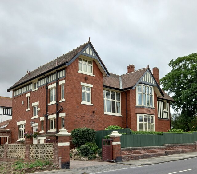
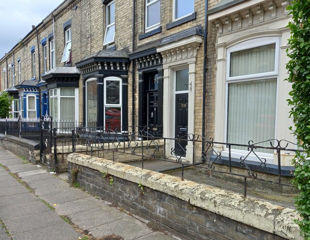
Stranton is home to a diverse population, with a mix of families, professionals, and retirees. The suburb offers a range of housing options, including terraced houses, semi-detached properties, and some larger detached homes. Amenities in Stranton are plentiful, with several local shops, supermarkets, and pubs catering to residents' daily needs.

Education is well-served in Stranton, with a number of primary and secondary schools located within the area. West View Primary School and St. Aidan's Primary School are two notable institutions that provide education for younger children, while Manor Community Academy offers secondary education.

Stranton Park, a local green space, provides opportunities for outdoor activities and leisure pursuits. The park features open fields, a children's play area, and sports facilities, making it a popular destination for families and individuals seeking recreation and relaxation.

Overall, Stranton is a quiet and welcoming suburb that offers a peaceful residential environment while being conveniently close to the amenities and transport links of Hartlepool.

If you have any feedback on the listing, please let us know in the comments section below.
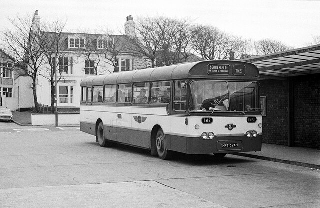
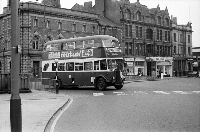
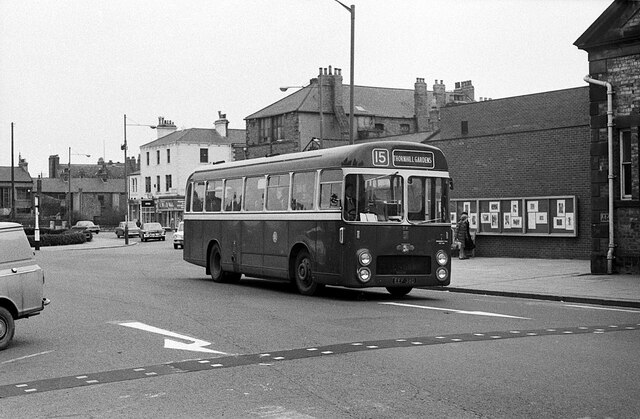
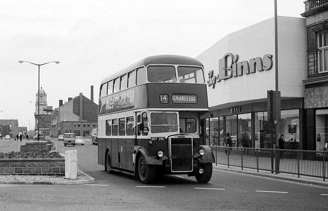
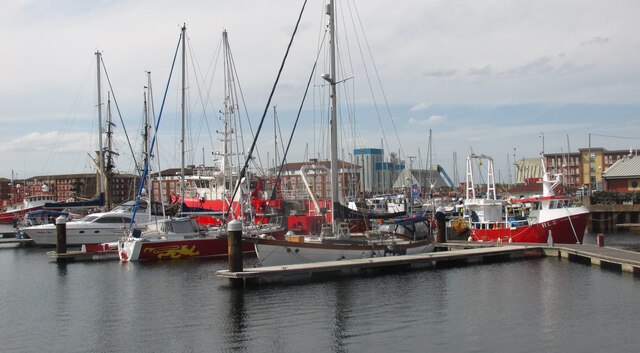
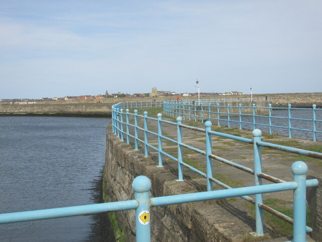
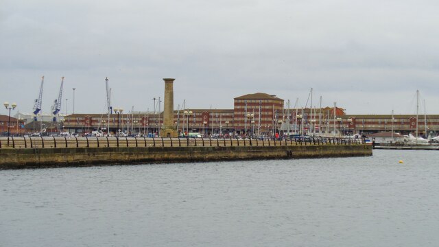
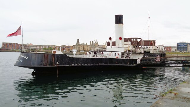
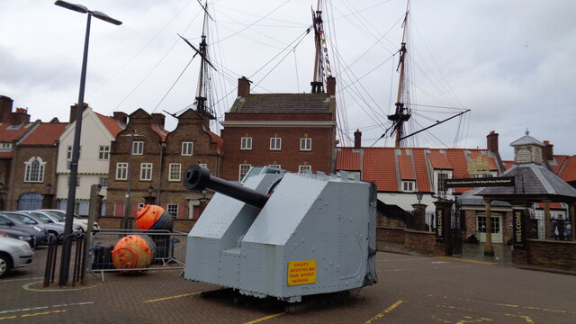
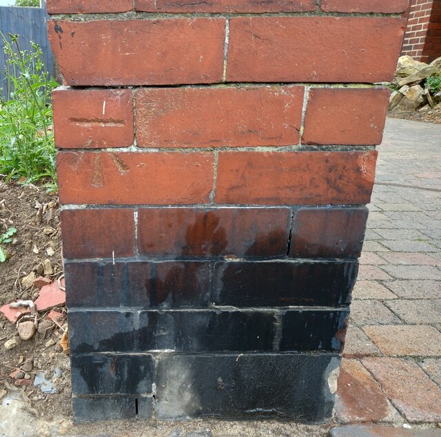
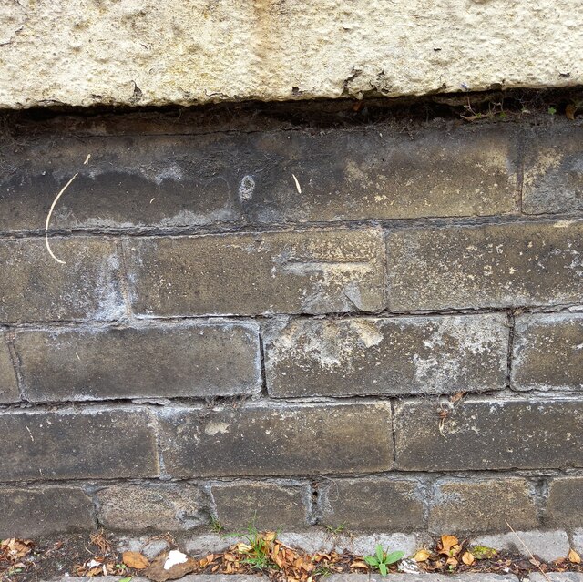
Stranton Images

Images are sourced within 2km of 54.679129/-1.2136529 or Grid Reference NZ5031. Thanks to Geograph Open Source API. All images are credited.

Hartlepool Bus Station – 1971 Although the modern Transport Interchange is on much the same site, the whole area has been developed out of recognition as a result of the construction of the modern A179, and the house in the background no longer exists.

Trimdon Motor Services was one of many independent operators serving the Durham coalfields with quite a substantial network of services, and one of the few to survive potential takeover by United Automobile service and the immediate aftermath of deregulation in 1986. The bus is a Leyland Leopard with Plaxton bodywork.

This is one of a series of views featuring buses in the 60s, 70s, and 80s. <a title="https://www.geograph.org.uk/search.php?i=137652761" href="https://www.geograph.org.uk/search.php?i=137652761">Link</a>
Hartlepool Bus Station – 1971
Although the modern Transport Interchange is on much the same site, the whole area has been developed out of recognition as a result of the construction of the modern A179, and the house in the background no longer exists. Trimdon Motor Services was one of many independent operators serving the Durham coalfields with quite a substantial network of services, and one of the few to survive potential takeover by United Automobile service and the immediate aftermath of deregulation in 1986. The bus is a Leyland Leopard with Plaxton bodywork. This is one of a series of views featuring buses in the 60s, 70s, and 80s. Link
Church Street, Hartlepool – 1971 Despite major redevelopment of Church Square and Church Street, this particular row of buildings has survived intact. The Devon was a bar, apparently in the basement, which appears to have had a less than salubrious reputation by the 1970s.

The bus is Hartlepool Corporation 81, a Daimler CVG6 with Roe bodywork new in 1953, so already long in the tooth for a municipal bus.

This is one of a series of views featuring buses in the 60s, 70s, and 80s. <a title="https://www.geograph.org.uk/search.php?i=137652761" href="https://www.geograph.org.uk/search.php?i=137652761">Link</a>
Church Street, Hartlepool – 1971
Despite major redevelopment of Church Square and Church Street, this particular row of buildings has survived intact. The Devon was a bar, apparently in the basement, which appears to have had a less than salubrious reputation by the 1970s. The bus is Hartlepool Corporation 81, a Daimler CVG6 with Roe bodywork new in 1953, so already long in the tooth for a municipal bus. This is one of a series of views featuring buses in the 60s, 70s, and 80s. Link
Church Street West, Hartlepool – 1971 The buildings visible are little changed, although the scenery has changed dramatically, the road, with Church Square beyond, now being a traffic free open space <a title="https://www.geograph.org.uk/photo/5953657" href="https://www.geograph.org.uk/photo/5953657">Link</a> .

The bus is Hartlepool Corporation 36, one of a batch of 5 Leyland Leopards with ECW bodywork. They were the first ECW bodies delivered to a non-BTC operator after Leyland had taken a 25% share in ECW in 1965. The front end design was non-standard and as far as I am aware was unique to these 5 buses.

This is one of a series of views featuring buses in the 60s, 70s, and 80s. <a title="https://www.geograph.org.uk/search.php?i=137652761" href="https://www.geograph.org.uk/search.php?i=137652761">Link</a>
Church Street West, Hartlepool – 1971
The buildings visible are little changed, although the scenery has changed dramatically, the road, with Church Square beyond, now being a traffic free open space Link . The bus is Hartlepool Corporation 36, one of a batch of 5 Leyland Leopards with ECW bodywork. They were the first ECW bodies delivered to a non-BTC operator after Leyland had taken a 25% share in ECW in 1965. The front end design was non-standard and as far as I am aware was unique to these 5 buses. This is one of a series of views featuring buses in the 60s, 70s, and 80s. Link
Stockton Street, Hartlepool – 1971 The shop proclaims 'Shop at Binns', and perhaps the most unusual feature of the picture is that the bus does not carry the same slogan on the front above the destination. The slogan was almost ubiquitous on double-deck buses throughout the north east. Binns was a chain of large department stores based in Sunderland but which then spread across the north east and later further afield. Following takeover by House of Fraser in 1953, stores from other taken-over companies were often given the Binns name. The name ceased to be used after 2006 when the ownership of House of Fraser changed. In the distance is the tower of the Co-operative department store <a title="https://www.geograph.org.uk/photo/4011351" href="https://www.geograph.org.uk/photo/4011351">Link</a> .

The bus is Hartlepool Corporation 28, a Leyland PD2 with Roe bodywork new in 1965. It was the last double deck bus to be purchased by the corporation.

This is one of a series of views featuring buses in the 60s, 70s, and 80s. <a title="https://www.geograph.org.uk/search.php?i=137652761" href="https://www.geograph.org.uk/search.php?i=137652761">Link</a>
Stockton Street, Hartlepool – 1971
The shop proclaims 'Shop at Binns', and perhaps the most unusual feature of the picture is that the bus does not carry the same slogan on the front above the destination. The slogan was almost ubiquitous on double-deck buses throughout the north east. Binns was a chain of large department stores based in Sunderland but which then spread across the north east and later further afield. Following takeover by House of Fraser in 1953, stores from other taken-over companies were often given the Binns name. The name ceased to be used after 2006 when the ownership of House of Fraser changed. In the distance is the tower of the Co-operative department store Link . The bus is Hartlepool Corporation 28, a Leyland PD2 with Roe bodywork new in 1965. It was the last double deck bus to be purchased by the corporation. This is one of a series of views featuring buses in the 60s, 70s, and 80s. Link
Hartlepool marina. Short walk around the marina.
Hartlepool marina.
Short walk around the marina.
West Harbour. Hartlepool.
West Harbour.
Hartlepool.
Jackson's Landing With the Seaton High Light, viewed from the 'Historic Quay'. The High Light is a re-positioned River Tees navigational light tower
Jackson's Landing
With the Seaton High Light, viewed from the 'Historic Quay'. The High Light is a re-positioned River Tees navigational light tower
PSS Wingfield Castle At the 'Historic Quay' museum, a former River Humber ferry
PSS Wingfield Castle
At the 'Historic Quay' museum, a former River Humber ferry
Historic Quay Entrance Naval gun exhibit with historic quayside buildings behind and the masts of HMS Trincomalee
Historic Quay Entrance
Naval gun exhibit with historic quayside buildings behind and the masts of HMS Trincomalee
Hartlepool, Elwick Road The benchmark is cut into the brick roadside wall on the south side of Elwick Road.
Hartlepool, Elwick Road
The benchmark is cut into the brick roadside wall on the south side of Elwick Road.
Hartlepool, Elwick Road There is a benchmark cut into the brick roadside wall on the south side of Elwick Road. The mark is immediately to the right of the stone wall.
Hartlepool, Elwick Road
There is a benchmark cut into the brick roadside wall on the south side of Elwick Road. The mark is immediately to the right of the stone wall.
Hartlepool, Redlands The benchmark is cut into a brick gatepost to the property, Redlands, located on Grange Road.
Hartlepool, Redlands
The benchmark is cut into a brick gatepost to the property, Redlands, located on Grange Road.
Hartlepool, Redlands There is a benchmark cut into the left brick gatepost of the property, Redlands, which is located on the south side of Grange Road.
Hartlepool, Redlands
There is a benchmark cut into the left brick gatepost of the property, Redlands, which is located on the south side of Grange Road.
Hartlepool, 79 Grange Road The benchmark is cut into the boundary wall of this property which is on the south side of Grange Road.
Hartlepool, 79 Grange Road
The benchmark is cut into the boundary wall of this property which is on the south side of Grange Road.
Hartlepool, 79 Grange Road There is a benchmark cut into the boundary wall of this property which is on the south side of Grange Road.
Hartlepool, 79 Grange Road
There is a benchmark cut into the boundary wall of this property which is on the south side of Grange Road.
Hartlepool, Grange Road Methodist Church According to the OS benchmark database there is a benchmark cut into the left end of the small boundary wall alongside the access ramp. Nothing was found.
Hartlepool, Grange Road Methodist Church
According to the OS benchmark database there is a benchmark cut into the left end of the small boundary wall alongside the access ramp. Nothing was found.
Hartlepool, St Paul's Church The benchmark is cut into the boundary and roadside wall of the church which is on the south side of Grange Road.
Hartlepool, St Paul's Church
The benchmark is cut into the boundary and roadside wall of the church which is on the south side of Grange Road.
Hartlepool, St Paul's Church There is a benchmark cut into the boundary and roadside wall of the church which is on the south side of Grange Road. The mark is cut into a coping stone.
Hartlepool, St Paul's Church
There is a benchmark cut into the boundary and roadside wall of the church which is on the south side of Grange Road. The mark is cut into a coping stone.
Show me another place!

Stranton is located at Grid Ref: NZ5031 (Lat: 54.679129, Lng: -1.2136529)

Unitary Authority: Hartlepool

Police Authority: Cleveland

What 3 Words

///bless.taps.piper. Near Hartlepool, Co. Durham

Nearby Locations

Stranton Bellevue

Related Wikis

Middleton Grange Shopping Centre

Middleton Grange is a shopping centre in Hartlepool, England. It was built in 1969 and it was opened by Princess Anne on 27 May 1970. The site of the shopping...

Hartlepool College of Further Education

Hartlepool College of Further Education is a non-denominational mixed further education college based in Hartlepool, United Kingdom, providing courses...

West Hartlepool War Memorial

West Hartlepool War Memorial or Victory Square War Memorial or Victoria Square Cenotaph is a war memorial in Hartlepool, County Durham, England commemorating...

Hartlepool Art Gallery

Hartlepool Art Gallery is an art gallery in Hartlepool, County Durham, England.The gallery opened in 1996 (1996). It is located in Church Square within...

West Hartlepool Town Hall

West Hartlepool Town Hall is a municipal building in Raby Road, Hartlepool, County Durham, England. The town hall, which was the meeting place of West...

St Joseph's Church, Hartlepool

St Joseph's Church is a Roman Catholic Parish church in Hartlepool, County Durham, England. It was built from 1893 to 1895 and designed by Edward Joseph...

Borough of Hartlepool

The Borough of Hartlepool is a unitary authority area in ceremonial County Durham, England. The borough's largest town is Hartlepool. It borders the County...

Hartlepool railway station

Hartlepool is a railway station on the Durham Coast Line, which runs between Newcastle and Middlesbrough via Hartlepool. The station, situated 18 miles...

Nearby Amenities

Located within 500m of 54.679129,-1.2136529
Traffic Signals
Crossing: traffic_signals
Crossing Ref: pelican
Lat/Long: 54.6825994/-1.211132
Traffic Signals
Lat/Long: 54.682488/-1.2167135
Traffic Signals
Lat/Long: 54.6796819/-1.2164975
Traffic Signals
Crossing: traffic_signals
Crossing Ref: pelican
Lat/Long: 54.6825767/-1.2109444
Traffic Signals
Lat/Long: 54.6754722/-1.2153837
Mini Roundabout
Source: bing
Lat/Long: 54.6833384/-1.2150951
Entrance: yes
Level: 0
Lat/Long: 54.6828067/-1.2131557
Traffic Signals
Lat/Long: 54.6825186/-1.2150073
Pub
The Causeway
Addr City: Hartlepool
Addr Postcode: TS24 7QT
Addr Suburb: Stranton
Brand: Marston's
Brand Wikidata: Q6773982
Fhrs Id: 259171
Source Addr: FHRS Open Data
Website: https://www.causewayhartlepool.co.uk/
Lat/Long: 54.6800056/-1.212882
Sign: end_of_bicycle_route
Lat/Long: 54.682454/-1.2143079
Crossing
Crossing: traffic_signals
Tactile Paving: yes
Lat/Long: 54.6828219/-1.2109696
Pub
The Blacksmiths Arms
Addr City: Hartlepool
Addr Postcode: TS24 7QT
Addr Suburb: Stranton
Fhrs Id: 259307
Source Addr: FHRS Open Data
Lat/Long: 54.6808198/-1.2117245
Place Of Worship
Saint Georges Church
Building: church
Denomination: united_reformed
Religion: christian
Lat/Long: 54.6822958/-1.2170507
Bank
NatWest
Atm: yes
Brand: NatWest
Brand Wikidata: Q2740021
Brand Wikipedia: en:NatWest
Opening Hours: Mo, Tu, Th, Fr 09:30-15:30; We 10:00-15:30; Sa, Su closed
Website: https://www.natwest.com/search-results/locator/branch.html?sortcode=558104&name=Hartlepool
Lat/Long: 54.6823871/-1.2164605
Bank
Barclays
Addr City: Hartlepool
Addr Street: York Road
Brand: Barclays
Brand Wikidata: Q245343
Brand Wikipedia: en:Barclays
Operator: Barclays Bank PLC
Lat/Long: 54.6826644/-1.2164533
Post Box
Collection Times: Mo-Fr 09:00; Sa 07:00
Lat/Long: 54.6793953/-1.2194789
Bank
Newcastle Building Society
Addr City: Hartlepool
Addr Street: York Road
Brand Wikidata: Q7017371
Lat/Long: 54.6831852/-1.2169462
Screwfix
Brand: Screwfix
Brand Wikidata: Q7439115
Brand Wikipedia: en:Screwfix
Opening Hours: Mo-Fr 07:00-20:00; Sa 07:00-18:00; Su 09:00-16:00
Shop: doityourself
Website: https://www.screwfix.com/stores/IA4/hartlepool
Lat/Long: 54.6795559/-1.2122048
Pharmacy
Lloyds Pharmacy
Brand: Lloyds Pharmacy
Brand Wikidata: Q6662870
Brand Wikipedia: en:LloydsPharmacy
Healthcare: pharmacy
Lat/Long: 54.682414/-1.2152806
Bank
Lloyds Bank
Addr City: Hartlepool
Addr Country: GB
Addr Housenumber: 128-132
Addr Street: York Road
Brand: Lloyds Bank
Brand Wikidata: Q1152847
Brand Wikipedia: en:Lloyds Bank
Contact Website: https://branches.lloydsbank.com/hartlepool/128-132-york-road
Opening Hours: Mo-Fr 09:00-15:30
Phone: +44 345 602 1997
Lat/Long: 54.683208/-1.2165105
Nationwide Tyres
Shop: car
Lat/Long: 54.6749346/-1.2159885
Traffic Signals
Lat/Long: 54.6786526/-1.2085785
Traffic Signals
Lat/Long: 54.6763755/-1.2110644
Traffic Signals
Lat/Long: 54.6764622/-1.2109036
Crossing
Lat/Long: 54.679325/-1.2118172
Crossing
Crossing: uncontrolled
Lat/Long: 54.6787016/-1.2116753
Crossing
Lat/Long: 54.6793155/-1.2116314
Londis
FIXME: check precise location
Brand: Londis
Brand Wikidata: Q21008564
Fixme: seems not to be here
Operator: Londis
Shop: convenience
Source: survey
Lat/Long: 54.6794864/-1.2181655
Crossing
Crossing Island: no
Priority: backward
Traffic Calming: choker
Lat/Long: 54.6820716/-1.2096603
Fast Food
Domino's
Addr City: Hartlepool
Addr Housenumber: 178
Addr Postcode: TS26 9EA
Addr Street: York Road
Brand: Domino's
Brand Wikidata: Q839466
Brand Wikipedia: en:Domino's Pizza
Contact Website: https://www.dominos.co.uk/pizza-near-me/hartlepool/178-york-road
Cuisine: pizza
Fhrs Id: 259573
Takeaway: yes
Lat/Long: 54.6813188/-1.2164804
Crossing
Lat/Long: 54.6778902/-1.2098481
Crossing
Lat/Long: 54.6773612/-1.2101591
Crossing
Lat/Long: 54.6774426/-1.2096525
Crossing
Crossing: uncontrolled
Crossing Ref: zebra
Lat/Long: 54.6792574/-1.2111896
Stranton
Place: suburb
Source: local_knowledge
Lat/Long: 54.6795889/-1.2138993
Barrier: bollard
Lat/Long: 54.678505/-1.2170282
Public Transport: stop_position
Lat/Long: 54.6825419/-1.2139416
Bus: yes
Public Transport: stop_position
Lat/Long: 54.6831832/-1.216759
Bus: yes
Public Transport: stop_position
Lat/Long: 54.6817137/-1.2166464
Park Road
Bus: yes
Public Transport: stop_position
Lat/Long: 54.6825029/-1.2158291
Drive Vauxhall
Shop: car
Lat/Long: 54.6792988/-1.2096716
Tones Cars
Addr City: Hartlepool
Addr Housenumber: 1
Addr Postcode: TS25 5SS
Addr Street: Oxford Road
Shop: car
Lat/Long: 54.6750572/-1.2155031
Pharmacy
Boots
Brand: Boots
Brand Wikidata: Q6123139
Brand Wikipedia: en:Boots UK
Healthcare: pharmacy
Lat/Long: 54.6819093/-1.2149172
Franks Factory Flooring
Shop: carpet
Lat/Long: 54.6794411/-1.2122799
Stranton DIY
Opening Hours: Mo-Fr 09:00-16:15; Sa 09:00-15:15
Shop: doityourself
Lat/Long: 54.6796218/-1.2132522
Pirouette Dancewear
FIXME: Not sure about the name, but it is something like that...
Shop: dance
Lat/Long: 54.6792372/-1.2130295
Parking
Gainford Street
Access: yes
Capacity: 26
Capacity Disabled: 2
Fee: yes
Lit: yes
Operator: Hartlepool Borough Council
Supervised: no
Surface: paved
Lat/Long: 54.6816545/-1.2160632
Bench: yes
Bin: yes
Bus: yes
Check Date Shelter: 2022-10-27
Public Transport: platform
Shelter: yes
Lat/Long: 54.6793979/-1.2164122
Bus: yes
Public Transport: stop_position
Lat/Long: 54.6793966/-1.2164781
Crossing
Crossing: uncontrolled
Crossing Ref: zebra
Lat/Long: 54.681209/-1.2166089
Bus Stop
Bench: yes
Local Ref: A
Public Transport: platform
Shelter: yes
Source: survey
Tactile Paving: no
Lat/Long: 54.6817189/-1.2165332
Crossing
Lat/Long: 54.6820295/-1.2149386
Cafe
Lat/Long: 54.6823997/-1.2158598
Bus Stop
Local Ref: Q
Public Transport: platform
Ref: Q
Lat/Long: 54.6825108/-1.2139476
Bus: yes
Public Transport: stop_position
Lat/Long: 54.6825626/-1.2123474
Crossing
Crossing: island
Lat/Long: 54.6825646/-1.2108059
Bus Stop
Park Road
Bench: yes
Bin: no
Lit: no
Local Ref: A
Passenger Information Display: no
Public Transport: platform
Ref: O
Shelter: yes
Tactile Paving: no
Lat/Long: 54.6825881/-1.2158221
Bus Stop
Local Ref: A
Passenger Information Display: no
Public Transport: platform
Shelter: yes
Lat/Long: 54.6826257/-1.2123364
Crossing
Crossing: traffic_signals
Tactile Paving: yes
Lat/Long: 54.6827686/-1.2111408
Crossing
Crossing: uncontrolled
Lat/Long: 54.6787367/-1.2118596
Crossing
Lat/Long: 54.6788076/-1.2114331
Crossing
Lat/Long: 54.6789154/-1.2113206
Crossing
Lat/Long: 54.6790088/-1.2112376
Crossing
Crossing: traffic_signals
Lat/Long: 54.6823947/-1.2111368
Crossing
Crossing: traffic_signals
Lat/Long: 54.6824181/-1.2109556
Crossing
Crossing: traffic_signals
Crossing Island: no
Lat/Long: 54.6825969/-1.2112649
Crossing
Crossing: uncontrolled
Lat/Long: 54.682244/-1.2148035
Crossing
Button Operated: yes
Crossing: traffic_signals
Crossing Island: no
Crossing Ref: pelican
Tactile Paving: yes
Lat/Long: 54.6824923/-1.216455
Crossing
Button Operated: yes
Crossing: traffic_signals
Crossing Ref: pelican
Lat/Long: 54.6825123/-1.2153359
Crossing
Crossing Island: yes
Lat/Long: 54.682656/-1.2150372
Bus Stop
Hartlepool Town Centre
Bench: yes
Bus: yes
Local Ref: Q
Passenger Information Display: no
Public Transport: platform
Lat/Long: 54.6831683/-1.2166572
Traffic Calming: hump
Lat/Long: 54.6775699/-1.2130382
Traffic Calming: hump
Lat/Long: 54.6784373/-1.2133864
Crossing
Lat/Long: 54.6785495/-1.2086322
Crossing
Crossing: traffic_signals
Lat/Long: 54.6786366/-1.2081821
Bus: yes
Public Transport: stop_position
Lat/Long: 54.6786933/-1.2164112
Bus Stop
Bench: yes
Bus: yes
Check Date Shelter: 2022-10-27
Public Transport: platform
Shelter: yes
Lat/Long: 54.678694/-1.2163465
Traffic Calming: hump
Lat/Long: 54.6788229/-1.2135411
Fast Food
Panda
Addr City: Hartlepool
Addr Housenumber: 51a
Addr Postcode: TS26 9AE
Addr Street: Elwick Road
Cuisine: chinese
Fhrs Id: 455918
Source Addr: FHRS Open Data
Lat/Long: 54.6794829/-1.2177744
Bus Stop
Bench: yes
Bus: yes
Naptan AtcoCode: 075071164A
Naptan NaptanCode: haratjt
Public Transport: platform
Shelter: yes
Source: survey
Tactile Paving: no
Lat/Long: 54.6800898/-1.2166395
Bus: yes
Public Transport: stop_position
Lat/Long: 54.6801075/-1.216528
Fast Food
Cuisine: regional
Lat/Long: 54.6805677/-1.2167862
Shop: funeral_directors
Lat/Long: 54.680676/-1.2168067
Crossing
Crossing: traffic_signals
Lat/Long: 54.6767643/-1.2158566
Platform
Bench: yes
Bus: yes
Public Transport: platform
Shelter: yes
Lat/Long: 54.6789613/-1.2165595
Bus: yes
Public Transport: stop_position
Lat/Long: 54.6789684/-1.2164412
Entrance: main
Lat/Long: 54.6773484/-1.209045
Crossing
Lat/Long: 54.6785497/-1.2088118
Crossing
Lat/Long: 54.678668/-1.2087695
Traffic Calming: hump
Lat/Long: 54.680981/-1.2094854
Larsen Hairdressing
Shop: hairdresser
Source: survey
Lat/Long: 54.6802013/-1.216342
Fast Food
Cuisine: indian
Source: survey
Takeaway: only
Lat/Long: 54.6804915/-1.2167856
Crossing
Button Operated: yes
Crossing: traffic_signals
Crossing Ref: pelican
Supervised: no
Tactile Paving: yes
Lat/Long: 54.68243/-1.214998
Doctors
Chadwick Practice
Addr City: Hartlepool
Addr Postcode: TS24 7PW
Addr Street: Park Road
Healthcare: doctor
Healthcare Speciality: general
Operator: Chadwick Practice
Lat/Long: 54.6819481/-1.2151592
Cafe
Starbucks
Addr City: Hartlepool
Addr Postcode: TS24 7LD
Addr Street: Green Street
Brand: Starbucks
Brand Wikidata: Q37158
Brand Wikipedia: en:Starbucks
Cuisine: coffee_shop
Fhrs Id: 1043387
Source Addr: FHRS Open Data
Website: https://www.starbucks.com/store-locator/store/1020829/hartlepool-green-street-dt-green-street-hartlepool-eng-ts-24-7-ld-gb
Lat/Long: 54.6800966/-1.2110286
Turning Loop
Lat/Long: 54.6804776/-1.2186193
Post Box
Brand: Royal Mail
Brand Wikidata: Q638098
Brand Wikipedia: en:Royal Mail
Collection Times: Mo-Fr 17:45; Sa 09:45
Operator: Royal Mail
Operator Wikidata: Q638098
Post Box Type: indoor_pillar
Ref: TS25 573
Royal Cypher: EIIR
Royal Cypher Wikidata: Q33102113
Source: survey
Lat/Long: 54.6773011/-1.2089361
Barrier: yes
Lat/Long: 54.6808477/-1.2159057
RAF Jet Provost
Historic: monument
Image: https://www.geograph.org.uk/photo/3894976
Lat/Long: 54.6831665/-1.2104099
Cafe
Mandy's 33 Coffee Shop
Addr City: Hartlepool
Addr Housenumber: 33
Addr Postcode: TS24 7PW
Addr Street: Park Road
Contact Facebook: mandysno33coffeeshop
Fhrs Id: 934070
Lat/Long: 54.6824013/-1.2134622
Jumbo Chinese Buffer
Cuisine: chinese
Disused Amenity: restaurant
Lat/Long: 54.6824455/-1.2125985
Fixme: What is here?
Shop: yes
Lat/Long: 54.6830882/-1.2164944
Tilly Bailey & Irvine LLP
Addr City: Hartlepool
Addr Street: York Road
Office: lawyer
Website: https://www.tbilaw.co.uk/
Lat/Long: 54.6830339/-1.2164918
Atm
Barclays
Brand: Barclays
Brand Wikidata: Q245343
Operator: Barclays
Operator Wikidata: Q245343
Lat/Long: 54.6825869/-1.2163979
Atm
Barclays
Brand: Barclays
Brand Wikidata: Q245343
Operator: Barclays
Operator Wikidata: Q245343
Lat/Long: 54.6825863/-1.2164301
Cafe
The Dancing Cup
Addr City: Hartlepool
Addr Street: York Road
Lat/Long: 54.6828285/-1.2164703
Tilly Bailey & Irvine LLP
Office: lawyer
Website: https://www.tbilaw.co.uk/
Lat/Long: 54.6830626/-1.2169451
Atm
Lloyds Bank
Brand: Lloyds Bank
Brand Wikidata: Q1152847
Operator: Lloyds Bank
Operator Wikidata: Q1152847
Lat/Long: 54.6832844/-1.2164904
Atm
Lloyds Bank
Brand: Lloyds Bank
Brand Wikidata: Q1152847
Operator: Lloyds Bank
Operator Wikidata: Q1152847
Lat/Long: 54.6832846/-1.2164717
Traffic Signals
Crossing: no
Traffic Signals Direction: forward
Lat/Long: 54.6767199/-1.2158408
Traffic Signals
Crossing: no
Traffic Signals Direction: backward
Lat/Long: 54.6767951/-1.2158676
Traffic Signals
Crossing: no
Traffic Signals Direction: forward
Lat/Long: 54.6825117/-1.2153686
Traffic Signals
Crossing: no
Traffic Signals Direction: backward
Lat/Long: 54.6824005/-1.2149949
Traffic Signals
Crossing: no
Traffic Signals Direction: backward
Lat/Long: 54.6825271/-1.2146793
Traffic Signals
Crossing: no
Traffic Signals Direction: forward
Lat/Long: 54.6827358/-1.2150492
Lfs
Office: financial
Lat/Long: 54.6816717/-1.2164889
The Carpet Stuio
Shop: carpet
Lat/Long: 54.6797441/-1.2163399
sureplan
Office: insurance
Lat/Long: 54.680594/-1.2163958
Prep School
Karen Liddle Studios
Note: dancing school
Lat/Long: 54.6828559/-1.2166081
Wet Rock n Ride
Opening Hours: Mo-Th 09:00-17:30; Fr 09:00-17:00; Sa 09:00-15:00; PH off
Shop: bicycle
Lat/Long: 54.6801527/-1.2163633
Fast Food
Tasty Bites
Cuisine: pizza
Lat/Long: 54.6815978/-1.2164943
M&I barbers
Shop: hairdresser
Lat/Long: 54.6819885/-1.2165223
Waste Basket
Lat/Long: 54.6812541/-1.2165672
just blinds
Shop: window_blind
Lat/Long: 54.6821193/-1.2164958
Diva
Shop: beauty
Lat/Long: 54.6818694/-1.2165301
Barbershop
Shop: hairdresser
Lat/Long: 54.680107/-1.2163582
Stray Aid
Shop: pet_grooming
Lat/Long: 54.6817763/-1.2164927
SP Photography
Craft: photographer
Lat/Long: 54.6803808/-1.2163902
Authentic Vintage & Retro Clothing
Shop: boutique
Lat/Long: 54.6822855/-1.216507
Fast Food
Dot's place
Lat/Long: 54.6804716/-1.2164042
K&C
Shop: beauty
Lat/Long: 54.6799445/-1.2163336
Bicycle Parking
Bicycle Parking: stands
Capacity: 6
Covered: no
Lat/Long: 54.6822182/-1.2166211
Waste Basket
Lat/Long: 54.6817948/-1.216597
Fast Food
Reem's
Cuisine: pizza;Burger;kebab
Lat/Long: 54.6812578/-1.2164762
Protein
Shop: yes
Lat/Long: 54.6806909/-1.2163944
Sew 'n' Sew
Craft: tailor
Lat/Long: 54.6819429/-1.2165337
Mkr Furnishings
Shop: furniture
Lat/Long: 54.6800536/-1.2163525
Reef
Shop: clothes
Lat/Long: 54.6814554/-1.216475
Bicycle Parking
Capacity: 6
Lat/Long: 54.6810001/-1.2165285
Waste Basket
Lat/Long: 54.6805239/-1.2164854
Salon D
Shop: beauty
Lat/Long: 54.6811905/-1.2164727
Smooth Vapourz
Shop: e-cigarette
Lat/Long: 54.6821927/-1.2165077
Barbies Blessings
Shop: baby_goods
Lat/Long: 54.6809474/-1.2164332
Solitaire
Shop: hairdresser
Lat/Long: 54.6799974/-1.2163489
Cafe
The Dancing Cup
Lat/Long: 54.6827392/-1.2165997
Talk Mobile
Shop: mobile_phone
Lat/Long: 54.6815577/-1.2164817
Personaleyez
Shop: gift
Lat/Long: 54.68115/-1.2164771
Steron
Shop: locksmith
Lat/Long: 54.6797984/-1.2163371
Tue Hanger
Shop: boutique
Lat/Long: 54.68109/-1.2164715
The Property Supermarket
Office: consulting
Lat/Long: 54.6808019/-1.2164189
Art Of Eternity
Shop: tattoo
Lat/Long: 54.6798606/-1.2163329
Bicycle Parking
Access: yes
Capacity: 4
Fee: no
Lat/Long: 54.6786138/-1.2164675
Waste Basket
Waste: cigarettes;dog_excrement;trash
Lat/Long: 54.6784904/-1.2165495
Camera Mount: pole
Camera Type: panning
Height: 8
Man Made: surveillance
Surveillance: public
Surveillance Type: camera
Lat/Long: 54.678048/-1.2164086
Hiking: yes
Information: guidepost
Tourism: information
Lat/Long: 54.6784816/-1.216566
Charging Station
Capacity: 10
Lat/Long: 54.6829294/-1.2148543
Traffic Calming: choker
Lat/Long: 54.6811496/-1.2143234
Bicycle: yes
Information: guidepost
Tourism: information
Lat/Long: 54.6791735/-1.214073
Camera Mount: pole
Camera Type: fixed
Height: 4
Man Made: surveillance
Operator: Hartlepool Borough Council
Surveillance: public
Surveillance Type: camera
Lat/Long: 54.6811337/-1.2142754
Camera Mount: pole
Camera Type: panning
Height: 6
Man Made: surveillance
Operator: Hartlepool Borough Council
Surveillance: public
Surveillance Type: camera
Lat/Long: 54.6811338/-1.2142754
Bicycle: yes
Information: guidepost
Tourism: information
Lat/Long: 54.6784889/-1.2170041
Bicycle: yes
Description: former guidepost, part of the signs has been broken so no text is readable, now acts as a route marker
Information: route_marker
Tourism: information
Lat/Long: 54.6783315/-1.2168968
Post Office
Hartlepool Post Office
Addr City: Hartlepool
Addr Country: GB
Addr Postcode: TS24 7RR
Brand: Post Office
Brand Wikidata: Q1783168
Level: 1
Ref Pol Id: 141434
Lat/Long: 54.683552/-1.2130574
Bicycle Parking
Access: yes
Bicycle Parking: wall_loops
Capacity: 6
Covered: no
Fee: no
Lat/Long: 54.6827467/-1.2133415
Waste Basket
Ashtray: yes
Touchless: yes
Lat/Long: 54.6760641/-1.2110657
Give Way
Direction: forward
Lat/Long: 54.6833412/-1.2155188
Leck's
Fixme: shop could be abandoned, I was there after 5pm
Shop: doityourself
Lat/Long: 54.6794196/-1.2133936
Waste Basket
Lat/Long: 54.6794088/-1.2193931
Fast Food
Pizza Time
Cuisine: pizza
Lat/Long: 54.6794867/-1.2176815
Balloonatics
Shop: gift
Lat/Long: 54.679594/-1.219114
Veterinary
Stranton Pets
Lat/Long: 54.6796838/-1.213188
Chequered Flag
Lat/Long: 54.6793642/-1.2189592
Cora's
Shop: convenience
Lat/Long: 54.6795338/-1.213339
Secret Garden
Lat/Long: 54.6795918/-1.2190212
Music School
Gaynor Lee
Lat/Long: 54.6793229/-1.2134483
Coral
Shop: bookmaker
Lat/Long: 54.6792065/-1.2135031
Camera Mount: pole
Camera Type: panning
Height: 5
Man Made: surveillance
Surveillance: public
Surveillance Type: camera
Surveillance Zone: town
Lat/Long: 54.675922/-1.2186449
Bench
Lat/Long: 54.678142/-1.2170637
Waste Basket
Lat/Long: 54.6780743/-1.2172261
Information: map
Tourism: information
Lat/Long: 54.6782537/-1.2171772
Bench
Lat/Long: 54.6780873/-1.217182
Waste Basket
Lat/Long: 54.6821663/-1.2166219
Bicycle: yes
Information: guidepost
Tourism: information
Lat/Long: 54.6795637/-1.2173971
Toolstation
Internet Access: wlan
Internet Access Registration: required
Opening Hours: Mo-Fr 07:00-20:00; Sa 07:00-18:00; Su 09:00-16:00
Shop: doityourself
Lat/Long: 54.675612/-1.2097889
Social Centre
Pathfinders Hub
Opening Hours: Mo-Fr 09:00-17:00
Operator: Hartlepool Borough Council
Phone: +44 1429 405588
Lat/Long: 54.6832462/-1.2157362
Disused Shop: yes
Lat/Long: 54.6832297/-1.2155725
Restaurant
Mary Lambert
Delivery: yes
Lat/Long: 54.6832313/-1.2159216
Curios Gifted
Shop: yes
Lat/Long: 54.6832293/-1.2154295
Charging Station
Brand: pod point
Description: 1*ccs cable, 1* chademo cable, pay by app or cards
Fee: yes
Motorcar: yes
Payment American Express: yes
Payment Apple Pay: yes
Payment Google Pay: yes
Payment Mastercard: yes
Payment Visa: yes
Socket Chademo: 1
Lat/Long: 54.6773812/-1.2108948
Charging Station
Authentication App: yes
Brand: pod point
Fee: yes
Socket Type2: 2
Socket Type2 Output: 22 kW
Lat/Long: 54.6774454/-1.2109208
Charging Station
Authentication App: yes
Brand: pod point
Fee: yes
Socket Type2: 2
Socket Type2 Output: 7 kW
Lat/Long: 54.6774154/-1.2109097
Post Box
Parcel Postbox
Collection Times: Mo-Fr 17:00; Sa 10:00
Operator: Royal Mail
Operator Wikidata: Q638098
Ref: TS24 300P
Lat/Long: 54.6814876/-1.209587
Post Box
Collection Times: Mo-Fr 17:30; Sa 10:00
Operator: Royal Mail
Operator Wikidata: Q638098
Ref: TS24 3
Lat/Long: 54.6814594/-1.2095835
The data included in this document is from www.openstreetmap.org. The data is made available under ODbL.

Have you been to Stranton?

Leave your review of Stranton below (or comments, questions and feedback).