Stragglethorpe

Settlement in Nottinghamshire Rushcliffe

England

Stragglethorpe

Bassingfield Lane, Bassingfield Recreating this First for the square <a title="https://www.geograph.org.uk/photo/51960" href="https://www.geograph.org.uk/photo/51960">Link</a>
Bassingfield Lane, Bassingfield Credit: Alan Murray-Rust

Stragglethorpe is a small village located in the county of Nottinghamshire, England. Situated approximately 12 miles east of Nottingham, this rural settlement is nestled amidst picturesque countryside and offers a tranquil atmosphere for its residents.

With a population of around 200 people, Stragglethorpe maintains its charming and close-knit community. The village is characterized by its quintessential English cottages, well-tended gardens, and an abundance of green spaces. The surrounding landscape is dominated by rolling hills, sprawling fields, and meandering streams, making it an idyllic location for nature enthusiasts and outdoor activities.

Stragglethorpe's history can be traced back to medieval times, and remnants of this past can still be observed in the architecture and layout of the village. The local church, St. Michael's, is a notable landmark, dating back to the 12th century and featuring stunning stained glass windows and intricately carved stonework.

Despite its small size, Stragglethorpe offers a few amenities for its residents. The village boasts a cozy pub that serves traditional British fare and acts as a social hub for locals. Additionally, a small village hall hosts community events and gatherings throughout the year.

While Stragglethorpe may not have extensive commercial facilities, its proximity to larger towns and cities ensures that residents have easy access to a wider range of services and amenities. The village's peaceful ambiance and scenic surroundings make it an attractive place to live for those seeking a slower-paced, rural lifestyle.

If you have any feedback on the listing, please let us know in the comments section below.

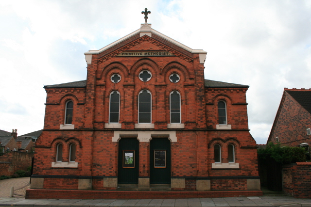
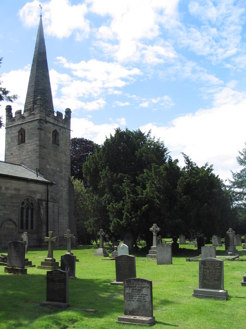
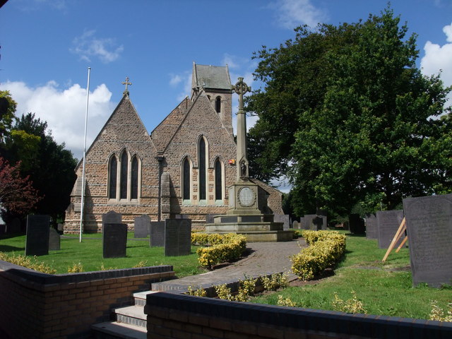
Stragglethorpe Images

Images are sourced within 2km of 52.932174/-1.0556389 or Grid Reference SK6337. Thanks to Geograph Open Source API. All images are credited.

Bassingfield Lane, Bassingfield Recreating this First for the square <a title="https://www.geograph.org.uk/photo/51960" href="https://www.geograph.org.uk/photo/51960">Link</a>
Bassingfield Lane, Bassingfield
Recreating this First for the square Link
Shepherd's, near Stragglethorpe, Nottinghamshire Recreating this 'First' for the square <a title="https://www.geograph.org.uk/photo/161588" href="https://www.geograph.org.uk/photo/161588">Link</a> . The restaurant is now known as 'The Shepherds'.
Shepherd's, near Stragglethorpe, Nottinghamshire
Recreating this 'First' for the square Link . The restaurant is now known as 'The Shepherds'.
Forest School at Wolds Childcare This is one element of a site which provides day nursery and pre-school for children up to 8 years of age. The website states that: “Within the  Forest School woodland experience, children explore their surroundings, investigate creatures in their habitats and find out about how seasonal changes affect the environment.”
Forest School at Wolds Childcare
This is one element of a site which provides day nursery and pre-school for children up to 8 years of age. The website states that: “Within the Forest School woodland experience, children explore their surroundings, investigate creatures in their habitats and find out about how seasonal changes affect the environment.”
Squidgy footpath Leading from Stragglethorpe to Bassingfield.
Squidgy footpath
Leading from Stragglethorpe to Bassingfield.
Public footpath through new plantation This was formerly part of the large arable/meadow field seen in <a title="https://www.geograph.org.uk/photo/7059076" href="https://www.geograph.org.uk/photo/7059076">Link</a> but was converted to woodland around 2010.
Public footpath through new plantation
This was formerly part of the large arable/meadow field seen in Link but was converted to woodland around 2010.
Stubble and new crop Corn stubble with new cereal planting.

Modern computer guidance of tractors allows the new crop to be sown precisely between the rows of the previous year's crop.
Stubble and new crop
Corn stubble with new cereal planting. Modern computer guidance of tractors allows the new crop to be sown precisely between the rows of the previous year's crop.
Footpath junction near Bassingfield Left to the White House on Radcliffe Road, right to The Shepherds and Stragglethorpe.
Footpath junction near Bassingfield
Left to the White House on Radcliffe Road, right to The Shepherds and Stragglethorpe.
Field footpath near Bassingfield This large field is looking rather neglected. The Google Earth timeline shows that it has traditionally been a grass field surrounded by arable land, but it is clearly a number of years since it was last cultivated, and the brambles are becoming quite widespread.
Field footpath near Bassingfield
This large field is looking rather neglected. The Google Earth timeline shows that it has traditionally been a grass field surrounded by arable land, but it is clearly a number of years since it was last cultivated, and the brambles are becoming quite widespread.
Bypassed stile It's not clear what it may have been attached to, but it is now easy for walkers to go round it.
Bypassed stile
It's not clear what it may have been attached to, but it is now easy for walkers to go round it.
Bridge over the Polser Brook The platform to the left appears to be there to enable water to be hauled up from the brook, probably for watering livestock. (It also provides an easier way through for dogs.)
Bridge over the Polser Brook
The platform to the left appears to be there to enable water to be hauled up from the brook, probably for watering livestock. (It also provides an easier way through for dogs.)
The Polser Brook near Bassingfield This is proposed as the basis of a new link between the Grantham Canal and the River Trent.
The Polser Brook near Bassingfield
This is proposed as the basis of a new link between the Grantham Canal and the River Trent.
Footpath through oilseed rape Clear enough at this time of year, but it may well become more difficult when the crop grows.
Footpath through oilseed rape
Clear enough at this time of year, but it may well become more difficult when the crop grows.
Nathans Lane Recreating this 'First' for the square <a title="https://www.geograph.org.uk/photo/51961" href="https://www.geograph.org.uk/photo/51961">Link</a> . The cars have updated, but little else
Nathans Lane
Recreating this 'First' for the square Link . The cars have updated, but little else
No Parking, keep driveway clear At least it doesn't claim to be in constant use!
No Parking, keep driveway clear
At least it doesn't claim to be in constant use!
View east from Hallam's Bridge More properly these days 'Hallam's Culvert!' <a title="https://www.geograph.org.uk/photo/3793494" href="https://www.geograph.org.uk/photo/3793494">Link</a> 
Compared with 2016, <a title="https://www.geograph.org.uk/photo/5175684" href="https://www.geograph.org.uk/photo/5175684">Link</a> the towpath side has been cleared of much of its vegetation, and the time of year means there is no surface weed.
View east from Hallam's Bridge
More properly these days 'Hallam's Culvert!' Link Compared with 2016, Link the towpath side has been cleared of much of its vegetation, and the time of year means there is no surface weed.
Holly Farm Looking rather dilapidated even compared with 2 years earlier <a title="https://www.geograph.org.uk/photo/6451905" href="https://www.geograph.org.uk/photo/6451905">Link</a>
Holly Farm
Looking rather dilapidated even compared with 2 years earlier Link
Bassingfield Lane, passing place Also providing turning space into fields on either side of the lane.
Bassingfield Lane, passing place
Also providing turning space into fields on either side of the lane.
Filling station near Bassingfield This has changed provider since I was here in 2009 <a title="https://www.geograph.org.uk/photo/1385869" href="https://www.geograph.org.uk/photo/1385869">Link</a>
Filling station near Bassingfield
This has changed provider since I was here in 2009 Link
Show me another place!

Stragglethorpe is located at Grid Ref: SK6337 (Lat: 52.932174, Lng: -1.0556389)

Administrative County: Nottinghamshire

District: Rushcliffe

Police Authority: Nottinghamshire

What 3 Words

///mock.vocal.minds. Near Radcliffe on Trent, Nottinghamshire

Related Wikis

Wollaton Road Methodist Church, Beeston

Wollaton Road Methodist Church, Beeston was a Methodist church on Wollaton Road, Beeston, Nottinghamshire from 1853 until 2014. == History == The church...

Bassingfield

Bassingfield is a hamlet in Nottinghamshire, England. It is located 3 miles (4.8 km) south east of Nottingham, close to the A52. It is in the civil parish...

Holme Pierrepont

Holme Pierrepont is a hamlet and civil parish located 5 miles (8 km) south-east of the city of Nottingham in Nottinghamshire, England. It is in the Gamston...

St Edmund's Church, Holme Pierrepont

St Edmund's Church, Holme Pierrepont is a parish church in the Church of England in Holme Pierrepont, Nottinghamshire. The church is Grade I listed by...

St Mary's Church, Radcliffe on Trent

St Mary's Church is a parish church in the Church of England in Radcliffe on Trent, Nottinghamshire. The church is Grade II listed by the Department for...

Holme Pierrepont Hall

Holme Pierrepont Hall is a medieval Manor House in Holme Pierrepont near Nottingham. It is a Grade I listed building. == History == The Pierrepont family...

Radcliffe Olympic F.C.

Radcliffe Olympic F.C. is a football club based in Radcliffe-on-Trent, near Nottingham, Nottinghamshire, England. The club are currently members of the...

National Cycle Route 15

National Cycle Route 15 is part of the National Cycle Network in the East Midlands which, when complete, will run from National Cycle Route 1 near Tattershall...

Nearby Amenities

Located within 500m of 52.932174,-1.0556389
Bus Stop
Cotgrave Golf Club
Bus: yes
Public Transport: platform
Source: survey
Lat/Long: 52.9290776/-1.0539076
Bus Stop
Cotgrave Golf Club
Bus: yes
Public Transport: platform
Source: survey
Lat/Long: 52.9290575/-1.0541787
Bus Stop
Nottingham Road
Bus: yes
Naptan AtcoCode: 3300RU0056
Naptan Bearing: S
Naptan CommonName: Nottingham Road
Naptan Crossing: Nottingham Road
Naptan Indicator: S-bound
Naptan NaptanCode: ntsajpgp
Naptan Notes: None
Naptan Street: Main Road
Naptan Verified: no
Public Transport: platform
Source: naptan_import
Lat/Long: 52.9312556/-1.0550042
Bus Stop
Nottingham Road
Bus: yes
Naptan AtcoCode: 3300RU0551
Naptan Bearing: NW
Naptan CommonName: Nottingham Road
Naptan Crossing: Nottingham Road
Naptan Indicator: NW-bound
Naptan Landmark: Shepherds
Naptan NaptanCode: ntsgawtd
Naptan Notes: none
Naptan Street: Main Road
Naptan Verified: no
Public Transport: platform
Source: naptan_import
Lat/Long: 52.9312393/-1.0552128
Power: pole
Lat/Long: 52.9325667/-1.0629782
Power: pole
Source: Bing
Lat/Long: 52.9319978/-1.0613901
Bicycle Parking
Covered: yes
Lat/Long: 52.9309494/-1.0563822
Barrier: kissing_gate
Lat/Long: 52.9318271/-1.0536897
Barrier: kissing_gate
Lat/Long: 52.9338134/-1.0556431
Power: pole
Lat/Long: 52.9364259/-1.0577217
Power: pole
Lat/Long: 52.9354456/-1.0568632
Power: pole
Lat/Long: 52.9346457/-1.0561625
Power: pole
Lat/Long: 52.9338799/-1.0555006
Power: pole
Lat/Long: 52.929088/-1.0527622
Power: pole
Lat/Long: 52.9300559/-1.0556636
Power: pole
Lat/Long: 52.9305995/-1.0572705
Power: pole
Lat/Long: 52.9293285/-1.0506674
Power: pole
Lat/Long: 52.9302664/-1.051681
The data included in this document is from www.openstreetmap.org. The data is made available under ODbL.

Have you been to Stragglethorpe?

Leave your review of Stragglethorpe below (or comments, questions and feedback).