Stein

Settlement in Inverness-shire

Scotland

Stein

Loch Bay and Stein, Vaternish Peninsula The prominent white houses of Stein including the hotel are visible in this view. Ardmore Point is visible in the distance and nearer is the woodland behind Waternish House. The view is taken from the road above Camuslusta.
Loch Bay and Stein, Vaternish Peninsula Credit: Julian Paren

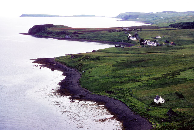
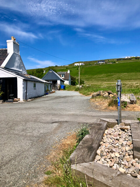
Stein is a small village located in the Inverness-shire region of Scotland. Situated on the Isle of Skye, Stein is known for its picturesque views of the surrounding mountains and the nearby Loch Bay. The village is home to a small population of residents, many of whom are involved in the local fishing industry.

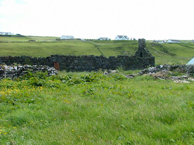
Stein has a rich history dating back to the 18th century when it was a bustling fishing port. Today, the village still maintains its maritime heritage with a small harbor where fishing boats can be seen coming and going. Visitors to Stein can enjoy fresh seafood at the local restaurants and cafes, as well as explore the quaint streets lined with traditional Scottish cottages.

In addition to its natural beauty and fishing industry, Stein is also a popular destination for outdoor enthusiasts. The surrounding area offers a variety of hiking trails, cycling routes, and water activities such as kayaking and fishing. Overall, Stein is a charming village that offers a peaceful retreat for those looking to experience the beauty of the Scottish Highlands.

If you have any feedback on the listing, please let us know in the comments section below.

Stein Images

Images are sourced within 2km of 57.517225/-6.5756322 or Grid Reference NG2656. Thanks to Geograph Open Source API. All images are credited.

Loch Bay and Stein, Vaternish Peninsula The prominent white houses of Stein including the hotel are visible in this view. Ardmore Point is visible in the distance and nearer is the woodland behind Waternish House. The view is taken from the road above Camuslusta.
Loch Bay and Stein, Vaternish Peninsula
The prominent white houses of Stein including the hotel are visible in this view. Ardmore Point is visible in the distance and nearer is the woodland behind Waternish House. The view is taken from the road above Camuslusta.
Port paraphernalia
Port paraphernalia
Up the lane, to where "End House" stands true to its name The lane continues in a footpath that climbs up through the fields, guiding the way to the whitewashed cottages of Brae Stein. Above, a vast expanse of blue skies reigns, adorned with delicate cirrus clouds.
Up the lane, to where "End House" stands true to its name
The lane continues in a footpath that climbs up through the fields, guiding the way to the whitewashed cottages of Brae Stein. Above, a vast expanse of blue skies reigns, adorned with delicate cirrus clouds.
Lochbay jetty
Lochbay jetty
Hall in Hallin Talla Bhatairnis / Waternish Community Hall, repainted and with wooden panels attached since 2008 <a title="https://www.geograph.org.uk/photo/1042794" href="https://www.geograph.org.uk/photo/1042794">Link</a>
Hall in Hallin
Talla Bhatairnis / Waternish Community Hall, repainted and with wooden panels attached since 2008 Link
A Palm tree by the shore Loch Bay viewed from the village of Stein.
A Palm tree by the shore
Loch Bay viewed from the village of Stein.
Loch Bay Viewed from Stein. The nearest headland is Rubha Maol and in the distance is Dunvegan Head.
Loch Bay
Viewed from Stein. The nearest headland is Rubha Maol and in the distance is Dunvegan Head.
Eastern shore of Loch Bay From the village of Stein.
Eastern shore of Loch Bay
From the village of Stein.
Ruined building at Stein The houses in the background are at Lusta.
Ruined building at Stein
The houses in the background are at Lusta.
Stein A pretty village on the shore of Loch Bay.The headland on the opposite side of the loch is Rubha Maol.
Stein
A pretty village on the shore of Loch Bay.The headland on the opposite side of the loch is Rubha Maol.
Waternish View This is the view from the main route through Waternish - the B886, looking towards the pastures surrounding Waternish House. The highest part of the headland in the far distance is called Beinn Bhreac.
Waternish View
This is the view from the main route through Waternish - the B886, looking towards the pastures surrounding Waternish House. The highest part of the headland in the far distance is called Beinn Bhreac.
Waternish View 2 This is the view looking towards the islands of Isay,Mingay and Clett to the left and Ardmore Point to the right, with the Outer Isles in the far distance.
Waternish View 2
This is the view looking towards the islands of Isay,Mingay and Clett to the left and Ardmore Point to the right, with the Outer Isles in the far distance.
Cattle above Stein Taken from the B886 near Lusta. View down the grassy slopes of cattle pasture toward Stein and Ardmore Bay. In the distance, Dunvegan Head can be seen. In front of it lie the Isles of Isay, Mingay and Clett. On the left, Rubha Maol marks the end of Loch Bay which is an offshoot off Ardmore Bay.
Cattle above Stein
Taken from the B886 near Lusta. View down the grassy slopes of cattle pasture toward Stein and Ardmore Bay. In the distance, Dunvegan Head can be seen. In front of it lie the Isles of Isay, Mingay and Clett. On the left, Rubha Maol marks the end of Loch Bay which is an offshoot off Ardmore Bay.
View to Stein Taken from the B886 above Stein. View down the cattle pasture to the village and over Loch Bay to Sgurr a' Bhàgh.

.
View to Stein
Taken from the B886 above Stein. View down the cattle pasture to the village and over Loch Bay to Sgurr a' Bhàgh. .
Cattle Grazing above Loch Bay Taken from the B886 above Stein. View down the grassy slopes of cattle pasture toward the head of Loch Bay. To the right rises Beinn Bhreac. More to the left in the background, Ben Horneval peeps over Druim a' Chaim.
Cattle Grazing above Loch Bay
Taken from the B886 above Stein. View down the grassy slopes of cattle pasture toward the head of Loch Bay. To the right rises Beinn Bhreac. More to the left in the background, Ben Horneval peeps over Druim a' Chaim.
Stein Looking down on the houses and pub at Stein. Across Loch Bay is Rubha Maol point, rising left to the 300m summit of Beinn Bhreac.
Stein
Looking down on the houses and pub at Stein. Across Loch Bay is Rubha Maol point, rising left to the 300m summit of Beinn Bhreac.
Stein: view from the road above Looking down on the village of Stein and across Loch Bay towards the dramatic cliffs below Beinn Bhreac.
Stein: view from the road above
Looking down on the village of Stein and across Loch Bay towards the dramatic cliffs below Beinn Bhreac.
Stein: the Stein Inn An inn in this small village, looking out over Loch Bay.
Stein: the Stein Inn
An inn in this small village, looking out over Loch Bay.
Show me another place!

Stein is located at Grid Ref: NG2656 (Lat: 57.517225, Lng: -6.5756322)

Unitary Authority: Highland

Police Authority: Highlands and Islands

What 3 Words

///gloves.townhouse.lives. Near Dunvegan, Highland

Nearby Locations

Lusta Stein

Related Wikis

Stein, Skye

Stein (Scottish Gaelic: Steinn) is a crofting township, situated on the north eastern shore of Loch Bay, in the west of the Waternish peninsula, on the...

Waternish

Waternish or Vaternish (Scottish Gaelic: Bhàtairnis) is a peninsula approximately 12 kilometres (7+1⁄2 miles) long on the island of Skye, Scotland, situated...

Dun Hallin

Dun Hallin is an Iron Age broch located near the northwest coast of the island of Skye, in Scotland (grid reference NG25665927). == Location == Dun Hallin...

Halistra

Halistra (Scottish Gaelic: Halastra), is a small crofting township located on the west coast of the Waternish peninsula, overlooking Loch Bay, on the island...

Nearby Amenities

Located within 500m of 57.517225,-6.5756322
Created By: dmgroom_coastlines
Source: PGS
Lat/Long: 57.51716/-6.5839
Created By: dmgroom_coastlines
Source: PGS
Lat/Long: 57.51687/-6.58202
Created By: dmgroom_coastlines
Source: PGS
Lat/Long: 57.51658/-6.58061
Created By: dmgroom_coastlines
Source: PGS
Lat/Long: 57.51645/-6.58038
Created By: dmgroom_coastlines
Source: PGS
Lat/Long: 57.51632/-6.58015
Source: PGS
Lat/Long: 57.5156888/-6.578268
Source: PGS
Lat/Long: 57.5158343/-6.5778
Source: PGS
Lat/Long: 57.5157741/-6.5769068
Source: PGS
Lat/Long: 57.51579/-6.5762116
Source: PGS
Lat/Long: 57.5158032/-6.5750872
Source: PGS
Lat/Long: 57.5156259/-6.5738887
Created By: dmgroom_coastlines
Source: PGS
Lat/Long: 57.51528/-6.5726
Source: PGS
Lat/Long: 57.5150052/-6.5722933
Source: PGS
Lat/Long: 57.5145313/-6.5719486
Source: PGS
Lat/Long: 57.5142891/-6.5715005
Source: PGS
Lat/Long: 57.5136957/-6.5711409
Post Box
Brand: Royal Mail
Brand Wikidata: Q638098
Collection Times: Mo-Sa 07:45
Drive Through: no
Operator: Royal Mail
Operator Wikidata: Q638098
Post Box Type: lamp
Ref: IV55 47
Source: survey
Lat/Long: 57.5155778/-6.5727979
Pub
Stein Inn
Website: https://www.stein-inn.co.uk/
Lat/Long: 57.5153336/-6.5722512
Generator Method: wind_turbine
Generator Source: wind
Power: generator
Lat/Long: 57.518579/-6.5724778
Dandelion Designes
Addr Postcode: IV55 8GA
Addr Street: Stein
Opening Hours: Mo-Su 11:00-17:00
Phone: +44 1470 592218
Shop: gift
Website: https://www.dandelion-designs.co.uk/
Lat/Long: 57.5150988/-6.5717901
Restaurant
Loch Bay Restaurant
Addr City: Stein
Addr Housenumber: 1
Addr Postcode: IV55 8GA
Addr Street: Macleods Terrace
Cuisine: regional
Phone: +44 1470 592235
Website: https://www.lochbay-restaurant.co.uk
Lat/Long: 57.5148534/-6.5711213
Charging Station
Lat/Long: 57.5192481/-6.5711256
Charging Station
Lat/Long: 57.5151919/-6.5720086
Restaurant
Stein Inn
Lat/Long: 57.5153115/-6.5722025
Stein Inn
Tourism: guest_house
Lat/Long: 57.51529/-6.5721548
Stein
Name Gd: Steinn
Old Name: Lochbay
Place: village
Wikidata: Q3777310
Wikipedia: en:Stein, Skye
Lat/Long: 57.5175241/-6.5714139
Power: pole
Lat/Long: 57.5205201/-6.5707085
Power: pole
Lat/Long: 57.5199429/-6.5703623
Power: pole
Lat/Long: 57.5195419/-6.5697101
Power: pole
Lat/Long: 57.5191246/-6.5691183
Power: pole
Lat/Long: 57.5187852/-6.5685949
Power: pole
Lat/Long: 57.5183225/-6.5679427
Power: pole
Lat/Long: 57.5180328/-6.5674435
Power: pole
Lat/Long: 57.5211493/-6.5719687
Power: pole
Lat/Long: 57.5212271/-6.5733858
Power: pole
Lat/Long: 57.5213049/-6.5747184
Defibrillator
Addr Postcode: IV55 8GD
Emergency: defibrillator
Indoor: no
Lat/Long: 57.5192558/-6.5713278
The data included in this document is from www.openstreetmap.org. The data is made available under ODbL.

Have you been to Stein?

Leave your review of Stein below (or comments, questions and feedback).