Staiside Court

Settlement in Midlothian

Scotland

Staiside Court

Auld Coal Terrace New houses seen from Burnbank Park, the site of Polton Colliery.  The Pittendriech Burn flows under the park through a culvert.
Auld Coal Terrace Credit: Richard Webb

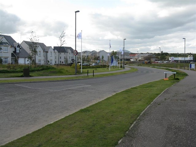
Staiside Court is a residential neighborhood located in Midlothian, a historic county in Scotland. Situated in the picturesque countryside, Staiside Court offers a peaceful and serene environment for its residents. The neighborhood is known for its well-maintained properties and beautiful surroundings.

Staiside Court consists of a collection of modern houses, designed to cater to the needs of families and individuals alike. The properties are predominantly detached or semi-detached, with spacious gardens and driveways. The architecture of the houses is contemporary, reflecting a blend of traditional and modern design elements.

The neighborhood boasts excellent amenities, including a community park and green spaces where residents can enjoy leisurely walks or outdoor activities. Additionally, Staiside Court benefits from its close proximity to local shops and services, ensuring convenience for its residents.

Midlothian, where Staiside Court is located, offers a wealth of attractions and amenities. The area is renowned for its rich history, with numerous castles and historic sites to explore. Nature enthusiasts will appreciate the nearby Pentland Hills Regional Park, which offers breathtaking views and a variety of outdoor activities such as hiking and cycling.

Overall, Staiside Court provides a desirable living environment, combining modern housing with a tranquil setting. With its convenient location and access to a range of amenities, it is an ideal place for individuals and families seeking a peaceful yet well-connected community in Midlothian.

If you have any feedback on the listing, please let us know in the comments section below.

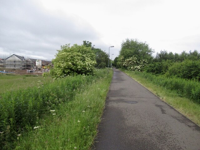
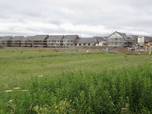
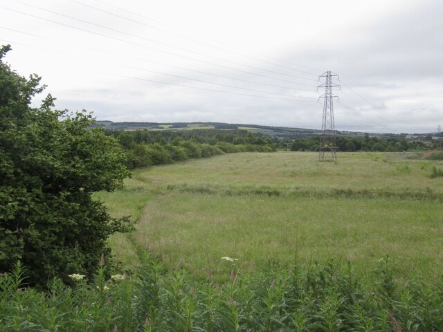
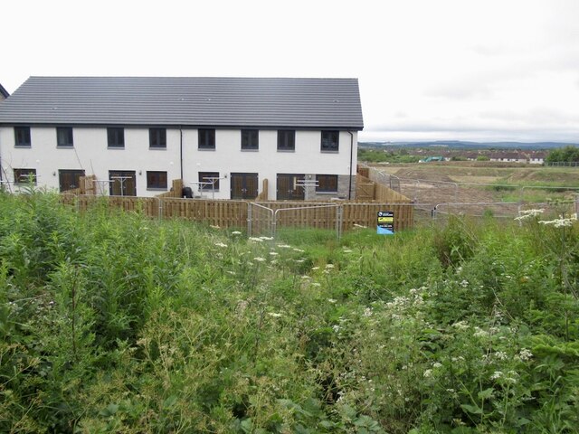
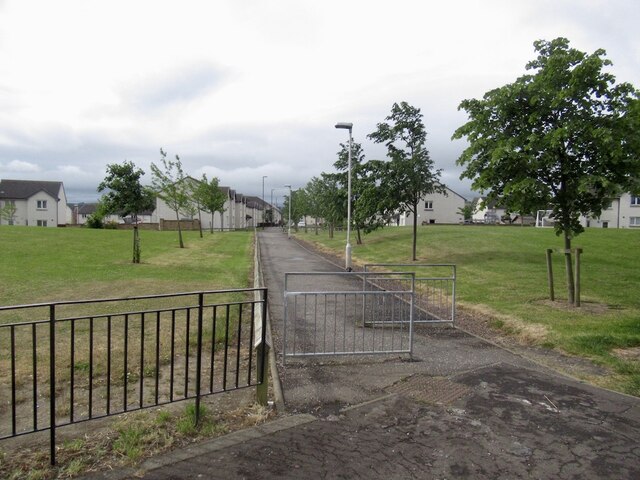
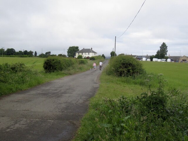
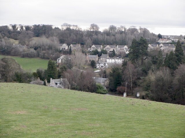
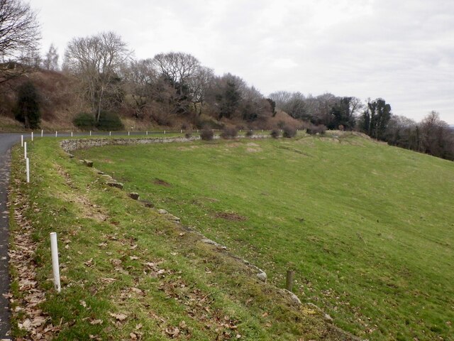
Staiside Court Images

Images are sourced within 2km of 55.870673/-3.1127439 or Grid Reference NT3064. Thanks to Geograph Open Source API. All images are credited.

Auld Coal Terrace New houses seen from Burnbank Park, the site of Polton Colliery.  The Pittendriech Burn flows under the park through a culvert.
Auld Coal Terrace
New houses seen from Burnbank Park, the site of Polton Colliery. The Pittendriech Burn flows under the park through a culvert.
Penicuik to Musselburgh Path Passing the hospital with a building site ahead.
Penicuik to Musselburgh Path
Passing the hospital with a building site ahead.
Building site Ground between Eskbank and Bonnyrigg is being filled in.
Building site
Ground between Eskbank and Bonnyrigg is being filled in.
Empty field It will soon be built upon.
Empty field
It will soon be built upon.
New houses, Bonnyrigg Ground between Eskbank and Bonnyrigg is being filled in.
New houses, Bonnyrigg
Ground between Eskbank and Bonnyrigg is being filled in.
Building site, Bonnyrigg Ground between Eskbank and Bonnyrigg is being filled in.
Building site, Bonnyrigg
Ground between Eskbank and Bonnyrigg is being filled in.
Penicuik to Musselburgh Path Building site on the left.
Penicuik to Musselburgh Path
Building site on the left.
Path, Bonnyrigg To the Auld Coal residential streets recently built to the south.
Path, Bonnyrigg
To the Auld Coal residential streets recently built to the south.
Penicuik to Musselburgh Path
Danger! The tar changed colour! Because the Heras did not block the road many people braved the hazardous colour.  (A section was resurfaced and the signs had not been fully removed)
Danger!
The tar changed colour! Because the Heras did not block the road many people braved the hazardous colour. (A section was resurfaced and the signs had not been fully removed)
Castell Maynes Crescent New houses by the rails to trails path, Bonnyrigg.
Castell Maynes Crescent
New houses by the rails to trails path, Bonnyrigg.
Penicuik to Musselburgh Path Passing Castell Maynes Crescent.
Penicuik to Musselburgh Path
Passing Castell Maynes Crescent.
Field, Dalhousie Chesters For how much longer? There are boreholes and it is within a bypass.
Field, Dalhousie Chesters
For how much longer? There are boreholes and it is within a bypass.
Penicuik to Musselburgh Path
Road from Dalhousie Chesters Agricultural, but within a bypass and there have been cores bored here.
Road from Dalhousie Chesters
Agricultural, but within a bypass and there have been cores bored here.
Road, Dalhousie Chesters
View over Lasswade
View over Lasswade
Road to Kings Acre golf courses
Show me another place!

Staiside Court is located at Grid Ref: NT3064 (Lat: 55.870673, Lng: -3.1127439)

Unitary Authority: Midlothian

Police Authority: The Lothians and Scottish Borders

What 3 Words

///officers.digested.camps. Near Bonnyrigg, Midlothian

Nearby Locations

Staiside Court Hopefield

Related Wikis

Hopefield, Bonnyrigg

Hopefield is an area in the south of Bonnyrigg, Midlothian, occupied by a mid-20th century residential neighbourhood and by an early-21st century, ongoing...

Lasswade High School Centre

Lasswade High School is a non-denominational secondary state school in Bonnyrigg, Midlothian, Scotland. == History == A parish school was first established...

Bonnyrigg railway station

Bonnyrigg railway station was a railway station that served the town of Bonnyrigg, Midlothian, Scotland from 1855 to 1965 on the Peebles Railway. ��2...
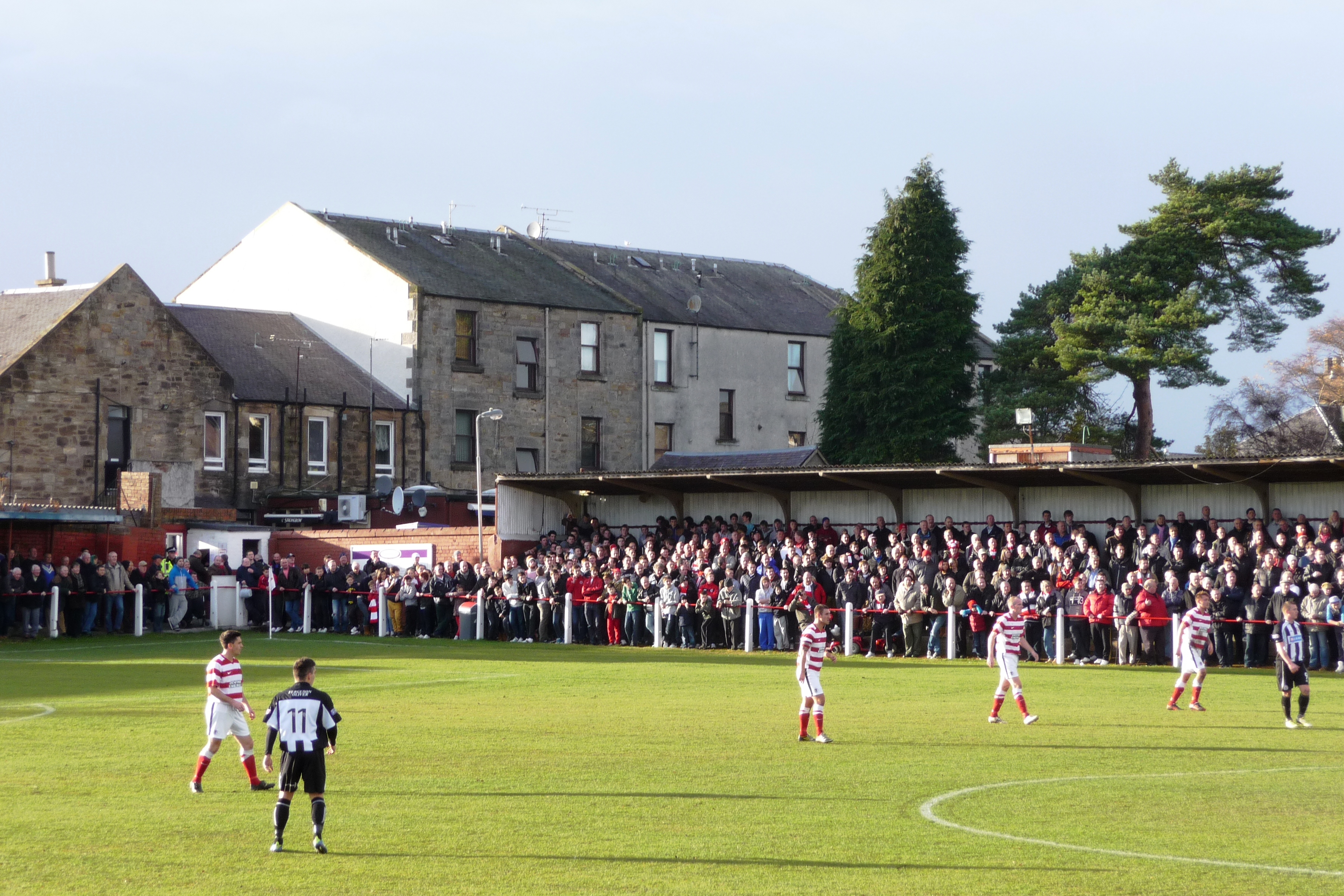
New Dundas Park

New Dundas Park is a stadium in Bonnyrigg, Scotland. It is used mostly for football matches as the home ground of Bonnyrigg Rose. The stadium has a capacity...

Nearby Amenities

Located within 500m of 55.870673,-3.1127439
Lanes: 1
Traffic Calming: choker
Lat/Long: 55.8683479/-3.1127706
Source: OS OpenData StreetView
Lat/Long: 55.8727305/-3.106168
Noexit: yes
Lat/Long: 55.8715884/-3.1086059
Source: yahoo tracing
Lat/Long: 55.8705072/-3.1093348
Traffic Signals
Traffic Signals: signal
Lat/Long: 55.8706514/-3.1122417
Traffic Calming: cushion
Lat/Long: 55.8742832/-3.1161693
Lanes: 1
Traffic Calming: choker
Lat/Long: 55.8681003/-3.1130944
Traffic Calming: cushion
Lat/Long: 55.8701906/-3.1125377
Barrier: bollard
Lat/Long: 55.8681219/-3.1165689
Post Box
Ref: EH18 281
Lat/Long: 55.8708785/-3.1136231
Post Box
Ref: EH19 283
Lat/Long: 55.874664/-3.1127751
Post Box
Ref: EH19 162
Lat/Long: 55.8674646/-3.1158457
Post Box
Ref: EH19 282
Lat/Long: 55.8718112/-3.1072052
Crossing
Crossing: uncontrolled
Crossing Ref: zebra
Lat/Long: 55.8666441/-3.1098679
Pub
Royal Oak
Addr Housenumber: 58
Addr Postcode: EH19 3DE
Addr Street: Polton Street
Fhrs Id: 158974
Source Addr: FHRS Open Data
Lat/Long: 55.8735469/-3.1073455
Bus Stop
Dobbies Road
Bench: yes
Bin: yes
Bus: yes
Lit: yes
Naptan AdministrativeAreaCode: 130
Naptan Area Name: Midlothian
Naptan AtcoAreaCode: 628
Naptan AtcoCode: 6280325955
Naptan Bearing: NE
Naptan CommonName: Dobbies Road
Naptan Indicator: at
Naptan Landmark: -
Naptan LocalityName: Bonnyrigg
Naptan NaptanCode: 64323275
Naptan NptgLocalityCode: ES000413
Naptan SourceLocalityType: Lo
Naptan StopAreaCode: 628G325955
Naptan StopAreaType: GPBS
Naptan StopArea Name: Dobbies Road
Naptan Street: Polton Street
Naptan Verified: yes
Passenger Information Display: yes
Public Transport: platform
Shelter: yes
Source: NaPTAN + Survey
Tactile Paving: no
Lat/Long: 55.8738474/-3.1074941
Bus Stop
Hazel Drive
Bus: yes
Naptan AdministrativeAreaCode: 130
Naptan Area Name: Midlothian
Naptan AtcoAreaCode: 628
Naptan AtcoCode: 6280325945
Naptan Bearing: NE
Naptan CommonName: Hazel Drive
Naptan Indicator: opp
Naptan Landmark: -
Naptan LocalityName: Bonnyrigg
Naptan NaptanCode: 64323289
Naptan NptgLocalityCode: ES000413
Naptan SourceLocalityType: Lo
Naptan StopAreaCode: 628G301790
Naptan StopAreaType: GPBS
Naptan StopArea Name: Hazel Drive
Naptan Street: Polton Road
Naptan Verified: yes
Public Transport: platform
Shelter: yes
Source: NaPTAN + Survey
Lat/Long: 55.8722922/-3.1098384
Bus Stop
Hazel Drive
Bus: yes
Naptan AdministrativeAreaCode: 130
Naptan Area Name: Midlothian
Naptan AtcoAreaCode: 628
Naptan AtcoCode: 6280301790
Naptan Bearing: SW
Naptan CommonName: Hazel Drive
Naptan Indicator: at
Naptan Landmark: -
Naptan LocalityName: Bonnyrigg
Naptan NaptanCode: 64323287
Naptan NptgLocalityCode: ES000413
Naptan SourceLocalityType: Lo
Naptan StopAreaCode: 628G301790
Naptan StopAreaType: GPBS
Naptan StopArea Name: Hazel Drive
Naptan Street: Polton Road
Naptan Verified: yes
Public Transport: platform
Source: NaPTAN + Survey
Lat/Long: 55.8721628/-3.1097566
Barrier: cycle_barrier
Bicycle: yes
Cycle Barrier: double
Foot: yes
Lat/Long: 55.8705283/-3.1049027
Barrier: cycle_barrier
Bicycle: yes
Foot: yes
Lat/Long: 55.8672175/-3.1120508
Barrier: cycle_barrier
Bicycle: yes
Foot: yes
Lat/Long: 55.8675496/-3.1113176
Barrier: cycle_barrier
Bicycle: yes
Cycle Barrier: double
Foot: yes
Lat/Long: 55.869528/-3.1067682
Barrier: cycle_barrier
Bicycle: yes
Cycle Barrier: double
Foot: yes
Lat/Long: 55.8698457/-3.1062324
Barrier: cycle_barrier
Bicycle: yes
Foot: yes
Lat/Long: 55.8689661/-3.1195401
Crossing
Crossing: traffic_signals
Crossing Island: no
Kerb: lowered
Tactile Paving: yes
Lat/Long: 55.8705454/-3.1124071
Crossing
Crossing: traffic_signals
Crossing Island: no
Kerb: lowered
Tactile Paving: yes
Lat/Long: 55.8708087/-3.1119963
Tesco Express
Addr Housenumber: 1
Addr Postcode: EH19 3PZ
Addr Street: Staiside Court
Brand: Tesco Express
Brand Wikidata: Q98456772
Brand Wikipedia: en:Tesco
Contact Website: https://www.tesco.com/store-locator/bonnyrigg/rosewell-rd
Fhrs Id: 799852
Shop: convenience
Source Addr: FHRS Open Data
Lat/Long: 55.8705497/-3.1127145
Crossing
Crossing: uncontrolled
Crossing Ref: zebra
Lat/Long: 55.87119/-3.112485
Barrier: bollard
Bicycle: yes
Foot: yes
Lat/Long: 55.8712518/-3.1126103
Crossing
Crossing: uncontrolled
Crossing Ref: zebra
Lat/Long: 55.8722557/-3.1131925
Bicycle Parking
Bicycle Parking: stands
Capacity: 80
Covered: yes
Lat/Long: 55.8724082/-3.1136633
Charging Station
Capacity: 2
Lat/Long: 55.8732204/-3.1156159
Crossing
Crossing: uncontrolled
Crossing Ref: zebra
Lat/Long: 55.8741324/-3.1157641
Give Way
Lat/Long: 55.8723664/-3.1130003
Give Way
Lat/Long: 55.8726751/-3.112444
Give Way
Lat/Long: 55.8730409/-3.1137241
Give Way
Lat/Long: 55.8731939/-3.1118328
Give Way
Lat/Long: 55.8736925/-3.1144794
Give Way
Lat/Long: 55.874094/-3.1155561
Give Way
Lat/Long: 55.8742838/-3.1080443
Give Way
Lat/Long: 55.87434/-3.1104051
Give Way
Lat/Long: 55.8743801/-3.116292
Give Way
Lat/Long: 55.8744183/-3.1106232
Lasswade Swimming Pool
Access: permissive
Covered: yes
Leisure: swimming_pool
Motor Vehicle: permissive
Operator: Midlothian Council
Source: Midlothian Council
Sport: swimming
Lat/Long: 55.87129/-3.1131657
Library
Lasswade Library
Source: Midlothian Council
Wikidata: Q62765308
Lat/Long: 55.8717713/-3.1137959
Bus Stop
Hopefield Place
Bench: yes
Bus: yes
Naptan AdministrativeAreaCode: 130
Naptan Area Name: Midlothian
Naptan AtcoAreaCode: 628
Naptan AtcoCode: 6280301800
Naptan Bearing: SW
Naptan CommonName: Hopefield Place
Naptan Indicator: opp
Naptan Landmark: Primary School
Naptan LocalityName: Bonnyrigg
Naptan NaptanCode: 64323279
Naptan NptgLocalityCode: ES000413
Naptan SourceLocalityType: Lo
Naptan StopAreaCode: 628G325940
Naptan StopAreaType: GPBS
Naptan StopArea Name: Hopefield Place
Naptan Street: Rosewell Road
Naptan Verified: yes
Public Transport: platform
Shelter: yes
Source: NaPTAN + Survey
Tactile Paving: no
Lat/Long: 55.8690461/-3.1146969
Bus Stop
Hopefield Place
Bench: yes
Bin: no
Bus: yes
Naptan AdministrativeAreaCode: 130
Naptan Area Name: Midlothian
Naptan AtcoAreaCode: 628
Naptan AtcoCode: 6280325940
Naptan Bearing: NE
Naptan CommonName: Hopefield Place
Naptan Indicator: at
Naptan Landmark: Staiside PH
Naptan LocalityName: Bonnyrigg
Naptan NaptanCode: 64323282
Naptan NptgLocalityCode: ES000413
Naptan SourceLocalityType: Lo
Naptan StopAreaCode: 628G325940
Naptan StopAreaType: GPBS
Naptan StopArea Name: Hopefield Place
Naptan Street: Rosewell Road
Naptan Verified: yes
Public Transport: platform
Shelter: yes
Source: NaPTAN + Survey
Lat/Long: 55.8703233/-3.1128665
Bus Stop
Dalhousie Drive
Bench: yes
Bin: no
Bus: yes
Lit: yes
Naptan AdministrativeAreaCode: 130
Naptan Area Name: Midlothian
Naptan AtcoAreaCode: 628
Naptan AtcoCode: 6280301760
Naptan Bearing: NW
Naptan CommonName: Dalhousie Drive
Naptan Indicator: opp
Naptan Landmark: Hawthornden Primary School
Naptan LocalityName: Poltonhall
Naptan NaptanCode: 64324387
Naptan NptgLocalityCode: ES003048
Naptan SourceLocalityType: U
Naptan StopAreaCode: 628G325920
Naptan StopAreaType: GPBS
Naptan StopArea Name: Dalhousie Drive
Naptan Street: Polton Avenue Road
Naptan Verified: yes
Public Transport: platform
Shelter: yes
Source: NaPTAN + Survey
Tactile Paving: no
Lat/Long: 55.8703022/-3.119198
Bus Stop
Dalhousie Drive
Bench: yes
Bin: no
Bus: yes
Naptan AdministrativeAreaCode: 130
Naptan Area Name: Midlothian
Naptan AtcoAreaCode: 628
Naptan AtcoCode: 6280325920
Naptan Bearing: SE
Naptan CommonName: Dalhousie Drive
Naptan Indicator: at
Naptan Landmark: Hawthornden Primary School
Naptan LocalityName: Poltonhall
Naptan NaptanCode: 64324389
Naptan NptgLocalityCode: ES003048
Naptan SourceLocalityType: U
Naptan StopAreaCode: 628G325920
Naptan StopAreaType: GPBS
Naptan StopArea Name: Dalhousie Drive
Naptan Street: Polton Avenue Road
Naptan Verified: yes
Public Transport: platform
Shelter: yes
Source: NaPTAN + Survey
Tactile Paving: no
Lat/Long: 55.8701335/-3.1186692
Bus Stop
Rosewell Road
Bench: yes
Bin: no
Bus: yes
Lit: yes
Naptan AdministrativeAreaCode: 130
Naptan Area Name: Midlothian
Naptan AtcoAreaCode: 628
Naptan AtcoCode: 6280301750
Naptan Bearing: NW
Naptan CommonName: Rosewell Road
Naptan Indicator: near
Naptan Landmark: Rugby Club
Naptan LocalityName: Poltonhall
Naptan NaptanCode: 64324395
Naptan NptgLocalityCode: ES003048
Naptan SourceLocalityType: U
Naptan StopAreaCode: 628G301750
Naptan StopAreaType: GPBS
Naptan StopArea Name: Rosewell Road
Naptan Street: Polton Avenue Road
Naptan Verified: yes
Public Transport: platform
Shelter: yes
Source: NaPTAN + Survey
Tactile Paving: no
Lat/Long: 55.868923/-3.1166761
Bus Stop
Skeltiemuir Avenue
Bus: yes
Naptan AdministrativeAreaCode: 130
Naptan Area Name: Midlothian
Naptan AtcoAreaCode: 628
Naptan AtcoCode: 6280325930
Naptan Bearing: NE
Naptan CommonName: Skeltiemuir Avenue
Naptan Indicator: opp
Naptan Landmark: -
Naptan LocalityName: Poltonhall
Naptan NaptanCode: 64323298
Naptan NptgLocalityCode: ES003048
Naptan SourceLocalityType: U
Naptan StopAreaCode: 628G301750
Naptan StopAreaType: GPBS
Naptan StopArea Name: Rosewell Road
Naptan Street: Rosewell Road
Naptan Verified: yes
Public Transport: platform
Shelter: yes
Source: NaPTAN + Survey
Lat/Long: 55.8688293/-3.1152322
Addr Housenumber: 107
Addr Street: Dobbie's Road
Lat/Long: 55.8743958/-3.1087971
Barrier: cycle_barrier
Bicycle: yes
Cycle Barrier: double
Foot: yes
Lat/Long: 55.8701608/-3.1056407
Barrier: bollard
Lat/Long: 55.8716181/-3.1051873
Crossing
Crossing: zebra
Crossing Island: no
Kerb: flush
Tactile Paving: yes
Lat/Long: 55.8677624/-3.107065
Crossing
Crossing: uncontrolled
Crossing Ref: zebra
Lat/Long: 55.8724701/-3.1132164
Traffic Calming: cushion
Lat/Long: 55.8737426/-3.1147258
Traffic Calming: cushion
Lat/Long: 55.8740039/-3.1154099
Give Way
Lat/Long: 55.8747074/-3.1116816
Give Way
Lat/Long: 55.8746667/-3.1132906
Traffic Calming: cushion
Lat/Long: 55.8741793/-3.1078139
Give Way
Lat/Long: 55.8728765/-3.1089212
Traffic Calming: cushion
Lat/Long: 55.8723778/-3.1085804
Traffic Calming: cushion
Lat/Long: 55.8720892/-3.1076812
Give Way
Lat/Long: 55.8725666/-3.109176
Crossing
Button Operated: yes
Crossing: traffic_signals
Crossing Island: no
Kerb: lowered
Tactile Paving: yes
Lat/Long: 55.8727101/-3.1090766
Give Way
Lat/Long: 55.8718973/-3.1071801
Give Way
Lat/Long: 55.8719472/-3.1070856
Traffic Calming: cushion
Lat/Long: 55.8718796/-3.1070293
Traffic Calming: cushion
Lat/Long: 55.8716279/-3.1062272
Traffic Calming: cushion
Lat/Long: 55.8725698/-3.1063562
Traffic Calming: cushion
Lat/Long: 55.8727633/-3.1062537
Traffic Calming: cushion
Lat/Long: 55.8710838/-3.1051218
Give Way
Lat/Long: 55.8713457/-3.1052645
Give Way
Lat/Long: 55.8712973/-3.1077541
Give Way
Lat/Long: 55.8709064/-3.1064437
Give Way
Lat/Long: 55.8709987/-3.1070028
Give Way
Lat/Long: 55.8700691/-3.1082129
Give Way
Lat/Long: 55.8703931/-3.1088801
Give Way
Lat/Long: 55.8704697/-3.1093761
Give Way
Lat/Long: 55.870962/-3.1083094
Give Way
Lat/Long: 55.8707527/-3.1101579
Crossing
Crossing: traffic_signals
Crossing Island: no
Kerb: lowered
Tactile Paving: yes
Lat/Long: 55.8707381/-3.1124053
Traffic Calming: hump
Lat/Long: 55.8716171/-3.1122779
Crossing
Button Operated: yes
Crossing: traffic_signals
Crossing Island: no
Kerb: lowered
Tactile Paving: yes
Lat/Long: 55.8713766/-3.1111137
Give Way
Lat/Long: 55.8712539/-3.1089928
Give Way
Lat/Long: 55.8713975/-3.1096705
Give Way
Lat/Long: 55.8717682/-3.1103958
Entrance: staircase
Lat/Long: 55.8720129/-3.110422
Entrance: staircase
Lat/Long: 55.8721514/-3.1102422
Entrance: staircase
Lat/Long: 55.8722745/-3.1100193
Give Way
Lat/Long: 55.8667594/-3.1093548
Crossing
Crossing: uncontrolled
Crossing Island: no
Kerb: lowered
Tactile Paving: yes
Lat/Long: 55.8666629/-3.1092015
Crossing
Crossing: uncontrolled
Kerb: lowered
Tactile Paving: yes
Lat/Long: 55.8670187/-3.1084004
Entrance: staircase
Lat/Long: 55.8670274/-3.1080528
Barrier: cycle_barrier
Lat/Long: 55.8679953/-3.1073795
Barrier: cycle_barrier
Lat/Long: 55.8678375/-3.107164
Give Way
Lat/Long: 55.8675578/-3.1074325
Crossing
Crossing: uncontrolled
Kerb: lowered
Tactile Paving: yes
Lat/Long: 55.8674742/-3.1073259
Give Way
Lat/Long: 55.8679551/-3.1065036
Crossing
Crossing: uncontrolled
Kerb: lowered
Tactile Paving: yes
Lat/Long: 55.8683311/-3.1060306
Entrance: staircase
Lat/Long: 55.8669142/-3.1097575
Lanes: 1
Traffic Calming: choker
Lat/Long: 55.8685263/-3.1124648
Lanes: 1
Traffic Calming: choker
Lat/Long: 55.8682983/-3.1114617
Give Way
Lat/Long: 55.8689996/-3.1095399
Give Way
Lat/Long: 55.8692489/-3.110255
Give Way
Lat/Long: 55.8702815/-3.1127488
Traffic Calming: cushion
Lat/Long: 55.8699046/-3.1118737
Traffic Calming: cushion
Lat/Long: 55.8696158/-3.1112032
Traffic Calming: cushion
Lat/Long: 55.8691207/-3.1100411
Traffic Calming: cushion
Lat/Long: 55.8693395/-3.1105619
Give Way
Lat/Long: 55.8678077/-3.116564
Give Way
Lat/Long: 55.8675127/-3.1159597
Give Way
Lat/Long: 55.866762/-3.1144031
Give Way
Lat/Long: 55.8666959/-3.1157848
Give Way
Lat/Long: 55.8670035/-3.1165271
Give Way
Lat/Long: 55.8716189/-3.1171163
Give Way
Lat/Long: 55.8715895/-3.1170072
Traffic Calming: cushion
Lat/Long: 55.8715463/-3.116794
Traffic Calming: cushion
Lat/Long: 55.8713464/-3.1157895
Traffic Calming: cushion
Lat/Long: 55.8711205/-3.114608
Traffic Calming: cushion
Lat/Long: 55.8708907/-3.1134571
Give Way
Lat/Long: 55.8698267/-3.1136485
Give Way
Lat/Long: 55.8691688/-3.1146817
Give Way
Lat/Long: 55.8710417/-3.1144054
Traffic Calming: cushion
Lat/Long: 55.8723772/-3.1191984
Traffic Calming: cushion
Lat/Long: 55.872575/-3.1197492
Traffic Calming: cushion
Lat/Long: 55.8718455/-3.1200418
Traffic Calming: cushion
Lat/Long: 55.8709337/-3.12024
Traffic Calming: cushion
Lat/Long: 55.8702037/-3.118918
Traffic Calming: cushion
Lat/Long: 55.8705093/-3.1194717
Crossing
Crossing: traffic_signals
Crossing Island: no
Tactile Paving: yes
Lat/Long: 55.8701295/-3.1130586
Traffic Calming: cushion
Lat/Long: 55.868923/-3.1165472
Traffic Calming: cushion
Lat/Long: 55.8686192/-3.1159697
Traffic Calming: cushion
Lat/Long: 55.8695219/-3.1176665
Traffic Calming: cushion
Lat/Long: 55.8699025/-3.1183716
Communication Mobile Phone: yes
Man Made: mast
Tower Type: communication
Lat/Long: 55.8683983/-3.1159745
Charging Station
Lat/Long: 55.8695707/-3.1134774
Barrier: cycle_barrier
Lat/Long: 55.8671717/-3.1118995
Barrier: cycle_barrier
Lat/Long: 55.8675202/-3.1111793
Bench
Lat/Long: 55.8673041/-3.1110141
Bench
Lat/Long: 55.8671566/-3.1112138
Bench
Lat/Long: 55.8671618/-3.1116122
Waste Basket
Lat/Long: 55.8705342/-3.1049574
Barrier: cycle_barrier
Lat/Long: 55.8691908/-3.1074708
Barrier: cycle_barrier
Lat/Long: 55.8685487/-3.1088117
Crossing
Crossing: traffic_signals
Lat/Long: 55.8682493/-3.1160322
The data included in this document is from www.openstreetmap.org. The data is made available under ODbL.

Have you been to Staiside Court?

Leave your review of Staiside Court below (or comments, questions and feedback).