South Lynn
Settlement in Norfolk King's Lynn and West Norfolk
England
South Lynn

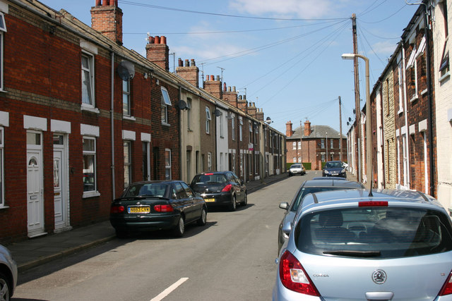
South Lynn is a small town located in the county of Norfolk, England. It is situated on the eastern bank of the River Great Ouse, just south of the larger town of King's Lynn. With a population of around 6,000 residents, South Lynn is a relatively quiet and close-knit community.
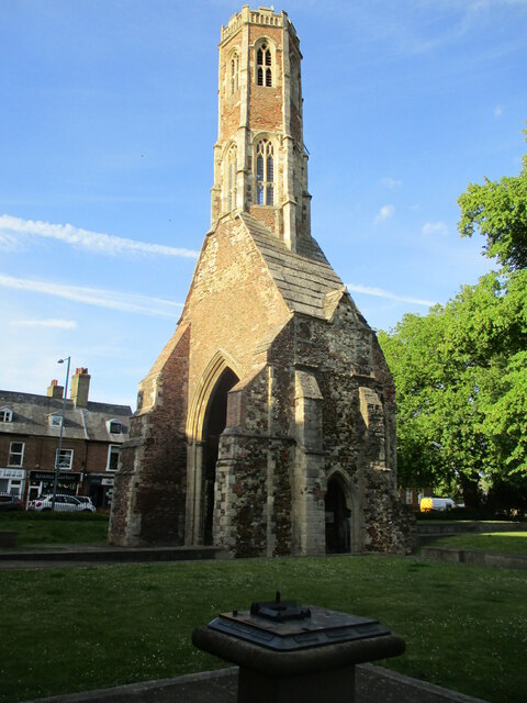
The town has a rich history, with evidence of human settlement dating back to the Bronze Age. Throughout the centuries, South Lynn has been influenced by its proximity to King's Lynn, which was once an important trading port. The town has its own distinct character, however, with a mix of traditional and modern architecture.
South Lynn offers a range of amenities to its residents. There are several schools in the area, providing education for children of all ages. The town also has a small selection of shops, including convenience stores and independent retailers, catering to the daily needs of the local community.
Nature enthusiasts will appreciate South Lynn's close proximity to the stunning Norfolk countryside. The River Great Ouse offers opportunities for boating and fishing, while the surrounding area is dotted with picturesque walking trails and nature reserves. The nearby Norfolk Coast Area of Outstanding Natural Beauty is also within reach, providing residents with access to beautiful beaches and coastal landscapes.
Transportation in South Lynn is well-served by both road and rail links. The A47 road runs nearby, providing easy access to the surrounding towns and cities. The nearest train station is King's Lynn, which offers regular services to London and other major UK cities.
Overall, South Lynn is a peaceful and charming town that offers a close community spirit and easy access to both rural and urban amenities.
If you have any feedback on the listing, please let us know in the comments section below.
South Lynn Images
Images are sourced within 2km of 52.741237/0.39222941 or Grid Reference TF6118. Thanks to Geograph Open Source API. All images are credited.


South Lynn is located at Grid Ref: TF6118 (Lat: 52.741237, Lng: 0.39222941)
Administrative County: Norfolk
District: King's Lynn and West Norfolk
Police Authority: Norfolk
What 3 Words
///agree.uses.wash. Near King's Lynn, Norfolk
Nearby Locations
Related Wikis
South Lynn
South Lynn is an area of King's Lynn, in the King's Lynn and West Norfolk district, in the county of Norfolk, England. It is located directly south of...
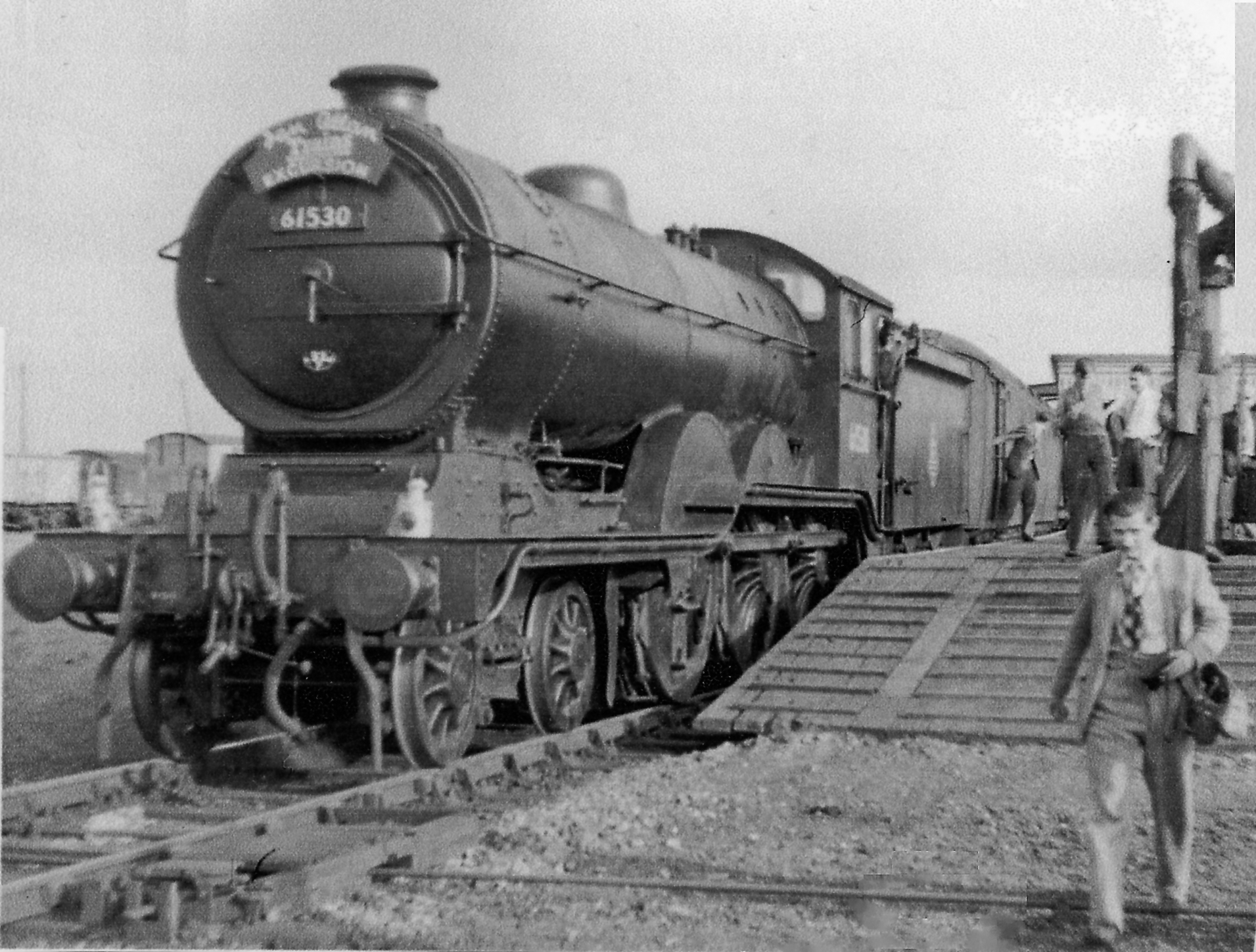
South Lynn railway station
South Lynn railway station was a railway station serving the areas of South Lynn and West Lynn in King's Lynn in Norfolk, England. The station was on the...

River Nar
The River Nar is a river in England, a tributary of the River Great Ouse. It rises at Mileham near Litcham in Norfolk and flows 15 miles west through Castle...

West Lynn railway station
West Lynn railway station served the area of West Lynn, Norfolk, England, from 1866 to 1886 on the Lynn and Sutton Bridge Railway. == History == The station...
Nearby Amenities
Located within 500m of 52.741237,0.39222941Have you been to South Lynn?
Leave your review of South Lynn below (or comments, questions and feedback).