Slindon Common

Settlement in Sussex Arun

England

Slindon Common

Spring flowers in Slindon Churchyard
Spring flowers in Slindon Churchyard Credit: Basher Eyre

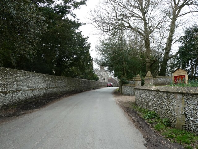
Slindon Common is a picturesque area located in the county of Sussex, England. Covering an area of approximately 200 acres, it is situated on the South Downs, just a few miles north of Arundel. The common is renowned for its diverse range of flora and fauna, making it a haven for nature enthusiasts and wildlife lovers.

The landscape of Slindon Common is characterized by rolling hills, open grasslands, and patches of woodland. It is home to a variety of plant species, including heather, gorse, and wildflowers, which create a stunning tapestry of colors throughout the year. The common also boasts several ancient oak trees, some of which are believed to be over 500 years old.

The area is teeming with wildlife, providing a habitat for numerous bird species, such as skylarks, kestrels, and buzzards. It is also a haven for smaller creatures like rabbits, foxes, and badgers. The common is particularly famous for its population of butterflies, with species such as the silver-studded blue and the purple emperor gracing its meadows during the summer months.

The National Trust manages Slindon Common, ensuring its conservation and protection. The common offers various walking trails, allowing visitors to explore its natural beauty, and there are also designated areas for picnics and relaxation. Additionally, the nearby village of Slindon provides amenities such as a pub and a quaint tea room, making it an ideal destination for a day out in the countryside.

If you have any feedback on the listing, please let us know in the comments section below.

Slindon Common Images

Images are sourced within 2km of 50.852984/-0.6221744 or Grid Reference SU9706. Thanks to Geograph Open Source API. All images are credited.

Spring flowers in Slindon Churchyard
Slindon Church: Noaj's Ark
The first day it was a pleasure to sit out Balmy weather in Slindon - it can't last!
The first day it was a pleasure to sit out
Balmy weather in Slindon - it can't last!
St Richard's RC Church: rear view
St Richard's RC Church, Slindon: churchyard (a)
St Richard's RC Church, Slindon: churchyard (b)
St Richard's RC Church, Slindon: font
Looking north-west along Top Road
St Richard's RC Church, Slindon: altar
Looking south-east along Top Road
St Richard's RC Church, Slindon: pulpit
Inside St Richard's RC Church, Slindon (I)
Inside St Richard's RC Church, Slindon (II)
Inside St Richard's RC Church, Slindon (III)
St Richard's RC Church, Slindon: 1st Station of the Cross
St Richard's RC Church, Slindon: 2nd Station of the Cross
St Richard's RC Church, Slindon: 3rd Station of the Cross
St Richard's RC Church, Slindon: 4th Station of the Cross
Show me another place!

Slindon Common is located at Grid Ref: SU9706 (Lat: 50.852984, Lng: -0.6221744)

Administrative County: West Sussex

District: Arun

Police Authority: Sussex

What 3 Words

///driving.snoozing.treaties. Near Walberton, West Sussex

Related Wikis

Walberton

Walberton is a village and civil parish in the Arun District of West Sussex, England, 5 miles (8 km) north-west of Littlehampton, and south of the A27...

St Mary's Church, Walberton

St Mary's Church is an Anglican church in the village of Walberton in the district of Arun, one of seven local government districts in the English county...

Fontwell (electoral division)

Fontwell is an electoral division of West Sussex in the United Kingdom and returns one member to sit on West Sussex County Council. The current County...

A27 road

The A27 is a major road in England. It runs from its junction with the A36 at Whiteparish (near Salisbury) in the county of Wiltshire, follows the south...

Nearby Amenities

Located within 500m of 50.852984,-0.6221744
Crossing
Crossing: unmarked
Crossing Markings: no
Tactile Paving: no
Lat/Long: 50.8534235/-0.6291941
Crossing
Crossing: unmarked
Crossing Markings: no
Tactile Paving: no
Lat/Long: 50.8533118/-0.6292166
Bus Stop
Woodlands Farm
Bus: yes
Naptan AtcoCode: 4400LH0301
Naptan Bearing: S
Naptan CommonName: Woodlands Farm
Naptan Indicator: Opp Woodlands Farm
Naptan Landmark: Mill Road
Naptan NaptanCode: wsxdapdw
Naptan Street: Mill Road
Naptan Verified: no
Public Transport: platform
Source: naptan_import
Lat/Long: 50.8567998/-0.6233537
Bus Stop
Woodlands Farm
Bus: yes
Naptan AtcoCode: 4400LH0302
Naptan Bearing: N
Naptan BusStopType: CUS
Naptan CommonName: Woodlands Farm
Naptan Indicator: o/s Woodlands Farm
Naptan Landmark: Mill Road
Naptan NaptanCode: wsxdapga
Naptan Street: Mill Road
Naptan Verified: no
Public Transport: platform
Source: naptan_import
Lat/Long: 50.8567649/-0.62344
Bus Stop
Oaks
Bench: no
Bin: no
Bus: yes
Lit: no
Naptan AtcoCode: 4400LH0329
Naptan Bearing: NW
Naptan CommonName: Oaks
Naptan Indicator: opp pub
Naptan Landmark: Arundel Road
Naptan NaptanCode: wsxdaptj
Naptan Street: Yapton Lane
Naptan Verified: no
Public Transport: platform
Shelter: no
Source: naptan_import
Tactile Paving: no
Lat/Long: 50.8519864/-0.6163352
Bus Stop
Hooe Farm
Bus: yes
Naptan AtcoCode: 4400LH0953
Naptan Bearing: N
Naptan BusStopType: CUS
Naptan CommonName: Hooe Farm
Naptan Indicator: Hooe Farm
Naptan Landmark: Hooe Farm
Naptan Street: Tye Lane
Naptan Verified: no
Public Transport: platform
Source: naptan_import
Lat/Long: 50.8493516/-0.6232036
Post Box
Brand: Royal Mail
Brand Wikidata: Q638098
Brand Wikipedia: en:Royal Mail
Collection Plate: CP7
Collection Times: Mo-Fr 17:00; Sa 11:00
Operator: Royal Mail
Operator Wikidata: Q638098
Post Box Type: lamp
Ref: BN18 1331
Royal Cypher: EIIR
Royal Cypher Wikidata: Q33102113
Lat/Long: 50.8533232/-0.6170925
Crossing
Crossing: unmarked
Crossing Markings: no
Lat/Long: 50.8527246/-0.6218321
Crossing
Crossing: unmarked
Crossing Markings: no
Lat/Long: 50.852828/-0.6215204
Crossing
Crossing: unmarked
Crossing Markings: no
Kerb: lowered
Lat/Long: 50.852901/-0.6173208
Crossing
Crossing: unmarked
Crossing Markings: no
Kerb: lowered
Lat/Long: 50.8530388/-0.6174514
The data included in this document is from www.openstreetmap.org. The data is made available under ODbL.

Have you been to Slindon Common?

Leave your review of Slindon Common below (or comments, questions and feedback).