Avisford

Settlement in Sussex Arun

England

Avisford

Path in Slindon Woods
Path in Slindon Woods Credit: PAUL FARMER

Avisford is a small village located in the district of Arun, West Sussex, England. Situated on the southern coast of England, it is part of the historic county of Sussex. The village is surrounded by picturesque countryside, offering stunning views of rolling hills and lush green fields.

Avisford is known for its peaceful and rural atmosphere, making it an ideal destination for those seeking a tranquil escape from the bustling city life. The village is characterized by its charming cottages and traditional architecture, giving it a timeless and idyllic appeal.

Despite its small size, Avisford is well-connected to nearby towns and cities. The village has good road links, with the A27 passing close by, providing easy access to locations such as Chichester and Worthing. Additionally, the nearby Barnham railway station offers regular train services to London and other major cities.

The village is surrounded by several natural attractions, including the South Downs National Park, which is a short distance to the north. This provides ample opportunities for outdoor activities such as hiking, cycling, and bird-watching.

Within the village, there are a few amenities for residents and visitors, including a local pub, a village hall, and a small convenience store. However, for more extensive shopping and entertainment options, nearby towns like Bognor Regis and Chichester provide a wider range of facilities.

Overall, Avisford is a charming and peaceful village, offering a perfect blend of rural tranquility and convenient access to nearby towns and attractions.

If you have any feedback on the listing, please let us know in the comments section below.

Avisford Images

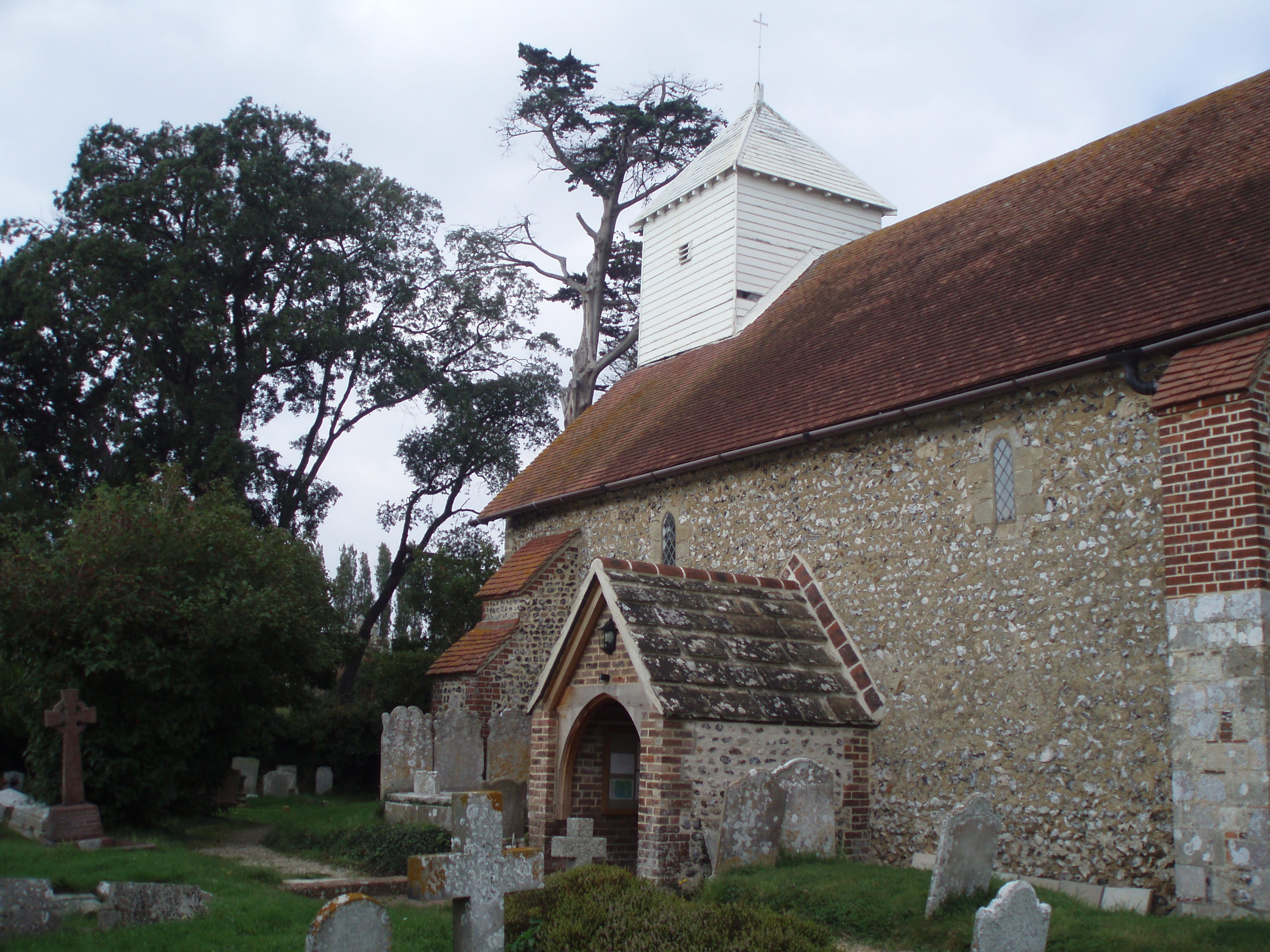
Images are sourced within 2km of 50.849005/-0.61349838 or Grid Reference SU9706. Thanks to Geograph Open Source API. All images are credited.

Path in Slindon Woods
The Spur at Slindon An inn on the A29 adjacent to a van dealership <a href="https://www.geograph.org.uk/photo/2209486">SU9708 : Spur of Slindon</a>
The Spur at Slindon
An inn on the A29 adjacent to a van dealership SU9708 : Spur of Slindon
Mill Road, Slindon Cars parked for car-sharing by drivers on the A29
Mill Road, Slindon
Cars parked for car-sharing by drivers on the A29
Houses at Slindon Common This row of houses is next to the junction crossroads of Reynolds Lane, Mill Road and Fairmile Bottom
Houses at Slindon Common
This row of houses is next to the junction crossroads of Reynolds Lane, Mill Road and Fairmile Bottom
Second Hand Van Sales This business known as Spur of Slindon sells vans and commercial vehicles from the site of an old petrol station on Fairmile Bottom the A429 close to the junction with Shellbridge Rd
Second Hand Van Sales
This business known as Spur of Slindon sells vans and commercial vehicles from the site of an old petrol station on Fairmile Bottom the A429 close to the junction with Shellbridge Rd
Lay-by A29
Lay-by A29
Path, Rewell Wood Through chestnut coppice.
Path, Rewell Wood
Through chestnut coppice.
Path junction, Rewell Wood The path from left to right is a public bridleway.
Path junction, Rewell Wood
The path from left to right is a public bridleway.
Bridleways. Rewell and Madehurst Woods Rewell Wood is to the right.
Bridleways. Rewell and Madehurst Woods
Rewell Wood is to the right.
Bridleway along ancient earthwork A bank and ditch extends for some considerable distance. Most of it, together with some nearby earthworks, are in an area scheduled as an Ancient Monument. This seems to be because they look likely to be of archaeological interest, although their origin and purpose remain obscure. Surmises range from Romano-British to mediaeval times.
Bridleway along ancient earthwork
A bank and ditch extends for some considerable distance. Most of it, together with some nearby earthworks, are in an area scheduled as an Ancient Monument. This seems to be because they look likely to be of archaeological interest, although their origin and purpose remain obscure. Surmises range from Romano-British to mediaeval times.
Madehurst - Arundel parish boundary The boundary here follows an ancient earthwork, and is further marked with a string of cast-iron plates. These have 'N' on the Arundel side, and 'F' on the Madehurst side. 'N' must be for Norfolk, the Duke of Norfolk has owned most of Arundel for centuries. 'F' probably stands for Fletcher, a Fletcher bought the Madehurst manor in the 1850s. No earlier landowner was an 'F'.
Madehurst - Arundel parish boundary
The boundary here follows an ancient earthwork, and is further marked with a string of cast-iron plates. These have 'N' on the Arundel side, and 'F' on the Madehurst side. 'N' must be for Norfolk, the Duke of Norfolk has owned most of Arundel for centuries. 'F' probably stands for Fletcher, a Fletcher bought the Madehurst manor in the 1850s. No earlier landowner was an 'F'.
A29, Slindon
A29, Slindon
A29 The A29 runs for 34 miles from the A24 at Capel, south of Dorking, through Billingshurst and Pulborough, crossing the South Downs at Bury Hill and passing Fontwell Park Racecourse before terminating on the B2166 on Bognor Regis sea front.
From Capel to Hardham, south of Pulborough, the road largely follows the path of the old Roman road, Stane Street.
A29
The A29 runs for 34 miles from the A24 at Capel, south of Dorking, through Billingshurst and Pulborough, crossing the South Downs at Bury Hill and passing Fontwell Park Racecourse before terminating on the B2166 on Bognor Regis sea front. From Capel to Hardham, south of Pulborough, the road largely follows the path of the old Roman road, Stane Street.
The Garden Lodge The Garden Lodge Conference Centre at Avisford Park.
The Garden Lodge
The Garden Lodge Conference Centre at Avisford Park.
Entrance to Walberton Church The Lych Gate Entrance to the Church.
Entrance to Walberton Church
The Lych Gate Entrance to the Church.
The Pond at Walberton Green
Approaching the A27 On Binsted Lane, beside Brickkiln Copse, heading northwards to the A27.
Approaching the A27
On Binsted Lane, beside Brickkiln Copse, heading northwards to the A27.
Old Flint Barn The barn at Binsted Nursery.
Old Flint Barn
The barn at Binsted Nursery.
Show me another place!

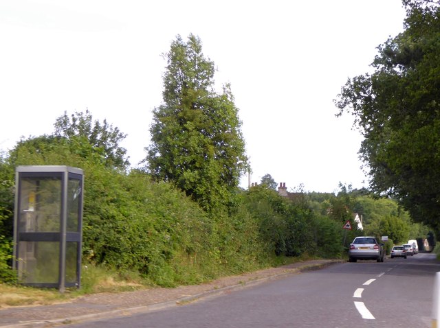
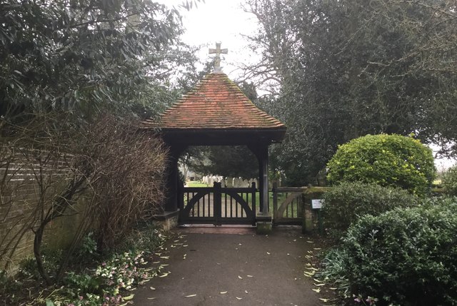
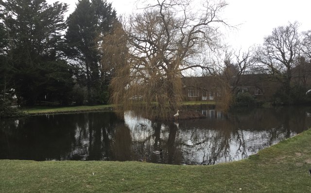
Avisford is located at Grid Ref: SU9706 (Lat: 50.849005, Lng: -0.61349838)

Administrative County: West Sussex

District: Arun

Police Authority: Sussex

What 3 Words

///stir.shuffles.tadpole. Near Walberton, West Sussex

Related Wikis

Walberton

Walberton is a village and civil parish in the Arun District of West Sussex, England, 5 miles (8 km) north-west of Littlehampton, and south of the A27...

St Mary's Church, Walberton

St Mary's Church is an Anglican church in the village of Walberton in the district of Arun, one of seven local government districts in the English county...

A27 road

The A27 is a major road in England. It runs from its junction with the A36 at Whiteparish (near Salisbury) in the county of Wiltshire, follows the south...

Fontwell (electoral division)

Fontwell is an electoral division of West Sussex in the United Kingdom and returns one member to sit on West Sussex County Council. The current County...

Slindon

Slindon is a mostly rural village and civil parish in the Arun District of West Sussex, England, containing a developed nucleus amid woodland. Much of...

John Baker's Mill, Barnham

John Baker's Mill (or Barnham Windmill) is a grade II listed tower mill at Barnham, Sussex, England, which was under restoration and is now to be converted...

Barnham, West Sussex

Barnham is a village, Anglican parish and former civil parish, now in the civil parish of Barnham and Eastergate, in the Arun district of West Sussex,...

Barnham railway station

Barnham railway station is in Barnham, West Sussex, England around 5 miles (8.0 km) north of Bognor Regis. It is located on the West Coastway Line between...

Nearby Amenities

Located within 500m of 50.849005,-0.61349838
Bus Stop
Manser Road
Bus: yes
Naptan AtcoCode: 4400LH0327
Naptan Bearing: S
Naptan CommonName: Manser Road
Naptan Indicator: Adj Manser Road
Naptan Landmark: Manser Road
Naptan NaptanCode: wsxdaptd
Naptan Street: Yapton Lane
Naptan Verified: no
Public Transport: platform
Source: naptan_import
Lat/Long: 50.846706/-0.6139487
Bus Stop
Manser Road
Bus: yes
Naptan AtcoCode: 4400LH0328
Naptan Bearing: S
Naptan CommonName: Manser Road
Naptan Indicator: Opp Manser Road
Naptan Landmark: Manser Road
Naptan NaptanCode: wsxdaptg
Naptan Street: Yapton Lane
Naptan Verified: no
Public Transport: platform
Source: naptan_import
Lat/Long: 50.8467674/-0.613819
Bus Stop
Oaks
Bus: yes
Naptan AtcoCode: 4400LH0329
Naptan Bearing: NW
Naptan CommonName: Oaks
Naptan Indicator: opp pub
Naptan Landmark: Arundel Road
Naptan NaptanCode: wsxdaptj
Naptan Street: Yapton Lane
Naptan Verified: no
Public Transport: platform
Source: naptan_import
Lat/Long: 50.8519864/-0.6163352
Avisford Park Hotel
Addr City: Arundel
Addr Postcode: BN18 0LS
Addr Street: Yapton Lane
Brand: Hilton
Brand Wikidata: Q598884
Brand Wikipedia: en:Hilton Hotels & Resorts
Building: yes
Contact Facebook: https://www.facebook.com/HiltonAvisfordPark
Contact Twitter: https://twitter.com/hiltonarundel
Email: reservations.avisfordpark@hilton.com
Fhrs Authority: Arun
Fhrs Id: 1578644
Fhrs Local Authority Id: 9104151
Operator: Hilton Hotels
Rooms: 140
Smoking: no
Stars: 4
Tourism: hotel
Wheelchair: yes
Lat/Long: 50.8499126/-0.6162946
Pub
The Black Horse
Addr City: Binsted
Addr Postcode: BN18 0LP
Addr Street: Binsted Lane
Contact Facebook: https://www.facebook.com/people/Black-Horse-Binsted/100063577210509/
Fhrs Authority: Arun
Fhrs Id: 521194
Fhrs Local Authority Id: 649161
Note: FHRS gives the postcode as BN18 0AL, but this contradicts the pub's own website.
Opening Hours: Tu-Su
Outdoor Seating: yes
Phone: +44 1243 553325
Website: https://theblackhorsebinsted.com/
Lat/Long: 50.84895/-0.6090617
The data included in this document is from www.openstreetmap.org. The data is made available under ODbL.

Have you been to Avisford?

Leave your review of Avisford below (or comments, questions and feedback).