Sketchley Old Village

Settlement in Leicestershire Hinckley and Bosworth

England

Sketchley Old Village

Goodacres Bridge, Ashby Canal Bridge 13 carries a footpath over the canal on the stretch between Burton Hastings and Hinckley.
Goodacres Bridge, Ashby Canal Credit: Stephen McKay

Sketchley Old Village is a quaint and picturesque village located in Leicestershire, England. Situated just two miles southwest of Hinckley, this historic village is known for its charming cottages, scenic countryside, and rich heritage.

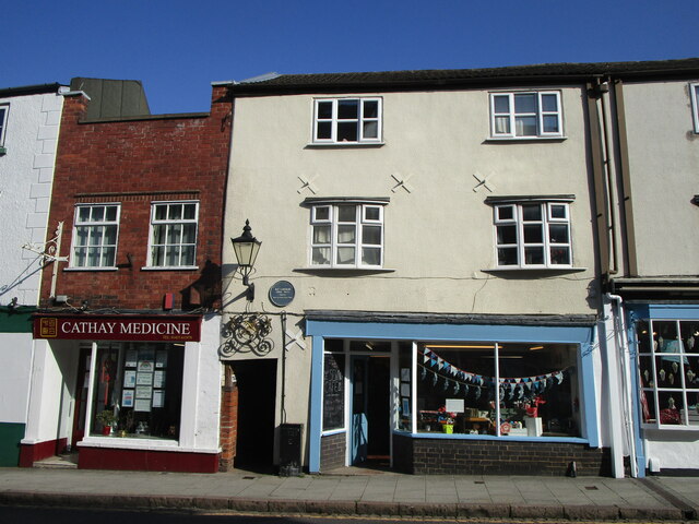
The heart of Sketchley Old Village is its cluster of thatched-roof cottages, which date back to the 17th century and exude a sense of timeless beauty. These cottages are made from local stone and feature traditional architecture, creating a visually stunning and idyllic atmosphere. The village is protected as a conservation area, ensuring that its unique character is preserved for future generations.

Surrounded by rolling green hills and lush farmland, Sketchley Old Village offers a tranquil escape from the hustle and bustle of modern life. The village is also home to the picturesque Sketchley Hill, which provides stunning panoramic views of the surrounding countryside.

In addition to its natural beauty, Sketchley Old Village boasts a fascinating history. It played a significant role during the Industrial Revolution, with the Grand Union Canal passing through the village and bringing trade and prosperity. The canal still exists today and is a popular spot for leisurely walks and boat trips.

Despite its small size, Sketchley Old Village has a strong sense of community. The village hosts various events throughout the year, including a summer fete and a Christmas market, bringing residents together and creating a close-knit atmosphere.

Overall, Sketchley Old Village is a hidden gem in Leicestershire, offering a glimpse into the past with its historic cottages, stunning landscapes, and warm community spirit. It is a place where visitors can experience the charm of rural England and immerse themselves in its rich heritage.

If you have any feedback on the listing, please let us know in the comments section below.

Sketchley Old Village Images

Images are sourced within 2km of 52.524983/-1.3755445 or Grid Reference SP4292. Thanks to Geograph Open Source API. All images are credited.

Goodacres Bridge, Ashby Canal Bridge 13 carries a footpath over the canal on the stretch between Burton Hastings and Hinckley.
Goodacres Bridge, Ashby Canal
Bridge 13 carries a footpath over the canal on the stretch between Burton Hastings and Hinckley.
The Lime Kilns, near Hinckley This pub, located on the A5 and the Ashby Canal, is seen here on a sunny summer morning. Not much had changed over the previous 15 years although the large lettering on the back of the pub has gone - <a href="https://www.geograph.org.uk/photo/162092">SP4192 : The Lime Kilns, nr. Hinckley</a>.
The Lime Kilns, near Hinckley
This pub, located on the A5 and the Ashby Canal, is seen here on a sunny summer morning. Not much had changed over the previous 15 years although the large lettering on the back of the pub has gone - SP4192 : The Lime Kilns, nr. Hinckley.
Shop'n Drive on the A5 BP petrol station and convenience store on the edge of Hinckley.
Shop'n Drive on the A5
BP petrol station and convenience store on the edge of Hinckley.
Ashby Canal from Limekiln Bridge Looking down the steps to the towpath from Limekiln Bridge which carries the A5 over the Ashby Canal.
Ashby Canal from Limekiln Bridge
Looking down the steps to the towpath from Limekiln Bridge which carries the A5 over the Ashby Canal.
Ashby Canal from Nutt's Bridge Looking down from bridge 16 in the outskirts of Hinckley where two narrowboats are moored by the towpath.
Ashby Canal from Nutt's Bridge
Looking down from bridge 16 in the outskirts of Hinckley where two narrowboats are moored by the towpath.
Strathmore Road, Hinckley Strathmore Road leads off Coventry Road and has a variety of takeaway food options available from the first building after the junction.
Strathmore Road, Hinckley
Strathmore Road leads off Coventry Road and has a variety of takeaway food options available from the first building after the junction.
Nutt's Bridge, Ashby Canal Nutt's Bridge carries Nutt's Lane over the Ashby Canal. To the right is the Hinckley Wharf Arm used for boat club moorings.
Nutt's Bridge, Ashby Canal
Nutt's Bridge carries Nutt's Lane over the Ashby Canal. To the right is the Hinckley Wharf Arm used for boat club moorings.
Ashby Canal, by Limekilns Bridge Two narrowboats are moored by the towpath on the approach to Limekilns Bridge opposite the Lime Kilns pub which is just out of shot.
Ashby Canal, by Limekilns Bridge
Two narrowboats are moored by the towpath on the approach to Limekilns Bridge opposite the Lime Kilns pub which is just out of shot.
Castle Street in Hinckley town centre
Britannia Shopping Centre in Hinckley
Union Inn, Hinckley This 18th century public house is at Stockwell Head in Hinckley town centre. The pub was on a main coaching route and was frequented by highwaymen.
Union Inn, Hinckley
This 18th century public house is at Stockwell Head in Hinckley town centre. The pub was on a main coaching route and was frequented by highwaymen.
Plaque to Nat Langham Above entrance to Cross Keys Yard
Plaque to Nat Langham
Above entrance to Cross Keys Yard
114 & 116 Castle Street, Hinckley Showing entrance to Cross Keys Yard and site of plaque <a href="https://www.geograph.org.uk/photo/6966474">SP4393 : Plaque to Nat Langham</a>.  116 occupied by The Sewing Cafe.
114 & 116 Castle Street, Hinckley
Showing entrance to Cross Keys Yard and site of plaque SP4393 : Plaque to Nat Langham. 116 occupied by The Sewing Cafe.
Plaque to William Bass On wall of 67 Castle Street, Hinckley
Plaque to William Bass
On wall of 67 Castle Street, Hinckley
Ye Old Sock Shoppe, 67 Castle St, Hinckley Showing location of plaque <a href="https://www.geograph.org.uk/photo/6966518">SP4293 : Plaque to William Bass</a>
Ye Old Sock Shoppe, 67 Castle St, Hinckley
Showing location of plaque SP4293 : Plaque to William Bass
Plaque to Jon Baker On right hand wall of entrance arch of Crown Court from Castle Street
Plaque to Jon Baker
On right hand wall of entrance arch of Crown Court from Castle Street
Plaque to Charlotte Mary Brame On wall of former home 35 Castle St, Hinckley
Plaque to Charlotte Mary Brame
On wall of former home 35 Castle St, Hinckley
35 Castle Street, Hinckley Shows site of plaque <a href="https://www.geograph.org.uk/photo/6966563">SP4293 : Plaque to Charlotte Mary Brame</a>
35 Castle Street, Hinckley
Show me another place!

Sketchley Old Village is located at Grid Ref: SP4292 (Lat: 52.524983, Lng: -1.3755445)

Administrative County: Leicestershire

District: Hinckley and Bosworth

Police Authority: Leicestershire

What 3 Words

///shunts.honey.radar. Near Hinckley, Leicestershire

Related Wikis

Stretton Baskerville

Stretton Baskerville is a deserted medieval village and civil parish in the English county of Warwickshire. It shares a parish council with the nearby...

Hinckley railway station

Hinckley railway station serves the town of Hinckley and village of Burbage in Leicestershire, England. The station is on the CrossCountry Birmingham to...

Hinckley power station

Hinckley power station supplied electricity to the town of Hinckley and the wider Leicestershire area from 1913. It was operated by the Leicestershire...

Britannia Fields

The Britannia Fields are a public open space at grid reference SP440919 in Britannia Road, Burbage, Leicestershire. The Fields land was once part of the...

Nearby Amenities

Located within 500m of 52.524983,-1.3755445
Mini Roundabout
Direction: clockwise
Lat/Long: 52.5258319/-1.368628
Bus Stop
Sketchley Lane
Bench: no
Bin: no
Bus: yes
Lit: yes
Naptan AtcoCode: 260010203
Naptan Bearing: SE
Naptan CommonName: Sketchley Lane
Naptan Indicator: opposite
Naptan Landmark: Sketchley Lane
Naptan NaptanCode: leijadgj
Naptan Notes: Hourly - County
Naptan Street: Rugby Road
Naptan Verified: no
Public Transport: platform
Shelter: no
Source: naptan_import
Tactile Paving: no
Lat/Long: 52.5263881/-1.3689174
Bus Stop
Sketchley Lane
Bench: no
Bin: no
Bus: yes
Lit: yes
Naptan AtcoCode: 260010205
Naptan Bearing: NW
Naptan CommonName: Sketchley Lane
Naptan Indicator: near
Naptan Landmark: Sketchley Lane
Naptan NaptanCode: leijadgp
Naptan Notes: Non-Hourly - County
Naptan Street: Rugby Road
Naptan Verified: no
Public Transport: platform
Shelter: no
Source: naptan_import
Tactile Paving: no
Lat/Long: 52.5263619/-1.3690652
Barrier: kissing_gate
Bicycle: no
Foot: yes
Horse: no
Motor Vehicle: no
Lat/Long: 52.5255515/-1.3796315
Barrier: kissing_gate
Bicycle: no
Foot: yes
Horse: no
Motor Vehicle: no
Lat/Long: 52.5270022/-1.3793597
Post Box
Collection Times: Mo-Fr 18:30; Sa off
Note: Franked mail only
Operator: Royal Mail
Operator Wikidata: Q638098
Post Box Type: meter
Ref: LE10 59
Royal Cypher: no
Source: survey
Lat/Long: 52.5253785/-1.3809125
Post Box
Collection Times: Mo-Fr 18:20; Sa 08:00
Operator: Royal Mail
Operator Wikidata: Q638098
Post Box Type: pillar
Ref: LE10 55
Royal Cypher: GR
Royal Cypher Wikidata: Q33102273
Source: survey
Lat/Long: 52.5254378/-1.3809064
Post Box
Operator: Royal Mail
Operator Wikidata: Q638098
Ref: LE10 48
Lat/Long: 52.528749/-1.3738091
Crossing
Crossing: traffic_signals
Crossing Island: no
Kerb: lowered
Tactile Paving: yes
Lat/Long: 52.5262358/-1.3689142
Generator Method: photovoltaic
Generator Output Electricity: yes
Generator Source: solar
Generator Type: solar_photovoltaic_panel
Location: roof
Power: generator
Lat/Long: 52.5226457/-1.3699552
Generator Method: photovoltaic
Generator Output Electricity: yes
Generator Source: solar
Generator Type: solar_photovoltaic_panel
Location: roof
Power: generator
Lat/Long: 52.5223683/-1.3708833
Fixme: needs survey for connection
Lat/Long: 52.5221405/-1.3721806
Generator Method: photovoltaic
Generator Output Electricity: yes
Generator Source: solar
Generator Type: solar_photovoltaic_panel
Location: roof
Power: generator
Lat/Long: 52.5259851/-1.3743405
Generator Method: photovoltaic
Generator Output Electricity: yes
Generator Source: solar
Generator Type: solar_photovoltaic_panel
Location: roof
Power: generator
Lat/Long: 52.5245548/-1.372082
Generator Method: photovoltaic
Generator Output Electricity: yes
Generator Source: solar
Generator Type: solar_photovoltaic_panel
Location: roof
Power: generator
Lat/Long: 52.5277026/-1.3758613
Generator Method: photovoltaic
Generator Output Electricity: yes
Generator Source: solar
Generator Type: solar_photovoltaic_panel
Location: roof
Power: generator
Lat/Long: 52.5282852/-1.3752792
Bus Stop
Bus: yes
Public Transport: platform
Lat/Long: 52.5238662/-1.3684469
Bus Stop
Bus: yes
Naptan AtcoCode: 260070173
Naptan NaptanCode: leijwjdw
Public Transport: platform
Lat/Long: 52.5247897/-1.3690746
Bus Stop
Bus: yes
Naptan AtcoCode: 260010287
Naptan NaptanCode: leimampw
Public Transport: platform
Lat/Long: 52.524793/-1.3693321
The data included in this document is from www.openstreetmap.org. The data is made available under ODbL.

Have you been to Sketchley Old Village?

Leave your review of Sketchley Old Village below (or comments, questions and feedback).