Short Ferry

Settlement in Lincolnshire West Lindsey

England

Short Ferry

Buildings at Bardney Lock Farm
Buildings at Bardney Lock Farm Credit: Jonathan Thacker

Short Ferry is a small village located in the county of Lincolnshire in eastern England. It is situated on the banks of the River Witham, approximately 9 miles east of the town of Lincoln. The village gets its name from the short ferry that used to operate across the river in the past.

The village is primarily known for its picturesque countryside and its proximity to the River Witham. The river offers various recreational activities such as fishing, boating, and birdwatching, attracting visitors from the surrounding areas. The area is also popular with hikers and nature enthusiasts who enjoy exploring the nearby rolling hills and woodlands.

In terms of amenities, Short Ferry is a quiet and rural village with limited facilities. There is a small pub and a village hall that hosts community events and gatherings. The nearest shops, schools, and medical facilities can be found in the nearby towns of Bardney and Lincoln.

Historically, Short Ferry played a significant role in the transportation of goods and people along the River Witham. The short ferry, which was replaced by a bridge in the early 20th century, was an essential link between the villages on either side of the river. Today, remnants of the old ferry station can still be seen, serving as a reminder of the village's past.

Overall, Short Ferry is a peaceful and idyllic village that offers a retreat from the hustle and bustle of urban life, with its natural beauty and close-knit community.

If you have any feedback on the listing, please let us know in the comments section below.
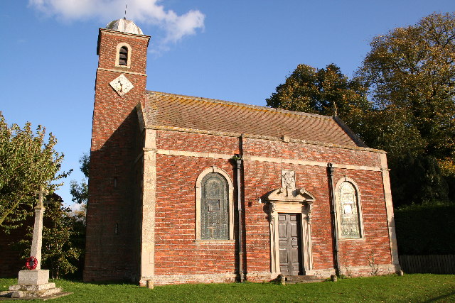
Short Ferry Images

Images are sourced within 2km of 53.230126/-0.36309025 or Grid Reference TF0971. Thanks to Geograph Open Source API. All images are credited.

Buildings at Bardney Lock Farm
Battered field of oats near Bardney Lock Farm Lincoln Cathedral just visible in the centre of the picture.
Battered field of oats near Bardney Lock Farm
Lincoln Cathedral just visible in the centre of the picture.
Bardney Lock Farm
Bardney Lock Farm
Fiskerton Road Penstock The name is given by the Environment Agency and displayed on the  notice, but the sluice is located on Ferry Road
Fiskerton Road Penstock
The name is given by the Environment Agency and displayed on the notice, but the sluice is located on Ferry Road
Barlings Abbey ruins The last remaining fragment of the Praemonstratensian Abbey founded 1154, surrounded by extensive earthworks, fishponds and smaller stone fragments. Grade I listed scheduled monument.
Barlings Abbey ruins
The last remaining fragment of the Praemonstratensian Abbey founded 1154, surrounded by extensive earthworks, fishponds and smaller stone fragments. Grade I listed scheduled monument.
Barlings grotesque A 14th century label stop for a vault springer in the ruins of Barlings Abbey <a title="https://www.geograph.org.uk/photo/7001830" href="https://www.geograph.org.uk/photo/7001830">Link</a>
Barlings grotesque
A 14th century label stop for a vault springer in the ruins of Barlings Abbey Link
Barlings Priory Site: aerial 2021 (1) See: <span class="nowrap"><a title="https://www.heritagegateway.org.uk/Gateway/Results_Single.aspx?uid=MLI54215&resourceID=1006" rel="nofollow ugc noopener" href="https://www.heritagegateway.org.uk/Gateway/Results_Single.aspx?uid=MLI54215&resourceID=1006">Link</a><img style="margin-left:2px;" alt="External link" title="External link - shift click to open in new window" src="https://s1.geograph.org.uk/img/external.png" width="10" height="10"/></span> and (upstanding remains): <span class="nowrap"><a title="https://www.heritagegateway.org.uk/Gateway/Results_Single.aspx?uid=MLI96528&resourceID=1006" rel="nofollow ugc noopener" href="https://www.heritagegateway.org.uk/Gateway/Results_Single.aspx?uid=MLI96528&resourceID=1006">Link</a><img style="margin-left:2px;" alt="External link" title="External link - shift click to open in new window" src="https://s1.geograph.org.uk/img/external.png" width="10" height="10"/></span>

Premonstratensian house founded 1154. Only part standing above ground is the NW pier of the crossing with a short length of wall between the nave and the N transept. This has nice c13 detail. The remainder of the site is unencumbered, being rough pasture, and it is possible that the whole ground could be recovered. No record can be found of any excavation.

Large area of earthworks and the NW pier and a short length of wall still standing; decoration on the wall is very similar to that in Southwell Minster chapter house. Other pieces of medieval masonry can be seen reused in the walls of the nearby cottage and its out-buildings.

Cropmark in foreground could be part of the original foortprint of the Priory.
Barlings Priory Site: aerial 2021 (1)
See: LinkExternal link and (upstanding remains): LinkExternal link Premonstratensian house founded 1154. Only part standing above ground is the NW pier of the crossing with a short length of wall between the nave and the N transept. This has nice c13 detail. The remainder of the site is unencumbered, being rough pasture, and it is possible that the whole ground could be recovered. No record can be found of any excavation. Large area of earthworks and the NW pier and a short length of wall still standing; decoration on the wall is very similar to that in Southwell Minster chapter house. Other pieces of medieval masonry can be seen reused in the walls of the nearby cottage and its out-buildings. Cropmark in foreground could be part of the original foortprint of the Priory.
Barlings Priory Site: aerial 2021 (2) See: <span class="nowrap"><a title="https://www.heritagegateway.org.uk/Gateway/Results_Single.aspx?uid=MLI54215&resourceID=1006" rel="nofollow ugc noopener" href="https://www.heritagegateway.org.uk/Gateway/Results_Single.aspx?uid=MLI54215&resourceID=1006">Link</a><img style="margin-left:2px;" alt="External link" title="External link - shift click to open in new window" src="https://s1.geograph.org.uk/img/external.png" width="10" height="10"/></span> and (upstanding remains): <span class="nowrap"><a title="https://www.heritagegateway.org.uk/Gateway/Results_Single.aspx?uid=MLI96528&resourceID=1006" rel="nofollow ugc noopener" href="https://www.heritagegateway.org.uk/Gateway/Results_Single.aspx?uid=MLI96528&resourceID=1006">Link</a><img style="margin-left:2px;" alt="External link" title="External link - shift click to open in new window" src="https://s1.geograph.org.uk/img/external.png" width="10" height="10"/></span>

Premonstratensian house founded 1154. Only part standing above ground is the NW pier of the crossing with a short length of wall between the nave and the N transept. This has nice c13 detail. The remainder of the site is unencumbered, being rough pasture, and it is possible that the whole ground could be recovered. No record can be found of any excavation.

Large area of earthworks and the NW pier and a short length of wall still standing; decoration on the wall is very similar to that in Southwell Minster chapter house. Other pieces of medieval masonry can be seen reused in the walls of the nearby cottage and its out-buildings.
Barlings Priory Site: aerial 2021 (2)
See: LinkExternal link and (upstanding remains): LinkExternal link Premonstratensian house founded 1154. Only part standing above ground is the NW pier of the crossing with a short length of wall between the nave and the N transept. This has nice c13 detail. The remainder of the site is unencumbered, being rough pasture, and it is possible that the whole ground could be recovered. No record can be found of any excavation. Large area of earthworks and the NW pier and a short length of wall still standing; decoration on the wall is very similar to that in Southwell Minster chapter house. Other pieces of medieval masonry can be seen reused in the walls of the nearby cottage and its out-buildings.
Barlings Priory Site: aerial 2021 (4) See: <span class="nowrap"><a title="https://www.heritagegateway.org.uk/Gateway/Results_Single.aspx?uid=MLI54215&resourceID=1006" rel="nofollow ugc noopener" href="https://www.heritagegateway.org.uk/Gateway/Results_Single.aspx?uid=MLI54215&resourceID=1006">Link</a><img style="margin-left:2px;" alt="External link" title="External link - shift click to open in new window" src="https://s1.geograph.org.uk/img/external.png" width="10" height="10"/></span> and (upstanding remains): <span class="nowrap"><a title="https://www.heritagegateway.org.uk/Gateway/Results_Single.aspx?uid=MLI96528&resourceID=1006" rel="nofollow ugc noopener" href="https://www.heritagegateway.org.uk/Gateway/Results_Single.aspx?uid=MLI96528&resourceID=1006">Link</a><img style="margin-left:2px;" alt="External link" title="External link - shift click to open in new window" src="https://s1.geograph.org.uk/img/external.png" width="10" height="10"/></span>

Premonstratensian house founded 1154. Only part standing above ground is the NW pier of the crossing with a short length of wall between the nave and the N transept. This has nice c13 detail. The remainder of the site is unencumbered, being rough pasture, and it is possible that the whole ground could be recovered. No record can be found of any excavation.

Large area of earthworks and the NW pier and a short length of wall still standing; decoration on the wall is very similar to that in Southwell Minster chapter house. Other pieces of medieval masonry can be seen reused in the walls of the nearby cottage and its out-buildings.
Barlings Priory Site: aerial 2021 (4)
See: LinkExternal link and (upstanding remains): LinkExternal link Premonstratensian house founded 1154. Only part standing above ground is the NW pier of the crossing with a short length of wall between the nave and the N transept. This has nice c13 detail. The remainder of the site is unencumbered, being rough pasture, and it is possible that the whole ground could be recovered. No record can be found of any excavation. Large area of earthworks and the NW pier and a short length of wall still standing; decoration on the wall is very similar to that in Southwell Minster chapter house. Other pieces of medieval masonry can be seen reused in the walls of the nearby cottage and its out-buildings.
Barlings and Stainfield Barrow Cemetery: aerial 2021 (1) See <span class="nowrap"><a title="https://www.heritagegateway.org.uk/Gateway/Results_Single.aspx?uid=MLI50187&resourceID=1006" rel="nofollow ugc noopener" href="https://www.heritagegateway.org.uk/Gateway/Results_Single.aspx?uid=MLI50187&resourceID=1006">Link</a><img style="margin-left:2px;" alt="External link" title="External link - shift click to open in new window" src="https://s1.geograph.org.uk/img/external.png" width="10" height="10"/></span>

The western scheduled area consists of four bowl barrows (maximum extent 130m by 70m). It is probable that all four mounds are encircled by ditches which survive as buried features, although no trace of these are visible on the surface.

The eastern scheduled area (300m to the east) includes 11 round barrows of varying type.  These earthworks are marked by circular areas of lighter sandy soil, some of them still slightly mounded, which are visible from the ground and from the air. The mounds were encircled by ditches which have become infilled but survive as buried features.
Barlings and Stainfield Barrow Cemetery: aerial 2021 (1)
See LinkExternal link The western scheduled area consists of four bowl barrows (maximum extent 130m by 70m). It is probable that all four mounds are encircled by ditches which survive as buried features, although no trace of these are visible on the surface. The eastern scheduled area (300m to the east) includes 11 round barrows of varying type. These earthworks are marked by circular areas of lighter sandy soil, some of them still slightly mounded, which are visible from the ground and from the air. The mounds were encircled by ditches which have become infilled but survive as buried features.
Barlings and Stainfield Barrow Cemetery: aerial 2021 (2) See <span class="nowrap"><a title="https://www.heritagegateway.org.uk/Gateway/Results_Single.aspx?uid=MLI50187&resourceID=1006" rel="nofollow ugc noopener" href="https://www.heritagegateway.org.uk/Gateway/Results_Single.aspx?uid=MLI50187&resourceID=1006">Link</a><img style="margin-left:2px;" alt="External link" title="External link - shift click to open in new window" src="https://s1.geograph.org.uk/img/external.png" width="10" height="10"/></span>

The western scheduled area consists of four bowl barrows (maximum extent 130m by 70m). It is probable that all four mounds are encircled by ditches which survive as buried features, although no trace of these are visible on the surface.

The eastern scheduled area (300m to the east) includes 11 round barrows of varying type.  These earthworks are marked by circular areas of lighter sandy soil, some of them still slightly mounded, which are visible from the ground and from the air. The mounds were encircled by ditches which have become infilled but survive as buried features.
Barlings and Stainfield Barrow Cemetery: aerial 2021 (2)
See LinkExternal link The western scheduled area consists of four bowl barrows (maximum extent 130m by 70m). It is probable that all four mounds are encircled by ditches which survive as buried features, although no trace of these are visible on the surface. The eastern scheduled area (300m to the east) includes 11 round barrows of varying type. These earthworks are marked by circular areas of lighter sandy soil, some of them still slightly mounded, which are visible from the ground and from the air. The mounds were encircled by ditches which have become infilled but survive as buried features.
Barlings and Stainfield Barrow Cemetery: aerial 2021 (3) See <span class="nowrap"><a title="https://www.heritagegateway.org.uk/Gateway/Results_Single.aspx?uid=MLI50187&resourceID=1006" rel="nofollow ugc noopener" href="https://www.heritagegateway.org.uk/Gateway/Results_Single.aspx?uid=MLI50187&resourceID=1006">Link</a><img style="margin-left:2px;" alt="External link" title="External link - shift click to open in new window" src="https://s1.geograph.org.uk/img/external.png" width="10" height="10"/></span>

The western scheduled area consists of four bowl barrows (maximum extent 130m by 70m). It is probable that all four mounds are encircled by ditches which survive as buried features, although no trace of these are visible on the surface.

The eastern scheduled area (300m to the east) includes 11 round barrows of varying type.  These earthworks are marked by circular areas of lighter sandy soil, some of them still slightly mounded, which are visible from the ground and from the air. The mounds were encircled by ditches which have become infilled but survive as buried features.
Barlings and Stainfield Barrow Cemetery: aerial 2021 (3)
See LinkExternal link The western scheduled area consists of four bowl barrows (maximum extent 130m by 70m). It is probable that all four mounds are encircled by ditches which survive as buried features, although no trace of these are visible on the surface. The eastern scheduled area (300m to the east) includes 11 round barrows of varying type. These earthworks are marked by circular areas of lighter sandy soil, some of them still slightly mounded, which are visible from the ground and from the air. The mounds were encircled by ditches which have become infilled but survive as buried features.
Barlings and Stainfield Barrow Cemetery: aerial 2021 (4) with Stainfield Stainfield in <a href="https://www.geograph.org.uk/gridref/TF1073">TF1073</a>.

Barrow cemetery:

See <span class="nowrap"><a title="https://www.heritagegateway.org.uk/Gateway/Results_Single.aspx?uid=MLI50187&resourceID=1006" rel="nofollow ugc noopener" href="https://www.heritagegateway.org.uk/Gateway/Results_Single.aspx?uid=MLI50187&resourceID=1006">Link</a><img style="margin-left:2px;" alt="External link" title="External link - shift click to open in new window" src="https://s1.geograph.org.uk/img/external.png" width="10" height="10"/></span>

The western scheduled area consists of four bowl barrows (maximum extent 130m by 70m). It is probable that all four mounds are encircled by ditches which survive as buried features, although no trace of these are visible on the surface.

The eastern scheduled area (300m to the east) includes 11 round barrows of varying type.  These earthworks are marked by circular areas of lighter sandy soil, some of them still slightly mounded, which are visible from the ground and from the air. The mounds were encircled by ditches which have become infilled but survive as buried features.
Barlings and Stainfield Barrow Cemetery: aerial 2021 (4) with Stainfield
Stainfield in TF1073. Barrow cemetery: See LinkExternal link The western scheduled area consists of four bowl barrows (maximum extent 130m by 70m). It is probable that all four mounds are encircled by ditches which survive as buried features, although no trace of these are visible on the surface. The eastern scheduled area (300m to the east) includes 11 round barrows of varying type. These earthworks are marked by circular areas of lighter sandy soil, some of them still slightly mounded, which are visible from the ground and from the air. The mounds were encircled by ditches which have become infilled but survive as buried features.
Stubble field off Ferry Road near Fiskerton
Long Wood Some felling has taken place giving the wood a somewhat trashed look.
Long Wood
Some felling has taken place giving the wood a somewhat trashed look.
Partly flooded field near Short Ferry
Farm track near Glebe Farm Looking towards the River Witham.
Farm track near Glebe Farm
Looking towards the River Witham.
Show me another place!

Short Ferry is located at Grid Ref: TF0971 (Lat: 53.230126, Lng: -0.36309025)

Division: Parts of Lindsey

Administrative County: Lincolnshire

District: West Lindsey

Police Authority: Lincolnshire

What 3 Words

///overused.catch.appear. Near Bardney, Lincolnshire

Nearby Locations

Short Ferry

Related Wikis

Barlings Abbey

Barlings Abbey was a one of nine Premonstratensian monasteries in the county of Lincolnshire, England. It was founded in 1154, as a daughter house of...

Bardney Abbey

Bardney Abbey in Lincolnshire, England, was a Benedictine monastery founded in 697 by King Æthelred of Mercia, who was to become the first abbot. The monastery...

Stainfield

Stainfield is a village and civil parish about 10 miles (16 km) east of the city of Lincoln, in the West Lindsey district of Lincolnshire, England. The...

Snakeholme Pit

Snakeholme Pit is a nature reserve near Langworth in the county of Lincolnshire, England, managed and owned by Butterfly Conservation. It is 2 acres.Animals...

Nearby Amenities

Located within 500m of 53.230126,-0.36309025
Bus Stop
Tyrwhitt Arms PH
Naptan AtcoCode: 270000009594
Naptan Bearing: SE
Naptan CommonName: Tyrwhitt Arms PH
Naptan Indicator: opp
Naptan Landmark: Tyrwhitt Arms PH
Naptan NaptanCode: linjdjmw
Naptan Street: Ferry Road
Naptan Verified: no
Source: naptan_import
Lat/Long: 53.2302855/-0.3634523
Bus Stop
Tyrwhitt Arms PH
Naptan AtcoCode: 2700LSF01919
Naptan Bearing: NW
Naptan CommonName: Tyrwhitt Arms PH
Naptan Indicator: adj
Naptan Landmark: Tyrwhitt Arms PH
Naptan NaptanCode: linamwjt
Naptan Street: Ferry Road
Naptan Verified: no
Source: naptan_import
Lat/Long: 53.2301262/-0.3629525
Power: pole
Lat/Long: 53.2325419/-0.3641316
Power: pole
Lat/Long: 53.2321829/-0.3636505
Power: pole
Lat/Long: 53.2329881/-0.3657679
Power: pole
Source: Bing
Lat/Long: 53.2307364/-0.3624474
Power: pole
Lat/Long: 53.2301926/-0.3614001
Power: pole
Lat/Long: 53.2295839/-0.3599441
Power: pole
Lat/Long: 53.2314674/-0.363063
Power: pole
Lat/Long: 53.2290014/-0.3589314
Power: pole
Lat/Long: 53.2310899/-0.361399
Short Ferry
Place: hamlet
Source: Bing
Lat/Long: 53.23053/-0.3656673
Short Ferry Bridge
Place: locality
Source: Bing
Lat/Long: 53.230598/-0.3626342
Grub Hill
Alt Name: Grubhill
Place: locality
Source: Bing
Lat/Long: 53.2317507/-0.3685103
Stainfield New Pumping Station
Man Made: pumping_station
Operator: Witham Third District Internal Drainage Board
Source: Bing
Lat/Long: 53.2303109/-0.3617033
Power: pole
Lat/Long: 53.2323925/-0.3687116
Power: pole
Lat/Long: 53.2322859/-0.3674277
Power: pole
Lat/Long: 53.2332953/-0.3670793
Power: pole
Lat/Long: 53.2313954/-0.360435
Power: pole
Lat/Long: 53.2316857/-0.359477
Power: pole
Lat/Long: 53.2320735/-0.3585688
Power: pole
Lat/Long: 53.2321607/-0.3585516
Power: pole
Lat/Long: 53.23265/-0.3592919
Power: pole
Lat/Long: 53.233128/-0.3600306
Power: pole
Lat/Long: 53.2335957/-0.3607452
Power: pole
Lat/Long: 53.2279101/-0.3569401
Power: pole
Lat/Long: 53.2283455/-0.3576674
The data included in this document is from www.openstreetmap.org. The data is made available under ODbL.

Have you been to Short Ferry?

Leave your review of Short Ferry below (or comments, questions and feedback).