Shirleywich

Settlement in Staffordshire Stafford

England

Shirleywich

View to Millennium Green, Hixon, Staffordshire The view is taken from the car park. The Bank House public house is immediately behind the camera. The Hixon Millennium Green was opened on January 1st 2000 as part of a nationwide series of Millennium Greens in England each managed by trustees.
View to Millennium Green, Hixon, Staffordshire Credit: Rod Grealish

Shirleywich is a quaint village located in Staffordshire, England. Situated approximately 7 miles east of Stafford, it is nestled in the rolling countryside of the West Midlands. The village is surrounded by picturesque landscapes, featuring lush green fields and gentle hills, providing residents with a peaceful and serene environment.

With a population of just over 500, Shirleywich retains a strong sense of community and offers a close-knit village atmosphere. The village is characterized by its charming traditional cottages, many of which date back to the 18th and 19th centuries, displaying the architectural heritage of the area.

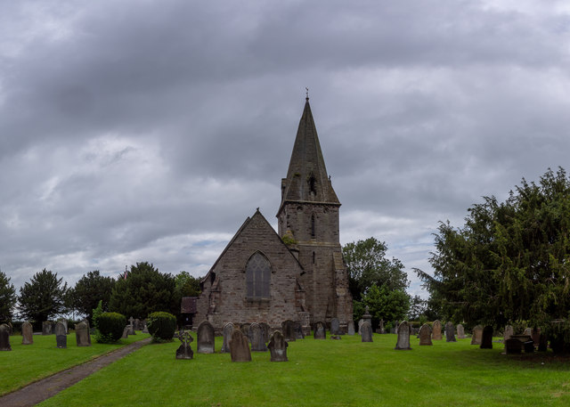
Shirleywich is known for its historic St. Michael and All Angels Church, which has been a focal point of the village for centuries. The church, with its striking spire, is an impressive example of medieval architecture and attracts visitors interested in its rich history and beautiful stained glass windows.

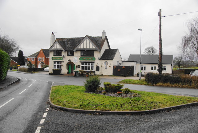
Despite its small size, Shirleywich has a few amenities to cater to its residents. The village has a local pub, The Shirley Arms, where locals and visitors can enjoy a refreshing drink and traditional English pub food. Additionally, a small convenience store provides essential groceries and supplies to the community.

The surrounding countryside offers ample opportunities for outdoor activities such as hiking, cycling, and nature walks. Shirleywich is also well-connected to neighboring towns and cities, with good transport links making it accessible for those who work or study in nearby areas.

Overall, Shirleywich is a charming and idyllic village, offering a tranquil retreat from the hustle and bustle of city life, while maintaining a strong sense of community and connection to its rich history.

If you have any feedback on the listing, please let us know in the comments section below.
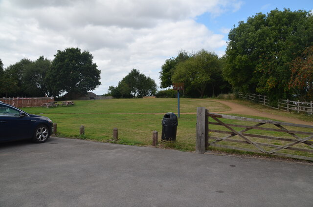
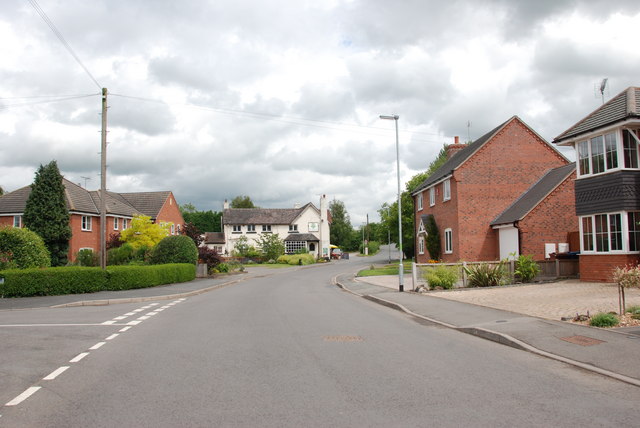
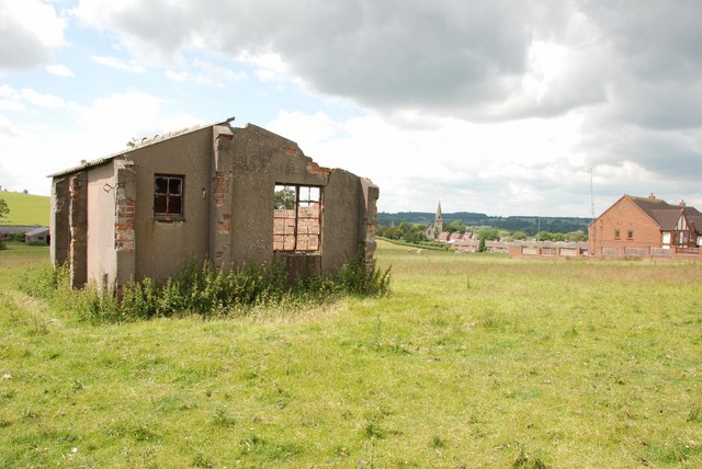
Shirleywich Images

Images are sourced within 2km of 52.828464/-2.0215377 or Grid Reference SJ9825. Thanks to Geograph Open Source API. All images are credited.

View to Millennium Green, Hixon, Staffordshire The view is taken from the car park. The Bank House public house is immediately behind the camera. The Hixon Millennium Green was opened on January 1st 2000 as part of a nationwide series of Millennium Greens in England each managed by trustees.
View to Millennium Green, Hixon, Staffordshire
The view is taken from the car park. The Bank House public house is immediately behind the camera. The Hixon Millennium Green was opened on January 1st 2000 as part of a nationwide series of Millennium Greens in England each managed by trustees.
St. Peter's Church, Hixon The 19th century parish church of Saint Peter is a Grade II listed building, in the early English Gothic style and was designed and built by the English Gothic revival architect George Gilbert Scott.

The site for the church was given by Lord Talbot and had previously been occupied by a windmill: this gives the church an unusual location on high ground, away from the road, on the edge of the village. The foundation stone was laid by the Marchioness of Lothian in July 1846. The Church was consecrated on St. Peter's Day 1848 (Tuesday, 29 June) by the then Bishop of Lichfield, John Lonsdale.

The church is part of the combined Mid-Trent Churches benefice of the Diocese of Lichfield, covering ten churches across eight parishes.

<span class="nowrap"><a title="https://en.wikipedia.org/wiki/Hixon,_Staffordshire" rel="nofollow ugc noopener" href="https://en.wikipedia.org/wiki/Hixon,_Staffordshire">Link</a><img style="margin-left:2px;" alt="External link" title="External link - shift click to open in new window" src="https://s1.geograph.org.uk/img/external.png" width="10" height="10"/></span>
St. Peter's Church, Hixon
The 19th century parish church of Saint Peter is a Grade II listed building, in the early English Gothic style and was designed and built by the English Gothic revival architect George Gilbert Scott. The site for the church was given by Lord Talbot and had previously been occupied by a windmill: this gives the church an unusual location on high ground, away from the road, on the edge of the village. The foundation stone was laid by the Marchioness of Lothian in July 1846. The Church was consecrated on St. Peter's Day 1848 (Tuesday, 29 June) by the then Bishop of Lichfield, John Lonsdale. The church is part of the combined Mid-Trent Churches benefice of the Diocese of Lichfield, covering ten churches across eight parishes. LinkExternal link
Entering Hixon on Church Lane Entrance to St. Peters is on the left hand side.
Entering Hixon on Church Lane
Entrance to St. Peters is on the left hand side.
Red Brick House, Smithy Lane, Hixon
Towards the Green Man, Legge Lane, Hixon
Track to Sewage Works
Sheep in Field next to Sewage Works, Church Lane
View across field to 2nd W.W.  Hospital, Hixon A local gentleman told me that these buildings were the Hospital and Mortuary, for Airmen who were wounded or worse, on returning from bombing raids to Hixon Airfield during the last war. It is an eerie feeling, to think of all the pain and suffering that went on in these nondescript buildings, and now they are being left to rot away. Thank you to those RAF men and boys who helped to save this country.
View across field to 2nd W.W. Hospital, Hixon
A local gentleman told me that these buildings were the Hospital and Mortuary, for Airmen who were wounded or worse, on returning from bombing raids to Hixon Airfield during the last war. It is an eerie feeling, to think of all the pain and suffering that went on in these nondescript buildings, and now they are being left to rot away. Thank you to those RAF men and boys who helped to save this country.
2nd W.W. Hospital Hut,  Hixon This hut stands on its own near Egg Lane, The other Hospital huts can be seen behind to the left. The spire of St.Peters to the right of the hut and a housing estate on the far right.
2nd W.W. Hospital Hut, Hixon
This hut stands on its own near Egg Lane, The other Hospital huts can be seen behind to the left. The spire of St.Peters to the right of the hut and a housing estate on the far right.
The Green Man, Hixon
W.W. 2   RAF Hospital, Hixon I have been told that the building on the right, was used for a mortuary during the war.
W.W. 2 RAF Hospital, Hixon
I have been told that the building on the right, was used for a mortuary during the war.
W.W. 2   RAF Hospital, Hixon This side of the hospital is towards Egg lane, it is laid out in a letter H formation. St Peters Church, Hixon, can be seen to the right, behind the electricity poles.
W.W. 2 RAF Hospital, Hixon
This side of the hospital is towards Egg lane, it is laid out in a letter H formation. St Peters Church, Hixon, can be seen to the right, behind the electricity poles.
W.W. 2   RAF Hospital, Hixon This is the left hand side from Egg Lane.
W.W. 2 RAF Hospital, Hixon
This is the left hand side from Egg Lane.
W.W. 2   RAF Hospital, Hixon This is a view of the rear, showing the centre passageway joining the two end blocks.
W.W. 2 RAF Hospital, Hixon
This is a view of the rear, showing the centre passageway joining the two end blocks.
W.W. 2   RAF Hospital, Hixon This is the right hand side. When the hospital was decommissioned, it was given to local people as housing, until they could be given regular houses, at which time it was given back to the farmer who owned the land. This bay of the hospital was then turned into a cow milking shed.<a title="https://www.geograph.org.uk/photo/2619227" href="https://www.geograph.org.uk/photo/2619227">Link</a>
W.W. 2 RAF Hospital, Hixon
This is the right hand side. When the hospital was decommissioned, it was given to local people as housing, until they could be given regular houses, at which time it was given back to the farmer who owned the land. This bay of the hospital was then turned into a cow milking shed.Link
W.W. 2 RAF Hospital, Hixon This is the cow milking shed, inside the right hand section of the hospital, looking towards Egg Lane.<a title="https://www.geograph.org.uk/photo/2619214ospital" href="https://www.geograph.org.uk/photo/2619214ospital">Link</a>.
W.W. 2 RAF Hospital, Hixon
This is the cow milking shed, inside the right hand section of the hospital, looking towards Egg Lane.Link.
Bank House Inn, Hixon It has now had the extension added, compared with previous submissions for this square. It has also lost the garish lettering on the gable.
Bank House Inn, Hixon
It has now had the extension added, compared with previous submissions for this square. It has also lost the garish lettering on the gable.
The Green Man, Hixon The other pub in Hixon, viewed from Puddle Hill.
The Green Man, Hixon
The other pub in Hixon, viewed from Puddle Hill.
Show me another place!

Shirleywich is located at Grid Ref: SJ9825 (Lat: 52.828464, Lng: -2.0215377)

Administrative County: Staffordshire

District: Stafford

Police Authority: Staffordshire

What 3 Words

///primary.report.reliving. Near Great Haywood, Staffordshire

Related Wikis

Hixon rail crash

On 6 January 1968, a low-loader transporter carrying a 120-ton electrical transformer was struck by a British Rail express train on a recently installed...

Hixon railway station

Hixon railway station is a disused railway station in Staffordshire, England. The railway line between Stone and Colwich was opened by the North Staffordshire...

Ingestre

Ingestre is a village and civil parish in the Stafford district, in the county of Staffordshire, England. The population of the civil parish taken at the...
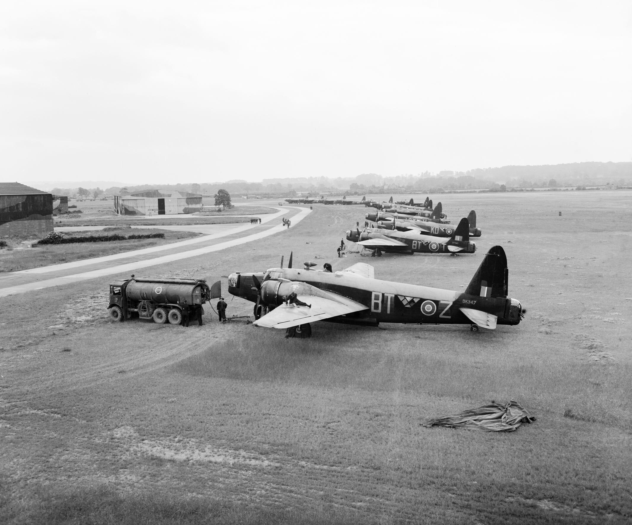
RAF Hixon

Royal Air Force Hixon, or more simply RAF Hixon, was a Royal Air Force station located on the north western edge of the village of Hixon in Staffordshire...

RAF Seighford

Royal Air Force Seighford or more simply RAF Seighford is a former Royal Air Force satellite station located 3.6 miles (5.8 km) northwest of Stafford,...

Ingestre railway station

Ingestre and Weston railway station was a former British railway station to serve the village of Ingestre in Staffordshire.It was opened by the Stafford...

Ingestre Hall

Ingestre Hall is a Grade II* 17th-century Jacobean mansion situated at Ingestre, near Stafford, Staffordshire, England. Formerly the seat of the Earls...

Hixon, Staffordshire

Hixon is a village and a civil parish in the English county of Staffordshire.grid reference SK003259 == Location == The village is 7.8 miles (12.6 km)...

Nearby Amenities

Located within 500m of 52.828464,-2.0215377
Waterway: turning_point
Lat/Long: 52.8284946/-2.0262443
Noexit: yes
Lat/Long: 52.8293576/-2.0218835
Noexit: yes
Lat/Long: 52.8290414/-2.0219235
Noexit: yes
Lat/Long: 52.8283684/-2.020422
Give Way
Direction: backward
Lat/Long: 52.8284896/-2.0214089
The data included in this document is from www.openstreetmap.org. The data is made available under ODbL.

Have you been to Shirleywich?

Leave your review of Shirleywich below (or comments, questions and feedback).