Sherston Parva

Settlement in Wiltshire

England

Sherston Parva

Road junction, Easton Grey
Road junction, Easton Grey Credit: Vieve Forward

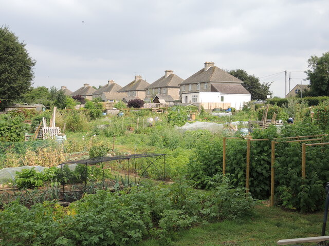
Sherston Parva is a small village located in the county of Wiltshire, England. Situated approximately 5 miles northwest of Malmesbury, it falls within the Cotswolds Area of Outstanding Natural Beauty. With a population of around 200 residents, Sherston Parva retains a charming and tranquil atmosphere.

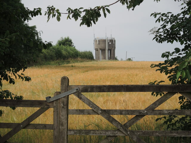
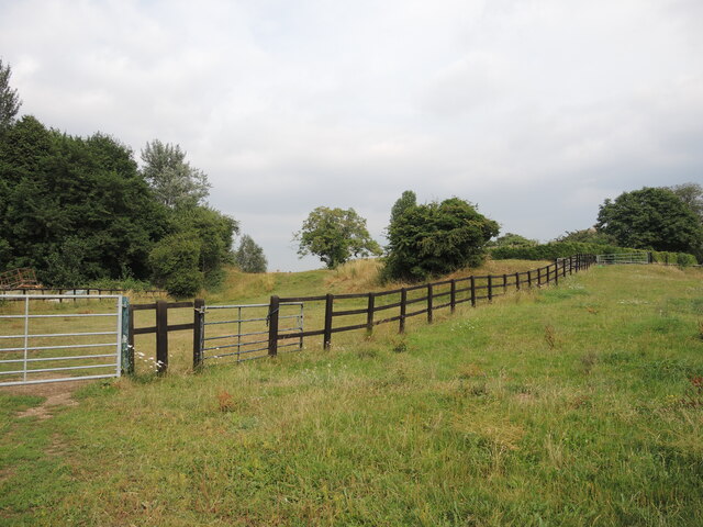
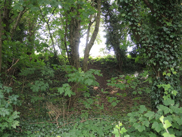
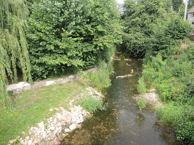
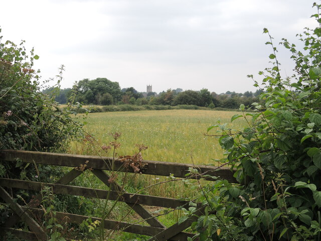
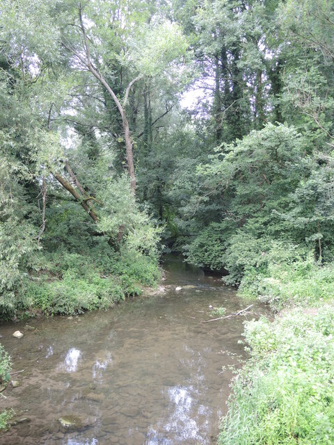
The village is set amidst picturesque countryside, characterized by rolling hills, lush green fields, and idyllic landscapes. It is known for its quintessential English village appearance, with traditional stone-built houses, thatched cottages, and a historic church, St. Mary the Virgin, dating back to the 13th century.

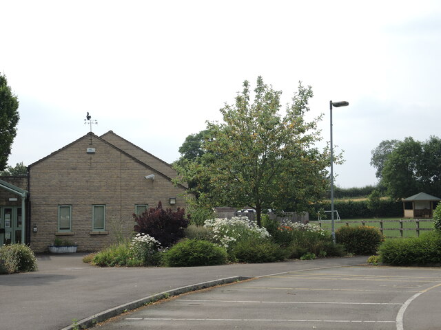
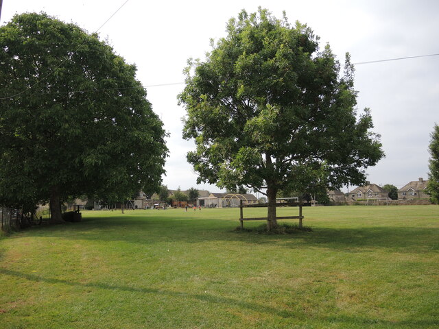
Sherston Parva offers a range of amenities to its residents and visitors. The village has a local pub, The Horse & Groom, which serves as a social hub and offers a selection of food and drink. There is also a village hall that hosts community events and activities.

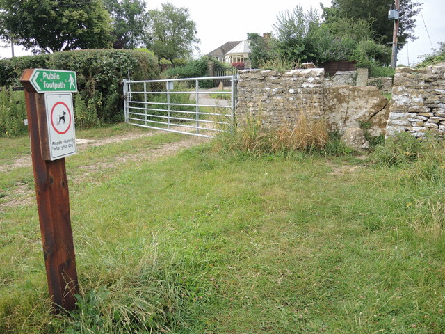
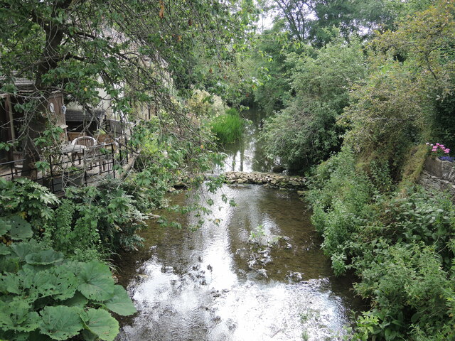
Nature enthusiasts can take advantage of the surrounding countryside by exploring the numerous walking and cycling trails in the area. The village is also conveniently located near the River Avon, providing opportunities for fishing and boating.

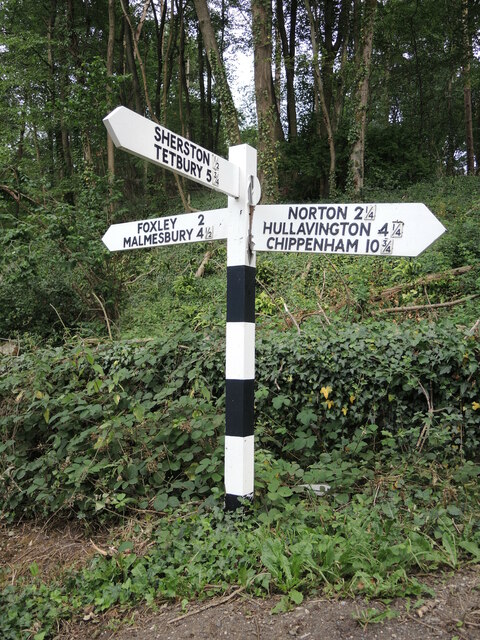
Within a short distance, residents can access a wider range of amenities in nearby towns, including Malmesbury, which offers supermarkets, shops, schools, and healthcare facilities.

Overall, Sherston Parva offers a peaceful and picturesque rural lifestyle, making it an attractive place to live for those seeking a close-knit community and a beautiful natural environment.

If you have any feedback on the listing, please let us know in the comments section below.

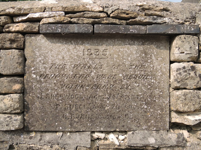
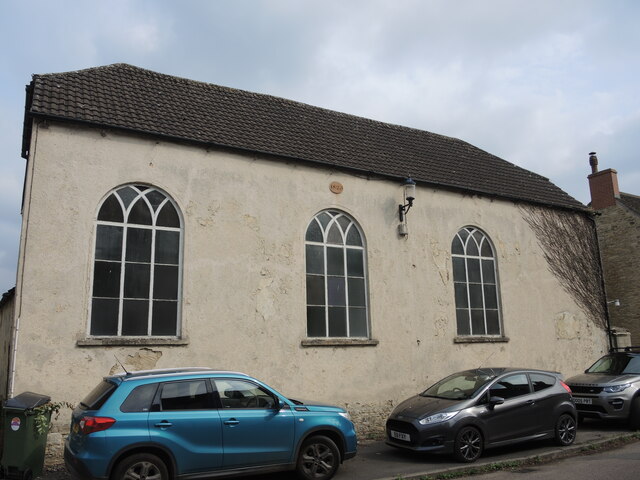
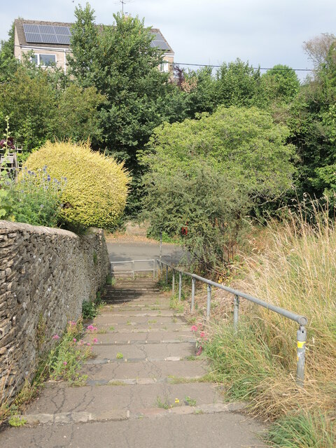
Sherston Parva Images

Images are sourced within 2km of 51.580465/-2.1954277 or Grid Reference ST8686. Thanks to Geograph Open Source API. All images are credited.

Road junction, Easton Grey
Sherston allotments A patch for the villagers to grow more.
Sherston allotments
A patch for the villagers to grow more.
Sherston school The village school, with a squirrel weathervane.
Sherston school
The village school, with a squirrel weathervane.
Sustainable Sherston A stall at the corner of the allotments show the results of some hard graft.
Sustainable Sherston
A stall at the corner of the allotments show the results of some hard graft.
Sherston reservoir To the west of the village is a covered reservoir, with a water tower-cum-mobile communications station.
Sherston reservoir
To the west of the village is a covered reservoir, with a water tower-cum-mobile communications station.
Sherston earthworks The pronounced earth embankment to the west of the village church is only partly enclosed and lies on the plateau close to the valley formed by the Sherston branch of the Avon. Fencing marks some of the line.

The village has a long history, and as it lies close to the Fosse Way it is not surprising there have been Roman finds. Indeed, there are a few flint arrowheads too, but the main records are of the Saxon era onwards.
Sherston earthworks
The pronounced earth embankment to the west of the village church is only partly enclosed and lies on the plateau close to the valley formed by the Sherston branch of the Avon. Fencing marks some of the line. The village has a long history, and as it lies close to the Fosse Way it is not surprising there have been Roman finds. Indeed, there are a few flint arrowheads too, but the main records are of the Saxon era onwards.
A path past the earthworks The footpath Sher22 leaves Sopworth Lane and goes past the ancient earthworks. It follows on to meet part of the Macmillan Way.
A path past the earthworks
The footpath Sher22 leaves Sopworth Lane and goes past the ancient earthworks. It follows on to meet part of the Macmillan Way.
A wall around Sherston? The ancient earthworks partly enclose a small area of land on the western edge of Sherston. It is mainly inaccessible but the embankment is clear from the road. Trees now proliferate.
A wall around Sherston?
The ancient earthworks partly enclose a small area of land on the western edge of Sherston. It is mainly inaccessible but the embankment is clear from the road. Trees now proliferate.
Pennymead: Sherston's recreation ground The village is well provided for with a large open field near the church. It now has modern play equipment for children after a successful grant from the National Lottery.
Pennymead: Sherston's recreation ground
The village is well provided for with a large open field near the church. It now has modern play equipment for children after a successful grant from the National Lottery.
Old hands at the game An inscribed stone records that the wall of the recreation ground was rebuilt in 1935 by three people, whose combined ages totalled 207 years!
Old hands at the game
An inscribed stone records that the wall of the recreation ground was rebuilt in 1935 by three people, whose combined ages totalled 207 years!
Sherston Congregational church Sherston has a small number of place to worship but this church in Cliff Road (previously Back Street) is an interesting one. It was originally a barn that was bought by a local farmer by the name of Cook. He rebuilt it as a licensed chapel with a vestry; it opened in October, 1825 , holding 200 parishioners.
Sherston Congregational church
Sherston has a small number of place to worship but this church in Cliff Road (previously Back Street) is an interesting one. It was originally a barn that was bought by a local farmer by the name of Cook. He rebuilt it as a licensed chapel with a vestry; it opened in October, 1825 , holding 200 parishioners.
A path down Tanners Hill A short but steep drop from Grove Road.
A path down Tanners Hill
A short but steep drop from Grove Road.
The Avon at the bottom of Tanners Hill The River Avon gathers a number of small streams, like the Shallow Brook, before running to the south of Sherston. Lining the banks are a few houses that make use of their backdrop.
The Avon at the bottom of Tanners Hill
The River Avon gathers a number of small streams, like the Shallow Brook, before running to the south of Sherston. Lining the banks are a few houses that make use of their backdrop.
Off to meet a good neighbour The River Avon (Sherston branch) flows through the village and along the bottom of Tanners Hill. Further on at Malmesbury it will meet the River Avon (Tetbury branch), and then go on towards Bristol.
Off to meet a good neighbour
The River Avon (Sherston branch) flows through the village and along the bottom of Tanners Hill. Further on at Malmesbury it will meet the River Avon (Tetbury branch), and then go on towards Bristol.
Sherston beyond the fields From a field gate, the tower of the church of the Holy Cross can be seen in the distance.
Sherston beyond the fields
From a field gate, the tower of the church of the Holy Cross can be seen in the distance.
Overgrown at Forlorn Some minor farm buildings at the crossroads known as Forlorn. The road from Easton Town is the C27 and meets the Foxley Road.
Overgrown at Forlorn
Some minor farm buildings at the crossroads known as Forlorn. The road from Easton Town is the C27 and meets the Foxley Road.
Signpost at Easton Town The post bears some wooden arms which have individual plastic lettering, tacked on. However, the fractional mileage are separate cast metal affairs, probably a left-over from when the whole arm was cast.
Signpost at Easton Town
The post bears some wooden arms which have individual plastic lettering, tacked on. However, the fractional mileage are separate cast metal affairs, probably a left-over from when the whole arm was cast.
The Avon at Pinkney Wood The fledgling Avon begins to gather momentum from Easton Town and there will be weirs coming up soon.
The Avon at Pinkney Wood
The fledgling Avon begins to gather momentum from Easton Town and there will be weirs coming up soon.
Show me another place!

Sherston Parva is located at Grid Ref: ST8686 (Lat: 51.580465, Lng: -2.1954277)

Unitary Authority: Wiltshire

Police Authority: Wiltshire

Also known as: Pinkney

What 3 Words

///truth.protester.passes. Near Sherston, Wiltshire

Related Wikis

Church of the Holy Cross, Sherston

The Church of the Holy Cross is the Grade I listed Anglican parish church in the village of Sherston, Wiltshire, England. It has Norman origins and contains...

Easton Grey

Easton Grey is a small village and civil parish in north Wiltshire, England, on the county boundary with Gloucestershire. The village lies just south of...

Sherston, Wiltshire

Sherston is a village and civil parish about 5 miles (8 km) west of Malmesbury in Wiltshire, England. The parish is bounded to the north by the county...

Westonbirt House

Westonbirt House is a country house in Gloucestershire, England, about 3 miles (5 km) southwest of the town of Tetbury. It belonged to the Holford family...

Nearby Amenities

Located within 500m of 51.580465,-2.1954277
Barrier: stile
Foot: yes
Lat/Long: 51.5801771/-2.1907861
Barrier: stile
Foot: yes
Lat/Long: 51.5808609/-2.189434
Turning Loop
Lat/Long: 51.5841318/-2.1992958
Defibrillator
Defibrillator Location: on wall
Emergency: defibrillator
Indoor: no
Operator: Community Heartbeat
Ref: CHT-10-592
Source: survey
Lat/Long: 51.5802807/-2.1951881
Post Box
Collection Times: Mo-Fr 16:15; Sa 10:30; Su off
Drive Through: no
Operator: Royal Mail
Post Box Type: lamp
Ref: SN16 205
Royal Cypher: EIIR
Royal Cypher Wikidata: Q33102113
Source: survey
Lat/Long: 51.5806735/-2.1955385
Power: pole
Lat/Long: 51.5836502/-2.1925757
Power: pole
Lat/Long: 51.5831276/-2.1937311
Power: pole
Lat/Long: 51.5826164/-2.1948464
Power: pole
Lat/Long: 51.5821129/-2.1959402
Power: pole
Lat/Long: 51.5816783/-2.1969015
Power: pole
Lat/Long: 51.5812243/-2.19792
Advertising: board
Support: pole
Lat/Long: 51.5804174/-2.1952646
Power: pole
Lat/Long: 51.5804378/-2.1952786
Power: pole
Lat/Long: 51.5808488/-2.199053
Power: pole
Lat/Long: 51.5804671/-2.2002117
Power: pole
Lat/Long: 51.5801004/-2.2013544
Power: pole
Lat/Long: 51.5797171/-2.202505
Power: pole
Lat/Long: 51.5820493/-2.1977687
Power: pole
Lat/Long: 51.5813887/-2.1968255
Power: pole
Lat/Long: 51.5811588/-2.1964332
Power: pole
Lat/Long: 51.5809251/-2.1960206
Power: pole
Lat/Long: 51.5806735/-2.1955232
Direction: 160
Generator Method: photovoltaic
Generator Output Electricity: yes
Generator Solar Modules: 204
Generator Source: solar
Generator Type: solar_photovoltaic_panel
Location: ground
Power: generator
Lat/Long: 51.5787486/-2.2007415
Booth: K6
Covered: booth
Disused Amenity: telephone
Man Made: telephone_box
Lat/Long: 51.5803261/-2.1953719
The data included in this document is from www.openstreetmap.org. The data is made available under ODbL.

Have you been to Sherston Parva?

Leave your review of Sherston Parva below (or comments, questions and feedback).