Seafield
Settlement in Hampshire Gosport
England
Seafield

Seafield is a small village located in the county of Hampshire, England. Situated in the southern part of the country, Seafield is nestled within a picturesque rural landscape. The village is positioned near the coast, offering residents and visitors easy access to stunning beaches and breathtaking views of the English Channel.
With a population of around 500, Seafield retains its tranquil and close-knit community atmosphere. The village is primarily residential, featuring a mix of traditional cottages and modern houses. The architecture reflects the area's rich history, with some buildings dating back several centuries.
Despite its size, Seafield has a few basic amenities to serve its residents. These include a local convenience store, a primary school, and a village hall that hosts community events and gatherings. For more extensive shopping and entertainment options, the nearby town of Southampton is only a short distance away.
Nature lovers will appreciate Seafield's proximity to beautiful natural attractions. The village is surrounded by scenic countryside, perfect for leisurely walks and cycling. The nearby New Forest National Park offers even more opportunities for outdoor activities, including hiking, horse riding, and wildlife spotting.
Transport links in Seafield are convenient, with regular bus services connecting the village to surrounding areas. The nearby M27 motorway provides easy access to other parts of Hampshire and beyond.
Seafield's idyllic location, close to the coast and surrounded by natural beauty, makes it an attractive place to live for those seeking a peaceful and scenic setting in the heart of Hampshire.
If you have any feedback on the listing, please let us know in the comments section below.
Seafield Images
Images are sourced within 2km of 50.790162/-1.1280445 or Grid Reference SZ6199. Thanks to Geograph Open Source API. All images are credited.


Seafield is located at Grid Ref: SZ6199 (Lat: 50.790162, Lng: -1.1280445)
Administrative County: Hampshire
District: Gosport
Police Authority: Hampshire
What 3 Words
///cups.arts.chemistry. Near Gosport, Hampshire
Nearby Locations
Related Wikis

Royal Hospital Haslar
The Royal Hospital Haslar, formerly the Royal Naval Hospital Haslar, in Gosport, Hampshire, was one of several hospitals serving the local area. It was...

Gosport Town Hall
Gosport Town Hall is a municipal structure in the High Street, Gosport, Hampshire, England. The structure currently serves as the headquarters of Gosport...
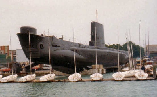
HMS Alliance (P417)
HMS Alliance (P417/S67) is a Royal Navy A-class, Amphion-class or Acheron-class submarine, laid down towards the end of the Second World War and completed...
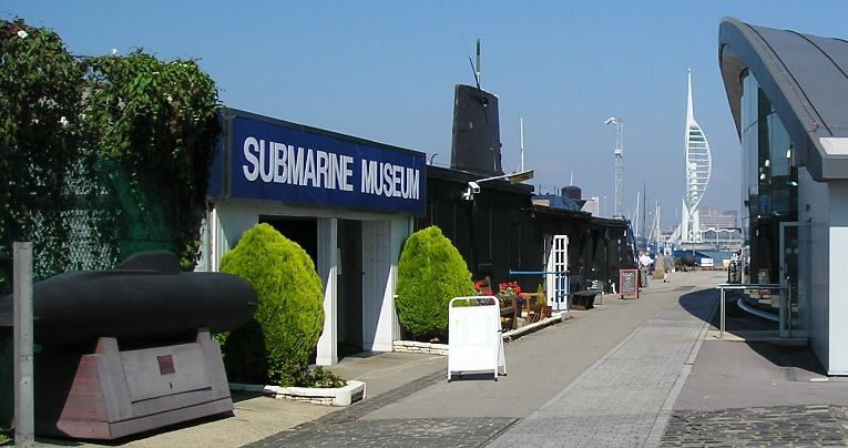
Royal Navy Submarine Museum
The Royal Navy Submarine Museum at Gosport is a maritime museum tracing the international history of submarine development from the age of Alexander the...

Haslar Marina
Haslar Marina is located inside Portsmouth Harbour, on the south coast of England, just to the west of the entrance. It can be easily identified by the...
HMS Dolphin (shore establishment)
The seventeenth Royal Navy vessel to be named HMS Dolphin was the Royal Naval shore establishment sited at Fort Blockhouse in Gosport. Dolphin was the...

Gosport bus station
Gosport bus station is a bus station in Gosport, England. == History == The original Gosport bus station was opened in 1972 with 10 stands. There have...

Gosport railway station
Gosport railway station was a terminus station designed by William Tite and opened to passenger and freight trains in 1841 by the London and South Western...
Nearby Amenities
Located within 500m of 50.790162,-1.1280445Have you been to Seafield?
Leave your review of Seafield below (or comments, questions and feedback).