Scotland Hills
Settlement in Kent Canterbury
England
Scotland Hills
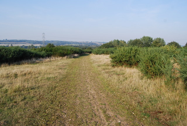
Scotland Hills is a small village located in the county of Kent, England. Situated in the southeastern part of the country, it is nestled in the picturesque countryside, surrounded by rolling hills and green fields. The village is known for its tranquillity and rural charm, offering residents and visitors a peaceful retreat from the hustle and bustle of city life.
The history of Scotland Hills dates back centuries, with evidence of human settlement in the area dating as far back as the Roman era. The village is steeped in history and boasts several well-preserved historic buildings, including a medieval church, which serves as a focal point for the community.
Despite its small size, Scotland Hills offers a range of amenities to its residents. The village is home to a primary school, a village hall, and a local pub, where locals and visitors can gather and socialize. Additionally, the surrounding countryside provides ample opportunities for outdoor activities such as hiking, cycling, and horseback riding.
The village is well-connected to larger towns and cities in the region, with good transport links and easy access to major roads. This makes Scotland Hills an attractive place to live for those seeking a peaceful rural lifestyle while still being within reach of urban amenities.
Overall, Scotland Hills, Kent, is a charming and idyllic village that offers a close-knit community, beautiful surroundings, and a rich history to its residents and visitors.
If you have any feedback on the listing, please let us know in the comments section below.
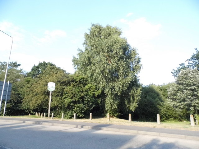
Scotland Hills Images
Images are sourced within 2km of 51.282241/1.1216086 or Grid Reference TR1758. Thanks to Geograph Open Source API. All images are credited.
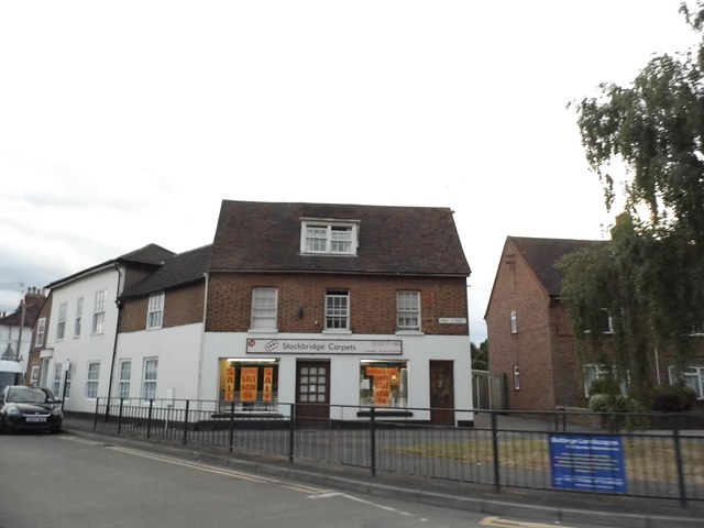
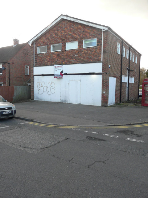
![Buildings for sale, High Street, Sturry Both are for sale through the estate agents PearsonGore <span class="nowrap"><a title="http://pearsongore.co.uk/" rel="nofollow ugc noopener" href="http://pearsongore.co.uk/">Link</a><img style="margin-left:2px;" alt="External link" title="External link - shift click to open in new window" src="https://s1.geograph.org.uk/img/external.png" width="10" height="10"/></span>
Straight ahead is The Swan Inn, which is open to unconditional offers in the region of £850,000 + VAT. The particulars also mention that it is grade II listed and has the following planning consent CA/14/01989/FUL granted by Canterbury City Council CA//14/01990 for “alterations and extensions to provide kitchen facilities and a block of six letting rooms”. The details of the grade II listing mention that it is probably a 15th century timber-framed building, which was re-fronted in the 18th century <span class="nowrap"><a title="http://www.britishlistedbuildings.co.uk/101085531-the-swan-inn-sturry#.WSXXj_6GPcc" rel="nofollow ugc noopener" href="http://www.britishlistedbuildings.co.uk/101085531-the-swan-inn-sturry#.WSXXj_6GPcc">Link</a><img style="margin-left:2px;" alt="External link" title="External link - shift click to open in new window" src="https://s1.geograph.org.uk/img/external.png" width="10" height="10"/></span>
On the left is The Jolly Chef, at number 10, which is a former Chinese takeaway and is open to offers in the region of £429,000. The particulars also mention that it is grade II listed and has the following planning consent CA/115/02203 [which is actually CA//15/02203] granted by Canterbury City Council for the “replacement of existing timber sheds with brick building”. The details of the grade II listing mention that the building dates from the 18th century <span class="nowrap"><a title="http://www.britishlistedbuildings.co.uk/101085530-7-10-high-street-sturry#.WSXVKv6GPcc" rel="nofollow ugc noopener" href="http://www.britishlistedbuildings.co.uk/101085530-7-10-high-street-sturry#.WSXVKv6GPcc">Link</a><img style="margin-left:2px;" alt="External link" title="External link - shift click to open in new window" src="https://s1.geograph.org.uk/img/external.png" width="10" height="10"/></span>
Pam Fray’s view of the <a href="https://www.geograph.org.uk/photo/1351242">TR1760 : High Street, Sturry</a> show both businesses, when they were thriving.](https://s1.geograph.org.uk/geophotos/05/40/34/5403473_a1290081.jpg)
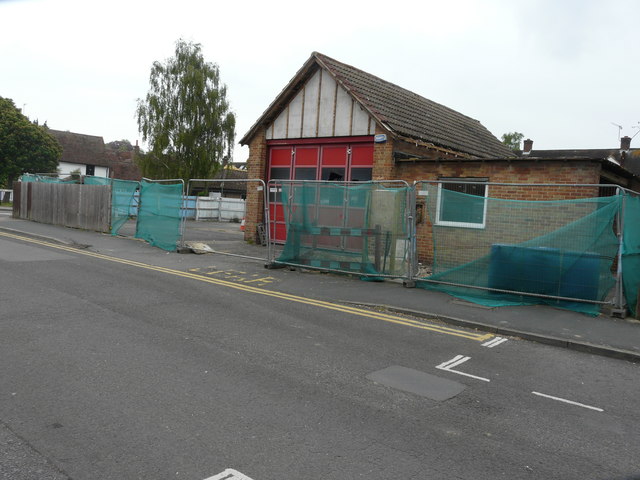
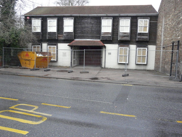
![Buildings for sale, High Street, Sturry Both are for sale through the estate agents PearsonGore <span class="nowrap"><a title="http://pearsongore.co.uk/" rel="nofollow ugc noopener" href="http://pearsongore.co.uk/">Link</a><img style="margin-left:2px;" alt="External link" title="External link - shift click to open in new window" src="https://s1.geograph.org.uk/img/external.png" width="10" height="10"/></span>
On the left is The Swan Inn, which is open to unconditional offers in the region of £850,000 + VAT. The particulars also mention that it is grade II listed and has the following planning consent CA/14/01989/FUL granted by Canterbury City Council CA//14/01990 for “alterations and extensions to provide kitchen facilities and a block of six letting rooms”. The details of the grade II listing mention that it is probably a 15th century timber-framed building, which was re-fronted in the 18th century <span class="nowrap"><a title="http://www.britishlistedbuildings.co.uk/101085531-the-swan-inn-sturry#.WSXXj_6GPcc" rel="nofollow ugc noopener" href="http://www.britishlistedbuildings.co.uk/101085531-the-swan-inn-sturry#.WSXXj_6GPcc">Link</a><img style="margin-left:2px;" alt="External link" title="External link - shift click to open in new window" src="https://s1.geograph.org.uk/img/external.png" width="10" height="10"/></span>
Straight ahead is The Jolly Chef, at number 10, which is a former Chinese takeaway and is open to offers in the region of £429,000. The particulars also mention that it is grade II listed and has the following planning consent CA/115/02203 [which is actually CA//15/02203] granted by Canterbury City Council for the “replacement of existing timber sheds with brick building”. The details of the grade II listing mention that the building dates from the 18th century <span class="nowrap"><a title="http://www.britishlistedbuildings.co.uk/101085530-7-10-high-street-sturry#.WSXVKv6GPcc" rel="nofollow ugc noopener" href="http://www.britishlistedbuildings.co.uk/101085530-7-10-high-street-sturry#.WSXVKv6GPcc">Link</a><img style="margin-left:2px;" alt="External link" title="External link - shift click to open in new window" src="https://s1.geograph.org.uk/img/external.png" width="10" height="10"/></span>
Pam Fray’s view of the <a href="https://www.geograph.org.uk/photo/1351242">TR1760 : High Street, Sturry</a> show both businesses, when they were thriving.](https://s2.geograph.org.uk/geophotos/05/40/34/5403482_96303f95.jpg)
Scotland Hills is located at Grid Ref: TR1758 (Lat: 51.282241, Lng: 1.1216086)
Administrative County: Kent
District: Canterbury
Police Authority: Kent
What 3 Words
///runs.curvy.organs. Near Sturry, Kent
Nearby Locations
Related Wikis


Related Videos

Canterbury Cathedral - Complete Virtual Tour Inside | Kent, England
A first-person view walking tour of the Canterbury Cathedral in Kent, England. This is a complete tour inside the oldest and most ...

Fordwich & Sturry, a Walking History Tour Guide Using Old Postcards Kent UK
Fordwich, (the smallest English town) and Sturry, Kent, UK, A walking history tour guide of Fordwich and Sturry using old ...
Beautiful Canterbury, UK!
uk #travel #summer #travelvlog #vacation #nature #london #dayout #fypシ #fy #fypシ゚viral #uk #daytrip.
Nearby Amenities
Located within 500m of 51.282241,1.1216086Have you been to Scotland Hills?
Leave your review of Scotland Hills below (or comments, questions and feedback).