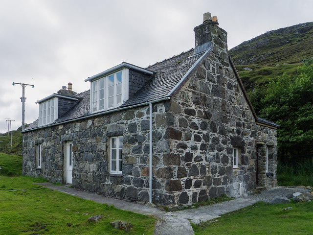
Reinigeadal

Settlement in Inverness-shire

Scotland

Reinigeadal

South eastern ridge from Todun To descend from this narrow ridge it is easiest to pick your way down the  eastern side to gain the road at the outflow from Loch Beag as there is a ravine downstream from this point.
South eastern ridge from Todun Credit: Colin Park

The requested URL returned error: 429 Too Many Requests

If you have any feedback on the listing, please let us know in the comments section below.
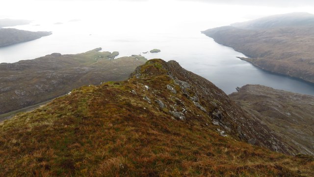
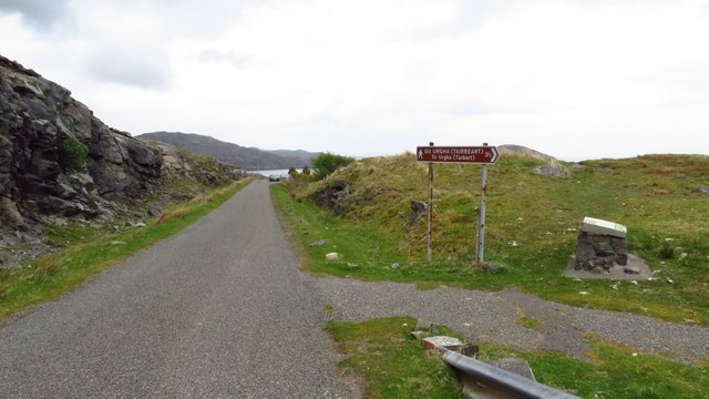
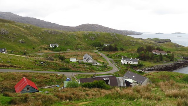
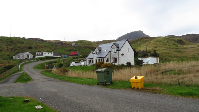
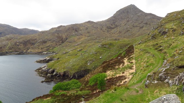
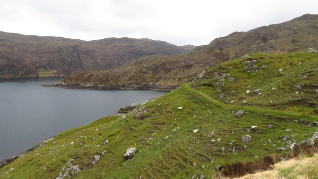
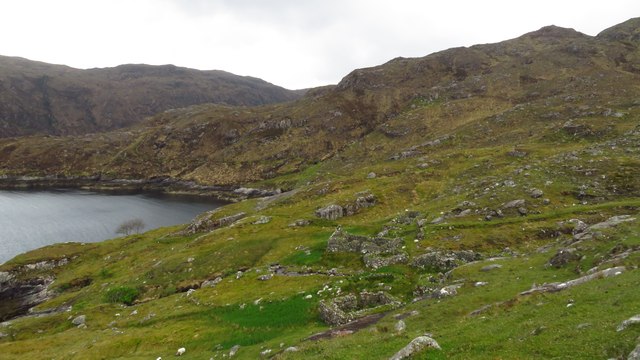
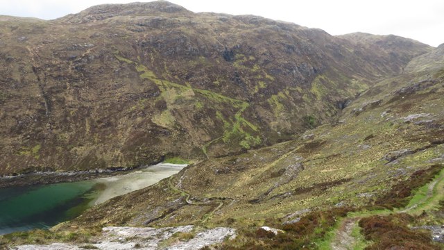
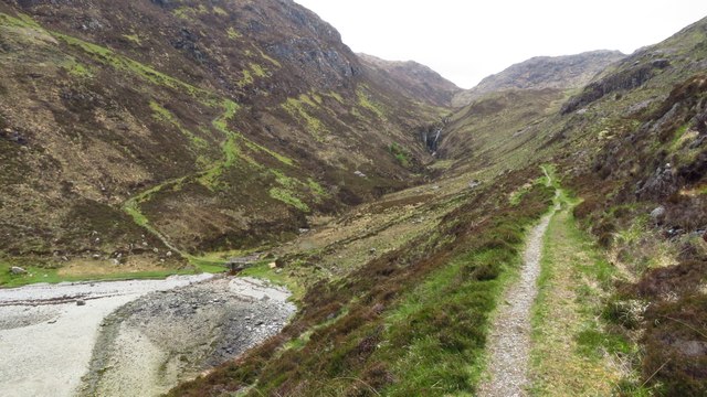
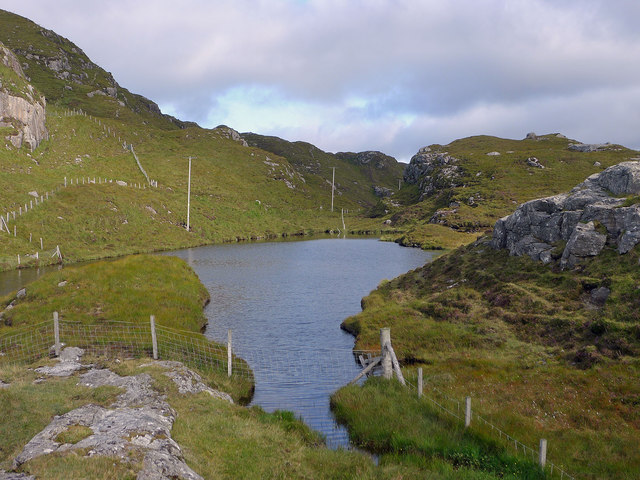
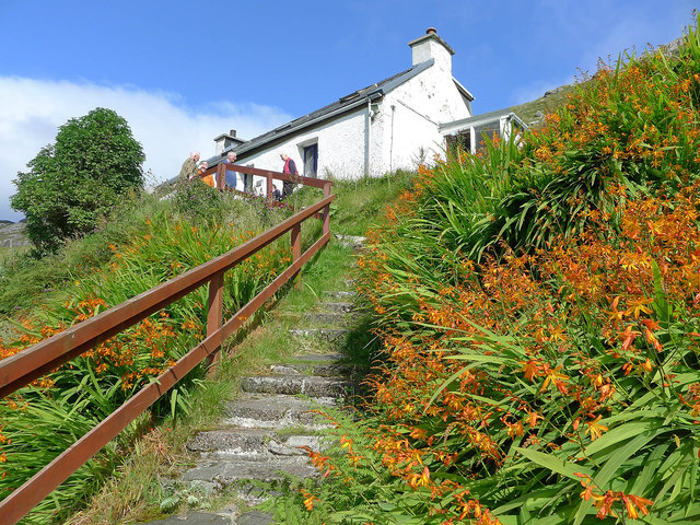
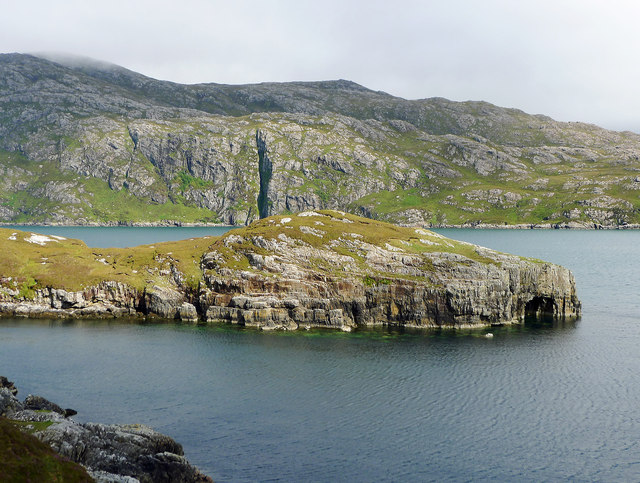
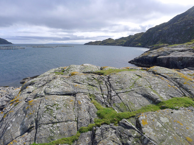
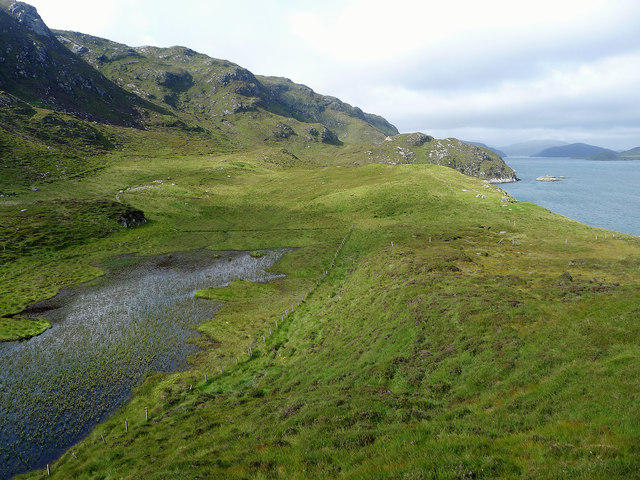
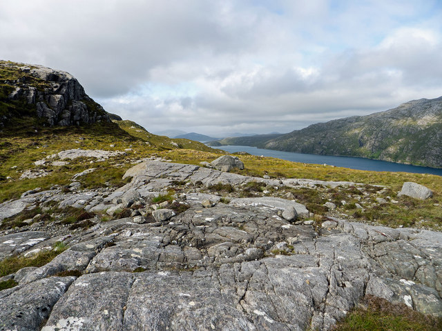
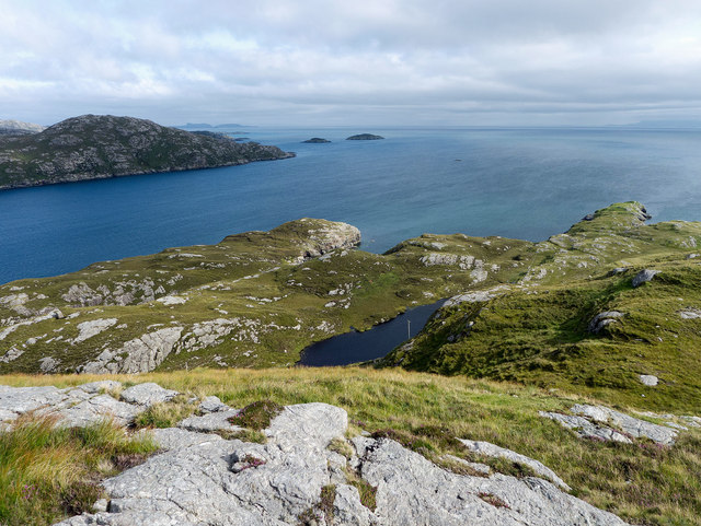
Reinigeadal Images

Images are sourced within 2km of 57.91886/-6.6815381 or Grid Reference NB2201. Thanks to Geograph Open Source API. All images are credited.

South eastern ridge from Todun To descend from this narrow ridge it is easiest to pick your way down the  eastern side to gain the road at the outflow from Loch Beag as there is a ravine downstream from this point.
South eastern ridge from Todun
To descend from this narrow ridge it is easiest to pick your way down the eastern side to gain the road at the outflow from Loch Beag as there is a ravine downstream from this point.
Junction with Postman's Path, west of Rhenigidale
Rhenigidale, Harris
Rhenigidale, Harris
Rhenigidale, Harris
Rhenigidale, Harris
Postman's Path between Rhenigidale to Gearraidh Lotaigear
On the Postman's Path near Gearraidh Lotaigear
Abandoned settlement at Gearraidh Lotaigear
On the Postman's Path descending towards the head of Loch Trolamaraig This is a good engineered path leading west from Rhenigidale. Note the zigzag path ascending the far hillside.
On the Postman's Path descending towards the head of Loch Trolamaraig
This is a good engineered path leading west from Rhenigidale. Note the zigzag path ascending the far hillside.
Postman's Path at the foot of Gleann Trolamaraig This is a good engineered path leading west from Rhenigidale. Note the zigzag path ascending the far hillside.
Postman's Path at the foot of Gleann Trolamaraig
This is a good engineered path leading west from Rhenigidale. Note the zigzag path ascending the far hillside.
On the Postman's Path west of Loch Trolamaraig
Water source for Rhenigidale before mains water The small lake still has the pipework for delivering the water to Rhenigidale, but now the village is on the mains.
Water source for Rhenigidale before mains water
The small lake still has the pipework for delivering the water to Rhenigidale, but now the village is on the mains.
Path to the entrance to Rhenigidale Hostel Rhenigidale Hostel is owned by a charity - the Gatliff Hebridean Hostels Trust - and has been open for over 50 years.  The Gatliff Trust is affiliated to the SYHA.
Path to the entrance to Rhenigidale Hostel
Rhenigidale Hostel is owned by a charity - the Gatliff Hebridean Hostels Trust - and has been open for over 50 years. The Gatliff Trust is affiliated to the SYHA.
Rubha na h-Uamha  This headland has a cave and juts into Loch Seaforth.
Rubha na h-Uamha
This headland has a cave and juts into Loch Seaforth.
Gearraidh Mhurchaidh A well restored cottage that may be accessed by a minor path from Rhenigidale or by boat to a small pier far below the cottage.  A "railway"connects the pier to the lawn beside the house allowing supplies to be easily taken up to the house.
Gearraidh Mhurchaidh
A well restored cottage that may be accessed by a minor path from Rhenigidale or by boat to a small pier far below the cottage. A "railway"connects the pier to the lawn beside the house allowing supplies to be easily taken up to the house.
Outlook from Creag Mhurchaidh Looking towards the open sea with a salmon farm in the middle of Loch Seaforth. In the far distance is part of the Isle of Skye.
Outlook from Creag Mhurchaidh
Looking towards the open sea with a salmon farm in the middle of Loch Seaforth. In the far distance is part of the Isle of Skye.
The fields at Nostar I gather that no one has lived at Nostar for a very long time but the fields were worked by a crofter until recently. Nostar is an area of green thanks to grass and bog-loving plants.
The fields at Nostar
I gather that no one has lived at Nostar for a very long time but the fields were worked by a crofter until recently. Nostar is an area of green thanks to grass and bog-loving plants.
Mountain terrain above Loch Seaforth The rock outcrops made for easier walking than the heather of the hillside. The east side of Loch Seaforth is seen as being excessively steep.
Mountain terrain above Loch Seaforth
The rock outcrops made for easier walking than the heather of the hillside. The east side of Loch Seaforth is seen as being excessively steep.
The entrance to Loch Seaforth from Druim Caol A bright afternoon to enjoy the coastal and mountain scenery of Rhenigidale.
The entrance to Loch Seaforth from Druim Caol
A bright afternoon to enjoy the coastal and mountain scenery of Rhenigidale.
Show me another place!

Reinigeadal is located at Grid Ref: NB2201 (Lat: 57.91886, Lng: -6.6815381)

Unitary Authority: Na h-Eileanan an Iar

Police Authority: Highlands and Islands

Also known as: Rhenigidale

What 3 Words

///introduce.exists.botanists. Near Tarbert, Na h-Eileanan Siar

Related Wikis

Rèinigeadal

Rèinigeadal (or Rhenigidale) is a small settlement in Harris, in the Western Isles in Scotland. It is situated on the east coast of Harris 8 kilometres...

Loch Seaforth

Loch Seaforth (Scottish Gaelic: Loch Shiphoirt or Shìophoirt) is a sea loch in the Outer Hebrides of Scotland. It consists of three distinct sections;...

Scalpay, Outer Hebrides

Scalpay (; Scottish Gaelic: Sgalpaigh or Sgalpaigh na Hearadh; i.e. "Scalpay of Harris" to distinguish it from Scalpay off Skye) is an island in the Outer...

Sgeotasaigh

Scotasay (Scottish Gaelic: Sgeotasaigh) is small island in the Outer Hebrides of Scotland. It lies 1 kilometre (0.6 miles) off the east coast of Harris...

Nearby Amenities

Located within 500m of 57.91886,-6.6815381
Rèinigeadal
Is In: Harris
Name En: Rhenigidale
Name Gd: Rèinigeadal
Place: village
Wikidata: Q7386078
Wikipedia: en:Rèinigeadal
Lat/Long: 57.9186309/-6.6835249
Passing Place
Lat/Long: 57.9181379/-6.6865625
Turning Circle
Lat/Long: 57.9195886/-6.6817773
Post Box
Collection Times: Mo-Sa 09:15
Drive Through: no
Operator: Royal Mail
Ref: HS3 111
Source: survey
Lat/Long: 57.9188584/-6.6812743
Bus Stop
Rhenigidale
Bench: no
Bin: no
Bus: yes
Lit: no
Naptan AtcoCode: 6010731787
Naptan Bearing: W
Naptan CommonName: Rhenigadale
Naptan Indicator: Youth Hostel
Naptan Landmark: Youth Hostel
Naptan NaptanCode: 94723684
Naptan Street: Youth Hostel
Naptan Verified: no
Public Transport: platform
Shelter: no
Source: naptan_import
Lat/Long: 57.9194019/-6.6811568
Barrier: cattle_grid
Lat/Long: 57.9182363/-6.684873
Entrance: yes
Lat/Long: 57.9195961/-6.6811476
Access: private
Entrance: yes
Lat/Long: 57.9185473/-6.6830347
Entrance: yes
Lat/Long: 57.9198263/-6.6823329
Material: wood
Power: pole
Lat/Long: 57.9198753/-6.6797455
Material: wood
Power: pole
Lat/Long: 57.9197059/-6.6802419
Material: wood
Power: pole
Lat/Long: 57.9189732/-6.682517
Material: wood
Power: pole
Lat/Long: 57.9190944/-6.6836248
Material: wood
Power: pole
Lat/Long: 57.9200129/-6.6792916
Material: wood
Power: pole
Lat/Long: 57.920583/-6.6797477
Material: wood
Power: pole
Lat/Long: 57.9211642/-6.6800802
Material: wood
Power: pole
Lat/Long: 57.9216542/-6.6803616
Material: wood
Power: pole
Lat/Long: 57.922308/-6.6806334
Material: wood
Power: pole
Lat/Long: 57.9197581/-6.6818062
Material: wood
Power: pole
Lat/Long: 57.9194405/-6.6820906
Material: wood
Power: pole
Lat/Long: 57.9208735/-6.6881818
Material: wood
Power: pole
Lat/Long: 57.9203992/-6.6870138
Material: wood
Power: pole
Lat/Long: 57.9200723/-6.6861689
Material: wood
Power: pole
Lat/Long: 57.9197276/-6.6853535
Material: wood
Power: pole
Lat/Long: 57.9193262/-6.6814435
Material: wood
Power: pole
Lat/Long: 57.9191979/-6.6823393
Material: wood
Power: pole
Lat/Long: 57.9183199/-6.6840338
Material: wood
Power: pole
Lat/Long: 57.918795/-6.684157
Material: wood
Power: pole
Lat/Long: 57.9177658/-6.684774
Material: wood
Power: pole
Lat/Long: 57.9191948/-6.684642
Direction: 350
Fee: no
Natural: cave_entrance
Lat/Long: 57.9209872/-6.6741035
Passing Place
Lat/Long: 57.9194723/-6.6814491
Access: private
Entrance: yes
Lat/Long: 57.9186548/-6.6832301
Access: private
Addr Street: R
Entrance: yes
Lat/Long: 57.9187066/-6.6832732
Access: private
Entrance: yes
Lat/Long: 57.9188841/-6.6835616
Access: private
Entrance: yes
Lat/Long: 57.9186063/-6.6816721
Access: private
Entrance: yes
Lat/Long: 57.9182787/-6.6807346
Defibrillator
Emergency: defibrillator
Indoor: no
Ref GB The Circuit: 1443DCF8-D38F-4906-A6E1-B07C01054890
Lat/Long: 57.9187726/-6.6833281
Information: guidepost
Operator: North Harris Trust
Tourism: information
Lat/Long: 57.9180279/-6.6879743
Ard Caol
Natural: cape
Lat/Long: 57.9172896/-6.6740024
Rubha Glas
Natural: cape
Lat/Long: 57.9168905/-6.6780426
Druim Caol
Natural: hill
Lat/Long: 57.9213244/-6.6812655
Material: wood
Power: pole
Lat/Long: 57.9230623/-6.6806788
Access: private
Entrance: yes
Lat/Long: 57.9189504/-6.6800295
Entrance: yes
Lat/Long: 57.9195758/-6.6810458
Material: wood
Power: pole
Lat/Long: 57.9179917/-6.6844729
The data included in this document is from www.openstreetmap.org. The data is made available under ODbL.

Have you been to Reinigeadal?

Leave your review of Reinigeadal below (or comments, questions and feedback).