Port Reinigeadal

Sea, Estuary, Creek in Inverness-shire

Scotland

Port Reinigeadal

Water source for Rhenigidale before mains water The small lake still has the pipework for delivering the water to Rhenigidale, but now the village is on the mains.
Water source for Rhenigidale before mains water Credit: Julian Paren

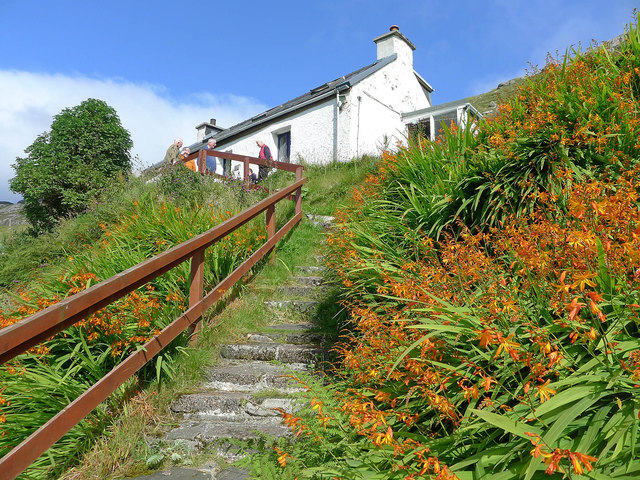
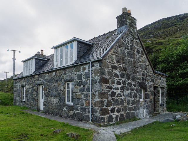
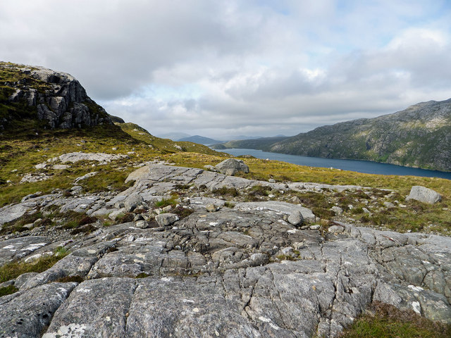
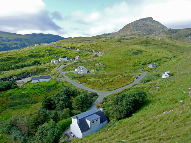
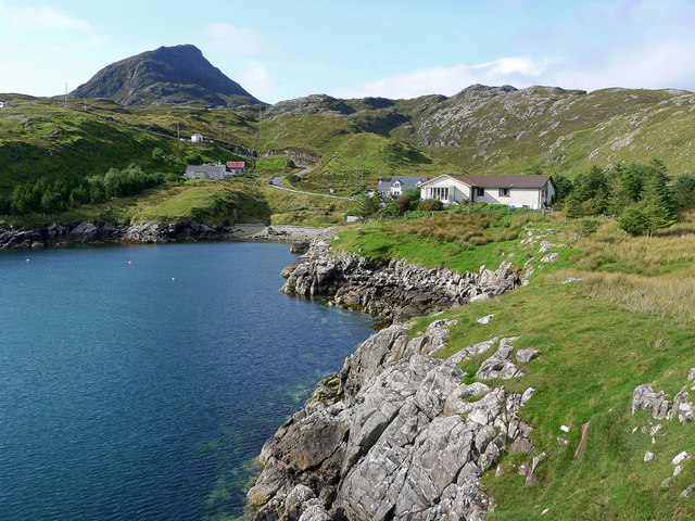
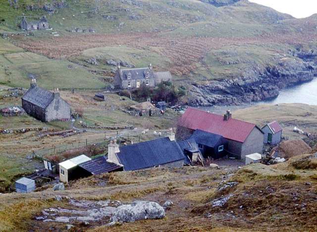
Port Reinigeadal is a picturesque coastal village located in Inverness-shire, Scotland. Situated on the west coast of the Isle of Lewis, it is nestled between the rugged cliffs and the pristine waters of the Atlantic Ocean. The village is named after the Reinigeadal River, which flows into the sea nearby.

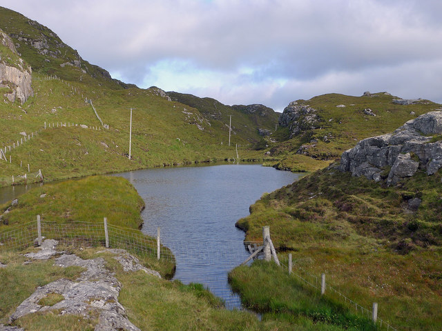
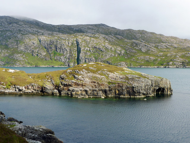
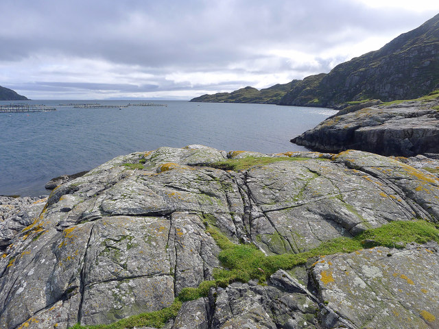
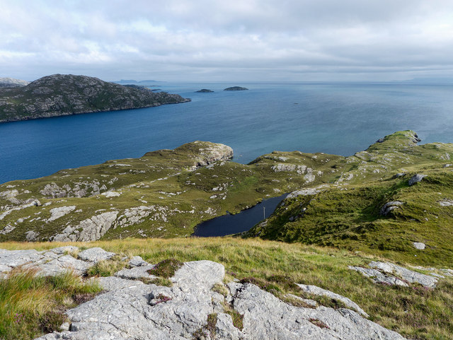
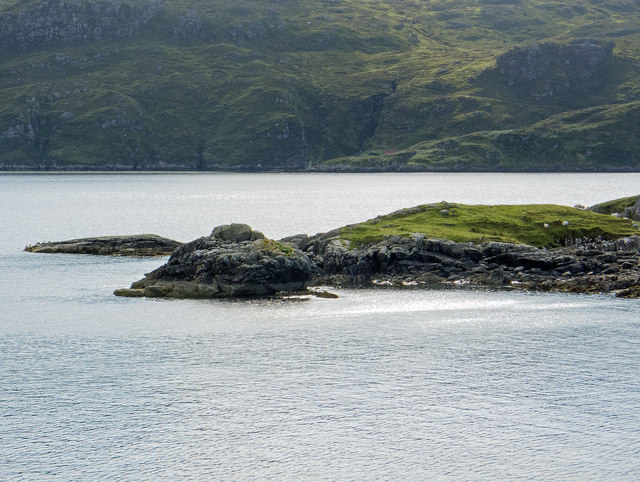
The sea surrounding Port Reinigeadal is known for its breathtaking beauty. Its azure waters are teeming with marine life, making it a popular destination for fishing enthusiasts. The coastline is characterized by towering cliffs that provide a dramatic backdrop to the village. Seabirds can often be spotted perched on the cliffs, adding to the area's natural charm.

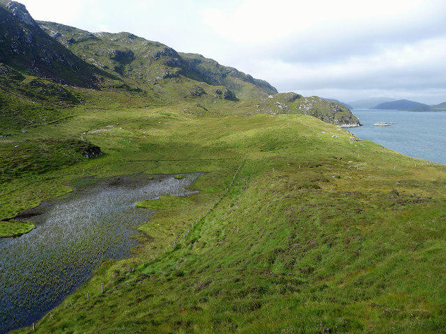
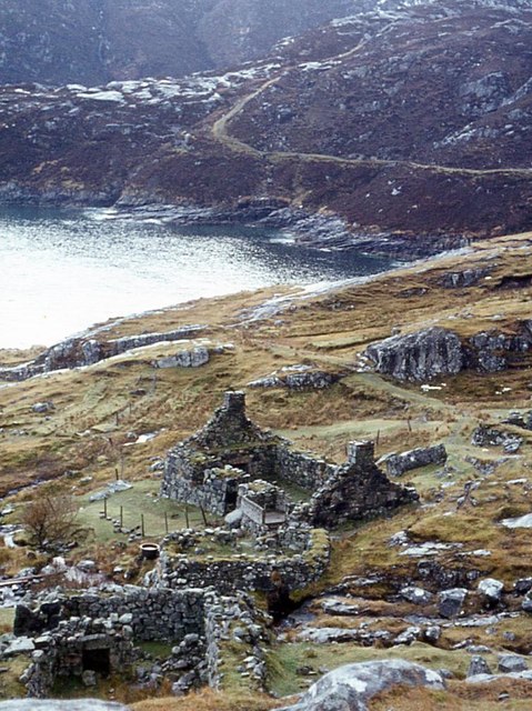
The estuary at Port Reinigeadal is a haven for wildlife. The tidal waters of the river attract a variety of bird species, including herons, ducks, and waders. The estuary is also home to a diverse range of flora and fauna, with salt marshes and mudflats providing essential habitats for many species.

A small creek runs through the heart of the village, giving it a distinct charm. The creek serves as a focal point for the community, with locals often gathering along its banks for leisurely strolls or to watch the boats sail in and out. The creek is also essential for the village's economy, as it provides a sheltered harbor for fishing boats and other vessels.

Overall, Port Reinigeadal is a hidden gem on the Scottish coast. Its stunning sea views, abundant wildlife, and charming creek make it a must-visit destination for nature lovers and those seeking a peaceful coastal retreat.

If you have any feedback on the listing, please let us know in the comments section below.

Port Reinigeadal Images

Images are sourced within 2km of 57.917173/-6.680456 or Grid Reference NB2201. Thanks to Geograph Open Source API. All images are credited.

Water source for Rhenigidale before mains water The small lake still has the pipework for delivering the water to Rhenigidale, but now the village is on the mains.
Water source for Rhenigidale before mains water
The small lake still has the pipework for delivering the water to Rhenigidale, but now the village is on the mains.
Path to the entrance to Rhenigidale Hostel Rhenigidale Hostel is owned by a charity - the Gatliff Hebridean Hostels Trust - and has been open for over 50 years.  The Gatliff Trust is affiliated to the SYHA.
Path to the entrance to Rhenigidale Hostel
Rhenigidale Hostel is owned by a charity - the Gatliff Hebridean Hostels Trust - and has been open for over 50 years. The Gatliff Trust is affiliated to the SYHA.
Rubha na h-Uamha  This headland has a cave and juts into Loch Seaforth.
Rubha na h-Uamha
This headland has a cave and juts into Loch Seaforth.
Gearraidh Mhurchaidh A well restored cottage that may be accessed by a minor path from Rhenigidale or by boat to a small pier far below the cottage.  A "railway"connects the pier to the lawn beside the house allowing supplies to be easily taken up to the house.
Gearraidh Mhurchaidh
A well restored cottage that may be accessed by a minor path from Rhenigidale or by boat to a small pier far below the cottage. A "railway"connects the pier to the lawn beside the house allowing supplies to be easily taken up to the house.
Outlook from Creag Mhurchaidh Looking towards the open sea with a salmon farm in the middle of Loch Seaforth. In the far distance is part of the Isle of Skye.
Outlook from Creag Mhurchaidh
Looking towards the open sea with a salmon farm in the middle of Loch Seaforth. In the far distance is part of the Isle of Skye.
The fields at Nostar I gather that no one has lived at Nostar for a very long time but the fields were worked by a crofter until recently. Nostar is an area of green thanks to grass and bog-loving plants.
The fields at Nostar
I gather that no one has lived at Nostar for a very long time but the fields were worked by a crofter until recently. Nostar is an area of green thanks to grass and bog-loving plants.
Mountain terrain above Loch Seaforth The rock outcrops made for easier walking than the heather of the hillside. The east side of Loch Seaforth is seen as being excessively steep.
Mountain terrain above Loch Seaforth
The rock outcrops made for easier walking than the heather of the hillside. The east side of Loch Seaforth is seen as being excessively steep.
The entrance to Loch Seaforth from Druim Caol A bright afternoon to enjoy the coastal and mountain scenery of Rhenigidale.
The entrance to Loch Seaforth from Druim Caol
A bright afternoon to enjoy the coastal and mountain scenery of Rhenigidale.
Looking across Port Rhenigidale Beyond the entrance to Rhenigidale lies Loch Trolamaraig.
Looking across Port Rhenigidale
Beyond the entrance to Rhenigidale lies Loch Trolamaraig.
The hamlet of Rhenigidale All but one of the houses of Rhenigidale are visible here.  The school bus calls daily in term time and on demand in the school holidays.  There is a postbox, a self catering cottage and the Gatliff Trust Youth Hostel. The Hostel Warden lives here as does the last postman who did the daily walk along the "Postman's Path" from Urgha on the Tarbert to Scalpay Road.

The mountain Toddun dominates the village.  The trees and road  are recent additions to the village.
The hamlet of Rhenigidale
All but one of the houses of Rhenigidale are visible here. The school bus calls daily in term time and on demand in the school holidays. There is a postbox, a self catering cottage and the Gatliff Trust Youth Hostel. The Hostel Warden lives here as does the last postman who did the daily walk along the "Postman's Path" from Urgha on the Tarbert to Scalpay Road. The mountain Toddun dominates the village. The trees and road are recent additions to the village.
Rhenigidale from the headland of Rubha Glas 2015 A similar viewpoint to <a href="https://www.geograph.org.uk/photo/330137">NB2301 : Coastline SE of Rhenigidale</a> taken in the 1980s.  Note the two new modern houses, the new road, the introduction of trees and, not so obvious but apparent on the ground, vast numbers of fences fencing parcels of land around the village.

The Youth Hostel is hidden by the woodland - not so in the earlier image.  Unchanging is the weather and the mass of Toddun overlooking the village.
Rhenigidale from the headland of Rubha Glas 2015
A similar viewpoint to NB2301 : Coastline SE of Rhenigidale taken in the 1980s. Note the two new modern houses, the new road, the introduction of trees and, not so obvious but apparent on the ground, vast numbers of fences fencing parcels of land around the village. The Youth Hostel is hidden by the woodland - not so in the earlier image. Unchanging is the weather and the mass of Toddun overlooking the village.
Ruins of Gearraidh Lotaigear The postman's path rounds the headland beyond on the way to Tarbert.
Ruins of Gearraidh Lotaigear
The postman's path rounds the headland beyond on the way to Tarbert.
Reinigeadal
Reinigeadal
Path to Reinigeadal passes the head of Loch Trolamaraig
Gleann Trolamaraig
Gleann Trolamaraig
Gearraidh Lotalgear Compared to west coast the east coast of Harris is rugged and harsh, lacking the fertile machair found on the western coast of the islands. Even today with no white sandy beaches few tourists make the 6 mile detour along the windy hilly single track road. Gearraidh Lotalgear was an outying settlement of Rhenigidale, today a community of a handful of cottages. Prior to the clearances there were just a couple of shepherding families at Rhenigidale reached by a 3½ mile mountainous walk from Tarbet. The track can be seen snaking around the hillside. When the landowners cleared the western lands for more sheep some of the evicted settled in communities like Rhenigidale swelling its population to over a 100 by the 1880s. Others went further afield, emigrating to Nova Scotia. Those left supplemented what meagre produce the land could provide with by fishing for the herring.

A century later the population had shrunk to 10 and Rhenigidale was on the verge of total abandonment. There was still no road to the rest of the island. It was not until 1989 that a road was constructed, and Rhenigidale became the last community in Scotland to be connected to the road network. The population is now at around 20. Gearraidh is a Gaelic word meaning the outer pastures. Its handful of stone ruins and lazy beds, now home to sheep, provide an evocative glimpse into past lives.

From my blog <span class="nowrap"><a title="https://fhithich.wordpress.com/2017/08/25/gearraidh-lotalgear/" rel="nofollow ugc noopener" href="https://fhithich.wordpress.com/2017/08/25/gearraidh-lotalgear/">Link</a><img style="margin-left:2px;" alt="External link" title="External link - shift click to open in new window" src="https://s1.geograph.org.uk/img/external.png" width="10" height="10"/></span>
Gearraidh Lotalgear
Compared to west coast the east coast of Harris is rugged and harsh, lacking the fertile machair found on the western coast of the islands. Even today with no white sandy beaches few tourists make the 6 mile detour along the windy hilly single track road. Gearraidh Lotalgear was an outying settlement of Rhenigidale, today a community of a handful of cottages. Prior to the clearances there were just a couple of shepherding families at Rhenigidale reached by a 3½ mile mountainous walk from Tarbet. The track can be seen snaking around the hillside. When the landowners cleared the western lands for more sheep some of the evicted settled in communities like Rhenigidale swelling its population to over a 100 by the 1880s. Others went further afield, emigrating to Nova Scotia. Those left supplemented what meagre produce the land could provide with by fishing for the herring. A century later the population had shrunk to 10 and Rhenigidale was on the verge of total abandonment. There was still no road to the rest of the island. It was not until 1989 that a road was constructed, and Rhenigidale became the last community in Scotland to be connected to the road network. The population is now at around 20. Gearraidh is a Gaelic word meaning the outer pastures. Its handful of stone ruins and lazy beds, now home to sheep, provide an evocative glimpse into past lives. From my blog LinkExternal link
Road down to Rhenigidale
Show me another place!

Port Reinigeadal is located at Grid Ref: NB2201 (Lat: 57.917173, Lng: -6.680456)

Unitary Authority: Na h-Eileanan an Iar

Police Authority: Highlands and Islands

What 3 Words

///daydreams.raking.seagull. Near Tarbert, Na h-Eileanan Siar

Related Wikis

Nearby Amenities

Located within 500m of 57.917173,-6.680456
Rèinigeadal
Is In: Harris
Name En: Rhenigidale
Name Gd: Rèinigeadal
Place: village
Wikidata: Q7386078
Wikipedia: en:Rèinigeadal
Lat/Long: 57.9186309/-6.6835249
Passing Place
Lat/Long: 57.9181379/-6.6865625
Turning Circle
Lat/Long: 57.9195886/-6.6817773
Post Box
Collection Times: Mo-Sa 09:15
Drive Through: no
Operator: Royal Mail
Ref: HS3 111
Source: survey
Lat/Long: 57.9188584/-6.6812743
Bus Stop
Rhenigidale
Bench: no
Bin: no
Bus: yes
Lit: no
Naptan AtcoCode: 6010731787
Naptan Bearing: W
Naptan CommonName: Rhenigadale
Naptan Indicator: Youth Hostel
Naptan Landmark: Youth Hostel
Naptan NaptanCode: 94723684
Naptan Street: Youth Hostel
Naptan Verified: no
Public Transport: platform
Shelter: no
Source: naptan_import
Lat/Long: 57.9194019/-6.6811568
Barrier: cattle_grid
Lat/Long: 57.9182363/-6.684873
Entrance: yes
Lat/Long: 57.9195961/-6.6811476
Access: private
Entrance: yes
Lat/Long: 57.9185473/-6.6830347
Entrance: yes
Lat/Long: 57.9198263/-6.6823329
Material: wood
Power: pole
Lat/Long: 57.9198753/-6.6797455
Material: wood
Power: pole
Lat/Long: 57.9197059/-6.6802419
Material: wood
Power: pole
Lat/Long: 57.9189732/-6.682517
Material: wood
Power: pole
Lat/Long: 57.9191086/-6.6836409
Material: wood
Power: pole
Lat/Long: 57.9200129/-6.6792916
Material: wood
Power: pole
Lat/Long: 57.920583/-6.6797477
Material: wood
Power: pole
Lat/Long: 57.9211642/-6.6800802
Material: wood
Power: pole
Lat/Long: 57.9216542/-6.6803616
Material: wood
Power: pole
Lat/Long: 57.9197581/-6.6818062
Material: wood
Power: pole
Lat/Long: 57.9194405/-6.6820906
Material: wood
Power: pole
Lat/Long: 57.9200723/-6.6861689
Material: wood
Power: pole
Lat/Long: 57.9197276/-6.6853535
Material: wood
Power: pole
Lat/Long: 57.9193383/-6.6814502
Material: wood
Power: pole
Lat/Long: 57.9191979/-6.6823393
Material: wood
Power: pole
Lat/Long: 57.9183199/-6.6840338
Material: wood
Power: pole
Lat/Long: 57.9187758/-6.6840739
Material: wood
Power: pole
Lat/Long: 57.9177658/-6.684774
Material: wood
Power: pole
Lat/Long: 57.9191948/-6.684642
Passing Place
Lat/Long: 57.9194723/-6.6814491
Access: private
Entrance: yes
Lat/Long: 57.9186548/-6.6832301
Access: private
Addr Street: R
Entrance: yes
Lat/Long: 57.9187066/-6.6832732
Access: private
Entrance: yes
Lat/Long: 57.9188841/-6.6835616
Access: private
Entrance: yes
Lat/Long: 57.9186063/-6.6816721
Access: private
Entrance: yes
Lat/Long: 57.9182787/-6.6807346
Defibrillator
Emergency: defibrillator
Indoor: no
Ref GB The Circuit: 1443DCF8-D38F-4906-A6E1-B07C01054890
Lat/Long: 57.9187726/-6.6833281
Information: guidepost
Operator: North Harris Trust
Tourism: information
Lat/Long: 57.9180279/-6.6879743
Ard Caol
Natural: cape
Lat/Long: 57.9172896/-6.6740024
Rubha Glas
Natural: cape
Lat/Long: 57.9168905/-6.6780426
Druim Caol
Natural: hill
Lat/Long: 57.9213244/-6.6812655
Access: private
Entrance: yes
Lat/Long: 57.9189504/-6.6800295
Entrance: yes
Lat/Long: 57.9195758/-6.6810458
Material: wood
Power: pole
Lat/Long: 57.9179917/-6.6844729
The data included in this document is from www.openstreetmap.org. The data is made available under ODbL.

Have you been to Port Reinigeadal?

Leave your review of Port Reinigeadal below (or comments, questions and feedback).