Ravensnest

Settlement in Derbyshire North East Derbyshire

England

Ravensnest

Field on Tansley Moor Part of a plateau of farmland. The Derwent valley can be seen in the background though the view is still affected by recent rain.
Field on Tansley Moor Credit: Bill Boaden

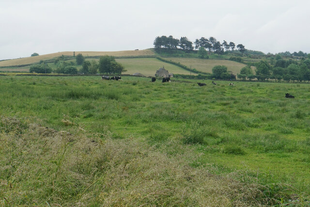
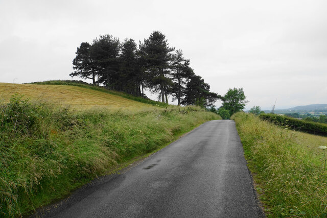
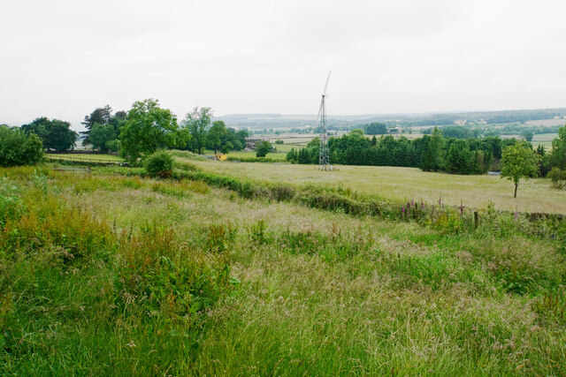
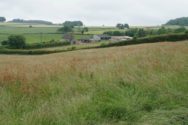
Ravensnest is a small hamlet situated in the county of Derbyshire, England. It is located within the Peak District National Park, renowned for its picturesque landscapes and outdoor activities. The hamlet is nestled in the heart of the Peak District, surrounded by rolling hills, lush greenery, and breathtaking views.

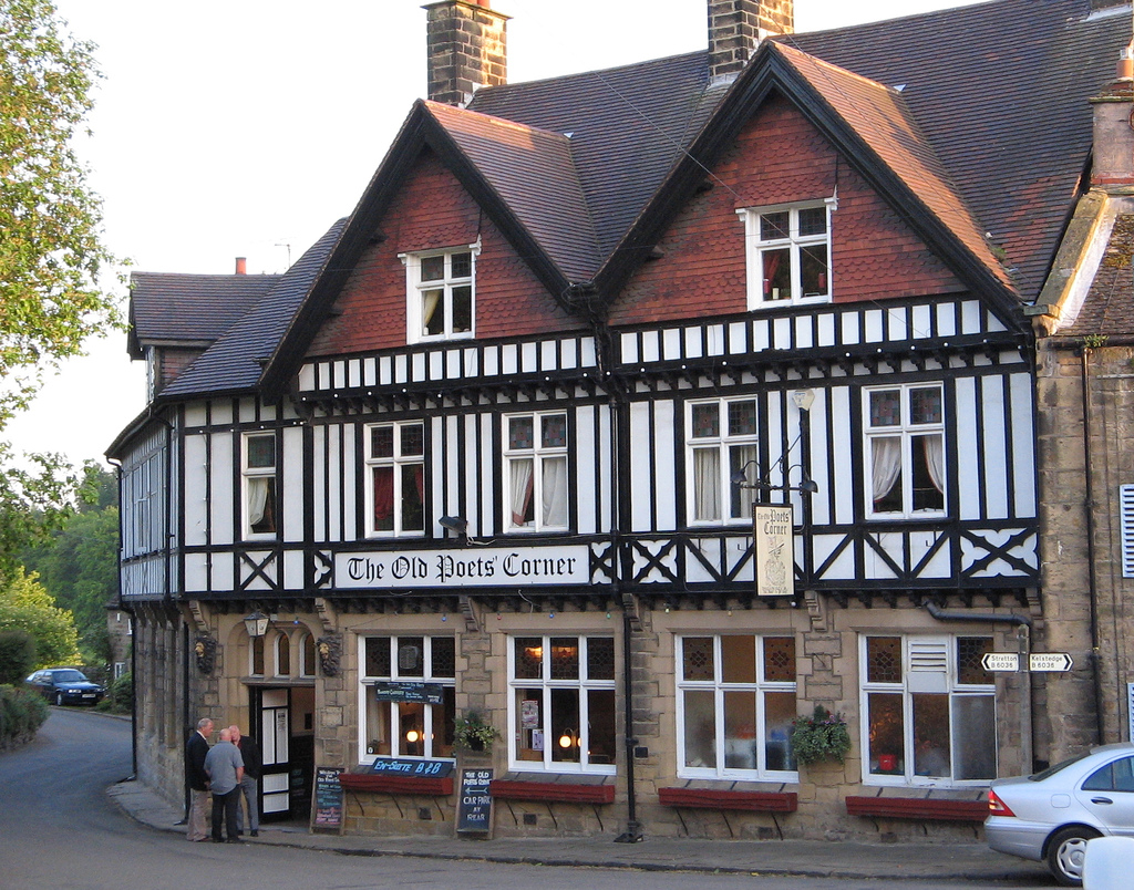
Ravensnest is a quiet and secluded area, offering a peaceful retreat for those seeking a break from the hustle and bustle of city life. The hamlet consists of a handful of traditional stone houses, giving it a quaint and charming atmosphere. The local community is small but close-knit, with a friendly and welcoming vibe.

Being situated within the Peak District National Park, Ravensnest offers a wealth of outdoor activities for nature enthusiasts. Hiking and walking trails crisscross the surrounding countryside, providing opportunities to explore the stunning scenery and discover hidden gems. The area is also popular for cycling, with various routes catering to different skill levels.

For those interested in history and culture, Ravensnest is conveniently located near several notable attractions. Chatsworth House, a magnificent stately home and gardens, is a short drive away. The historic market town of Bakewell, famous for its delicious Bakewell pudding, is also within easy reach.

Overall, Ravensnest is a charming and tranquil hamlet that offers a perfect base for exploring the natural beauty of the Peak District and immersing oneself in the rich history and culture of Derbyshire.

If you have any feedback on the listing, please let us know in the comments section below.
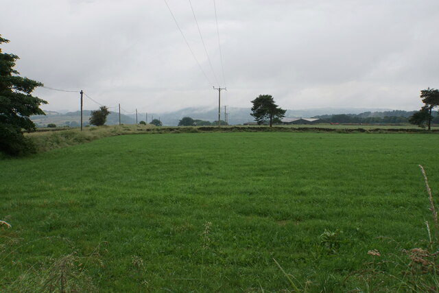
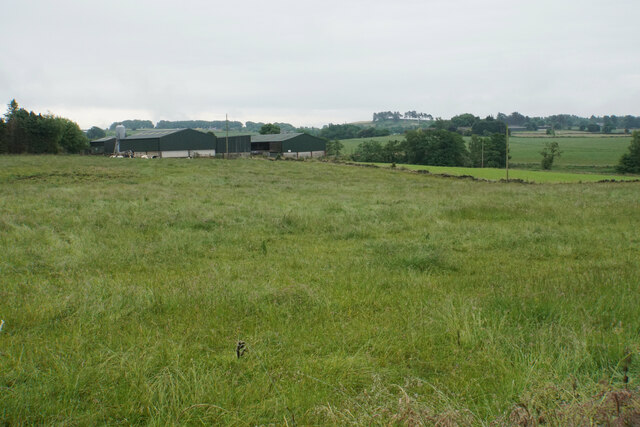
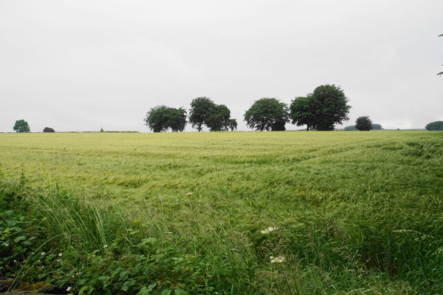
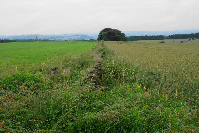
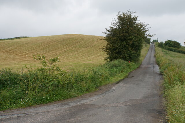
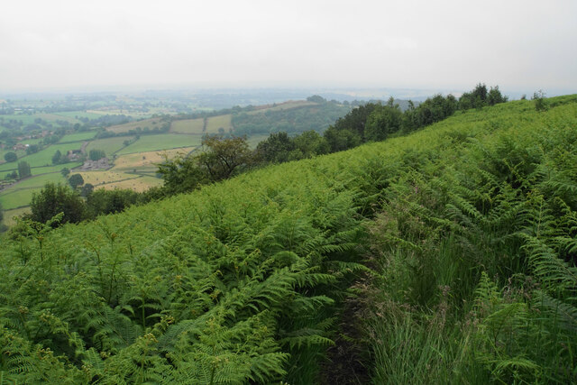
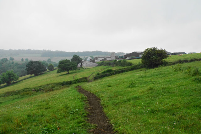
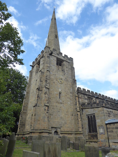
Ravensnest Images

Images are sourced within 2km of 53.147842/-1.4823813 or Grid Reference SK3461. Thanks to Geograph Open Source API. All images are credited.

Field on Tansley Moor Part of a plateau of farmland. The Derwent valley can be seen in the background though the view is still affected by recent rain.
Field on Tansley Moor
Part of a plateau of farmland. The Derwent valley can be seen in the background though the view is still affected by recent rain.
Field by North Carolina Farm A view from Lant Lane with Blakelow Hill in the background.
Field by North Carolina Farm
A view from Lant Lane with Blakelow Hill in the background.
Lant Lodge Farm Viewed from Lant Lane. There are Belted Galloways in the field, quite a common breed locally..
Lant Lodge Farm
Viewed from Lant Lane. There are Belted Galloways in the field, quite a common breed locally..
Barley field by Lant Lane Part of the plateau of farmland between the Amber and Derwent valleys.
Barley field by Lant Lane
Part of the plateau of farmland between the Amber and Derwent valleys.
Ramshackle barn off Holestone Gate Road Not in the best state but still providing useful service as a store of silage bales.
Ramshackle barn off Holestone Gate Road
Not in the best state but still providing useful service as a store of silage bales.
Field boundary below Holestone Gate Road Despite the poor weather, the Derwent valley can be seen in the background with Riber Castle overlooking it.
Field boundary below Holestone Gate Road
Despite the poor weather, the Derwent valley can be seen in the background with Riber Castle overlooking it.
Farm buildings at Old Engine Farm A farm off Holestone Gate Road.
Farm buildings at Old Engine Farm
A farm off Holestone Gate Road.
Farm track and a field of oats Looking from Holestone Gate Road up to the top of the ridge near Cocking Tor.
Farm track and a field of oats
Looking from Holestone Gate Road up to the top of the ridge near Cocking Tor.
Cattle near Holestone Farm Blakelow Hill is only a small hill but still stands quite impressively behind the farm.
Cattle near Holestone Farm
Blakelow Hill is only a small hill but still stands quite impressively behind the farm.
Allen Lane On the top of Blakelow Hill.
Allen Lane
On the top of Blakelow Hill.
Access land on Blakelow Hill There is a small plot of access land on the western side of Blakelow Hill but it appears to be impenetrable scrub and there is no obvious way into it. The wind turbine belongs to Blakelow Farm which is in the trees.
Access land on Blakelow Hill
There is a small plot of access land on the western side of Blakelow Hill but it appears to be impenetrable scrub and there is no obvious way into it. The wind turbine belongs to Blakelow Farm which is in the trees.
The northern side of Blakelow Farm Looking down towards Holestone Farm.
The northern side of Blakelow Farm
Looking down towards Holestone Farm.
Allen Lane Heading towards Tansley Moor and initially passing Blakelow Hill.
Allen Lane
Heading towards Tansley Moor and initially passing Blakelow Hill.
Path to Ravensnest Tor There is a big steep drop to the left, but because of the foliage you don't see much.
Path to Ravensnest Tor
There is a big steep drop to the left, but because of the foliage you don't see much.
Path south from Ravensnest Tor This is the point at which the path emerges from the woodland and you get a view, or you would if it were not a wet misty day.
Path south from Ravensnest Tor
This is the point at which the path emerges from the woodland and you get a view, or you would if it were not a wet misty day.
Butterley Top Farm Situated on top of the edge. Visibility is not so good on this wet day.
Butterley Top Farm
Situated on top of the edge. Visibility is not so good on this wet day.
Ashover, All Saints
Ashover, All Saints
The Amber valley As seen from Eastwood Lane on its descent from Littlemoor.
The Amber valley
As seen from Eastwood Lane on its descent from Littlemoor.
Show me another place!

Ravensnest is located at Grid Ref: SK3461 (Lat: 53.147842, Lng: -1.4823813)

Administrative County: Derbyshire

District: North East Derbyshire

Police Authority: Derbyshire

What 3 Words

///muted.passport.bake. Near Tansley, Derbyshire

Related Wikis

Milltown, Derbyshire

Milltown is a village in Derbyshire, England. It is located 1 mile south east of Ashover and is part of Ashover civil parish. To the north of the village...

Milltown railway station (Derbyshire)

Milltown railway station served the village of Milltown, Derbyshire, England, from 1925 to 1936 on the Ashover Light Railway. == History == The station...

Milltown Methodist Church

Milltown Methodist Church (known alternatively as Milltown Chapel, Milltown Primitive Methodist Chapel and Ashover Hay Primitive Methodist Chapel) is a...

Fallgate railway station

Fallgate railway station co-served the village of Milltown, Derbyshire, England, from 1925 to 1936 on the Ashover Light Railway. == History == The station...

Dale Bank railway station

Dale Bank railway station served the hamlet of Dalebank, Derbyshire, England, from 1925 to 1936 on the Ashover Light Railway. == History == The station...

Salter Lane railway station

Salter Lane railway station co-served the village of Ashover, Derbyshire, England, from 1925 to 1936 on the Ashover Light Railway. == History == The station...

Ashover

Ashover is a village and civil parish in the English county of Derbyshire. It is in the North East Derbyshire district of the county. The population of...

Ashover Butts railway station

Ashover Butts railway station was a railway station serving the village of Ashover in Derbyshire, England. It was the terminus of the 1 ft 11+1⁄2 in (597...

Nearby Amenities

Located within 500m of 53.147842,-1.4823813
Barrier: stile
Lat/Long: 53.1456294/-1.4768512
Barrier: stile
Lat/Long: 53.1458765/-1.4779241
Barrier: stile
Lat/Long: 53.1464068/-1.4804819
Barrier: stile
Lat/Long: 53.1467671/-1.4816148
Barrier: stile
Steps: 2
Stile: stepover
Lat/Long: 53.1482291/-1.4822071
Barrier: stile
Steps: 2
Stile: stepover
Lat/Long: 53.1491924/-1.4832205
Barrier: stile
Stile: squeezer
Lat/Long: 53.1503044/-1.4833329
Barrier: stile
Steps: 2
Stile: wall
Lat/Long: 53.150914/-1.4826506
Ele: 281.7899170
Lat/Long: 53.14443/-1.4848418
Ele: 262
Lat/Long: 53.1467464/-1.4866836
Ele: 247
Lat/Long: 53.1494023/-1.4873609
Barrier: stile
Ele: 149.6097412
Stile: squeezer
Lat/Long: 53.1483796/-1.4751473
Ele: 143.8419189
Lat/Long: 53.1495776/-1.4772404
Ele: 142.6402588
Lat/Long: 53.1494299/-1.4768671
Ele: 142.1596680
Lat/Long: 53.1494524/-1.4768956
Ele: 201
Lat/Long: 53.1519954/-1.484758
Ele: 191
Lat/Long: 53.1518161/-1.4842449
Barrier: stile
Ele: 149.3693848
Stile: squeezer
Lat/Long: 53.1489507/-1.4759415
Ele: 202
Man Made: chimney
Lat/Long: 53.1515836/-1.4853126
Barrier: stile
Ele: 168.0000000
Steps: 0
Stile: stepover
Lat/Long: 53.1522085/-1.4828638
Ele: 262
Lat/Long: 53.1504311/-1.4882689
Ele: 203
Lat/Long: 53.146518/-1.4846785
Ele: 208
Lat/Long: 53.1465421/-1.4847741
Ele: 210
Lat/Long: 53.1466032/-1.4848248
Ele: 232
Lat/Long: 53.1462154/-1.4852954
Ele: 237
Lat/Long: 53.1461576/-1.485431
Barrier: stile
Ele: 260
Stile: squeezer
Lat/Long: 53.1466248/-1.4863696
Ele: 191
Lat/Long: 53.1466917/-1.4839021
Barrier: stile
Ele: 210
Stile: squeezer
Lat/Long: 53.14661/-1.4847985
Barrier: stile
Material: stone
Source: survey;gps
Stile: squeezer
Lat/Long: 53.1488521/-1.4880746
The data included in this document is from www.openstreetmap.org. The data is made available under ODbL.

Have you been to Ravensnest?

Leave your review of Ravensnest below (or comments, questions and feedback).