Point of Sleat

Settlement in Inverness-shire

Scotland

Point of Sleat

Camus Daraich A sandy beach east of the Point of Sleat.
Camus Daraich Credit: Ian Taylor

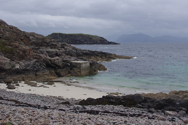
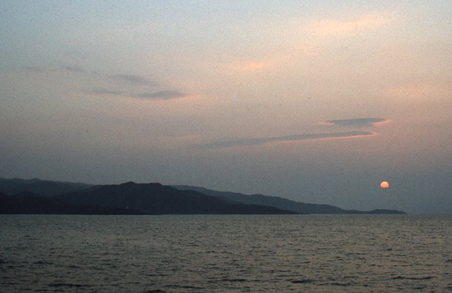
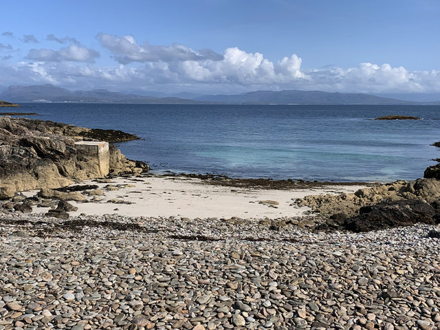
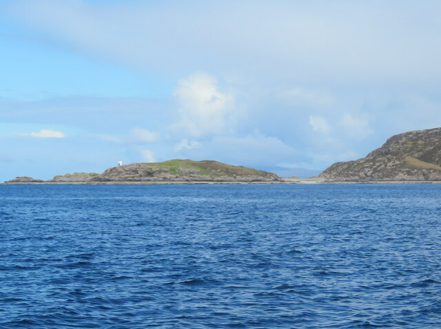
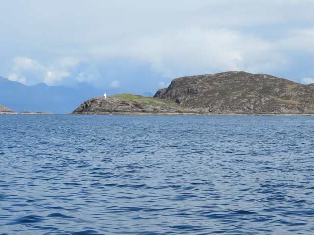
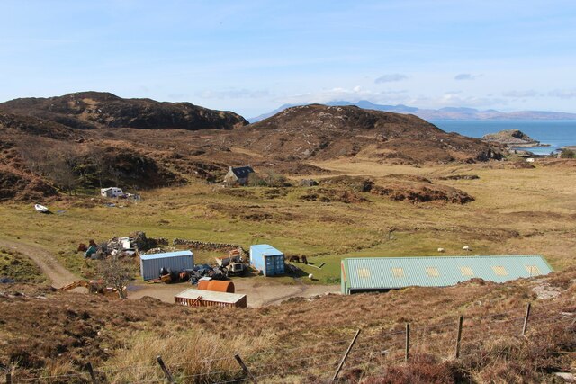
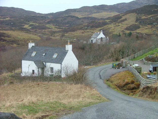
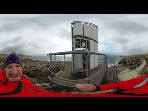
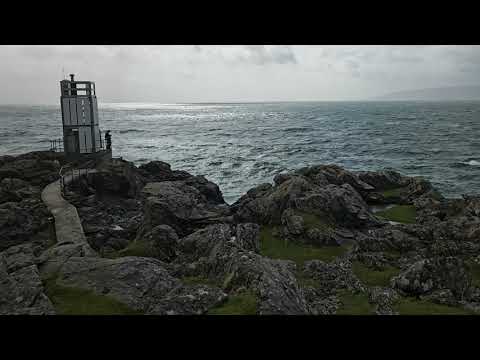
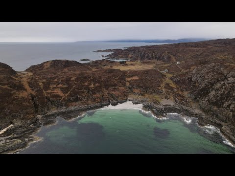
Located on the Isle of Skye in Inverness-shire, Scotland, Point of Sleat is a stunning and remote coastal area known for its natural beauty and tranquility. Also known as Rubha An T-Sleibhte in Gaelic, this picturesque peninsula extends into the Sound of Sleat, offering breathtaking views of the surrounding waters and distant mountains.

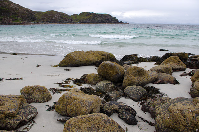
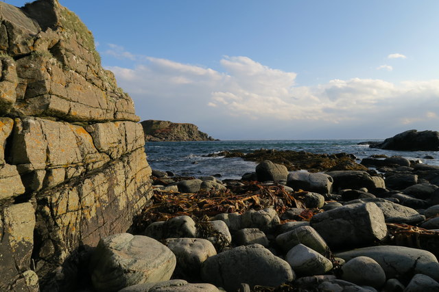
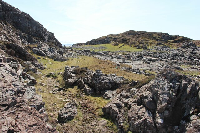
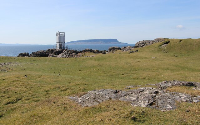
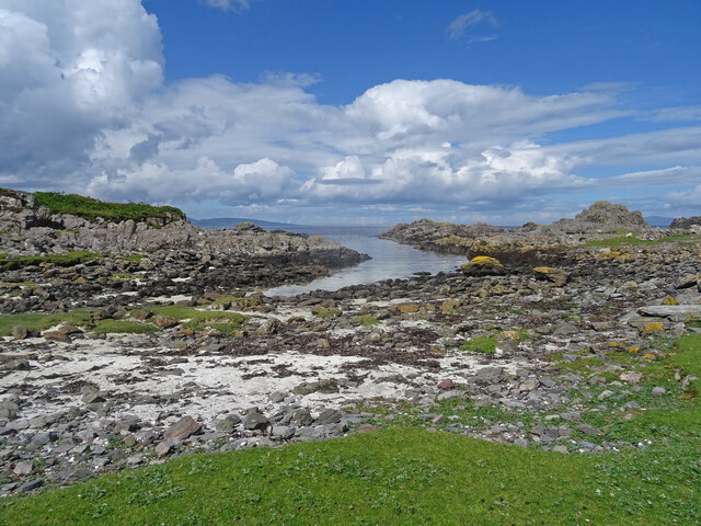
Point of Sleat is characterized by its rugged coastline, with towering cliffs, hidden coves, and golden sandy beaches. The area is a haven for wildlife enthusiasts, as it is home to a variety of bird species, including puffins, guillemots, and sea eagles. Visitors may also spot seals and dolphins swimming in the crystal-clear waters.

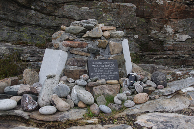
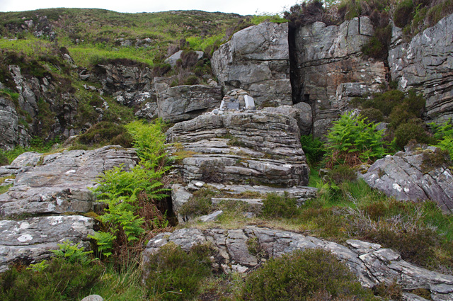
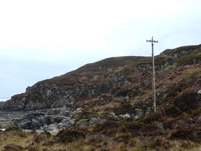
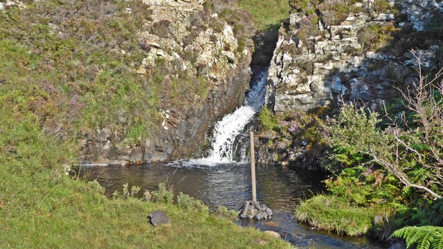
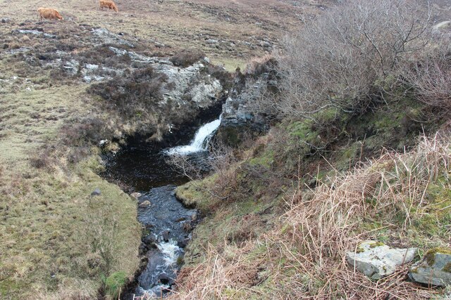
The landscape at Point of Sleat is dominated by rolling hills and moorland, providing ample opportunities for hiking and exploring. The peninsula is crisscrossed by numerous walking trails, offering panoramic views of the surrounding countryside. The area is also rich in archaeological sites, with ancient cairns and standing stones dotting the landscape, providing a glimpse into the region's past.

Despite its remote location, Point of Sleat is easily accessible by car or on foot. The nearest town, Armadale, offers amenities such as accommodations, restaurants, and shops, making it a convenient base for exploring the area.

In summary, Point of Sleat is a captivating coastal area in Inverness-shire, Scotland, offering breathtaking scenery, abundant wildlife, and a sense of tranquility for nature lovers and outdoor enthusiasts.

If you have any feedback on the listing, please let us know in the comments section below.

Point of Sleat Images

Images are sourced within 2km of 57.020362/-6.0181897 or Grid Reference NM5699. Thanks to Geograph Open Source API. All images are credited.

Camus Daraich A sandy beach east of the Point of Sleat.
Camus Daraich
A sandy beach east of the Point of Sleat.
Memorial cairn, Camus Daraich Memorial for William Taylor, an airman in 70 Squadron during WWII. There are 2 other plaques, presumably commemorating his wife and daughter.
Memorial cairn, Camus Daraich
Memorial for William Taylor, an airman in 70 Squadron during WWII. There are 2 other plaques, presumably commemorating his wife and daughter.
Memorial cairn and outcrop, Camus Daraich See <a href="https://www.geograph.org.uk/photo/5417917">NM5699 : Memorial cairn, Camus Daraich</a> for a closer view of the cairn.
Memorial cairn and outcrop, Camus Daraich
See NM5699 : Memorial cairn, Camus Daraich for a closer view of the cairn.
Beach near Point of Sleat A small sandy beach on the east side of the Point of Sleat. North Morar is just visible in the distance.
The concrete pier may have been built to enable unloading of materials for construction of the lighthouse.
Beach near Point of Sleat
A small sandy beach on the east side of the Point of Sleat. North Morar is just visible in the distance. The concrete pier may have been built to enable unloading of materials for construction of the lighthouse.
Camas Daraich Beach Tide in, looking East towards a small island.
Camas Daraich Beach
Tide in, looking East towards a small island.
Point of Sleat The Point of Sleat from offshore. The lighthouse is just visible, below the high-point (Creag Mhor) of the second promontory. The sun has just risen above the third promontory (Ard Thurinish).
Estimated camera position NM547980.
Point of Sleat
The Point of Sleat from offshore. The lighthouse is just visible, below the high-point (Creag Mhor) of the second promontory. The sun has just risen above the third promontory (Ard Thurinish). Estimated camera position NM547980.
Small beach on Point of Sleat White sand and a turquoise sea in the Sound of Sleat, with Mallaig and the Morar beaches visible on the far mainland shore. The concrete structure on the left is a pier associated with access to the nearby Sleat Point light. <a href="https://www.geograph.org.uk/photo/377298">NM5699 : Point of Sleat Light</a>
Small beach on Point of Sleat
White sand and a turquoise sea in the Sound of Sleat, with Mallaig and the Morar beaches visible on the far mainland shore. The concrete structure on the left is a pier associated with access to the nearby Sleat Point light. NM5699 : Point of Sleat Light
Old telegraph pole, Camas Daraich What was its purpose? Was there a telephone connection to the Point of Sleat lighthouse? I did not see any other poles in the area.
Old telegraph pole, Camas Daraich
What was its purpose? Was there a telephone connection to the Point of Sleat lighthouse? I did not see any other poles in the area.
The Point of Sleat Lighthouse <span class="nowrap"><a title="https://en.wikipedia.org/wiki/Point_of_Sleat_Lighthouse" rel="nofollow ugc noopener" href="https://en.wikipedia.org/wiki/Point_of_Sleat_Lighthouse">Link</a><img style="margin-left:2px;" alt="External link" title="External link - shift click to open in new window" src="https://s1.geograph.org.uk/img/external.png" width="10" height="10"/></span>  at the southernmost extremity of the Isle of Skye.
The Point of Sleat
Lighthouse LinkExternal link at the southernmost extremity of the Isle of Skye.
The Point of Sleat Lighthouse <span class="nowrap"><a title="https://en.wikipedia.org/wiki/Point_of_Sleat_Lighthouse" rel="nofollow ugc noopener" href="https://en.wikipedia.org/wiki/Point_of_Sleat_Lighthouse">Link</a><img style="margin-left:2px;" alt="External link" title="External link - shift click to open in new window" src="https://s1.geograph.org.uk/img/external.png" width="10" height="10"/></span> at the southernmost extremity of the Isle of Skye.
The Point of Sleat
Lighthouse LinkExternal link at the southernmost extremity of the Isle of Skye.
Camas Daraich
Camas Daraich
The rocky Point of Sleat
Beacon at Point of Sleat The south tip of the Isle of Skye.  In the background is the Island of Eigg.
Beacon at Point of Sleat
The south tip of the Isle of Skye. In the background is the Island of Eigg.
Dead Jellyfish A few of the hundreds of dead Jellyfish washed up Camas Daraich beach on the Sleat peninsula on Skye.
Dead Jellyfish
A few of the hundreds of dead Jellyfish washed up Camas Daraich beach on the Sleat peninsula on Skye.
Point of Sleat Scenery Looking west at the isthmus just north of the Point of Sleat. Land in the distance is the very top of Rum.
Point of Sleat Scenery
Looking west at the isthmus just north of the Point of Sleat. Land in the distance is the very top of Rum.
Waterfall off the track to Point of Sleat Just to the north of the track to Point of Sleat, walkers are treated to the sight of this waterfall.
Waterfall off the track to Point of Sleat
Just to the north of the track to Point of Sleat, walkers are treated to the sight of this waterfall.
Waterfall by the track to Point of Sleat
Acairseid an Rubha Rum in the background.
Acairseid an Rubha
Rum in the background.
Show me another place!

Point of Sleat is located at Grid Ref: NM5699 (Lat: 57.020362, Lng: -6.0181897)

Unitary Authority: Highland

Police Authority: Highlands and Islands

What 3 Words

///blunt.assets.workbench. Near Armadale, Highland

Related Wikis

Aird of Sleat

Aird of Sleat (Scottish Gaelic: Àird Shlèite) is a village on the Isle of Skye in Scotland. It is at the southern end of the Sleat peninsula, 4 miles...

Ardvasar

Ardvasar (Scottish Gaelic: Àird a’ Bhàsair) is a village near the southern end of the Sleat peninsula, on the Isle of Skye in Scotland. It is just to the...

Armadale, Skye

Armadale (Scottish Gaelic: Armadal) is a village near the southern end of the Sleat peninsula on the Isle of Skye, in the Highland council area of Scotland...
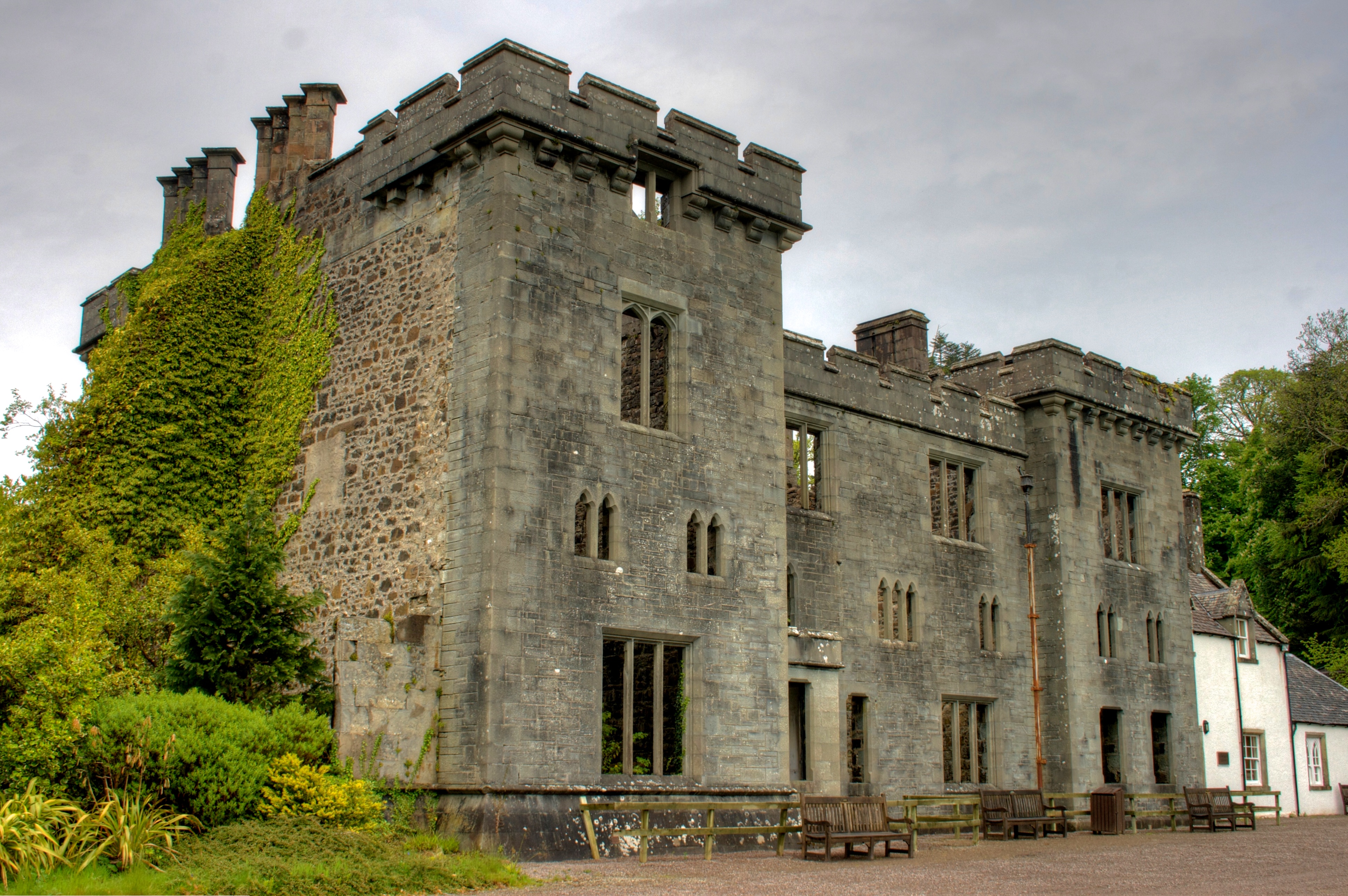
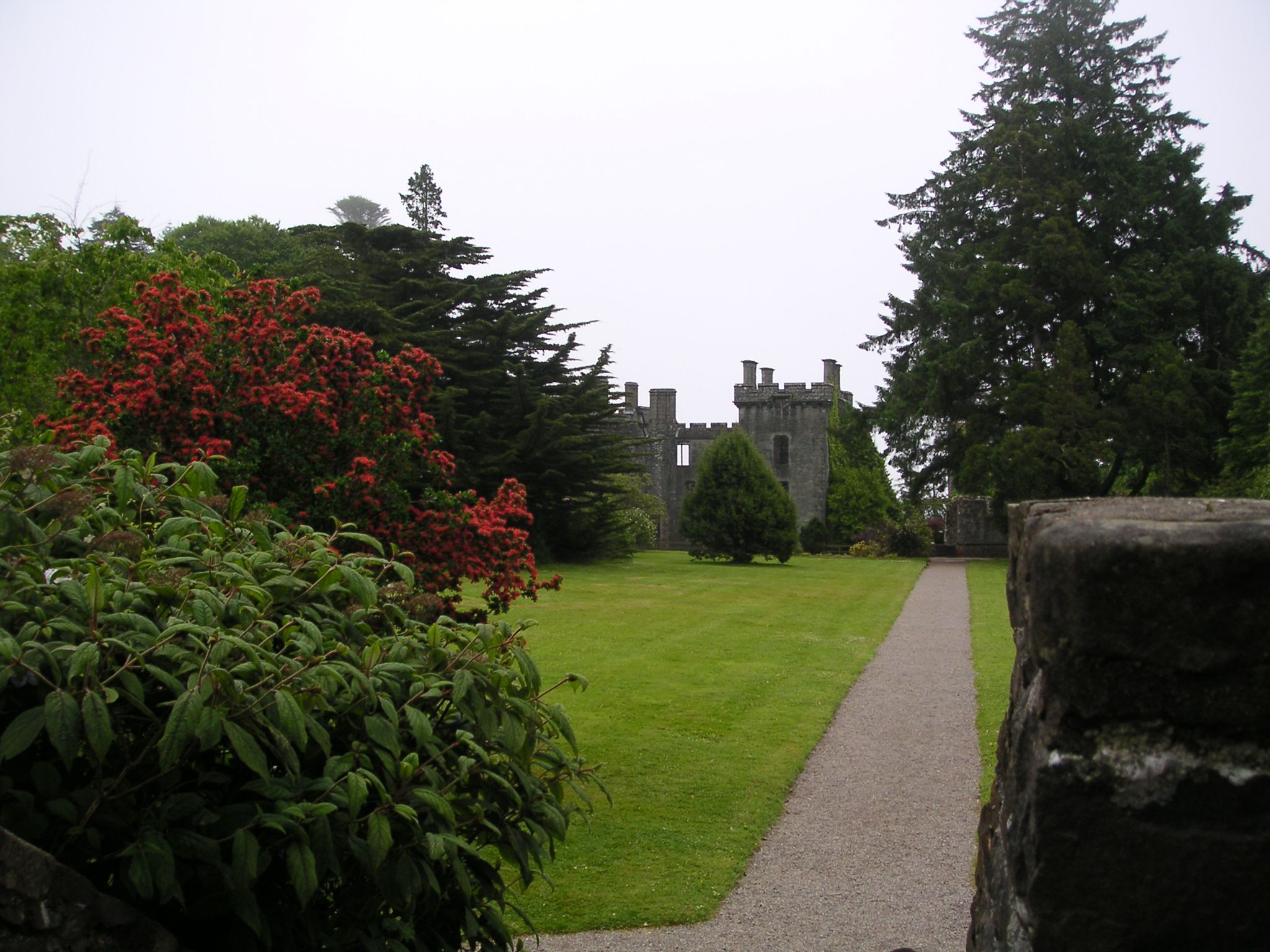
Armadale Castle

Armadale Castle is a ruined country house in Armadale, Skye, former home of the MacDonalds. A mansion house was first built here around 1790, facing south...

Related Videos

Point of Sleat and Camas Daraich Beach - Isle of Skye - Scotland | 4K | DJI Mini2

Though Scottish Islands are well known for their beautiful beaches, Isle of Skye is slightly lacking in that area. Most famous ...

Nearby Amenities

Located within 500m of 57.020362,-6.0181897
Sleat Point Lighthouse
Man Made: lighthouse
Seamark Light Character: Fl
Seamark Light Colour: white
Seamark Light Height: 20
Seamark Light Period: 3
Seamark Light Range: 9
Seamark Light Reference: A 3952
Seamark Light Sequence: 1+(2)
Seamark Name: Sleat
Seamark Type: light_minor
Source: survey
Wikidata: Q24515751
Lat/Long: 57.0183042/-6.0178577
Point of Sleat
Name Gd: Rubha Shlèite
Natural: cape
Lat/Long: 57.0180701/-6.0173825
Generator Method: photovoltaic
Generator Output Electricity: yes
Generator Source: solar
Generator Type: solar_photovoltaic_panel
Power: generator
Lat/Long: 57.0182863/-6.0178607
The data included in this document is from www.openstreetmap.org. The data is made available under ODbL.

Have you been to Point of Sleat?

Leave your review of Point of Sleat below (or comments, questions and feedback).