Marton Moss Side

Settlement in Lancashire

England

Marton Moss Side

School Road, Great Marton Moss
School Road, Great Marton Moss Credit: David Dixon

Marton Moss Side is a small village located in the county of Lancashire, England. Situated approximately 5 miles northwest of the city of Blackpool, Marton Moss Side falls within the boundaries of Blackpool Borough Council.

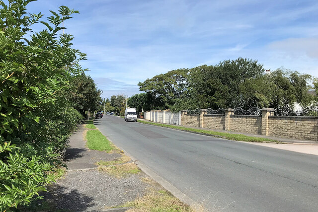
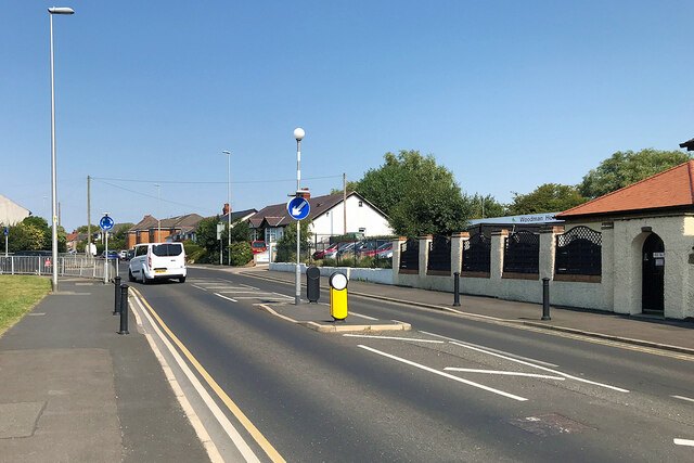
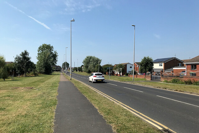
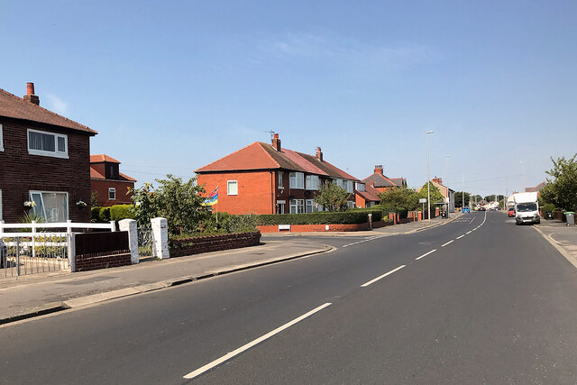
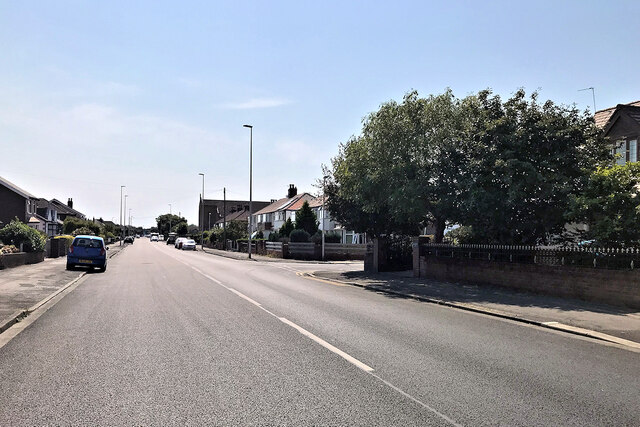
The village is primarily residential, characterized by a mix of detached and semi-detached houses, as well as a few small apartment buildings. The area is known for its quiet and peaceful atmosphere, making it an attractive place to live for families and retirees seeking a more tranquil lifestyle.

Despite its rural setting, Marton Moss Side benefits from its proximity to Blackpool, which offers a wide range of amenities and services. The village itself has limited facilities, with a small convenience store and a pub being the main local establishments.

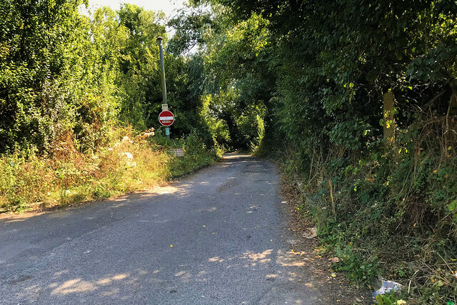
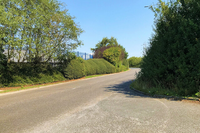
Marton Moss Side is surrounded by green fields and farmland, providing ample opportunities for outdoor activities such as walking, cycling, and horse riding. The nearby Marton Mere Nature Reserve is a notable attraction, offering a haven for wildlife and a peaceful retreat for visitors.

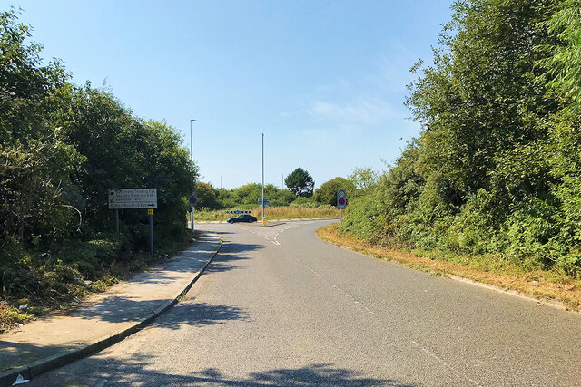
Transport links to Marton Moss Side are convenient, with regular bus services connecting the village to Blackpool and other nearby towns. The village is also easily accessible by car, with the M55 motorway only a short drive away.

Overall, Marton Moss Side offers a pleasant and idyllic setting for those seeking a peaceful village lifestyle while still enjoying the amenities and services of nearby urban areas.

If you have any feedback on the listing, please let us know in the comments section below.

Marton Moss Side Images

Images are sourced within 2km of 53.788985/-3.0184582 or Grid Reference SD3333. Thanks to Geograph Open Source API. All images are credited.

School Road, Great Marton Moss
Great Marton Moss, Midgeland Road
Midgeland Road, Great Marton Moss
Midgeland Villa Victorian house (dated 1984) on Midgeland Road. Now used by a riding school.
Midgeland Villa
Victorian house (dated 1984) on Midgeland Road. Now used by a riding school.
Midgeland Road
Midgeland Road
Highfield Road, Walker's Hill, Blackpool
Common Edge Road
Common Edge Road
Blackpool, Common Edge Road
Old House Lane
Old House Lane
Blackpool and Fylde Industrial Estate, Jenny Lane
Jenny Lane, Blackpool
Queensway to Lytham St Annes The road runs round the perimeter of Blackpool Airport.
Queensway to Lytham St Annes
The road runs round the perimeter of Blackpool Airport.
Properties in Lytham Road, Blackpool The view is from the corner of Rosebery Avenue, a little to the right (south) of <a href="https://www.geograph.org.uk/photo/4441241">SD3132 : Butterfly Lodge Nursery, Lytham Road</a>.
Properties in Lytham Road, Blackpool
The view is from the corner of Rosebery Avenue, a little to the right (south) of SD3132 : Butterfly Lodge Nursery, Lytham Road.
Arnold School boarded up, Lytham Road, Blackpool Seen from the corner of Rosebery Avenue.
Arnold School boarded up, Lytham Road, Blackpool
Seen from the corner of Rosebery Avenue.
Premises and a postbox on Lytham Road, Blackpool The boarded-up buildings appear to be part of the former Arnold School. The postbox is number FY4 9. The view is from near the corner of Burlington Road.
Premises and a postbox on Lytham Road, Blackpool
The boarded-up buildings appear to be part of the former Arnold School. The postbox is number FY4 9. The view is from near the corner of Burlington Road.
Buildings of the closed Arnold School, Arnold Avenue, Blackpool
First Avenue, South Shore, Blackpool
Playing fields of the closed Arnold School by Arnold Avenue, Blackpool
Show me another place!

Marton Moss Side is located at Grid Ref: SD3333 (Lat: 53.788985, Lng: -3.0184582)

Unitary Authority: Blackpool

Police Authority: Lancashire

What 3 Words

///caring.shut.blunt. Near Great Marton, Lancashire

Related Wikis

Highfield Leadership Academy

Highfield Leadership Academy is a co-educational secondary school located in Marton, Blackpool, Lancashire, England. == History == It was originally known...

Squires Gate

Squires Gate is a district and an electoral ward in South Shore, Blackpool on the Fylde coast, in the Blackpool district, in the ceremonial county of Lancashire...

Marton, Blackpool

Marton is a historic village on the coastal plain of the Fylde in the Borough of Blackpool in Lancashire, England, most of which is now forms a part of...

St George's School, Blackpool

St. George's School is a Church of England secondary school with academy status in Marton, Blackpool, Lancashire, England with an intake of both boys and...

Nearby Amenities

Located within 500m of 53.788985,-3.0184582
Traffic Signals
Lat/Long: 53.7893122/-3.02528
Mini Roundabout
Lat/Long: 53.7908946/-3.0154869
Marton Moss Side
Place: suburb
Source: npe
Lat/Long: 53.7933693/-3.0168073
Pub
The Highfield
Addr City: Blackpool
Addr Postcode: FY4 3LA
Addr Street: Highfield Road
Fhrs Id: 140789
Operator: Sizzling Pub Co
Lat/Long: 53.7889299/-3.0255109
Turning Circle
Lat/Long: 53.7890383/-3.019174
Turning Circle
Lat/Long: 53.7875289/-3.0159639
Turning Circle
Lat/Long: 53.7868511/-3.0182187
Turning Circle
Lat/Long: 53.7875103/-3.0188177
Turning Circle
Lat/Long: 53.7879344/-3.014944
Turning Circle
Lat/Long: 53.7902944/-3.0158482
Turning Circle
Lat/Long: 53.7896632/-3.016018
Turning Circle
Lat/Long: 53.7887968/-3.0190407
Turning Circle
Lat/Long: 53.7881245/-3.0160773
Turning Circle
Lat/Long: 53.7870352/-3.0156315
Turning Circle
Lat/Long: 53.786954/-3.0198892
Turning Circle
Lat/Long: 53.7882993/-3.0190655
Turning Circle
Lat/Long: 53.7885907/-3.0156254
Turning Circle
Lat/Long: 53.78737/-3.0232136
Mini Roundabout
Direction: clockwise
Lat/Long: 53.7897498/-3.0223809
Turning Circle
Lat/Long: 53.7899916/-3.0191072
Turning Circle
Lat/Long: 53.787435/-3.021472
Turning Circle
Lat/Long: 53.7897044/-3.0217122
Turning Circle
Lat/Long: 53.7882718/-3.0207505
Turning Circle
Lat/Long: 53.7887327/-3.0207456
Turning Circle
Lat/Long: 53.7873614/-3.0207528
Post Box
Brand: Royal Mail
Brand Wikidata: Q638098
Collection Times: Mo-Fr 16:00; Sa 12:30; Su off
Drive Through: no
Operator: Royal Mail
Operator Wikidata: Q638098
Post Box Type: pillar
Ref: FY4 255
Royal Cypher: GR
Royal Cypher Wikidata: Q33102273
Lat/Long: 53.7901386/-3.0213618
Daily Savers Local
Addr City: Blackpool
Addr Housenumber: 17-19
Addr Postcode: FY4 5AX
Addr Street: Common Edge Road
Brand: Premier
Brand Wikidata: Q7240340
Shop: convenience
Website: https://www.premier-stores.co.uk/our-stores/fy4-convenience-store
Lat/Long: 53.7884267/-3.0250779
My Store
Addr City: Blackpool
Addr Housenumber: 2-4
Addr Postcode: FY4 5AU
Addr Street: Common Edge Road
Fhrs Id: 502409
Shop: convenience
Lat/Long: 53.7892338/-3.0249923
Doctors
Abbey-dale Medical Centre
Addr City: Blackpool
Addr Housenumber: 50
Addr Postcode: FY4 5AU
Addr Street: Common Edge Road
Healthcare: doctor
Lat/Long: 53.7879918/-3.024097
Pharmacy
Whitworth Chemists Ltd
Addr City: Blackpool
Addr Housenumber: 23
Addr Postcode: FY4 5AX
Addr Street: Common Edge Road
Healthcare: pharmacy
Lat/Long: 53.788306/-3.0250123
Post Box
Brand: Royal Mail
Brand Wikidata: Q638098
Collection Times: Mo-Fr 16:00; Sa 12:30; Su off
Drive Through: no
Operator: Royal Mail
Operator Wikidata: Q638098
Post Box Type: pillar
Ref: FY4 98
Royal Cypher: EIIR
Royal Cypher Wikidata: Q33102113
Lat/Long: 53.7876486/-3.0138279
Cafe
Tea World
Addr City: Blackpool
Addr Housenumber: 6
Addr Postcode: FY4 5AU
Addr Street: Common Edge Road
Fhrs Id: 1393386
Lat/Long: 53.7891193/-3.0249014
Nursing Home
Brooklands Nursing Home
Addr City: Blackpool
Addr Postcode: FY4 4LY
Addr Street: Roundhay
Fhrs Id: 716671
Lat/Long: 53.7932531/-3.0183817
Olympian Swimming School
Addr City: Blackpool
Addr Postcode: FY4 5BE
Addr Street: Bennett's Lane
Leisure: swimming_pool
Sport: swimming
Lat/Long: 53.7866498/-3.0217204
Stanley Ward Conservative Club
Addr City: Blackpool
Addr Housenumber: 92-94
Addr Postcode: FY4 5AZ
Addr Street: Common Edge Road
Club: social_club
Lat/Long: 53.7860682/-3.0230534
Crossing
Crossing: marked
Source: Bing
Lat/Long: 53.7893379/-3.0228782
Roberto 23
Addr City: Blackpool
Addr Housenumber: 5
Addr Postcode: FY4 5AX
Addr Street: Common Edge Road
Shop: hairdresser
Lat/Long: 53.7887105/-3.025336
David Peters
Addr City: Blackpool
Addr Housenumber: 7
Addr Postcode: FY4 5AX
Addr Street: Common Edge Road
Shop: hairdresser
Lat/Long: 53.7886559/-3.0252998
Dentist
Denluce Dental Practice
Addr City: Blackpool
Addr Housenumber: 9
Addr Postcode: FY4 5AX
Addr Street: Common Edge Road
Healthcare: dentist
Lat/Long: 53.7886004/-3.0252582
Heather Lea Florists
Addr City: Blackpool
Addr Housenumber: 15
Addr Postcode: FY4 5AX
Addr Street: Common Edge Road
Shop: florist
Lat/Long: 53.7884713/-3.025175
Crossleys Accident Repair Centre
Addr City: Blackpool
Addr Housenumber: 1
Addr Postcode: FY4 3LX
Addr Street: Stanmore Avenue
Shop: car_repair
Lat/Long: 53.7880418/-3.0249363
Eyedeal Vision
Addr City: Blackpool
Addr Housenumber: 63
Addr Postcode: FY4 5AX
Addr Street: Common Edge Road
Shop: optician
Lat/Long: 53.7870887/-3.0243704
Barrier: bollard
Lat/Long: 53.7848566/-3.0158063
Turning Circle
Lat/Long: 53.7883711/-3.0231122
Social Facility
Windmill House
Addr City: Blackpool
Addr Housenumber: 4
Addr Postcode: FY4 5PE
Addr Street: Millfield Road
Social Facility: assisted_living
Social Facility For: senior
Lat/Long: 53.7885243/-3.0232278
Defibrillator
Access: yes
Emergency: defibrillator
Lat/Long: 53.7861348/-3.023268
Barrier: bollard
Bollard: fixed
Lat/Long: 53.786865/-3.017047
Crossing
Crossing: marked
Lat/Long: 53.7916669/-3.0197476
Turning Circle
Lat/Long: 53.7878232/-3.0207259
Community Centre
Aysgarth Court Community Centre
Lat/Long: 53.7904173/-3.0202124
Parking
Access: private
Lat/Long: 53.7862892/-3.0232048
Barrier: bollard
Lat/Long: 53.7919943/-3.0178881
Turning Circle
Lat/Long: 53.7896238/-3.0215941
Turning Circle
Lat/Long: 53.7877227/-3.0207965
Turning Circle
Lat/Long: 53.7875038/-3.0186397
Turning Circle
Lat/Long: 53.7869133/-3.0155378
Turning Circle
Lat/Long: 53.7875601/-3.0157231
Turning Circle
Lat/Long: 53.7885986/-3.015839
Turning Circle
Lat/Long: 53.7892071/-3.0159977
Turning Circle
Lat/Long: 53.7890867/-3.0159952
Turning Circle
Lat/Long: 53.7897391/-3.0161864
Turning Circle
Lat/Long: 53.7873798/-3.0205578
Turning Circle
Lat/Long: 53.7872787/-3.0231087
Turning Circle
Lat/Long: 53.7886245/-3.0208245
Turning Circle
Lat/Long: 53.78894/-3.0190312
Turning Circle
Lat/Long: 53.7886112/-3.019077
Turning Circle
Lat/Long: 53.7870458/-3.0197587
Turning Circle
Lat/Long: 53.7882547/-3.0188986
Barrier: bollard
Lat/Long: 53.7847899/-3.0185113
Crossing
Crossing: zebra
Lat/Long: 53.7930154/-3.0168674
Fast Food
Lunchbox
Addr City: Blackpool
Addr Housenumber: 21
Addr Postcode: FY4 5AX
Addr Street: Common Edge Road
Cuisine: sandwich
Fhrs Id: 1558385
Lat/Long: 53.788368/-3.0250411
Fast Food
Dottie's Deserts
Addr City: Blackpool
Addr Housenumber: 11
Addr Postcode: FY4 5AX
Addr Street: Common Edge Road
Cuisine: ice_cream
Fhrs Id: 1295484
Lat/Long: 53.7885372/-3.0251936
Post Office
Common Edge Lane Post Office
Addr City: Blackpool
Addr Housenumber: 2-4
Addr Postcode: FY4 5AU
Addr Street: Common Edge Road
Brand: Post Office
Brand Wikidata: Q1783168
Ref Pol Id: 149345
Lat/Long: 53.7891742/-3.0249559
Defibrillator
Access: yes
Defibrillator Location: Aysgarth Court Community Centre
Emergency: defibrillator
Lat/Long: 53.7904354/-3.020249
The data included in this document is from www.openstreetmap.org. The data is made available under ODbL.

Have you been to Marton Moss Side?

Leave your review of Marton Moss Side below (or comments, questions and feedback).