Peppard Hill

Settlement in Oxfordshire South Oxfordshire

England

Peppard Hill

Sonning Common The centre of this sprawling commuter village.  There is no obvious connection with the village of Sonning on the Thames, 8km to the south-east
Sonning Common Credit: Rosalind Mitchell

Peppard Hill is a picturesque village located in Oxfordshire, England. Situated about 5 miles north of the historic town of Henley-on-Thames, it is nestled in the Chiltern Hills, an Area of Outstanding Natural Beauty. The village is home to a small, tight-knit community and offers residents and visitors a charming rural setting.

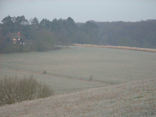
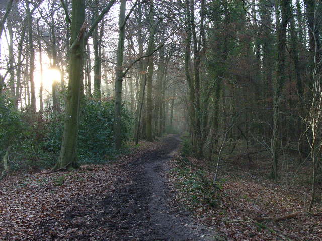
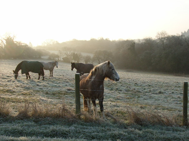
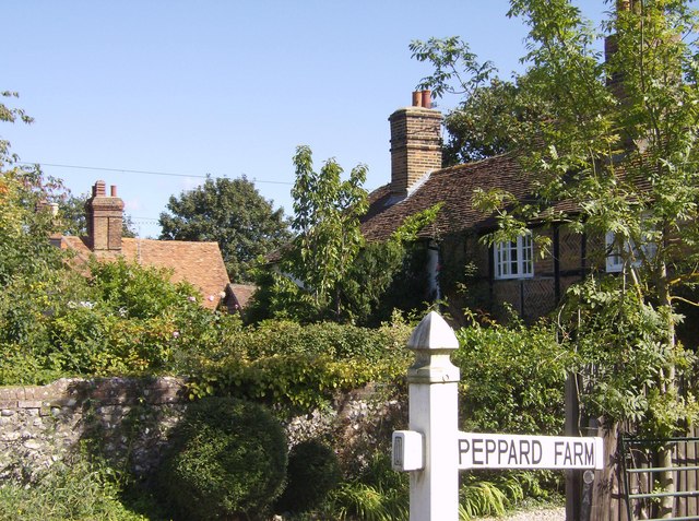
The landscape surrounding Peppard Hill is characterized by rolling hills, lush green fields, and dense woodlands, providing ample opportunities for outdoor activities and scenic walks. The village itself is comprised of a mix of traditional thatched cottages, period houses, and modern dwellings, giving it a unique blend of old-world charm and contemporary design.

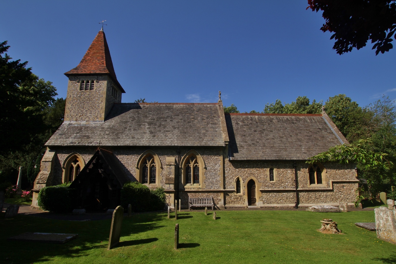
One of the notable features of Peppard Hill is the 12th-century church, St. Nicholas Church, which stands majestically at the heart of the village. This historic place of worship adds to the village's overall character and serves as a focal point for community events and gatherings.

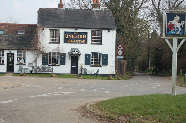
Peppard Hill benefits from its proximity to Henley-on-Thames, a renowned riverside town famous for its annual Royal Regatta. Henley provides a range of amenities, including shops, restaurants, and leisure facilities, which are easily accessible from the village.

Overall, Peppard Hill offers a tranquil and idyllic setting for those seeking a peaceful village life while still being within reach of larger towns and cities. With its natural beauty, rich history, and welcoming community, it is an attractive destination for both residents and visitors alike.

If you have any feedback on the listing, please let us know in the comments section below.
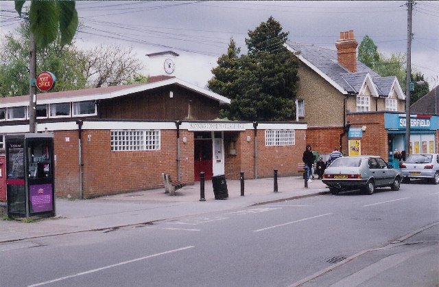
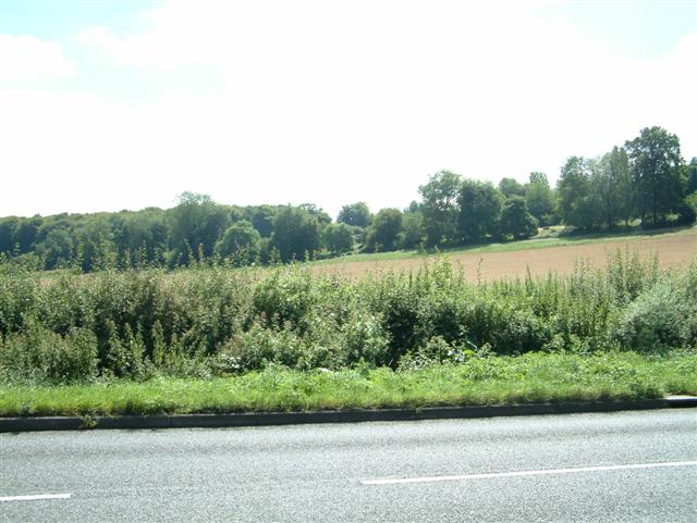
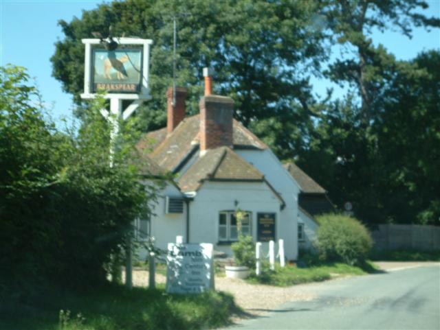
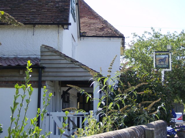
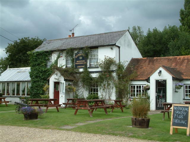
Peppard Hill Images

Images are sourced within 2km of 51.53024/-0.99125918 or Grid Reference SU7081. Thanks to Geograph Open Source API. All images are credited.

Sonning Common The centre of this sprawling commuter village.  There is no obvious connection with the village of Sonning on the Thames, 8km to the south-east
Sonning Common
The centre of this sprawling commuter village. There is no obvious connection with the village of Sonning on the Thames, 8km to the south-east
All Saints' Church, Rotherfield Peppard This pretty church sits on the edge of agricultural land that fills much of this square
All Saints' Church, Rotherfield Peppard
This pretty church sits on the edge of agricultural land that fills much of this square
The north end of Stony Bottom The north end of Stony Bottom taken from SU707816 looking South towards Green Trees Farm.
The north end of Stony Bottom
The north end of Stony Bottom taken from SU707816 looking South towards Green Trees Farm.
Peppard Common Looking NW across Peppard Common towards Manor Farm.
Peppard Common
Looking NW across Peppard Common towards Manor Farm.
School, Rotherfield Peppard Rotherfield Peppard School.
School, Rotherfield Peppard
Rotherfield Peppard School.
The Lamb, Satwell The Lamb at Satwell
The Lamb, Satwell
The Lamb at Satwell
Satwell Close, Shepherd's green Satwell Close, Shepherd's green
Satwell Close, Shepherd's green
Satwell
Satwell
The Lamb at Satwell
The Lamb at Satwell
Bolt's Cross
Bolt's Cross
The valley north of Peppard Looking from the hillside above Littlebottom Wood over to the house and woods in the northwestern area of the square.
The valley north of Peppard
Looking from the hillside above Littlebottom Wood over to the house and woods in the northwestern area of the square.
The bridleway in Littlebottom Wood Looking southwards from the northern end of the wood.
The bridleway in Littlebottom Wood
Looking southwards from the northern end of the wood.
Horses above Littlebottom Wood
Church Porch, Parish Church of All Saints Rotherfield Peppard
The Unicorn PH, Peppard Hill
Peppard Farm One of the cottages adjacent to the farm, adjacent to the main road from Sonning Common to Nettlebed.
Peppard Farm
One of the cottages adjacent to the farm, adjacent to the main road from Sonning Common to Nettlebed.
In the Dog House again Adjacent to the main entrance to The Dog public house at Rotherfield Peppard.  Yes, the Gents is outside.
In the Dog House again
Adjacent to the main entrance to The Dog public house at Rotherfield Peppard. Yes, the Gents is outside.
The Dog, Rotherfield Peppard One of two pubs in the village, on the main road from Nettlebed to Sonning Common.
The Dog, Rotherfield Peppard
One of two pubs in the village, on the main road from Nettlebed to Sonning Common.
Show me another place!

Peppard Hill is located at Grid Ref: SU7081 (Lat: 51.53024, Lng: -0.99125918)

Administrative County: Oxfordshire

District: South Oxfordshire

Police Authority: Thames Valley

What 3 Words

///refills.visual.crown. Near Rotherfield Peppard, Oxfordshire

Related Wikis

Gallowstree Common

Gallowstree Common is a hamlet in South Oxfordshire, England, about 4.5 miles (7.2 km) north of Reading, Berkshire. The village had a public house, the...

Bear, Oveys and Great Bottom Woods

Bear, Oveys and Great Bottom Woods is a 64.1-hectare (158-acre) biological Site of Special Scientific Interest west of Henley-on-Thames in Oxfordshire...

Maiden Erlegh Chiltern Edge

Maiden Erlegh Chiltern Edge (formerly Chiltern Edge Community School) is a coeducational secondary school located in Sonning Common, Oxfordshire, England...

Wyfold Court

Wyfold Court is a country house at Rotherfield Peppard in south Oxfordshire. It is a Grade II* listed building. By the year 2000, the estate had been converted...

Sonning Common

Sonning Common is a village and civil parish in a relatively flat, former common land part of the Chiltern Hills in South Oxfordshire, centred 3.5 miles...

Kidmore End

Kidmore End is a village and civil parish in South Oxfordshire, centred 6 miles (10 km) NNW of Reading, Berkshire, an important regional centre of commerce...

Rotherfield Peppard

Rotherfield Peppard (often referred to simply as Peppard by locals) is a village and civil parish in the Chiltern Hills in South Oxfordshire. It is centred...

Rotherfield Greys

Rotherfield Greys is a village and civil parish in the Chiltern Hills in South Oxfordshire. It is 2 miles (3 km) west of Henley-on-Thames and just over...

Nearby Amenities

Located within 500m of 51.53024,-0.99125918
Pub
The Unicorn
Addr City: Henley-on-Thames
Addr Postcode: RG9 5LX
Addr Street: Colmore Lane
Lat/Long: 51.5305628/-0.9904639
Bus Stop
The Unicorn;The Unicorn PH
Bus: yes
Naptan AtcoCode: 340000607UNI
Naptan Bearing: SE
Naptan CommonName: The Unicorn PH
Naptan Indicator: Colliers Lane
Naptan Landmark: Bus Shelter
Naptan NaptanCode: oxfatamw
Naptan Street: Crossroads
Naptan Verified: no
Public Transport: platform
Shelter: yes
Source: naptan_import
Lat/Long: 51.5304567/-0.9912571
Bus Stop
Dove Lane
Bus: yes
Naptan AtcoCode: 340001630OPP
Naptan Bearing: NW
Naptan CommonName: Dove Lane
Naptan Indicator: Corner
Naptan Landmark: Dove Cottage
Naptan NaptanCode: oxfgdptj
Naptan Street: Stoke Row Road
Naptan Verified: no
Public Transport: platform
Source: naptan_import
Lat/Long: 51.5323706/-0.9954944
Bus Stop
Dove Lane
Bus: yes
Naptan AtcoCode: 340001630OUT
Naptan Bearing: SE
Naptan CommonName: Dove Lane
Naptan Indicator: Opposite
Naptan Landmark: Dove Cottage
Naptan NaptanCode: oxfgdptg
Naptan Street: Stoke Row Road
Naptan Verified: no
Public Transport: platform
Source: naptan_import
Lat/Long: 51.5323758/-0.9952245
Bus Stop
Peppard Cricket Club
Bus: yes
Naptan AtcoCode: 340001648NOR
Naptan Bearing: SE
Naptan CommonName: Peppard Cricket Club
Naptan Indicator: Outside
Naptan Landmark: Peppard Cricket Club
Naptan NaptanCode: oxfgdtdj
Naptan Street: Stoke Row Road
Naptan Verified: no
Public Transport: platform
Shelter: no
Source: naptan_import
Lat/Long: 51.5279803/-0.9890031
Bus Stop
Peppard Cricket Club
Naptan AtcoCode: 340001648SOU
Naptan Bearing: NW
Naptan CommonName: Peppard Cricket Club
Naptan Indicator: Opposite
Naptan Landmark: Peppard Cricket Club
Naptan NaptanCode: oxfgdtdg
Naptan Street: Stoke Row Road
Naptan Verified: no
Shelter: no
Source: naptan_import
Lat/Long: 51.5281836/-0.989566
Bus Stop
The Unicorn PH
Naptan AtcoCode: 340001675OPP
Naptan Bearing: NW
Naptan CommonName: The Unicorn PH
Naptan Indicator: Stoke Row Road
Naptan Landmark: Garden House
Naptan NaptanCode: oxfgdadj
Naptan Street: Stoke Row Road
Naptan Verified: no
Source: naptan_import
Lat/Long: 51.5309208/-0.992086
Turning Circle
Lat/Long: 51.530615/-0.9931828
Barrier: kissing_gate
Foot: yes
Lat/Long: 51.5287815/-0.9955215
Direction: 135
Generator Method: photovoltaic
Generator Output Electricity: yes
Generator Solar Modules: 16
Generator Source: solar
Generator Type: solar_photovoltaic_panel
Location: roof
Power: generator
Lat/Long: 51.5268609/-0.987738
Direction: 225
Generator Method: photovoltaic
Generator Output Electricity: yes
Generator Solar Modules: 16
Generator Source: solar
Generator Type: solar_photovoltaic_panel
Location: roof
Power: generator
Lat/Long: 51.5275623/-0.9895552
Direction: 90
Generator Method: photovoltaic
Generator Output Electricity: yes
Generator Solar Modules: 3
Generator Source: solar
Generator Type: solar_photovoltaic_panel
Location: roof
Power: generator
Lat/Long: 51.529123/-0.9906474
Direction: 270
Generator Method: photovoltaic
Generator Output Electricity: yes
Generator Solar Modules: 8
Generator Source: solar
Generator Type: solar_photovoltaic_panel
Location: roof
Power: generator
Lat/Long: 51.5291363/-0.9906948
Direction: 175
Fixme: survey for panel count
Generator Method: photovoltaic
Generator Output Electricity: yes
Generator Solar Modules: 17
Generator Source: solar
Generator Type: solar_photovoltaic_panel
Location: roof
Power: generator
Lat/Long: 51.5300935/-0.990396
Direction: 160
Fixme: survey for panel count
Generator Method: photovoltaic
Generator Output Electricity: yes
Generator Solar Modules: 20
Generator Source: solar
Generator Type: solar_photovoltaic_panel
Location: roof
Power: generator
Lat/Long: 51.5301252/-0.9898626
Direction: 155
Fixme: survey for panel count
Generator Method: photovoltaic
Generator Output Electricity: yes
Generator Solar Modules: 16
Generator Source: solar
Generator Type: solar_photovoltaic_panel
Location: roof
Power: generator
Lat/Long: 51.5305104/-0.9882086
Direction: 200
Fixme: survey for panel count
Generator Method: photovoltaic
Generator Output Electricity: yes
Generator Solar Modules: 9
Generator Source: solar
Generator Type: solar_photovoltaic_panel
Location: roof
Power: generator
Lat/Long: 51.5321638/-0.9951639
Direction: 130
Fixme: survey for panel count
Generator Method: photovoltaic
Generator Output Electricity: yes
Generator Solar Modules: 16
Generator Source: solar
Generator Type: solar_photovoltaic_panel
Location: roof
Power: generator
Lat/Long: 51.5259052/-0.9925725
The data included in this document is from www.openstreetmap.org. The data is made available under ODbL.

Have you been to Peppard Hill?

Leave your review of Peppard Hill below (or comments, questions and feedback).