Pen-y-garn

Settlement in Carmarthenshire

Wales

Pen-y-garn

Bwlch y Rhyd Llwybr cyhoeddus yn dringo lan at Ffarm Bwlch y Rhyd -adfail sy bellach wedi ei hamgylchynu gan blanhigfa goniferaidd.

A public footpath leading up towards the ruined farm of Bwlch y Rhyd (trans. pass of the ford). The farm is today surrounded by a conifer plantation.
Bwlch y Rhyd Credit: Alan Richards

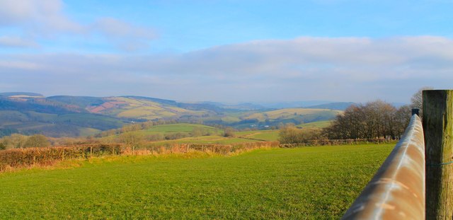
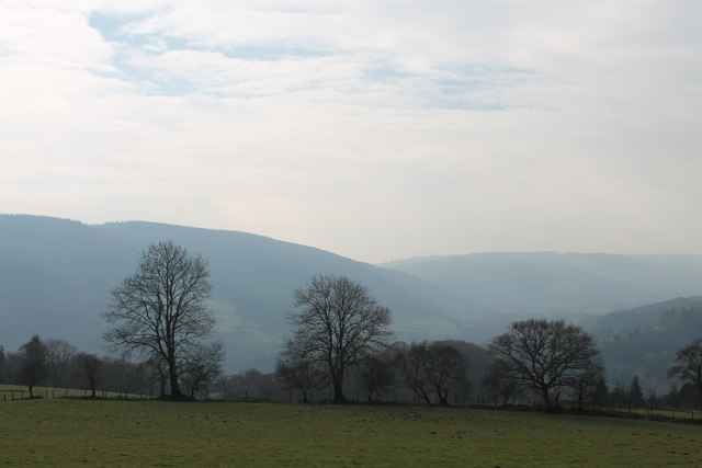
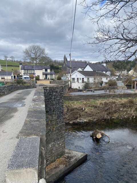
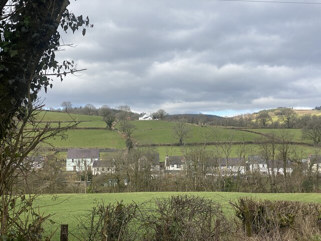
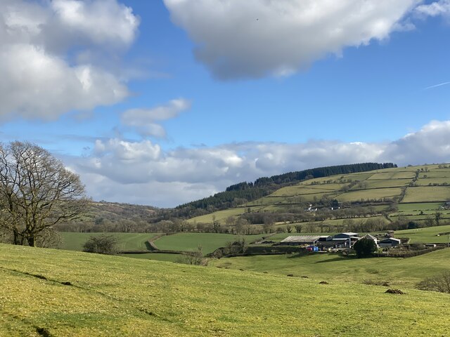
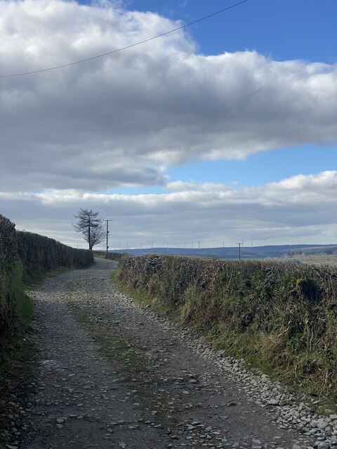
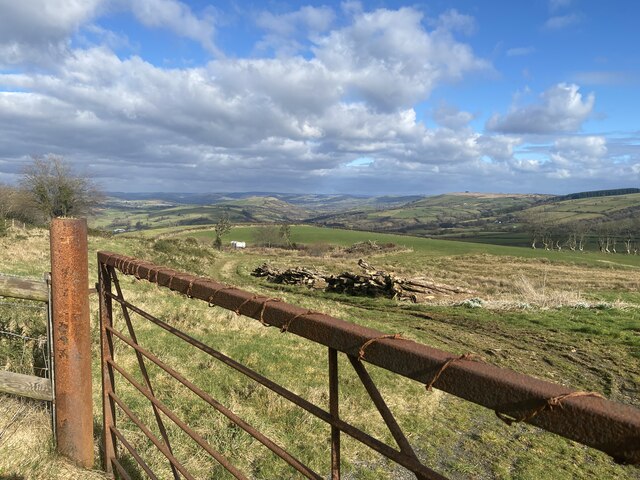
Pen-y-garn is a small village located in the county of Carmarthenshire, Wales. Situated approximately 9 miles north of the county town of Carmarthen, it lies in the picturesque Tywi Valley. The village is surrounded by rolling hills and lush green countryside, offering a tranquil and scenic setting.

Pen-y-garn is a close-knit community with a population of around 400 residents. The village is predominantly residential, characterized by traditional Welsh cottages and a handful of modern houses. The local economy is mainly based on agriculture, with farming playing a significant role in the area.

Despite its small size, Pen-y-garn offers a range of amenities for its residents. The village boasts a primary school, providing education for children up to the age of 11. There is also a community hall, which serves as a venue for various events and gatherings throughout the year. Additionally, a local pub offers a social hub for residents and visitors alike, providing a place to relax and socialize.

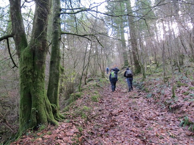
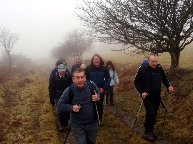
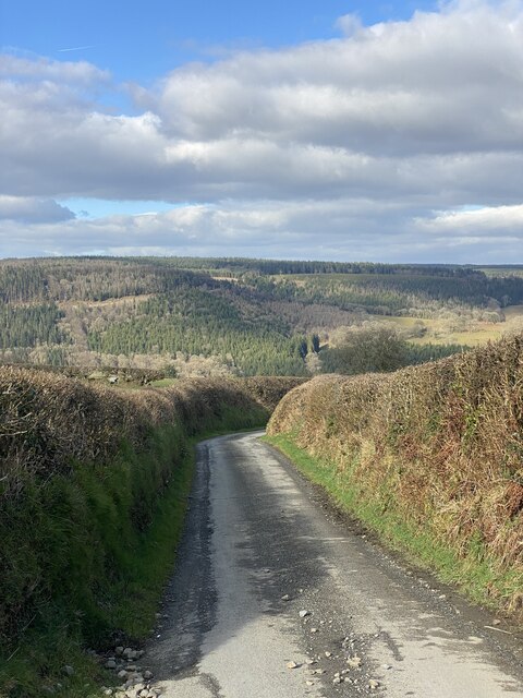
For outdoor enthusiasts, Pen-y-garn is a gateway to the natural beauty of Carmarthenshire. The surrounding countryside offers ample opportunities for hiking, cycling, and exploring the nearby Tywi Forest. The village is also within close proximity to the Brecon Beacons National Park, a popular destination for outdoor activities and stunning landscapes.

Overall, Pen-y-garn is a charming and peaceful village, offering a close community spirit and easy access to the natural wonders of Carmarthenshire.

If you have any feedback on the listing, please let us know in the comments section below.
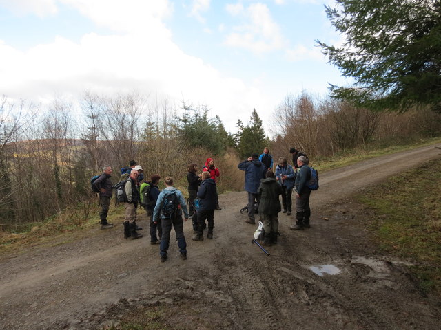
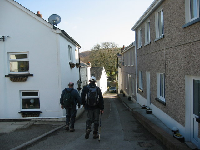
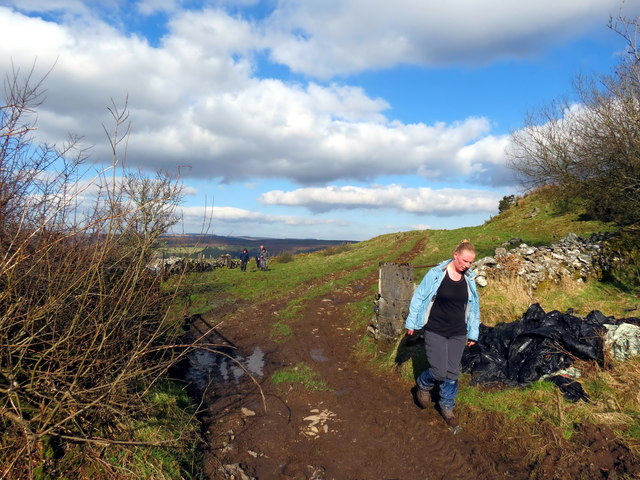
Pen-y-garn Images

Images are sourced within 2km of 51.968496/-4.0767943 or Grid Reference SN5732. Thanks to Geograph Open Source API. All images are credited.

Bwlch y Rhyd Llwybr cyhoeddus yn dringo lan at Ffarm Bwlch y Rhyd -adfail sy bellach wedi ei hamgylchynu gan blanhigfa goniferaidd.

A public footpath leading up towards the ruined farm of Bwlch y Rhyd (trans. pass of the ford). The farm is today surrounded by a conifer plantation.
Bwlch y Rhyd
Llwybr cyhoeddus yn dringo lan at Ffarm Bwlch y Rhyd -adfail sy bellach wedi ei hamgylchynu gan blanhigfa goniferaidd. A public footpath leading up towards the ruined farm of Bwlch y Rhyd (trans. pass of the ford). The farm is today surrounded by a conifer plantation.
Sticil Clawddowen Stile, Llanfynydd Sticil wael ger Ffarm Clawddowen, Llanfynydd / A poor stile near Clawddowen Farm, Llanfynydd
Sticil Clawddowen Stile, Llanfynydd
Sticil wael ger Ffarm Clawddowen, Llanfynydd / A poor stile near Clawddowen Farm, Llanfynydd
Telephone Box and Notice Board, Bro Nant, Nantyffin The telephone box and community notice board as they were in March 2004, when the telephone still took coins. BT wanted to remove it but local protests made them leave it in place. It can only be used by card now, but emergency calls are free. Just as well, as few mobile signals can be received around here.
Telephone Box and Notice Board, Bro Nant, Nantyffin
The telephone box and community notice board as they were in March 2004, when the telephone still took coins. BT wanted to remove it but local protests made them leave it in place. It can only be used by card now, but emergency calls are free. Just as well, as few mobile signals can be received around here.
Heol Rhandir Gini Road Cerddwyr yn dilyn hen heol i gyfeiriad Rhandir Gini (adfail)

Walkers following an old road in the direction of the ruined property known as Rhandir Gini.
Heol Rhandir Gini Road
Cerddwyr yn dilyn hen heol i gyfeiriad Rhandir Gini (adfail) Walkers following an old road in the direction of the ruined property known as Rhandir Gini.
Uwchben / Above Ffinnant Cerddwyr yn cael seibiant ar groesffordd o draciau uwchben Ffarm Ffinnant.

Walkers having a breather at a crossroads of tracks above Ffinnant Farm (trans. boundary stream).
Uwchben / Above Ffinnant
Cerddwyr yn cael seibiant ar groesffordd o draciau uwchben Ffarm Ffinnant. Walkers having a breather at a crossroads of tracks above Ffinnant Farm (trans. boundary stream).
Abergorlech Cerddwyr yn cyrraedd pentre Abergorlech.

Walkers arriving at Abergorelch village.
Abergorlech
Cerddwyr yn cyrraedd pentre Abergorlech. Walkers arriving at Abergorelch village.
Tuag at / Towards Penygarn Cerddwyr yn dilyn llwybr cyhoeddus i'r heol ym Mhenygarn.

Walkers following a footpath towards the road at Penygarn (trans. top of the cairn)
Tuag at / Towards Penygarn
Cerddwyr yn dilyn llwybr cyhoeddus i'r heol ym Mhenygarn. Walkers following a footpath towards the road at Penygarn (trans. top of the cairn)
View East from above Trebwl View towards Llansawel...
View East from above Trebwl
View towards Llansawel...
View from below Rhandir Gini
Churn Stand
Churn Stand
Foot Bridge
Foot Bridge
Ordnance Survey Cut Mark This OS cut mark can be found on the gatepost NW side of the road. It marks a point 290.278m above mean sea level.
Ordnance Survey Cut Mark
This OS cut mark can be found on the gatepost NW side of the road. It marks a point 290.278m above mean sea level.
Pont Cothi Bridge over Afon Cothi, Abergorlech.
Pont Cothi
Bridge over Afon Cothi, Abergorlech.
Approaching Abergorlech
Carmarthenshire countryside Beili Bedw farm.
Carmarthenshire countryside
Beili Bedw farm.
Country lane Lane leading to Abergorlech.
Country lane
Lane leading to Abergorlech.
Track towards Blaen Nant y Garn
Rusty gate - Pen y Garn
Show me another place!

Pen-y-garn is located at Grid Ref: SN5732 (Lat: 51.968496, Lng: -4.0767943)

Unitary Authority: Carmarthenshire

Police Authority: Dyfed Powys

What 3 Words

///lakes.clearly.abstracts. Near Llanfynydd, Carmarthenshire

Nearby Locations

Pen-y-garn

Related Wikis

Abergorlech

Abergorlech is a village 8 miles (13 km) to the north-west of Llandeilo in Carmarthenshire, Wales. It lies on the River Cothi on the B4310 road, between...

Llanfihangel Rhos-y-Corn

Llanfihangel Rhos-y-Corn is a sparsely populated community of Carmarthenshire, Wales. The population of the community taken at the 2011 census was 468...

Carmarthen East and Dinefwr (Senedd constituency)

Carmarthen East and Dinefwr (Welsh: Dwyrain Caerfyrddin a Dinefwr) is a constituency of the Senedd. It elects one Member of the Senedd by the first past...

Carmarthen East and Dinefwr (UK Parliament constituency)

Carmarthen East and Dinefwr (Welsh: Dwyrain Caerfyrddin a Dinefwr) is a constituency of the House of Commons of the Parliament of the United Kingdom represented...

Nearby Amenities

Located within 500m of 51.968496,-4.0767943
Place: farm
Lat/Long: 51.9706753/-4.0772089
Place: farm
Lat/Long: 51.9678678/-4.0823992
Direction: SSE
Generator Method: photovoltaic
Generator Output Electricity: yes
Generator Solar Modules: 18
Generator Source: solar
Generator Type: solar_photovoltaic_panel
Location: roof
Power: generator
Lat/Long: 51.9707212/-4.0773037
The data included in this document is from www.openstreetmap.org. The data is made available under ODbL.

Have you been to Pen-y-garn?

Leave your review of Pen-y-garn below (or comments, questions and feedback).