Pen-y-Bont

Settlement in Cardiganshire

Wales

Pen-y-Bont

The new Bow Street interchange I find it very convenient as it is just a short drive from my house, but generally, the current lack of use does cause one to question the expenditure on the development. Maybe usage will increase when normality returns after covid.
The new Bow Street interchange Credit: John Lucas

Pen-y-Bont is a small village located in the county of Cardiganshire, Wales. Situated on the western coast of the country, it is nestled between the rolling hills and the stunning Cardigan Bay. The village is located approximately 4 miles south of Aberystwyth, the largest town in the area.

The name Pen-y-Bont translates to "end of the bridge," reflecting the village's location at the southern end of the historic stone bridge that spans the River Ystwyth. This bridge has been a vital crossing point for centuries and serves as a connection between Pen-y-Bont and the neighboring communities.

The village itself is charming and picturesque, with a population of around 500 residents. It has maintained its traditional Welsh character, with many of the buildings reflecting the local architectural style. The surrounding landscape is characterized by lush green fields, wooded areas, and the nearby mountains, providing breathtaking views.

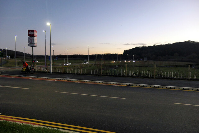
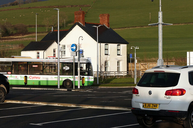
Despite its small size, Pen-y-Bont has a strong sense of community, with a range of amenities available for residents and visitors. These include a local pub, a primary school, a village hall, and a post office. The village also benefits from regular bus services, providing convenient connections to larger towns nearby.

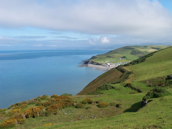
The area around Pen-y-Bont offers a wealth of outdoor activities, such as hiking, cycling, and fishing. The beautiful coastline of Cardigan Bay is within easy reach, providing opportunities for beach walks, water sports, and wildlife spotting.

Overall, Pen-y-Bont is a tranquil and idyllic village, perfect for those seeking a peaceful retreat amidst the natural beauty of Cardiganshire.

If you have any feedback on the listing, please let us know in the comments section below.

Pen-y-Bont Images

Images are sourced within 2km of 52.433715/-4.056841 or Grid Reference SN6083. Thanks to Geograph Open Source API. All images are credited.
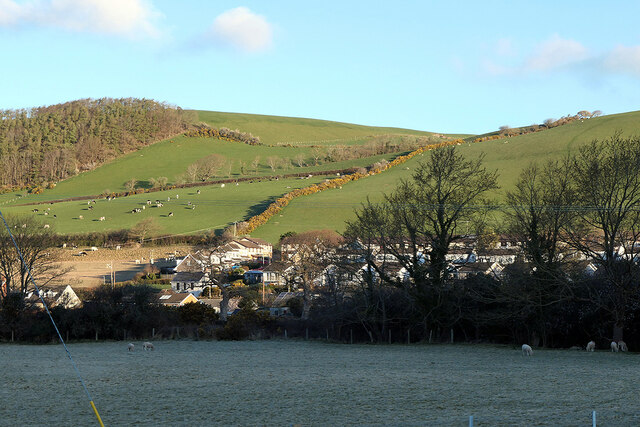
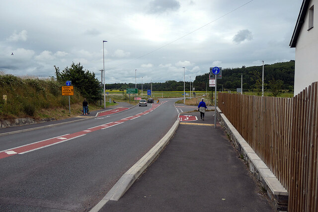
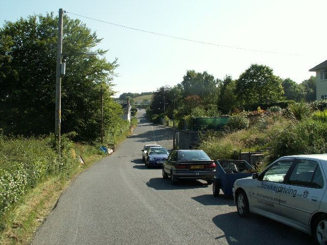
The new Bow Street interchange I find it very convenient as it is just a short drive from my house, but generally, the current lack of use does cause one to question the expenditure on the development. Maybe usage will increase when normality returns after covid.
The new Bow Street interchange
I find it very convenient as it is just a short drive from my house, but generally, the current lack of use does cause one to question the expenditure on the development. Maybe usage will increase when normality returns after covid.
A train for Shrewsbury arriving at Bow Street station
Road junction south of Bow Street The A4159 road joining the A487. This is a revised layout, it previously being a 'Y' junction. The layout was changed as part of the development of the new Bow Street railway station between 2018 and 2021.
Road junction south of Bow Street
The A4159 road joining the A487. This is a revised layout, it previously being a 'Y' junction. The layout was changed as part of the development of the new Bow Street railway station between 2018 and 2021.
On Bow Street station platform Over an hour until the next train. The hourly service on the Aberystwyth line, promised by Transport for Wales when it gained the franchise and due to start this year, has now been delayed until 2024. It would appear that TFW has not explained the change.
On Bow Street station platform
Over an hour until the next train. The hourly service on the Aberystwyth line, promised by Transport for Wales when it gained the franchise and due to start this year, has now been delayed until 2024. It would appear that TFW has not explained the change.
The A487 road Viewed from Bow Street station entrance.
The A487 road
Viewed from Bow Street station entrance.
Early evening - Bow Street station
Tree clearance at Bow Street A lot of Network Rail activity taking place at Bow Street, with lineside trees being removed. Possibly to reduce the incidence of the dreaded 'leaves on the line'.
Tree clearance at Bow Street
A lot of Network Rail activity taking place at Bow Street, with lineside trees being removed. Possibly to reduce the incidence of the dreaded 'leaves on the line'.
A TrawsCymru bus passes by the 'Hell House' at Bow Street The bus is nearing completion of its journey from Bangor to Aberystwyth, running as the TrawsCymru T2 service.

For an explanation of the 'Hell House', see <a href="https://www.geograph.org.uk/photo/6753775">SN6284 : Would you write this on your house?</a>.
A TrawsCymru bus passes by the 'Hell House' at Bow Street
The bus is nearing completion of its journey from Bangor to Aberystwyth, running as the TrawsCymru T2 service. For an explanation of the 'Hell House', see SN6284 : Would you write this on your house?.
Welcome to Hell Someone doesn't like Bow Street! Slogan facing passengers arriving at the new railway station.
Welcome to Hell
Someone doesn't like Bow Street! Slogan facing passengers arriving at the new railway station.
A train at Bow Street station This would normally have been a through train from Aberystwyth to Birmingham International. However, as a result of flood damage in the Welshpool area in February, the train will go only to Machynlleth, with onward travel by bus from there to Shrewsbury. It is expected that the repairs to the line will be completed during the current week.
A train at Bow Street station
This would normally have been a through train from Aberystwyth to Birmingham International. However, as a result of flood damage in the Welshpool area in February, the train will go only to Machynlleth, with onward travel by bus from there to Shrewsbury. It is expected that the repairs to the line will be completed during the current week.
Frosty and sunlit fields at Bryn-y-castell Bryn-y-castell is a 'suburb' of Bow Street. This view was taken from Bow Street station.
Frosty and sunlit fields at Bryn-y-castell
Bryn-y-castell is a 'suburb' of Bow Street. This view was taken from Bow Street station.
Waiting for the train on a cold, wet morning At Bow Street station.
Waiting for the train on a cold, wet morning
At Bow Street station.
Not platform 2! The sign suggests that Bow Street has two platforms - it has only one - whereas it is the stop point for two car trains.
Not platform 2!
The sign suggests that Bow Street has two platforms - it has only one - whereas it is the stop point for two car trains.
Bow Street railway station This is a railway station on the Cambrian Line, which runs between Shrewsbury and Aberystwyth or Pwllheli. It serves the villages of Bow Street and Pen-y-garn. It is owned by Network Rail and managed by Transport for Wales.
The original station was closed on 14 June 1965. The current station was constructed on a different site, just south of the original. Funded by the Welsh Government and the Department for Transport, it opened on 14 February 2021.
Bow Street railway station
This is a railway station on the Cambrian Line, which runs between Shrewsbury and Aberystwyth or Pwllheli. It serves the villages of Bow Street and Pen-y-garn. It is owned by Network Rail and managed by Transport for Wales. The original station was closed on 14 June 1965. The current station was constructed on a different site, just south of the original. Funded by the Welsh Government and the Department for Transport, it opened on 14 February 2021.
Bryn Castell Now a road through a housing estate, but was once an old route leading to Bryn-y-castell [farm] and over the hills to Llandre and Borth. Much of the route can still be walked, access to which is via the farm, which can be seen ahead.
Bryn Castell
Now a road through a housing estate, but was once an old route leading to Bryn-y-castell [farm] and over the hills to Llandre and Borth. Much of the route can still be walked, access to which is via the farm, which can be seen ahead.
The A487 road heading out of Bow Street towards Aberystwyth The entrance to the new Bow Street station is just ahead on the right.
The A487 road heading out of Bow Street towards Aberystwyth
The entrance to the new Bow Street station is just ahead on the right.
Road junction at Bow Street This was a 'Y' junction until it was remodelled, the access to the new Bow Street station being added on the right in 2019/20.
Road junction at Bow Street
This was a 'Y' junction until it was remodelled, the access to the new Bow Street station being added on the right in 2019/20.
A train for Shrewsbury departing from Bow Street On the right is a Huws Gray builders' merchants, which stands on the site of the original Bow Street station yard.
A train for Shrewsbury departing from Bow Street
On the right is a Huws Gray builders' merchants, which stands on the site of the original Bow Street station yard.
Show me another place!

Pen-y-Bont is located at Grid Ref: SN6083 (Lat: 52.433715, Lng: -4.056841)

Unitary Authority: Ceredigion

Police Authority: Dyfed Powys

What 3 Words

///arranges.bonkers.albatross. Near Bow Street, Ceredigion

Related Wikis

Afon Clarach

The Afon Clarach (English: River Clarach) is a small river discharging into Cardigan Bay north of Aberystwyth. It flows through a largely agricultural...

Glan-y-môr, Ceredigion

Glan-y-môr is a small village in the community of Tirymynach, Ceredigion, Wales, which is 76.4 miles (123 km) from Cardiff and 180 miles (289.7 km) from...

Faenor, Ceredigion

Faenor is a community and electoral ward sharing a boundary with the town of Aberystwyth in Ceredigion, Wales.Faenor also has two community wards which...

Clarach Bay

Clarach Bay is a small bay on the coast of Ceredigion, Wales, to the north of Aberystwyth, where the Afon Clarach flows into the sea. It has given homes...

Tirymynach

Tirymynach is a community in Ceredigion, Wales, also an electoral ward, which lies immediately to the north of Aberystwyth. Tirymynach is represented in...

Aberystwyth University

Aberystwyth University (Welsh: Prifysgol Aberystwyth) is a public research university in Aberystwyth, Wales. Aberystwyth was a founding member institution...

Comins Coch

Comins Coch (officially spelt Comins-coch) is a small village in Ceredigion, Wales, to the northeast of Aberystwyth. The village is covered by Faenor community/parish...

Penglais Nature Park

Penglais Nature Park (Welsh: Parc Natur Penglais) is a woodland situated in Aberystwyth, Ceredigion in Wales. The park is a combination of woodland and...

Nearby Amenities

Located within 500m of 52.433715,-4.056841
Llangorwen
Is In: Ceredigion, Wales, UK
Name Cy: Llangorwen
Name En: Llangorwen
Place: village
Wikidata: Q15242560
Wikipedia: en:Llangorwen
Lat/Long: 52.4357327/-4.0578162
Post Box
Operator: Royal Mail
Ref: SY23 011
Lat/Long: 52.4356887/-4.058952
Barrier: kissing_gate
Lat/Long: 52.4337931/-4.0563637
Barrier: kissing_gate
Lat/Long: 52.4342787/-4.0535957
Barrier: stile
Lat/Long: 52.43117/-4.0562816
Barrier: stile
Lat/Long: 52.4317061/-4.0575256
Barrier: stile
Lat/Long: 52.4331455/-4.0615881
Direction: S
Generator Method: photovoltaic
Generator Output Electricity: yes
Generator Solar Modules: 14
Generator Source: solar
Generator Type: solar_photovoltaic_panel
Location: roof
Power: generator
Lat/Long: 52.4355494/-4.0603119
Direction: S
Generator Method: photovoltaic
Generator Output Electricity: yes
Generator Solar Modules: 16
Generator Source: solar
Generator Type: solar_photovoltaic_panel
Location: roof
Power: generator
Lat/Long: 52.4355527/-4.060674
Direction: SSE
Generator Method: photovoltaic
Generator Output Electricity: yes
Generator Solar Modules: 12
Generator Source: solar
Generator Type: solar_photovoltaic_panel
Location: roof
Power: generator
Lat/Long: 52.436663/-4.0602556
Direction: SSE
Generator Method: photovoltaic
Generator Output Electricity: yes
Generator Solar Modules: 16
Generator Source: solar
Generator Type: solar_photovoltaic_panel
Location: roof
Power: generator
Lat/Long: 52.4363392/-4.0602341
Direction: 145
Generator Method: photovoltaic
Generator Output Electricity: yes
Generator Solar Modules: 12
Generator Source: solar
Generator Type: solar_photovoltaic_panel
Location: roof
Power: generator
Lat/Long: 52.4364324/-4.0609208
Direction: SSE
Generator Method: photovoltaic
Generator Output Electricity: yes
Generator Solar Modules: 16
Generator Source: solar
Generator Type: solar_photovoltaic_panel
Location: roof
Power: generator
Lat/Long: 52.4360841/-4.0574299
The data included in this document is from www.openstreetmap.org. The data is made available under ODbL.

Have you been to Pen-y-Bont?

Leave your review of Pen-y-Bont below (or comments, questions and feedback).