Patrick Green

Settlement in Yorkshire

England

Patrick Green

Lake Lock Drive, Stanley
Lake Lock Drive, Stanley Credit: Ian S

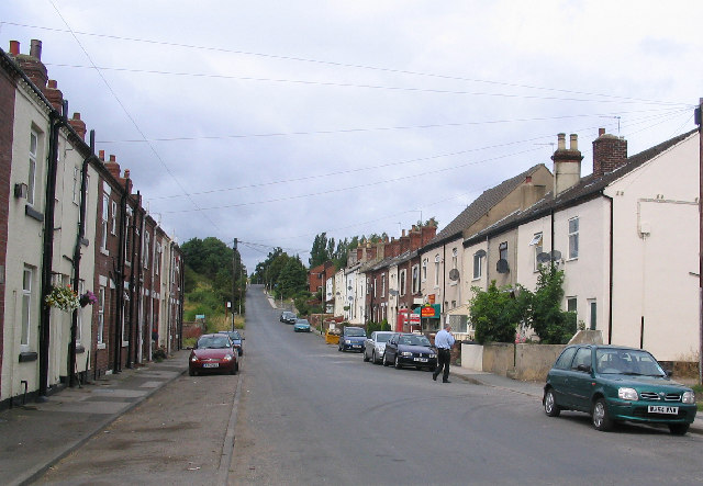
Patrick Green is a small hamlet located in the county of Yorkshire, England. Situated in the eastern part of the country, it falls within the administrative district of North Yorkshire. The hamlet is nestled amidst picturesque countryside, surrounded by rolling hills, lush green fields, and charming farmland.

With a population of around 100 residents, Patrick Green has a close-knit community that fosters a friendly and welcoming atmosphere. The hamlet consists mainly of traditional stone-built houses and cottages, which add to its rustic and idyllic charm.

Despite its small size, Patrick Green benefits from its proximity to nearby towns and villages, providing residents with access to amenities and services. The hamlet is conveniently located near the town of Malton, which offers a range of facilities including shops, schools, healthcare services, and recreational activities.

The area surrounding Patrick Green is renowned for its natural beauty and offers numerous opportunities for outdoor pursuits. The Yorkshire Wolds, an Area of Outstanding Natural Beauty, is within easy reach, providing residents with scenic walking and cycling routes, as well as opportunities for wildlife spotting.

Overall, Patrick Green offers a tranquil and peaceful lifestyle, away from the hustle and bustle of urban areas. Its stunning surroundings, close community, and convenient location make it an attractive place to live for those seeking the charm and beauty of rural Yorkshire.

If you have any feedback on the listing, please let us know in the comments section below.

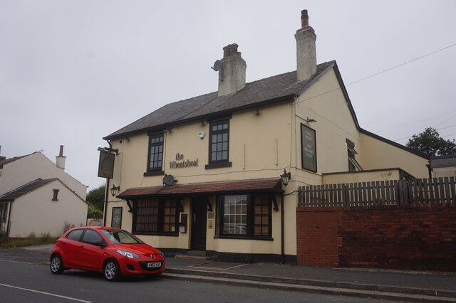
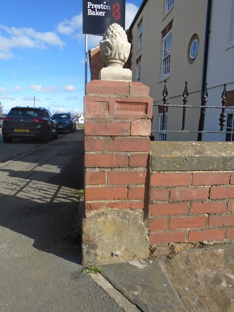
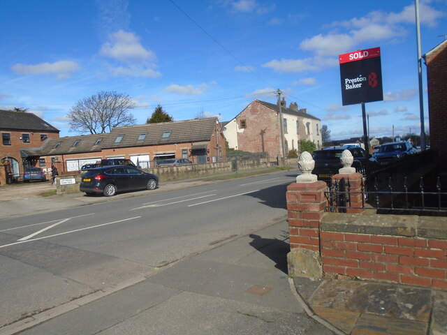
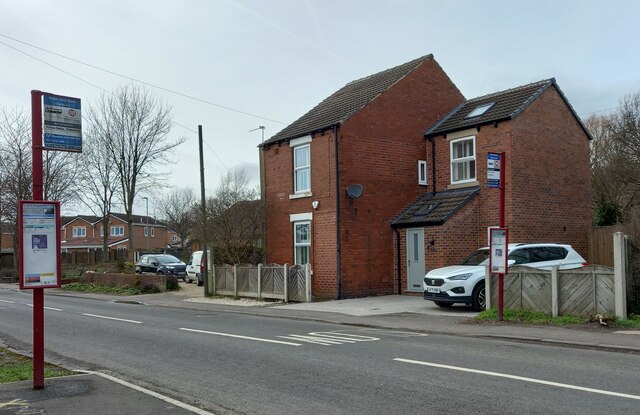
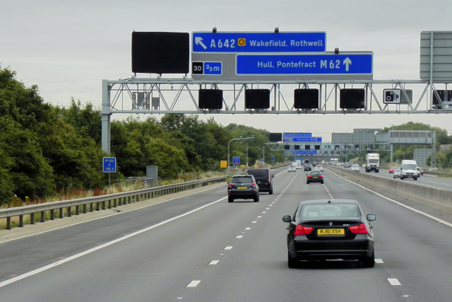
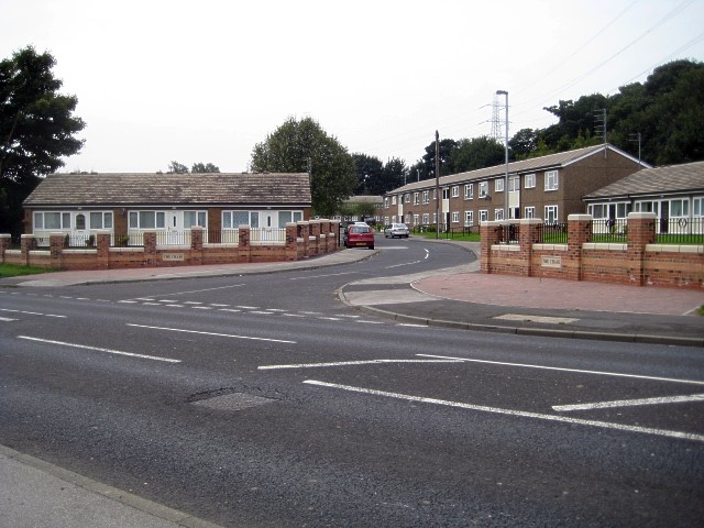
Patrick Green Images

Images are sourced within 2km of 53.727664/-1.4726227 or Grid Reference SE3425. Thanks to Geograph Open Source API. All images are credited.

Lake Lock Drive, Stanley
St Peter's Church and Church Centre On Lake Lock Road, Stanley.
St Peter's Church and Church Centre
On Lake Lock Road, Stanley.
The Wheatsheaf public house On Lake Lock Road, Stanley.
The Wheatsheaf public house
On Lake Lock Road, Stanley.
Old milestone The Leeds to Wakefield turnpike road was first enacted in 1761 and lasted until the  1870s.   It was 8.3 miles long.   This milestone in Lofthouse Gate, outside 124 Leeds Road, Hopkinsons Cottage, is the only one remaining from that era.   Although the pavement is built up around it, the metal peg suggests that a plate was cast with the legends.   Perhaps Leeds 6, Wakefield 3.  Note the brick in the wall with the makers name, Armitage.
Old milestone
The Leeds to Wakefield turnpike road was first enacted in 1761 and lasted until the 1870s. It was 8.3 miles long. This milestone in Lofthouse Gate, outside 124 Leeds Road, Hopkinsons Cottage, is the only one remaining from that era. Although the pavement is built up around it, the metal peg suggests that a plate was cast with the legends. Perhaps Leeds 6, Wakefield 3. Note the brick in the wall with the makers name, Armitage.
Old milestone Hopkinsons Cottage, quite a tall house, has been sold.  Hopefully the new owners will not remove the milestone.
Old milestone
Hopkinsons Cottage, quite a tall house, has been sold. Hopefully the new owners will not remove the milestone.
Stanley, 189 Rooks Nest Road The benchmark is cut into the east face of the property.
Stanley, 189 Rooks Nest Road
The benchmark is cut into the east face of the property.
Stanley, 189 Rooks Nest Road There is a benchmark is cut into the east face of the property.
Stanley, 189 Rooks Nest Road
There is a benchmark is cut into the east face of the property.
Moss Carr Wood
Moss Carr Wood
Leeds Country Way heading West towards Cheesecake Farm A faint indentation in the grass shows the direction of the footpath
Leeds Country Way heading West towards Cheesecake Farm
A faint indentation in the grass shows the direction of the footpath
Queen Street, Carlton Small village near Rothwell, at the centre of the Rhubarb Triangle
Queen Street, Carlton
Small village near Rothwell, at the centre of the Rhubarb Triangle
Main Street, Carlton Village in the centre of the Rhubarb Triangle, south of Leeds.
This street has been adopted by the Leeds Country Way long distance footpath since 2006, when the trail was redrawn to exclude the Wakefield section.
Main Street, Carlton
Village in the centre of the Rhubarb Triangle, south of Leeds. This street has been adopted by the Leeds Country Way long distance footpath since 2006, when the trail was redrawn to exclude the Wakefield section.
View Northwards from Carlton Village Green This is an area to the west of Wakefield in West Yorkshire, about 9 square miles in extent, where traditional Yorkshire forced rhubarb is still produced. Originally the name covered a much larger area, bounded by Leeds, Bradford and Wakefield, but the availability of imported sweet fruit after the second World War led to a huge drop in demand, and producers are now down to about a dozen. The growing of forced rhubarb is still labour intensive as a lot of hand-operation still has to be maintained to avoid damage to the plants. The roots are grown outdoors for 2 years before being carefully lifted and brought into the forcing sheds where heat and a lack of light cause the rhubarb to grow more delicate and sweeter leaf stalks than outdoors. Harvesting still takes place by candlelight to prevent unwanted photosynthesis, and the stalks have to be individually selected and hand harvested.
Since 2010, the product has benefited from Protected Designation of Origin status, meaning that the name Yorkshire Forced Rhubarb can only be apply to produce grown in the traditional area.
Several factors made the area particularly suitable for the growing of rhubarb. The soil is rich and retains moisture (rhubarb does not grow well in dry soils) and a combination of good rainfall in the Pennine shadow and early frosts make for ideal growing conditions. The local coal industry meant that fuel for the warming of the forcing sheds was cheap, and finally the wool wastes from the local shoddy industry were found to be an ideal fertiliser, high in Nitrogen content. See <span class="nowrap"><a title="http://en.wikipedia.org/wiki/Rhubarb_Triangle" rel="nofollow ugc noopener" href="http://en.wikipedia.org/wiki/Rhubarb_Triangle">Link</a><img style="margin-left:2px;" alt="External link" title="External link - shift click to open in new window" src="https://s1.geograph.org.uk/img/external.png" width="10" height="10"/></span> for more information.
View Northwards from Carlton Village Green
This is an area to the west of Wakefield in West Yorkshire, about 9 square miles in extent, where traditional Yorkshire forced rhubarb is still produced. Originally the name covered a much larger area, bounded by Leeds, Bradford and Wakefield, but the availability of imported sweet fruit after the second World War led to a huge drop in demand, and producers are now down to about a dozen. The growing of forced rhubarb is still labour intensive as a lot of hand-operation still has to be maintained to avoid damage to the plants. The roots are grown outdoors for 2 years before being carefully lifted and brought into the forcing sheds where heat and a lack of light cause the rhubarb to grow more delicate and sweeter leaf stalks than outdoors. Harvesting still takes place by candlelight to prevent unwanted photosynthesis, and the stalks have to be individually selected and hand harvested. Since 2010, the product has benefited from Protected Designation of Origin status, meaning that the name Yorkshire Forced Rhubarb can only be apply to produce grown in the traditional area. Several factors made the area particularly suitable for the growing of rhubarb. The soil is rich and retains moisture (rhubarb does not grow well in dry soils) and a combination of good rainfall in the Pennine shadow and early frosts make for ideal growing conditions. The local coal industry meant that fuel for the warming of the forcing sheds was cheap, and finally the wool wastes from the local shoddy industry were found to be an ideal fertiliser, high in Nitrogen content. See LinkExternal link for more information.
Farm land adjacent to Jumbles Lane, Lofthouse Farm land adjacent to Jumbles Lane, Lofthouse, Wakefield.
Part of the area of West Yorkshire designated "the Rhubarb Triangle"
Adjacent to the A61 main Leeds - Wakefield road
Farm land adjacent to Jumbles Lane, Lofthouse
Farm land adjacent to Jumbles Lane, Lofthouse, Wakefield. Part of the area of West Yorkshire designated "the Rhubarb Triangle" Adjacent to the A61 main Leeds - Wakefield road
Jumbles Lane, Lofthouse looking across the A61 towards Long Thorpe Lane Jumbles Lane, Lofthouse; looking across the A61 (the main Leeds to Wakefield road) towards the eastern end of Long Thorpe Lane
Jumbles Lane, Lofthouse looking across the A61 towards Long Thorpe Lane
Jumbles Lane, Lofthouse; looking across the A61 (the main Leeds to Wakefield road) towards the eastern end of Long Thorpe Lane
Eastbound M62, Leeds Road Bridge The M62 is the west to east trans-Pennine motorway. It is 107 miles long running from Liverpool to Hull. It was built between 1971 and 1976. At Windy Hill it is 372m above sea level, making it the highest point on any British motorway.
Wikipedia: <span class="nowrap"><a title="http://en.wikipedia.org/wiki/M62_motorway" rel="nofollow ugc noopener" href="http://en.wikipedia.org/wiki/M62_motorway">Link</a><img style="margin-left:2px;" alt="External link" title="External link - shift click to open in new window" src="https://s1.geograph.org.uk/img/external.png" width="10" height="10"/></span>
Eastbound M62, Leeds Road Bridge
The M62 is the west to east trans-Pennine motorway. It is 107 miles long running from Liverpool to Hull. It was built between 1971 and 1976. At Windy Hill it is 372m above sea level, making it the highest point on any British motorway. Wikipedia: LinkExternal link
Signal Gantry over the M62 near to Lofthouse The M62 is the west to east trans-Pennine motorway. It is 107 miles long running from Liverpool to Hull. It was built between 1971 and 1976. At Windy Hill it is 372m above sea level, making it the highest point on any British motorway.
Wikipedia: <span class="nowrap"><a title="http://en.wikipedia.org/wiki/M62_motorway" rel="nofollow ugc noopener" href="http://en.wikipedia.org/wiki/M62_motorway">Link</a><img style="margin-left:2px;" alt="External link" title="External link - shift click to open in new window" src="https://s1.geograph.org.uk/img/external.png" width="10" height="10"/></span>
Signal Gantry over the M62 near to Lofthouse
The M62 is the west to east trans-Pennine motorway. It is 107 miles long running from Liverpool to Hull. It was built between 1971 and 1976. At Windy Hill it is 372m above sea level, making it the highest point on any British motorway. Wikipedia: LinkExternal link
Traffic Camera on eastbound M62 near Lofthouse The M62 is the west to east trans-Pennine motorway. It is 107 miles long running from Liverpool to Hull. It was built between 1971 and 1976. At Windy Hill it is 372m above sea level, making it the highest point on any British motorway.
Wikipedia: <span class="nowrap"><a title="http://en.wikipedia.org/wiki/M62_motorway" rel="nofollow ugc noopener" href="http://en.wikipedia.org/wiki/M62_motorway">Link</a><img style="margin-left:2px;" alt="External link" title="External link - shift click to open in new window" src="https://s1.geograph.org.uk/img/external.png" width="10" height="10"/></span>
Traffic Camera on eastbound M62 near Lofthouse
The M62 is the west to east trans-Pennine motorway. It is 107 miles long running from Liverpool to Hull. It was built between 1971 and 1976. At Windy Hill it is 372m above sea level, making it the highest point on any British motorway. Wikipedia: LinkExternal link
Overhead Sign Gantry, Eastbound M62 The M62 is the west to east trans-Pennine motorway. It is 107 miles long running from Liverpool to Hull. It was built between 1971 and 1976. At Windy Hill it is 372m above sea level, making it the highest point on any British motorway.
Wikipedia: <span class="nowrap"><a title="http://en.wikipedia.org/wiki/M62_motorway" rel="nofollow ugc noopener" href="http://en.wikipedia.org/wiki/M62_motorway">Link</a><img style="margin-left:2px;" alt="External link" title="External link - shift click to open in new window" src="https://s1.geograph.org.uk/img/external.png" width="10" height="10"/></span>
Overhead Sign Gantry, Eastbound M62
The M62 is the west to east trans-Pennine motorway. It is 107 miles long running from Liverpool to Hull. It was built between 1971 and 1976. At Windy Hill it is 372m above sea level, making it the highest point on any British motorway. Wikipedia: LinkExternal link
Show me another place!

Patrick Green is located at Grid Ref: SE3425 (Lat: 53.727664, Lng: -1.4726227)

Division: West Riding

Unitary Authority: Wakefield

Police Authority: West Yorkshire

What 3 Words

///allow.member.spit. Near Lofthouse, West Yorkshire

Nearby Locations

Coney Warren Patrick Green

Related Wikis

Stanley (West Yorkshire) railway station

Stanley railway station on the Methley Joint Railway served the village of Stanley east of Outwood, Wakefield, West Yorkshire. Some early railways already...

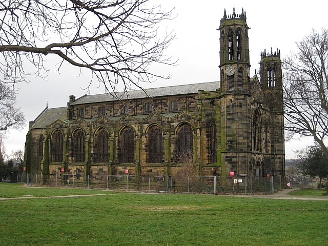
St Peter's Church, Stanley, West Yorkshire

St Peter's Church in Stanley, Wakefield, West Yorkshire, England was a Church of England church. The church opened in 1824, closed in 2001 and after falling...
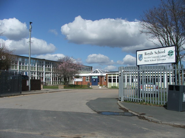
Oulton Academy

Oulton Academy (formerly Royds Academy, Royds School), founded in 1956, is a co-educational secondary school located in Leeds, West Yorkshire, England...

Bottom Boat

Bottom Boat is a village in the Wakefield district of West Yorkshire. In the 2011 United Kingdom census, its population was 1,169, and it was included...

Nearby Amenities

Located within 500m of 53.727664,-1.4726227
Motorway Junction
Rothwell Interchange
Ref: 30
Lat/Long: 53.7284114/-1.4658256
Power: tower
Lat/Long: 53.7237815/-1.4760699
Power: pole
Lat/Long: 53.7267146/-1.466137
Power: pole
Lat/Long: 53.7288491/-1.4669364
Power: pole
Lat/Long: 53.7277725/-1.466584
Power: pole
Lat/Long: 53.7294371/-1.46701
Power: pole
Lat/Long: 53.7309562/-1.4775117
Power: pole
Lat/Long: 53.7279092/-1.4763082
Power: pole
Lat/Long: 53.7299972/-1.4670374
Power: pole
Lat/Long: 53.7305089/-1.4774343
Power: pole
Lat/Long: 53.7298609/-1.4771783
Power: pole
Lat/Long: 53.7291672/-1.4768569
Power: pole
Lat/Long: 53.7273516/-1.4760703
Power: pole
Lat/Long: 53.7284699/-1.4765473
Power: pole
Lat/Long: 53.7305488/-1.4670822
Power: pole
Lat/Long: 53.725432/-1.4752008
Power: pole
Lat/Long: 53.7247222/-1.4753401
Power: pole
Lat/Long: 53.7242819/-1.476391
Power: pole
Lat/Long: 53.7267931/-1.4758366
Power: pole
Lat/Long: 53.7245685/-1.476364
Power: pole
Lat/Long: 53.7261225/-1.4755435
Power: pole
Lat/Long: 53.724193/-1.4772536
Access: foot
Barrier: stile
Foot: yes
Lat/Long: 53.7287053/-1.4697394
Access: foot
Barrier: stile
Foot: yes
Lat/Long: 53.7286247/-1.4714615
Animal Boarding
Royds Cat Hotel
Addr City: Leeds
Addr Postcode: LS26 8HH
Addr Street: Castle Gate
Animal Boarding: cat
Phone: +44 113 282 5984
Website: https://www.roydscathotel.co.uk/
Lat/Long: 53.7277132/-1.4697167
Power: pole
Lat/Long: 53.7250019/-1.4753137
The data included in this document is from www.openstreetmap.org. The data is made available under ODbL.

Have you been to Patrick Green?

Leave your review of Patrick Green below (or comments, questions and feedback).