Oaks Tye

Settlement in Suffolk Babergh

England

Oaks Tye

The ford at Kersey The River Brett crosses the main street of the village.
The ford at Kersey Credit: Jonathan Thacker

Oaks Tye is a small village located in the county of Suffolk, England. Situated approximately 10 miles northwest of the town of Ipswich, Oaks Tye is known for its picturesque rural setting and tranquil atmosphere. The village is surrounded by lush green fields, meadows, and woodlands, offering residents and visitors an idyllic countryside experience.

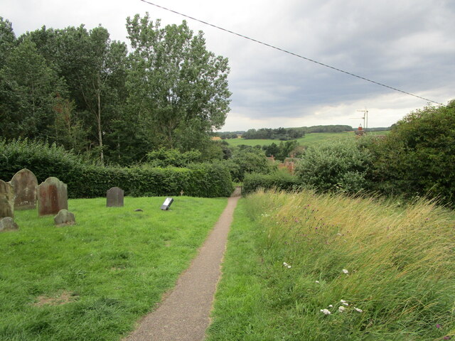
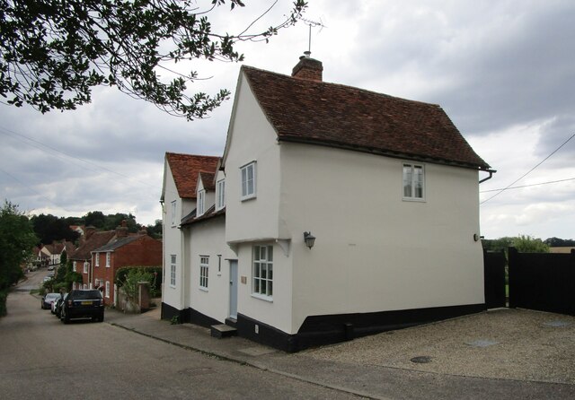
Despite its small size, Oaks Tye has a rich history dating back several centuries. The village is home to a number of historic buildings, including a 14th-century church, St. Peter's, which serves as a prominent landmark in the area. The church features beautiful stained glass windows and intricate architectural details.

In terms of amenities, Oaks Tye is relatively modest. The village is home to a local pub, The Oak Inn, which is a popular gathering spot for both locals and visitors. The pub offers a wide range of beverages and traditional British pub food.

Oaks Tye is also known for its strong sense of community. The village holds various events throughout the year, including summer fairs and Christmas markets, which bring residents together and create a friendly and welcoming atmosphere.

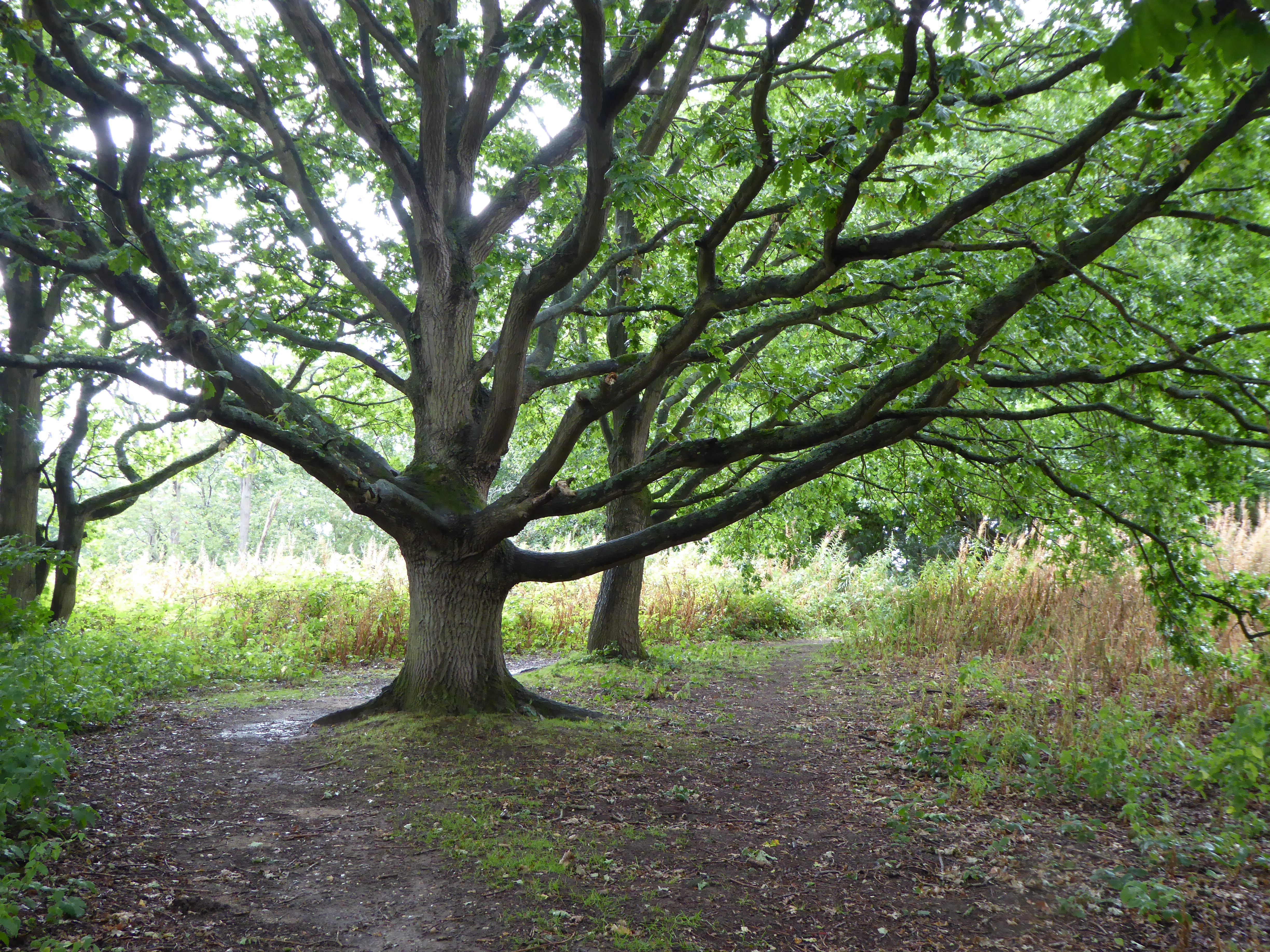
For those seeking outdoor activities, Oaks Tye offers plenty of opportunities for walking, cycling, and exploring the surrounding countryside. The village is located near several nature reserves and parks, providing ample space for outdoor enthusiasts to enjoy the natural beauty of Suffolk.

Overall, Oaks Tye is a charming village that offers a peaceful retreat from the hustle and bustle of city life. With its rich history, beautiful surroundings, and close-knit community, Oaks Tye is a hidden gem in the heart of Suffolk.

If you have any feedback on the listing, please let us know in the comments section below.

Oaks Tye Images

Images are sourced within 2km of 52.056705/0.92607076 or Grid Reference TM0043. Thanks to Geograph Open Source API. All images are credited.

The ford at Kersey The River Brett crosses the main street of the village.
The ford at Kersey
The River Brett crosses the main street of the village.
The churchyard at Kersey This churchyard has a numerous collection of iron grave markers of the early twentieth century. There were two local manufacturers of such markers - Hunt at the Atlas Works, Earls Colne, Essex and L Ward at Long Melford <span class="nowrap"><a title="https://industrial-archaeology.org/wp-content/uploads/2016/04/AIA-Bulletin-15-3-1988.pdf" rel="nofollow ugc noopener" href="https://industrial-archaeology.org/wp-content/uploads/2016/04/AIA-Bulletin-15-3-1988.pdf">Link</a><img style="margin-left:2px;" alt="External link" title="External link - shift click to open in new window" src="https://s1.geograph.org.uk/img/external.png" width="10" height="10"/></span>
The churchyard at Kersey
This churchyard has a numerous collection of iron grave markers of the early twentieth century. There were two local manufacturers of such markers - Hunt at the Atlas Works, Earls Colne, Essex and L Ward at Long Melford LinkExternal link
The Bell Inn, Kersey Dates from the fifteenth and sixteenth centuries <span class="nowrap"><a title="https://historicengland.org.uk/listing/the-list/list-entry/1285465?section=official-listing" rel="nofollow ugc noopener" href="https://historicengland.org.uk/listing/the-list/list-entry/1285465?section=official-listing">Link</a><img style="margin-left:2px;" alt="External link" title="External link - shift click to open in new window" src="https://s1.geograph.org.uk/img/external.png" width="10" height="10"/></span>
The Bell Inn, Kersey
Dates from the fifteenth and sixteenth centuries LinkExternal link
Carlton House, Kersey Datea from the sixteenth and seventeenth centuries <span class="nowrap"><a title="https://historicengland.org.uk/listing/the-list/list-entry/1037248?section=official-listing" rel="nofollow ugc noopener" href="https://historicengland.org.uk/listing/the-list/list-entry/1037248?section=official-listing">Link</a><img style="margin-left:2px;" alt="External link" title="External link - shift click to open in new window" src="https://s1.geograph.org.uk/img/external.png" width="10" height="10"/></span>
Carlton House, Kersey
Datea from the sixteenth and seventeenth centuries LinkExternal link
The River Brett at Kersey
River View, Kersey Of seventeenth century origin <span class="nowrap"><a title="https://historicengland.org.uk/listing/the-list/list-entry/1037234?section=official-listing" rel="nofollow ugc noopener" href="https://historicengland.org.uk/listing/the-list/list-entry/1037234?section=official-listing">Link</a><img style="margin-left:2px;" alt="External link" title="External link - shift click to open in new window" src="https://s1.geograph.org.uk/img/external.png" width="10" height="10"/></span>
River View, Kersey
Of seventeenth century origin LinkExternal link
Olde Drift House. Kersey Much altered house dating from the sixteenth century <span class="nowrap"><a title="https://historicengland.org.uk/listing/the-list/list-entry/1037235?section=official-listing" rel="nofollow ugc noopener" href="https://historicengland.org.uk/listing/the-list/list-entry/1037235?section=official-listing">Link</a><img style="margin-left:2px;" alt="External link" title="External link - shift click to open in new window" src="https://s1.geograph.org.uk/img/external.png" width="10" height="10"/></span>
Olde Drift House. Kersey
Much altered house dating from the sixteenth century LinkExternal link
7 Church Hill, Kersey Seventeenth century cottage <span class="nowrap"><a title="https://historicengland.org.uk/listing/the-list/list-entry/1037274?section=official-listing" rel="nofollow ugc noopener" href="https://historicengland.org.uk/listing/the-list/list-entry/1037274?section=official-listing">Link</a><img style="margin-left:2px;" alt="External link" title="External link - shift click to open in new window" src="https://s1.geograph.org.uk/img/external.png" width="10" height="10"/></span>
7 Church Hill, Kersey
Seventeenth century cottage LinkExternal link
Path and steps to the church, Kersey
Church Hill, Kersey
Church Hill, Kersey
St. Mary's church, Kersey The church largely dates from the fourteenth and fifteenth centuries <span class="nowrap"><a title="https://historicengland.org.uk/listing/the-list/list-entry/1351459?section=official-listing" rel="nofollow ugc noopener" href="https://historicengland.org.uk/listing/the-list/list-entry/1351459?section=official-listing">Link</a><img style="margin-left:2px;" alt="External link" title="External link - shift click to open in new window" src="https://s1.geograph.org.uk/img/external.png" width="10" height="10"/></span>
St. Mary's church, Kersey
The church largely dates from the fourteenth and fifteenth centuries LinkExternal link
Church Hill, Kersey
Church Hill, Kersey
Path through the churchyard, Kersey
The Little Manor, Kersey The oldest parts date to the fourteenth century <span class="nowrap"><a title="https://historicengland.org.uk/listing/the-list/list-entry/1351461?section=official-listing" rel="nofollow ugc noopener" href="https://historicengland.org.uk/listing/the-list/list-entry/1351461?section=official-listing">Link</a><img style="margin-left:2px;" alt="External link" title="External link - shift click to open in new window" src="https://s1.geograph.org.uk/img/external.png" width="10" height="10"/></span>
The Little Manor, Kersey
The oldest parts date to the fourteenth century LinkExternal link
Ley's House, Kersey A much altered timber framed house <span class="nowrap"><a title="https://historicengland.org.uk/listing/the-list/list-entry/1180354?section=official-listing" rel="nofollow ugc noopener" href="https://historicengland.org.uk/listing/the-list/list-entry/1180354?section=official-listing">Link</a><img style="margin-left:2px;" alt="External link" title="External link - shift click to open in new window" src="https://s1.geograph.org.uk/img/external.png" width="10" height="10"/></span>
Ley's House, Kersey
A much altered timber framed house LinkExternal link
The ford at Kersey With St Mary’s church beyond, at the summit of Church Hill.
The ford at Kersey
With St Mary’s church beyond, at the summit of Church Hill.
Church Hill The village of Kersey from near the summit.
Church Hill
The village of Kersey from near the summit.
Show me another place!

Oaks Tye is located at Grid Ref: TM0043 (Lat: 52.056705, Lng: 0.92607076)

Administrative County: Suffolk

District: Babergh

Police Authority: Suffolk

What 3 Words

///snacking.error.survived. Near Hadleigh, Suffolk

Nearby Locations

Oaks Tye Fenn's Grove

Related Wikis

Kersey, Suffolk

Kersey is a village and civil parish in the Babergh district in Suffolk, in the east of England. The main street has a ford across a stream. Its principal...

Kersey Priory

Kersey Priory was a priory in Kersey, Suffolk, England. It was founded before 1218 as a hospital dedicated St Mary the Blessed Virgin and St Anthony under...

Babergh District

Babergh District (pronounced , BAY-bə) is a local government district in Suffolk, England. Primarily a rural area, Babergh contains two towns of notable...

Broom Hill, Hadleigh

Broom Hill, Hadleigh is a 9.6 hectares (24 acres) Local Nature Reserve in Hadleigh in Suffolk. It is owned and managed by Babergh District Council.This...

Riverside Walk, Hadleigh

Riverside Walk is a 4.6-hectare Local Nature Reserve on the western outskirts of Hadleigh in Suffolk. It is owned and managed by Babergh District Council...

St Mary's Church, Hadleigh

St Mary's is an Anglican church in Hadleigh, Suffolk. It is an active parish church in the Diocese of St Edmundsbury and Ipswich and the archdeaconry of...

Hadleigh Town Hall

Hadleigh Town Hall, also referred to as the New Town Hall, is a municipal building in the Market Place in Hadleigh, Suffolk, England. The building, which...

Corn Exchange, Hadleigh

The Corn Exchange is a commercial building in the Market Place in Hadleigh, Suffolk, England. The structure, which currently accommodates a small business...

Nearby Amenities

Located within 500m of 52.056705,0.92607076
Post Box
Ref: IP7 1390
Lat/Long: 52.0550795/0.9206139
The data included in this document is from www.openstreetmap.org. The data is made available under ODbL.

Have you been to Oaks Tye?

Leave your review of Oaks Tye below (or comments, questions and feedback).