Nutclough

Settlement in Yorkshire

England

Nutclough

The Flying Saucer at Hebden Bridge Cafe and studio in old canal warehouse
The Flying Saucer at Hebden Bridge Credit: Raymond Knapman

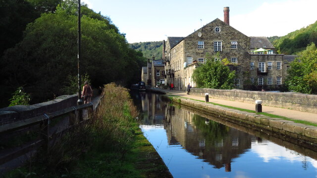
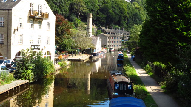
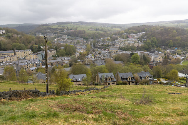
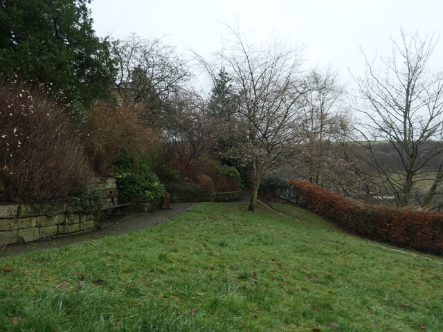
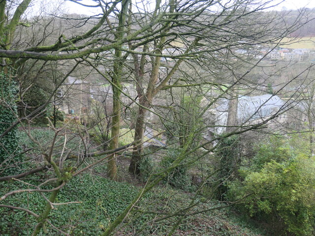
Nutclough is a picturesque village located in the metropolitan borough of Calderdale in West Yorkshire, England. Situated on the outskirts of Hebden Bridge, the village is nestled within the breathtaking countryside of the Upper Calder Valley. With its rolling hills, lush green fields, and charming stone houses, Nutclough offers a peaceful and idyllic setting.

The village is renowned for its natural beauty and is surrounded by dense woodland, making it a popular destination for outdoor enthusiasts and nature lovers. Nutclough also boasts a thriving local community and a strong sense of community spirit. The village has a small primary school, a local pub, and a community center that hosts various events and activities throughout the year.

One of the main attractions in Nutclough is the Nutclough Woods, a stunning woodland area that offers scenic walking trails and breathtaking views of the surrounding countryside. The woods are home to an array of wildlife, including birds, squirrels, and deer, making it a haven for nature enthusiasts and birdwatchers.

In addition to its natural beauty, Nutclough is also known for its rich history. The village has several historic buildings, including a 17th-century manor house and a medieval church, which add to its charm and character.

Overall, Nutclough is a hidden gem in the heart of Yorkshire, offering a tranquil escape from the hustle and bustle of city life. With its stunning scenery, strong community spirit, and rich history, Nutclough is a destination that truly captures the essence of Yorkshire's countryside.

If you have any feedback on the listing, please let us know in the comments section below.

Nutclough Images

Images are sourced within 2km of 53.745234/-2.0163234 or Grid Reference SD9927. Thanks to Geograph Open Source API. All images are credited.

The Flying Saucer at Hebden Bridge Cafe and studio in old canal warehouse
The Flying Saucer at Hebden Bridge
Cafe and studio in old canal warehouse
Northgate View along Northgate towards the main village
Northgate
View along Northgate towards the main village
From above the church tower Picture taken from my DJi Mini drone of the top of the church tower, the new graveyard just beyond, and in the far distance Whiteley Arches rail bridge in the green Calder Valley.
From above the church tower
Picture taken from my DJi Mini drone of the top of the church tower, the new graveyard just beyond, and in the far distance Whiteley Arches rail bridge in the green Calder Valley.
Whitehall Farm archway Archway marking the entrance to Whitehall Farm, inscribed on the lintel are the initials JB standing for John Bentley, once owner of the farm and the date of 1578..
Whitehall Farm archway
Archway marking the entrance to Whitehall Farm, inscribed on the lintel are the initials JB standing for John Bentley, once owner of the farm and the date of 1578..
View along the church roof A view along the roof of the church of St Thomas the Apostle, looking towards the village of Old town in the distance.
View along the church roof
A view along the roof of the church of St Thomas the Apostle, looking towards the village of Old town in the distance.
Heptonstall from Smeekin Hill Taken from the Smeekin Hill/Wadsworth war memorial looking across Hebden Dale towards Heptonstall and in the far distance the peace monument of Stoodley Pike Monument.
Heptonstall from Smeekin Hill
Taken from the Smeekin Hill/Wadsworth war memorial looking across Hebden Dale towards Heptonstall and in the far distance the peace monument of Stoodley Pike Monument.
Looking up the church tower Looking up the tower of the church of St Thomas the Apostle.
Looking up the church tower
Looking up the tower of the church of St Thomas the Apostle.
Halifax Road at Calderside View from rail line on Whiteley Arches
Halifax Road at Calderside
View from rail line on Whiteley Arches
Oakville Road at Calderside View from Rochdale to Leeds railway
Oakville Road at Calderside
View from Rochdale to Leeds railway
The aqueduct carrying the Rochdale Canal over the Calder at Hebden Bridge The Rochdale Canal runs for 33 miles between Manchester and Sowerby Bridge in West Yorkshire, UK. In Sowerby Bridge it connects with the Calder and Hebble Navigation. In Manchester it connects with the Ashton and Bridgewater Canals. 

The canal was opened between Sowerby Bridge and Todmorden and from Manchester to Rochdale in 1799 and between Todmorden and Rochdale in 1805. Most of the canal was closed in 1952. Restoration work began in late 1980s and by  1996 the canal was opened to navigation once again between Sowerby Bridge and the summit level. The canal was re-opened to navigation along its entire length in July 2002 and forms part of the South Pennine Ring. 

<span class="nowrap"><a title="http://www.penninewaterways.co.uk/rochdale/index.htm" rel="nofollow ugc noopener" href="http://www.penninewaterways.co.uk/rochdale/index.htm">Link</a><img style="margin-left:2px;" alt="External link" title="External link - shift click to open in new window" src="https://s1.geograph.org.uk/img/external.png" width="10" height="10"/></span>
The aqueduct carrying the Rochdale Canal over the Calder at Hebden Bridge
The Rochdale Canal runs for 33 miles between Manchester and Sowerby Bridge in West Yorkshire, UK. In Sowerby Bridge it connects with the Calder and Hebble Navigation. In Manchester it connects with the Ashton and Bridgewater Canals. The canal was opened between Sowerby Bridge and Todmorden and from Manchester to Rochdale in 1799 and between Todmorden and Rochdale in 1805. Most of the canal was closed in 1952. Restoration work began in late 1980s and by 1996 the canal was opened to navigation once again between Sowerby Bridge and the summit level. The canal was re-opened to navigation along its entire length in July 2002 and forms part of the South Pennine Ring. LinkExternal link
Seat at eastern end of Horsehold Wood & view over Calderside A seat with a view.
Seat at eastern end of Horsehold Wood & view over Calderside
A seat with a view.
View towards Hebden Bridge from eastern end of Horsehold Wood
Rochdale Canal at Hebden Bridge
Hebden Bridge viewed from hills to the south west
Warship adoption plaque, Hebden Bridge In the Memorial Gardens. "The plaque marks the adoption by Heben Bridge and Heptonstall of H.M.S. Bradford during Warship Week, 1942. It shows reliefs of the Old Bridge and Heptonstall's ruined Church." Quoted from 'Hebden Bridge Trail', published by Calder Civic Trust Ltd in 1979.
Warship adoption plaque, Hebden Bridge
In the Memorial Gardens. "The plaque marks the adoption by Heben Bridge and Heptonstall of H.M.S. Bradford during Warship Week, 1942. It shows reliefs of the Old Bridge and Heptonstall's ruined Church." Quoted from 'Hebden Bridge Trail', published by Calder Civic Trust Ltd in 1979.
Memorial garden, off Birchcliffe Road, Hebden Bridge A plaque in the north-western corner reads "This garden was opened on 8th June 1961 by Mrs P. K. Griffiths, of Maidenhead, and is the gift of Mrs Lilian Blackburn of Darlington, formerly of Hebden Bridge, in loving and treasured memory of her elder daughter, June Megan Blackburn, who died on 11th February 1932, aged 9 yaars".
Memorial garden, off Birchcliffe Road, Hebden Bridge
A plaque in the north-western corner reads "This garden was opened on 8th June 1961 by Mrs P. K. Griffiths, of Maidenhead, and is the gift of Mrs Lilian Blackburn of Darlington, formerly of Hebden Bridge, in loving and treasured memory of her elder daughter, June Megan Blackburn, who died on 11th February 1932, aged 9 yaars".
The western end of Common Bank Wood, Hebden Bridge High above Commercial Street, but far below Birchcliffe Road.
The western end of Common Bank Wood, Hebden Bridge
High above Commercial Street, but far below Birchcliffe Road.
Show me another place!

Nutclough is located at Grid Ref: SD9927 (Lat: 53.745234, Lng: -2.0163234)

Division: West Riding

Unitary Authority: Calderdale

Police Authority: West Yorkshire

What 3 Words

///lotteries.incline.clash. Near Hebden Bridge, West Yorkshire

Related Wikis

Hepton Rural District

Hepton was a rural district in the West Riding of Yorkshire, England, from 1894 to 1974. The district included four civil parishes: Heptonstall, Blackshaw...

Hebden Bridge Town Hall

Hebden Bridge Town Hall, formerly Hebden Bridge Council Offices, is a municipal building in St George's Street, Hebden Bridge, West Yorkshire, England...

Battle of Heptonstall

The Battle of Heptonstall occurred in November 1643 during the First English Civil War at Hebden Bridge and Heptonstall, Yorkshire. During the battle,...

Birchcliffe Baptist Church

Birchcliffe Baptist Church is a redundant Baptist chapel in the town of Hebden Bridge, West Yorkshire, England. It was founded by Daniel Taylor in 1764...

Nearby Amenities

Located within 500m of 53.745234,-2.0163234
Ele: 98.3
Lat/Long: 53.7411354/-2.0137686
Ele: 171.1
Lat/Long: 53.7442998/-2.0163558
Ele: 184.4
Lat/Long: 53.7463438/-2.0176495
Ele: 100.2
Lat/Long: 53.7413852/-2.0149368
Turning Circle
Lat/Long: 53.7464264/-2.0107193
Waterway: weir
Lat/Long: 53.7428876/-2.0120237
Crossing
Lat/Long: 53.7425389/-2.0170855
Heptonstall
Place: village
Population: 1400
Wikidata: Q2677260
Wikipedia: en:Heptonstall
Lat/Long: 53.748713/-2.0209069
Parking
Lat/Long: 53.7435053/-2.0176872
Brooklyn
Fixme: Fix location
Shop: car_repair
Lat/Long: 53.7441967/-2.0118844
Pub
The White Lion Hotel
Fixme: No trace of FHRS ID?
Image: https://www.geograph.org.uk/photo/6538124
Website: https://whitelionhotel.net/
Wheelchair: limited
Wikidata: Q26523252
Lat/Long: 53.7424275/-2.0118637
Fustian Knife Sculpture
Image: https://www.geograph.org.uk/photo/4108760
Tourism: artwork
Lat/Long: 53.7421549/-2.0124992
Shop: butcher
Lat/Long: 53.7415721/-2.0125053
Oasis
Addr City: Hebden Bridge
Addr Country: GB
Addr Housename: Carlton Chambers
Addr Housenumber: 4
Addr Postcode: HX7 8ER
Addr Street: Crown Street
Fhrs Id: 348801
Shop: convenience
Source Addr: FHRS Open Data
Lat/Long: 53.7416405/-2.0123681
One Stop
Addr City: Hebden Bridge
Addr Housenumber: 12
Addr Postcode: HX7 8EH
Addr Street: Crown Street
Brand: One Stop
Brand Wikidata: Q65954217
Contact Website: https://www.onestop.co.uk/store?store=05702165-5840-42e6-8e97-10b23fdb3e01
Fhrs Id: 1546416
Shop: convenience
Lat/Long: 53.7414966/-2.0125146
Fast Food
Crown Street Fisheries
Addr City: Hebden Bridge
Addr Housenumber: 6 - 8
Addr Postcode: HX7 8EH
Addr Street: Crown Street
Cuisine: fish_and_chips
Fhrs Id: 1547930
Source Addr: FHRS Open Data
Takeaway: yes
Lat/Long: 53.7412672/-2.0128473
Cafe
Coffee Cali
Addr City: Hebden Bridge
Addr Housenumber: 19
Addr Postcode: HX7 8EX
Addr Street: Bridge Gate
Contact Facebook: CoffeeCaliHB
Lat/Long: 53.7420606/-2.0129858
The Launderette
Self Service: yes
Shop: laundry
Lat/Long: 53.7421002/-2.0128881
Arts Centre
Salem Mill
Lat/Long: 53.7409979/-2.0166753
Bus Stop
HB12 Hollins Place
Bus: yes
Local Ref: 45018995
Naptan AtcoCode: 450018995
Naptan Bearing: N
Naptan CommonName: HB12 Hollins Place
Naptan Crossing: Crown Street
Naptan Indicator: Stop 45018995
Naptan PlusbusZoneRef: LEEDS
Naptan ShortCommonName: Crown Street
Naptan Street: Hollins Place
Naptan Verified: no
Public Transport: platform
Shelter: yes
Source: naptan_import
Lat/Long: 53.7420814/-2.0116596
Bus Stop
Keighley Road Lees Road
Bench: no
Bin: no
Bus: yes
Lit: yes
Local Ref: 45018996
Naptan AtcoCode: 450018996
Naptan Bearing: N
Naptan CommonName: Keighley Road Lees Road
Naptan Crossing: Lees Road
Naptan Indicator: Stop 45018996
Naptan Notes: OSR taken place 061005
Naptan PlusbusZoneRef: LEEDS
Naptan ShortCommonName: Lees Road
Naptan Street: Keighley Road
Naptan Verified: no
Public Transport: platform
Shelter: no
Source: naptan_import
Tactile Paving: no
Lat/Long: 53.7460724/-2.0097046
Bus Stop
Keighley Road Lee Mill Road
Bus: yes
Local Ref: 45018997
Naptan AtcoCode: 450018997
Naptan Bearing: NW
Naptan CommonName: Keighley Road Lee Mill Road
Naptan Crossing: Lee Mill Road
Naptan Indicator: Stop 45018997
Naptan Notes: OSR taken place 061005
Naptan PlusbusZoneRef: LEEDS
Naptan ShortCommonName: Lee Mill Road
Naptan Street: Keighley Road
Naptan Verified: no
Public Transport: platform
Source: naptan_import
Lat/Long: 53.7472498/-2.0109787
Bus Stop
Keighley Road
Local Ref: 45018998
Naptan AtcoCode: 450018998
Naptan Bearing: NW
Naptan CommonName: Keighley Road
Naptan Crossing: Midgehole Road
Naptan Indicator: Stop 45018998
Naptan PlusbusZoneRef: LEEDS
Naptan ShortCommonName: Midgehole Road
Naptan Street: Keighley Road
Naptan Verified: no
Source: naptan_import
Lat/Long: 53.7480676/-2.0117219
Bus Stop
HB15 Market Street
Bench: no
Bin: no
Bus: yes
Local Ref: 45019585
Naptan AtcoCode: 450019585
Naptan Bearing: E
Naptan CommonName: HB15 Market Street
Naptan Crossing: Salem Street
Naptan Indicator: Stop 45019585
Naptan Landmark: Co-op
Naptan PlusbusZoneRef: LEEDS
Naptan ShortCommonName: Salem Street
Naptan Street: Market Street
Naptan Verified: no
Public Transport: platform
Shelter: no
Source: naptan_import
Lat/Long: 53.7413618/-2.0168144
Bus Stop
HB14 Market Street
Bus: yes
Local Ref: 45019586
Naptan AtcoCode: 450019586
Naptan Bearing: W
Naptan CommonName: HB14 Market Street
Naptan Crossing: Salem Street
Naptan Indicator: Stop 45019586
Naptan Landmark: Co-op
Naptan PlusbusZoneRef: LEEDS
Naptan ShortCommonName: Salem Street
Naptan Street: Market Street
Naptan Verified: no
Public Transport: platform
Shelter: yes
Source: naptan_import
Lat/Long: 53.7411998/-2.0181031
Bus Stop
Market Street
Bus: yes
Local Ref: 45019589
Naptan AtcoCode: 450019589
Naptan Bearing: E
Naptan CommonName: Market Street
Naptan Crossing: Heptonstall Road
Naptan Indicator: Stop 45019589
Naptan PlusbusZoneRef: LEEDS
Naptan ShortCommonName: Market Street
Naptan Street: Market Street
Naptan Verified: no
Public Transport: platform
Shelter: no
Source: naptan_import
Lat/Long: 53.7418106/-2.0205444
Bus Stop
Heptonstall Road Queens Terrace
Bus: yes
Local Ref: 45019590
Naptan AtcoCode: 450019590
Naptan Bearing: NE
Naptan CommonName: Heptonstall Road Queens Terrace
Naptan Crossing: Queens Terrace
Naptan Indicator: Stop 45019590
Naptan Notes: L/C No Num
Naptan PlusbusZoneRef: LEEDS
Naptan ShortCommonName: Queens Terrace
Naptan Street: Heptonstall Road
Naptan Verified: no
Public Transport: platform
Shelter: no
Source: naptan_import
Lat/Long: 53.7423143/-2.0181339
Bus Stop
Heptonstall Road Lee Wood Road
Local Ref: 45019591
Naptan AtcoCode: 450019591
Naptan Bearing: S
Naptan CommonName: Heptonstall Road Lee Wood Road
Naptan Crossing: Lee Wood Road
Naptan Indicator: Stop 45019591
Naptan PlusbusZoneRef: LEEDS
Naptan ShortCommonName: Lee Wood Road
Naptan Street: Heptonstall Road
Naptan Verified: no
Shelter: no
Source: naptan_import
Lat/Long: 53.7440763/-2.0162242
Bus Stop
Heptonstall Road
Local Ref: 45019592
Naptan AtcoCode: 450019592
Naptan Bearing: NW
Naptan CommonName: Heptonstall Road
Naptan Crossing: Adj Valley View Road
Naptan Indicator: Stop 45019592
Naptan PlusbusZoneRef: LEEDS
Naptan ShortCommonName: Heptonstall Road
Naptan Street: Heptonstall Road
Naptan Verified: no
Shelter: no
Source: naptan_import
Lat/Long: 53.7476712/-2.0187428
Bus Stop
Southfield
Local Ref: 45019593
Naptan AtcoCode: 450019593
Naptan Bearing: NW
Naptan CommonName: Southfield
Naptan Crossing: Longfield
Naptan Indicator: Stop 45019593
Naptan PlusbusZoneRef: LEEDS
Naptan ShortCommonName: Southfield
Naptan Street: Southfield
Naptan Verified: no
Shelter: no
Source: naptan_import
Lat/Long: 53.7464844/-2.0212443
Bus Stop
Heptonstall Longfield
Bench: yes
Bin: yes
Bus: yes
Departures Board: timetable
Local Ref: 45019594
Naptan AtcoCode: 450019594
Naptan Bearing: SE
Naptan CommonName: Heptonstall Longfield
Naptan Crossing: Valley View Road
Naptan Indicator: Stop 45019594
Naptan PlusbusZoneRef: LEEDS
Naptan ShortCommonName: Longfield
Naptan Street: Longfield
Naptan Verified: no
Public Transport: platform
Shelter: yes
Source: naptan_import
Lat/Long: 53.7469071/-2.0198039
Bus Stop
Hepton Drive Longfield
Bus: yes
Local Ref: 45019595
Naptan AtcoCode: 450019595
Naptan Bearing: SW
Naptan CommonName: Hepton Drive Longfield
Naptan Crossing: Longfield
Naptan Indicator: Stop 45019595
Naptan PlusbusZoneRef: LEEDS
Naptan ShortCommonName: Hepton Drive
Naptan Street: Hepton Drive
Naptan Verified: no
Public Transport: platform
Shelter: no
Source: naptan_import
Lat/Long: 53.7482884/-2.020844
Bus Stop
Hepton Drive
Bench: yes
Bin: yes
Bus: yes
Departures Board: timetable
Ele: 257.2
Local Ref: 45019596
Naptan AtcoCode: 450019596
Naptan Bearing: N
Naptan CommonName: Hepton Drive
Naptan Crossing: Church Lane
Naptan Indicator: Stop 45019596
Naptan PlusbusZoneRef: LEEDS
Naptan ShortCommonName: Hepton Drive
Naptan Street: Hepton Drive
Naptan Verified: no
Public Transport: platform
Shelter: yes
Source: naptan_import
Lat/Long: 53.7484571/-2.0208817
Bus Stop
Heptonstall Smithwell Lane
Local Ref: 45019597
Naptan AtcoCode: 450019597
Naptan Bearing: W
Naptan CommonName: Heptonstall Smithwell Lane
Naptan Crossing: Church Lane
Naptan Indicator: Stop 45019597
Naptan Landmark: Post Office
Naptan PlusbusZoneRef: LEEDS
Naptan ShortCommonName: Church Lane
Naptan Street: Town Gate
Naptan Verified: no
Source: naptan_import
Lat/Long: 53.7487136/-2.0205023
Keighley Road Lee Mill Lane
Local Ref: 45025581
Naptan AtcoCode: 450025581
Naptan Bearing: SE
Naptan BusStopType: CUS
Naptan CommonName: Keighley Road Lee Mill Lane
Naptan Crossing: Lee Mill Lane
Naptan Indicator: Stop 45025581
Naptan PlusbusZoneRef: LEEDS
Naptan ShortCommonName: Lee Mill Lane
Naptan Street: Keighley Road
Naptan Verified: no
Source: naptan_import
Lat/Long: 53.7472947/-2.0108574
Keighley Road Lees Road
Local Ref: 45025582
Naptan AtcoCode: 450025582
Naptan Bearing: S
Naptan BusStopType: CUS
Naptan CommonName: Keighley Road Lees Road
Naptan Crossing: Lee Road
Naptan Indicator: Stop 45025582
Naptan PlusbusZoneRef: LEEDS
Naptan ShortCommonName: Lees Road
Naptan Street: Keighley Road
Naptan Verified: no
Source: naptan_import
Lat/Long: 53.7460005/-2.0095378
Birchcliffe Road
Local Ref: 45025584
Naptan AtcoCode: 450025584
Naptan Bearing: NE
Naptan BusStopType: CUS
Naptan CommonName: Birchcliffe Road
Naptan Crossing: Nr-At Eiffel Street
Naptan Indicator: Stop 45025584
Naptan PlusbusZoneRef: LEEDS
Naptan ShortCommonName: Eiffel Street
Naptan Street: Birchcliffe Road
Naptan Verified: no
Source: naptan_import
Lat/Long: 53.7436006/-2.0105683
Birchcliffe Road
Local Ref: 45025585
Naptan AtcoCode: 450025585
Naptan Bearing: SW
Naptan BusStopType: CUS
Naptan CommonName: Birchcliffe Road
Naptan Crossing: St Johns Close
Naptan Indicator: Stop 45025585
Naptan PlusbusZoneRef: LEEDS
Naptan ShortCommonName: St. Johns Close
Naptan Street: Birchcliffe Road
Naptan Verified: no
Source: naptan_import
Lat/Long: 53.7432769/-2.0108412
Bus Stop
Keighley Road
Bench: no
Bin: no
Bus: yes
Local Ref: 45025671
Naptan AtcoCode: 450025671
Naptan Bearing: NE
Naptan CommonName: Keighley Road
Naptan Crossing: Nr-At Foster Lane
Naptan Indicator: Stop 45025671
Naptan PlusbusZoneRef: LEEDS
Naptan ShortCommonName: Eiffel Buildings
Naptan Street: Keighley Road
Naptan Verified: no
Public Transport: platform
Shelter: no
Source: naptan_import
Lat/Long: 53.7438432/-2.0105229
Bus Stop
Keighley Road
Local Ref: 45025676
Naptan AtcoCode: 450025676
Naptan Bearing: SE
Naptan CommonName: Keighley Road
Naptan Crossing: Hurst Road
Naptan Indicator: Stop 45025676
Naptan PlusbusZoneRef: LEEDS
Naptan ShortCommonName: Hurst Road
Naptan Street: Keighley Road
Naptan Verified: no
Source: naptan_import
Lat/Long: 53.7481306/-2.0116158
Bus Stop
Heptonstall Road Lee Royd
Bus: yes
Local Ref: 45025752
Naptan AtcoCode: 450025752
Naptan Bearing: SW
Naptan CommonName: Heptonstall Road Lee Royd
Naptan Crossing: Lee Royd
Naptan Indicator: Stop 45025752
Naptan PlusbusZoneRef: LEEDS
Naptan ShortCommonName: Lee Royd
Naptan Street: Heptonstall Road
Naptan Verified: no
Public Transport: platform
Shelter: no
Source: naptan_import
Lat/Long: 53.7421885/-2.0183006
Bus Stop
Heptonstall Road Lee Wood Road
Local Ref: 45025753
Naptan AtcoCode: 450025753
Naptan Bearing: N
Naptan CommonName: Heptonstall Road Lee Wood Road
Naptan Crossing: Lee Wood Road
Naptan Indicator: Stop 45025753
Naptan PlusbusZoneRef: LEEDS
Naptan ShortCommonName: Lee Wood Road
Naptan Street: Heptonstall Road
Naptan Verified: no
Shelter: no
Source: naptan_import
Lat/Long: 53.7439594/-2.0163303
Bus Stop
Keighley Road Nutclough Road
Bus: yes
Local Ref: 45024963
Naptan AtcoCode: 450024963
Naptan Bearing: SW
Naptan CommonName: Keighley Road Nutclough Road
Naptan Crossing: Nutclough Road
Naptan Indicator: Stop 45024963
Naptan PlusbusZoneRef: LEEDS
Naptan ShortCommonName: Nutclough Road
Naptan Street: Keighley Road
Naptan Verified: no
Public Transport: platform
Source: naptan_import
Lat/Long: 53.744059/-2.0095829
Valley Road
Naptan AtcoCode: 450028731
Naptan Bearing: S
Naptan BusStopType: CUS
Naptan CommonName: Valley Road
Naptan Crossing: Regent Street
Naptan Landmark: Unknown
Naptan ShortCommonName: Valley Road
Naptan Street: Valley Road
Naptan Verified: no
Source: naptan_import
Lat/Long: 53.7434315/-2.0119243
Bus Stop
Market Street
Bench: no
Bin: no
Bus: yes
Local Ref: 45028043
Naptan AtcoCode: 450028043
Naptan Bearing: W
Naptan CommonName: Market Street
Naptan Crossing: Adj Fairfield Road
Naptan Indicator: Stop 45028043
Naptan Landmark: Unknown
Naptan PlusbusZoneRef: LEEDS
Naptan ShortCommonName: Market Street
Naptan Street: Market Street
Naptan Verified: no
Public Transport: platform
Shelter: no
Source: naptan_import
Lat/Long: 53.741335/-2.0155257
Heptonstall Road
Local Ref: 45050840
Naptan AtcoCode: 450050840
Naptan Bearing: SE
Naptan BusStopType: CUS
Naptan CommonName: Heptonstall Road
Naptan Indicator: Stop 45050840
Naptan PlusbusZoneRef: LEEDS
Naptan ShortCommonName: Valley View Road
Naptan Street: Heptonstall Road
Naptan Verified: no
Source: naptan_import
Lat/Long: 53.7477162/-2.0186367
Barrier: block
Lat/Long: 53.7434613/-2.0175297
Man Made: tower
Lat/Long: 53.7451452/-2.0207189
Bench
Ele: 182
Lat/Long: 53.7462608/-2.017463
Cafe
Towngate Tearoom
Addr City: Hebden Bridge
Addr Country: GB
Addr Hamlet: Heptonstall
Addr Housenumber: 34
Addr Postcode: HX7 7NB
Addr Street: Towngate
Fhrs Id: 347154
Source Addr: FHRS Open Data
Wheelchair: limited
Lat/Long: 53.7488212/-2.0204019
Tourism: guest_house
Lat/Long: 53.7443738/-2.0124255
Birchcliffe
Place: hamlet
Lat/Long: 53.7432258/-2.009967
The Bookcase
Addr City: Hebden Bridge
Addr Country: GB
Addr Housenumber: 29
Addr Postcode: HX7 6EU
Addr Street: Market Street
Check Date: 2023-12-23
Shop: books
Source: website
Website: https://www.bookcase.co.uk/
Lat/Long: 53.7412741/-2.0163655
Addr Housenumber: 1
Addr Street: Slater Avenue
Lat/Long: 53.7450322/-2.0142932
Addr Housenumber: 10
Addr Street: Slater Avenue
Lat/Long: 53.7455353/-2.0148194
Addr Housenumber: 14
Addr Street: Slater Avenue
Lat/Long: 53.745656/-2.0148586
Addr Housenumber: 15
Addr Street: Hangingroyd Lane
Lat/Long: 53.7434936/-2.0128342
Addr Housenumber: 2
Addr Street: Slater Avenue
Lat/Long: 53.7452892/-2.014733
Addr Housenumber: 37
Addr Street: Hangingroyd Lane
Lat/Long: 53.7439939/-2.0124696
Addr Housenumber: 5
Addr Street: Slater Avenue
Lat/Long: 53.7451715/-2.0142487
Addr Housenumber: 8
Addr Street: Slater Avenue
Lat/Long: 53.7454672/-2.0147932
Clock
Millenium Clock
Check Date: 2021-07-25
Image: https://www.geograph.org.uk/photo/1325319
Start Date: 2000
Support: wall_mounted
Lat/Long: 53.7425784/-2.0127416
Post Box
Collection Times: Mo-Fr 17:00; Sa 11:30
Operator: Royal Mail
Post Box Type: wall
Ref: HX7 167
Royal Cypher: EIIR
Royal Cypher Wikidata: Q33102113
Lat/Long: 53.7438847/-2.0123332
Ayup Digital
Addr City: Hebden Bridge
Addr Housename: Town Hall
Addr Postcode: HX7 7BY
Addr Street: St George's Street
Phone: +44 1422 400 120
Website: https://ayup.agency
Wheelchair: yes
Lat/Long: 53.7424608/-2.0132542
Thorncliffe
Addr City: Hebden Bridge
Addr Postcode: HX7 7BZ
Addr Street: Alexandra Road
Phone: +44 14 22 84 21 63
Tourism: guest_house
Website: http://www.thorncliffe.uk.net/
Lat/Long: 53.7432231/-2.0095977
The Attic B&B
Addr City: Hebden Bridge
Addr Housenumber: 23
Addr Postcode: HX7 6AS
Addr Street: Melbourne Street
Tourism: guest_house
Website: https://www.theatticbnb.co.uk/
Lat/Long: 53.7416158/-2.0178511
Cafe
Sauce
Addr City: Hebden Bridge
Addr Country: GB
Addr Housenumber: 4
Addr Postcode: HX7 8ET
Addr Street: St George's Square
Cuisine: sandwich
Fhrs Id: 346990
Fixme: Now Mijo's?
Source Addr: FHRS Open Data
Lat/Long: 53.7420164/-2.0125352
Pub
The Pub
Addr City: Hebden Bridge
Addr Housenumber: 3
Addr Postcode: HX7 8EX
Addr Street: The Courtyard
Contact Facebook: thepubhebden
Craft: brewery
Fixme: Has microbrewery gone?
Old Name: Calan's
Lat/Long: 53.7413965/-2.0133067
Shop: gift
Lat/Long: 53.7417604/-2.011526
Cafe
Square One Coffee Co.
Addr City: Hebden Bridge
Addr Housenumber: 19
Addr Postcode: HX7 8ET
Addr Street: Saint George's Square
Contact Facebook: SquareOneHebden
Cuisine: coffee_shop
Fhrs Id: 1546550
Lat/Long: 53.7420545/-2.0122093
Country Stores
Addr City: Hebden Bridge
Addr Housenumber: 11-13
Addr Postcode: HX7 8ET
Addr Street: Saint George's Square
Contact Facebook: piesandbutties
Fhrs Id: 1548148
Shop: deli
Lat/Long: 53.7421735/-2.0122737
Fat Face
Brand: Fat Face
Brand Wikidata: Q5437186
Brand Wikipedia: en:Fat Face
Shop: clothes
Lat/Long: 53.741658/-2.0132507
Post Box
Brand: Royal Mail
Brand Wikidata: Q638098
Brand Wikipedia: en:Royal Mail
Collection Times: Mo-Fr 09:00; Sa 07:00
Operator: Royal Mail
Operator Wikidata: Q638098
Post Box Type: wall
Ref: HX7 276D
Royal Cypher: EIIR
Royal Cypher Wikidata: Q33102113
Lat/Long: 53.7478956/-2.0211786
Telephone
Booth: K6
Covered: booth
Ele: 253.1
Listed Status: Grade II
Phone: +44 1422 843665
Lat/Long: 53.748622/-2.0208369
Generator Method: run-of-the-river
Generator Output Electricity: yes
Generator Source: hydro
Generator Type: hydrodynamic_screw
Power: generator
Lat/Long: 53.7425784/-2.0122638
The Egg Factory
Addr Unit: Unit 4
Description: Creative co-working space
Office: cooperative
Website: https://www.theeggfactory.co/
Lat/Long: 53.7458067/-2.0130636
Valley Organics
Addr City: Hebden Bridge
Addr Housenumber: 31
Addr Postcode: HX7 6EU
Addr Street: Market Street
Fhrs Id: 1548220
Opening Hours: Mo-Fr 10:00-18:00; Sa 09:30-17:30; Su,PH 11:30-16:30
Shop: health_food
Source Addr: FHRS Open Data
Lat/Long: 53.7412691/-2.0164868
Cafe
Humblest of Pleasures
Addr City: Hebden Bridge
Addr Country: GB
Addr Housenumber: 35
Addr Postcode: HX7 6EU
Addr Street: Market Street
Cuisine: british;breakfast
Diet Vegan: only
Diet Vegetarian: only
Fhrs Id: 1548322
Happycow Id: 96089
Lat/Long: 53.7412711/-2.0164285
Pub
Drink?
Addr City: Hebden Bridge
Addr Housenumber: 15
Addr Postcode: HX7 6EU
Addr Street: Market Street
Fhrs Id: 1546564
Shop: alcohol
Source Addr: FHRS Open Data
Lat/Long: 53.7413032/-2.0153689
The Menagerie
Shop: pet
Lat/Long: 53.7416031/-2.0145941
Cafe
Mooch Cafe-Bar
Addr City: Hebden Bridge
Addr Housenumber: 24
Addr Postcode: HX7 6AA
Addr Street: Market Street
Cuisine: coffee_shop
Fhrs Id: 1547810
Lat/Long: 53.7414156/-2.0163898
Peter David Properties
Addr City: Hebden Bridge
Addr Housenumber: 20
Addr Postcode: HX7 8EF
Addr Street: New Road
Office: estate_agent
Website: https://www.peterdavid.co.uk/
Lat/Long: 53.7411216/-2.0133512
Restaurant
blue
Addr City: Hebden Bridge
Addr Housenumber: 22
Addr Postcode: HX7 8EF
Addr Street: New Road
Contact Facebook: bluejsf
Cuisine: japanese
Fhrs Id: 1548419
Lat/Long: 53.74114/-2.0134211
Addr City: Hebden Bridge
Addr Housenumber: 8
Addr Postcode: HX7 8EX
Addr Street: Bridge Gate
Disused Shop: alcohol
Fhrs Id: 1546675
Old Name: Pennine Wine & Cheese
Lat/Long: 53.7413074/-2.0136055
Reeds Rains
Addr City: Hebden Bridge
Addr Housenumber: 10
Addr Postcode: HX7 8EX
Addr Street: Bridge Gate
Image: https://www.geograph.org.uk/photo/2583370
Office: estate_agent
Website: https://www.reedsrains.co.uk/estate-agent/hebden-bridge
Lat/Long: 53.7413445/-2.0135614
Restaurant
Nizza Pizza
Addr City: Hebden Bridge
Addr Housenumber: 4
Addr Postcode: HX7 7BN
Addr Street: Valley Road
Contact Facebook: nizzapizzahebden
Cuisine: italian;pizza
Fhrs Id: 1547197
Phone: +44 1422 649595
Lat/Long: 53.7429152/-2.0122718
Restaurant
La Perla Italian Restaurant
Addr City: Hebden Bridge
Addr Postcode: HX7 7DD
Addr Street: Hangingroyd Lane
Cuisine: italian;italian_pizza
Lat/Long: 53.7430605/-2.0131625
Silly Billy's
Shop: toys
Lat/Long: 53.7418621/-2.014016
Defibrillator
Access: yes
Defibrillator Location: outside post office Towngate, Heptonstall
Emergency: defibrillator
Indoor: no
Lat/Long: 53.7489039/-2.0206683
Access: no
Barrier: stile
Bicycle: no
Foot: yes
Horse: no
Material: stone
Motor Vehicle: no
Stile: squeezer
Lat/Long: 53.7463357/-2.0175917
Bench
Backrest: yes
Material: wood
Seats: 2
Lat/Long: 53.7485476/-2.0209512
Bench
Backrest: yes
Material: wood
Seats: 2
Lat/Long: 53.7486063/-2.0209929
Bench
Backrest: yes
Material: wood
Seats: 2
Lat/Long: 53.7486466/-2.0209684
Bench
Backrest: yes
Material: wood
Seats: 2
Lat/Long: 53.748712/-2.0208691
Crossing
Crossing: zebra
Crossing Island: no
Lat/Long: 53.7413494/-2.0159569
BROUG'S homeware & gifts
Addr City: Hebden Bridge
Addr Housenumber: 14
Addr Postcode: HX7 6AA
Addr Street: Market Street
Shop: gift
Website: https://www.brougs.shop/
Lat/Long: 53.7414243/-2.0159706
Post Box
Post Box Type: wall
Ref: HX7 183
Royal Cypher: EVIIR
Royal Cypher Wikidata: Q33102324
Lat/Long: 53.7458911/-2.0096087
Charging Station
Capacity: 1
Operator: Calderdale Council
Parking Fee: yes
Lat/Long: 53.7427385/-2.012871
Generator Method: photovoltaic
Generator Output Electricity: yes
Generator Source: solar
Generator Type: solar_photovoltaic_panel
Power: generator
Lat/Long: 53.7459865/-2.0122855
Generator Method: photovoltaic
Generator Output Electricity: yes
Generator Source: solar
Generator Type: solar_photovoltaic_panel
Power: generator
Lat/Long: 53.7454993/-2.0108085
Generator Method: photovoltaic
Generator Output Electricity: yes
Generator Source: solar
Generator Type: solar_photovoltaic_panel
Power: generator
Lat/Long: 53.7456343/-2.0105696
Generator Method: photovoltaic
Generator Output Electricity: yes
Generator Source: solar
Generator Type: solar_photovoltaic_panel
Power: generator
Lat/Long: 53.7455485/-2.0108704
Generator Method: photovoltaic
Generator Output Electricity: yes
Generator Source: solar
Generator Type: solar_photovoltaic_panel
Power: generator
Lat/Long: 53.7455883/-2.0109571
Generator Method: photovoltaic
Generator Output Electricity: yes
Generator Source: solar
Generator Type: solar_photovoltaic_panel
Power: generator
Lat/Long: 53.7409845/-2.0159975
Bus Stop
Bench: no
Bin: no
Bus: yes
Departures Board: timetable
Public Transport: platform
Shelter: no
Lat/Long: 53.7411435/-2.0175388
Crossing
Crossing: zebra
Crossing Island: no
Lat/Long: 53.741292/-2.0171951
Generator Method: photovoltaic
Generator Output Electricity: yes
Generator Source: solar
Generator Type: solar_photovoltaic_panel
Power: generator
Lat/Long: 53.7411547/-2.0147001
Public Bookcase
Booth: K6
Disused Amenity: telephone
Listed Status: Grade II
Man Made: telephone_box
Public Bookcase Type: phone_box
Lat/Long: 53.7419244/-2.0118911
Post Box
Brand: Royal Mail
Brand Wikidata: Q638098
Brand Wikipedia: en:Royal Mail
Collection Times: Mo-Fr 17:00; Sa 11:30; Su off
Operator: Royal Mail
Operator Wikidata: Q638098
Post Box Type: wall
Ref: HX7 196
Royal Cypher: EIIR
Royal Cypher Wikidata: Q33102113
Lat/Long: 53.741916/-2.0120214
Post Box
Brand: Royal Mail
Brand Wikidata: Q638098
Brand Wikipedia: en:Royal Mail
Collection Times: Mo-Fr 17:00; Sa 11:15
Operator: Royal Mail
Operator Wikidata: Q638098
Post Box Type: pillar
Ref: HX7 244
Royal Cypher: GR
Royal Cypher Wikidata: Q33102273
Lat/Long: 53.7413262/-2.0173419
Public Bookcase
Public Bookcase Type: wooden_cabinet
Lat/Long: 53.7469076/-2.0228464
Siren
Emergency: siren
Operator: Enivornment Agency
Siren Purpose: flooding
Siren Type: pneumatic
Lat/Long: 53.7426921/-2.0128613
Post Box
Brand: Royal Mail
Brand Wikidata: Q638098
Brand Wikipedia: en:Royal Mail
Collection Times: Mo-Fr 09:00; Sa 07:00
Operator: Royal Mail
Operator Wikidata: Q638098
Post Box Type: wall
Ref: HX7 176D
Royal Cypher: GR
Royal Cypher Wikidata: Q33102273
Lat/Long: 53.7422933/-2.0111662
Cafe
Innovation Cafe
Addr City: Hebden Bridge
Addr Postcode: HX7 8ET
Fhrs Id: 1547069
Outdoor Seating: yes
Website: http://www.innovationhebdenbridge.co.uk/innovation-cafe.php
Lat/Long: 53.742449/-2.0123665
Innovation
Shop: gift
Website: http://www.innovationhebdenbridge.co.uk/innovation-shop.php
Lat/Long: 53.7423721/-2.012475
Leisure: outdoor_seating
Lat/Long: 53.7421886/-2.0126904
Image: https://www.geograph.org.uk/photo/641699
Man Made: chimney
Lat/Long: 53.7424081/-2.0125717
The Only Way Is Melts
Addr City: Hebden Bridge
Addr Housenumber: 3
Addr Postcode: HX7 8EX
Addr Street: Bridge Gate
Shop: perfumery
Website: https://tracymelts.com/
Lat/Long: 53.7413278/-2.0139652
Disused Shop: yes
Old Name: William Holt
Lat/Long: 53.7412374/-2.0136693
Restaurant
The Olive Branch
Addr City: Hebden Bridge
Addr Housenumber: 21
Addr Postcode: HX7 8UQ
Addr Street: West End
Cuisine: turkish
Fhrs Id: 1547274
Website: https://theolivebranchrestaurants.com/hebden-bridge/
Lat/Long: 53.7411027/-2.0140821
Valli Hebden Bridge
Addr City: Hebden Bridge
Addr Housenumber: 1
Addr Postcode: HX7 8JN
Addr Street: Bridge Gate
Note: Postcode from CodePoint. Website gives 8EX
Operator: Valli
Shop: optician
Website: https://www.valliopticians.co.uk/practice/hebden-bridge
Lat/Long: 53.7412664/-2.0140785
James Shepherd
Addr City: Hebden Bridge
Addr Place: Pennine Industrial Park
Addr Postcode: HX7 7BZ
Addr Street: Valley Road
Addr Unit: Unit 5
Second Hand: only
Shop: car
Website: https://www.jamesshepherdlimited.co.uk/
Lat/Long: 53.7442387/-2.0108534
Addr City: Hebden Bridge
Addr Housename: Hawkstone House
Addr Housenumber: 2
Addr Postcode: HX7 7BL
Addr Street: Valley Road
Addr Unit: Unit 2
Healthcare: physiotherapist
Website: https://www.hbphysiotherapy.com/
Lat/Long: 53.7426215/-2.0126874
Covered: no
Leisure: picnic_table
Lat/Long: 53.7474832/-2.0138535
Bench
Backrest: yes
Inscription: Forever in our Hearts Thomas Livesey 1983-2020 Enjoy the moment, share the view in this place that Tom loved
Material: metal
Lat/Long: 53.7438412/-2.021097
Bench
Backrest: yes
Material: metal
Lat/Long: 53.7451645/-2.0225705
Cafe
The Dog Friendly Coffee Shop + Bakery
Lat/Long: 53.7411152/-2.0142393
Information: guidepost
Tourism: information
Lat/Long: 53.7487586/-2.020742
Information: board
Tourism: information
Lat/Long: 53.7487369/-2.0207599
Charging Station
Lat/Long: 53.7457788/-2.0205641
Defibrillator
Access: yes
Defibrillator Location: outside Hebden Bridge Town Hall - to right of main entrance on St George's Street
Emergency: defibrillator
Indoor: no
Lat/Long: 53.7425845/-2.0130535
Entrance: yes
Lat/Long: 53.7425702/-2.0129685
The data included in this document is from www.openstreetmap.org. The data is made available under ODbL.

Have you been to Nutclough?

Leave your review of Nutclough below (or comments, questions and feedback).