Joan Wood

Wood, Forest in Yorkshire

England

Joan Wood

The Flying Saucer at Hebden Bridge Cafe and studio in old canal warehouse
The Flying Saucer at Hebden Bridge Credit: Raymond Knapman

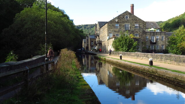
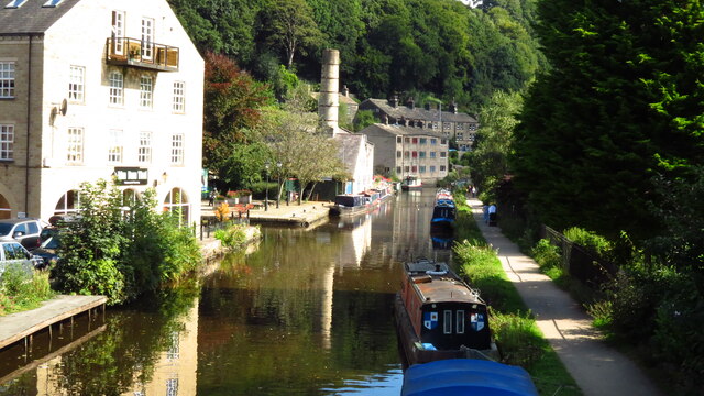
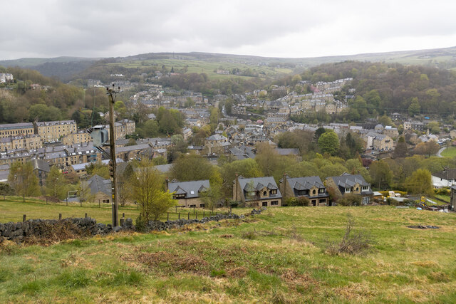
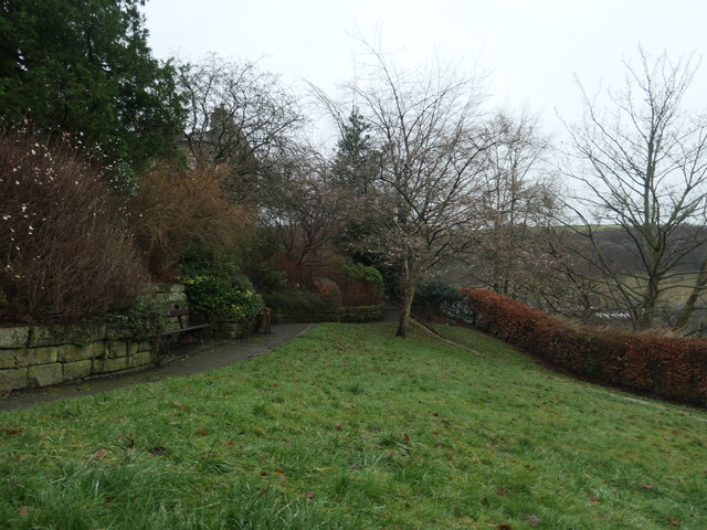
Joan Wood is a picturesque forest located in Yorkshire, England. Situated in the heart of the county, this enchanting woodland covers a vast area of approximately 500 acres. Joan Wood is renowned for its natural beauty, lush greenery, and diverse range of flora and fauna.

As visitors enter Joan Wood, they are immediately greeted by towering trees that create a sense of tranquility and serenity. The forest is predominantly made up of oak, beech, and birch trees, which provide a rich canopy, casting dappled sunlight onto the forest floor. The woodland is also home to various wildflowers, such as bluebells and primroses, which bloom in vibrant colors during the springtime, adding to the beauty of the surroundings.

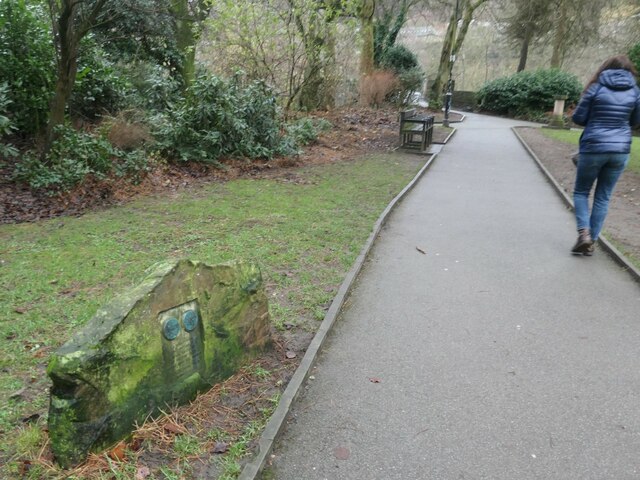
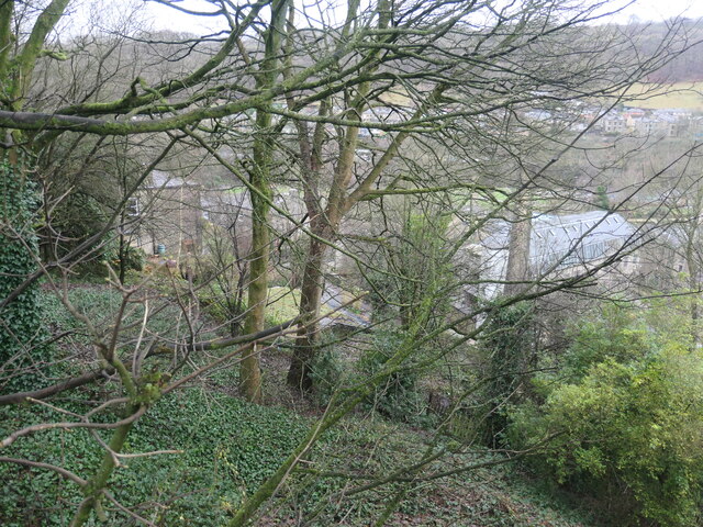
The forest is crisscrossed by numerous walking trails and footpaths, allowing visitors to explore its natural wonders at their own pace. These trails wind through the woodland, leading visitors to hidden glades, babbling brooks, and panoramic viewpoints that offer breathtaking vistas of the surrounding countryside.

Joan Wood is not only a haven for nature enthusiasts but also a sanctuary for a diverse range of wildlife. The forest is home to numerous species of birds, including woodpeckers, owls, and various songbirds. Squirrels, badgers, and rabbits can also be spotted in the forest, adding to the charm of the natural ecosystem.

Overall, Joan Wood is a captivating destination for those seeking solace in nature. Its enchanting woodland, diverse flora and fauna, and tranquil atmosphere make it a perfect escape from the bustling city life. Whether it is for a leisurely stroll, birdwatching, or simply appreciating the beauty of nature, Joan Wood offers an unforgettable experience for visitors of all ages.

If you have any feedback on the listing, please let us know in the comments section below.

Joan Wood Images

Images are sourced within 2km of 53.74643/-2.0088484 or Grid Reference SD9927. Thanks to Geograph Open Source API. All images are credited.

The Flying Saucer at Hebden Bridge Cafe and studio in old canal warehouse
The Flying Saucer at Hebden Bridge
Cafe and studio in old canal warehouse
Northgate View along Northgate towards the main village
Northgate
View along Northgate towards the main village
From above the church tower Picture taken from my DJi Mini drone of the top of the church tower, the new graveyard just beyond, and in the far distance Whiteley Arches rail bridge in the green Calder Valley.
From above the church tower
Picture taken from my DJi Mini drone of the top of the church tower, the new graveyard just beyond, and in the far distance Whiteley Arches rail bridge in the green Calder Valley.
Whitehall Farm archway Archway marking the entrance to Whitehall Farm, inscribed on the lintel are the initials JB standing for John Bentley, once owner of the farm and the date of 1578..
Whitehall Farm archway
Archway marking the entrance to Whitehall Farm, inscribed on the lintel are the initials JB standing for John Bentley, once owner of the farm and the date of 1578..
View along the church roof A view along the roof of the church of St Thomas the Apostle, looking towards the village of Old town in the distance.
View along the church roof
A view along the roof of the church of St Thomas the Apostle, looking towards the village of Old town in the distance.
Heptonstall from Smeekin Hill Taken from the Smeekin Hill/Wadsworth war memorial looking across Hebden Dale towards Heptonstall and in the far distance the peace monument of Stoodley Pike Monument.
Heptonstall from Smeekin Hill
Taken from the Smeekin Hill/Wadsworth war memorial looking across Hebden Dale towards Heptonstall and in the far distance the peace monument of Stoodley Pike Monument.
Looking up the church tower Looking up the tower of the church of St Thomas the Apostle.
Looking up the church tower
Looking up the tower of the church of St Thomas the Apostle.
Halifax Road at Calderside View from rail line on Whiteley Arches
Halifax Road at Calderside
View from rail line on Whiteley Arches
Oakville Road at Calderside View from Rochdale to Leeds railway
Oakville Road at Calderside
View from Rochdale to Leeds railway
The aqueduct carrying the Rochdale Canal over the Calder at Hebden Bridge The Rochdale Canal runs for 33 miles between Manchester and Sowerby Bridge in West Yorkshire, UK. In Sowerby Bridge it connects with the Calder and Hebble Navigation. In Manchester it connects with the Ashton and Bridgewater Canals. 

The canal was opened between Sowerby Bridge and Todmorden and from Manchester to Rochdale in 1799 and between Todmorden and Rochdale in 1805. Most of the canal was closed in 1952. Restoration work began in late 1980s and by  1996 the canal was opened to navigation once again between Sowerby Bridge and the summit level. The canal was re-opened to navigation along its entire length in July 2002 and forms part of the South Pennine Ring. 

<span class="nowrap"><a title="http://www.penninewaterways.co.uk/rochdale/index.htm" rel="nofollow ugc noopener" href="http://www.penninewaterways.co.uk/rochdale/index.htm">Link</a><img style="margin-left:2px;" alt="External link" title="External link - shift click to open in new window" src="https://s1.geograph.org.uk/img/external.png" width="10" height="10"/></span>
The aqueduct carrying the Rochdale Canal over the Calder at Hebden Bridge
The Rochdale Canal runs for 33 miles between Manchester and Sowerby Bridge in West Yorkshire, UK. In Sowerby Bridge it connects with the Calder and Hebble Navigation. In Manchester it connects with the Ashton and Bridgewater Canals. The canal was opened between Sowerby Bridge and Todmorden and from Manchester to Rochdale in 1799 and between Todmorden and Rochdale in 1805. Most of the canal was closed in 1952. Restoration work began in late 1980s and by 1996 the canal was opened to navigation once again between Sowerby Bridge and the summit level. The canal was re-opened to navigation along its entire length in July 2002 and forms part of the South Pennine Ring. LinkExternal link
Seat at eastern end of Horsehold Wood & view over Calderside A seat with a view.
Seat at eastern end of Horsehold Wood & view over Calderside
A seat with a view.
View towards Hebden Bridge from eastern end of Horsehold Wood
Rochdale Canal at Hebden Bridge
Hebden Bridge viewed from hills to the south west
Warship adoption plaque, Hebden Bridge In the Memorial Gardens. "The plaque marks the adoption by Heben Bridge and Heptonstall of H.M.S. Bradford during Warship Week, 1942. It shows reliefs of the Old Bridge and Heptonstall's ruined Church." Quoted from 'Hebden Bridge Trail', published by Calder Civic Trust Ltd in 1979.
Warship adoption plaque, Hebden Bridge
In the Memorial Gardens. "The plaque marks the adoption by Heben Bridge and Heptonstall of H.M.S. Bradford during Warship Week, 1942. It shows reliefs of the Old Bridge and Heptonstall's ruined Church." Quoted from 'Hebden Bridge Trail', published by Calder Civic Trust Ltd in 1979.
Memorial garden, off Birchcliffe Road, Hebden Bridge A plaque in the north-western corner reads "This garden was opened on 8th June 1961 by Mrs P. K. Griffiths, of Maidenhead, and is the gift of Mrs Lilian Blackburn of Darlington, formerly of Hebden Bridge, in loving and treasured memory of her elder daughter, June Megan Blackburn, who died on 11th February 1932, aged 9 yaars".
Memorial garden, off Birchcliffe Road, Hebden Bridge
A plaque in the north-western corner reads "This garden was opened on 8th June 1961 by Mrs P. K. Griffiths, of Maidenhead, and is the gift of Mrs Lilian Blackburn of Darlington, formerly of Hebden Bridge, in loving and treasured memory of her elder daughter, June Megan Blackburn, who died on 11th February 1932, aged 9 yaars".
The western end of Common Bank Wood, Hebden Bridge High above Commercial Street, but far below Birchcliffe Road.
The western end of Common Bank Wood, Hebden Bridge
High above Commercial Street, but far below Birchcliffe Road.
Show me another place!

Joan Wood is located at Grid Ref: SD9927 (Lat: 53.74643, Lng: -2.0088484)

Division: West Riding

Unitary Authority: Calderdale

Police Authority: West Yorkshire

What 3 Words

///corner.business.trifling. Near Hebden Bridge, West Yorkshire

Related Wikis

Birchcliffe Baptist Church

Birchcliffe Baptist Church is a redundant Baptist chapel in the town of Hebden Bridge, West Yorkshire, England. It was founded by Daniel Taylor in 1764...

Hebden Royd

Hebden Royd is a civil parish in the Metropolitan Borough of Calderdale in West Yorkshire, England. According to the 2001 census it had a population of...

Hebden Bridge

Hebden Bridge is a market town in the Calderdale district of West Yorkshire, England. It is in the Upper Calder Valley, 8 miles (13 km) west of Halifax...

Hebden Bridge Town Hall

Hebden Bridge Town Hall, formerly Hebden Bridge Council Offices, is a municipal building in St George's Street, Hebden Bridge, West Yorkshire, England...

Nearby Amenities

Located within 500m of 53.74643,-2.0088484
Turning Circle
Lat/Long: 53.7464264/-2.0107193
Waterway: weir
Lat/Long: 53.7428876/-2.0120237
Dodd Naze
Place: locality
Lat/Long: 53.742644/-2.0050169
Brooklyn
Fixme: Fix location
Shop: car_repair
Lat/Long: 53.7441967/-2.0118844
Pub
The White Lion Hotel
Fixme: No trace of FHRS ID?
Image: https://www.geograph.org.uk/photo/6538124
Website: https://whitelionhotel.net/
Wheelchair: limited
Wikidata: Q26523252
Lat/Long: 53.7424275/-2.0118637
Bus Stop
Birchcliffe Road
Bus: yes
Naptan AtcoCode: 450015867
Naptan Bearing: NW
Naptan CommonName: Birchcliffe Road
Naptan Landmark: Unknown
Naptan ShortCommonName: Birchcliffe Road
Naptan Street: Birchcliffe Road
Naptan Verified: no
Public Transport: platform
Source: naptan_import
Lat/Long: 53.7431872/-2.0093097
Bus Stop
Birchcliffe Road
Bus: yes
Naptan AtcoCode: 450015868
Naptan Bearing: SE
Naptan CommonName: Birchcliffe Road
Naptan Crossing: Sandygate
Naptan Landmark: Unknown
Naptan ShortCommonName: Birchcliffe Road
Naptan Street: Birchcliffe Road
Naptan Verified: no
Public Transport: platform
Source: naptan_import
Lat/Long: 53.7431872/-2.0091581
Bus Stop
Keighley Road Lees Road
Bench: no
Bin: no
Bus: yes
Lit: yes
Local Ref: 45018996
Naptan AtcoCode: 450018996
Naptan Bearing: N
Naptan CommonName: Keighley Road Lees Road
Naptan Crossing: Lees Road
Naptan Indicator: Stop 45018996
Naptan Notes: OSR taken place 061005
Naptan PlusbusZoneRef: LEEDS
Naptan ShortCommonName: Lees Road
Naptan Street: Keighley Road
Naptan Verified: no
Public Transport: platform
Shelter: no
Source: naptan_import
Tactile Paving: no
Lat/Long: 53.7460724/-2.0097046
Bus Stop
Keighley Road Lee Mill Road
Bus: yes
Local Ref: 45018997
Naptan AtcoCode: 450018997
Naptan Bearing: NW
Naptan CommonName: Keighley Road Lee Mill Road
Naptan Crossing: Lee Mill Road
Naptan Indicator: Stop 45018997
Naptan Notes: OSR taken place 061005
Naptan PlusbusZoneRef: LEEDS
Naptan ShortCommonName: Lee Mill Road
Naptan Street: Keighley Road
Naptan Verified: no
Public Transport: platform
Source: naptan_import
Lat/Long: 53.7472498/-2.0109787
Bus Stop
Keighley Road
Local Ref: 45018998
Naptan AtcoCode: 450018998
Naptan Bearing: NW
Naptan CommonName: Keighley Road
Naptan Crossing: Midgehole Road
Naptan Indicator: Stop 45018998
Naptan PlusbusZoneRef: LEEDS
Naptan ShortCommonName: Midgehole Road
Naptan Street: Keighley Road
Naptan Verified: no
Source: naptan_import
Lat/Long: 53.7480676/-2.0117219
Bus Stop
Midgehole Road
Local Ref: 45018999
Naptan AtcoCode: 450018999
Naptan Bearing: S
Naptan CommonName: Midgehole Road
Naptan Crossing: Nr-At Keighley Road
Naptan Indicator: Stop 45018999
Naptan PlusbusZoneRef: LEEDS
Naptan ShortCommonName: Hebden Grove
Naptan Street: Midgehole Road
Naptan Verified: no
Source: naptan_import
Lat/Long: 53.7502068/-2.012314
Bus Stop
Keighley Road
Local Ref: 45024091
Naptan AtcoCode: 450024091
Naptan Bearing: N
Naptan CommonName: Keighley Road
Naptan Crossing: Nr-At Midgehole Road (0.2km towards Pecket Well)
Naptan Indicator: Stop 45024091
Naptan Notes: OSR taken place 051005
Naptan PlusbusZoneRef: LEEDS
Naptan ShortCommonName: Midgehole Road
Naptan Street: Keighley Road
Naptan Verified: no
Source: naptan_import
Lat/Long: 53.7502069/-2.0115557
Keighley Road Lee Mill Lane
Local Ref: 45025581
Naptan AtcoCode: 450025581
Naptan Bearing: SE
Naptan BusStopType: CUS
Naptan CommonName: Keighley Road Lee Mill Lane
Naptan Crossing: Lee Mill Lane
Naptan Indicator: Stop 45025581
Naptan PlusbusZoneRef: LEEDS
Naptan ShortCommonName: Lee Mill Lane
Naptan Street: Keighley Road
Naptan Verified: no
Source: naptan_import
Lat/Long: 53.7472947/-2.0108574
Keighley Road Lees Road
Local Ref: 45025582
Naptan AtcoCode: 450025582
Naptan Bearing: S
Naptan BusStopType: CUS
Naptan CommonName: Keighley Road Lees Road
Naptan Crossing: Lee Road
Naptan Indicator: Stop 45025582
Naptan PlusbusZoneRef: LEEDS
Naptan ShortCommonName: Lees Road
Naptan Street: Keighley Road
Naptan Verified: no
Source: naptan_import
Lat/Long: 53.7460005/-2.0095378
Birchcliffe Road
Local Ref: 45025584
Naptan AtcoCode: 450025584
Naptan Bearing: NE
Naptan BusStopType: CUS
Naptan CommonName: Birchcliffe Road
Naptan Crossing: Nr-At Eiffel Street
Naptan Indicator: Stop 45025584
Naptan PlusbusZoneRef: LEEDS
Naptan ShortCommonName: Eiffel Street
Naptan Street: Birchcliffe Road
Naptan Verified: no
Source: naptan_import
Lat/Long: 53.7436006/-2.0105683
Birchcliffe Road
Local Ref: 45025585
Naptan AtcoCode: 450025585
Naptan Bearing: SW
Naptan BusStopType: CUS
Naptan CommonName: Birchcliffe Road
Naptan Crossing: St Johns Close
Naptan Indicator: Stop 45025585
Naptan PlusbusZoneRef: LEEDS
Naptan ShortCommonName: St. Johns Close
Naptan Street: Birchcliffe Road
Naptan Verified: no
Source: naptan_import
Lat/Long: 53.7432769/-2.0108412
Bus Stop
Keighley Road
Bench: no
Bin: no
Bus: yes
Local Ref: 45025671
Naptan AtcoCode: 450025671
Naptan Bearing: NE
Naptan CommonName: Keighley Road
Naptan Crossing: Nr-At Foster Lane
Naptan Indicator: Stop 45025671
Naptan PlusbusZoneRef: LEEDS
Naptan ShortCommonName: Eiffel Buildings
Naptan Street: Keighley Road
Naptan Verified: no
Public Transport: platform
Shelter: no
Source: naptan_import
Lat/Long: 53.7438432/-2.0105229
Bus Stop
Keighley Road
Local Ref: 45025676
Naptan AtcoCode: 450025676
Naptan Bearing: SE
Naptan CommonName: Keighley Road
Naptan Crossing: Hurst Road
Naptan Indicator: Stop 45025676
Naptan PlusbusZoneRef: LEEDS
Naptan ShortCommonName: Hurst Road
Naptan Street: Keighley Road
Naptan Verified: no
Source: naptan_import
Lat/Long: 53.7481306/-2.0116158
Birchcliffe Road Sandy Gate
Local Ref: 45024663
Naptan AtcoCode: 450024663
Naptan Bearing: SE
Naptan BusStopType: CUS
Naptan CommonName: Birchcliffe Road Sandy Gate
Naptan Crossing: Sandy Gate
Naptan Indicator: Stop 45024663
Naptan PlusbusZoneRef: LEEDS
Naptan ShortCommonName: Sandy Gate
Naptan Street: Birchcliffe Road
Naptan Verified: no
Source: naptan_import
Lat/Long: 53.7427378/-2.0087941
Bus Stop
Keighley Road Nutclough Road
Bus: yes
Local Ref: 45024963
Naptan AtcoCode: 450024963
Naptan Bearing: SW
Naptan CommonName: Keighley Road Nutclough Road
Naptan Crossing: Nutclough Road
Naptan Indicator: Stop 45024963
Naptan PlusbusZoneRef: LEEDS
Naptan ShortCommonName: Nutclough Road
Naptan Street: Keighley Road
Naptan Verified: no
Public Transport: platform
Source: naptan_import
Lat/Long: 53.744059/-2.0095829
Valley Road
Naptan AtcoCode: 450028731
Naptan Bearing: S
Naptan BusStopType: CUS
Naptan CommonName: Valley Road
Naptan Crossing: Regent Street
Naptan Landmark: Unknown
Naptan ShortCommonName: Valley Road
Naptan Street: Valley Road
Naptan Verified: no
Source: naptan_import
Lat/Long: 53.7434315/-2.0119243
Midgehole Road
Local Ref: 45050729
Naptan AtcoCode: 450050729
Naptan Bearing: N
Naptan BusStopType: CUS
Naptan CommonName: Midgehole Road
Naptan Indicator: Stop 45050729
Naptan PlusbusZoneRef: LEEDS
Naptan ShortCommonName: Hebden Grove
Naptan Street: Midgehole Road
Naptan Verified: no
Source: naptan_import
Lat/Long: 53.7502068/-2.0123898
Keighley Road
Local Ref: 45051386
Naptan AtcoCode: 450051386
Naptan Bearing: S
Naptan BusStopType: CUS
Naptan CommonName: Keighley Road
Naptan Indicator: Stop 45051386
Naptan PlusbusZoneRef: LEEDS
Naptan ShortCommonName: Boston Hill Wood
Naptan Street: Keighley Road
Naptan Verified: no
Source: naptan_import
Lat/Long: 53.7501889/-2.0114344
Tourism: guest_house
Lat/Long: 53.7443738/-2.0124255
Birchcliffe
Place: hamlet
Lat/Long: 53.7432258/-2.009967
Addr Housenumber: 1
Addr Street: Slater Avenue
Lat/Long: 53.7450322/-2.0142932
Addr Housenumber: 10
Addr Street: Slater Avenue
Lat/Long: 53.7455353/-2.0148194
Addr Housenumber: 14
Addr Street: Slater Avenue
Lat/Long: 53.745656/-2.0148586
Addr Housenumber: 15
Addr Street: Hangingroyd Lane
Lat/Long: 53.7434936/-2.0128342
Addr Housenumber: 2
Addr Street: Slater Avenue
Lat/Long: 53.7452892/-2.014733
Addr Housenumber: 37
Addr Street: Hangingroyd Lane
Lat/Long: 53.7439939/-2.0124696
Addr Housenumber: 5
Addr Street: Slater Avenue
Lat/Long: 53.7451715/-2.0142487
Addr Housenumber: 8
Addr Street: Slater Avenue
Lat/Long: 53.7454672/-2.0147932
Clock
Millenium Clock
Check Date: 2021-07-25
Image: https://www.geograph.org.uk/photo/1325319
Start Date: 2000
Support: wall_mounted
Lat/Long: 53.7425784/-2.0127416
Post Box
Collection Times: Mo-Fr 17:00; Sa 11:30
Operator: Royal Mail
Post Box Type: wall
Ref: HX7 167
Royal Cypher: EIIR
Royal Cypher Wikidata: Q33102113
Lat/Long: 53.7438847/-2.0123332
Thorncliffe
Addr City: Hebden Bridge
Addr Postcode: HX7 7BZ
Addr Street: Alexandra Road
Phone: +44 14 22 84 21 63
Tourism: guest_house
Website: http://www.thorncliffe.uk.net/
Lat/Long: 53.7432231/-2.0095977
Entrance: yes
Lat/Long: 53.7435861/-2.0083991
Generator Method: run-of-the-river
Generator Output Electricity: yes
Generator Source: hydro
Generator Type: hydrodynamic_screw
Power: generator
Lat/Long: 53.7425784/-2.0122638
The Egg Factory
Addr Unit: Unit 4
Description: Creative co-working space
Office: cooperative
Website: https://www.theeggfactory.co/
Lat/Long: 53.7458067/-2.0130636
Restaurant
Nizza Pizza
Addr City: Hebden Bridge
Addr Housenumber: 4
Addr Postcode: HX7 7BN
Addr Street: Valley Road
Contact Facebook: nizzapizzahebden
Cuisine: italian;pizza
Fhrs Id: 1547197
Phone: +44 1422 649595
Lat/Long: 53.7429152/-2.0122718
Restaurant
La Perla Italian Restaurant
Addr City: Hebden Bridge
Addr Postcode: HX7 7DD
Addr Street: Hangingroyd Lane
Cuisine: italian;italian_pizza
Lat/Long: 53.7430605/-2.0131625
Post Box
Post Box Type: wall
Ref: HX7 183
Royal Cypher: EVIIR
Royal Cypher Wikidata: Q33102324
Lat/Long: 53.7458911/-2.0096087
Charging Station
Capacity: 1
Operator: Calderdale Council
Parking Fee: yes
Lat/Long: 53.7427385/-2.012871
Generator Method: photovoltaic
Generator Output Electricity: yes
Generator Source: solar
Generator Type: solar_photovoltaic_panel
Power: generator
Lat/Long: 53.7459865/-2.0122855
Generator Method: photovoltaic
Generator Output Electricity: yes
Generator Source: solar
Generator Type: solar_photovoltaic_panel
Power: generator
Lat/Long: 53.7454993/-2.0108085
Generator Method: photovoltaic
Generator Output Electricity: yes
Generator Source: solar
Generator Type: solar_photovoltaic_panel
Power: generator
Lat/Long: 53.7456343/-2.0105696
Generator Method: photovoltaic
Generator Output Electricity: yes
Generator Source: solar
Generator Type: solar_photovoltaic_panel
Power: generator
Lat/Long: 53.7455485/-2.0108704
Generator Method: photovoltaic
Generator Output Electricity: yes
Generator Source: solar
Generator Type: solar_photovoltaic_panel
Power: generator
Lat/Long: 53.7455883/-2.0109571
Barrier: stile
Lat/Long: 53.7472142/-2.006388
Post Box
Brand: Royal Mail
Brand Wikidata: Q638098
Brand Wikipedia: en:Royal Mail
Collection Times: Mo-Fr 09:00; Sa 07:00
Operator: Royal Mail
Operator Wikidata: Q638098
Post Box Type: wall
Ref: HX7 291D
Royal Cypher: EIIR
Royal Cypher Wikidata: Q33102113
Lat/Long: 53.7428206/-2.0090136
Siren
Emergency: siren
Operator: Enivornment Agency
Siren Purpose: flooding
Siren Type: pneumatic
Lat/Long: 53.7426921/-2.0128613
Post Box
Brand: Royal Mail
Brand Wikidata: Q638098
Brand Wikipedia: en:Royal Mail
Collection Times: Mo-Fr 09:00; Sa 07:00
Operator: Royal Mail
Operator Wikidata: Q638098
Post Box Type: wall
Ref: HX7 176D
Royal Cypher: GR
Royal Cypher Wikidata: Q33102273
Lat/Long: 53.7422933/-2.0111662
Cafe
Innovation Cafe
Addr City: Hebden Bridge
Addr Postcode: HX7 8ET
Fhrs Id: 1547069
Outdoor Seating: yes
Website: http://www.innovationhebdenbridge.co.uk/innovation-cafe.php
Lat/Long: 53.742449/-2.0123665
James Shepherd
Addr City: Hebden Bridge
Addr Place: Pennine Industrial Park
Addr Postcode: HX7 7BZ
Addr Street: Valley Road
Addr Unit: Unit 5
Second Hand: only
Shop: car
Website: https://www.jamesshepherdlimited.co.uk/
Lat/Long: 53.7442387/-2.0108534
Addr City: Hebden Bridge
Addr Housename: Hawkstone House
Addr Housenumber: 2
Addr Postcode: HX7 7BL
Addr Street: Valley Road
Addr Unit: Unit 2
Healthcare: physiotherapist
Website: https://www.hbphysiotherapy.com/
Lat/Long: 53.7426215/-2.0126874
Covered: no
Leisure: picnic_table
Lat/Long: 53.7474832/-2.0138535
The data included in this document is from www.openstreetmap.org. The data is made available under ODbL.

Have you been to Joan Wood?

Leave your review of Joan Wood below (or comments, questions and feedback).