Beesby

Settlement in Lincolnshire East Lindsey

England

Beesby

Old military installations at Strubby: aerial 2022
Old military installations at Strubby: aerial 2022 Credit: Simon Tomson

Beesby is a small village located in the East Lindsey district of Lincolnshire, England. Situated approximately 6 miles northeast of the market town of Louth, Beesby is a picturesque rural settlement with a population of around 150 residents.

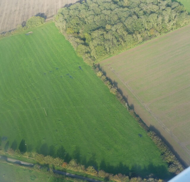
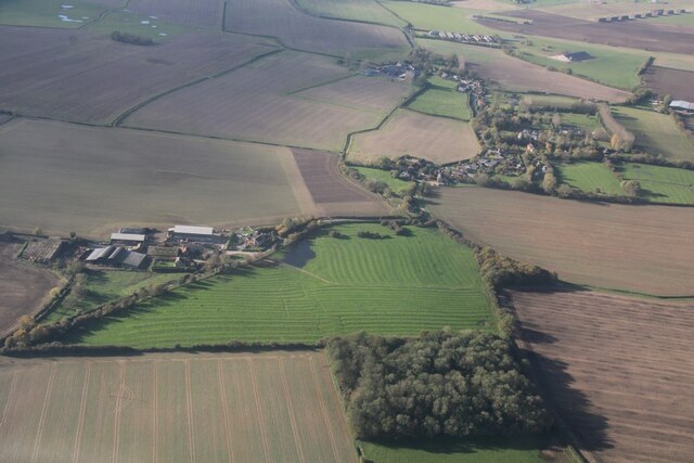
The village is known for its charming and idyllic setting, surrounded by rolling hills, farmland, and the scenic beauty of the Lincolnshire Wolds, an Area of Outstanding Natural Beauty. It offers a peaceful and tranquil environment, making it an attractive destination for nature lovers and those seeking a quieter way of life.

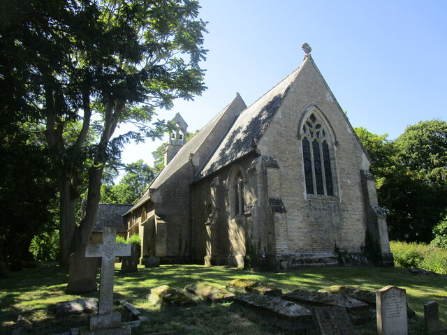
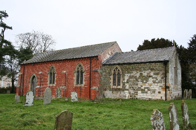
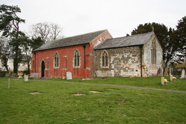
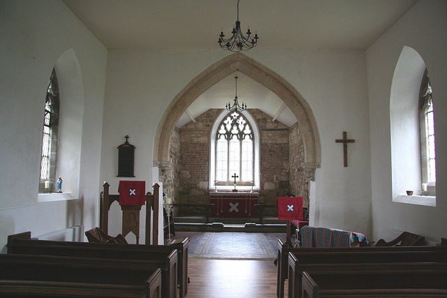
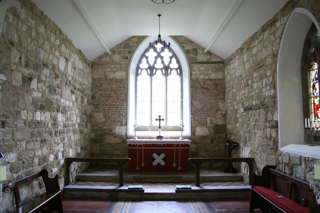
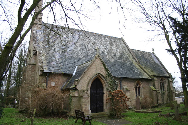
Beesby is home to a handful of traditional stone-built houses, many of which date back several hundred years, showcasing the village's rich history and heritage. The St. Andrew's Church, a Grade II listed building, is a prominent feature in the village, serving as a reminder of its medieval origins.

Despite its small size, Beesby benefits from its close proximity to nearby towns and amenities. Louth, the nearest town, offers a range of services including shops, schools, medical facilities, and leisure activities. The village also benefits from good transportation links, with regular bus services connecting it to surrounding areas.

The community in Beesby is close-knit and friendly, with a strong sense of community spirit. The village organizes various events and activities throughout the year, fostering a sense of togetherness among its residents.

Overall, Beesby is a charming village that offers a peaceful retreat in the heart of the Lincolnshire countryside while still providing access to essential amenities. Its natural beauty and historical charm make it a desirable place to live or visit.

If you have any feedback on the listing, please let us know in the comments section below.
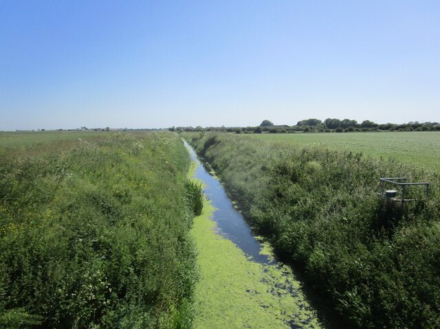
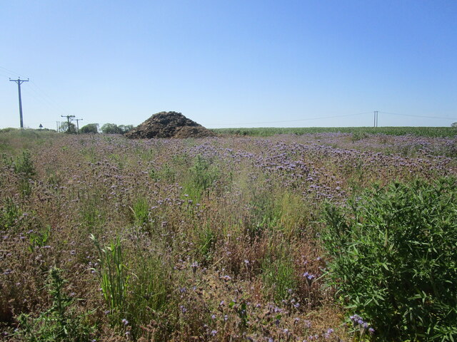
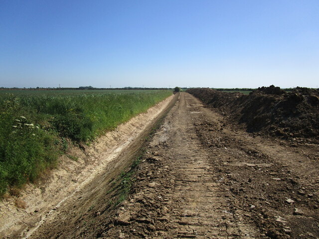
Beesby Images

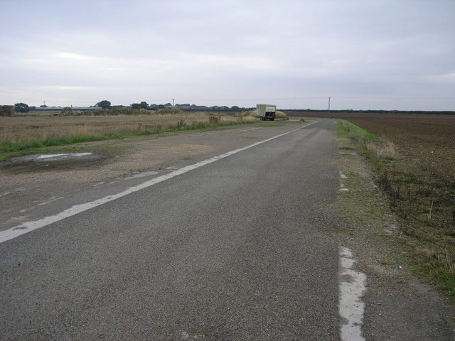
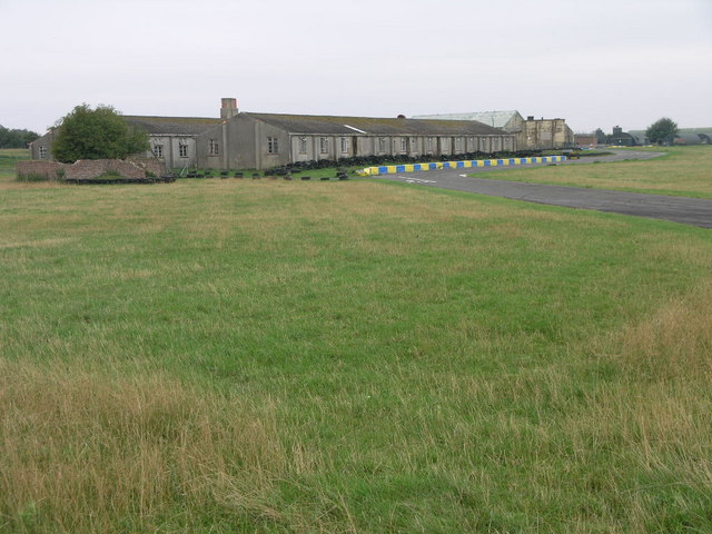
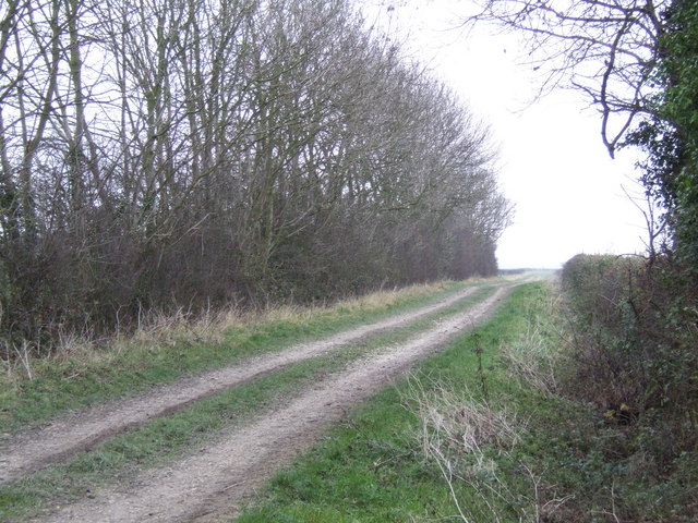
Images are sourced within 2km of 53.29817/0.19588 or Grid Reference TF4680. Thanks to Geograph Open Source API. All images are credited.

Old military installations at Strubby: aerial 2022
Wold Grift Drain Drains a large area between Alford and the sea.
Wold Grift Drain
Drains a large area between Alford and the sea.
Phacelia near Saleby Usually grown as a cover crop/green manure.
Phacelia near Saleby
Usually grown as a cover crop/green manure.
Newly cleared drain off Mill Lane, Saleby
St Margaret's church, Saleby Built in 1850 <span class="nowrap"><a title="https://historicengland.org.uk/listing/the-list/list-entry/1063011?section=official-list-entry" rel="nofollow ugc noopener" href="https://historicengland.org.uk/listing/the-list/list-entry/1063011?section=official-list-entry">Link</a><img style="margin-left:2px;" alt="External link" title="External link - shift click to open in new window" src="https://s1.geograph.org.uk/img/external.png" width="10" height="10"/></span> and designed by Stephen Lewin <span class="nowrap"><a title="https://en.wikipedia.org/wiki/Stephen_Lewin" rel="nofollow ugc noopener" href="https://en.wikipedia.org/wiki/Stephen_Lewin">Link</a><img style="margin-left:2px;" alt="External link" title="External link - shift click to open in new window" src="https://s1.geograph.org.uk/img/external.png" width="10" height="10"/></span>
St Margaret's church, Saleby
Built in 1850 LinkExternal link and designed by Stephen Lewin LinkExternal link
Ridge and furrow near Beesby in the Marsh: aerial 2023
Ridge and furrow, Beesby in the Marsh: aerial 2023
All Saints' church, Maltby le Marsh, Lincs. A splendid medieval church in a very sorry state of disrepair ! A wide nave c1300 with classic Y tracery windows, a short chancel and Perpendicular tower. Now redundant, without its fittings and permanently closed due to safety issues. A shameless fate for a wonderful church.
All Saints' church, Maltby le Marsh, Lincs.
A splendid medieval church in a very sorry state of disrepair ! A wide nave c1300 with classic Y tracery windows, a short chancel and Perpendicular tower. Now redundant, without its fittings and permanently closed due to safety issues. A shameless fate for a wonderful church.
St.Andrew's church, Beesby, Lincs. A curious marriage of vibrant red brick and stone. The chancel looks 13th century but much restored, but the 1841 rebuilding of the nave uses brick on the south side and stone on the north.
St.Andrew's church, Beesby, Lincs.
A curious marriage of vibrant red brick and stone. The chancel looks 13th century but much restored, but the 1841 rebuilding of the nave uses brick on the south side and stone on the north.
Perimeter Bridleway This bridleway leading to Manor Farm follows the old perimeter road of the former RAF Strubby airfield.  This bridleway was probably created around the airfield since the siting of the runways removed a road which linked the same two points as the bridleway.
Perimeter Bridleway
This bridleway leading to Manor Farm follows the old perimeter road of the former RAF Strubby airfield. This bridleway was probably created around the airfield since the siting of the runways removed a road which linked the same two points as the bridleway.
Strubby Airfield These buildings appear to date from the 1940s when Strubby was an operational RAF base.
Strubby Airfield
These buildings appear to date from the 1940s when Strubby was an operational RAF base.
Field and Hangar The bump on the horizon is the roof of an old aircraft hangar on the former RAF Strubby airfield.
Field and Hangar
The bump on the horizon is the roof of an old aircraft hangar on the former RAF Strubby airfield.
The Turks Head
The Turks Head
Marsh Lane To the east of Maltby le Marsh, the lane passes a sail-less windmill.
Marsh Lane
To the east of Maltby le Marsh, the lane passes a sail-less windmill.
Old Mill House B&B - showing the property from the A1104 Old Mill House takes its name from the flour mill and the milling business that were the origins of our buildings.  Although long since disused and even with the sails removed, the Grade II Listed mill tower still dominates the property.

The Maltby le Marsh Mill was built by Saundersons of Louth in 1841. It was worked by wind until 1952 and then by engine for a few more years. 

Like many mills in Lincolnshire its ironware was removed for scrap at the end of its working life. The sails and ogee cap were removed at the same time. The mill stones were taken out in 1978 for use in other mills. All that remains now of the mill's machinery is a large, wooden, drive shaft. 

Originally four patent sails drove three pairs of French stones. A pair of early stones can still be seen on the site. A replica cap was fitted in the 1980s as a means of weather proofing the tower.

In recent years some of the buildings have been renovated and the property supports a small Bed & Breakfast business.
Old Mill House B&B - showing the property from the A1104
Old Mill House takes its name from the flour mill and the milling business that were the origins of our buildings. Although long since disused and even with the sails removed, the Grade II Listed mill tower still dominates the property. The Maltby le Marsh Mill was built by Saundersons of Louth in 1841. It was worked by wind until 1952 and then by engine for a few more years. Like many mills in Lincolnshire its ironware was removed for scrap at the end of its working life. The sails and ogee cap were removed at the same time. The mill stones were taken out in 1978 for use in other mills. All that remains now of the mill's machinery is a large, wooden, drive shaft. Originally four patent sails drove three pairs of French stones. A pair of early stones can still be seen on the site. A replica cap was fitted in the 1980s as a means of weather proofing the tower. In recent years some of the buildings have been renovated and the property supports a small Bed & Breakfast business.
St.Andrew's church A remarkable transformation from neglected church <a title="https://www.geograph.org.uk/photo/108099" href="https://www.geograph.org.uk/photo/108099">Link</a> to community building
St.Andrew's church is now a parish room as well as a place of worship and has an optimistic future
St.Andrew's church
A remarkable transformation from neglected church Link to community building St.Andrew's church is now a parish room as well as a place of worship and has an optimistic future
St.Andrew's nave The nave is now multi-purpose space for the parishioners of Beesby, the pews are to be replaced by chairs soon. The chancel arch is 13th century.
St.Andrew's nave
The nave is now multi-purpose space for the parishioners of Beesby, the pews are to be replaced by chairs soon. The chancel arch is 13th century.
St.Andrew's chancel Recently stripped of plaster to reveal much-restored 13th century masonry
St.Andrew's chancel
Recently stripped of plaster to reveal much-restored 13th century masonry
Show me another place!

Beesby is located at Grid Ref: TF4680 (Lat: 53.29817, Lng: 0.19588)

Division: Parts of Lindsey

Administrative County: Lincolnshire

District: East Lindsey

Police Authority: Lincolnshire

What 3 Words

///backs.partly.keen. Near Alford, Lincolnshire

Nearby Locations

Beesby

Related Wikis

Beesby with Saleby

Beesby with Saleby is a civil parish in the East Lindsey district of Lincolnshire, England. It includes Beesby and Saleby. According to the 2001 Census...

Maltby le Marsh

Maltby le Marsh is a village and civil parish in the East Lindsey district of Lincolnshire, England. The village is situated between Alford and Mablethorpe...

Saleby

Saleby is a village in the civil parish of Beesby with Saleby, in the East Lindsey district of Lincolnshire, England. It is on the Alford road to Louth...
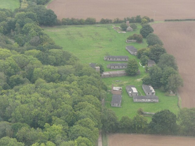
RAF Strubby

Royal Air Force Strubby or more simply RAF Strubby is a former Royal Air Force station 2.9 miles (4.7 km) north of Alford, Lincolnshire, and 8.6 miles...

Nearby Amenities

Located within 500m of 53.29817,0.19588
Beesby
Place: hamlet
Source: Bing
Lat/Long: 53.2984529/0.1951147
Note: Name?
Place: farm
Source: Bing
Lat/Long: 53.2973298/0.1890389
The data included in this document is from www.openstreetmap.org. The data is made available under ODbL.

Have you been to Beesby?

Leave your review of Beesby below (or comments, questions and feedback).