North Ella

Settlement in Yorkshire

England

North Ella

North Lodge, De La Pole Hospital One of a pair of lodges at the Willerby Low Road entrance to the former psychiatric hospital. The lodge is neatly bisected by the TA03 gridline, so is in two squares.
North Lodge, De La Pole Hospital Credit: Paul Harrop

North Ella is a small village situated in the East Riding of Yorkshire, England. It is located approximately 8 miles west of the city of Kingston upon Hull and is part of the civil parish of Welton. The village is nestled in the picturesque Yorkshire Wolds, surrounded by beautiful countryside and rolling hills.

Historically, North Ella has been an agricultural community, with farming playing a significant role in the local economy. The village itself is small and quaint, characterized by its charming cottages and traditional architecture. It has a close-knit community, with a population of around 200 residents.

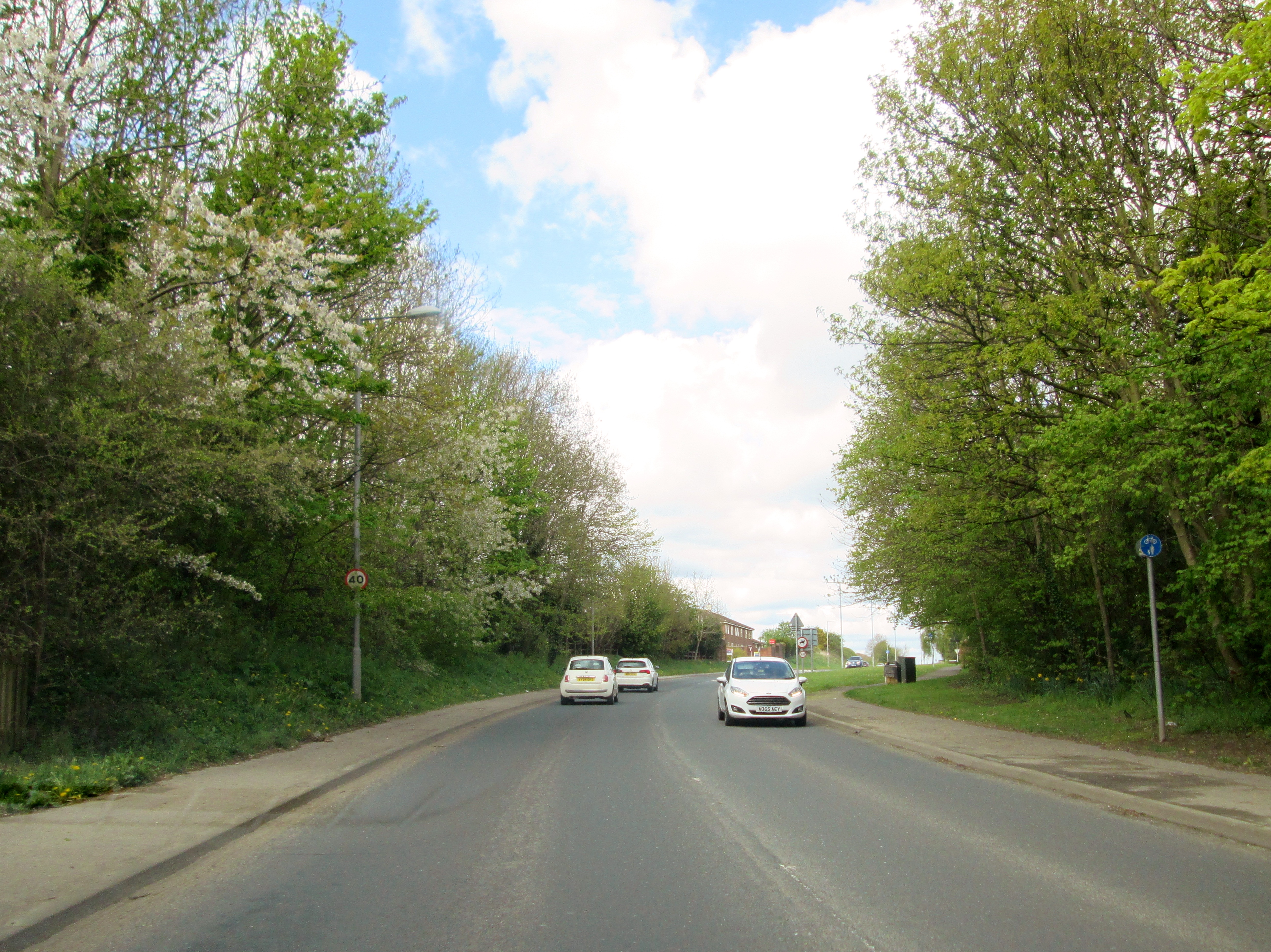
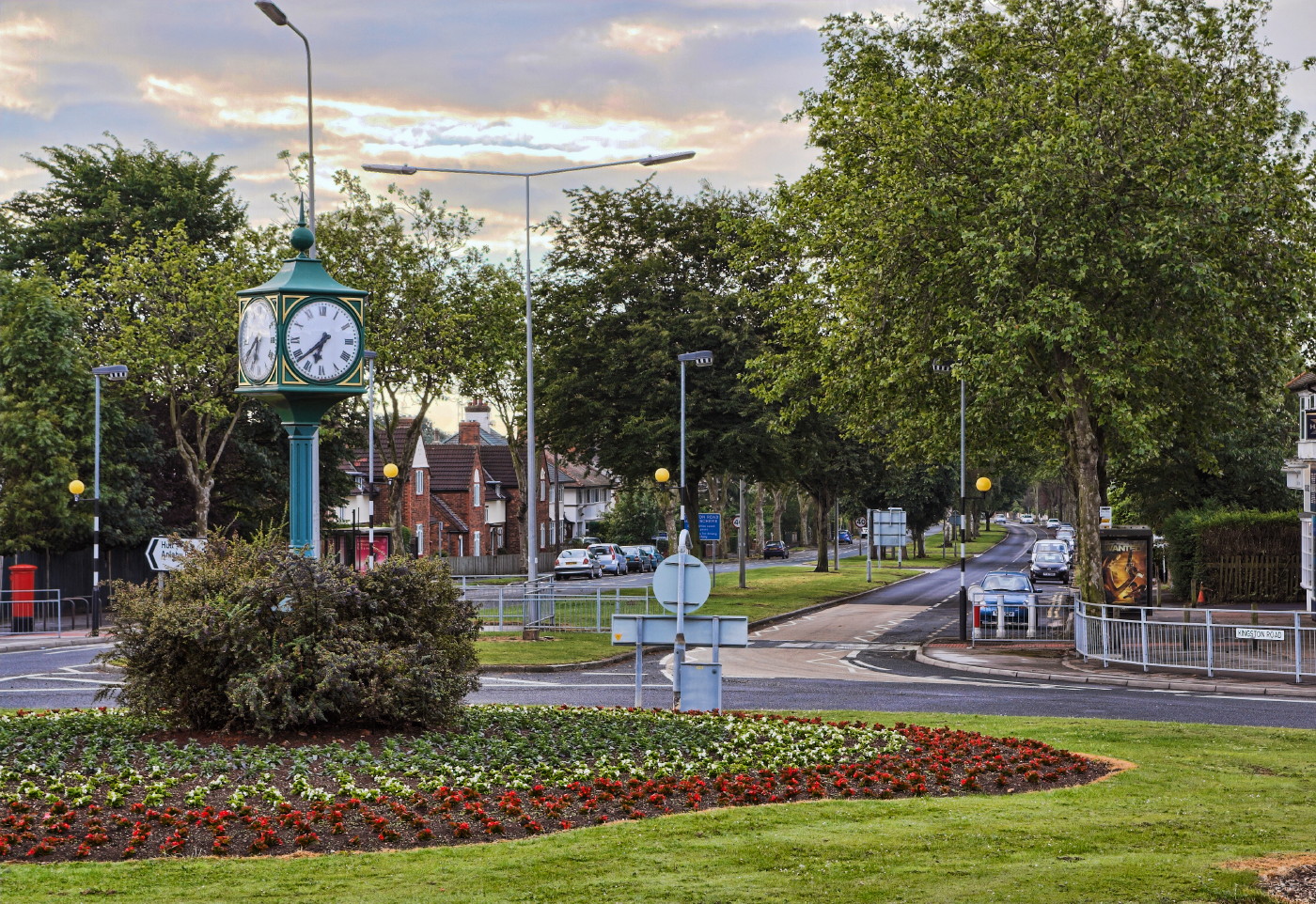
The village is well-connected, with good transport links to nearby towns and cities. The A63 road runs close by, providing easy access to Hull and other major cities in the region. Additionally, there are regular bus services connecting North Ella to surrounding areas.

Despite its small size, North Ella boasts a number of amenities for its residents. The village has a primary school, providing education for children in the local area. There is also a church, offering religious services and community events.

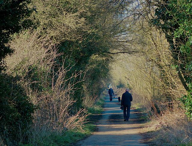
For outdoor enthusiasts, North Ella is surrounded by beautiful countryside, offering ample opportunities for walking, hiking, and exploring nature. The Yorkshire Wolds Way, a long-distance footpath, passes close to the village, attracting walkers and nature lovers from far and wide.

Overall, North Ella is a charming and peaceful village, perfect for those seeking a tranquil rural setting with easy access to nearby urban areas.

If you have any feedback on the listing, please let us know in the comments section below.

North Ella Images

Images are sourced within 2km of 53.758276/-0.43925 or Grid Reference TA0230. Thanks to Geograph Open Source API. All images are credited.

North Lodge, De La Pole Hospital One of a pair of lodges at the Willerby Low Road entrance to the former psychiatric hospital. The lodge is neatly bisected by the TA03 gridline, so is in two squares.
North Lodge, De La Pole Hospital
One of a pair of lodges at the Willerby Low Road entrance to the former psychiatric hospital. The lodge is neatly bisected by the TA03 gridline, so is in two squares.
Trees and power lines, near Willerby The view east across fields next to Willerby Low Road
Trees and power lines, near Willerby
The view east across fields next to Willerby Low Road
New build housing, Cottingham Houses at the western end of the Persimmon Homes development off Castle Road. Cottingham's recent and ongoing expansion has tended to be, like this, on higher ground to the west of the settlement. I imagine this is partly because of flood risk on lower land, but also because development to the east or south would mean the 'village' effectively merging with Hull.

Persimmon Homes was, in 2018, granted planning permission for these 180 homes on 20 acres of surplus farmland opposite Castle Hill Hospital, which it bought from Hull & East Yorkshire NHS Trust.
New build housing, Cottingham
Houses at the western end of the Persimmon Homes development off Castle Road. Cottingham's recent and ongoing expansion has tended to be, like this, on higher ground to the west of the settlement. I imagine this is partly because of flood risk on lower land, but also because development to the east or south would mean the 'village' effectively merging with Hull. Persimmon Homes was, in 2018, granted planning permission for these 180 homes on 20 acres of surplus farmland opposite Castle Hill Hospital, which it bought from Hull & East Yorkshire NHS Trust.
Taylor Avenue, Cottingham Houses at the eastern end of the Persimmon Homes development off Castle Road, near to its boundary at Willerby Low Road. Cottingham's recent and ongoing expansion has tended to be, like this, on higher ground to the west of the settlement. I imagine this is partly because of flood risk on lower land, but also because development to the east or south would mean the 'village' effectively merging with Hull.

Persimmon Homes was, in 2018, granted planning permission for these 180 homes on 20 acres of surplus farmland opposite Castle Hill Hospital, which it bought from Hull & East Yorkshire NHS Trust.
Taylor Avenue, Cottingham
Houses at the eastern end of the Persimmon Homes development off Castle Road, near to its boundary at Willerby Low Road. Cottingham's recent and ongoing expansion has tended to be, like this, on higher ground to the west of the settlement. I imagine this is partly because of flood risk on lower land, but also because development to the east or south would mean the 'village' effectively merging with Hull. Persimmon Homes was, in 2018, granted planning permission for these 180 homes on 20 acres of surplus farmland opposite Castle Hill Hospital, which it bought from Hull & East Yorkshire NHS Trust.
Wheatley Drive, Cottingham Houses on the Persimmon Homes development off Castle Road. Cottingham's recent and ongoing expansion has tended to be, like this, on higher ground to the west of the settlement. I imagine this is partly because of flood risk on lower land, but also because development to the east or south would mean the 'village' effectively merging with Hull.

Persimmon Homes was, in 2018, granted planning permission for these 180 homes on 20 acres of surplus farmland opposite Castle Hill Hospital, which it bought from Hull & East Yorkshire NHS Trust.
Wheatley Drive, Cottingham
Houses on the Persimmon Homes development off Castle Road. Cottingham's recent and ongoing expansion has tended to be, like this, on higher ground to the west of the settlement. I imagine this is partly because of flood risk on lower land, but also because development to the east or south would mean the 'village' effectively merging with Hull. Persimmon Homes was, in 2018, granted planning permission for these 180 homes on 20 acres of surplus farmland opposite Castle Hill Hospital, which it bought from Hull & East Yorkshire NHS Trust.
New Costa, Willerby Drive-through coffee shop next to the Willerby Business Park at Castle Hill. Along with an adjacent Burger King restaurant, it opened in October 2021 in the grounds of the <a href="https://www.geograph.org.uk/photo/508481">TA0231 : Total Fitness health club</a>
New Costa, Willerby
Drive-through coffee shop next to the Willerby Business Park at Castle Hill. Along with an adjacent Burger King restaurant, it opened in October 2021 in the grounds of the TA0231 : Total Fitness health club
Hand car wash, Willerby Car wash by Grange Park Lane, at the northern end of the Willerby Shopping Park, behind the Sewell 'On the Go' filling station. Of the several hand car wash businesses in and around Hull, this is one of the more upmarket, catering here mainly, but not exclusively, for Mercedes owners with personalised number plates. It is well sited to cater for shoppers leaving the adjacent branch of Waitrose.
Hand car wash, Willerby
Car wash by Grange Park Lane, at the northern end of the Willerby Shopping Park, behind the Sewell 'On the Go' filling station. Of the several hand car wash businesses in and around Hull, this is one of the more upmarket, catering here mainly, but not exclusively, for Mercedes owners with personalised number plates. It is well sited to cater for shoppers leaving the adjacent branch of Waitrose.
Hand finishing, Willerby car wash Workers at the business shown at <a href="https://www.geograph.org.uk/photo/7108709">TA0231 : Hand car wash, Willerby</a> by Grange Park Lane, at the northern end of the Willerby Shopping Park, behind the Sewell 'On the Go' filling station. Having passed through the covered area, cars are then rinsed and dried by hand.
Hand finishing, Willerby car wash
Workers at the business shown at TA0231 : Hand car wash, Willerby by Grange Park Lane, at the northern end of the Willerby Shopping Park, behind the Sewell 'On the Go' filling station. Having passed through the covered area, cars are then rinsed and dried by hand.
Horse at Willerby Tethered horse in a field next to the car park of the Mercure Hull Grange Park Hotel. These horses are often seen on fields and river banks etc in the area, and generally belong to travellers. Although there are a couple of traveller sites not far away, these horses are some distance from either.
Horse at Willerby
Tethered horse in a field next to the car park of the Mercure Hull Grange Park Hotel. These horses are often seen on fields and river banks etc in the area, and generally belong to travellers. Although there are a couple of traveller sites not far away, these horses are some distance from either.
Carr Lane, Willerby Public footpath/cycle path running along the northern edge of Springhead Park golf course. It has the same name as, and continues the course of, the residential road, but this section is closed to motorised traffic.
Carr Lane, Willerby
Public footpath/cycle path running along the northern edge of Springhead Park golf course. It has the same name as, and continues the course of, the residential road, but this section is closed to motorised traffic.
Farm at Willerby Bellfield Farm, seen from the east on Well Lane. The dairy herd farmed here can just about be made out in the yard, being fed bales of fodder; presumably it is not yet time for them to be let out on to the fields.
Farm at Willerby
Bellfield Farm, seen from the east on Well Lane. The dairy herd farmed here can just about be made out in the yard, being fed bales of fodder; presumably it is not yet time for them to be let out on to the fields.
Demolition site, Willerby Seen through the gate to the site from the footway on the public road outside, this structure on Well Lane is all that remains of the Willerby Manor Hotel. The hotel closed during the Covid 19 lockdown in 2020 and it was later announced that it would not re-open.

The original manor house dated from the late 19th century, was converted to a hotel around the start of the 1960s and later considerably extended. Geograph does not appear to have any pictures of it pre-demolition; the following link is to a history of the building and includes a number of maps and photographs:
<span class="nowrap"><a title="https://u3asites.org.uk/files/a/awake/docs/willerbymanorpart2.pdf" rel="nofollow ugc noopener" href="https://u3asites.org.uk/files/a/awake/docs/willerbymanorpart2.pdf">Link</a><img style="margin-left:2px;" alt="External link" title="External link - shift click to open in new window" src="https://s1.geograph.org.uk/img/external.png" width="10" height="10"/></span>

The site has been sold and will be developed by Duchy Homes into an estate of 50 houses, under the banner of 'Manor Grange'.
Demolition site, Willerby
Seen through the gate to the site from the footway on the public road outside, this structure on Well Lane is all that remains of the Willerby Manor Hotel. The hotel closed during the Covid 19 lockdown in 2020 and it was later announced that it would not re-open. The original manor house dated from the late 19th century, was converted to a hotel around the start of the 1960s and later considerably extended. Geograph does not appear to have any pictures of it pre-demolition; the following link is to a history of the building and includes a number of maps and photographs: LinkExternal link The site has been sold and will be developed by Duchy Homes into an estate of 50 houses, under the banner of 'Manor Grange'.
Self-service dairy shop, Willerby Customers arrive at 'The Milk Well' at Bellfield Farm on Well Lane. Equipped with vending machines for the farm's milk, as well as for glass bottles and coffee, the shop opened in late October 2022. (For an inside view, see <a href="https://www.geograph.org.uk/photo/7363748">TA0230 : Inside The Milk Well, Willerby</a>).

Founded in 1928, the original 'Botanic' pedigree herd took its name from the former Botanic railway station in Hull. Today the 200-acre farm on greenbelt land between Willerby and Cottingham has 70 Holstein and Jersey cows.

The farm joins an estimated 400 others around the UK which are turning to selling milk directly to consumers from vending machines in an attempt to counter the low wholesale prices paid to farmers.
Self-service dairy shop, Willerby
Customers arrive at 'The Milk Well' at Bellfield Farm on Well Lane. Equipped with vending machines for the farm's milk, as well as for glass bottles and coffee, the shop opened in late October 2022. (For an inside view, see TA0230 : Inside The Milk Well, Willerby). Founded in 1928, the original 'Botanic' pedigree herd took its name from the former Botanic railway station in Hull. Today the 200-acre farm on greenbelt land between Willerby and Cottingham has 70 Holstein and Jersey cows. The farm joins an estimated 400 others around the UK which are turning to selling milk directly to consumers from vending machines in an attempt to counter the low wholesale prices paid to farmers.
Inside The Milk Well, Willerby Vending machines inside <a href="https://www.geograph.org.uk/photo/7363747">TA0230 : Self-service dairy shop, Willerby</a>. The touch-screen controls and contactless card payment technology seemed simple enough for even slightly confused elderly customers.
Inside The Milk Well, Willerby
Vending machines inside TA0230 : Self-service dairy shop, Willerby. The touch-screen controls and contactless card payment technology seemed simple enough for even slightly confused elderly customers.
Silver birches, Willerby Some of the remaining trees in a former area of woodland, most of which has been felled in recent months. The cleared land occupies around 20 hectares bounded to the south and east by Willerby Low Road. There does not appear to be any information online or on the site about the reasons for the development.
Silver birches, Willerby
Some of the remaining trees in a former area of woodland, most of which has been felled in recent months. The cleared land occupies around 20 hectares bounded to the south and east by Willerby Low Road. There does not appear to be any information online or on the site about the reasons for the development.
'Solar field', Cottingham One of two fields of ground-mounted solar photovoltaic arrays to the south of Castle Road. They were installed between 2021 and 2022 to provide power to the Castle Hill Hospital complex on the north side of Castle Road.

The two sets of solar arrays, Field A, and Field B (shown here) between them provide 5MW from nearly 11,000 panels, making the hospital self-sufficient in energy during the summer and saving around £250,000 to £300,000 per month on energy bills (although this saving is presumably larger now due to recent price rises).

Fuller details can be seen via this <span class="nowrap"><a title="https://www.openaccessgovernment.org/castle-hill-hospital-solar-field-the-photo-voltaic-power-station/144484/" rel="nofollow ugc noopener" href="https://www.openaccessgovernment.org/castle-hill-hospital-solar-field-the-photo-voltaic-power-station/144484/">Link</a><img style="margin-left:2px;" alt="External link" title="External link - shift click to open in new window" src="https://s1.geograph.org.uk/img/external.png" width="10" height="10"/></span>
'Solar field', Cottingham
One of two fields of ground-mounted solar photovoltaic arrays to the south of Castle Road. They were installed between 2021 and 2022 to provide power to the Castle Hill Hospital complex on the north side of Castle Road. The two sets of solar arrays, Field A, and Field B (shown here) between them provide 5MW from nearly 11,000 panels, making the hospital self-sufficient in energy during the summer and saving around £250,000 to £300,000 per month on energy bills (although this saving is presumably larger now due to recent price rises). Fuller details can be seen via this LinkExternal link
Sunrise tree, Willerby With the rising sun partly hidden behind it, this tree, or maybe trees, is on Haggs Lane, seen from Willerby Low Road
Sunrise tree, Willerby
With the rising sun partly hidden behind it, this tree, or maybe trees, is on Haggs Lane, seen from Willerby Low Road
Clump of trees, Willerby Some of the remaining trees in a former area of woodland, most of which has been felled in recent months. The cleared land occupies around 20 hectares bounded to the south and east by Willerby Low Road. There does not appear to be any information online or on the site about the reasons for the development.
Clump of trees, Willerby
Some of the remaining trees in a former area of woodland, most of which has been felled in recent months. The cleared land occupies around 20 hectares bounded to the south and east by Willerby Low Road. There does not appear to be any information online or on the site about the reasons for the development.
Show me another place!

North Ella is located at Grid Ref: TA0230 (Lat: 53.758276, Lng: -0.43925)

Division: East Riding

Unitary Authority: East Riding of Yorkshire

Police Authority: Humberside

What 3 Words

///waddle.tall.cowboy. Near Willerby, East Yorkshire

Nearby Locations

North Ella Willerby

Related Wikis

Willerby and Kirk Ella railway station

Willerby and Kirk Ella railway station was a station on the Hull and Barnsley Railway, and served the villages of Willerby and Kirk Ella in the East Riding...

Haltemprice

Haltemprice is an area in the East Riding of Yorkshire, England, directly to the west of Hull. Originally an extra-parochial area, it became a civil parish...

Willerby, East Riding of Yorkshire

Willerby is a village and civil parish located on the western outskirts of the city of Kingston upon Hull in the East Riding of Yorkshire, England. Willerby...

Haltemprice (UK Parliament constituency)

Haltemprice (which from 1950 to 1955 was officially known as Kingston upon Hull, Haltemprice) was a constituency in the East Riding of Yorkshire, a traditional...

Nearby Amenities

Located within 500m of 53.758276,-0.43925
Willerby
Is In: East Riding of Yorkshire, England, UK
Is In County: East Riding of Yorkshire
Place: village
Population: 7940
Population Date: 2011
Source Population: 2011 United Kingdom census
Wikidata: Q3272747
Wikimedia Commons: Category:Willerby, East Riding of Yorkshire
Wikipedia: en:Willerby, East Riding of Yorkshire
Lat/Long: 53.7573815/-0.4465522
Barrier: cycle_barrier
Cycle Barrier Type: double
Lat/Long: 53.7552614/-0.4434261
Turning Circle
Lat/Long: 53.7565448/-0.4456588
Turning Circle
Lat/Long: 53.7608562/-0.4333155
Turning Circle
Lat/Long: 53.75818/-0.4331237
Turning Circle
Lat/Long: 53.756335/-0.4346678
Crossing
Crossing: unmarked
Lat/Long: 53.7594905/-0.4323717
Turning Circle
Diameter: 8.5
Source Diameter: estimated
Lat/Long: 53.7585527/-0.4453488
Turning Circle
Lat/Long: 53.7559017/-0.4370246
Post Box
Post Box Type: pillar
Lat/Long: 53.7573164/-0.4459028
Post Box
Collection Times: Mo-Fr 16:45
Operator: Royal Mail
Lat/Long: 53.7558491/-0.4410492
Post Box
Post Box Type: pillar
Lat/Long: 53.7545817/-0.4358149
Bus Stop
Willerby Kingston Road
Bus: yes
Kerb: raised
Layby: yes
Naptan AtcoCode: 2200YEA00010
Naptan Bearing: SE
Naptan CommonName: Willerby Kingston Road
Naptan Landmark: Post Office
Naptan PlusbusZoneRef: HULL
Naptan Street: Kingston Road
Note: no code on sign
Public Transport: platform
Shelter: yes
Source: naptan + survey
Lat/Long: 53.7572526/-0.4456519
Bus Stop
Willerby Kingston Road
Bench: yes
Bin: yes
Bus: yes
Kerb: raised
Lit: yes
Naptan AtcoCode: 2200YEA00011
Naptan Bearing: NW
Naptan CommonName: Willerby Kingston Road
Naptan Landmark: Opposite Post Office
Naptan PlusbusZoneRef: HULL
Naptan Street: Kingston Road
Public Transport: platform
Shelter: yes
Source: naptan + survey
Tactile Paving: no
Lat/Long: 53.7570998/-0.445954
Bus Stop
Willerby The Parkway
Bus: yes
Naptan AtcoCode: 2200YEA00135
Naptan Bearing: N
Naptan CommonName: Willerby The Park Way
Naptan PlusbusZoneRef: HULL
Naptan Street: The Parkway
Note: no code on sign
Public Transport: platform
Shelter: no
Source: naptan + survey
Lat/Long: 53.7550764/-0.4345379
Bus Stop
Willerby Kingston Road
Bus: yes
Kerb: raised
Naptan AtcoCode: 2200YEA00143
Naptan Bearing: E
Naptan CommonName: Willerby Kingston Road
Naptan PlusbusZoneRef: HULL
Naptan Street: Kingston Road
Public Transport: platform
Shelter: yes
Source: naptan + survey
Lat/Long: 53.7559584/-0.4415131
Bus Stop
Willerby Kingston Road
Bus: yes
Kerb: raised
Naptan AtcoCode: 2200YEA00144
Naptan Bearing: NW
Naptan CommonName: Willerby Kingston Road
Naptan PlusbusZoneRef: HULL
Naptan Street: Kingston Road
Public Transport: platform
Shelter: no
Source: naptan + survey
Lat/Long: 53.7555837/-0.4410416
Bus Stop
Willerby Kingston Road
Bus: yes
Kerb: raised
Naptan AtcoCode: 2200YEA00145
Naptan Bearing: E
Naptan CommonName: Willerby Kingston Road
Naptan Landmark: Outside Number 115
Naptan PlusbusZoneRef: HULL
Naptan Street: Kingston Road
Public Transport: platform
Shelter: yes
Source: naptan + survey
Lat/Long: 53.7550393/-0.4378915
Bus Stop
Willerby Kingston Road
Bench: no
Bin: no
Bus: yes
Kerb: raised
Lit: no
Naptan AtcoCode: 2200YEA00146
Naptan Bearing: NW
Naptan CommonName: Willerby Kingston Road
Naptan Landmark: Outside Number 134
Naptan PlusbusZoneRef: HULL
Naptan Street: Kingston Road
Public Transport: platform
Shelter: no
Source: naptan + survey
Tactile Paving: no
Lat/Long: 53.7546249/-0.4371333
Bus Stop
Willerby Well Lane
Bus: yes
Naptan AtcoCode: 2200YEA00644
Naptan Bearing: E
Naptan CommonName: Willerby Well Lane
Naptan PlusbusZoneRef: HULL
Naptan Street: Well Lane
Note: no code on sign
Public Transport: platform
Shelter: no
Source: naptan + survey
Lat/Long: 53.7614141/-0.4442238
Bus Stop
Willerby Well Lane
Bus: yes
Naptan AtcoCode: 2200YEA00645
Naptan Bearing: W
Naptan CommonName: Willerby Well Lane
Naptan PlusbusZoneRef: HULL
Naptan Street: Well Lane
Note: sign shared across road
Public Transport: platform
Shelter: no
Source: naptan + survey
Lat/Long: 53.7613333/-0.4442268
Bus Stop
Willerby Well Lane
Bus: yes
Naptan AtcoCode: 2200YEA00646
Naptan Bearing: E
Naptan CommonName: Willerby Well Lane
Naptan Landmark: Farm Adjacent
Naptan PlusbusZoneRef: HULL
Naptan Street: Well Lane
Note: no code on sign
Public Transport: platform
Shelter: no
Source: naptan + survey
Lat/Long: 53.7613243/-0.4407682
Bus Stop
Willerby Well Lane
Bus: yes
Naptan AtcoCode: 2200YEA00647
Naptan Bearing: W
Naptan CommonName: Willerby Well Lane
Naptan Landmark: Farm
Naptan PlusbusZoneRef: HULL
Naptan Street: Well Lane
Note: sign shared across road
Public Transport: platform
Shelter: no
Source: naptan + survey
Lat/Long: 53.7611967/-0.4406364
Bus Stop
Willerby Well Lane
Bus: yes
Naptan AtcoCode: 2200YEA00648
Naptan Bearing: E
Naptan CommonName: Willerby Well Lane
Naptan PlusbusZoneRef: HULL
Naptan Street: Well Lane
Note: no code on sign
Public Transport: platform
Shelter: no
Source: naptan + survey
Lat/Long: 53.7619788/-0.4358134
Bus Stop
Willerby Well Lane
Bus: yes
Naptan AtcoCode: 2200YEA00649
Naptan Bearing: W
Naptan CommonName: Willerby Well Lane
Naptan PlusbusZoneRef: HULL
Naptan Street: Well Lane
Note: sign shared across road
Public Transport: platform
Shelter: no
Source: naptan + survey
Lat/Long: 53.7619068/-0.435801
Bus Stop
Willerby The Parkway
Bus: yes
Naptan AtcoCode: 2200YEA00654
Naptan Bearing: SW
Naptan CommonName: Willerby The Parkway
Naptan PlusbusZoneRef: HULL
Naptan Street: The Parkway
Note: no code on sign; sign says And Opposite but no NaPTAN stop
Public Transport: platform
Shelter: no
Source: naptan + survey
Lat/Long: 53.7566998/-0.4328848
Addr Housenumber: 94
Addr Street: Kingston Road
Lat/Long: 53.7552695/-0.4405381
Addr Housenumber: 136
Addr Street: Kingston Road
Lat/Long: 53.7544409/-0.4368705
Addr Housenumber: 138
Addr Street: Kingston Road
Lat/Long: 53.7543626/-0.4365149
Addr Housenumber: 104
Addr Street: Kingston Road
Lat/Long: 53.7550181/-0.4395549
Addr Housenumber: 106
Addr Street: Kingston Road
Lat/Long: 53.7549397/-0.4392203
Addr Housenumber: 144
Addr Street: Kingston Road
Lat/Long: 53.7542719/-0.4360408
Addr Housenumber: 122
Addr Street: Kingston Road
Lat/Long: 53.7546553/-0.4378536
Turning Circle
Diameter: 18.5
Lat/Long: 53.7552087/-0.443277
Addr Housenumber: 120
Addr Street: Kingston Road
Lat/Long: 53.7547089/-0.4382371
Addr Housenumber: 1
Addr Street: Palmer Avenue
Lat/Long: 53.7546696/-0.4393697
Addr Housenumber: 20
Lat/Long: 53.754074/-0.4403727
Addr Housenumber: 22
Lat/Long: 53.7539488/-0.4404981
Addr Housenumber: 2
Addr Street: Marshall Avenue
Lat/Long: 53.7544344/-0.4385138
Addr Housenumber: 1
Addr Street: Marshall Avenue
Lat/Long: 53.7544472/-0.437995
Addr Housenumber: 1
Addr Street: Thornwick Avenue
Lat/Long: 53.7540798/-0.4366699
Addr Housenumber: 21
Lat/Long: 53.7539309/-0.4399274
Addr Housenumber: 2
Addr Street: Palmer Avenue
Lat/Long: 53.7547514/-0.4398539
Addr Housenumber: 2
Addr Street: Thornwick Avenue
Lat/Long: 53.7542292/-0.437069
Crossing
Crossing: marked
Lat/Long: 53.7544119/-0.4357254
Crossing
Crossing: marked
Lat/Long: 53.754493/-0.4355068
Arrival Design
Office: graphic_design
Lat/Long: 53.7570779/-0.4462963
Oscars
Office: estate_agent
Lat/Long: 53.7571328/-0.4464331
e.surv
Office: chartered_surveyor
Lat/Long: 53.7571195/-0.4464725
Crossing
Crossing: marked
Tactile Paving: yes
Lat/Long: 53.7572065/-0.4461072
Crossing
Crossing: marked
Tactile Paving: yes
Lat/Long: 53.7572967/-0.4459616
Crossing: unmarked
Lat/Long: 53.758745/-0.4359212
Crossing
Crossing: unmarked
Lat/Long: 53.7591743/-0.4322682
Crossing
Crossing: unmarked
Lat/Long: 53.7592402/-0.4322951
Crossing
Crossing: unmarked
Lat/Long: 53.7546692/-0.4348143
Bicycle Parking
Bicycle Parking: stands
Capacity: 6
Covered: no
Lat/Long: 53.7573179/-0.4458447
Telephone
Booth: K6
Colour: white
Covered: booth
Phone: +44 1482 656595
Lat/Long: 53.7574836/-0.4462477
Bicycle Parking
Bicycle Parking: stands
Capacity: 6
Covered: no
Lat/Long: 53.7575226/-0.4462488
Noexit: yes
Lat/Long: 53.7605855/-0.437308
Barrier: fence
Lat/Long: 53.7572544/-0.4318812
Turning Circle
Lat/Long: 53.7586265/-0.4420928
Noexit: yes
Lat/Long: 53.7611499/-0.4427251
Entrance: main
Lat/Long: 53.7604996/-0.443171
Entrance: main
Lat/Long: 53.7598785/-0.4438433
Crossing
Crossing: marked
Tactile Paving: yes
Lat/Long: 53.7610741/-0.4440302
Artwork Type: statue
Description: Two men sat thinking with their head rested on their knee.
Note: The statue has a name, needs to be added. Used to be at the old upper school site.
Tourism: artwork
Lat/Long: 53.760721/-0.4425196
Entrance: yes
Lat/Long: 53.7601573/-0.4438787
Entrance: yes
Lat/Long: 53.7601284/-0.4430534
Entrance: yes
Lat/Long: 53.7603169/-0.4422147
Entrance: yes
Lat/Long: 53.7597351/-0.4440614
Entrance: yes
Lat/Long: 53.7597393/-0.444018
Entrance: yes
Lat/Long: 53.760046/-0.4442029
Bench
Backrest: no
Material: wood
Lat/Long: 53.7603975/-0.4419202
Bench
Backrest: no
Material: wood
Lat/Long: 53.7604178/-0.4419389
Bench
Material: wood
Lat/Long: 53.7599217/-0.4430998
Bench
Material: wood
Lat/Long: 53.7599335/-0.4431347
Bench
Material: wood
Lat/Long: 53.7597818/-0.443004
Bench
Material: wood
Lat/Long: 53.7597587/-0.4429998
Bench
Backrest: no
Material: wood
Lat/Long: 53.7595283/-0.4428747
Bench
Backrest: no
Material: wood
Lat/Long: 53.7596459/-0.4429045
Bench
Backrest: no
Material: wood
Lat/Long: 53.7592305/-0.4428563
Bench
Backrest: no
Material: wood
Lat/Long: 53.7592099/-0.44285
Advertising: board
Operator: Wolfreton School and Sixth Form College
Lat/Long: 53.7580939/-0.4419926
Advertising: board
Operator: Wolfreton School and Sixth Form College
Lat/Long: 53.7581172/-0.4417962
Natural: tree_stump
Lat/Long: 53.7610852/-0.4427394
Leisure: pitch
Sport: shot-put
Surface: concrete
Lat/Long: 53.7599724/-0.4402587
Entrance: yes
Lat/Long: 53.7596928/-0.4446775
Entrance: yes
Lat/Long: 53.7599724/-0.4447541
Clock
Barometer: no
Colour: #748968
Display: analog
Faces: 4
Hygrometer: no
Material: metal
Support: pole
Thermometer: no
Visibility: street
Lat/Long: 53.7573714/-0.4465649
Willerby / Wilgardi Statue Sign
Board Title: Wilgardi
Board Type: history
Information: board
Note: For image and text contact User GoodClover (oliversimmo@gmail.com)
Tourism: information
Lat/Long: 53.7545521/-0.4352647
Crossing
Crossing: unmarked
Lat/Long: 53.7557394/-0.4340582
Crossing
Crossing: unmarked
Lat/Long: 53.7551552/-0.4383619
Crossing
Crossing: unmarked
Crossing Island: no
Tactile Paving: no
Lat/Long: 53.7545059/-0.4365793
Crossing
Crossing: unmarked
Lat/Long: 53.7551019/-0.4342323
Crossing
Crossing: unmarked
Crossing Island: no
Tactile Paving: yes
Lat/Long: 53.75479/-0.4379547
Crossing
Crossing: unmarked
Lat/Long: 53.7551049/-0.4392996
Crossing
Crossing: unmarked
Lat/Long: 53.7554551/-0.4406256
Crossing
Crossing: unmarked
Lat/Long: 53.7565695/-0.4443405
Crossing
Crossing: unmarked
Lat/Long: 53.7569006/-0.4453422
Crossing
Crossing: unmarked
Lat/Long: 53.7558224/-0.4409858
Door: hinged
Entrance: yes
Lat/Long: 53.7577106/-0.4370833
Door: hinged
Entrance: yes
Lat/Long: 53.7576447/-0.4368566
Door: overhead
Entrance: yes
Lat/Long: 53.7577513/-0.4368786
Door: hinged
Entrance: yes
Lat/Long: 53.7577288/-0.4369365
Door: hinged
Entrance: yes
Lat/Long: 53.7577403/-0.4368523
Door: hinged
Entrance: home
Lat/Long: 53.7577241/-0.4366358
Crossing: unmarked
Lat/Long: 53.7593125/-0.4363058
Crossing: marked
Lat/Long: 53.75987/-0.4365377
Crossing: marked
Lat/Long: 53.7589315/-0.4360854
Noexit: yes
Lat/Long: 53.7574594/-0.4363605
Noexit: yes
Lat/Long: 53.7576192/-0.436555
Noexit: yes
Lat/Long: 53.7580747/-0.4367488
Noexit: yes
Lat/Long: 53.7555688/-0.437008
Crossing
Crossing: unmarked
Lat/Long: 53.7545919/-0.4349799
Crossing
Crossing: unmarked
Lat/Long: 53.7600259/-0.4332891
Crossing
Crossing: unmarked
Lat/Long: 53.7598339/-0.4324304
Crossing
Crossing: unmarked
Lat/Long: 53.7601201/-0.433237
Crossing
Crossing: unmarked
Lat/Long: 53.7597882/-0.4325218
Crossing
Crossing: unmarked
Lat/Long: 53.7600253/-0.4338875
Crossing
Crossing: unmarked
Lat/Long: 53.757033/-0.4457796
Barrier: bollard
Lat/Long: 53.7576669/-0.4461379
Entrance: main
Lat/Long: 53.7577553/-0.4461603
Crossing
Crossing: unmarked
Lat/Long: 53.7576076/-0.4461228
Noexit: yes
Lat/Long: 53.758062/-0.4463853
Noexit: yes
Lat/Long: 53.755631/-0.43524
Noexit: yes
Lat/Long: 53.7554938/-0.4370244
Noexit: yes
Lat/Long: 53.7556903/-0.4350509
Building Colour: #db7
Lat/Long: 53.7607561/-0.4329171
Door: hinged
Entrance: yes
Lat/Long: 53.7575978/-0.4371229
Door: hinged
Entrance: yes
Lat/Long: 53.7575976/-0.4370905
Noexit: yes
Lat/Long: 53.7570784/-0.4363485
Noexit: yes
Lat/Long: 53.7570868/-0.4362787
Noexit: yes
Lat/Long: 53.7571454/-0.4367314
Noexit: yes
Lat/Long: 53.7571351/-0.436785
Noexit: yes
Lat/Long: 53.7570852/-0.4370398
Noexit: yes
Lat/Long: 53.7570721/-0.4374066
Noexit: yes
Lat/Long: 53.7568675/-0.4376581
Noexit: yes
Lat/Long: 53.7568358/-0.4378586
Noexit: yes
Lat/Long: 53.7567767/-0.4382213
Noexit: yes
Lat/Long: 53.7567593/-0.4383876
Noexit: yes
Lat/Long: 53.7569873/-0.438633
Noexit: yes
Lat/Long: 53.7570374/-0.4385267
Noexit: yes
Lat/Long: 53.7573393/-0.4388047
Noexit: yes
Lat/Long: 53.7572216/-0.4387611
Noexit: yes
Lat/Long: 53.7583534/-0.4375079
Noexit: yes
Lat/Long: 53.7583926/-0.4372483
Noexit: yes
Lat/Long: 53.7582991/-0.438114
Noexit: yes
Lat/Long: 53.7582737/-0.4382917
Noexit: yes
Lat/Long: 53.7582852/-0.4385103
Noexit: yes
Lat/Long: 53.758265/-0.4385693
Noexit: yes
Lat/Long: 53.7582178/-0.4391125
Direction: 125
Traffic Sign: GB:606,515
Lat/Long: 53.757308/-0.4464322
Direction: 310
Traffic Sign: GB:606,515
Lat/Long: 53.7574325/-0.4466951
Direction: 30
Traffic Sign: GB:606,515
Lat/Long: 53.7574594/-0.4464684
Turning Circle
Lat/Long: 53.75819/-0.4451555
Barrier: kerb
Kerb: raised
Tactile Paving: no
Lat/Long: 53.7558393/-0.4410417
Entrance: yes
Lat/Long: 53.7601254/-0.4430844
Bench
Backrest: no
Material: wood
Lat/Long: 53.7595777/-0.4428874
Crossing
Crossing: unmarked
Lat/Long: 53.7606922/-0.44317
Crossing
Crossing: unmarked
Lat/Long: 53.7608297/-0.4432082
Crossing
Crossing: unmarked
Lat/Long: 53.760986/-0.4432508
Noexit: yes
Lat/Long: 53.7606137/-0.4436392
Man Made: goal
Sport: rugby_union
Lat/Long: 53.7589857/-0.4410262
Man Made: goal
Sport: rugby_union
Lat/Long: 53.7597999/-0.4412502
Man Made: goal
Sport: soccer
Lat/Long: 53.7596469/-0.4443656
Man Made: goal
Sport: soccer
Lat/Long: 53.7592354/-0.4437299
Man Made: goal
Sport: soccer
Lat/Long: 53.7587248/-0.4441229
Man Made: goal
Sport: soccer
Lat/Long: 53.7588358/-0.4446754
Man Made: goal
Sport: soccer
Lat/Long: 53.7591363/-0.4447559
Man Made: goal
Sport: soccer
Lat/Long: 53.7594479/-0.4448444
Man Made: goal
Sport: soccer
Lat/Long: 53.7595478/-0.4438224
Man Made: goal
Sport: soccer
Lat/Long: 53.7589302/-0.4436468
Man Made: goal
Sport: soccer
Lat/Long: 53.7589476/-0.4421125
Man Made: goal
Sport: soccer
Lat/Long: 53.7597603/-0.4423298
Man Made: goal
Sport: soccer
Lat/Long: 53.7592045/-0.438332
Man Made: goal
Sport: soccer
Lat/Long: 53.7590895/-0.4394491
Man Made: goal
Sport: soccer
Lat/Long: 53.7590308/-0.440062
Man Made: goal
Sport: soccer
Lat/Long: 53.7598056/-0.4402678
Noexit: yes
Lat/Long: 53.7553805/-0.4432189
Noexit: yes
Lat/Long: 53.7553565/-0.4434684
Noexit: yes
Lat/Long: 53.7554205/-0.4437661
Barrier: cycle_barrier
Cycle Barrier Type: double
Lat/Long: 53.7564568/-0.4440264
Noexit: yes
Lat/Long: 53.7548889/-0.4433772
Noexit: yes
Lat/Long: 53.7550363/-0.4435898
Noexit: yes
Lat/Long: 53.7550685/-0.4436404
Noexit: yes
Lat/Long: 53.755258/-0.443746
Noexit: yes
Lat/Long: 53.7554439/-0.4427985
Noexit: yes
Lat/Long: 53.7555319/-0.4432283
Noexit: yes
Lat/Long: 53.7555026/-0.4427157
Crossing
Crossing: unmarked
Lat/Long: 53.7559995/-0.4425304
Barrier: bollard
Lat/Long: 53.7615003/-0.4379638
Crossing
Crossing: unmarked
Lat/Long: 53.7617485/-0.43651
Fixme: continue
Lat/Long: 53.7617758/-0.4363538
Barrier: bollard
Lat/Long: 53.761201/-0.4402048
Fixme: continue
Lat/Long: 53.7611441/-0.4408405
Crossing
Crossing: unmarked
Lat/Long: 53.7611524/-0.440762
Entrance: yes
Lat/Long: 53.761853/-0.4403584
The data included in this document is from www.openstreetmap.org. The data is made available under ODbL.

Have you been to North Ella?

Leave your review of North Ella below (or comments, questions and feedback).