North Burcombe

Settlement in Wiltshire

England

North Burcombe

Pines, Bishopstone Down A dogless version of <a href="https://www.geograph.org.uk/photo/297132">SU0629 : Hill Top Trees</a> though I have these in a different part of the square. See also <a href="https://www.geograph.org.uk/photo/4550542">SU0629 : Pigs on Bishopstone Down</a> for adjacent pigs. The right of way is restricted byway BURC 2.
Pines, Bishopstone Down Credit: Derek Harper

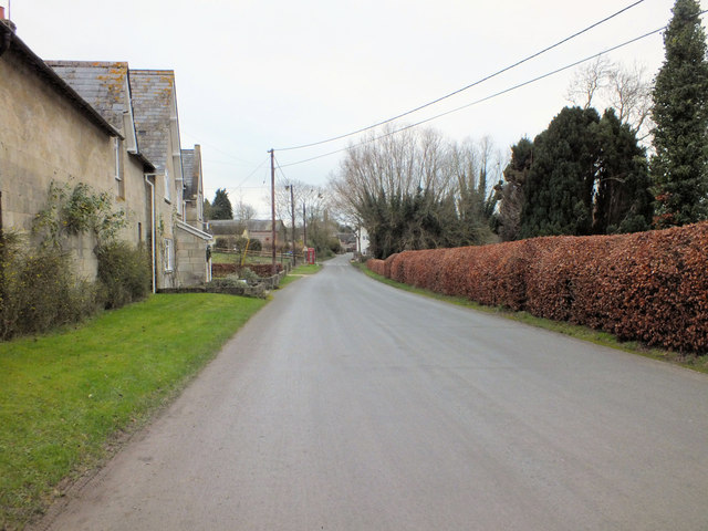
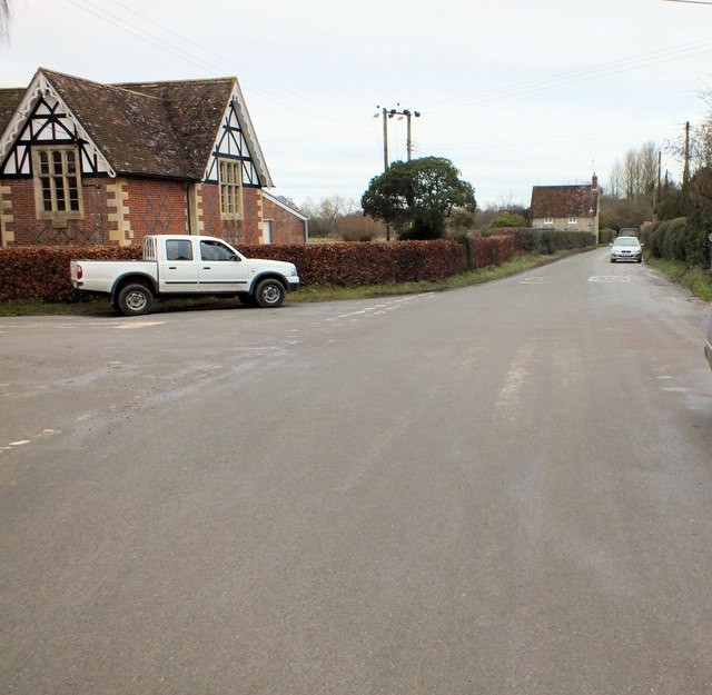
North Burcombe is a small village located in the county of Wiltshire, England. Situated approximately 5 miles east of the town of Warminster, it lies within the Longleat estate and is surrounded by picturesque countryside. The village is part of the civil parish of Horningsham and falls within the South West Wiltshire parliamentary constituency.

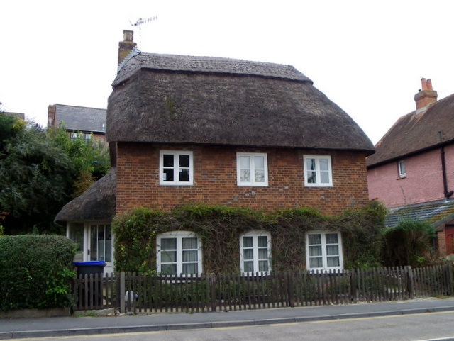
With a population of around 100 residents, North Burcombe is a close-knit community that offers a peaceful and idyllic rural lifestyle. The village is characterized by its charming thatched cottages and traditional stone houses, which give it a timeless and quintessentially English feel.

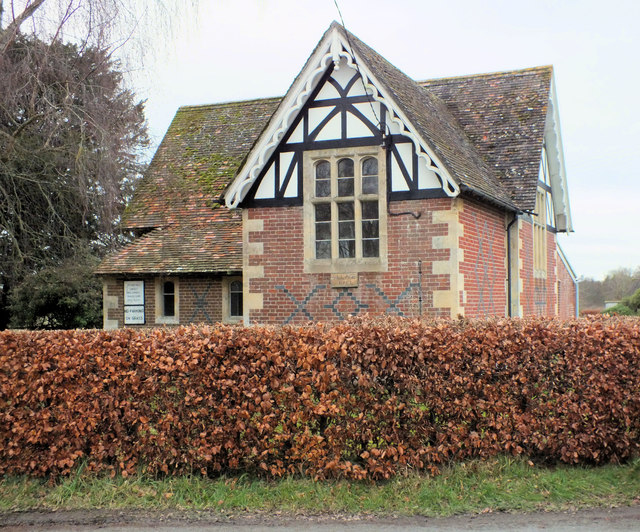
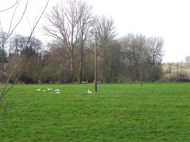
Despite its small size, North Burcombe boasts a few amenities to cater to its residents. These include a village hall, where local events and gatherings take place, as well as a small church that serves as a center for religious and community activities. The village is also surrounded by ample green spaces, offering opportunities for outdoor activities such as walking, cycling, and picnicking.

North Burcombe's proximity to Longleat Safari Park, one of the UK's most popular tourist attractions, makes it an appealing destination for visitors. The park's extensive grounds, which include a stately home, gardens, and a drive-through safari experience, attract thousands of tourists each year, providing opportunities for local businesses to thrive.

Overall, North Burcombe is a charming and tranquil village that offers a slice of rural English life, with its picturesque surroundings, community spirit, and convenient access to nearby attractions.

If you have any feedback on the listing, please let us know in the comments section below.

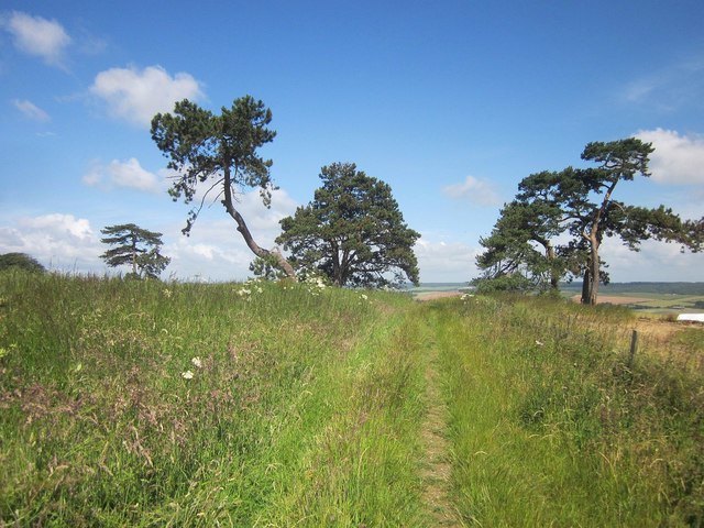
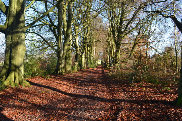
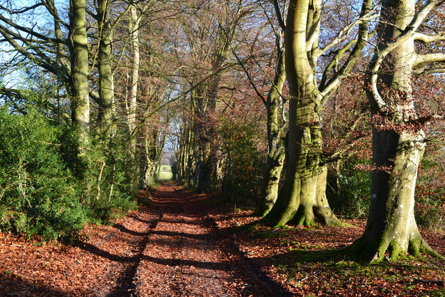
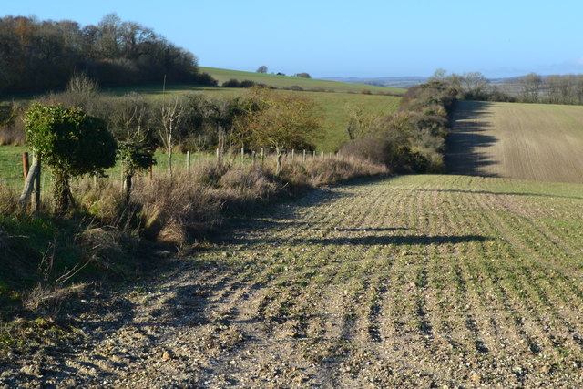
North Burcombe Images

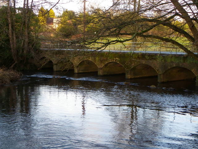
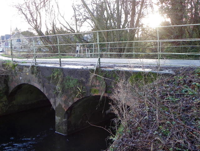
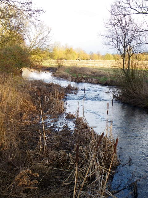
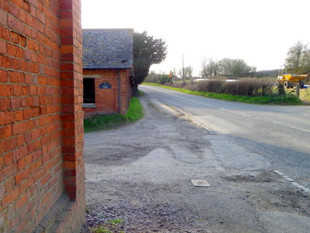
Images are sourced within 2km of 51.079537/-1.8969397 or Grid Reference SU0731. Thanks to Geograph Open Source API. All images are credited.

Pines, Bishopstone Down A dogless version of <a href="https://www.geograph.org.uk/photo/297132">SU0629 : Hill Top Trees</a> though I have these in a different part of the square. See also <a href="https://www.geograph.org.uk/photo/4550542">SU0629 : Pigs on Bishopstone Down</a> for adjacent pigs. The right of way is restricted byway BURC 2.
Pines, Bishopstone Down
A dogless version of SU0629 : Hill Top Trees though I have these in a different part of the square. See also SU0629 : Pigs on Bishopstone Down for adjacent pigs. The right of way is restricted byway BURC 2.
Leafy track between trees near Burnbake
Autumn sunlight on avenue of trees near Burnbake
Avenue of trees near Burnbake
Field edge near Vesey Trees
Thatched cottage, Shaftesbury Road The cottage stands beside the A30, Shaftesbury Road and it has a firemark over the middle window of the lower floor.
Thatched cottage, Shaftesbury Road
The cottage stands beside the A30, Shaftesbury Road and it has a firemark over the middle window of the lower floor.
Firemark, 50 Shaftesbury Road The firemark is attached to <a href="https://www.geograph.org.uk/photo/2658603">SU0931 : Thatched cottage, Shaftesbury Road</a>

Firemarks originated around the late 17th century at which time insurance companies operated their own fire brigades to protect insured property.  As many buildings did not have a formal address until the advent of the postal system, insurance companies identified insured properties by placing a mark on the outside wall of the buildings.
Firemark, 50 Shaftesbury Road
The firemark is attached to SU0931 : Thatched cottage, Shaftesbury Road Firemarks originated around the late 17th century at which time insurance companies operated their own fire brigades to protect insured property. As many buildings did not have a formal address until the advent of the postal system, insurance companies identified insured properties by placing a mark on the outside wall of the buildings.
Benchmark on Manor Farm This cut mark can be found on the former farm buildings, now used by small businesses, part way up the byway heading to Old Shaftesbury Drove. See <a href="https://www.geograph.org.uk/photo/2738588">SU0730 : Up the byway</a> for a wider view, and for more information on the mark visit <span class="nowrap"><a title="http://www.bench-marks.org.uk/bm40606" rel="nofollow ugc noopener" href="http://www.bench-marks.org.uk/bm40606">Link</a><img style="margin-left:2px;" alt="External link" title="External link - shift click to open in new window" src="https://s1.geograph.org.uk/img/external.png" width="10" height="10"/></span> .
Benchmark on Manor Farm
This cut mark can be found on the former farm buildings, now used by small businesses, part way up the byway heading to Old Shaftesbury Drove. See SU0730 : Up the byway for a wider view, and for more information on the mark visit LinkExternal link .
Up the byway Looking up the byway that leads from Burcombe, up the hill past Manor Farm, to the Old Shaftesbury Drove. On the right is Manor Farm Meats, a local butcher producing their own meat (see <a href="https://www.geograph.org.uk/photo/331394">SU0730 : Manor Farm Meats, Burcombe</a> by Trish Steel). There is a benchmark on the building wall just behind the white van, see <a href="https://www.geograph.org.uk/photo/2738575">SU0730 : Benchmark on Manor Farm</a>.
Up the byway
Looking up the byway that leads from Burcombe, up the hill past Manor Farm, to the Old Shaftesbury Drove. On the right is Manor Farm Meats, a local butcher producing their own meat (see SU0730 : Manor Farm Meats, Burcombe by Trish Steel). There is a benchmark on the building wall just behind the white van, see SU0730 : Benchmark on Manor Farm.
Through the village Looking along Burcombe village as the road heads towards the A30, Manor Farm is on the left.
Through the village
Looking along Burcombe village as the road heads towards the A30, Manor Farm is on the left.
To Wilton Looking along the road through South Burcombe on its way to Wilton. <a href="https://www.geograph.org.uk/photo/2738662">SU0730 : Burcombe Village Hall</a> is on the left.
To Wilton
Looking along the road through South Burcombe on its way to Wilton. SU0730 : Burcombe Village Hall is on the left.
Burcombe Village Hall Formerly a Victorian school, the village hall has recently gone through extensive renovation and modernisation.
Burcombe Village Hall
Formerly a Victorian school, the village hall has recently gone through extensive renovation and modernisation.
Swans, Burcombe Swans resting in a meadow field on the Nadder floodplain.

The three species wintering in Britain are all protected, the most familiar being he mis-named mute swan, which not only makes a musical whistling sound with its wings while flying, but also utters a variety of grunts and hisses.  The mute swan is a resident breeder in Britain, nesting in inland lakes and  rivers and moving only very short distances in winter.  Like all swans, the mute is highly aggressive and territorial during the breeding season, using its bright white plumage for advertisement and chasing away any intruder that ventures near its large nest.
Swans, Burcombe
Swans resting in a meadow field on the Nadder floodplain. The three species wintering in Britain are all protected, the most familiar being he mis-named mute swan, which not only makes a musical whistling sound with its wings while flying, but also utters a variety of grunts and hisses. The mute swan is a resident breeder in Britain, nesting in inland lakes and rivers and moving only very short distances in winter. Like all swans, the mute is highly aggressive and territorial during the breeding season, using its bright white plumage for advertisement and chasing away any intruder that ventures near its large nest.
The Church of St John the Baptist, Burcombe Looking towards the squat church from the minor road that leaves the A30 opposite the church.
The Church of St John the Baptist, Burcombe
Looking towards the squat church from the minor road that leaves the A30 opposite the church.
River Nadder, Burcombe The river rises at Donhead St Mary and flows for 22 miles before joining the Wylye near Salisbury.
River Nadder, Burcombe
The river rises at Donhead St Mary and flows for 22 miles before joining the Wylye near Salisbury.
Bridge, Burcombe The road bridge over the river takes cars from the village to the A30.

Growing on the bridge are spleenworts, harts tongue and liverworts.
Bridge, Burcombe
The road bridge over the river takes cars from the village to the A30. Growing on the bridge are spleenworts, harts tongue and liverworts.
River Nadder, Burcombe The river rises at Donhead St Mary and flows for 22 miles before joining the Wylye near Salisbury.
River Nadder, Burcombe
The river rises at Donhead St Mary and flows for 22 miles before joining the Wylye near Salisbury.
Ugford Farm, Wilton Standing beside the A30 are the brick built farm buildings of Ugford Farm.
Ugford Farm, Wilton
Standing beside the A30 are the brick built farm buildings of Ugford Farm.
Show me another place!

North Burcombe is located at Grid Ref: SU0731 (Lat: 51.079537, Lng: -1.8969397)

Unitary Authority: Wiltshire

Police Authority: Wiltshire

What 3 Words

///dishes.billiard.supposes. Near Wilton, Wiltshire

Nearby Locations

North Burcombe

Related Wikis

Burcombe

Burcombe is a village in the civil parish of Burcombe Without, in Wiltshire, England. The village is about 4.5 miles (7 km) west of Salisbury city centre...

Barford St Martin

Barford St Martin is a village and civil parish in Wiltshire, England, about 2.5 miles (4 km) west of Wilton, around the junction of the A30 and the B3089...

Burcombe Down

Burcombe Down (grid reference SU064295) is an area of chalk grassland situated on a north-facing scarp slope to the south of Burcombe in Wiltshire, England...

Battle of Wilton

The Battle of Wilton was a battle of the civil war in England known as The Anarchy. It was fought on 1 July 1143 at Wilton in Wiltshire. An army under...

Nearby Amenities

Located within 500m of 51.079537,-1.8969397
Burcombe
Is In: Wiltshire, England, UK
Place: village
Wikidata: Q4998228
Lat/Long: 51.0775484/-1.9004712
Wikidata: Q26439348
Lat/Long: 51.0767249/-1.9002421
Bus Stop
Burcombe Turn Shelter
Bus: yes
Naptan AtcoCode: 4600WIA12457
Naptan Bearing: NW
Naptan CommonName: Burcombe Turn Shelter
Naptan Indicator: opp
Naptan NaptanCode: wilawgwp
Naptan Street: A30
Naptan Verified: no
Public Transport: platform
Lat/Long: 51.0798359/-1.8981675
Post Box
Brand: Royal Mail
Brand Wikidata: Q638098
Brand Wikipedia: en:Royal Mail
Operator: Royal Mail
Operator Wikidata: Q638098
Post Box Type: lamp
Ref: SP2 413D
Royal Cypher: EIIR
Royal Cypher Wikidata: Q33102113
Lat/Long: 51.0798148/-1.8977263
Bus Stop
Burcombe Turn Shelter
Bus: yes
Naptan AtcoCode: 4600WIA12456
Naptan Bearing: SE
Naptan CommonName: Burcombe Turn Shelter
Naptan Indicator: SE-bound
Naptan NaptanCode: wilawjap
Naptan Street: A30
Naptan Verified: no
Public Transport: platform
Lat/Long: 51.0798156/-1.8976847
Post Box
Post Box Type: lamp
Royal Cypher: EIIR
Royal Cypher Wikidata: Q33102113
Lat/Long: 51.0776421/-1.9003799
Public Bookcase
Booth: K6
Disused Amenity: telephone
Man Made: telephone_box
Public Bookcase Type: phone_box
Lat/Long: 51.0776522/-1.9004148
Historic: milestone
Lat/Long: 51.0796641/-1.8977593
Leisure: picnic_table
Lat/Long: 51.078691/-1.901996
Leisure: picnic_table
Lat/Long: 51.0787087/-1.902051
Leisure: picnic_table
Lat/Long: 51.0786531/-1.9019718
Leisure: picnic_table
Lat/Long: 51.078659/-1.9020443
Leisure: picnic_table
Lat/Long: 51.0786775/-1.9021113
Leisure: picnic_table
Lat/Long: 51.0787003/-1.9021931
Leisure: picnic_table
Lat/Long: 51.0787112/-1.9023487
Leisure: picnic_table
Lat/Long: 51.0786826/-1.9023098
Leisure: picnic_table
Lat/Long: 51.0786632/-1.9022816
Leisure: picnic_table
Lat/Long: 51.0786362/-1.9026223
Leisure: picnic_table
Lat/Long: 51.0785806/-1.9025002
Leisure: picnic_table
Lat/Long: 51.0785638/-1.9024681
The data included in this document is from www.openstreetmap.org. The data is made available under ODbL.

Have you been to North Burcombe?

Leave your review of North Burcombe below (or comments, questions and feedback).