No Man's Heath

Settlement in Cheshire

England

No Man's Heath

Former Malpas station, 2003 The station, well-preserved as a private house, is seen from the B5069. It was on the former minor ex-LNW branch from Chester (left) to Whitchurch (right), closed to passengers 16/9/57, goods 4/11/63.
Former Malpas station, 2003 Credit: Ben Brooksbank

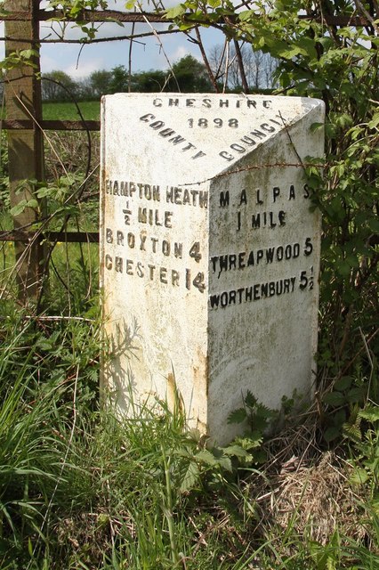
No Man's Heath is a small village located in the county of Cheshire, England. Situated approximately 4 miles north-west of the town of Malpas, it lies close to the border with Wales. The village is part of the Cheshire West and Chester district and falls within the civil parish of Malpas.

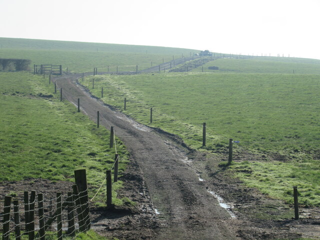
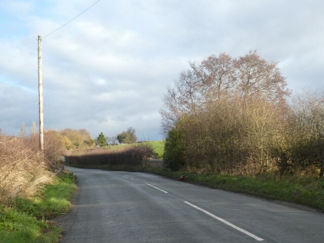
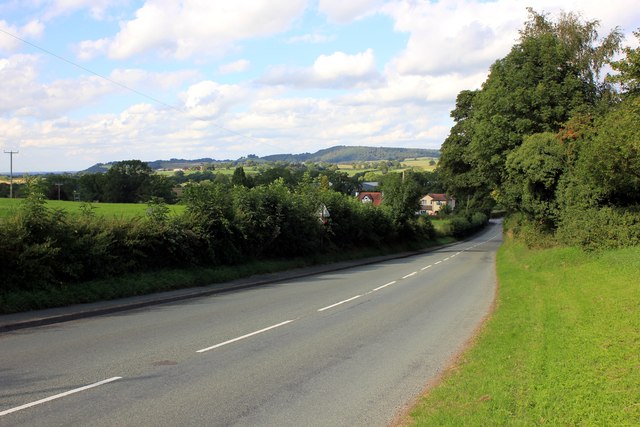
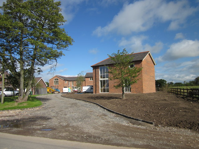
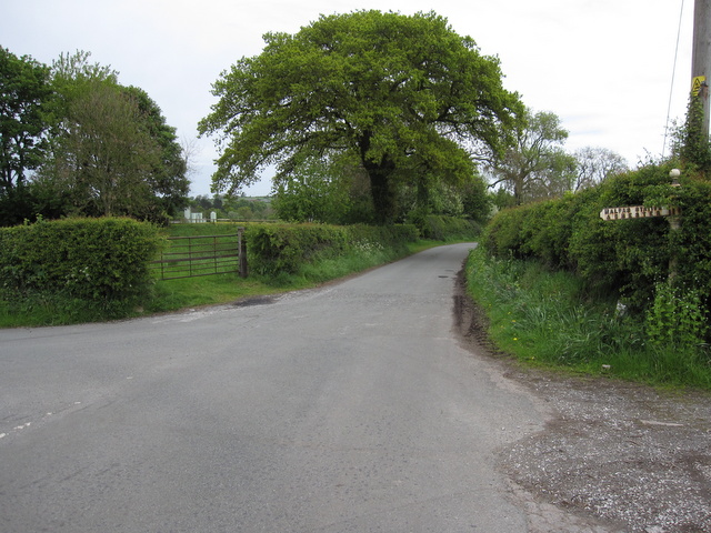
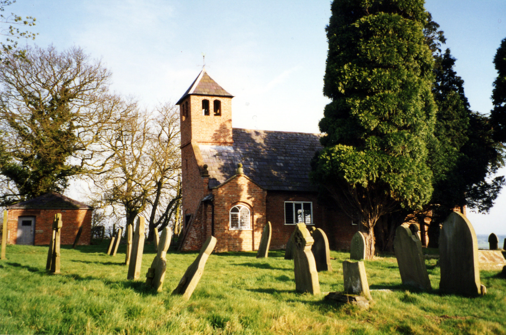
No Man's Heath is a predominantly rural area, characterized by its picturesque countryside and rolling hills. It is known for its tranquil environment and offers residents and visitors a peaceful retreat from the hustle and bustle of nearby towns and cities.

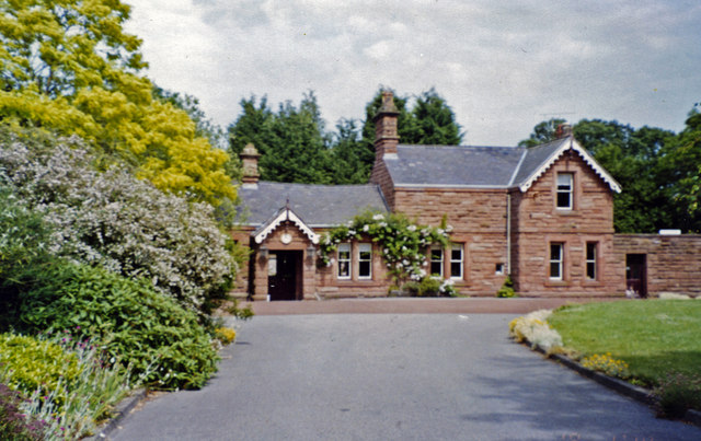
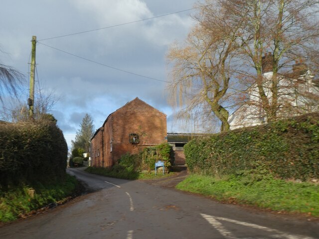
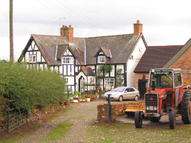
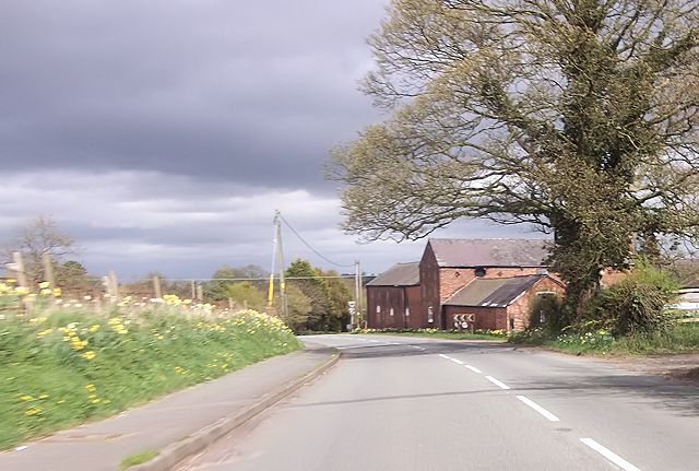
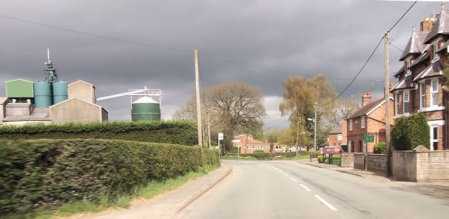
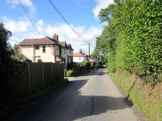
The village itself is relatively small, with a small population and a close-knit community. It features a scattering of residential properties, including charming cottages and traditional houses. The village also has a local pub, which serves as a social hub for residents and visitors alike.

Surrounded by farmland, No Man's Heath offers ample opportunities for outdoor activities such as walking, hiking, and cycling. The area is also home to several nature reserves and wildlife habitats, making it an ideal destination for nature enthusiasts.

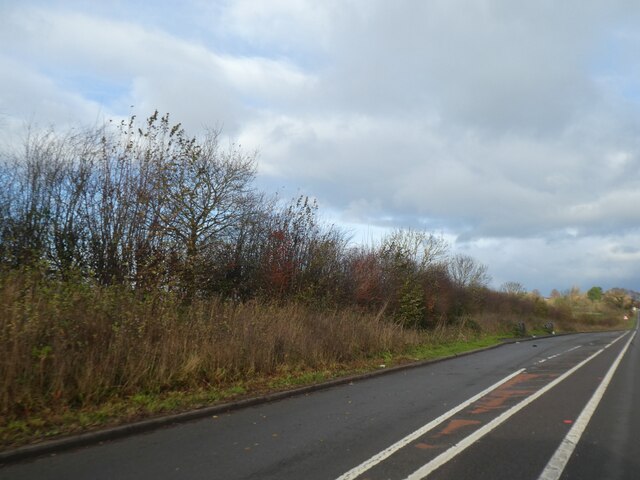
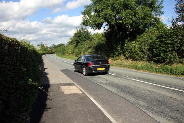
In terms of amenities, the village is in close proximity to the larger town of Malpas, which provides essential services such as schools, shops, and healthcare facilities. The village is well-connected by road, with easy access to major transportation routes, making it convenient for those commuting to nearby towns or cities for work or leisure.

Overall, No Man's Heath is a charming and idyllic village that offers a peaceful countryside setting, making it an attractive place to live or visit for those seeking a rural escape.

If you have any feedback on the listing, please let us know in the comments section below.

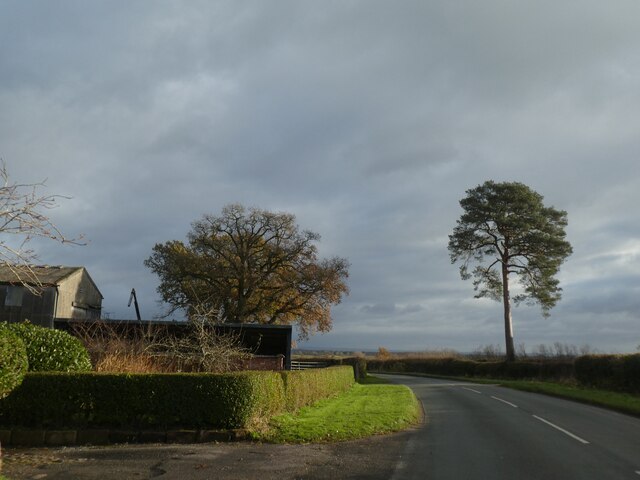
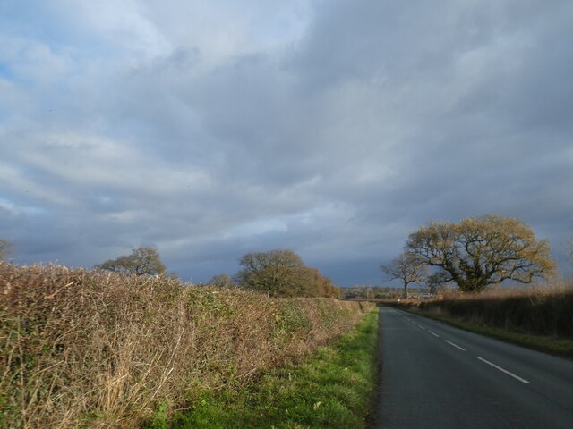
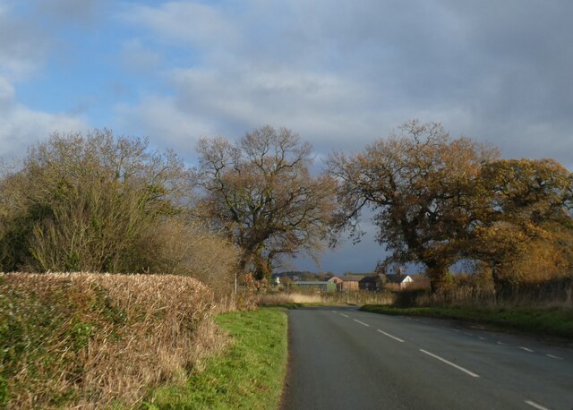
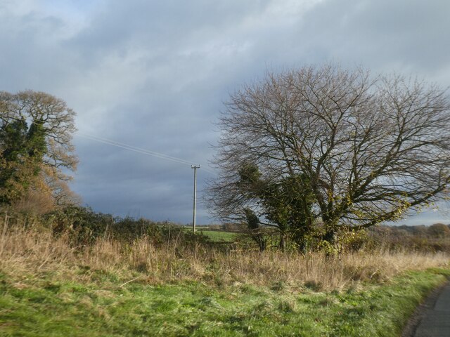
No Man's Heath Images

Images are sourced within 2km of 53.026386/-2.7274723 or Grid Reference SJ5147. Thanks to Geograph Open Source API. All images are credited.

Former Malpas station, 2003 The station, well-preserved as a private house, is seen from the B5069. It was on the former minor ex-LNW branch from Chester (left) to Whitchurch (right), closed to passengers 16/9/57, goods 4/11/63.
Former Malpas station, 2003
The station, well-preserved as a private house, is seen from the B5069. It was on the former minor ex-LNW branch from Chester (left) to Whitchurch (right), closed to passengers 16/9/57, goods 4/11/63.
Old Milepost by the B5069 in Ebnal Cast iron post by the B5069, in parish of Malpas (Chester District), Ebnal, on the verge, on North West side of road. Cast iron CCC1898, erected by the County Council in the 19th century.

Inscription reads:-
: HAMPTON HEATH / ½ MILE / BROXTON 4 / CHESTER 14 : : CHESHIRE / 1898 / COUNTY COUNCIL : : MALPAS / 1 MILE / THREAPWOOD 5 / WORTHENBURY 5½ :
Maker:-
: W H SMITH & CO / MAKERS / WHITCHURCH :

Milestone Society National ID: CH_MPHH01
Old Milepost by the B5069 in Ebnal
Cast iron post by the B5069, in parish of Malpas (Chester District), Ebnal, on the verge, on North West side of road. Cast iron CCC1898, erected by the County Council in the 19th century. Inscription reads:- : HAMPTON HEATH / ½ MILE / BROXTON 4 / CHESTER 14 : : CHESHIRE / 1898 / COUNTY COUNCIL : : MALPAS / 1 MILE / THREAPWOOD 5 / WORTHENBURY 5½ : Maker:- : W H SMITH & CO / MAKERS / WHITCHURCH : Milestone Society National ID: CH_MPHH01
Farm track
Farm track
Lay-by by A41 south of No Man's Heath A protected lay-by by the northbound lane.  This is part of a major realignment of the road
Lay-by by A41 south of No Man's Heath
A protected lay-by by the northbound lane. This is part of a major realignment of the road
Lone tree by the road in Bickleywood
Neat hedge by Bickley Lane
Where the Sandstone Trail crosses Bickley Lane The Sandstone Trail follows the road for a short distance and then leaves by the trees on the left, on the bend
Where the Sandstone Trail crosses Bickley Lane
The Sandstone Trail follows the road for a short distance and then leaves by the trees on the left, on the bend
Wide verge by road near Bickley Hall This verge is marked on the OS 1992-1914 map;
Wide verge by road near Bickley Hall
This verge is marked on the OS 1992-1914 map;
Bickley Town Bridge The bridge parapet on the right marks the crossing of Bickley Brook
Bickley Town Bridge
The bridge parapet on the right marks the crossing of Bickley Brook
Bank Farm, Bickley Town
Farm at Ebnal
Farm at Ebnal
The B5069 (Chester Road) at Ebnal The B5069 (Chester Road) from the junction with Mates Lane heading north towards Hampton Heath.
The B5069 (Chester Road) at Ebnal
The B5069 (Chester Road) from the junction with Mates Lane heading north towards Hampton Heath.
The B5069 (Chester Road) at Ebnal The B5069 (Chester Road) at the junction with Ebnal Lane heading north towards Hampton Heath. In the distance are the Peckforton and Bickerton Hills.
The B5069 (Chester Road) at Ebnal
The B5069 (Chester Road) at the junction with Ebnal Lane heading north towards Hampton Heath. In the distance are the Peckforton and Bickerton Hills.
Farm at Ebnal
Farm at Ebnal
B5069 at Post Office Lane Just before Industrial estate
B5069 at Post Office Lane
Just before Industrial estate
Cross o' th' Hill, Malpas The small hamlet of Cross o' th' Hill looking west and down hill on Well Street.
Cross o' th' Hill, Malpas
The small hamlet of Cross o' th' Hill looking west and down hill on Well Street.
New Build at Cross o' th' Hill New house building on Well Street in the hamlet of Cross o' th' Hill near Malpas.
New Build at Cross o' th' Hill
New house building on Well Street in the hamlet of Cross o' th' Hill near Malpas.
Ebnal Lane junction and an old direction indicator Looking across the junction of Ebnal Lane with Ebnal Lane.  There is also a track on the right making it into a cross roads.  Partially hidden in the hedge on the right is an old cast iron direction indicator pointing to 'MALPAS STATION & CHESTER', although the station and railway have long since disappeared. The sign first appeared on the 1912-13 O.S. map, and would have been a very welcome sight to any one who had taken the wrong fork at the previous junction, as following this lane straight on would have curved round to take you due south away from the station. See also <a href="https://www.geograph.org.uk/photo/4340986">SJ4948 : Malpas Station & Chester signpost</a>  and <a href="https://www.geograph.org.uk/photo/4340991">SJ4948 : Malpas Station & Chester direction signpost (2)</a>
Ebnal Lane junction and an old direction indicator
Looking across the junction of Ebnal Lane with Ebnal Lane. There is also a track on the right making it into a cross roads. Partially hidden in the hedge on the right is an old cast iron direction indicator pointing to 'MALPAS STATION & CHESTER', although the station and railway have long since disappeared. The sign first appeared on the 1912-13 O.S. map, and would have been a very welcome sight to any one who had taken the wrong fork at the previous junction, as following this lane straight on would have curved round to take you due south away from the station. See also SJ4948 : Malpas Station & Chester signpost and SJ4948 : Malpas Station & Chester direction signpost (2)
Show me another place!

No Man's Heath is located at Grid Ref: SJ5147 (Lat: 53.026386, Lng: -2.7274723)

Unitary Authority: Cheshire West and Chester

Police Authority: Cheshire

What 3 Words

///unwraps.engraving.kidney. Near Bickley, Cheshire

Nearby Locations

No Man's Heath

Related Wikis

Macefen

Macefen is a former civil parish in the unitary authority of Cheshire West and Chester and the ceremonial county of Cheshire, England. Its area is now...

No Man's Heath, Cheshire

No Man's Heath is a village in the unitary authority of Cheshire West and Chester and the ceremonial county of Cheshire, England. Its name has historically...

Tushingham

Tushingham is a scattered community in the civil parish of Tushingham-cum-Grindley, Macefen and Bradley (Tushingham cum Grindley until 2015), in the Cheshire...

Hampton Old Hall

Hampton Old Hall is a country house in the parish of No Man's Heath and District, Cheshire, England. It is dated 1591, and was built for the Bromley family...

Nearby Amenities

Located within 500m of 53.026386,-2.7274723
Mini Roundabout
Direction: clockwise
Odbl: clean
Source: Bing
Lat/Long: 53.0262346/-2.7238602
Mini Roundabout
Direction: clockwise
Source: GPS survey
Lat/Long: 53.0264246/-2.7241969
Turning Circle
Lat/Long: 53.0272942/-2.7264479
Turning Circle
Lat/Long: 53.0274828/-2.7265704
Turning Circle
Lat/Long: 53.025695/-2.7258762
Turning Circle
Lat/Long: 53.0268636/-2.7260113
Turning Circle
Lat/Long: 53.0269833/-2.7256714
Turning Circle
Lat/Long: 53.0268707/-2.7255663
Post Office
Nomans Heath Post Office
Addr City: Malpas
Addr Country: GB
Addr Housenumber: 1-3
Addr Postcode: SY14 8DU
Addr Street: Meadow Court
Addr Village: Nomans Heath
Brand: Post Office
Brand Wikidata: Q1783168
Check Date: 2022-05-27
Check Date Opening Hours: 2022-05-27
Contact Website: https://www.postoffice.co.uk/branch-finder/3076415/nomans-heath
Opening Hours: Mo-Fr 07:00-19:00; Sa,Su 08:00-19:00
Ref Pol Id: 12312
Lat/Long: 53.0266507/-2.7261782
Pub
Wheatsheaf Inn
Addr Postcode: SY14 8DY
Addr Street: Chester Road
Fhrs Id: 980318
Source Addr: FHRS Open Data
Lat/Long: 53.027597/-2.7254395
No Man's Heath
Alt Name: No Mans Heath
Alt Name 1: Nomansheath
Place: village
Lat/Long: 53.0264929/-2.7263981
Parking
Parking: surface
Lat/Long: 53.0275407/-2.7253466
Barrier: kissing_gate
Foot: yes
Lat/Long: 53.029285/-2.7234506
Barrier: kissing_gate
Foot: yes
Lat/Long: 53.0288982/-2.7238907
Barrier: stile
Foot: yes
Lat/Long: 53.0284558/-2.7241485
Historic: pump
Lat/Long: 53.0271151/-2.7248318
Celia Fiennes Monument
Historic: monument
Lat/Long: 53.0246215/-2.7225025
Bus Stop
No Mans Heath, Cross o'th Hill Road / Far Meadow
Bus: yes
Naptan AtcoCode: 0610CH553
Naptan Bearing: E
Naptan CommonName: Far Meadow
Naptan Indicator: opp
Naptan Landmark: Far Meadow
Naptan LocalityName: No Mans Heath
Naptan NaptanCode: chwdmwa
Naptan ShortCommonName: Far Meadow
Naptan Street: Cross o'th Hill Road
Naptan Verified: no
Public Transport: platform
Source: naptan_import
Lat/Long: 53.026476/-2.726192
Bus Stop
No Mans Heath, Cross o'th Hill Road / Far Meadow
Bus: yes
Naptan AtcoCode: 0610CH630
Naptan Bearing: W
Naptan BusStopType: CUS
Naptan CommonName: Far Meadow
Naptan Indicator: o/s
Naptan Landmark: Far Meadow
Naptan LocalityName: No Mans Heath
Naptan NaptanCode: chwdtgp
Naptan ShortCommonName: Far Meadow
Naptan Street: Cross o'th Hill Road
Naptan Verified: no
Public Transport: platform
Source: naptan_import
Lat/Long: 53.026332/-2.726189
Barrier: cycle_barrier
Foot: yes
Lat/Long: 53.0263066/-2.7249558
Common Farm
Historic Place: farm
Source: Bing
Lat/Long: 53.0284859/-2.7278308
Top House Farm
Place: farm
Source: Bing
Lat/Long: 53.0268988/-2.7238999
Colour: green
Man Made: street_cabinet
Operator: Openreach
Street Cabinet: telecom
Lat/Long: 53.0263634/-2.72392
Post Box
Brand: Royal Mail
Brand Wikidata: Q638098
Brand Wikipedia: en:Royal Mail
Collection Times: Mo-Fr 17:15; Sa 10:30; Su off
Drive Through: no
Operator: Royal Mail
Operator Wikidata: Q638098
Post Box Type: lamp
Ref: SY14 708
Royal Cypher: EIIR
Royal Cypher Wikidata: Q33102113
Survey Date: 2023-04-22
Lat/Long: 53.0265842/-2.7260585
Defibrillator
Defibrillator Location: in pub
Emergency: defibrillator
Lat/Long: 53.0276677/-2.7255578
Direction: WNW
Generator Method: photovoltaic
Generator Output Electricity: yes
Generator Source: solar
Generator Type: solar_photovoltaic_panel
Location: rooftop
Power: generator
Lat/Long: 53.0259594/-2.7246889
Direction: ESE
Generator Method: photovoltaic
Generator Output Electricity: yes
Generator Source: solar
Generator Type: solar_photovoltaic_panel
Location: rooftop
Power: generator
Lat/Long: 53.0259264/-2.7246463
Direction: S
Generator Method: photovoltaic
Generator Output Electricity: yes
Generator Source: solar
Generator Type: solar_photovoltaic_panel
Location: rooftop
Power: generator
Lat/Long: 53.0255986/-2.7285217
Direction: E
Generator Method: photovoltaic
Generator Output Electricity: yes
Generator Source: solar
Generator Type: solar_photovoltaic_panel
Location: rooftop
Power: generator
Lat/Long: 53.0256365/-2.7282492
Direction: SSW
Generator Method: photovoltaic
Generator Output Electricity: yes
Generator Source: solar
Generator Type: solar_photovoltaic_panel
Location: rooftop
Power: generator
Lat/Long: 53.0250762/-2.7238851
Parish Council Information Board
Information: board
Tourism: information
Lat/Long: 53.0265444/-2.7260752
Power: pole
Lat/Long: 53.0279324/-2.733863
Power: pole
Lat/Long: 53.0268355/-2.7339166
Power: pole
Lat/Long: 53.0256441/-2.7275451
Power: pole
Lat/Long: 53.0248359/-2.7276389
Power: pole
Lat/Long: 53.0246253/-2.7276872
Power: pole
Lat/Long: 53.0244301/-2.7287936
Power: pole
Lat/Long: 53.0246382/-2.7297525
Power: pole
Lat/Long: 53.024969/-2.7313028
Power: pole
Lat/Long: 53.0258587/-2.7340347
Power: pole
Lat/Long: 53.0250964/-2.7330074
Power: pole
Lat/Long: 53.0247625/-2.7312478
Power: pole
Lat/Long: 53.0245447/-2.7301294
Power: pole
Lat/Long: 53.0242801/-2.7287239
Power: pole
Lat/Long: 53.0232782/-2.7278951
Power: pole
Lat/Long: 53.0224732/-2.7274257
Power: pole
Lat/Long: 53.0257836/-2.7207148
Power: pole
Lat/Long: 53.0256877/-2.7219808
Power: pole
Lat/Long: 53.0255901/-2.7232468
Material: wood
Power: pole
Lat/Long: 53.0283905/-2.721608
Material: wood
Power: pole
Lat/Long: 53.0288067/-2.7224663
Power: pole
Lat/Long: 53.02926/-2.7233675
Material: wood
Power: pole
Lat/Long: 53.0296222/-2.7249138
Power: pole
Lat/Long: 53.030319/-2.7280574
Material: wood
Power: pole
Lat/Long: 53.0300351/-2.7267404
Fire Hydrant
Emergency: fire_hydrant
Fire Hydrant Type: underground
Water Source: main
Lat/Long: 53.0256943/-2.7309811
Colour: green
Man Made: street_cabinet
Operator: Openreach
Street Cabinet: telecom
Lat/Long: 53.026549/-2.7241177
The data included in this document is from www.openstreetmap.org. The data is made available under ODbL.

Have you been to No Man's Heath?

Leave your review of No Man's Heath below (or comments, questions and feedback).