Neyland Vale
Settlement in Pembrokeshire
Wales
Neyland Vale

Neyland Vale is a picturesque village located in the county of Pembrokeshire, Wales. Situated on the banks of the River Cleddau, it offers stunning views of the surrounding countryside and the estuary. With a population of around 2,000 people, it maintains a close-knit community atmosphere.
The village is well-known for its natural beauty and is a popular destination for tourists seeking a peaceful retreat. The rolling hills and lush greenery provide ample opportunities for outdoor activities such as hiking, cycling, and birdwatching. The estuary also offers excellent conditions for boating and fishing enthusiasts.
Neyland Vale boasts a rich history, with evidence of human habitation dating back thousands of years. Additionally, the area played a significant role during World War II as a base for the Royal Navy and RAF. Visitors can explore historical landmarks such as the remains of the old military installations and the Neyland War Memorial.
The village offers a range of amenities, including local shops, cafes, and pubs, catering to the needs of both residents and visitors. Additionally, Neyland Vale has a primary school, providing education for the local children.
Transportation in the area is convenient, with regular bus services connecting the village to nearby towns and cities. Furthermore, Neyland Vale has its own train station, providing easy access to other parts of Pembrokeshire and beyond.
Overall, Neyland Vale is a charming village that combines natural beauty, a rich history, and a strong sense of community, making it an ideal destination for those seeking a tranquil and picturesque getaway.
If you have any feedback on the listing, please let us know in the comments section below.
Neyland Vale Images
Images are sourced within 2km of 51.710683/-4.9574778 or Grid Reference SM9505. Thanks to Geograph Open Source API. All images are credited.


Neyland Vale is located at Grid Ref: SM9505 (Lat: 51.710683, Lng: -4.9574778)
Unitary Authority: Pembrokeshire
Police Authority: Dyfed Powys
What 3 Words
///curiosity.frostbite.pelted. Near Neyland, Pembrokeshire
Nearby Locations
Related Wikis

Neyland
Neyland is a town and community in Pembrokeshire, Wales, lying on the River Cleddau and the upstream end of the Milford Haven estuary. The Cleddau Bridge...

Llanstadwell
Llanstadwell (Welsh: Llanudwal) is a small village, parish and community in south Pembrokeshire, Wales, on the north bank of the River Cleddau between...
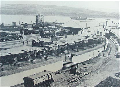
Neyland railway station
Neyland railway station was on the north bank of the Milford Haven Waterway in Pembrokeshire, Wales. == History == The Great Western Railway (GWR) was...
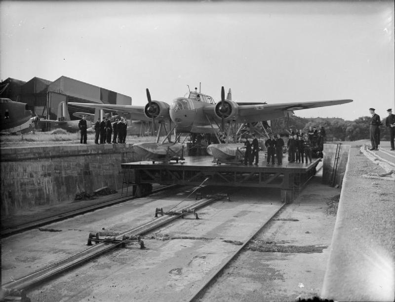
RAF Pembroke Dock
Royal Air Force Pembroke Dock, or more simply RAF Pembroke Dock, was a Royal Air Force Seaplane and Flying boat station located at Pembroke Dock, Pembrokeshire...
Nearby Amenities
Located within 500m of 51.710683,-4.9574778Have you been to Neyland Vale?
Leave your review of Neyland Vale below (or comments, questions and feedback).