Newtown

Settlement in Nottinghamshire Bassetlaw

England

Newtown

A638 Eaton
A638 Eaton Credit: thejackrustles

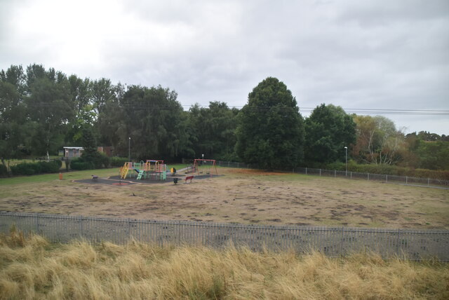
Newtown is a small village located in the district of Bassetlaw, Nottinghamshire, England. Situated approximately 6 miles south-east of the town of Retford, Newtown has a population of around 500 people. The village is surrounded by picturesque countryside and offers a rural setting for its residents.

Historically, Newtown has a rich heritage dating back centuries. The village is mentioned in the Domesday Book of 1086, highlighting its long-standing presence. Over the years, Newtown has developed from a primarily agricultural community to a residential area with a mix of modern and traditional houses.

Despite its small size, Newtown offers a range of amenities for its residents. The village has a local primary school, providing education for young children in the area. Additionally, there is a village hall that serves as a hub for various community activities and events. Newtown also boasts a pub and a few shops, ensuring basic necessities are easily accessible to its inhabitants.

The village is well-connected to nearby towns and cities. Retford, with its train station, is a convenient transportation hub, providing easy access to London and other major cities. The A1 road passes close to Newtown, connecting it to the wider road network.

The surrounding countryside offers opportunities for outdoor activities, such as walking, cycling, and exploring nature. Newtown's location also provides easy access to nearby attractions, including the historic town of Newark-on-Trent and the beautiful Sherwood Forest.

Overall, Newtown offers a peaceful and close-knit community for its residents, with its historical significance and access to both rural and urban amenities.

If you have any feedback on the listing, please let us know in the comments section below.
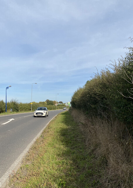
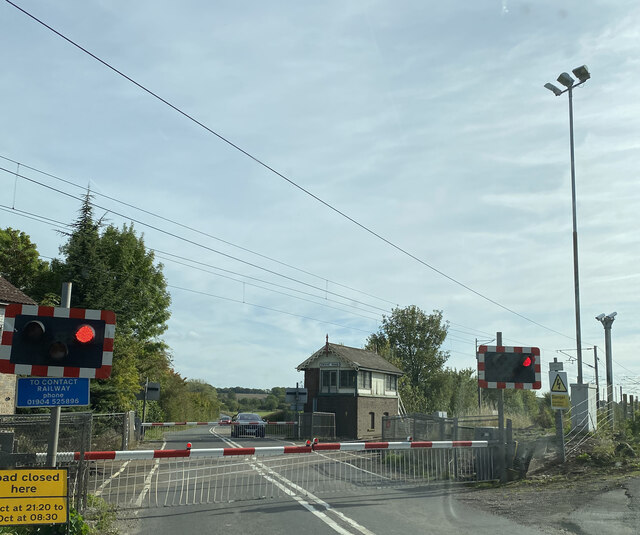
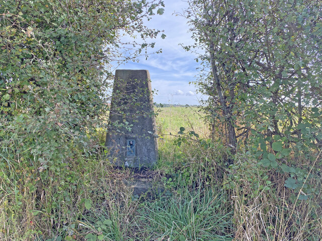
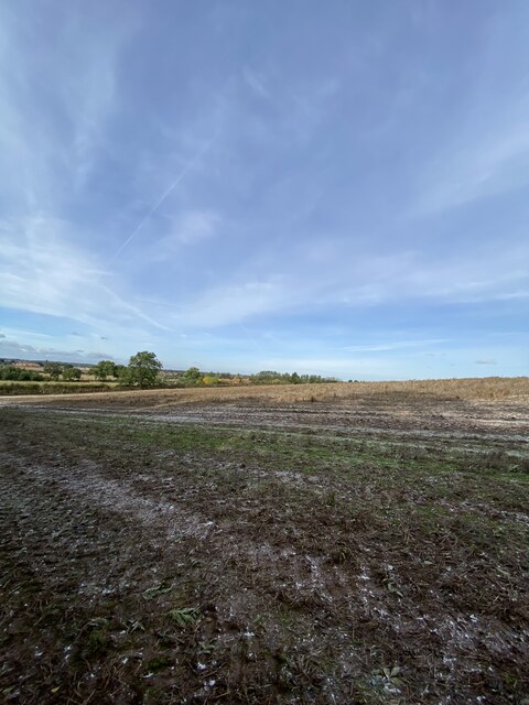
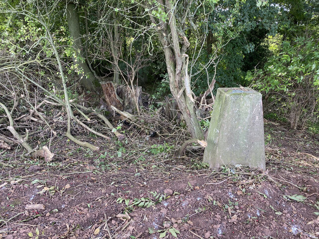
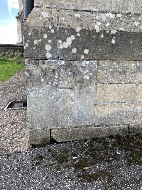
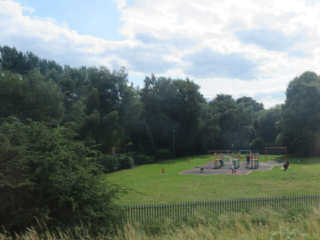
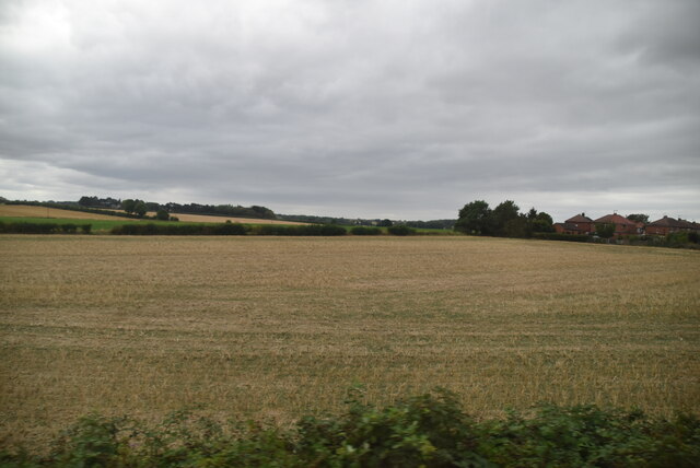
Newtown Images

Images are sourced within 2km of 53.316211/-0.93344743 or Grid Reference SK7180. Thanks to Geograph Open Source API. All images are credited.

A638 Eaton
A638 Eaton
Grove Road Level Crossing
Hall Farm Trig Point Flush Bracket S4830
Fields near Grove Kennels Trig Point
Grove Kennels Trig Point Flush Bracket S4834
All Hallows' Church All Hallows' Church, Grade II* listed, 13thC with tower added 15thC
All Hallows' Church
All Hallows' Church, Grade II* listed, 13thC with tower added 15thC
OS Cut Mark - Ordsall, All Hallows Church <span class="nowrap"><a title="https://www.bench-marks.org.uk/bm29487" rel="nofollow ugc noopener" href="https://www.bench-marks.org.uk/bm29487">Link</a><img style="margin-left:2px;" alt="External link" title="External link - shift click to open in new window" src="https://s1.geograph.org.uk/img/external.png" width="10" height="10"/></span>
OS Cut Mark - Ordsall, All Hallows Church
Location of OS Cut Mark - Ordsall, All Hallows Church <span class="nowrap"><a title="https://www.bench-marks.org.uk/bm29487" rel="nofollow ugc noopener" href="https://www.bench-marks.org.uk/bm29487">Link</a><img style="margin-left:2px;" alt="External link" title="External link - shift click to open in new window" src="https://s1.geograph.org.uk/img/external.png" width="10" height="10"/></span>
Location of OS Cut Mark - Ordsall, All Hallows Church
Graveyard, Retford
Graveyard, Retford
Houses on Bridon Close, South Retford Rough grassland on the edge of an expanding housing estate. Seen from the East Coast Mainline.
Houses on Bridon Close, South Retford
Rough grassland on the edge of an expanding housing estate. Seen from the East Coast Mainline.
Bridge over the River Idle Looking southwest to All Hallow's Church at Ordsall.
Bridge over the River Idle
Looking southwest to All Hallow's Church at Ordsall.
Weedy lake at Ordsall An inlet of a larger lake, surrounded by trees and other vegetation.
Weedy lake at Ordsall
An inlet of a larger lake, surrounded by trees and other vegetation.
Lake at Ordsall, south of Repton Seen from the East Coast Mainline, and east of the River Idle.
Lake at Ordsall, south of Repton
Seen from the East Coast Mainline, and east of the River Idle.
Play space at Ordsall Seen from the East Coast Mainline, so good for trainspotting.
Play space at Ordsall
Seen from the East Coast Mainline, so good for trainspotting.
Large field
Large field
Goosemoor Park
Goosemoor Park
River Idle The River Idle is a 26 mile long river in Nottinghamshire. Its source is the confluence of the River Maun and River Meden, near Markham Moor. From there, it flows north through Retford and Bawtry before entering the River Trent at Stockwith near Misterton.
Wikipedia: <span class="nowrap"><a title="http://en.wikipedia.org/wiki/River_Idle" rel="nofollow ugc noopener" href="http://en.wikipedia.org/wiki/River_Idle">Link</a><img style="margin-left:2px;" alt="External link" title="External link - shift click to open in new window" src="https://s1.geograph.org.uk/img/external.png" width="10" height="10"/></span>
River Idle
The River Idle is a 26 mile long river in Nottinghamshire. Its source is the confluence of the River Maun and River Meden, near Markham Moor. From there, it flows north through Retford and Bawtry before entering the River Trent at Stockwith near Misterton. Wikipedia: LinkExternal link
Show me another place!

Newtown is located at Grid Ref: SK7180 (Lat: 53.316211, Lng: -0.93344743)

Administrative County: Nottinghamshire

District: Bassetlaw

Police Authority: Nottinghamshire

What 3 Words

///remind.submit.ridge. Near Retford, Nottinghamshire

Nearby Locations

Thrumpton Newtown

Related Wikis

Albert Road drill hall, Retford

The Albert Road drill hall is a former military installation in Retford. == History == The building was designed as a mission hall for All Hallows' Church...

Retford bus station

Retford bus station serves the town of Retford, Nottinghamshire, England. It is managed by Nottinghamshire County Council. The bus station, of eight stands...
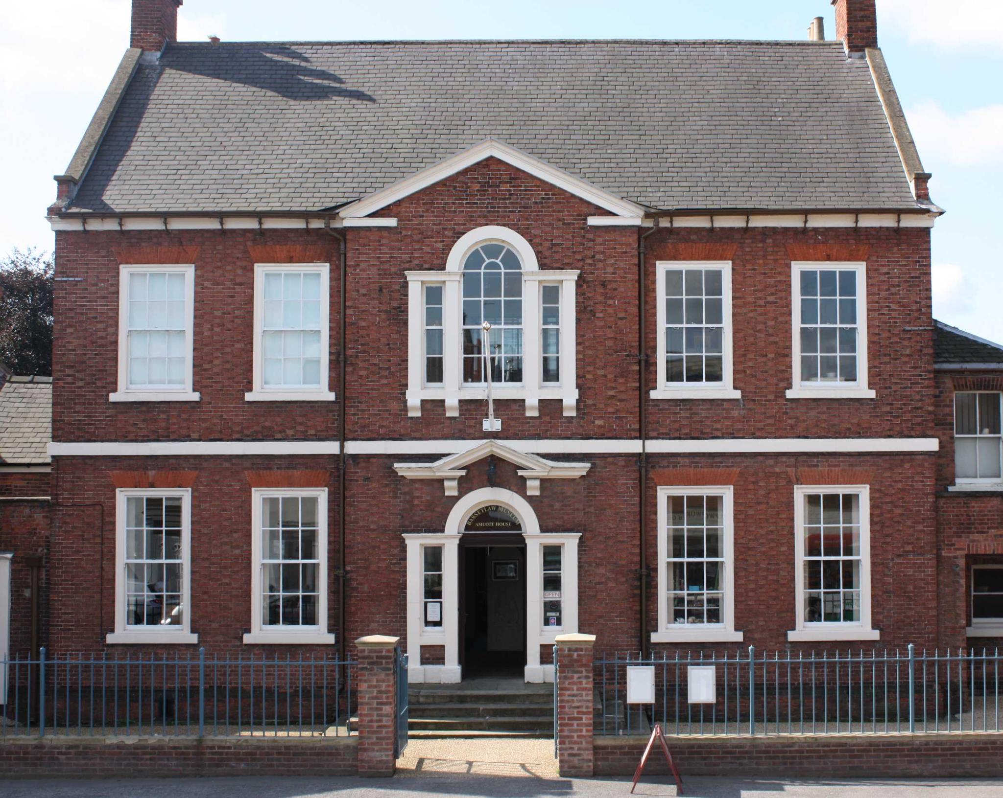
Bassetlaw Museum

The Bassetlaw Museum is a museum in Retford, Nottinghamshire which documents the history of North Nottinghamshire from the earliest times to the present...
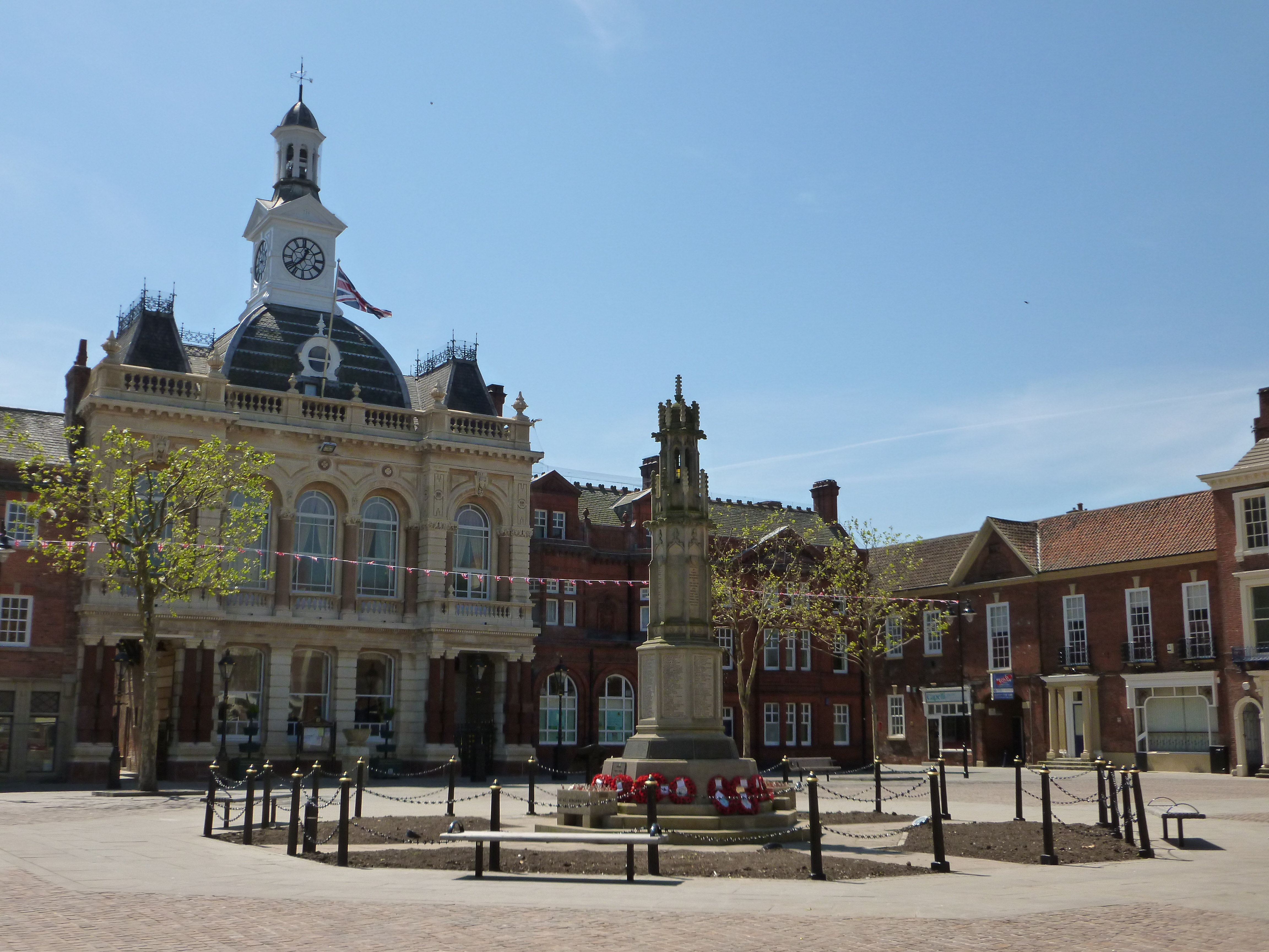
Retford Town Hall

Retford Town Hall is a municipal building in The Square, Retford, Nottinghamshire, England. The town hall, which was the meeting place of Retford Borough...

Nearby Amenities

Located within 500m of 53.316211,-0.93344743
Barrier: bollard
Bollard: fixed
Lat/Long: 53.3157675/-0.9338368
Railway: level_crossing
Source: Bing
Lat/Long: 53.3149714/-0.9403293
Turning Circle
Lat/Long: 53.3147252/-0.9355532
Turning Circle
Lat/Long: 53.313032/-0.938407
Bus Stop
Avenue Road
Bus: yes
Naptan AtcoCode: 3300BA0086
Naptan Bearing: NW
Naptan CommonName: Avenue Road
Naptan Crossing: Avenue Road
Naptan Indicator: adj
Naptan NaptanCode: ntsgatgj
Naptan Notes: none
Naptan Street: London Road
Naptan Verified: no
Public Transport: platform
Source: naptan_import
Lat/Long: 53.315855/-0.935297
Bus Stop
London Road
Bus: yes
Naptan AtcoCode: 3300BA0093
Naptan Bearing: SE
Naptan CommonName: London Road
Naptan Crossing: South Street
Naptan Indicator: SE-bound
Naptan NaptanCode: ntsgatjg
Naptan Notes: BW--3300BA0934
Naptan Street: London Road
Naptan Verified: no
Public Transport: platform
Source: naptan_import
Lat/Long: 53.3180993/-0.938752
Bus Stop
Avenue Road
Bus: yes
Naptan AtcoCode: 3300BA0095
Naptan Bearing: SE
Naptan CommonName: Avenue Road
Naptan Crossing: Avenue Road
Naptan Indicator: opp
Naptan NaptanCode: ntsgatjp
Naptan Notes: none
Naptan Street: London Road
Naptan Verified: no
Public Transport: platform
Source: naptan_import
Lat/Long: 53.315625/-0.9347022
Bus Stop
Whinney Moor Lane
Naptan AtcoCode: 3300BA0099
Naptan Bearing: S
Naptan CommonName: Whinney Moor Lane
Naptan Crossing: Whinney Moor Lane
Naptan Indicator: opp
Naptan NaptanCode: ntsdpwmd
Naptan Notes: none
Naptan Street: London Road
Naptan Verified: no
Source: naptan_import
Lat/Long: 53.3117837/-0.933387
Bus Stop
Whinney Moor Lane
Naptan AtcoCode: 3300BA0100
Naptan Bearing: N
Naptan CommonName: Whinney Moor Lane
Naptan Crossing: Whinney Moor Lane
Naptan Indicator: adj
Naptan NaptanCode: ntsdpwmg
Naptan Notes: none
Naptan Street: London Road
Naptan Verified: no
Source: naptan_import
Lat/Long: 53.3123986/-0.9337919
Bus Stop
Primary School
Bus: yes
Naptan AtcoCode: 3300BA0649
Naptan Bearing: E
Naptan CommonName: Primary School
Naptan Crossing: Rose Avenue
Naptan Indicator: o/s
Naptan Landmark: Primary School
Naptan NaptanCode: ntsgdmwg
Naptan Notes: BW--3300BA0936
Naptan Street: Bracken Lane
Naptan Verified: no
Public Transport: platform
Source: naptan_import
Lat/Long: 53.3123671/-0.9302653
Bus Stop
The Elms Hotel
Bus: yes
Naptan AtcoCode: 3300BA0728
Naptan Bearing: S
Naptan CommonName: The Elms Hotel
Naptan Crossing: Elm Walk
Naptan Indicator: opp
Naptan Landmark: The Elms Hotel
Naptan NaptanCode: ntsdajwm
Naptan Street: London Road
Naptan Verified: no
Public Transport: platform
Source: naptan_import
Lat/Long: 53.3137911/-0.9336972
London Road
Naptan AtcoCode: 3300BA0934
Naptan Bearing: NW
Naptan BusStopType: CUS
Naptan CommonName: London Road
Naptan Crossing: South Street
Naptan Indicator: NW-bound
Naptan NaptanCode: ntsgmdma
Naptan Notes: CUS--3300BA0093
Naptan Street: London Road
Naptan Verified: no
Source: naptan_import
Lat/Long: 53.3180009/-0.9388145
Bus Stop
Primary School
Bus: yes
Naptan AtcoCode: 3300BA0936
Naptan Bearing: W
Naptan BusStopType: CUS
Naptan CommonName: Primary School
Naptan Crossing: Rose Avenue
Naptan Indicator: opp
Naptan Landmark: Primary School
Naptan NaptanCode: ntsgmdmg
Naptan Notes: CUS--3300BA0649
Naptan Street: Bracken Lane
Naptan Verified: no
Public Transport: platform
Source: naptan_import
Lat/Long: 53.3122952/-0.930103
Bus Stop
The Elms Hotel
Naptan AtcoCode: 3300BA1009
Naptan Bearing: N
Naptan CommonName: The Elms Hotel
Naptan Crossing: Elm Walk
Naptan Indicator: o/s
Naptan Landmark: The Elms Hotel
Naptan NaptanCode: ntsgpdjg
Naptan Street: London Road
Naptan Verified: no
Source: naptan_import
Lat/Long: 53.31373/-0.9338938
Railway: switch
Lat/Long: 53.316075/-0.93714
Traffic Signals
Traffic Signals Direction: forward
Lat/Long: 53.3184372/-0.9395516
Traffic Signals
Traffic Signals: signal
Traffic Signals Direction: forward
Lat/Long: 53.3186966/-0.9395386
Turning Circle
Lat/Long: 53.31749/-0.9334621
Turning Circle
Lat/Long: 53.3133781/-0.9370299
Post Box
Post Box Type: pillar
Royal Cypher: VR
Royal Cypher Wikidata: Q33102356
Source: survey
Lat/Long: 53.3156572/-0.9347527
Railway: level_crossing
Source: Bing
Lat/Long: 53.3149946/-0.9403501
Railway: switch
Lat/Long: 53.3163965/-0.9364881
Railway: switch
Lat/Long: 53.3166762/-0.9358263
Generator Method: photovoltaic
Generator Output Electricity: yes
Generator Source: solar
Generator Type: solar_photovoltaic_panel
Location: roof
Power: generator
Lat/Long: 53.3135151/-0.9374234
Generator Method: photovoltaic
Generator Output Electricity: yes
Generator Source: solar
Generator Type: solar_photovoltaic_panel
Location: roof
Power: generator
Lat/Long: 53.313552/-0.937296
Generator Method: photovoltaic
Generator Output Electricity: yes
Generator Source: solar
Generator Type: solar_photovoltaic_panel
Location: roof
Power: generator
Lat/Long: 53.3142873/-0.9379798
Generator Method: photovoltaic
Generator Output Electricity: yes
Generator Source: solar
Generator Type: solar_photovoltaic_panel
Location: roof
Power: generator
Lat/Long: 53.3145164/-0.9381595
Generator Method: photovoltaic
Generator Output Electricity: yes
Generator Source: solar
Generator Type: solar_photovoltaic_panel
Location: roof
Power: generator
Lat/Long: 53.3144107/-0.9392431
Generator Method: photovoltaic
Generator Output Electricity: yes
Generator Source: solar
Generator Type: solar_photovoltaic_panel
Location: roof
Power: generator
Lat/Long: 53.3133563/-0.9390232
Generator Method: photovoltaic
Generator Output Electricity: yes
Generator Source: solar
Generator Type: solar_photovoltaic_panel
Location: roof
Power: generator
Lat/Long: 53.313063/-0.9376687
Generator Method: photovoltaic
Generator Output Electricity: yes
Generator Source: solar
Generator Type: solar_photovoltaic_panel
Location: roof
Power: generator
Lat/Long: 53.3121174/-0.9313186
Generator Method: photovoltaic
Generator Output Electricity: yes
Generator Source: solar
Generator Type: solar_photovoltaic_panel
Location: roof
Power: generator
Lat/Long: 53.3188684/-0.9314567
Generator Method: photovoltaic
Generator Output Electricity: yes
Generator Source: solar
Generator Type: solar_photovoltaic_panel
Location: roof
Power: generator
Lat/Long: 53.3124174/-0.9313777
Generator Method: photovoltaic
Generator Output Electricity: yes
Generator Source: solar
Generator Type: solar_photovoltaic_panel
Location: roof
Power: generator
Lat/Long: 53.3142025/-0.9353232
Generator Method: photovoltaic
Generator Output Electricity: yes
Generator Source: solar
Generator Type: solar_photovoltaic_panel
Location: roof
Power: generator
Lat/Long: 53.315054/-0.9330937
Generator Method: photovoltaic
Generator Output Electricity: yes
Generator Source: solar
Generator Type: solar_photovoltaic_panel
Location: roof
Power: generator
Lat/Long: 53.3150463/-0.9331356
Generator Method: photovoltaic
Generator Output Electricity: yes
Generator Source: solar
Generator Type: solar_photovoltaic_panel
Location: roof
Power: generator
Lat/Long: 53.3152223/-0.9333672
Generator Method: photovoltaic
Generator Output Electricity: yes
Generator Source: solar
Generator Type: solar_photovoltaic_panel
Location: roof
Power: generator
Lat/Long: 53.3149834/-0.9328483
Telephone
Booth: KX300
Covered: booth
Operator: BT
Operator Wikidata: Q593786
Phone: +44 1777 702112
Lat/Long: 53.3183522/-0.9341
Camera Type: dome
Contact Webcam: http://data.nottinghamtravelwise.org.uk/images60.jpg
Man Made: surveillance
Surveillance: public
Surveillance Type: camera
Surveillance Zone: traffic
Lat/Long: 53.3185104/-0.9393964
Traffic Signals
Traffic Signals: signal
Traffic Signals Direction: both
Lat/Long: 53.3180108/-0.9387367
Parking Entrance
Lat/Long: 53.3173861/-0.9385995
Generator Method: photovoltaic
Generator Output Electricity: yes
Generator Source: solar
Generator Type: solar_photovoltaic_panel
Location: roof
Power: generator
Lat/Long: 53.3187364/-0.9356524
Generator Method: photovoltaic
Generator Output Electricity: yes
Generator Source: solar
Generator Type: solar_photovoltaic_panel
Location: roof
Power: generator
Lat/Long: 53.318593/-0.9361634
Generator Method: photovoltaic
Generator Output Electricity: yes
Generator Source: solar
Generator Type: solar_photovoltaic_panel
Location: roof
Power: generator
Lat/Long: 53.3201504/-0.9358576
Generator Method: photovoltaic
Generator Output Electricity: yes
Generator Source: solar
Generator Type: solar_photovoltaic_panel
Location: roof
Power: generator
Lat/Long: 53.3201168/-0.9356296
Generator Method: photovoltaic
Generator Output Electricity: yes
Generator Source: solar
Generator Type: solar_photovoltaic_panel
Location: roof
Power: generator
Lat/Long: 53.3201039/-0.9363136
Generator Method: photovoltaic
Generator Output Electricity: yes
Generator Source: solar
Generator Type: solar_photovoltaic_panel
Location: roof
Power: generator
Lat/Long: 53.3203503/-0.9357275
Generator Method: photovoltaic
Generator Output Electricity: yes
Generator Source: solar
Generator Type: solar_photovoltaic_panel
Location: roof
Power: generator
Lat/Long: 53.3155635/-0.936268
Generator Method: photovoltaic
Generator Output Electricity: yes
Generator Source: solar
Generator Type: solar_photovoltaic_panel
Location: roof
Power: generator
Lat/Long: 53.3156644/-0.9363619
Generator Method: photovoltaic
Generator Output Electricity: yes
Generator Source: solar
Generator Type: solar_photovoltaic_panel
Location: roof
Power: generator
Lat/Long: 53.3159368/-0.9325451
Generator Method: photovoltaic
Generator Output Electricity: yes
Generator Source: solar
Generator Type: solar_photovoltaic_panel
Location: roof
Power: generator
Lat/Long: 53.3165081/-0.9328777
Generator Method: photovoltaic
Generator Output Electricity: yes
Generator Source: solar
Generator Type: solar_photovoltaic_panel
Location: roof
Power: generator
Lat/Long: 53.3181336/-0.9312174
Generator Method: photovoltaic
Generator Output Electricity: yes
Generator Source: solar
Generator Type: solar_photovoltaic_panel
Location: roof
Power: generator
Lat/Long: 53.318116/-0.9319711
Generator Method: photovoltaic
Generator Output Electricity: yes
Generator Source: solar
Generator Type: solar_photovoltaic_panel
Location: roof
Power: generator
Lat/Long: 53.3174158/-0.9331781
Generator Method: photovoltaic
Generator Output Electricity: yes
Generator Source: solar
Generator Type: solar_photovoltaic_panel
Location: roof
Power: generator
Lat/Long: 53.3171017/-0.9333122
Generator Method: photovoltaic
Generator Output Electricity: yes
Generator Source: solar
Generator Type: solar_photovoltaic_panel
Location: roof
Power: generator
Lat/Long: 53.3155266/-0.932065
Generator Method: photovoltaic
Generator Output Electricity: yes
Generator Source: solar
Generator Type: solar_photovoltaic_panel
Location: roof
Power: generator
Lat/Long: 53.3162869/-0.9327382
Generator Method: photovoltaic
Generator Output Electricity: yes
Generator Source: solar
Generator Type: solar_photovoltaic_panel
Location: roof
Power: generator
Lat/Long: 53.3163366/-0.9336139
Generator Method: photovoltaic
Generator Output Electricity: yes
Generator Source: solar
Generator Type: solar_photovoltaic_panel
Location: roof
Power: generator
Lat/Long: 53.3163622/-0.9337333
Barrier: bollard
Foot: yes
Lat/Long: 53.3182674/-0.9394125
Bicycle Parking
Bicycle Parking: stands
Capacity: 10
Covered: yes
Lat/Long: 53.3171594/-0.9386744
Newtown
Place: suburb
Lat/Long: 53.3161724/-0.9330976
Charging Station
Lat/Long: 53.3174858/-0.9386457
Power: substation
Lat/Long: 53.3200771/-0.9347767
Thrumpton
Place: suburb
Lat/Long: 53.3140432/-0.9397982
The data included in this document is from www.openstreetmap.org. The data is made available under ODbL.

Have you been to Newtown?

Leave your review of Newtown below (or comments, questions and feedback).