Newtown

Settlement in Staffordshire Stafford

England

Newtown

Southern end of the bridleway The track from Walton on the Hill, which runs in a generally southeasterly direction, emerges here onto Sawpit Lane at Brocton.
Southern end of the bridleway Credit: Richard Law

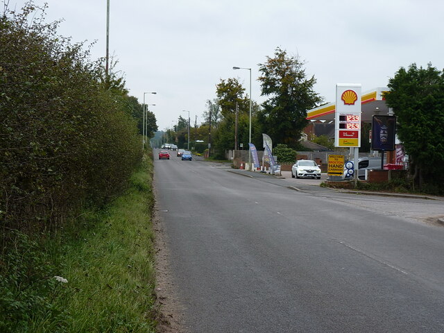
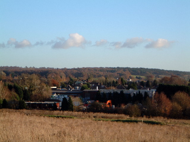
Newtown is a small village located in the county of Staffordshire, England. Situated approximately 4 miles southwest of the bustling town of Stafford, Newtown is a peaceful and scenic area that offers a tranquil escape from city life.

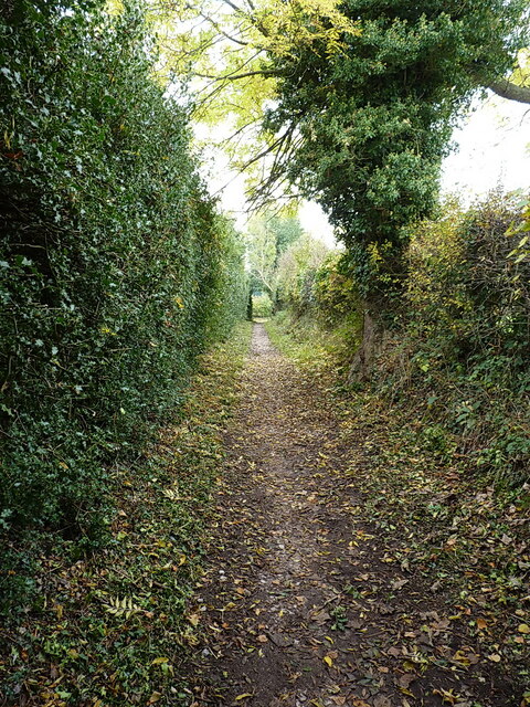
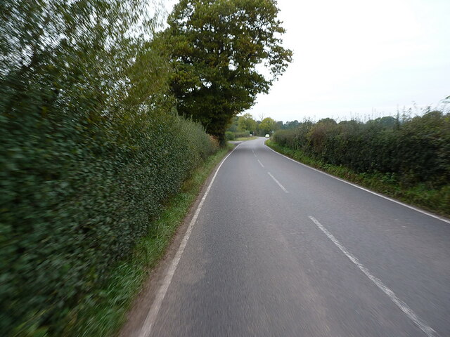
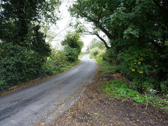
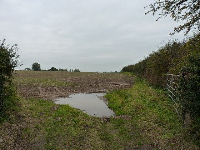
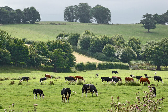
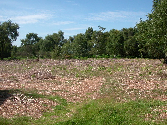
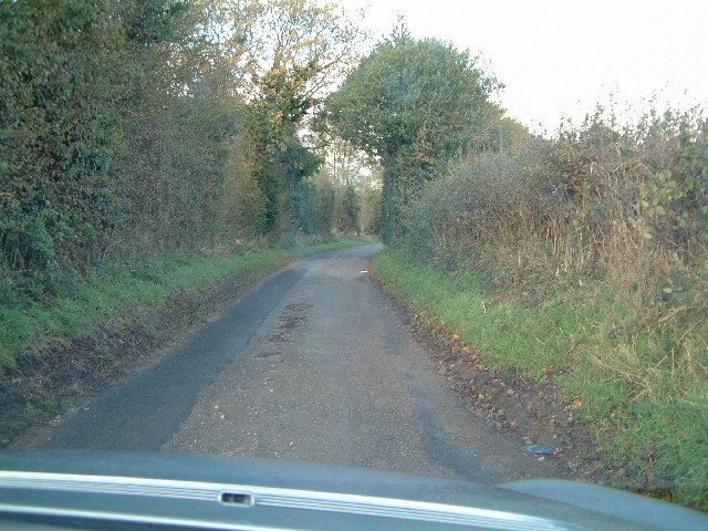
The village is surrounded by picturesque countryside, with rolling hills, lush green fields, and charming country lanes. This rural setting makes Newtown a popular destination for nature enthusiasts and those seeking outdoor activities. There are several walking and cycling routes that provide stunning views of the surrounding landscape.

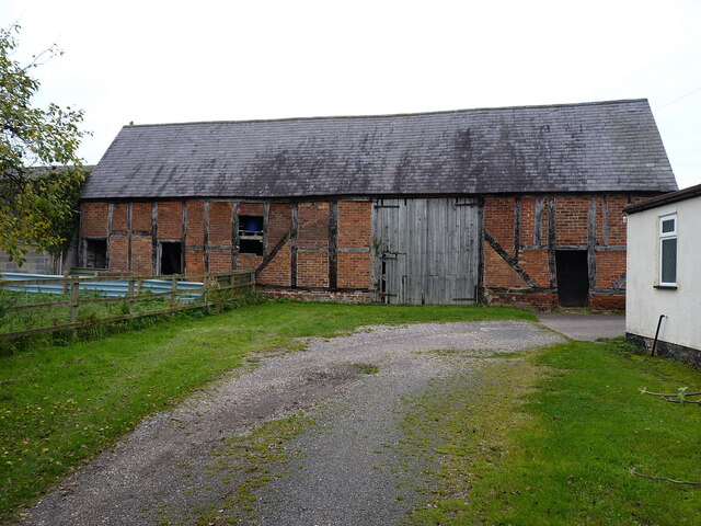
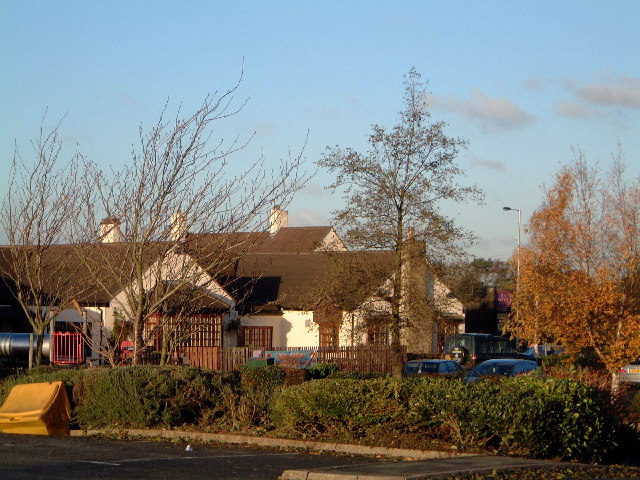
Despite its small size, Newtown has a close-knit community that takes pride in its heritage. The village features a few historic buildings, including a 12th-century church that adds to its charm. The local pub, The Crown, is a popular gathering spot for residents and visitors alike, offering a friendly atmosphere and traditional British pub food.

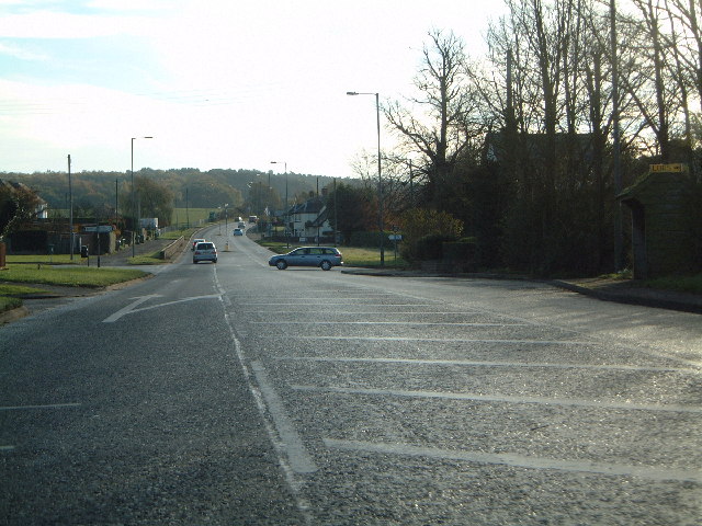
Although Newtown does not have many amenities, its close proximity to Stafford means that residents have easy access to a wider range of services, including shops, schools, and healthcare facilities. The village is well-connected by road, with the A34 passing nearby, providing convenient links to other towns and cities in the region.

In summary, Newtown, Staffordshire is a small village that offers a peaceful and idyllic lifestyle in the midst of beautiful countryside. With its strong sense of community and close proximity to amenities in Stafford, Newtown provides a delightful place to live or visit for those seeking a slower pace of life.

If you have any feedback on the listing, please let us know in the comments section below.

Newtown Images

Images are sourced within 2km of 52.770961/-2.0625068 or Grid Reference SJ9519. Thanks to Geograph Open Source API. All images are credited.

Southern end of the bridleway The track from Walton on the Hill, which runs in a generally southeasterly direction, emerges here onto Sawpit Lane at Brocton.
Southern end of the bridleway
The track from Walton on the Hill, which runs in a generally southeasterly direction, emerges here onto Sawpit Lane at Brocton.
Dovecot at Brocton Hall In the grounds of Brocton Hall, which is now the golf club, this 18th century former dovecot was Grade II listed <span class="nowrap"><a title="https://britishlistedbuildings.co.uk/101116692-dovecote-at-brocton-hall-brocton#.Yle9wOjMI2w" rel="nofollow ugc noopener" href="https://britishlistedbuildings.co.uk/101116692-dovecote-at-brocton-hall-brocton#.Yle9wOjMI2w">Link</a><img style="margin-left:2px;" alt="External link" title="External link - shift click to open in new window" src="https://s1.geograph.org.uk/img/external.png" width="10" height="10"/></span> & <span class="nowrap"><a title="https://historicengland.org.uk/listing/the-list/list-entry/1116692" rel="nofollow ugc noopener" href="https://historicengland.org.uk/listing/the-list/list-entry/1116692">Link</a><img style="margin-left:2px;" alt="External link" title="External link - shift click to open in new window" src="https://s1.geograph.org.uk/img/external.png" width="10" height="10"/></span> in 1968.
Dovecot at Brocton Hall
In the grounds of Brocton Hall, which is now the golf club, this 18th century former dovecot was Grade II listed LinkExternal link & LinkExternal link in 1968.
Brocton Hall Originally the 18th century hall had a third floor, but this was lost to a fire around the start of WWII, and was never rebuilt. The hall is now the clubhouse of the golf club, and attracted a Grade II listing <span class="nowrap"><a title="https://britishlistedbuildings.co.uk/101116688-brocton-hall-brocton#.Yle__ujMI2w" rel="nofollow ugc noopener" href="https://britishlistedbuildings.co.uk/101116688-brocton-hall-brocton#.Yle__ujMI2w">Link</a><img style="margin-left:2px;" alt="External link" title="External link - shift click to open in new window" src="https://s1.geograph.org.uk/img/external.png" width="10" height="10"/></span> & <span class="nowrap"><a title="https://historicengland.org.uk/listing/the-list/list-entry/1116688" rel="nofollow ugc noopener" href="https://historicengland.org.uk/listing/the-list/list-entry/1116688">Link</a><img style="margin-left:2px;" alt="External link" title="External link - shift click to open in new window" src="https://s1.geograph.org.uk/img/external.png" width="10" height="10"/></span> in 1953.
Brocton Hall
Originally the 18th century hall had a third floor, but this was lost to a fire around the start of WWII, and was never rebuilt. The hall is now the clubhouse of the golf club, and attracted a Grade II listing LinkExternal link & LinkExternal link in 1953.
Ruins of a medieval building behind Brocton Hall Tucked away, attached to the wall of the large rear kitchen garden of <a href="https://www.geograph.org.uk/photo/7146661">SJ9619 : Brocton Hall</a>, these stone arches are the remains of an unknown building that once lay somewhere nearby. Despite the lack of detail, they were Grade II listed <span class="nowrap"><a title="https://britishlistedbuildings.co.uk/101116745-ruins-to-north-west-of-brocton-hall-brocton#.YlfBVujMI2w" rel="nofollow ugc noopener" href="https://britishlistedbuildings.co.uk/101116745-ruins-to-north-west-of-brocton-hall-brocton#.YlfBVujMI2w">Link</a><img style="margin-left:2px;" alt="External link" title="External link - shift click to open in new window" src="https://s1.geograph.org.uk/img/external.png" width="10" height="10"/></span> & <span class="nowrap"><a title="https://historicengland.org.uk/listing/the-list/list-entry/1116745" rel="nofollow ugc noopener" href="https://historicengland.org.uk/listing/the-list/list-entry/1116745">Link</a><img style="margin-left:2px;" alt="External link" title="External link - shift click to open in new window" src="https://s1.geograph.org.uk/img/external.png" width="10" height="10"/></span> in 1968.
Ruins of a medieval building behind Brocton Hall
Tucked away, attached to the wall of the large rear kitchen garden of SJ9619 : Brocton Hall, these stone arches are the remains of an unknown building that once lay somewhere nearby. Despite the lack of detail, they were Grade II listed LinkExternal link & LinkExternal link in 1968.
Filling station on the Cannock Road, A34, at Newtown Petrol at this point in time was for sale at £1.239 per litre, with diesel a few pence more than that.
Filling station on the Cannock Road, A34, at Newtown
Petrol at this point in time was for sale at £1.239 per litre, with diesel a few pence more than that.
Along Teddesley Road near Newtown
Narrow lane east of Acton Trussell The fly-tipped furniture <a href="https://www.geograph.org.uk/photo/2805943">SJ9418 : Discarded furniture by a country lane</a> that was here on Acton Hall Lane some years ago has been removed.
Narrow lane east of Acton Trussell
The fly-tipped furniture SJ9418 : Discarded furniture by a country lane that was here on Acton Hall Lane some years ago has been removed.
Some people clearly can't read Or they genuinely do not give a monkey's about anyone else, or the state of the countryside around them. This sort of inexcusable behaviour warrants the return of capital punishment, in my book.
Some people clearly can't read
Or they genuinely do not give a monkey's about anyone else, or the state of the countryside around them. This sort of inexcusable behaviour warrants the return of capital punishment, in my book.
Field and hedgerow near Acton Hall Lane
Timber-framed barn at Lower Farm Described in its 1986 Grade II listing <span class="nowrap"><a title="https://britishlistedbuildings.co.uk/101039249-barn-incorporating-cowhouse-approximately-5-yards-north-of-lower-farmhouse-acton-trussell-and-bednall#.Ymo90drMI2w" rel="nofollow ugc noopener" href="https://britishlistedbuildings.co.uk/101039249-barn-incorporating-cowhouse-approximately-5-yards-north-of-lower-farmhouse-acton-trussell-and-bednall#.Ymo90drMI2w">Link</a><img style="margin-left:2px;" alt="External link" title="External link - shift click to open in new window" src="https://s1.geograph.org.uk/img/external.png" width="10" height="10"/></span> & <span class="nowrap"><a title="https://historicengland.org.uk/listing/the-list/list-entry/1039249" rel="nofollow ugc noopener" href="https://historicengland.org.uk/listing/the-list/list-entry/1039249">Link</a><img style="margin-left:2px;" alt="External link" title="External link - shift click to open in new window" src="https://s1.geograph.org.uk/img/external.png" width="10" height="10"/></span> as "Early 18th century", this building is still in agricultural use. It has a cowhouse at the left end, and a threshing room to the right of the full-height doorway.
Timber-framed barn at Lower Farm
Described in its 1986 Grade II listing LinkExternal link & LinkExternal link as "Early 18th century", this building is still in agricultural use. It has a cowhouse at the left end, and a threshing room to the right of the full-height doorway.
Fallow deer in hollow of old quarry There are around fifty deer in the image in open ground close to the village of Brocton on Cannock Chase. Maps indicate a quarry face of unknown height beyond the animals, screened by the woodland.
Fallow deer in hollow of old quarry
There are around fifty deer in the image in open ground close to the village of Brocton on Cannock Chase. Maps indicate a quarry face of unknown height beyond the animals, screened by the woodland.
Staffordshire pasture near Wildwood, Stafford These pasture fields are south-east of Deptmore Lock, seen from the canal towpath.
Staffordshire pasture near Wildwood, Stafford
These pasture fields are south-east of Deptmore Lock, seen from the canal towpath.
Site of P.O.W. Camp at Cannock Chase 1914-1918 A small P.O.W. camp for U Boat crew was part of the Army Base. Some of the Prison Guards were men from the New Zealand Rifles, including my Father.
Site of P.O.W. Camp at Cannock Chase 1914-1918
A small P.O.W. camp for U Boat crew was part of the Army Base. Some of the Prison Guards were men from the New Zealand Rifles, including my Father.
Junction of A34 and Sawpit Lane and the way to Penkridge
Junction of A34 and Sawpit Lane
and the way to Penkridge
Country lane near Bednall Small country lane
Country lane near Bednall
Small country lane
Acton Hill Farm Could view bag the hill in the distance as well???
Acton Hill Farm
Could view bag the hill in the distance as well???
Newtown from the 7 stars Industrial estate outside Newtown, as viewed from the carpark of the Seven Stars at Brocton
Newtown from the 7 stars
Industrial estate outside Newtown, as viewed from the carpark of the Seven Stars at Brocton
Seven Stars at Brocton Public house
Seven Stars at Brocton
Public house
Show me another place!

Newtown is located at Grid Ref: SJ9519 (Lat: 52.770961, Lng: -2.0625068)

Administrative County: Staffordshire

District: Stafford

Police Authority: Staffordshire

What 3 Words

///afterglow.cuddling.betrayed. Near Stafford, Staffordshire

Nearby Locations

Newtown

Related Wikis

Brocton, Staffordshire

Brocton is a village and civil parish in the English county of Staffordshire. It is within the borough of Stafford. The village describes itself as the...

Walton-on-the-Hill, Staffordshire

Walton-on-the-Hill is a village in the Borough of Stafford in Staffordshire, England. It is about 5 km east of the centre of Stafford, and lies on the...

Walton High School, Stafford

Walton High School is a large mixed secondary school and sixth form serving a community in the southern part of Stafford, England.There are approximately...

Acton Trussell and Bednall

Acton Trussell and Bednall is a civil parish in the South Staffordshire district of Staffordshire, England. As the name indicates, it contains the two...

Milford Hall

Milford Hall is a privately owned 18th-century English country house at Milford, near Stafford. It is the family seat of the Levett Haszard family and...

Berkswich

Berkswich ( BAHK-switch) is a civil parish in the borough of Stafford in Staffordshire, England. According to the 2001 census it had a population of 1...

Milford, Staffordshire

Milford is a village in the county of Staffordshire, England. It lies at the edge of Cannock Chase, on the A513 road between Stafford and Rugeley. Just...

Bednall

Bednall is a village in Staffordshire, England. == Location == Bednall lies somewhat remote from main roads, in dairy-farming countryside some 2.5 miles...

Nearby Amenities

Located within 500m of 52.770961,-2.0625068
Bus Stop
Crossroads
Bus: yes
Naptan AtcoCode: 3800C701100
Naptan Bearing: SE
Naptan CommonName: Crossroads
Naptan Indicator: Adj
Naptan Landmark: Crossroads (S)
Naptan Street: Cannock Rd
Naptan Verified: no
Public Transport: platform
Source: naptan_import
Lat/Long: 52.7685563/-2.0565002
Bus Stop
Crossroads
Bus: yes
Naptan AtcoCode: 3800C701101
Naptan Bearing: NW
Naptan CommonName: Crossroads
Naptan Indicator: Adj
Naptan Landmark: Crossroads (N)
Naptan Street: Cannock Rd
Naptan Verified: no
Public Transport: platform
Source: naptan_import
Lat/Long: 52.7697147/-2.0590808
Bus Stop
Sawpit Lane
Bus: yes
Naptan AtcoCode: 3800C744401
Naptan Bearing: NE
Naptan CommonName: Sawpit Lane
Naptan Indicator: Adj
Naptan Landmark: Crossroads
Naptan Street: Sawpit Lane
Naptan Verified: no
Public Transport: platform
Source: naptan_import
Lat/Long: 52.7697333/-2.0578357
Bus Stop
Chase Crescent
Bus: yes
Naptan AtcoCode: 3800C744402
Naptan Bearing: SW
Naptan CommonName: Chase Crescent
Naptan Indicator: Adj
Naptan Landmark: Chase Crescent
Naptan Street: Sawpit Lane
Naptan Verified: no
Public Transport: platform
Source: naptan_import
Lat/Long: 52.7709567/-2.0561328
Bus Stop
Brocton Hall Golf Club
Bus: yes
Naptan AtcoCode: 3800C754201
Naptan Bearing: NE
Naptan CommonName: Brocton Hall Golf Club
Naptan Indicator: Adj
Naptan Street: Sawpit Lane
Naptan Verified: no
Public Transport: platform
Source: naptan_import
Lat/Long: 52.7712624/-2.0559701
Bus Stop
Brocton Crescent
Bus: yes
Naptan AtcoCode: 3800C790500
Naptan Bearing: NW
Naptan CommonName: Brocton Crescent
Naptan Indicator: Adj
Naptan Landmark: Brocton Crescent
Naptan Street: Cannock Road
Naptan Verified: no
Public Transport: platform
Source: naptan_import
Lat/Long: 52.7722743/-2.0637831
Bus Stop
Brocton Crescent
Bus: yes
Naptan AtcoCode: 3800C790501
Naptan Bearing: SE
Naptan CommonName: Brocton Crescent
Naptan Indicator: Opp
Naptan Landmark: Brocton Crescent
Naptan Street: Cannock Road
Naptan Verified: no
Public Transport: platform
Source: naptan_import
Lat/Long: 52.7719781/-2.0630267
Post Box
Brand: Royal Mail
Brand Wikidata: Q638098
Brand Wikipedia: en:Royal Mail
Collection Times: Mo-Fr 09:00; Sa 07:00
Operator: Royal Mail
Operator Wikidata: Q638098
Post Box Mounting: brick_pillar
Post Box Type: wall
Ref: ST17 89D
Royal Cypher: GR
Royal Cypher Wikidata: Q33102273
Source: survey
Lat/Long: 52.7697097/-2.0579315
Turning Circle
Lat/Long: 52.7697609/-2.0562498
Barrier: kissing_gate
Lat/Long: 52.7690099/-2.0560805
Londis
Brand: Londis
Brand Wikidata: Q21008564
Brand Wikipedia: en:Londis (United Kingdom)
Shop: convenience
Lat/Long: 52.7723705/-2.0641584
R & J Aggregates
Shop: trade
Trade: aggregates
Lat/Long: 52.7718285/-2.0655055
Fuel
Esso
Brand: Esso
Brand Wikidata: Q867662
Brand Wikipedia: en:Esso
Lat/Long: 52.772286/-2.0640119
Clay & Concrete Ltd
Shop: trade
Trade: civil engineers
Lat/Long: 52.7725666/-2.0654374
Car Wash
Lat/Long: 52.7723355/-2.0641823
Note: 40 mph speed limit sign SW-bound
Lat/Long: 52.7695829/-2.0580741
Telephone
Defibrillator
Booth: K6
Covered: booth
Defibrillator Location: inside red phone box, Sawpit Lane, Brocton
Emergency: defibrillator
Man Made: telephone_box
Old Phone: +44 1785 660171
Source: survey
Lat/Long: 52.7697659/-2.0578739
Speed Camera
Source: survey
Lat/Long: 52.7702876/-2.0599067
Note: National speed limit sign NW-bound
Lat/Long: 52.7735861/-2.0660676
Barrier: stile
Steps: 1
Stile: stepover
Lat/Long: 52.7673597/-2.0581638
Barrier: stile
Steps: 1
Stile: stepover
Lat/Long: 52.768293/-2.0567855
Advertising: board
Lat/Long: 52.7697428/-2.0578987
The data included in this document is from www.openstreetmap.org. The data is made available under ODbL.

Have you been to Newtown?

Leave your review of Newtown below (or comments, questions and feedback).