Newtown

Settlement in Somerset South Somerset

England

Newtown

View from Burrow Hill
View from Burrow Hill Credit: Pam Goodey

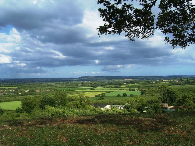
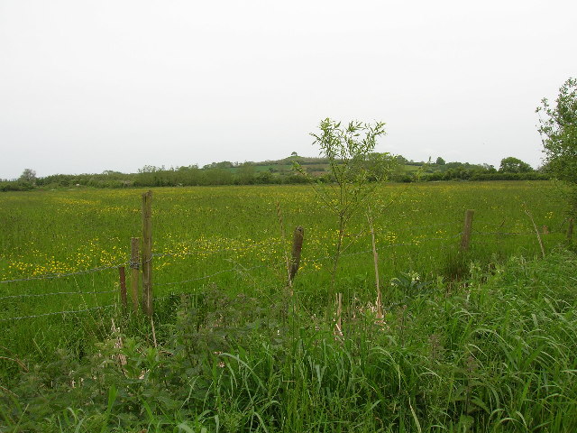
Newtown is a small village located in the county of Somerset, England. Situated in the picturesque Mendip Hills, it is surrounded by rolling countryside and offers a tranquil and idyllic setting. The village is part of the Mendip district and is approximately 15 miles south of the city of Bath.

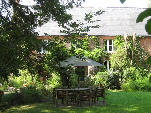
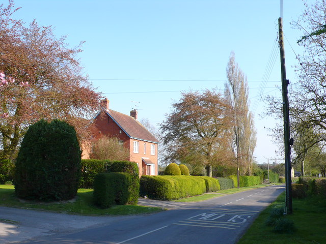
With a population of around 600 residents, Newtown is a close-knit community known for its friendly and welcoming atmosphere. The village retains a traditional charm with its historic buildings and quaint cottages, creating a sense of timeless beauty. The local architecture is a mix of styles, including Georgian and Victorian, adding to the village's character.

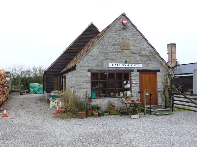
Despite its small size, Newtown offers a range of amenities for its residents. These include a village hall, a primary school, a post office, and a local pub, which serves as a social hub for the community. The village is also well-served by public transportation, with regular bus services connecting Newtown to nearby towns and cities.

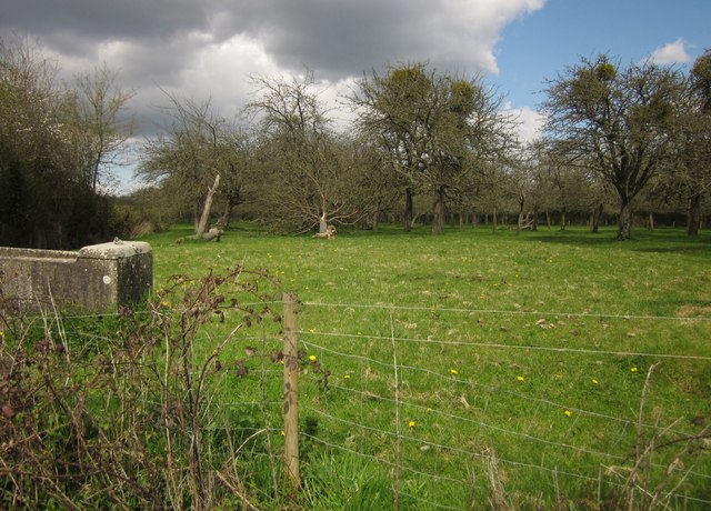
Nature lovers and outdoor enthusiasts will find plenty to enjoy in Newtown. The surrounding area is a haven for hikers, cyclists, and walkers, with numerous trails and paths offering breathtaking views of the countryside. The village is also close to popular attractions such as Cheddar Gorge and Wookey Hole Caves, adding to its appeal for visitors.

In summary, Newtown, Somerset, offers a peaceful and charming village lifestyle amidst stunning natural surroundings. With a strong sense of community and a range of amenities, it is an ideal place to live for those seeking a tranquil and picturesque setting.

If you have any feedback on the listing, please let us know in the comments section below.

Newtown Images

Images are sourced within 2km of 50.99149/-2.8087658 or Grid Reference ST4321. Thanks to Geograph Open Source API. All images are credited.

View from Burrow Hill
Town Tree Farmhouse Town Tree farmhouse is situated in the centre of the walk through the 22 acres of nature garden that was started in the 1970's and opened to the public in 1987. The land was originally flat farmland until Chris Burnett who was born in the farmhouse, started his dream of forming the garden.
Town Tree Farmhouse
Town Tree farmhouse is situated in the centre of the walk through the 22 acres of nature garden that was started in the 1970's and opened to the public in 1987. The land was originally flat farmland until Chris Burnett who was born in the farmhouse, started his dream of forming the garden.
Town Tree nature garden This stone commemorates the opening of the nature garden in the 1980's by Richard Wyatt of HTV Bristol.
Town Tree nature garden
This stone commemorates the opening of the nature garden in the 1980's by Richard Wyatt of HTV Bristol.
Fuel Wood For Pottery Kilns This stack of timber offcuts from a sawmill will be used as fuel for the kilns at the pottery of John Leach in Muchelney
Fuel Wood For Pottery Kilns
This stack of timber offcuts from a sawmill will be used as fuel for the kilns at the pottery of John Leach in Muchelney
John Leach Pottery This is the shop and gallery of John Leach at his pottery in Muchelney. the work of other artists is also displayed in the gallery.
John Leach Pottery
This is the shop and gallery of John Leach at his pottery in Muchelney. the work of other artists is also displayed in the gallery.
House in Stembridge Ash This is the view south along New Cross Hill which runs from Stembridge up to New Cross.
House in Stembridge Ash
This is the view south along New Cross Hill which runs from Stembridge up to New Cross.
Orchard, Stembridge This is beside Deadlands Lane near Oak Tree Farm.
Orchard, Stembridge
This is beside Deadlands Lane near Oak Tree Farm.
Westmoor Catchwater This drainage channel runs around the southern edge of West Moor. Seen here from a bridge across it on bridleway L 17/12 (Middle Drove). Footpath L 17/3 runs alongside it on the right.
Westmoor Catchwater
This drainage channel runs around the southern edge of West Moor. Seen here from a bridge across it on bridleway L 17/12 (Middle Drove). Footpath L 17/3 runs alongside it on the right.
Westmoor Catchwater The west side of the bridge from which <a href="https://www.geograph.org.uk/photo/3472353">ST4121 : Westmoor Catchwater</a> was taken. In the background, Middle Drove carries bridleway L 17/12 off across West Moor.
Westmoor Catchwater
The west side of the bridge from which ST4121 : Westmoor Catchwater was taken. In the background, Middle Drove carries bridleway L 17/12 off across West Moor.
Westmoor Catchwater Following footpath L 17/3 along the drainage channel shown in <a href="https://www.geograph.org.uk/photo/3472353">ST4121 : Westmoor Catchwater</a> as it curves around Palmer's End.
Westmoor Catchwater
Following footpath L 17/3 along the drainage channel shown in ST4121 : Westmoor Catchwater as it curves around Palmer's End.
Path by the catchwater The Westmoor Catchwater, shown a little further west in <a href="https://www.geograph.org.uk/photo/3472363">ST4121 : Westmoor Catchwater</a>, has dwindled in size here. Footpath L 17/3, conversely, has become a bit more prominent as it approaches the first of two stiles by gates.
Path by the catchwater
The Westmoor Catchwater, shown a little further west in ST4121 : Westmoor Catchwater, has dwindled in size here. Footpath L 17/3, conversely, has become a bit more prominent as it approaches the first of two stiles by gates.
Stile by Westmoor Catchwater Footpath L 17/3 continues along this side of the channel towards Stembridge, while, among the trees, a footbridge takes footpath L 17/2 off to the other side for Kingsbury Episcopi.
Stile by Westmoor Catchwater
Footpath L 17/3 continues along this side of the channel towards Stembridge, while, among the trees, a footbridge takes footpath L 17/2 off to the other side for Kingsbury Episcopi.
Westmoor Catchwater Footpath L 17/3 runs along the drainage channel, which briefly crosses the southwest corner of the square, with a tangled hedge of bushes on the other side.
Westmoor Catchwater
Footpath L 17/3 runs along the drainage channel, which briefly crosses the southwest corner of the square, with a tangled hedge of bushes on the other side.
Footpath to Kingsbury Episcopi Footpath L 17/2 passes through this opening in the hedge at the southern edge of West Moor.
Footpath to Kingsbury Episcopi
Footpath L 17/2 passes through this opening in the hedge at the southern edge of West Moor.
Field on West Moor Bordered by Sharpam Drove on its north side - over on the left - and by Westmoor Catchwater on its south side, and crossed by footpath L 17/2, which enters through this gap on the hedge, seen in <a href="https://www.geograph.org.uk/photo/3472572">ST4221 : Footpath to Kingsbury Episcopi</a>.
Field on West Moor
Bordered by Sharpam Drove on its north side - over on the left - and by Westmoor Catchwater on its south side, and crossed by footpath L 17/2, which enters through this gap on the hedge, seen in ST4221 : Footpath to Kingsbury Episcopi.
Field on West Moor Looking to the left across the field shown in the foreground of <a href="https://www.geograph.org.uk/photo/3472572">ST4221 : Footpath to Kingsbury Episcopi</a>.
Field on West Moor
Looking to the left across the field shown in the foreground of ST4221 : Footpath to Kingsbury Episcopi.
Westmoor Catchwater Showing a footbridge by which footpath L 17/2 crosses the drainage channel to join  footpath L 17/3 on the left side.
Westmoor Catchwater
Showing a footbridge by which footpath L 17/2 crosses the drainage channel to join footpath L 17/3 on the left side.
Palmer's End Lane Leading onto the levels from Lower Burrow, and soon turning into Middle Drove.
Palmer's End Lane
Leading onto the levels from Lower Burrow, and soon turning into Middle Drove.
Show me another place!

Newtown is located at Grid Ref: ST4321 (Lat: 50.99149, Lng: -2.8087658)

Administrative County: Somerset

District: South Somerset

Police Authority: Avon and Somerset

What 3 Words

///entitle.workroom.party. Near Martock, Somerset

Nearby Locations

Kingsbury Episcopi Newtown

Related Wikis

Kingsbury Episcopi

Kingsbury Episcopi is a village and civil parish on the River Parrett in Somerset, England, situated 9 miles (14.5 km) north west of Yeovil in the South...

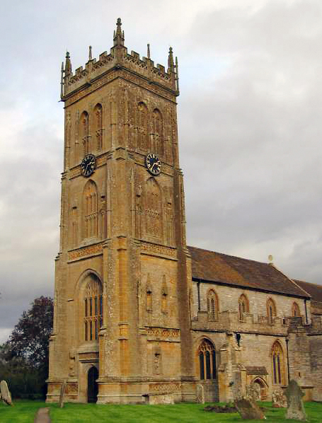
St Martin's Church, Kingsbury Episcopi

The Church of St Martin in Kingsbury Episcopi, Somerset, England, dates from the 14th century and has been designated as a Grade I listed building.The...

West Moor SSSI

West Moor (grid reference ST420220) is a 213.0 hectare (526.3 acre) biological Site of Special Scientific Interest on the River Parrett in Somerset, notified...

Burrow Hill Cider Farm

Burrow Hill Cider Farm is a cider farm in Somerset, England at the base of Burrow Hill overlooking the Somerset Levels. It has views of most of South Somerset...

River Isle

The River Isle (also known as the River Ile) flows from its source near Combe St Nicholas, through Somerset, England and discharges into the River Parrett...

Midelney Manor

Midelney Manor in Drayton, Somerset, England was built in the late 16th century in two distinct halves by Richard and Thomas Trevillian. It has been designated...

East Lambrook

East Lambrook is an English village situated in the civil parish of Kingsbury Episcopi, within the South Somerset district of Somerset. It is noted particularly...

East Lambrook Manor

East Lambrook Manor is a small 15th-century manor house in East Lambrook, Somerset, England, registered by English Heritage as a Grade II* listed building...

Nearby Amenities

Located within 500m of 50.99149,-2.8087658
Post Box
Operator: Royal Mail
Operator Wikidata: Q638098
Ref: TA12 139
Lat/Long: 50.9885312/-2.8071157
Barrier: bollard
Lat/Long: 50.9879308/-2.8095025
Crossing: informal
Lat/Long: 50.9924316/-2.8071819
Defibrillator
Emergency: defibrillator
Lat/Long: 50.9881138/-2.806213
Post Office
Kingsbury Post Office
Addr City: Martock
Addr Country: GB
Addr County: Somerset
Addr Postcode: TA12 6BG
Addr Street: Thorney Road
Addr Village: Kingsbury Episcopi
Brand: Post Office
Brand Wikidata: Q1783168
Brand Wikipedia: en:Post Office Ltd
Contact Website: https://www.postoffice.co.uk/branch-finder/4375491/kingsbury
Opening Hours: Mo-Sa 08:00-18:00; Su 09:00-12:00
Operator: Post Office Ltd
Ref Pol Id: 147705
Lat/Long: 50.9885345/-2.8062045
Power: pole
Source: bing
Lat/Long: 50.9928954/-2.8143197
Power: pole
Source: bing
Lat/Long: 50.9924429/-2.8141241
Power: pole
Source: bing
Lat/Long: 50.9918132/-2.8138974
Power: pole
Source: bing
Lat/Long: 50.9911717/-2.8136547
Power: pole
Source: bing
Lat/Long: 50.9905799/-2.8134334
Power: pole
Source: bing
Lat/Long: 50.9899586/-2.813196
Power: pole
Source: bing
Lat/Long: 50.9892757/-2.8129318
Material: wood
Power: pole
Source: bing
Transformer: distribution
Lat/Long: 50.9905436/-2.8078826
Material: wood
Power: pole
Source: bing
Lat/Long: 50.9893618/-2.8071865
Power: pole
Source: bing
Lat/Long: 50.9908441/-2.8025906
Power: pole
Source: bing
Lat/Long: 50.9904018/-2.8039478
Power: pole
Source: bing
Lat/Long: 50.990179/-2.8045633
Power: pole
Source: bing
Lat/Long: 50.9891312/-2.8079347
Power: pole
Source: bing
Lat/Long: 50.9887118/-2.8097682
Power: pole
Source: bing
Lat/Long: 50.9883792/-2.8112783
Power: pole
Source: bing
Lat/Long: 50.9886721/-2.8127173
Power: pole
Source: bing
Lat/Long: 50.9880921/-2.8125027
Post Box
Operator: Royal Mail
Post Box Type: lamp
Ref: TA12 220
Royal Cypher: EIIR
Royal Cypher Wikidata: Q33102113
Lat/Long: 50.9945228/-2.8134307
Leisure: playground
Lat/Long: 50.9884514/-2.8052516
Community Centre
Kingsbury Episcopi Community Centre
Lat/Long: 50.9887115/-2.8061778
The data included in this document is from www.openstreetmap.org. The data is made available under ODbL.

Have you been to Newtown?

Leave your review of Newtown below (or comments, questions and feedback).