Newton Town

Settlement in Nottinghamshire Mansfield

England

Newton Town

Small park off Waverley Road, Mansfield
Small park off Waverley Road, Mansfield Credit: Jonathan Thacker

Newton Town is a small village located in the county of Nottinghamshire, England. Situated approximately 12 miles northeast of the city of Nottingham, it is nestled amidst the picturesque countryside of the East Midlands. With a population of around 1,000 residents, Newton Town has a close-knit community feel.

The village is renowned for its tranquil and idyllic setting, surrounded by rolling hills and lush green fields. It offers a peaceful retreat from the hustle and bustle of urban life. The landscape is dotted with charming cottages, many of which date back to the 19th century, adding to the village's quaint and rustic appeal.

Despite its small size, Newton Town boasts a few amenities that cater to the needs of its residents. The village has a local pub, the Newton Arms, where locals and visitors alike can enjoy a pint of ale or a hearty meal. Additionally, there is a small convenience store that provides essential groceries and household items.

For outdoor enthusiasts, Newton Town offers several walking and cycling trails that showcase the area's natural beauty. Nearby attractions include the Sherwood Forest Country Park, famous for its association with the legendary Robin Hood, and the historic town of Southwell, home to the stunning Southwell Minster.

Overall, Newton Town offers a charming and peaceful setting, ideal for those seeking a slower pace of life surrounded by natural beauty. Its friendly community and proximity to the countryside make it an attractive place to live or visit.

If you have any feedback on the listing, please let us know in the comments section below.
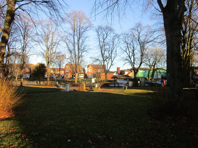
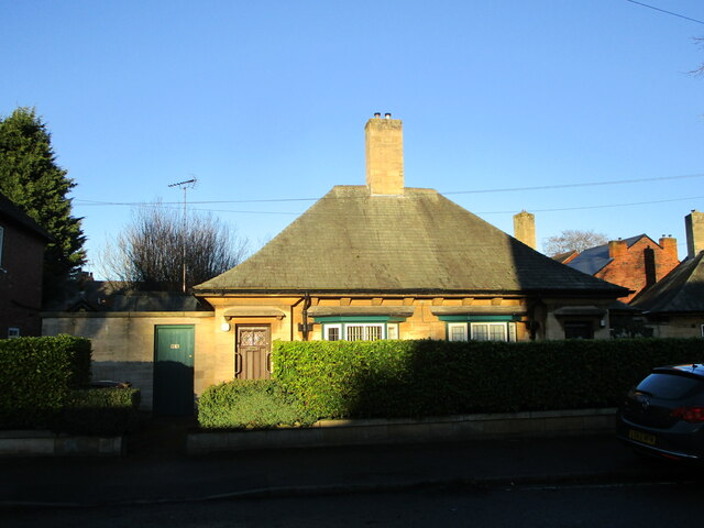
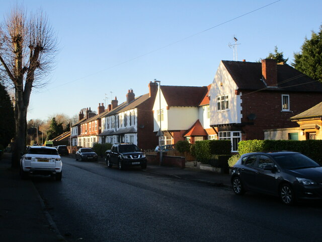
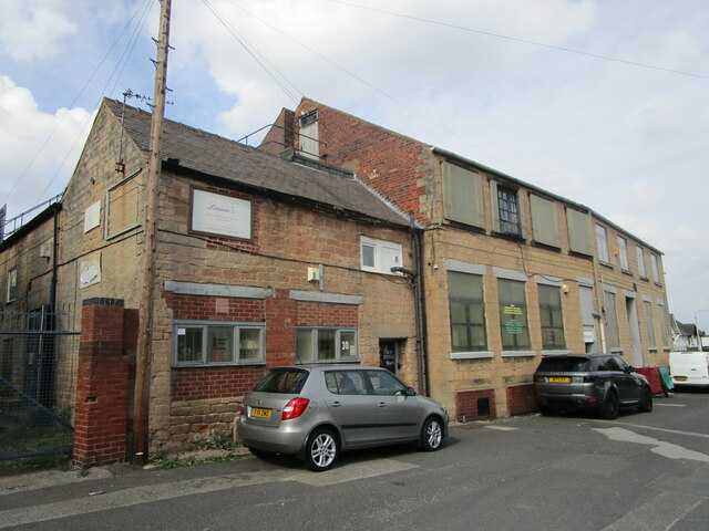
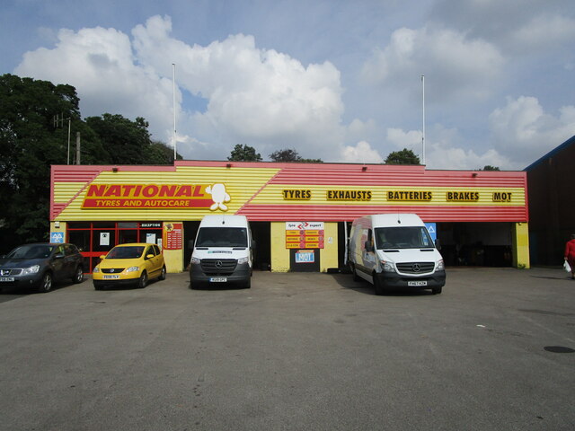
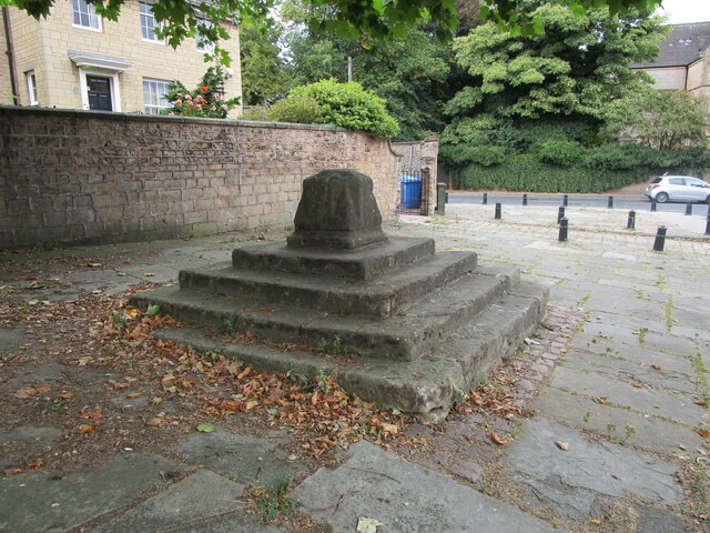
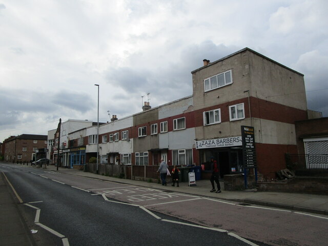
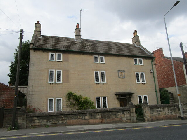
Newton Town Images

Images are sourced within 2km of 53.149647/-1.2046484 or Grid Reference SK5361. Thanks to Geograph Open Source API. All images are credited.

Small park off Waverley Road, Mansfield
William Singleton Almshouses, Waverley Road, Mansfield Designed by F.W. Tempest 1936. One of three linked buildings.
William Singleton Almshouses, Waverley Road, Mansfield
Designed by F.W. Tempest 1936. One of three linked buildings.
Houses in Waverley Road, Mansfield
Tanning Lounge, Chesterfield Road, Mansfield
Factory buildings, Grove Street, Mansfield Woodhouse
Yard off High Street, Mansfield Woodhouse Yards are a common feature of the older parts of Mansfield Woodhouse. This one shows that the building fronting High Street is partly timber framed.
Yard off High Street, Mansfield Woodhouse
Yards are a common feature of the older parts of Mansfield Woodhouse. This one shows that the building fronting High Street is partly timber framed.
National Tyre Depot, Mansfield
Remains of the Market Cross, Mansfield Woodhouse Dates from the early fourteenth century <span class="nowrap"><a title="https://historicengland.org.uk/listing/the-list/list-entry/1253491" rel="nofollow ugc noopener" href="https://historicengland.org.uk/listing/the-list/list-entry/1253491">Link</a><img style="margin-left:2px;" alt="External link" title="External link - shift click to open in new window" src="https://s1.geograph.org.uk/img/external.png" width="10" height="10"/></span>
Remains of the Market Cross, Mansfield Woodhouse
Dates from the early fourteenth century LinkExternal link
Moderne in Mansfield Woodhouse An altered block of shops and houses. This, no doubt, had Crittall windows <span class="nowrap"><a title="https://en.wikipedia.org/wiki/Crittall_Windows" rel="nofollow ugc noopener" href="https://en.wikipedia.org/wiki/Crittall_Windows">Link</a><img style="margin-left:2px;" alt="External link" title="External link - shift click to open in new window" src="https://s1.geograph.org.uk/img/external.png" width="10" height="10"/></span> and a uniform external decoration.
Moderne in Mansfield Woodhouse
An altered block of shops and houses. This, no doubt, had Crittall windows LinkExternal link and a uniform external decoration.
82/84 Station Street, Mansfield Woodhouse Eighteenth century house refronted in the nineteenth century <span class="nowrap"><a title="https://historicengland.org.uk/listing/the-list/list-entry/1262548" rel="nofollow ugc noopener" href="https://historicengland.org.uk/listing/the-list/list-entry/1262548">Link</a><img style="margin-left:2px;" alt="External link" title="External link - shift click to open in new window" src="https://s1.geograph.org.uk/img/external.png" width="10" height="10"/></span>
82/84 Station Street, Mansfield Woodhouse
Eighteenth century house refronted in the nineteenth century LinkExternal link
B and J Parr, Manfield Woodhouse Plastic recycling plant <span class="nowrap"><a title="https://bjparr.co.uk/" rel="nofollow ugc noopener" href="https://bjparr.co.uk/">Link</a><img style="margin-left:2px;" alt="External link" title="External link - shift click to open in new window" src="https://s1.geograph.org.uk/img/external.png" width="10" height="10"/></span>
B and J Parr, Manfield Woodhouse
Plastic recycling plant LinkExternal link
The Library, Mansfield Woodhouse A CLASP building of 1960. Designed by Robert Matthews, Johnson-Marshall and Partners.
The Library, Mansfield Woodhouse
A CLASP building of 1960. Designed by Robert Matthews, Johnson-Marshall and Partners.
Path between Grove Street and Station Street, Mansfield Woodhouse Looking towards Station Street.
Path between Grove Street and Station Street, Mansfield Woodhouse
Looking towards Station Street.
31 Station Street, Mansfield Woodhouse A former malthouse <span class="nowrap"><a title="https://historicengland.org.uk/listing/the-list/list-entry/1251863" rel="nofollow ugc noopener" href="https://historicengland.org.uk/listing/the-list/list-entry/1251863">Link</a><img style="margin-left:2px;" alt="External link" title="External link - shift click to open in new window" src="https://s1.geograph.org.uk/img/external.png" width="10" height="10"/></span>
31 Station Street, Mansfield Woodhouse
A former malthouse LinkExternal link
The former White Swan Inn, Mansfield Woodhouse Converted to a convenience store in 2011.
The former White Swan Inn, Mansfield Woodhouse
Converted to a convenience store in 2011.
Mansfield Woodhouse Children's Centre A former Police Station.
Mansfield Woodhouse Children's Centre
A former Police Station.
Christadelphian Church, Mansfield Woodhouse Built as a Baptist church in 1905.
Christadelphian Church, Mansfield Woodhouse
Built as a Baptist church in 1905.
The Angel Inn, Mansfield Woodhouse Early nineteenth century inn <span class="nowrap"><a title="https://historicengland.org.uk/listing/the-list/list-entry/1254406" rel="nofollow ugc noopener" href="https://historicengland.org.uk/listing/the-list/list-entry/1254406">Link</a><img style="margin-left:2px;" alt="External link" title="External link - shift click to open in new window" src="https://s1.geograph.org.uk/img/external.png" width="10" height="10"/></span>
The Angel Inn, Mansfield Woodhouse
Early nineteenth century inn LinkExternal link
Show me another place!

Newton Town is located at Grid Ref: SK5361 (Lat: 53.149647, Lng: -1.2046484)

Administrative County: Nottinghamshire

District: Mansfield

Police Authority: Nottinghamshire

What 3 Words

///debate.speak.live. Near Mansfield Woodhouse, Nottinghamshire

Nearby Locations

Newton Town Mansfield

Related Wikis

St Philip Neri Church, Mansfield

St Philip Neri Church is a Roman Catholic parish church in Mansfield, Nottinghamshire, England. It was founded by Edward Bagshawe, Bishop of Nottingham...

Mansfield District

Mansfield District is a local government district in Nottinghamshire, England. Its council is based in the town of Mansfield. The district is bounded by...

St John's Church, Mansfield

St. John's Church, Mansfield is a parish church in the Church of England located in Mansfield, Nottinghamshire. The church is Grade II listed by the Department...

A Spire for Mansfield

A Spire for Mansfield, also shortened to A-Spire is a 13-metre (42.7-foot) sculpture, which lies within the centre of Mansfield, Nottinghamshire, England...

All Saints' Catholic Academy

All Saints' Catholic Academy (formerly All Saints RC School) is a Roman Catholic secondary school in Mansfield, Nottinghamshire, England. It is the only...

Moot Hall, Mansfield

The Moot Hall is a municipal building in the Market Place in Mansfield, Nottinghamshire, England. The building, which now operates as a shop, is a Grade...

Palace Theatre, Mansfield

The Palace Theatre in Mansfield, Nottinghamshire, England first opened in 1910 as a cinema. It was later converted to a live theatre, which has been its...

Mansfield

Mansfield is a market town and the administrative centre of the Mansfield District in Nottinghamshire, England. It is the largest town in the wider Mansfield...

Nearby Amenities

Located within 500m of 53.149647,-1.2046484
Traffic Calming: hump
Lat/Long: 53.1502437/-1.2108896
Crossing
Button Operated: yes
Crossing: traffic_signals
Crossing Island: no
Crossing Markings: dots
Tactile Paving: yes
Lat/Long: 53.1475678/-1.1997403
Traffic Signals
Traffic Signals: signal
Lat/Long: 53.1506334/-1.2024438
Crossing
Crossing: marked
Lat/Long: 53.1470289/-1.2090946
Crossing
Crossing: marked
Lat/Long: 53.147286/-1.2083242
Traffic Signals
Crossing: no
Traffic Signals Direction: backward
Lat/Long: 53.1483698/-1.2064169
Traffic Signals
Lat/Long: 53.1465899/-1.1995578
Turning Circle
Lat/Long: 53.1490494/-1.2119606
Turning Circle
Turning Circle: hammer
Lat/Long: 53.1512618/-1.2015771
Traffic Signals
Traffic Signals: crossing
Lat/Long: 53.149915/-1.2016177
Traffic Signals
Traffic Signals: crossing
Lat/Long: 53.1500753/-1.2016087
Bus Stop
Westgate
Bus: yes
Naptan AtcoCode: 3300MA0028
Naptan Bearing: N
Naptan CommonName: Westgate
Naptan Crossing: Chesterfield Road South
Naptan Indicator: N-bound
Naptan NaptanCode: ntsdmtdg
Naptan Notes: none
Naptan PlusbusZoneRef: MFLDTWN
Naptan Street: Westgate
Naptan Verified: yes
Public Transport: platform
Source: naptan_import
Lat/Long: 53.1470576/-1.1996393
Bus Stop
St Philip Neri's Church
Bench: yes
Bin: yes
Bus: yes
Departures Board: realtime
Local Ref: A
Naptan AtcoCode: 3300MA0089
Naptan Bearing: NW
Naptan CommonName: St Philip Neris Church
Naptan Crossing: Paulsons Drive
Naptan Indicator: Stop A
Naptan Landmark: St Philip Neris Church
Naptan NaptanCode: ntsamtjt
Naptan Notes: none
Naptan PlusbusZoneRef: MFLDTWN
Naptan Street: Chesterfield Road South
Naptan Verified: yes
Public Transport: platform
Shelter: yes
Lat/Long: 53.1481704/-1.2004021
Bus Stop
Thoresby Street
Bus: yes
Naptan AtcoCode: 3300MA0091
Naptan Bearing: W
Naptan CommonName: Thoresby Street
Naptan Crossing: Thoresby Street
Naptan Indicator: opp
Naptan NaptanCode: ntsamtma
Naptan Notes: none
Naptan PlusbusZoneRef: MFLDTWN
Naptan Street: Wood Street
Naptan Verified: no
Public Transport: platform
Source: naptan_import
Lat/Long: 53.1466497/-1.2038185
Bus Stop
Tesco
Bench: yes
Bin: yes
Bus: yes
Lit: no
Naptan AtcoCode: 3300MA0092
Naptan Bearing: NW
Naptan CommonName: Tesco
Naptan Crossing: Norfolk Drive
Naptan Indicator: adj
Naptan Landmark: Tesco
Naptan NaptanCode: ntsamtmd
Naptan Notes: none
Naptan PlusbusZoneRef: MFLDTWN
Naptan Street: Chesterfield Road South
Naptan Verified: no
Public Transport: platform
Shelter: yes
Source: naptan_import
Tactile Paving: no
Lat/Long: 53.1496119/-1.2014263
Bus Stop
Samuel Close
Bus: yes
Naptan AtcoCode: 3300MA0162
Naptan Bearing: SE
Naptan CommonName: Samuel Close
Naptan Crossing: Samuel Close
Naptan Indicator: adj
Naptan NaptanCode: ntsdtmwg
Naptan Notes: none
Naptan PlusbusZoneRef: MFLDTWN
Naptan Street: Broomhill Lane
Naptan Verified: no
Public Transport: platform
Source: naptan_import
Lat/Long: 53.1509155/-1.2100807
Bus Stop
Samuel Close
Bus: yes
Naptan AtcoCode: 3300MA0170
Naptan Bearing: NW
Naptan CommonName: Samuel Close
Naptan Crossing: Samuel Close
Naptan Indicator: opp
Naptan NaptanCode: ntsapjpa
Naptan Notes: none
Naptan PlusbusZoneRef: MFLDTWN
Naptan Street: Broomhill Lane
Naptan Verified: no
Public Transport: platform
Source: naptan_import
Lat/Long: 53.1510896/-1.210464
Bus Stop
Fire Station
Bus: yes
Naptan AtcoCode: 3300MA0172
Naptan Bearing: NE
Naptan CommonName: Fire Station
Naptan Indicator: o/s
Naptan Landmark: Fire Station
Naptan NaptanCode: ntsgdptp
Naptan Notes: none
Naptan PlusbusZoneRef: MFLDTWN
Naptan Street: Rosemary Street
Naptan Verified: no
Public Transport: platform
Source: naptan_import
Lat/Long: 53.149802/-1.2048279
Bus Stop
Fire Station
Bus: yes
Naptan AtcoCode: 3300MA0173
Naptan Bearing: SW
Naptan CommonName: Fire Station
Naptan Indicator: opp
Naptan Landmark: Fire Station
Naptan NaptanCode: ntsgdptw
Naptan Notes: none
Naptan PlusbusZoneRef: MFLDTWN
Naptan Street: Rosemary Street
Naptan Verified: no
Public Transport: platform
Source: naptan_import
Lat/Long: 53.1495606/-1.2050267
Bus Stop
Magistrates Court
Bus: yes
Naptan AtcoCode: 3300MA0174
Naptan Bearing: W
Naptan CommonName: Magistrates Court
Naptan Crossing: Welbeck Street
Naptan Indicator: opp
Naptan Landmark: Magistrates Court
Naptan NaptanCode: ntsgdpwa
Naptan Notes: none
Naptan PlusbusZoneRef: MFLDTWN
Naptan Street: Westfield Lane
Naptan Verified: no
Public Transport: platform
Source: naptan_import
Lat/Long: 53.1481762/-1.2050224
Bus Stop
Broomhill Lane
Bus: yes
Naptan AtcoCode: 3300MA0175
Naptan Bearing: NW
Naptan CommonName: Broomhill Lane
Naptan Crossing: Broomhill Lane
Naptan Indicator: opp
Naptan NaptanCode: ntsgdpwd
Naptan Notes: none
Naptan PlusbusZoneRef: MFLDTWN
Naptan Street: Westfield Lane
Naptan Verified: no
Public Transport: platform
Source: naptan_import
Lat/Long: 53.1494328/-1.2087823
Bus Stop
Broomhill Lane
Bus: yes
Naptan AtcoCode: 3300MA0176
Naptan Bearing: SE
Naptan CommonName: Broomhill Lane
Naptan Crossing: Broomhill Lane
Naptan Indicator: adj
Naptan NaptanCode: ntsgdpwg
Naptan PlusbusZoneRef: MFLDTWN
Naptan Street: Westfield Lane
Naptan Verified: no
Public Transport: platform
Source: naptan_import
Lat/Long: 53.1496945/-1.2089419
Bus Stop
Council Office
Bench: no
Bin: no
Bus: yes
Lit: no
Naptan AtcoCode: 3300MA0230
Naptan Bearing: NW
Naptan CommonName: Council Office
Naptan Crossing: Pheasant Hill
Naptan Indicator: adj
Naptan Landmark: Council Office
Naptan NaptanCode: ntsampjw
Naptan Notes: none
Naptan PlusbusZoneRef: MFLDTWN
Naptan Street: Chesterfield Road South
Naptan Verified: no
Public Transport: platform
Shelter: yes
Source: naptan_import
Tactile Paving: no
Lat/Long: 53.151939/-1.2044594
Bus Stop
Burns Street
Bus: yes
Naptan AtcoCode: 3300MA0336
Naptan Bearing: NE
Naptan CommonName: Burns Street
Naptan Crossing: Burns Street
Naptan Indicator: opp
Naptan NaptanCode: ntsapjdm
Naptan Notes: none
Naptan PlusbusZoneRef: MFLDTWN
Naptan Street: Ladybrook Lane
Naptan Verified: no
Public Transport: platform
Source: naptan_import
Lat/Long: 53.1474945/-1.2079507
Bus Stop
Burns Street
Bus: yes
Naptan AtcoCode: 3300MA0337
Naptan Bearing: SW
Naptan CommonName: Burns Street
Naptan Crossing: Burns Street
Naptan Indicator: adj
Naptan NaptanCode: ntsapjdp
Naptan Notes: none
Naptan PlusbusZoneRef: MFLDTWN
Naptan Street: Ladybrook Lane
Naptan Verified: no
Public Transport: platform
Source: naptan_import
Lat/Long: 53.1475088/-1.2073972
Bus Stop
Rosemary Street
Bus: yes
Naptan AtcoCode: 3300MA0338
Naptan Bearing: SE
Naptan CommonName: Rosemary Street
Naptan Crossing: Wood Street
Naptan Indicator: SE-bound
Naptan NaptanCode: ntsapjdt
Naptan Notes: none
Naptan PlusbusZoneRef: MFLDTWN
Naptan Street: Rosemary Street
Naptan Verified: no
Public Transport: platform
Source: naptan_import
Lat/Long: 53.1467937/-1.2053021
Bus Stop
Rosemary Street
Bus: yes
Naptan AtcoCode: 3300MA0355
Naptan Bearing: NW
Naptan CommonName: Rosemary Street
Naptan Crossing: Wood Street
Naptan Indicator: NW-bound
Naptan NaptanCode: ntsdmpap
Naptan Notes: none
Naptan PlusbusZoneRef: MFLDTWN
Naptan Street: Rosemary Street
Naptan Verified: no
Public Transport: platform
Source: naptan_import
Lat/Long: 53.1466687/-1.205439
Bus Stop
Wood Street
Bench: no
Bin: no
Bus: yes
Departures Board: timetable
Naptan AtcoCode: 3300MA0373
Naptan Bearing: W
Naptan CommonName: Wood Street
Naptan Crossing: Westfield Lane
Naptan Indicator: W-bound
Naptan NaptanCode: ntsamdmp
Naptan Notes: none
Naptan PlusbusZoneRef: MFLDTWN
Naptan Street: Wood Street
Naptan Verified: yes
Public Transport: platform
Shelter: no
Source: naptan_import
Lat/Long: 53.1472387/-1.2001792
Bus Stop
Council Office
Bench: no
Bin: no
Bus: yes
Lit: no
Naptan AtcoCode: 3300MA0417
Naptan Bearing: SE
Naptan CommonName: Council Office
Naptan Crossing: Pheasant Hill
Naptan Indicator: opp
Naptan Landmark: Council Office
Naptan NaptanCode: ntsamdwp
Naptan Notes: none
Naptan PlusbusZoneRef: MFLDTWN
Naptan Street: Chesterfield Road South
Naptan Verified: no
Public Transport: platform
Shelter: no
Source: naptan_import
Tactile Paving: no
Lat/Long: 53.1527328/-1.2052877
Bus Stop
Tesco
Bench: no
Bin: no
Bus: yes
Lit: no
Naptan AtcoCode: 3300MA0418
Naptan Bearing: SE
Naptan CommonName: Tesco
Naptan Crossing: West Bank Avenue
Naptan Indicator: opp
Naptan Landmark: Tesco
Naptan NaptanCode: ntsamdwt
Naptan Notes: none
Naptan PlusbusZoneRef: MFLDTWN
Naptan Street: Chesterfield Road South
Naptan Verified: no
Public Transport: platform
Shelter: no
Source: naptan_import
Tactile Paving: no
Lat/Long: 53.1505108/-1.2019438
Bus Stop
St Philip Neri School Bus Park
Bus: yes
Local Ref: IN
Naptan AtcoCode: 3300MA0675
Naptan Bearing: SW
Naptan BusStopType: CUS
Naptan CommonName: St Philip Neri School Bus Park
Naptan Indicator: in
Naptan Landmark: St Philip Neri School
Naptan NaptanCode: ntsgpwjw
Naptan Notes: CUS
Naptan Street: Bus Park
Naptan Verified: no
Public Transport: platform
Source: naptan_import
Lat/Long: 53.1496351/-1.2040684
Traffic Signals
Traffic Signals: signal
Lat/Long: 53.1457579/-1.203943
Crossing
Button Operated: yes
Crossing: traffic_signals
Crossing Island: no
Tactile Paving: yes
Lat/Long: 53.1457633/-1.2038992
Turning Circle
Lat/Long: 53.151293/-1.2097948
Traffic Signals
Crossing: no
Traffic Signals: signal
Lat/Long: 53.1455525/-1.203877
Glansfields
Lawyer: solicitor
Office: lawyer
Lat/Long: 53.1460798/-1.2014382
Dentist
Dentalcare Centre
Healthcare: dentist
Lat/Long: 53.1458411/-1.2029681
APC Chartered Accountants
Office: accountant
Lat/Long: 53.1459776/-1.2037916
Child and Family Therapy
Office: social_facility
Lat/Long: 53.1458377/-1.2028716
Mansfield Chiropractic Clinic
Healthcare: alternative
Healthcare Speciality: chiropractic
Lat/Long: 53.1458345/-1.2030432
Pharmacy
Manor Pharmacy
Brand: Peak Pharmacy
Brand Wikidata: Q122829165
Healthcare: pharmacy
Lat/Long: 53.1454063/-1.2033723
Veterinary
Lat/Long: 53.1453403/-1.2038861
Toilets
Access: permissive
Addr City: Mansfield
Addr Postcode: NG19 7TS
Addr Street: Chesterfield Road South
Opening Hours: Mo-Sa 00:00-24:00; Su 10:00-16:00
Unisex: yes
Website: https://www.tesco.com/store-locator/uk/?bID=5437
Wheelchair: yes
Lat/Long: 53.1493632/-1.2030821
Pharmacy
Tesco Extra
Addr City: Mansfield
Addr Postcode: NG19 7TS
Addr Street: Chesterfield Road South
Dispensing: yes
Healthcare: pharmacy
Opening Hours: Mo 08:00-22:30; Tu-Fr 06:30-22:30; Sa 06:30-22:00; Su 10:00-16:00
Operator: Tesco
Website: https://www.tesco.com/store-locator/uk/?bID=5437
Lat/Long: 53.1494491/-1.2029264
Crossing
Crossing: marked
Lat/Long: 53.1490856/-1.2031756
Crossing
Crossing: marked
Lat/Long: 53.1484938/-1.2027008
Entrance: main
Lat/Long: 53.1514987/-1.2044459
Barrier: kerb
Kerb: lowered
Lat/Long: 53.1475283/-1.2000476
Barrier: kerb
Kerb: lowered
Lat/Long: 53.1474655/-1.1999809
Crossing
Crossing: unmarked
Crossing Island: no
Crossing Markings: no
Tactile Paving: yes
Lat/Long: 53.1474921/-1.2000091
Crossing
Crossing: uncontrolled
Lat/Long: 53.14808/-1.2003108
Barrier: kerb
Kerb: lowered
Tactile Paving: yes
Lat/Long: 53.1489182/-1.2010097
Barrier: kerb
Kerb: lowered
Tactile Paving: yes
Lat/Long: 53.1491107/-1.201162
Crossing
Button Operated: yes
Crossing: traffic_signals
Crossing Island: no
Tactile Paving: yes
Lat/Long: 53.1466149/-1.1994854
Entrance: yes
Lat/Long: 53.15106/-1.2053478
Traffic Signals
Crossing: no
Traffic Signals: signal
Lat/Long: 53.1490211/-1.2010761
Traffic Signals
Crossing: no
Traffic Signals: signal
Lat/Long: 53.149057/-1.201143
Crossing
Button Operated: yes
Crossing: traffic_signals
Crossing Island: no
Tactile Paving: yes
Lat/Long: 53.1490965/-1.2011013
Crossing
Button Operated: yes
Crossing: traffic_signals
Crossing Island: no
Tactile Paving: yes
Traffic Signals Sound: yes
Traffic Signals Vibration: yes
Lat/Long: 53.1489593/-1.2010304
Crossing
Button Operated: yes
Crossing: traffic_signals
Crossing Island: no
Tactile Paving: yes
Lat/Long: 53.1490405/-1.2010062
Crossing
Button Operated: yes
Crossing: traffic_signals
Crossing Island: no
Tactile Paving: yes
Lat/Long: 53.1477145/-1.2064811
Direction: 215
Generator Method: photovoltaic
Generator Output Electricity: yes
Generator Solar Modules: 4
Generator Source: solar
Generator Type: solar_photovoltaic_panel
Location: roof
Power: generator
Lat/Long: 53.1529914/-1.2096258
Crossing
Crossing: marked
Tactile Paving: yes
Lat/Long: 53.1495493/-1.2021783
Traffic Calming: hump
Lat/Long: 53.1455338/-1.2070948
Traffic Calming: hump
Lat/Long: 53.1460034/-1.2068856
Traffic Calming: hump
Lat/Long: 53.1471095/-1.2074624
Traffic Calming: hump
Lat/Long: 53.1464545/-1.2069069
Traffic Calming: hump
Lat/Long: 53.1468487/-1.2082146
Traffic Calming: hump
Lat/Long: 53.1461797/-1.2076364
Direction: 215
Generator Method: photovoltaic
Generator Output Electricity: yes
Generator Solar Modules: 6
Generator Source: solar
Generator Type: solar_photovoltaic_panel
Location: roof
Power: generator
Lat/Long: 53.1525145/-1.1988973
A Spire for Mansfield
Artwork Type: sculpture
Tourism: artwork
Wikidata: Q4659754
Wikipedia: en:A Spire for Mansfield
Lat/Long: 53.1473045/-1.1998536
Traffic Signals
Crossing: no
Lat/Long: 53.1467947/-1.198955
Crossing
Button Operated: yes
Crossing: traffic_signals
Crossing Island: no
Tactile Paving: yes
Traffic Signals Sound: yes
Traffic Signals Vibration: yes
Lat/Long: 53.1506932/-1.20288
Crossing
Button Operated: yes
Crossing: traffic_signals
Crossing Island: no
Tactile Paving: yes
Traffic Signals Sound: yes
Traffic Signals Vibration: yes
Lat/Long: 53.1506615/-1.2027191
Crossing
Crossing: unmarked
Crossing Markings: no
Lat/Long: 53.150078/-1.2043613
Crossing
Crossing: unmarked
Crossing Markings: no
Lat/Long: 53.1498957/-1.2044465
Crossing
Lat/Long: 53.1497841/-1.2045451
Crossing
Lat/Long: 53.1501803/-1.2036796
Crossing
Button Operated: yes
Crossing: traffic_signals
Crossing Island: no
Tactile Paving: yes
Lat/Long: 53.1485535/-1.2065822
Traffic Signals
Crossing: no
Traffic Signals Direction: forward
Lat/Long: 53.148629/-1.206356
Crossing
Button Operated: yes
Crossing: traffic_signals
Crossing Island: yes
Tactile Paving: yes
Lat/Long: 53.1485907/-1.2063757
Crossing
Button Operated: yes
Crossing: traffic_signals
Crossing Island: yes
Tactile Paving: yes
Lat/Long: 53.148454/-1.206239
Crossing
Button Operated: yes
Crossing: traffic_signals
Crossing Island: yes
Tactile Paving: yes
Lat/Long: 53.1484014/-1.2064146
Traffic Signals
Crossing: no
Lat/Long: 53.1483799/-1.2062025
Crossing
Crossing: marked
Lat/Long: 53.1483685/-1.2062365
Crossing
Lat/Long: 53.1504863/-1.2049963
Crossing
Lat/Long: 53.150338/-1.2048498
Crossing
Lat/Long: 53.1492444/-1.2059836
Bench
Backrest: yes
Lat/Long: 53.1517696/-1.204241
Bench
Backrest: yes
Lat/Long: 53.1515674/-1.203976
Waste Basket
Lat/Long: 53.1517838/-1.2042412
Waste Basket
Lat/Long: 53.1515672/-1.2039618
Crossing
Button Operated: yes
Crossing: traffic_signals
Crossing Island: no
Tactile Paving: yes
Traffic Signals Sound: yes
Traffic Signals Vibration: yes
Lat/Long: 53.1507027/-1.2023549
Crossing
Button Operated: yes
Crossing: traffic_signals
Crossing Island: no
Tactile Paving: yes
Traffic Signals Sound: yes
Traffic Signals Vibration: yes
Lat/Long: 53.1506679/-1.2024983
Crossing
Button Operated: yes
Crossing: traffic_signals
Crossing Island: no
Tactile Paving: yes
Traffic Signals Sound: no
Traffic Signals Vibration: no
Lat/Long: 53.1508627/-1.2026285
Crossing
Button Operated: yes
Crossing: traffic_signals
Crossing Island: no
Tactile Paving: yes
Traffic Signals Sound: no
Traffic Signals Vibration: no
Lat/Long: 53.1508295/-1.202757
Crossing
Button Operated: yes
Crossing: traffic_signals
Crossing Island: no
Crossing Ref: toucan
Tactile Paving: yes
Traffic Signals Sound: yes
Traffic Signals Vibration: yes
Lat/Long: 53.1499328/-1.2016399
Crossing
Button Operated: yes
Crossing: traffic_signals
Crossing Island: no
Crossing Ref: toucan
Tactile Paving: yes
Traffic Signals Sound: yes
Traffic Signals Vibration: yes
Lat/Long: 53.1500441/-1.2015813
Clock
Check Date: 2024-03-26
Lat/Long: 53.150534/-1.2025913
Traffic Signals
Traffic Signals: signal
Lat/Long: 53.1508915/-1.2026783
Traffic Signals
Traffic Signals: signal
Lat/Long: 53.1506706/-1.2029355
Traffic Signals
Traffic Signals: signal
Lat/Long: 53.1486219/-1.2065997
Crossing
Button Operated: yes
Crossing: traffic_signals
Crossing Island: no
Tactile Paving: yes
Lat/Long: 53.1486327/-1.2065494
Traffic Signals
Crossing: no
Traffic Signals Direction: forward
Lat/Long: 53.1485673/-1.2066215
Traffic Signals
Crossing: no
Traffic Signals Direction: backward
Lat/Long: 53.1484373/-1.2061817
Entrance: main
Lat/Long: 53.1488479/-1.2059749
Clothes: schoolwear
Shop: clothes
Lat/Long: 53.1465245/-1.1994411
Cafe
Wood Cafe
Lat/Long: 53.1466788/-1.1997253
RSPCA
Addr City: Mansfield
Addr Street: Westgate
Brand: RSPCA
Brand Wikidata: Q584819
Brand Wikipedia: en:Royal Society for the Prevention of Cruelty to Animals
Phone: +44 1623 422887
Shop: charity
Lat/Long: 53.1468291/-1.1996221
Nicks Chippy
Addr City: Mansfield
Addr Street: Westgate
Cuisine: fish_and_chips
Disused Amenity: fast_food
Lat/Long: 53.1470183/-1.1998075
Shop: e-cigarette
Lat/Long: 53.146469/-1.1994198
Access: customers
Barrier: lift_gate
Lat/Long: 53.1497633/-1.2045183
Access: customers
Barrier: lift_gate
Lat/Long: 53.1500503/-1.2037211
Generator Method: photovoltaic
Generator Output Electricity: yes
Generator Source: solar
Generator Type: solar_photovoltaic_panel
Power: generator
Lat/Long: 53.149703/-1.200652
Wild Orchid
Addr City: Mansfield
Addr Street: Westgate
Phone: +44 1623 625231
Shop: florist
Lat/Long: 53.1467461/-1.199572
Cafe
Westgate Deli & Tea Room
Addr City: Mansfield
Addr County: Nottinghamshire
Addr Housenumber: 72-74
Addr Postcode: NG18 1RR
Addr Street: West Gate
Fhrs Id: 1204342
Source Addr: FHRS Open Data
Lat/Long: 53.1469484/-1.1993299
Mansfield Chiropody
Addr City: Mansfield
Addr Street: Westgate
Healthcare: alternative
Healthcare Speciality: chiropractic
Lat/Long: 53.1471376/-1.1994394
VAMP'D Hair & Beauty
Addr City: Mansfield
Addr Street: Westgate
Shop: hairdresser
Lat/Long: 53.1470797/-1.1994063
Gino Tailoring
Addr City: Mansfield
Addr Street: Westgate
Shop: tailor
Lat/Long: 53.1470166/-1.1993659
Addr City: Mansfield
Addr Street: Westgate
Disused Office: yes
Lat/Long: 53.1469796/-1.1997576
Flare Design & Print Studio
Addr City: Mansfield
Addr Street: Westgate
Phone: +44 1623 232270
Shop: yes
Website: http://flareprint.co.uk
Lat/Long: 53.1469519/-1.199722
Chiropody Surgery
Addr City: Mansfield
Addr Street: Westgate
Healthcare: alternative
Healthcare Speciality: chiropractic
Phone: +44 1623 23376
Lat/Long: 53.1469246/-1.1996868
Zigzags Hair
Addr City: Mansfield
Addr Street: Westgate
Phone: +44 1623 621402
Shop: hairdresser
Lat/Long: 53.1468995/-1.1996545
Direction: 235
Generator Method: photovoltaic
Generator Output Electricity: yes
Generator Solar Modules: 10
Generator Source: solar
Generator Type: solar_photovoltaic_panel
Location: roof
Power: generator
Lat/Long: 53.1529607/-1.2031791
Generator Method: photovoltaic
Generator Output Electricity: yes
Generator Source: solar
Generator Type: solar_photovoltaic_panel
Location: roof
Power: generator
Lat/Long: 53.1516028/-1.2004179
Generator Method: photovoltaic
Generator Output Electricity: yes
Generator Source: solar
Generator Type: solar_photovoltaic_panel
Location: roof
Power: generator
Lat/Long: 53.147288/-1.200569
Generator Method: photovoltaic
Generator Output Electricity: yes
Generator Source: solar
Generator Type: solar_photovoltaic_panel
Location: roof
Power: generator
Lat/Long: 53.1467776/-1.2036108
Generator Method: photovoltaic
Generator Output Electricity: yes
Generator Source: solar
Generator Type: solar_photovoltaic_panel
Location: roof
Power: generator
Lat/Long: 53.151594/-1.2003259
Direction: 235
Generator Method: photovoltaic
Generator Output Electricity: yes
Generator Solar Modules: lots
Generator Source: solar
Generator Type: solar_photovoltaic_panel
Location: roof
Power: generator
Lat/Long: 53.1512022/-1.2051212
Direction: 235
Generator Method: photovoltaic
Generator Output Electricity: yes
Generator Solar Modules: 30
Generator Source: solar
Generator Type: solar_photovoltaic_panel
Location: roof
Power: generator
Lat/Long: 53.151241/-1.2056103
Direction: 235
Generator Method: photovoltaic
Generator Output Electricity: yes
Generator Solar Modules: 152
Generator Source: solar
Generator Type: solar_photovoltaic_panel
Location: roof
Power: generator
Lat/Long: 53.1509318/-1.2050562
Direction: 235
Generator Method: photovoltaic
Generator Output Electricity: yes
Generator Solar Modules: 56
Generator Source: solar
Generator Type: solar_photovoltaic_panel
Location: roof
Power: generator
Lat/Long: 53.1512016/-1.2054341
Direction: 145
Generator Method: photovoltaic
Generator Output Electricity: yes
Generator Solar Modules: 16
Generator Source: solar
Generator Type: solar_photovoltaic_panel
Location: roof
Power: generator
Lat/Long: 53.1500011/-1.20485
Generator Method: photovoltaic
Generator Output Electricity: yes
Generator Source: solar
Generator Type: solar_photovoltaic_panel
Location: roof
Power: generator
Lat/Long: 53.1494209/-1.2058846
Direction: SSE
Generator Method: photovoltaic
Generator Output Electricity: yes
Generator Solar Modules: 18
Generator Source: solar
Generator Type: solar_photovoltaic_panel
Power: generator
Lat/Long: 53.1468301/-1.2089745
Crossing
Crossing: uncontrolled
Lat/Long: 53.1479646/-1.2104398
Direction: SSE
Generator Method: photovoltaic
Generator Output Electricity: yes
Generator Solar Modules: 8
Generator Source: solar
Generator Type: solar_photovoltaic_panel
Location: roof
Power: generator
Lat/Long: 53.1489488/-1.2111793
Direction: SW
Generator Method: photovoltaic
Generator Output Electricity: yes
Generator Solar Modules: 20
Generator Source: solar
Generator Type: solar_photovoltaic_panel
Location: roof
Power: generator
Lat/Long: 53.1514125/-1.2103766
Direction: 235
Generator Method: photovoltaic
Generator Output Electricity: yes
Generator Solar Modules: 16
Generator Source: solar
Generator Type: solar_photovoltaic_panel
Location: roof
Power: generator
Lat/Long: 53.1515955/-1.2101895
Direction: 235
Generator Method: photovoltaic
Generator Output Electricity: yes
Generator Solar Modules: 9
Generator Source: solar
Generator Type: solar_photovoltaic_panel
Location: roof
Power: generator
Lat/Long: 53.1517395/-1.2103813
Direction: 235
Generator Method: photovoltaic
Generator Output Electricity: yes
Generator Solar Modules: 16
Generator Source: solar
Generator Type: solar_photovoltaic_panel
Location: roof
Power: generator
Lat/Long: 53.1518239/-1.2104993
Direction: 145
Generator Method: photovoltaic
Generator Output Electricity: yes
Generator Solar Modules: 12
Generator Source: solar
Generator Type: solar_photovoltaic_panel
Location: roof
Power: generator
Lat/Long: 53.1516818/-1.2102613
Direction: 145
Generator Method: photovoltaic
Generator Output Electricity: yes
Generator Solar Modules: 8
Generator Source: solar
Generator Type: solar_photovoltaic_panel
Location: roof
Power: generator
Lat/Long: 53.145236/-1.2042197
Direction: S
Generator Method: photovoltaic
Generator Output Electricity: yes
Generator Solar Modules: 14
Generator Source: solar
Generator Type: solar_photovoltaic_panel
Location: roof
Power: generator
Lat/Long: 53.1509702/-1.201934
Traffic Signals
Crossing: no
Traffic Signals Direction: forward
Lat/Long: 53.1477033/-1.2065442
Crossing
Button Operated: yes
Crossing: traffic_signals
Crossing Island: no
Tactile Paving: yes
Lat/Long: 53.1478075/-1.2060472
Crossing
Crossing: traffic_signals
Crossing Island: no
Tactile Paving: yes
Lat/Long: 53.1476442/-1.2061706
Traffic Signals
Crossing: no
Traffic Signals Direction: backward
Lat/Long: 53.1476238/-1.2061531
Crossing
Crossing: traffic_signals
Crossing Island: no
Tactile Paving: yes
Lat/Long: 53.1478807/-1.2063282
Traffic Signals
Crossing: no
Traffic Signals Direction: forward
Lat/Long: 53.1479069/-1.206341
Traffic Signals
Traffic Signals: crossing
Lat/Long: 53.1456487/-1.2040872
Crossing
Button Operated: yes
Crossing: traffic_signals
Crossing Island: no
Tactile Paving: yes
Lat/Long: 53.1456779/-1.2041304
Traffic Signals
Traffic Signals: signal
Lat/Long: 53.1456985/-1.2040095
Crossing
Button Operated: yes
Crossing: traffic_signals
Crossing Island: no
Tactile Paving: yes
Lat/Long: 53.1456809/-1.2039826
Crossing
Button Operated: yes
Crossing: traffic_signals
Crossing Island: no
Tactile Paving: yes
Lat/Long: 53.1456985/-1.2038563
Crossing
Button Operated: yes
Crossing: traffic_signals
Crossing Island: no
Lat/Long: 53.1469566/-1.1987532
Crossing
Button Operated: yes
Crossing: traffic_signals
Crossing Island: no
Lat/Long: 53.1468568/-1.1987822
Crossing
Crossing: traffic_signals
Crossing Island: no
Tactile Paving: yes
Lat/Long: 53.1468323/-1.1989179
Traffic Signals
Crossing: no
Lat/Long: 53.1467534/-1.1989112
Traffic Signals
Crossing: no
Lat/Long: 53.1469851/-1.198808
Crossing
Button Operated: yes
Crossing: traffic_signals
Crossing Island: no
Crossing Markings: dots
Tactile Paving: yes
Lat/Long: 53.1474656/-1.1997943
Traffic Signals
Crossing: no
Lat/Long: 53.1475827/-1.1997576
Traffic Signals
Crossing: no
Lat/Long: 53.1474379/-1.1997567
Crossing
Button Operated: yes
Crossing: traffic_signals
Crossing Island: no
Tactile Paving: yes
Lat/Long: 53.1491497/-1.200829
Crossing
Button Operated: yes
Crossing: traffic_signals
Crossing Island: no
Tactile Paving: yes
Lat/Long: 53.1491145/-1.2009374
Traffic Signals
Crossing: no
Traffic Signals: signal
Lat/Long: 53.1491857/-1.2008585
Traffic Signals
Crossing: no
Traffic Signals: signal
Lat/Long: 53.1488914/-1.2007593
Crossing
Button Operated: yes
Crossing: traffic_signals
Crossing Island: no
Tactile Paving: yes
Lat/Long: 53.1537405/-1.2076485
Crossing
Button Operated: yes
Crossing: traffic_signals
Crossing Island: no
Tactile Paving: yes
Lat/Long: 53.15367/-1.207715
Traffic Signals
Crossing: no
Lat/Long: 53.1536446/-1.2076485
Bus Stop
Bus: yes
Public Transport: platform
Lat/Long: 53.1453297/-1.2033744
Camera Mount: pole
Camera Type: dome
Contact Webcam: http://data.nottinghamtravelwise.org.uk/images212.jpg
Man Made: surveillance
Surveillance: public
Surveillance Type: camera
Surveillance Zone: traffic
Lat/Long: 53.1490153/-1.2009462
Camera Mount: traffic_signals
Camera Type: dome
Contact Webcam: http://data.nottinghamtravelwise.org.uk/images106.jpg
Man Made: surveillance
Surveillance: public
Surveillance Type: camera
Surveillance Zone: traffic
Lat/Long: 53.1508545/-1.2027205
Camera Mount: wall
Camera Type: dome
Man Made: surveillance
Surveillance: outdoor
Surveillance Type: camera
Surveillance Zone: building
Lat/Long: 53.1485665/-1.2053128
Camera Mount: pole
Camera Type: dome
Man Made: surveillance
Surveillance: public
Surveillance Type: camera
Surveillance Zone: town
Lat/Long: 53.1465624/-1.1993863
Camera Direction: 160
Camera Mount: pole
Camera Type: fixed
Man Made: surveillance
Surveillance: public
Surveillance Type: camera
Lat/Long: 53.1484347/-1.2056732
Speed Camera
Maxspeed: 30 mph
Lat/Long: 53.1493976/-1.2053518
Speed Camera
Maxspeed: 30 mph
Lat/Long: 53.1502519/-1.2038086
Speed Camera
Maxspeed: 30 mph
Lat/Long: 53.1463018/-1.2047405
Recycling
Recycling Type: container
Lat/Long: 53.1497674/-1.2052302
Crossing
Lat/Long: 53.1496476/-1.2051609
Generator Method: photovoltaic
Generator Output Electricity: yes
Generator Source: solar
Generator Type: solar_photovoltaic_panel
Location: roof
Power: generator
Lat/Long: 53.1498533/-1.2061998
Camera Mount: pole
Camera Type: panning
Man Made: surveillance
Surveillance: public
Surveillance Type: camera
Surveillance Zone: town
Lat/Long: 53.1519084/-1.2044683
Camera Mount: traffic_signals
Camera Type: dome
Contact Webcam: http://data.nottinghamtravelwise.org.uk/images211.jpg
Man Made: surveillance
Surveillance: public
Surveillance Type: camera
Surveillance Zone: traffic
Lat/Long: 53.1484897/-1.2065945
Car Wash
Lat/Long: 53.1491003/-1.203403
Noexit: yes
Lat/Long: 53.1471292/-1.2054866
Shop: gas
Lat/Long: 53.1469557/-1.2059698
Traffic Signals
Traffic Signals: signal
Traffic Signals Direction: forward
Lat/Long: 53.1466569/-1.2052705
Traffic Signals
Traffic Signals: signal
Traffic Signals Direction: backward
Lat/Long: 53.1466117/-1.2052233
Crossing
Crossing: marked
Lat/Long: 53.1466367/-1.2052495
Entrance: main
Lat/Long: 53.1483628/-1.2007523
Waste Basket
Lat/Long: 53.1482571/-1.2004534
Access: private
Barrier: traffic_cones
Foot: yes
Lat/Long: 53.1488433/-1.2014694
Turning Circle
Lat/Long: 53.1492969/-1.2092964
Turning Circle
Lat/Long: 53.1501157/-1.2068742
Turning Circle
Lat/Long: 53.1514963/-1.2099746
Traffic Calming: bump
Lat/Long: 53.1513717/-1.2107255
Noexit: yes
Lat/Long: 53.1457547/-1.2045981
Justina Corner Shop
Shop: convenience
Lat/Long: 53.1477094/-1.2009904
Crossing
Traffic Calming: table
Lat/Long: 53.1470968/-1.1997158
Post Box
Post Box Type: pillar
Lat/Long: 53.1471596/-1.1999814
Post Box
Post Box Type: pillar
Lat/Long: 53.1471561/-1.199993
Barrier: kerb
Kerb: lowered
Lat/Long: 53.1475885/-1.1996887
Barrier: kerb
Kerb: lowered
Lat/Long: 53.1474483/-1.1998375
Crossing
Crossing: unmarked
Crossing Island: no
Crossing Markings: no
Tactile Paving: yes
Lat/Long: 53.1473493/-1.2001681
Crossing
Crossing: unmarked
Crossing Island: no
Crossing Markings: no
Tactile Paving: yes
Lat/Long: 53.1470003/-1.1995046
Bench
Lat/Long: 53.1471219/-1.1997757
Bench
Lat/Long: 53.147251/-1.1997777
Bench
Lat/Long: 53.1472393/-1.1998931
Bench
Lat/Long: 53.1473132/-1.1999824
Telephone
Booth: KX100
Covered: booth
Lat/Long: 53.1472827/-1.199957
Waste Basket
Lat/Long: 53.147307/-1.1999753
Waste Basket
Lat/Long: 53.1472491/-1.1999035
Bicycle Parking
Lat/Long: 53.1472084/-1.1999368
W Slack and Sons
Shop: outdoor
Lat/Long: 53.1453245/-1.2031905
Shop: hairdresser
Lat/Long: 53.1453385/-1.203282
The data included in this document is from www.openstreetmap.org. The data is made available under ODbL.

Have you been to Newton Town?

Leave your review of Newton Town below (or comments, questions and feedback).