Newham

Settlement in Cornwall

England

Newham

Truro Cathedral The nave of Truro Cathedral
Truro Cathedral Credit: Nathan Hadley

Newham is a small village located in the county of Cornwall, in the southwestern part of England. It is situated near the coast, overlooking the Celtic Sea. With a population of around 500 residents, it is a close-knit community that offers a peaceful and tranquil atmosphere.

The village of Newham is known for its picturesque surroundings, with rolling hills, lush green fields, and beautiful sandy beaches nearby. It is a popular destination for nature lovers and outdoor enthusiasts, who can explore the scenic coastal paths, go hiking in the nearby forests, or enjoy water sports in the crystal-clear waters.

The village itself is characterized by its charming cottages and traditional architecture, which adds to its quaint and timeless appeal. Newham has a rich history, dating back to ancient times, and there are several historical landmarks and sites of interest in the area. Visitors can explore the ruins of a medieval castle, visit the local church, or learn about the village's past at the small museum.

Newham is also home to a handful of local businesses, including a few small shops, cafes, and pubs, where residents and visitors can enjoy a warm and friendly atmosphere. The community spirit is strong in Newham, with regular events and activities organized by local organizations and clubs.

Overall, Newham, Cornwall offers a peaceful and idyllic retreat, with its stunning natural surroundings, rich history, and close-knit community. It is a place where visitors can unwind, connect with nature, and experience the charm of rural Cornwall.

If you have any feedback on the listing, please let us know in the comments section below.
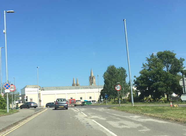
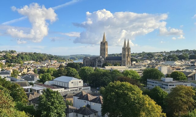
Newham Images

Images are sourced within 2km of 50.254468/-5.0445392 or Grid Reference SW8343. Thanks to Geograph Open Source API. All images are credited.

Truro Cathedral The nave of Truro Cathedral
Truro Cathedral
The nave of Truro Cathedral
Truro with view to Cathedral spires
Sainsbury's supermarket, Truro View across the upper deck car park.
Sainsbury's supermarket, Truro
View across the upper deck car park.
Enjoy Clothing, Truro An impressive and enticing facade.
Enjoy Clothing, Truro
An impressive and enticing facade.
Truro - Cathedral as seen along Cathedral Lane Cathedral Lane is a narrow alley linking Boscawen Street with High Cross (to the north) - and allowing this view of one of the cathedral's three spires.
Truro - Cathedral as seen along Cathedral Lane
Cathedral Lane is a narrow alley linking Boscawen Street with High Cross (to the north) - and allowing this view of one of the cathedral's three spires.
Truro - Cathedral - West front The twin-spired frontage of Truro's cathedral as seen across the pedestrian area in front of it to the north of High Cross. The cathedral was built between 1880 and 1910 in the Victorian Gothic Revival style by the architect J.L. Pearson.
The cathedral has a third spire over the crossing, making it one of only two English cathedrals with three spires - the other being <a href="https://www.geograph.org.uk/photo/1830659">SK1109 : Lichfield Cathedral - West Front</a>
Truro - Cathedral - West front
The twin-spired frontage of Truro's cathedral as seen across the pedestrian area in front of it to the north of High Cross. The cathedral was built between 1880 and 1910 in the Victorian Gothic Revival style by the architect J.L. Pearson. The cathedral has a third spire over the crossing, making it one of only two English cathedrals with three spires - the other being SK1109 : Lichfield Cathedral - West Front
Truro - Cathedral - Crossing below central spire Looking directly upwards from the Crossing (where the transepts meet the nave and quire). Above this square aperture rises the central spire of the cathedral.
Truro - Cathedral - Crossing below central spire
Looking directly upwards from the Crossing (where the transepts meet the nave and quire). Above this square aperture rises the central spire of the cathedral.
The Body Shop on Pydar Street
Glimpse of Truro Cathedral from Boscawen Street
Disused railway bridge over the A39 Truro
Truro Cathedral From a passing train
Truro Cathedral
From a passing train
Pasture, St Clement Beside the direct footpath between the village and Malpas.
Pasture, St Clement
Beside the direct footpath between the village and Malpas.
Pasture, Kea The hillside to the east of the A39.
Pasture, Kea
The hillside to the east of the A39.
Milepost cycle route 3 Sustrans MP 526 <span class="nowrap"><a title="https://wiki.openstreetmap.org/wiki/Sustrans_Millennium_Mileposts" rel="nofollow ugc noopener" href="https://wiki.openstreetmap.org/wiki/Sustrans_Millennium_Mileposts">Link</a><img style="margin-left:2px;" alt="External link" title="External link - shift click to open in new window" src="https://s1.geograph.org.uk/img/external.png" width="10" height="10"/></span>
Milepost cycle route 3
Sustrans MP 526 LinkExternal link
Phonebox
Phonebox
Victorian postbox
Victorian postbox
Boundary stone Milestone Society National ID: CW_TRURO01br
Boundary stone
Milestone Society National ID: CW_TRURO01br
Boundary stone
Boundary stone
Show me another place!

Newham is located at Grid Ref: SW8343 (Lat: 50.254468, Lng: -5.0445392)

Unitary Authority: Cornwall

Police Authority: Devon and Cornwall

What 3 Words

///beside.owner.marble. Near Truro, Cornwall

Nearby Locations

Newham Calenick Creek

Related Wikis

Truro River

The Truro River (Cornish: Hyldreth) is a river in the city of Truro in Cornwall, England, UK. It is the product of the convergence of the two rivers named...
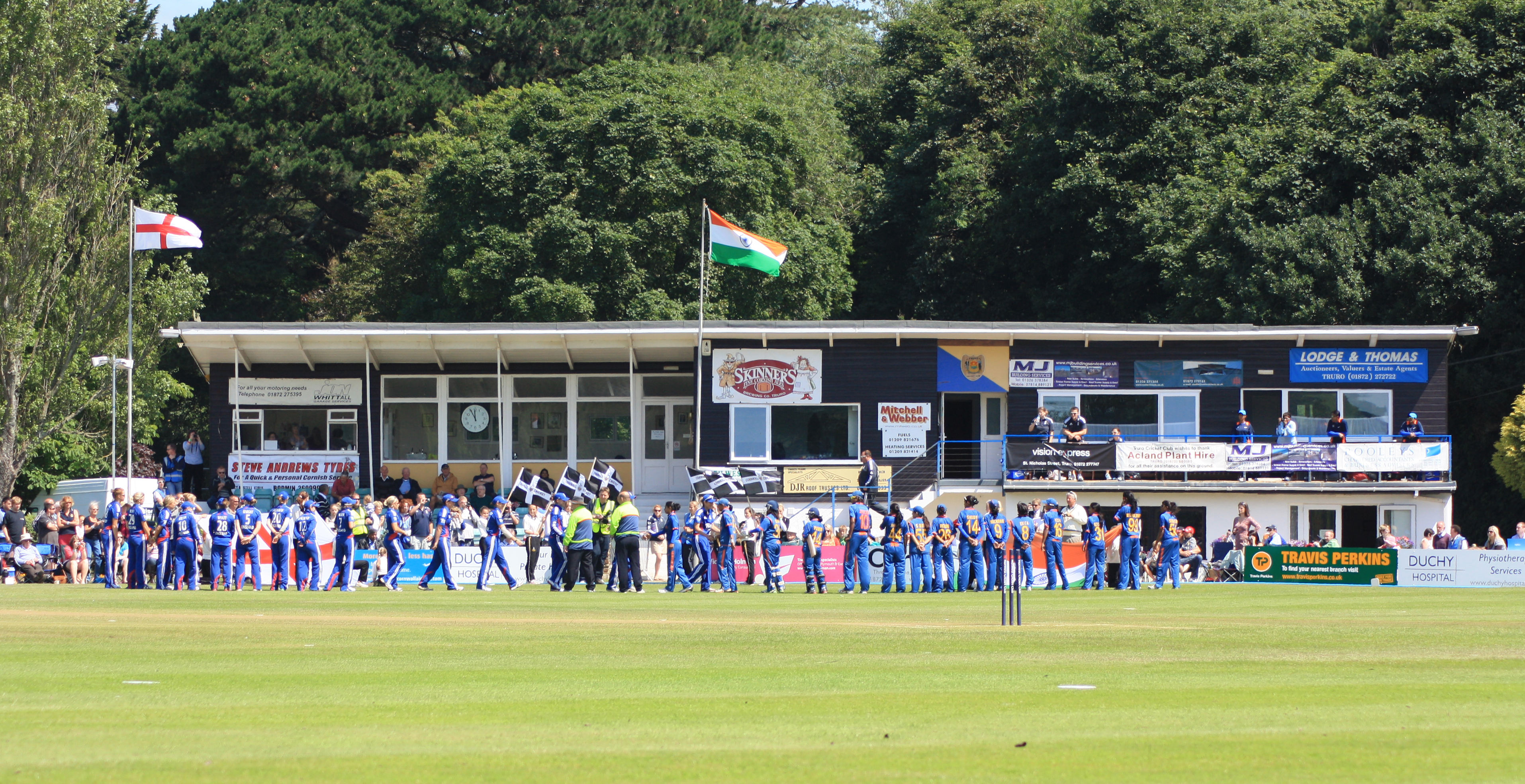
Boscawen Park

Boscawen Park (Cornish: Park Bosskawen) is a cricket ground located in recreation grounds along Malpas Road in Truro, Cornwall. The ground is situated...

Truro School

Truro School is a coeducational private boarding and day school located in the city of Truro, Cornwall, England. It is the largest coeducational independent...

Royal Cornwall Infirmary

Royal Cornwall Infirmary was a hospital in the south of the centre of Truro, Cornwall, England. == History == The Royal Cornwall Infirmary was designed...

Nearby Amenities

Located within 500m of 50.254468,-5.0445392
Source: PGS
Lat/Long: 50.2523073/-5.0414109
Source: PGS
Lat/Long: 50.2525955/-5.0426018
Source: PGS
Lat/Long: 50.2530109/-5.0428562
Source: PGS
Lat/Long: 50.2532481/-5.0431676
Source: PGS
Lat/Long: 50.2549502/-5.0443373
Source: PGS
Lat/Long: 50.2555851/-5.044738
Source: PGS
Lat/Long: 50.2561573/-5.0452065
Source: PGS
Lat/Long: 50.2562201/-5.0452492
Source: PGS
Lat/Long: 50.2570285/-5.045776
Source: PGS
Lat/Long: 50.2584626/-5.0467805
Source: PGS
Lat/Long: 50.2586307/-5.0451564
Created By: almien_coastlines
Source: PGS
Lat/Long: 50.258216/-5.04509
Source: PGS
Lat/Long: 50.2575413/-5.0446339
Source: PGS
Lat/Long: 50.2571846/-5.0441833
Source: PGS
Lat/Long: 50.2567456/-5.0437541
Source: PGS
Lat/Long: 50.2564027/-5.0433464
Source: PGS
Lat/Long: 50.2562792/-5.0428314
Source: PGS
Lat/Long: 50.2561008/-5.0426383
Source: PGS
Lat/Long: 50.2557871/-5.0419528
Source: PGS
Lat/Long: 50.2554892/-5.0415113
Source: PGS
Lat/Long: 50.2551567/-5.0409041
Source: PGS
Lat/Long: 50.2544709/-5.0401048
Source: PGS
Lat/Long: 50.2526504/-5.041038
Created By: almien_coastlines
Source: PGS
Lat/Long: 50.251117/-5.040587
Source: PGS
Lat/Long: 50.2513887/-5.0407496
Source: PGS
Lat/Long: 50.2521324/-5.0412848
Source: PGS
Lat/Long: 50.2517567/-5.0403285
Source: PGS
Lat/Long: 50.2514487/-5.0400994
Railway Historic: depot
Lat/Long: 50.2579475/-5.0465443
Millennium Milepost Truro
Description: 1) St Austell 31, Redruth 11 2) Truro City Centre, Newquay 15
Image: https://www.cyclestreets.net/location/194734/cyclestreets194734.jpg
Information: guidepost
Ncn Milepost: rowe
Sustrans Ref: MP 526
Tourism: information
Lat/Long: 50.258223/-5.047207
Mini Roundabout
Direction: clockwise
Lat/Long: 50.254346/-5.0397571
Bus Stop
British Legion Flats
Bus: yes
Naptan AtcoCode: 0800COA10001
Naptan Bearing: NW
Naptan BusStopType: CUS
Naptan CommonName: British Legion Flats
Naptan Crossing: Malpas Road
Naptan Indicator: Opp
Naptan NaptanCode: corawtda
Naptan PlusbusZoneRef: TRURO
Naptan StopType: BCT
Naptan Street: Carew-pole Close
Naptan TimingStatus: OTH
Naptan Verified: no
Public Transport: platform
Source: naptan_import
Lat/Long: 50.2569449/-5.0437698
Bus Stop
Truronian Depot
Bus: yes
Naptan AtcoCode: 0800COA10010
Naptan Bearing: S
Naptan BusStopType: MKD
Naptan CommonName: Truronian Depot
Naptan Crossing: Lighterage Hill
Naptan NaptanCode: corawtaw
Naptan PlusbusZoneRef: TRURO
Naptan StopType: BCT
Naptan Street: Heron Way
Naptan TimingStatus: OTH
Naptan Verified: no
Public Transport: platform
Source: naptan_import
Lat/Long: 50.2510534/-5.0433941
Bus Stop
Malpas Roundabout
Bus: yes
Naptan AtcoCode: 0800COC30009
Naptan Bearing: NW
Naptan BusStopType: MKD
Naptan CommonName: Malpas Roundabout
Naptan Crossing: Pendeen Road
Naptan Indicator: opp
Naptan NaptanCode: corawtjd
Naptan PlusbusZoneRef: TRURO
Naptan StopType: BCT
Naptan Street: Malpas Road
Naptan TimingStatus: OTH
Naptan Verified: no
Public Transport: platform
Source: naptan_import
Lat/Long: 50.2560648/-5.0423386
Bus Stop
Tregothnan Road
Bus: yes
Name Kw: Tregudhnans
Naptan AtcoCode: 0800COC30012
Naptan Bearing: NW
Naptan BusStopType: MKD
Naptan CommonName: Tregothnan Road
Naptan Crossing: Trevelva Road
Naptan NaptanCode: cordadjd
Naptan PlusbusZoneRef: TRURO
Naptan StopType: BCT
Naptan Street: Tregothnan Road
Naptan TimingStatus: OTH
Naptan Verified: no
Public Transport: platform
Source: naptan_import
Lat/Long: 50.2562604/-5.0393342
Bus Stop
Pendeen Road
Bus: yes
Naptan AtcoCode: 0800COC30013
Naptan Bearing: SW
Naptan BusStopType: MKD
Naptan CommonName: Pendeen Road
Naptan Crossing: Tregothnan Road
Naptan NaptanCode: corawtpm
Naptan PlusbusZoneRef: TRURO
Naptan StopType: BCT
Naptan Street: Pendeen Road
Naptan TimingStatus: OTH
Naptan Verified: no
Public Transport: platform
Source: naptan_import
Lat/Long: 50.2568539/-5.0414066
Bus Stop
British Legion Flats
Bus: yes
Naptan AtcoCode: 0800COC30014
Naptan Bearing: SE
Naptan BusStopType: CUS
Naptan CommonName: Trennick Villas
Naptan Crossing: Malpas Road
Naptan NaptanCode: corawtdt
Naptan PlusbusZoneRef: TRURO
Naptan StopType: BCT
Naptan Street: Carew-pole Close
Naptan TimingStatus: OTH
Naptan Verified: no
Public Transport: platform
Source: naptan_import
Lat/Long: 50.2568793/-5.0435271
Bus Stop
Riverside View
Bus: yes
Naptan AtcoCode: 0800TRY38421
Naptan Bearing: NW
Naptan CommonName: Riverside View
Naptan Crossing: Carew-pole Close
Naptan NaptanCode: corawtjt
Naptan PlusbusZoneRef: TRURO
Naptan Street: Riverside View
Naptan Verified: no
Public Transport: platform
Source: naptan_import
Lat/Long: 50.2578795/-5.0420894
Bus Stop
Malpas Estate Roundabout
Bus: yes
Naptan AtcoCode: 0800TRY38423
Naptan Bearing: SE
Naptan BusStopType: CUS
Naptan CommonName: Roundabout
Naptan Crossing: Malpas Road
Naptan Indicator: SE-bound
Naptan NaptanCode: corawtjm
Naptan PlusbusZoneRef: TRURO
Naptan Street: Pendeen Road
Naptan Verified: no
Public Transport: platform
Source: naptan;bing
Lat/Long: 50.2562651/-5.0423285
Skinner's Brewery
Disused Amenity: pub
Lat/Long: 50.2575143/-5.047027
Leisure: playground
Lat/Long: 50.253339/-5.0396272
Source: PGS
Lat/Long: 50.2530518/-5.0412525
Leisure: slipway
Lat/Long: 50.2528674/-5.0410527
Toilets
Access: yes
Fee: no
Toilets Disposal: flush
Lat/Long: 50.253182/-5.0380527
Bus Stop
Trennick Mill
Bus: yes
Naptan AtcoCode: 0800COC30008
Naptan BusStopType: CUS
Naptan NaptanCode: cordadmp
Naptan StopType: BCT
Naptan TimingStatus: OTH
Public Transport: platform
Lat/Long: 50.2538793/-5.038244
Bus Stop
Trennick Mill
Bus: yes
Naptan AtcoCode: 0800COC30007
Naptan BusStopType: CUS
Naptan NaptanCode: cordadmd
Naptan StopType: BCT
Naptan TimingStatus: OTH
Public Transport: platform
Lat/Long: 50.2538397/-5.0383818
Bus Stop
Rundles Court
Bus: yes
Naptan AtcoCode: 0800COA15844
Naptan BusStopType: CUS
Naptan NaptanCode: corgmadm
Naptan StopType: BCT
Naptan TimingStatus: OTH
Public Transport: platform
Lat/Long: 50.2589265/-5.0450902
Bus Stop
Bottom Trevelva Road
Bus: yes
Naptan AtcoCode: 0800COC30010
Naptan BusStopType: CUS
Naptan NaptanCode: corawtpj
Naptan StopType: BCT
Naptan TimingStatus: OTH
Public Transport: platform
Lat/Long: 50.2557773/-5.0413394
Bus Stop
Rundles Court
Bus: yes
Naptan AtcoCode: 0800COC30015
Naptan BusStopType: CUS
Naptan NaptanCode: corawpwt
Naptan StopType: BCT
Naptan TimingStatus: OTH
Public Transport: platform
Lat/Long: 50.2589149/-5.0451877
Bus Stop
Top Trevelva Road
Bus: yes
Naptan AtcoCode: 0800COC30011
Naptan BusStopType: CUS
Naptan NaptanCode: cordadat
Naptan StopType: BCT
Naptan TimingStatus: OTH
Public Transport: platform
Lat/Long: 50.2553161/-5.0400612
Millennium Milepost Lighterage Hill
Description: 1) Truro City Centre 1, Newquay 16 2) St Austell 30, Redruth 10
Image: https://www.cyclestreets.net/location/194735/cyclestreets194735.jpg
Information: guidepost
Ncn Milepost: mills
Sustrans Ref: MP 479
Tourism: information
Lat/Long: 50.2522703/-5.0430805
Generator Method: photovoltaic
Generator Output Electricity: yes
Generator Source: solar
Generator Type: solar_photovoltaic_panel
Location: roof
Power: generator
Lat/Long: 50.2561746/-5.0382802
Newham
Name Kw: Trenowydh
Place: suburb
Lat/Long: 50.2524806/-5.0430572
Dwellworks
Addr City: Truro
Addr Country: GB
Addr Housename: Vivian House
Addr Postcode: TR1 2DP
Addr Street: Newham Road
Office: company
Lat/Long: 50.2583139/-5.046756
Anti-Matter Games
Addr City: Truro
Addr Country: GB
Addr Housename: Vivian House
Addr Postcode: TR1 2DP
Addr Street: Newham Road
Office: company
Lat/Long: 50.2582367/-5.0467131
Post Box
Collection Times: Mo-Fr 09:00; Sa 07:00; Su off
Drive Through: no
Operator: Royal Mail
Operator Wikidata: Q638098
Post Box Mounting: pier
Post Box Type: lamp
Ref: TR1 53D
Royal Cypher: EIIR
Royal Cypher Wikidata: Q33102113
Source: survey;aerial imagery
Lat/Long: 50.2562714/-5.0422159
Post Box
Collection Times: Mo-Fr 19:00; Sa 12:30; Su off
Drive Through: no
Operator: Royal Mail
Operator Wikidata: Q638098
Post Box Apertures: 2
Post Box Mounting: building
Post Box Type: posting_suite
Ref: TR1 249;TR1 2490
Royal Cypher: no
Source: survey;aerial imagery
Lat/Long: 50.2557653/-5.0466004
The data included in this document is from www.openstreetmap.org. The data is made available under ODbL.

Have you been to Newham?

Leave your review of Newham below (or comments, questions and feedback).