New Town

Settlement in Wiltshire

England

New Town

River Chalke near Mount Sorrel A little bridge takes a track over the laneside stream and into a field.
River Chalke near Mount Sorrel Credit: Derek Harper

New Town is a small village located in the county of Wiltshire, England. Situated approximately 10 miles east of the city of Salisbury, it is nestled in a picturesque countryside setting. With a population of around 1,500 residents, New Town maintains a close-knit community atmosphere.

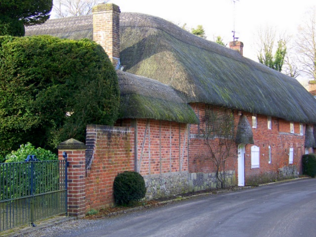
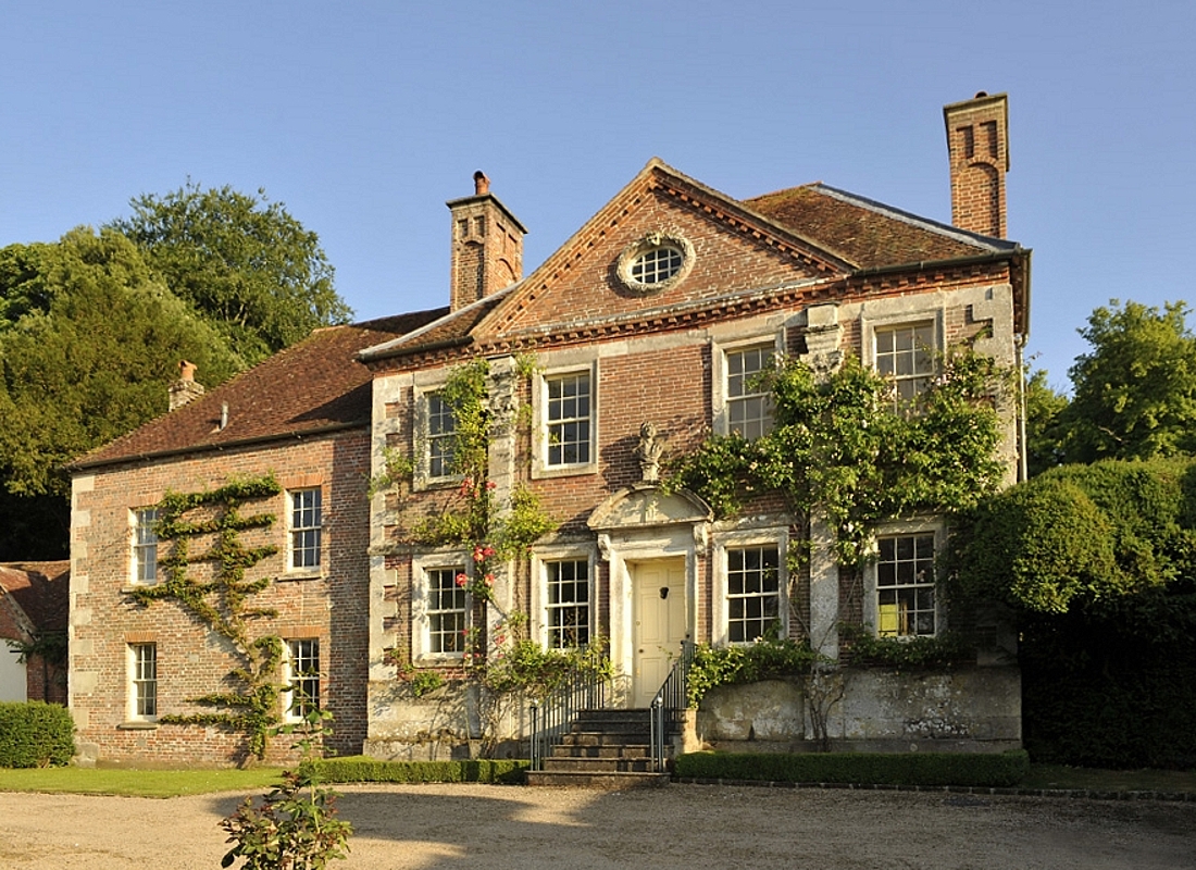
The village is characterized by its charming and historic architecture. Many of the buildings in New Town date back several centuries, adding to the village's unique character and charm. The village center features a traditional market square, surrounded by a variety of local shops, cafes, and pubs. The village also boasts a beautiful parish church, which is a focal point for many community events and activities.

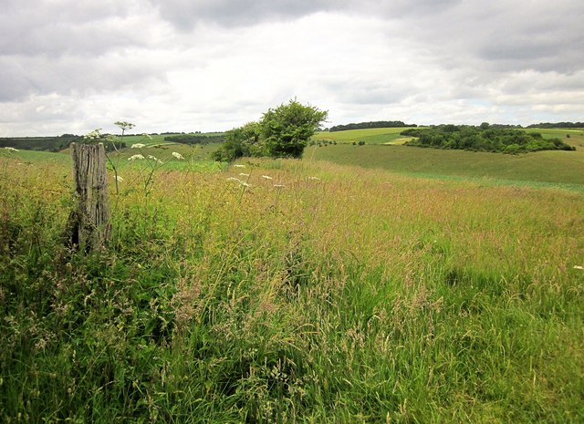
Surrounded by rolling hills and farmland, New Town offers numerous opportunities for outdoor activities and exploration. The village is surrounded by several walking and cycling trails, offering stunning views of the surrounding countryside. Additionally, the nearby River Avon provides opportunities for fishing and boating enthusiasts.

New Town is well-connected by road, with the A36 passing through the village, providing easy access to nearby towns and cities. The village is also served by regular bus services, connecting residents to Salisbury and other neighboring areas.

Overall, New Town is a tranquil and idyllic village, offering a peaceful and picturesque way of life. With its rich history, stunning countryside, and welcoming community, it is a place that attracts both visitors and residents alike.

If you have any feedback on the listing, please let us know in the comments section below.

New Town Images

Images are sourced within 2km of 51.026243/-1.9395631 or Grid Reference SU0425. Thanks to Geograph Open Source API. All images are credited.

River Chalke near Mount Sorrel A little bridge takes a track over the laneside stream and into a field.
River Chalke near Mount Sorrel
A little bridge takes a track over the laneside stream and into a field.
Lane at Mount Sorrel The road from Bowerchalke passes buildings at the hamlet.
Lane at Mount Sorrel
The road from Bowerchalke passes buildings at the hamlet.
Martins Barn, Mount Sorrel The lane from Bowerchalke crosses the River Chalke just before passing this impressive building. <a href="https://www.geograph.org.uk/photo/4547191">SU0324 : River Chalke at Mount Sorrel</a> was taken from the bridge.
Martins Barn, Mount Sorrel
The lane from Bowerchalke crosses the River Chalke just before passing this impressive building. SU0324 : River Chalke at Mount Sorrel was taken from the bridge.
River Chalke at Mount Sorrel Looking upstream as the little river runs beside the road. On the left is <a href="https://www.geograph.org.uk/photo/4745301">SU0324 : Martins Barn, Mount Sorrel</a>.
River Chalke at Mount Sorrel
Looking upstream as the little river runs beside the road. On the left is SU0324 : Martins Barn, Mount Sorrel.
River Chalke at Cliff Side The laneside stream passes a pair of semis southwest of Broad Chalke.
River Chalke at Cliff Side
The laneside stream passes a pair of semis southwest of Broad Chalke.
River Chalke at Cliff Side A reverse view of <a href="https://www.geograph.org.uk/photo/4745347">SU0325 : River Chalke at Cliff Side</a>, from the junction of Knapp Hill and South Street.
River Chalke at Cliff Side
A reverse view of SU0325 : River Chalke at Cliff Side, from the junction of Knapp Hill and South Street.
Watercress beds at Broad Chalke See <a title="https://www.geograph.org.uk/discuss/index.php?action=vthread&topic=15556" href="https://www.geograph.org.uk/discuss/index.php?action=vthread&topic=15556">Link</a> . This is beside Knapp Hill.
Watercress beds at Broad Chalke
See Link . This is beside Knapp Hill.
On bridleway BROA 21 Trees along a field boundary that heads towards the dry valley below Knapp Down.
On bridleway BROA 21
Trees along a field boundary that heads towards the dry valley below Knapp Down.
Broad Chalke - The Queen's Head Pub on North Street in the centre of Broad Chalke village.
Broad Chalke - The Queen's Head
Pub on North Street in the centre of Broad Chalke village.
Broad Chalke - River Ebble A study in green beside Broad Chalke Church.
Broad Chalke - River Ebble
A study in green beside Broad Chalke Church.
Church Bottom Cattle on grassland south of Broad Chalke.
Church Bottom
Cattle on grassland south of Broad Chalke.
Broad Chalke - Dry Valley Wiltshire downland with a dry side valley winding uphill from Church Bottom.
Broad Chalke - Dry Valley
Wiltshire downland with a dry side valley winding uphill from Church Bottom.
Cereal Harvest Farming activity on the Wiltshire Downs at Bowerchalke.
Cereal Harvest
Farming activity on the Wiltshire Downs at Bowerchalke.
Field Barn Downland farm in the Ebble Valley near Bowerchalke.
Field Barn
Downland farm in the Ebble Valley near Bowerchalke.
Approaching Field Barn Country lane in the Wiltshire Downs near Bowerchalke.
Approaching Field Barn
Country lane in the Wiltshire Downs near Bowerchalke.
Mount Sorrel Rolling on the rolling downland near Broad Chalke, Wiltshire. The cereal fields have been recently harvested.
Mount Sorrel
Rolling on the rolling downland near Broad Chalke, Wiltshire. The cereal fields have been recently harvested.
Chalk Stream Good stream for trout fishermen and for watercress at Broad Chalke in the Wiltshire Downs.
Chalk Stream
Good stream for trout fishermen and for watercress at Broad Chalke in the Wiltshire Downs.
Ostrich Egg Uncommon product at Broad Chalke, Wiltshire. [The average length of an ostrich egg is ca. 6 inches]. The village has an ostrich-rearing smallholding.
Ostrich Egg
Uncommon product at Broad Chalke, Wiltshire. [The average length of an ostrich egg is ca. 6 inches]. The village has an ostrich-rearing smallholding.
Show me another place!

New Town is located at Grid Ref: SU0425 (Lat: 51.026243, Lng: -1.9395631)

Unitary Authority: Wiltshire

Police Authority: Wiltshire

What 3 Words

///hikes.exchanges.equal. Near Bishopstone, Wiltshire

Related Wikis

Broad Chalke

Broad Chalke, sometimes spelled Broadchalke, Broad Chalk or Broadchalk, is a village and civil parish in Wiltshire, England, about 8 miles (13 km) west...

Reddish House

Reddish House, also known as Reddish Manor, is an early 18th-century manor house in the village of Broad Chalke in Wiltshire, England. It was possibly...

River Chalke

The River Chalke is a small river within the English county of Wiltshire. It is the most significant tributary of the River Ebble. The river rises at Mead...

Knighton Downs and Wood

Knighton Downs and Wood (grid reference SU048237) is a 203.7 hectare biological Site of Special Scientific Interest in Wiltshire, notified in 1971. �...

Nearby Amenities

Located within 500m of 51.026243,-1.9395631
Barrier: stile
Foot: yes
Lat/Long: 51.0294659/-1.9379015
Barrier: stile
Foot: yes
Lat/Long: 51.0279123/-1.9419301
Historic: memorial
Memorial: war_memorial
Wikidata: Q26678125
Lat/Long: 51.0268692/-1.9432729
Post Box
Operator: Royal Mail
Post Box Type: wall
Ref: SP5 188
Royal Cypher: EIIR
Royal Cypher Wikidata: Q33102113
Lat/Long: 51.0268864/-1.9442287
Post Box
Operator: Royal Mail
Post Box Type: lamp
Ref: SP5 319D
Royal Cypher: EIIR
Royal Cypher Wikidata: Q33102113
Lat/Long: 51.0264089/-1.9345205
Grit Bin
Colour: yellow
Material: plastic
Lat/Long: 51.027465/-1.9423319
Waste Basket
Lat/Long: 51.0270104/-1.9431553
The data included in this document is from www.openstreetmap.org. The data is made available under ODbL.

Have you been to New Town?

Leave your review of New Town below (or comments, questions and feedback).