Ness-side

Settlement in Inverness-shire

Scotland

Ness-side

River Ness & Canal River Ness & Canal <a href="https://www.geograph.org.uk/gridref/NH+645+428">NH 645 428</a> photographed from elevated part of Torvean Quarry <a href="https://www.geograph.org.uk/gridref/NH+651+433">NH 651 433</a>.
River Ness & Canal Credit: Ivor MacKenzie

Ness-side is a picturesque area located in Inverness-shire, Scotland. Situated on the banks of the renowned Loch Ness, it offers stunning views of the surrounding highlands and is steeped in history and natural beauty.

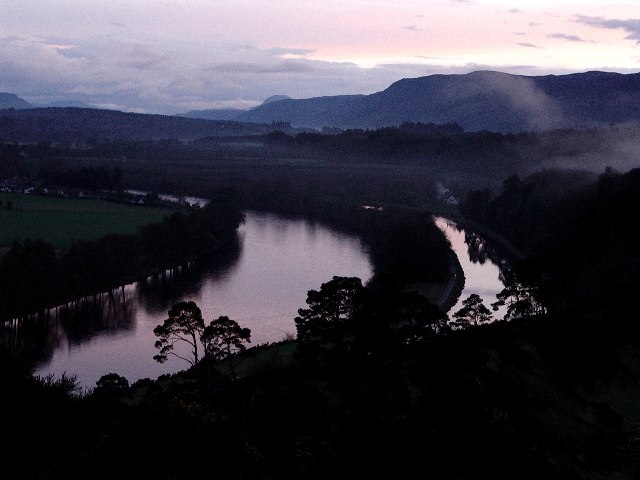
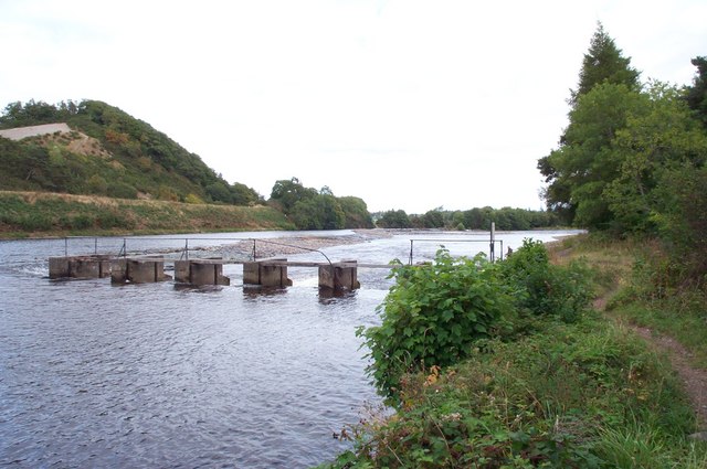
The main attraction of Ness-side is undoubtedly Loch Ness itself. Known worldwide for the legendary Loch Ness Monster, it stretches approximately 23 miles in length, making it the second largest Scottish loch by surface area. The lake is surrounded by lush greenery and rolling hills, providing a serene and tranquil atmosphere for visitors. Many tourists come to Ness-side in the hopes of catching a glimpse of the elusive Nessie, while others simply enjoy the breathtaking scenery.

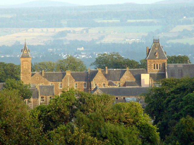
In addition to the Loch, Ness-side is also home to the charming village of Drumnadrochit, which serves as a popular tourist hub. Here, visitors can explore the renowned Loch Ness Centre and Exhibition, which delves into the history and mysteries surrounding the Loch and its legendary monster. Drumnadrochit also boasts a variety of shops, restaurants, and accommodations, allowing visitors to fully immerse themselves in the local culture.

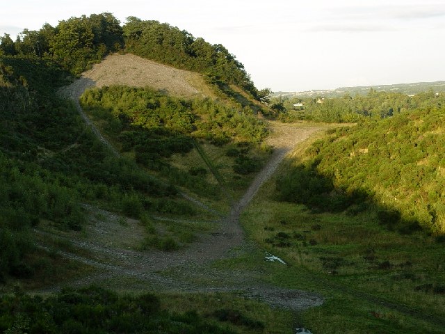
For outdoor enthusiasts, Ness-side offers a plethora of activities. The surrounding area is ideal for hiking, with scenic trails that wind through forests and along the Loch's shoreline. Water sports such as kayaking and canoeing are also popular, allowing visitors to experience the Loch up close and personal.

Overall, Ness-side in Inverness-shire is a captivating destination that combines natural beauty, intriguing folklore, and rich history. It continues to draw visitors from all over the world who seek to discover the secrets of Loch Ness and immerse themselves in the stunning Scottish landscape.

If you have any feedback on the listing, please let us know in the comments section below.
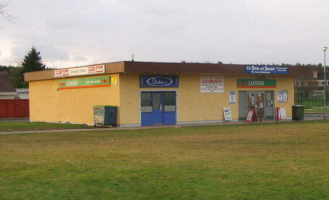
Ness-side Images

Images are sourced within 2km of 57.45235/-4.2590285 or Grid Reference NH6442. Thanks to Geograph Open Source API. All images are credited.

River Ness & Canal River Ness & Canal <a href="https://www.geograph.org.uk/gridref/NH+645+428">NH 645 428</a> photographed from elevated part of Torvean Quarry <a href="https://www.geograph.org.uk/gridref/NH+651+433">NH 651 433</a>.
River Ness & Canal
River Ness & Canal NH 645 428 photographed from elevated part of Torvean Quarry NH 651 433.
Craig Dunain Hospital Old mental hospital that now seems to be being demolished.
Craig Dunain Hospital
Old mental hospital that now seems to be being demolished.
Craig Dunain Hospital Old mental hospital now apparently being demolished
Craig Dunain Hospital
Old mental hospital now apparently being demolished
Pet Cemetery near Craig Dunain Hospital There are graves of pets from different wards at the hospital
Pet Cemetery near Craig Dunain Hospital
There are graves of pets from different wards at the hospital
Craig Dunain Burial Ground This small burial ground is at the rear of Craig Dunain Hospital.  There is only one recognisable headstone inside the burial ground.  The area was cleared by the Argyll and Sutherland Highlanders a few years ago and this memorial erected to Colour Sergeant James Munro VC who won his medal at the Lucknow and was buried somewhere nearby in a pauper's grave.
Craig Dunain Burial Ground
This small burial ground is at the rear of Craig Dunain Hospital. There is only one recognisable headstone inside the burial ground. The area was cleared by the Argyll and Sutherland Highlanders a few years ago and this memorial erected to Colour Sergeant James Munro VC who won his medal at the Lucknow and was buried somewhere nearby in a pauper's grave.
Craig Dunain Hospital Taken from the old golf course
Craig Dunain Hospital
Taken from the old golf course
Torvean Quarry
Torvean Quarry
River Ness near Ness-side The picture shows a sluice (foreground) and a weir. In the middle left of the picture the straight edge a few metres above river level is the bank of the Caledonian Canal (not itself visible) which then veers away to the left. The distant trees just to right of centre show where the river divides around Whin Island.
River Ness near Ness-side
The picture shows a sluice (foreground) and a weir. In the middle left of the picture the straight edge a few metres above river level is the bank of the Caledonian Canal (not itself visible) which then veers away to the left. The distant trees just to right of centre show where the river divides around Whin Island.
Lochardil Stores Local convenience store in Lochardil area of Inverness on the right of the building. There is a ladies hairdresser (blue frontage) on the left. Lies at one end of an open grassed area.
Lochardil Stores
Local convenience store in Lochardil area of Inverness on the right of the building. There is a ladies hairdresser (blue frontage) on the left. Lies at one end of an open grassed area.
Caledonian Canal at  A82 To the west of Inverness
Caledonian Canal at A82
To the west of Inverness
Caledonian Canal at  A82 (2) To the west of Inverness
Caledonian Canal at A82 (2)
To the west of Inverness
Provost Lamp The provosts of many of Scotland's royal burghs were honoured by having a lamp outside their house. With changes in local government Inverness is no longer a royal burgh but it still has a provost (I'm not clear how that works). A current provost has two lamps and past provosts retain one so there is a sprinkling of houses with a single lamp outside all over the town. The arms are those of the burgh.
Provost Lamp
The provosts of many of Scotland's royal burghs were honoured by having a lamp outside their house. With changes in local government Inverness is no longer a royal burgh but it still has a provost (I'm not clear how that works). A current provost has two lamps and past provosts retain one so there is a sprinkling of houses with a single lamp outside all over the town. The arms are those of the burgh.
Golf course, Kinmylies, Inverness
Dunain Park Hotel roadside entrance.
Country track to Dunain Park Hotel.
Grazing land near entrance to Dunain house.
Inviting driveway off Stratherrick Road, Inverness
Road to Stonend, Torbreck
Show me another place!

Ness-side is located at Grid Ref: NH6442 (Lat: 57.45235, Lng: -4.2590285)

Unitary Authority: Highland

Police Authority: Highlands and Islands

What 3 Words

///drill.adjusting.slower. Near Inverness, Highland

Nearby Locations

Ness-side

Related Wikis

Inverness Rowing Club

Inverness Rowing Club is a rowing club on the Caledonian Canal next to the River Ness based at Torvean, Inverness, Scottish Highlands. The club is affiliated...

Craig Dunain Hospital

Craig Dunain Hospital was a mental health facility near Inverness in Scotland. The former hospital is a Category B listed building. == History == The hospital...

Ness Islands Railway

The Ness Islands Railway is a 7+1⁄4 in (184 mm) gauge miniature railway in Inverness, Scotland, opened in 1983. == Overview == Operating around a site...

Culduthel

Culduthel (Gaelic: Cùil Daothail) is an area in the south of the city of Inverness, in the Highland council area of Scotland. The area is largely residential...

Nearby Amenities

Located within 500m of 57.45235,-4.2590285
Source: Landsat photo
Lat/Long: 57.4506447/-4.2622864
Source: Landsat photo
Lat/Long: 57.4516469/-4.262159
Source: Landsat photo
Lat/Long: 57.4524398/-4.2615889
Source: Landsat photo
Lat/Long: 57.4539459/-4.2606556
Source: Landsat photo
Lat/Long: 57.4547137/-4.2597706
Source: Landsat photo
Lat/Long: 57.4557799/-4.2578354
Ness-side
Place: hamlet
Source: survey
Lat/Long: 57.4524645/-4.2599127
Rapids: 2
Waterway: weir
Lat/Long: 57.4495316/-4.2613256
Fuel
Tesco
Brand: Tesco
Brand Wikidata: Q487494
Brand Wikipedia: en:Tesco
Operator: Tesco
Website: https://www.tesco.com/store-locator/inverness/dores-rd/petrol-filling-station
Lat/Long: 57.451257/-4.2520081
Mini Roundabout
Direction: clockwise
Width: 25.0
Lat/Long: 57.4517803/-4.2517016
Turning Circle
Lat/Long: 57.4545883/-4.2625888
Parking
Parking: layby
Source: survey
Lat/Long: 57.4560335/-4.255221
The data included in this document is from www.openstreetmap.org. The data is made available under ODbL.

Have you been to Ness-side?

Leave your review of Ness-side below (or comments, questions and feedback).