Napsbury Park

Settlement in Hertfordshire St. Albans

England

Napsbury Park

Rolling farmland Farmland occupies most of the western half of TL1804, partially rape fields, but also a children's open farm called Willow's Farm
Rolling farmland Credit: Mike Hartley

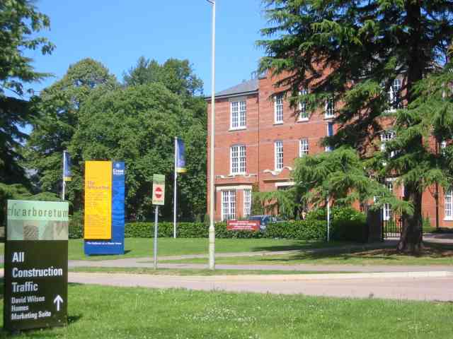
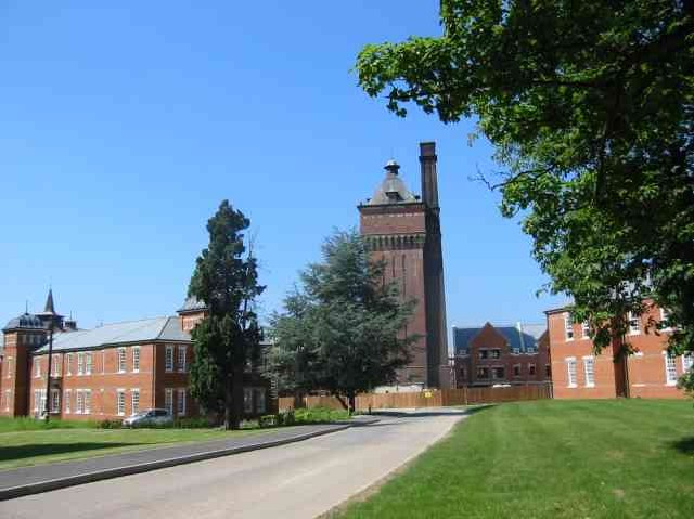
Napsbury Park is a historic estate located in Hertfordshire, England. Situated in the parish of St. Albans, the park covers an area of approximately 100 acres and is known for its picturesque landscapes and stunning architectural features.

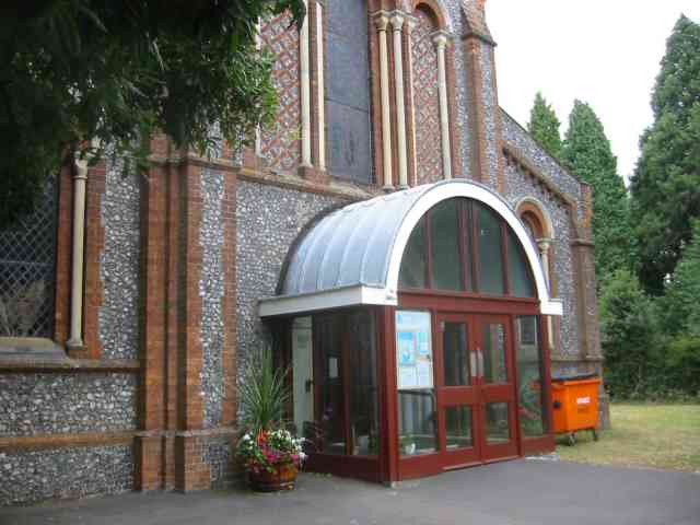
Originally, the land was home to the Napsbury Asylum, a psychiatric hospital that opened in 1905. The asylum was designed by architect George Thomas Hine and featured a grandiose central administration building, as well as several other structures to accommodate patients and staff.

In the late 20th century, the asylum was closed and the estate was converted into a residential area. Today, Napsbury Park is a sought-after community with a mix of beautiful period properties and modern homes. The original asylum building has been preserved and converted into luxury apartments, maintaining its historic charm while offering contemporary living spaces.

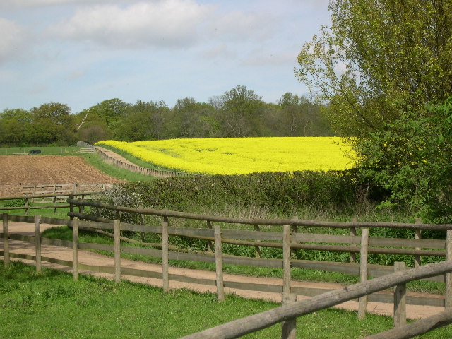
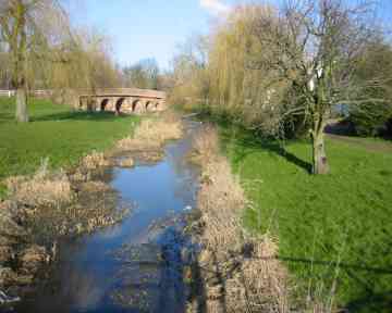
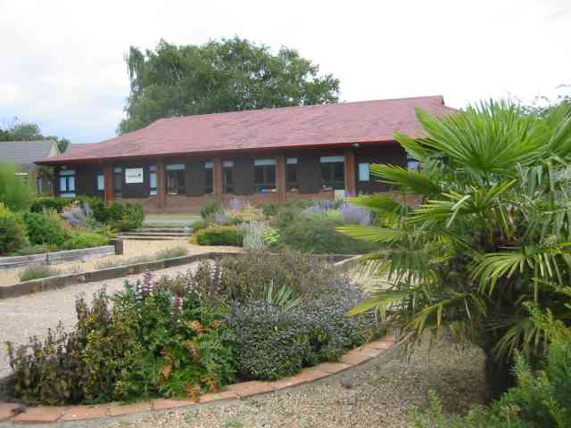
The park itself boasts well-manicured gardens, tree-lined avenues, and open green spaces, providing residents with a tranquil environment to enjoy. It is a popular destination for walks, picnics, and leisure activities. Additionally, the park is home to a variety of wildlife, including deer, which can often be spotted roaming the grounds.

Napsbury Park is also conveniently located, with easy access to nearby towns and cities. The bustling city of St. Albans is just a short drive away, offering a range of amenities such as shops, restaurants, and cultural attractions. Overall, Napsbury Park offers a unique blend of history, natural beauty, and modern living, making it an attractive place to reside in Hertfordshire.

If you have any feedback on the listing, please let us know in the comments section below.

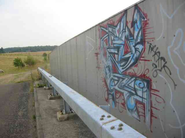
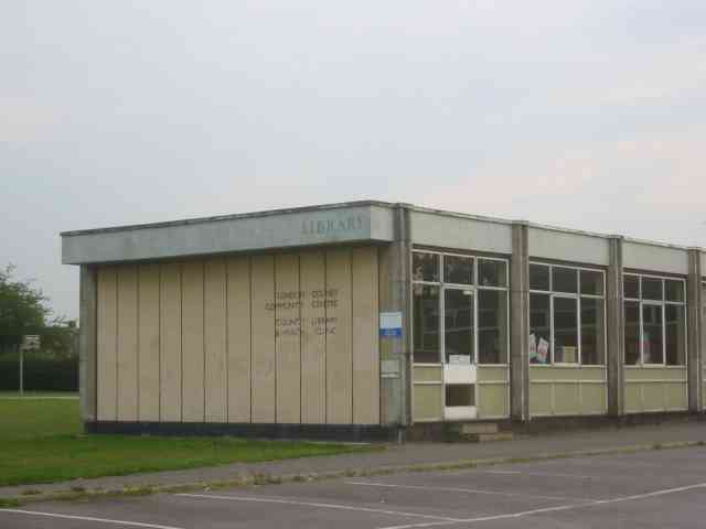
Napsbury Park Images

Images are sourced within 2km of 51.723944/-0.30734959 or Grid Reference TL1704. Thanks to Geograph Open Source API. All images are credited.

Rolling farmland Farmland occupies most of the western half of TL1804, partially rape fields, but also a children's open farm called Willow's Farm
Rolling farmland
Farmland occupies most of the western half of TL1804, partially rape fields, but also a children's open farm called Willow's Farm
Road Bridge at London Colney Three years ago this area was flooded and much damage was caused to buildings.
Road Bridge at London Colney
Three years ago this area was flooded and much damage was caused to buildings.
Orbital business park, St Albans Entry is controlled so I have no idea of the businesses.
Orbital business park, St Albans
Entry is controlled so I have no idea of the businesses.
Pastoral Centre  Broad Colney The complex was once a convent, built in 1899 for an Anglican order. It was sold to the Roman Catholic Diocese of Westminster in the mid-1970s and became a Retreat/Conference/Training Centre with residential accommodation.
Pastoral Centre Broad Colney
The complex was once a convent, built in 1899 for an Anglican order. It was sold to the Roman Catholic Diocese of Westminster in the mid-1970s and became a Retreat/Conference/Training Centre with residential accommodation.
Napsbury Hospital London Colney This is now a housing development called the Arboretum  Expensive prices.
Napsbury Hospital London Colney
This is now a housing development called the Arboretum Expensive prices.
Napsbury Hospital London Colney The site is now a housing project, The water tower is being left until last in the hopes that a keen
person with half a million pounds will purchase it
Napsbury Hospital London Colney
The site is now a housing project, The water tower is being left until last in the hopes that a keen person with half a million pounds will purchase it
London Colney Bypass  A1081 What a difference a bypass can make to a town
London Colney Bypass A1081
What a difference a bypass can make to a town
The Cemetery  St Albans Was surprised by the heart shaped balloon flying over that gravestone.
The Cemetery St Albans
Was surprised by the heart shaped balloon flying over that gravestone.
Community Hall at  Hill End Lane St Albans This building houses play schools and similar activities. The gravel areas in the planting are intended for use as boules rinks by parents.The area was once a hospital so there are hundreds of new houses in the vicinity.
Community Hall at Hill End Lane St Albans
This building houses play schools and similar activities. The gravel areas in the planting are intended for use as boules rinks by parents.The area was once a hospital so there are hundreds of new houses in the vicinity.
Holy Trinity Church Frogmore I rather like the round top to the porch. It echoes the Romanesque arches over the windows.
Holy Trinity Church Frogmore
I rather like the round top to the porch. It echoes the Romanesque arches over the windows.
Hedges Farm North Orbital Road A mixture of building types with an old stable {now superseded}
Hedges Farm North Orbital Road
A mixture of building types with an old stable {now superseded}
Hedges Farm  North Orbital Road This steel structure would be described as a Dutch Barn but usually they had  curved roofs.
Hedges Farm North Orbital Road
This steel structure would be described as a Dutch Barn but usually they had curved roofs.
Van in the River Colne This section of the River Colne is a kilometre from a highway but via a locked farm gate and farmtrack this van was deposited by joy riders. The van originated from the remote village of Foulness
Van in the River Colne
This section of the River Colne is a kilometre from a highway but via a locked farm gate and farmtrack this van was deposited by joy riders. The van originated from the remote village of Foulness
Lake at Broad Colney Lakes This one is fed from the main lake which is also the course of the River Colne.
Lake at Broad Colney Lakes
This one is fed from the main lake which is also the course of the River Colne.
Graffiti on M25 Bridge This is a section of an effort which ran out of steam or perhaps ...
Graffiti on M25 Bridge
This is a section of an effort which ran out of steam or perhaps ...
Graffiti on a bridge over M25 or did they have only a small quantity of red spray
Graffiti on a bridge over M25
or did they have only a small quantity of red spray
More Graffiti on the bridge over the M25 The bay willow herb was enrolled to bring colour to the designs. The colour in any case is fading quite quickly
More Graffiti on the bridge over the M25
The bay willow herb was enrolled to bring colour to the designs. The colour in any case is fading quite quickly
Library and Clinic at London Colney The prefab construction has a rather grim appearance and the approach is rather bleak
Library and Clinic at London Colney
The prefab construction has a rather grim appearance and the approach is rather bleak
Show me another place!

Napsbury Park is located at Grid Ref: TL1704 (Lat: 51.723944, Lng: -0.30734959)

Administrative County: Hertfordshire

District: St. Albans

Police Authority: Hertfordshire

What 3 Words

///hurray.last.city. Near St Albans, Hertfordshire

Related Wikis

Napsbury Hospital

Napsbury Hospital was a mental health facility near London Colney in Hertfordshire. It had two sister institutions, Harperbury Hospital and Shenley Hospital...

Napsbury Park

Napsbury Park is a residential development in Hertfordshire, England. It is located to the north of London, at Junction 22 of the M25 motorway and Junction...

London Colney F.C.

London Colney Football Club is a football club based in London Colney, near St Albans, England. They are currently members of the Combined Counties League...

London Colney

London Colney () is a village and civil parish in Hertfordshire, England. It is located to the north of London, close to Junction 22 of the M25 motorway...

Napsbury railway station

Napsbury railway station was built by the Midland Railway in 1905 on its line to St Pancras station. It was never more than an island platform between...

Fir and Pond Woods

Fir and Pond Woods is a 29 hectare nature reserve in Potters Bar in Hertfordshire. It is managed by the Herts and Middlesex Wildlife Trust. It is two separate...

Broad Colney Lakes

Broad Colney Lakes is an 11 hectare nature reserve previously managed by Herts and Middlesex Wildlife Trust in London Colney in Hertfordshire. It has recently...

All Saints Pastoral Centre

All Saints Pastoral Centre is a complex of buildings at London Colney on the southern outskirts of St Albans, Hertfordshire, England. It was built as a...

Related Videos

Holiday Inn Express, St Albans | October 2021

A quick look around the Holiday Inn Express in St Albans, Hertfordshire (also known as London Colney for those that are local to ...

Digital Travel Connect 2022

As shifting customer behaviour is transforming the travel industry post-pandemic… The race is now on for travel companies to ...

One Too Many or One Too Few? de Havilland's Three Engine Designs: DH.121 Trident and DH.66 Hercules

Why have an aircraft with three engines? The de Havilland DH66 Hercules was a three engine two-bay biplane with room for ...

Restarting Daily Walking Practice | Daily Vlog | Mon 26 Feb (2024)

Our daily and weekend vlogs are bite-sized chunks from our weekly vlogs. This vlog covers a quiet and productive day as I ...

Nearby Amenities

Located within 500m of 51.723944,-0.30734959
Traffic Calming: table
Lat/Long: 51.7255527/-0.3010757
Bus Stop
Peters Avenue
Bus: yes
Naptan AtcoCode: 210021504800
Naptan Bearing: SW
Naptan CommonName: Peters Avenue
Naptan Crossing: Colney Medical Centre
Naptan Indicator: opp
Naptan Landmark: Colney Medical Centre
Naptan NaptanCode: hrtawmaw
Naptan PlusbusZoneRef: RADLETT;STALBCY
Naptan ShortCommonName: NA
Naptan Street: Kings Road
Naptan Verified: no
Public Transport: platform
Shelter: no
Source: naptan_import
Lat/Long: 51.7254703/-0.3011824
Bus Stop
Boyes Crescent
Bus: yes
Naptan AtcoCode: 210021504805
Naptan Bearing: E
Naptan CommonName: Boyes Crescent
Naptan Crossing: Lime Tree Court
Naptan Indicator: opp
Naptan Landmark: Lime Tree Court
Naptan NaptanCode: hrtgwpjp
Naptan PlusbusZoneRef: RADLETT;STALBCY
Naptan ShortCommonName: NA
Naptan Street: Goldring Way
Naptan Verified: no
Public Transport: platform
Source: naptan_import
Lat/Long: 51.7234647/-0.3089383
Bus Stop
Boyes Crescent
Bus: yes
Naptan AtcoCode: 210021504815
Naptan Bearing: W
Naptan CommonName: Boyes Crescent
Naptan Crossing: Pavillion House
Naptan Indicator: adj
Naptan Landmark: Pavillion House
Naptan NaptanCode: hrtgwpjt
Naptan PlusbusZoneRef: RADLETT;STALBCY
Naptan ShortCommonName: NA
Naptan Street: Goldring Way
Naptan Verified: no
Public Transport: platform
Source: naptan_import
Lat/Long: 51.7233166/-0.3083244
Bus Stop
Shenley Lane
Bus: yes
Local Ref: B
Naptan AtcoCode: 210021504820
Naptan Bearing: SW
Naptan CommonName: Shenley Lane
Naptan Crossing: Shenley Lane
Naptan Indicator: Stop B
Naptan Landmark: Shenley Lane
Naptan NaptanCode: hrtawmdg
Naptan PlusbusZoneRef: RADLETT;STALBCY
Naptan ShortCommonName: NA
Naptan Street: King's Road
Naptan Verified: no
Public Transport: platform
Shelter: no
Source: naptan_import
Lat/Long: 51.723729/-0.3054268
Bus Stop
The Chapel
Naptan AtcoCode: 210021504825
Naptan Bearing: E
Naptan CommonName: The Chapel
Naptan Crossing: Siding Way
Naptan Indicator: adj
Naptan Landmark: Siding Way
Naptan NaptanCode: hrtgwpjw
Naptan PlusbusZoneRef: RADLETT;STALBCY
Naptan ShortCommonName: NA
Naptan Street: Goldring Way
Naptan Verified: no
Public Transport: platform
Source: naptan_import
Lat/Long: 51.7229605/-0.3118746
Bus Stop
The Clock Tower
Naptan AtcoCode: 210021504835
Naptan Bearing: SW
Naptan CommonName: The Clock Tower
Naptan Crossing: opp Spinney Row
Naptan Indicator: adj
Naptan Landmark: opp Spinney Row
Naptan NaptanCode: hrtgwpma
Naptan PlusbusZoneRef: RADLETT;STALBCY
Naptan ShortCommonName: NA
Naptan Street: Goldring Way
Naptan Verified: no
Public Transport: platform
Source: naptan_import
Lat/Long: 51.7222164/-0.3139148
Bus Stop
Telford Road
Local Ref: NR
Naptan AtcoCode: 210021504850
Naptan Bearing: SE
Naptan CommonName: Telford Road
Naptan Crossing: Walsingham Way
Naptan Indicator: nr
Naptan Landmark: Walsingham Way
Naptan NaptanCode: hrtawjtm
Naptan PlusbusZoneRef: RADLETT;STALBCY
Naptan ShortCommonName: NA
Naptan Street: Shenley Lane
Naptan Verified: no
Public Transport: platform
Source: naptan_import
Lat/Long: 51.7214636/-0.3040646
Bus Stop
Telford Road
Bus: yes
Naptan AtcoCode: 210021507040
Naptan Bearing: NW
Naptan CommonName: Telford Road
Naptan Crossing: The Birches
Naptan Indicator: opp
Naptan Landmark: The Birches
Naptan NaptanCode: hrtawdap
Naptan PlusbusZoneRef: RADLETT;STALBCY
Naptan ShortCommonName: NA
Naptan Street: Shenley Lane
Naptan Verified: no
Public Transport: platform
Shelter: yes
Source: naptan_import
Lat/Long: 51.721981/-0.3047462
Bus Stop
Shenley Lane
Bus: yes
Local Ref: A
Naptan AtcoCode: 210021507050
Naptan Bearing: NE
Naptan CommonName: Shenley Lane
Naptan Crossing: Shenley Lane
Naptan Indicator: Stop A
Naptan Landmark: Shenley Lane
Naptan NaptanCode: hrtawdat
Naptan PlusbusZoneRef: RADLETT;STALBCY
Naptan ShortCommonName: NA
Naptan Street: King's Road
Naptan Verified: no
Public Transport: platform
Shelter: no
Source: naptan_import
Lat/Long: 51.7235847/-0.3059491
Bus Stop
Peters Avenue
Bus: yes
Naptan AtcoCode: 210021507060
Naptan Bearing: NE
Naptan CommonName: Peters Avenue
Naptan Crossing: Baptist Church
Naptan Indicator: adj
Naptan Landmark: Baptist Church
Naptan NaptanCode: hrtawdga
Naptan PlusbusZoneRef: RADLETT;STALBCY
Naptan ShortCommonName: NA
Naptan Street: King's Road
Naptan Verified: no
Public Transport: platform
Shelter: no
Source: naptan_import
Lat/Long: 51.7257287/-0.300742
Traffic Calming: table
Lat/Long: 51.723589/-0.3108033
Traffic Calming: table
Lat/Long: 51.7244724/-0.31093
Crossing
Crossing: unmarked
Lat/Long: 51.7222272/-0.3140144
Traffic Calming: table
Lat/Long: 51.7239937/-0.3087369
Traffic Calming: table
Lat/Long: 51.7239973/-0.3109546
Crossing
Crossing: unmarked
Lat/Long: 51.7229692/-0.31137
Crossing
Crossing: unmarked
Lat/Long: 51.7232493/-0.3095128
Crossing
Crossing: unmarked
Lat/Long: 51.7230531/-0.311432
Crossing
Crossing: unmarked
Lat/Long: 51.7226887/-0.3126766
Napsbury Park
Place: hamlet
Wikidata: Q6965141
Wikipedia: en:Napsbury Park
Lat/Long: 51.722781/-0.3129532
Restaurant
Cinnamon Lounge
Addr City: London Colney
Addr Housenumber: 1
Addr Postcode: AL2 1LP
Addr Street: Shenley Lane
Cuisine: indian
Fhrs Authority: St Albans City
Fhrs Id: 305871
Website: http://www.cinnamon-lounge.co.uk
Lat/Long: 51.7243868/-0.306652
Crossing
Bicycle: yes
Crossing: traffic_signals
Crossing Island: no
Crossing Ref: toucan
Lat/Long: 51.7217135/-0.3043711
Crossing
Crossing: unmarked
Lat/Long: 51.7236489/-0.3145655
Crossing
Crossing: unmarked
Lat/Long: 51.7230032/-0.3128502
Crossing
Crossing: unmarked
Lat/Long: 51.7234576/-0.3093164
Post Box
Collection Times: Mo-Fr 17:45; Sa 11:30
Operator: Royal Mail
Post Box Type: pillar
Ref: AL2 494
Royal Cypher: VR
Royal Cypher Wikidata: Q33102356
Lat/Long: 51.7221737/-0.314019
Post Box
Collection Times: Mo-Fr 17:30; Sa 11:30
Operator: Royal Mail
Post Box Type: pillar
Ref: AL2 69
Royal Cypher: VR
Royal Cypher Wikidata: Q33102356
Lat/Long: 51.7241597/-0.3066824
Post Box
Collection Times: Mo-Fr 09:00; Sa 07:00
Operator: Royal Mail
Post Box Type: lamp
Ref: AL2 203D
Royal Cypher: EIIR
Royal Cypher Wikidata: Q33102113
Lat/Long: 51.7215521/-0.3026993
Direction: 250
Generator Method: photovoltaic
Generator Output Electricity: yes
Generator Solar Modules: 11
Generator Source: solar
Generator Type: solar_photovoltaic_panel
Location: roof
Power: generator
Lat/Long: 51.7220359/-0.3069922
Direction: 190
Generator Method: photovoltaic
Generator Output Electricity: yes
Generator Solar Modules: 16
Generator Source: solar
Generator Type: solar_photovoltaic_panel
Location: roof
Power: generator
Lat/Long: 51.7222759/-0.3063429
Direction: 180
Generator Method: photovoltaic
Generator Output Electricity: yes
Generator Solar Modules: 17
Generator Source: solar
Generator Type: solar_photovoltaic_panel
Location: roof
Power: generator
Lat/Long: 51.7225461/-0.3067846
Traffic Calming: island
Lat/Long: 51.7238175/-0.3067437
Traffic Calming: island
Lat/Long: 51.7240279/-0.3067242
Crossing
Crossing: unmarked
Crossing Island: yes
Tactile Paving: yes
Traffic Calming: island
Lat/Long: 51.7241866/-0.3072132
Traffic Calming: island
Lat/Long: 51.7235454/-0.3085134
Traffic Calming: cushion
Lat/Long: 51.7208799/-0.3035359
Traffic Calming: island
Lat/Long: 51.721121/-0.303668
Direction: 235
Generator Method: photovoltaic
Generator Output Electricity: yes
Generator Solar Modules: 12
Generator Source: solar
Generator Type: solar_photovoltaic_panel
Location: roof
Power: generator
Lat/Long: 51.7215936/-0.301995
Direction: 145
Generator Method: photovoltaic
Generator Output Electricity: yes
Generator Solar Modules: 9
Generator Source: solar
Generator Type: solar_photovoltaic_panel
Location: roof
Power: generator
Lat/Long: 51.7240564/-0.3042985
Direction: 145
Generator Method: photovoltaic
Generator Output Electricity: yes
Generator Solar Modules: 8
Generator Source: solar
Generator Type: solar_photovoltaic_panel
Location: roof
Power: generator
Lat/Long: 51.7242735/-0.3037482
Direction: 145
Generator Method: photovoltaic
Generator Output Electricity: yes
Generator Solar Modules: 8
Generator Source: solar
Generator Type: solar_photovoltaic_panel
Location: roof
Power: generator
Lat/Long: 51.7242961/-0.303685
Direction: 145
Generator Method: photovoltaic
Generator Output Electricity: yes
Generator Solar Modules: 11
Generator Source: solar
Generator Type: solar_photovoltaic_panel
Location: roof
Power: generator
Lat/Long: 51.7269902/-0.3032054
Direction: 200
Generator Method: photovoltaic
Generator Output Electricity: yes
Generator Solar Modules: 14
Generator Source: solar
Generator Type: solar_photovoltaic_panel
Location: roof
Power: generator
Lat/Long: 51.7262517/-0.3030175
Direction: 200
Generator Method: photovoltaic
Generator Output Electricity: yes
Generator Solar Modules: 9
Generator Source: solar
Generator Type: solar_photovoltaic_panel
Location: roof
Power: generator
Lat/Long: 51.726127/-0.3036689
Direction: 200
Generator Method: photovoltaic
Generator Output Electricity: yes
Generator Solar Modules: 12
Generator Source: solar
Generator Type: solar_photovoltaic_panel
Location: roof
Power: generator
Lat/Long: 51.7262756/-0.3042947
Direction: 200
Generator Method: photovoltaic
Generator Output Electricity: yes
Generator Solar Modules: 16
Generator Source: solar
Generator Type: solar_photovoltaic_panel
Location: roof
Power: generator
Lat/Long: 51.7262964/-0.3043924
Fixme: solar panels?
Lat/Long: 51.7259272/-0.3053552
Traffic Calming: island
Lat/Long: 51.7246988/-0.3074181
Crossing
Crossing: unmarked
Lat/Long: 51.7233544/-0.309596
Crossing
Crossing: unmarked
Lat/Long: 51.7234044/-0.3081389
Crossing
Crossing: unmarked
Lat/Long: 51.72355/-0.3082673
Crossing
Crossing: unmarked
Traffic Calming: table
Lat/Long: 51.7236373/-0.3085638
Crossing
Crossing: unmarked
Lat/Long: 51.72368/-0.3075004
Crossing
Crossing: unmarked
Lat/Long: 51.7234236/-0.3076214
Crossing
Crossing: unmarked
Lat/Long: 51.7237554/-0.3076309
Crossing
Crossing: unmarked
Lat/Long: 51.7231744/-0.3088132
Give Way
Lat/Long: 51.723278/-0.3089588
Give Way
Direction: backward
Lat/Long: 51.7235284/-0.3085041
Crossing
Crossing: unmarked
Crossing Island: yes
Tactile Paving: yes
Lat/Long: 51.7230027/-0.3102
Give Way
Direction: forward
Lat/Long: 51.7234244/-0.3092904
Give Way
Direction: forward
Lat/Long: 51.7228058/-0.3124114
Tactile Paving: yes
Lat/Long: 51.7216974/-0.3044152
Tactile Paving: yes
Lat/Long: 51.7217289/-0.3043287
Traffic Signals
Traffic Signals Direction: backward
Lat/Long: 51.7216764/-0.3043312
The data included in this document is from www.openstreetmap.org. The data is made available under ODbL.

Have you been to Napsbury Park?

Leave your review of Napsbury Park below (or comments, questions and feedback).