Moseley

Settlement in Staffordshire

England

Moseley

Tower block refurbishment The nearer pair of 1960s towerblocks are the latest to get a facelift.
Tower block refurbishment Credit: John M

Moseley is a small village located in the county of Staffordshire, England. Situated approximately four miles north of the city of Birmingham, Moseley is a residential area known for its charming character and vibrant community atmosphere.

The village is home to a diverse population, with a mix of families, young professionals, and retirees. The housing in Moseley consists mainly of Victorian and Edwardian-era properties, lending the area a distinct historic charm. The village center is adorned with an array of independent shops, boutiques, and cafes, creating a bustling and lively environment for residents and visitors alike.

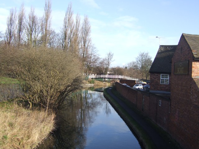
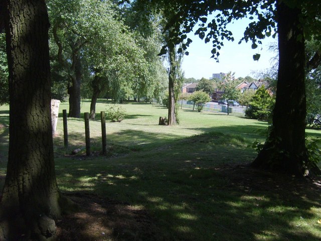
Moseley is also known for its cultural and artistic scene. The village hosts various events throughout the year, including the Moseley Folk Festival, which attracts renowned musicians and artists from around the country. Additionally, the historic Moseley Park and Pool provide residents with a serene green space to relax and enjoy nature.

Transportation in Moseley is well-served, with regular bus services connecting the village to Birmingham city center and other nearby areas. The village also benefits from close proximity to major road networks, including the A435 and the A34, making it easily accessible for commuters.

Overall, Moseley offers a delightful blend of history, community spirit, and cultural vibrancy. With its picturesque streets, thriving local businesses, and excellent transport links, Moseley is a sought-after location for those seeking a charming village lifestyle within close proximity to a major city.

If you have any feedback on the listing, please let us know in the comments section below.

Moseley Images

Images are sourced within 2km of 52.584222/-2.086474 or Grid Reference SO9498. Thanks to Geograph Open Source API. All images are credited.

Tower block refurbishment The nearer pair of 1960s towerblocks are the latest to get a facelift.
Tower block refurbishment
The nearer pair of 1960s towerblocks are the latest to get a facelift.
Wyrley and Essington Canal - View to Trapmakers Bridge A quiet winter's day beside the 'Curly Wyrley'
Wyrley and Essington Canal - View to Trapmakers Bridge
A quiet winter's day beside the 'Curly Wyrley'
Former Great Horse PH - Prestwood Road Yet another local pub closure. This one has opened as a One-Stop convenience store. One Stop is a Tesco owned brand.
Former Great Horse PH - Prestwood Road
Yet another local pub closure. This one has opened as a One-Stop convenience store. One Stop is a Tesco owned brand.
Wednesfield Gurdwara The view of Guru Nanak Gurdwara temple in Well Lane, Wolverhampton.
Wednesfield Gurdwara
The view of Guru Nanak Gurdwara temple in Well Lane, Wolverhampton.
The Pyle Cock Pub The view in Wednesfield, Wolverhampton.
The Pyle Cock Pub
The view in Wednesfield, Wolverhampton.
New Heath Close, Wednesfield This cul de sac, off Graiseley Lane (foreground), leads to several blocks of low rise flats adjacent to the south eastern corner of the New Cross Hospital campus.
New Heath Close, Wednesfield
This cul de sac, off Graiseley Lane (foreground), leads to several blocks of low rise flats adjacent to the south eastern corner of the New Cross Hospital campus.
The Village Inn, Wednesfield Overshadowed by the (apparently contemporary) tower blocks, the Village Inn faces Wolverhampton Road (out of frame to the right) as it nears Wednesfield town centre.
The Village Inn, Wednesfield
Overshadowed by the (apparently contemporary) tower blocks, the Village Inn faces Wolverhampton Road (out of frame to the right) as it nears Wednesfield town centre.
Wyrley & Essington Canal in Wednesfield (1) Looking north west from Wolverhampton Road bridge.
Wyrley & Essington Canal in Wednesfield (1)
Looking north west from Wolverhampton Road bridge.
Wyrley & Essington Canal in Wednesfield (2) Looking east along the backs of the shops that front onto Rookery Street.
Wyrley & Essington Canal in Wednesfield (2)
Looking east along the backs of the shops that front onto Rookery Street.
Waddens Brook Lane Heading west.
Waddens Brook Lane
Heading west.
Houses on March End Road, Wednesfield
March End Road, Wednesfield Heading west.
March End Road, Wednesfield
Heading west.
New Cross Hospital The Royal Wolverhampton Hospitals NHS Trust.
New Cross Hospital
The Royal Wolverhampton Hospitals NHS Trust.
New Cross Hospital The Royal Wolverhampton Hospitals NHS Trust.
New Cross Hospital
The Royal Wolverhampton Hospitals NHS Trust.
Access road, New Cross Hospital
Council Housing - Grange, Lathe and Grosvenor Courts Recently refurbished 1962 Wimpey built tower blocks.
Council Housing - Grange, Lathe and Grosvenor Courts
Recently refurbished 1962 Wimpey built tower blocks.
Wednesfield Past and Present One of a pair of artistic panels on the re-vamped Sainsbury's store nicely set off by the shopping trolleys and traffic cone.

The panel shows the Battle of Wodensfelde in 910, the trapmaking industry and the arrival of the Wyrley and Essington Canal.

With recent changes in Planning rules this type of public art will no longer be required.
Wednesfield Past and Present
One of a pair of artistic panels on the re-vamped Sainsbury's store nicely set off by the shopping trolleys and traffic cone. The panel shows the Battle of Wodensfelde in 910, the trapmaking industry and the arrival of the Wyrley and Essington Canal. With recent changes in Planning rules this type of public art will no longer be required.
Tower Block in Wednesfield The 1960s block originally built for Wednesfield UDC is currently undergoing a facelift under the 'Decent Homes' programme.
Tower Block in Wednesfield
The 1960s block originally built for Wednesfield UDC is currently undergoing a facelift under the 'Decent Homes' programme.
Show me another place!

Moseley is located at Grid Ref: SO9498 (Lat: 52.584222, Lng: -2.086474)

Unitary Authority: Wolverhampton

Police Authority: West Midlands

What 3 Words

///beats.spout.couple. Near Wednesfield, West Midlands

Nearby Locations

Moseley Stowlawn Wood

Related Wikis

St Matthias School

St Matthias School is a mixed secondary school located in Wolverhampton in the West Midlands of England.It was established as Deansfield High School in...

Stow Heath

Stow Heath is an area and ancient manor in the city of Wolverhampton, West Midlands, located in the east half of the city. == Place name and origins... ==

Deansfield

Deansfield is an area of Wolverhampton, West Midlands, England. It is situated in the city council's East Park ward, to the east of the city centre. Most...

East Park, Wolverhampton

East Park is a public park in Wolverhampton, England. Situated off Hickman Avenue, near Monmore Green stadium, the park has good transport links to the...

East Park (ward)

East Park is the name of a ward of Wolverhampton City Council, West Midlands, England. It lies to the east of Wolverhampton city centre, stretching to...

Portobello railway station (Wolverhampton)

Portobello railway station was a station built on the Grand Junction Railway in 1837. It served the Portobello area of Willenhall, and was located near...

St Matthew's Church, Wolverhampton

St Matthew's Church, Wolverhampton is a parish church in the Church of England in Wolverhampton == History == The first church was built situated in Lower...

Portobello, West Midlands

Portobello is an area in Willenhall on the Wolverhampton side of the border, in the West Midlands, England. It is situated to the east of the city centre...

Nearby Amenities

Located within 500m of 52.584222,-2.086474
Bus Stop
Willenhall Rd / Hurstbourne Crescent
NaPTANAreaCode: 43000710701
Bench: yes
Bin: no
Bus: yes
Naptan AtcoCode: 43000710701
Naptan Bearing: W
Naptan BusStopType: MKD
Naptan CommonName: Hurstbourne Crescent
Naptan Indicator: adj
Naptan NaptanCode: nwmjdwta
Naptan PlusbusZoneRef: BHAMNWS
Naptan Status: ACT
Naptan StopType: BCT
Naptan Street: WILLENHALL RD
Naptan Towards: Wolverhampton
Naptan Verified: no
Public Transport: platform
Route Ref: 53;529
Shelter: yes
Shelter Ref: 103006
Source: WMCA
Tactile Paving: no
Lat/Long: 52.5834968/-2.0891306
Bus Stop
Willenhall Rd / Hurstbourne Crescent
NaPTANAreaCode: 43000710702
Bench: yes
Bin: no
Bus: yes
Naptan AtcoCode: 43000710702
Naptan Bearing: E
Naptan BusStopType: MKD
Naptan CommonName: Hurstbourne Crescent
Naptan Indicator: opp
Naptan NaptanCode: nwmjdwtd
Naptan PlusbusZoneRef: BHAMNWS
Naptan Status: ACT
Naptan StopType: BCT
Naptan Street: WILLENHALL RD
Naptan Towards: Willenhall
Naptan Verified: no
Public Transport: platform
Route Ref: 53;529
Shelter: yes
Shelter Ref: 103007
Source: WMCA
Tactile Paving: no
Lat/Long: 52.5836264/-2.0895011
Bus Stop
Deans Rd / Julian Rd
NaPTANAreaCode: 43000711401
Bus: yes
Naptan AtcoCode: 43000711401
Naptan Bearing: NW
Naptan BusStopType: MKD
Naptan CommonName: Julian Rd
Naptan Indicator: adj
Naptan NaptanCode: nwmjgada
Naptan PlusbusZoneRef: BHAMNWS
Naptan Status: ACT
Naptan StopType: BCT
Naptan Street: DEANS RD
Naptan Towards: Wolverhampton
Naptan Verified: no
Public Transport: platform
Route Ref: 82;545
Shelter: yes
Shelter Ref: 103008
Source: WMCA
Lat/Long: 52.5864886/-2.0915721
Bus Stop
Deans Rd / Julian Rd
Bus: yes
Naptan AtcoCode: 43000711402
Naptan Bearing: SE
Naptan BusStopType: MKD
Naptan CommonName: Julian Rd
Naptan Indicator: opp
Naptan NaptanCode: nwmjgadg
Naptan PlusbusZoneRef: BHAMNWS
Naptan Status: ACT
Naptan StopType: BCT
Naptan Street: DEANS RD
Naptan Towards: Bilston
Naptan Verified: no
Public Transport: platform
Route Ref: 82;545
Source: WMCA
Lat/Long: 52.5862824/-2.0908042
Bus Stop
Deans Rd / Deansfield School
Bus: yes
Naptan AtcoCode: 43000712101
Naptan Bearing: NW
Naptan BusStopType: MKD
Naptan CommonName: Deansfield School
Naptan Indicator: opp
Naptan NaptanCode: nwmjgadj
Naptan PlusbusZoneRef: BHAMNWS
Naptan Status: ACT
Naptan StopType: BCT
Naptan Street: DEANS RD
Naptan Towards: Wolverhampton
Naptan Verified: no
Public Transport: platform
Route Ref: 82;545
Source: WMCA
Lat/Long: 52.5851692/-2.0888241
Bus Stop
Deans Rd / Deansfield School
NaPTANAreaCode: 43000712102
Bus: yes
Naptan AtcoCode: 43000712102
Naptan Bearing: SE
Naptan BusStopType: MKD
Naptan CommonName: Deansfield School
Naptan Indicator: adj
Naptan NaptanCode: nwmjgadm
Naptan PlusbusZoneRef: BHAMNWS
Naptan Status: ACT
Naptan StopType: BCT
Naptan Street: DEANS RD
Naptan Towards: Bilston
Naptan Verified: no
Public Transport: platform
Route Ref: 82;545
Shelter: yes
Shelter Ref: 103068
Source: WMCA
Lat/Long: 52.5849719/-2.08813
Bus Stop
Stowheath Lane / Wentbridge Rd
Bus: yes
Naptan AtcoCode: 43000712201
Naptan Bearing: SW
Naptan BusStopType: MKD
Naptan CommonName: Wentbridge Rd
Naptan Indicator: before
Naptan NaptanCode: nwmtawma
Naptan PlusbusZoneRef: BHAMNWS
Naptan Status: ACT
Naptan StopType: BCT
Naptan Street: STOWHEATH LANE
Naptan Towards: Wolverhampton
Naptan Verified: no
Public Transport: platform
Route Ref: 53
Source: WMCA
Lat/Long: 52.5819791/-2.0868695
Bus Stop
Stowheath Lane / Wentbridge Rd
Bus: yes
Naptan AtcoCode: 43000712202
Naptan Bearing: NE
Naptan BusStopType: MKD
Naptan CommonName: Wentbridge Rd
Naptan Indicator: after
Naptan NaptanCode: nwmtawmd
Naptan PlusbusZoneRef: BHAMNWS
Naptan Status: ACT
Naptan StopType: BCT
Naptan Street: STOWHEATH LANE
Naptan Towards: New Cross Hospital
Naptan Verified: no
Public Transport: platform
Route Ref: 53
Source: WMCA
Lat/Long: 52.5820689/-2.0870025
Bus Stop
Willenhall Rd / Deans Rd
NaPTANAreaCode: 43000712301
Bench: yes
Bin: no
Bus: yes
Naptan AtcoCode: 43000712301
Naptan Bearing: E
Naptan BusStopType: MKD
Naptan Indicator: opp
Naptan NaptanCode: nwmjgadp
Naptan PlusbusZoneRef: BHAMNWS
Naptan Status: ACT
Naptan StopType: BCT
Naptan Street: WILLENHALL RD
Naptan Towards: Willenhall
Naptan Verified: no
Public Transport: platform
Route Ref: 53;529
Shelter: yes
Shelter Ref: 103125
Source: WMCA
Tactile Paving: no
Lat/Long: 52.5836964/-2.0866072
Bus Stop
Willenhall Rd / Deans Rd
NaPTANAreaCode: 43000712302
Bench: yes
Bin: yes
Bus: yes
Naptan AtcoCode: 43000712302
Naptan Bearing: W
Naptan BusStopType: MKD
Naptan Indicator: adj
Naptan NaptanCode: nwmjgadt
Naptan PlusbusZoneRef: BHAMNWS
Naptan Status: ACT
Naptan StopType: BCT
Naptan Street: WILLENHALL RD
Naptan Towards: Wolverhampton
Naptan Verified: no
Public Transport: platform
Route Ref: 53;529
Shelter: yes
Shelter Ref: 103101
Source: WMCA
Tactile Paving: no
Lat/Long: 52.5835167/-2.0865183
Bus Stop
Willenhall Rd / Neachells Lane
NaPTANAreaCode: 43000712402
Bench: yes
Bin: no
Bus: yes
Naptan AtcoCode: 43000712402
Naptan Bearing: E
Naptan BusStopType: MKD
Naptan CommonName: Neachells Lane
Naptan Indicator: adj
Naptan NaptanCode: nwmjgadw
Naptan PlusbusZoneRef: BHAMNWS
Naptan Status: ACT
Naptan StopType: BCT
Naptan Street: WILLENHALL RD
Naptan Towards: Willenhall
Naptan Verified: no
Public Transport: platform
Route Ref: 529
Shelter: yes
Shelter Ref: 103103
Source: WMCA
Lat/Long: 52.5838078/-2.0817516
Bus Stop
Willenhall Rd / Cleveland Close
NaPTANAreaCode: 43000712403
Bench: yes
Bin: yes
Bus: yes
Naptan AtcoCode: 43000712403
Naptan Bearing: W
Naptan BusStopType: MKD
Naptan Indicator: opp
Naptan NaptanCode: nwmjgaga
Naptan PlusbusZoneRef: BHAMNWS
Naptan Status: ACT
Naptan StopType: BCT
Naptan Street: WILLENHALL RD
Naptan Towards: Wolverhampton
Naptan Verified: no
Public Transport: platform
Route Ref: 82;529;545
Shelter: yes
Shelter Ref: 103102
Source: WMCA
Tactile Paving: no
Lat/Long: 52.5836107/-2.0808881
Bus Stop
Deans Rd / Stowheath Lane
NaPTANAreaCode: 43007120503
Bus: yes
Naptan AtcoCode: 43007120503
Naptan Bearing: NW
Naptan BusStopType: MKD
Naptan CommonName: Stowheath Lane
Naptan Indicator: after
Naptan Landmark: Merryboys
Naptan NaptanCode: nwmpmgat
Naptan Status: ACT
Naptan StopType: BCT
Naptan Street: DEANS RD
Naptan Towards: Wolverhampton
Naptan Verified: no
Public Transport: platform
Route Ref: 82;545
Shelter: yes
Shelter Ref: 103069
Source: WMCA
Lat/Long: 52.5841012/-2.086239
Telephone
Booth: KXPlus
Check Date: 2023-04-01
Covered: booth
Lat/Long: 52.5836533/-2.0882196
Mini Roundabout
Direction: clockwise
Lat/Long: 52.586842/-2.0920417
Moseley Village
Place: locality
Source: OS_OpenData_StreetView
Lat/Long: 52.5854537/-2.0821887
Mini Roundabout
Source: bing
Lat/Long: 52.5817233/-2.0873518
Turning Circle
Source: bing
Lat/Long: 52.5824337/-2.0842843
Speed Camera
Lat/Long: 52.583423/-2.0925076
Traffic Signals
Lat/Long: 52.5837599/-2.0855733
Traffic Signals
Source: bing
Lat/Long: 52.5838941/-2.0793599
Traffic Signals
Lat/Long: 52.5835/-2.0854654
Traffic Signals
Lat/Long: 52.5835272/-2.0850861
Traffic Signals
Source: bing
Lat/Long: 52.5836863/-2.0793429
Traffic Signals
Source: bing
Lat/Long: 52.5837206/-2.0792006
Traffic Signals
Source: bing
Lat/Long: 52.583961/-2.0793542
Crossing
Crossing: traffic_signals
Lat/Long: 52.5836448/-2.0821525
Crossing
Crossing: traffic_signals
Lat/Long: 52.583748/-2.0824291
Give Way
Source: bing
Lat/Long: 52.5837552/-2.0850376
Crossing
Crossing: unmarked
Crossing Island: no
Kerb: lowered
Tactile Paving: yes
Lat/Long: 52.5839294/-2.0830411
Crossing
Crossing: uncontrolled
Lat/Long: 52.5851625/-2.0886374
Pharmacy
Mayfield
Addr Street: Willenhall Road
Healthcare: pharmacy
Lat/Long: 52.5830647/-2.0932777
Traffic Signals
Lat/Long: 52.5835323/-2.0853424
Traffic Signals
Lat/Long: 52.5836179/-2.0850796
Traffic Signals
Source: bing
Lat/Long: 52.5836928/-2.0855677
Traffic Signals
Lat/Long: 52.5837943/-2.0851449
Traffic Signals
Source: bing
Lat/Long: 52.5838045/-2.0853639
Barrier: bollard
Lat/Long: 52.5828726/-2.0882232
Generator Method: photovoltaic
Generator Output Electricity: yes
Generator Source: solar
Generator Type: solar_photovoltaic_panel
Location: roof
Power: generator
Lat/Long: 52.5856464/-2.0901972
Generator Method: photovoltaic
Generator Output Electricity: yes
Generator Source: solar
Generator Type: solar_photovoltaic_panel
Location: roof
Power: generator
Lat/Long: 52.5848495/-2.0910448
Generator Method: photovoltaic
Generator Output Electricity: yes
Generator Source: solar
Generator Type: solar_photovoltaic_panel
Location: roof
Power: generator
Lat/Long: 52.5848446/-2.0911682
Generator Method: photovoltaic
Generator Output Electricity: yes
Generator Source: solar
Generator Type: solar_photovoltaic_panel
Location: roof
Power: generator
Lat/Long: 52.5851151/-2.0915946
Generator Method: photovoltaic
Generator Output Electricity: yes
Generator Source: solar
Generator Type: solar_photovoltaic_panel
Location: roof
Power: generator
Lat/Long: 52.5851217/-2.0916939
Generator Method: photovoltaic
Generator Output Electricity: yes
Generator Source: solar
Generator Type: solar_photovoltaic_panel
Location: roof
Power: generator
Lat/Long: 52.5879653/-2.0885772
Generator Method: photovoltaic
Generator Output Electricity: yes
Generator Source: solar
Generator Type: solar_photovoltaic_panel
Location: roof
Power: generator
Lat/Long: 52.5882472/-2.088427
Generator Method: photovoltaic
Generator Output Electricity: yes
Generator Source: solar
Generator Type: solar_photovoltaic_panel
Location: roof
Power: generator
Lat/Long: 52.5831986/-2.0896983
Generator Method: photovoltaic
Generator Output Electricity: yes
Generator Source: solar
Generator Type: solar_photovoltaic_panel
Location: roof
Power: generator
Lat/Long: 52.5829574/-2.0887837
Generator Method: photovoltaic
Generator Output Electricity: yes
Generator Source: solar
Generator Type: solar_photovoltaic_panel
Location: roof
Power: generator
Lat/Long: 52.582902/-2.0884457
Generator Method: photovoltaic
Generator Output Electricity: yes
Generator Source: solar
Generator Type: solar_photovoltaic_panel
Location: roof
Power: generator
Lat/Long: 52.5828955/-2.088325
Generator Method: photovoltaic
Generator Output Electricity: yes
Generator Source: solar
Generator Type: solar_photovoltaic_panel
Location: roof
Power: generator
Lat/Long: 52.5834692/-2.0818958
Generator Method: photovoltaic
Generator Output Electricity: yes
Generator Source: solar
Generator Type: solar_photovoltaic_panel
Location: roof
Power: generator
Lat/Long: 52.5835066/-2.0806834
Crossing
Crossing: marked
Lat/Long: 52.5835268/-2.0850869
Crossing
Crossing: marked
Tactile Paving: yes
Lat/Long: 52.5835137/-2.085508
Crossing
Crossing: marked
Lat/Long: 52.5836174/-2.0851267
Crossing
Crossing: marked
Lat/Long: 52.5837098/-2.085141
Crossing
Crossing: marked
Lat/Long: 52.5835375/-2.0853404
Crossing
Crossing: marked
Lat/Long: 52.5835398/-2.0852808
Crossing
Crossing: marked
Tactile Paving: yes
Lat/Long: 52.5836092/-2.0854946
Crossing
Crossing: marked
Tactile Paving: yes
Lat/Long: 52.5836957/-2.0855034
Crossing
Crossing: marked
Tactile Paving: yes
Lat/Long: 52.5837738/-2.0855578
Crossing
Crossing: marked
Tactile Paving: yes
Lat/Long: 52.583779/-2.0851063
Crossing
Crossing: marked
Crossing Island: yes
Tactile Paving: yes
Lat/Long: 52.5835875/-2.0883337
Parcel Locker
Brand: InPost
Brand Wikidata: Q3182097
Operator: inpost
Parcel Mail In: yes
Parcel Pickup: yes
Lat/Long: 52.5840591/-2.0862668
The data included in this document is from www.openstreetmap.org. The data is made available under ODbL.

Have you been to Moseley?

Leave your review of Moseley below (or comments, questions and feedback).