Morvich

Settlement in Ross-shire

Scotland

Morvich

View from Lower Slopes of Sgùrr an Airgid Generally in Scotland the word 'strath' is used to signify a wide flat valley bottom, whereas a 'glen' signifies a narrow steep one. Strath Croe here follows the rules to the letter - there is a striking contrast between the brown autumn hillsides and the bright green pasture land below.
The path to the summit of Sgùrr an Airgid is very straightforward, though only the first part is indicated on the OS map. There is a gate directly opposite a parking area near to a burial ground which leads to a good path that takes you NorthEast up the lower slopes. The path than veers left (West) at an obvious cairn which leads to the top. The cairn is rather redundant now, as the path marked on the map disappears at this point, but it must have been built to alert hillwalkers of a junction once upon a time. It would appear that these days walking up hills is far more popular than shooting animals!
View from Lower Slopes of Sgùrr an Airgid Credit: Ian Dodds

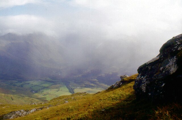
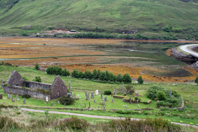
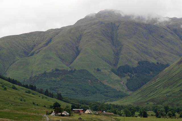
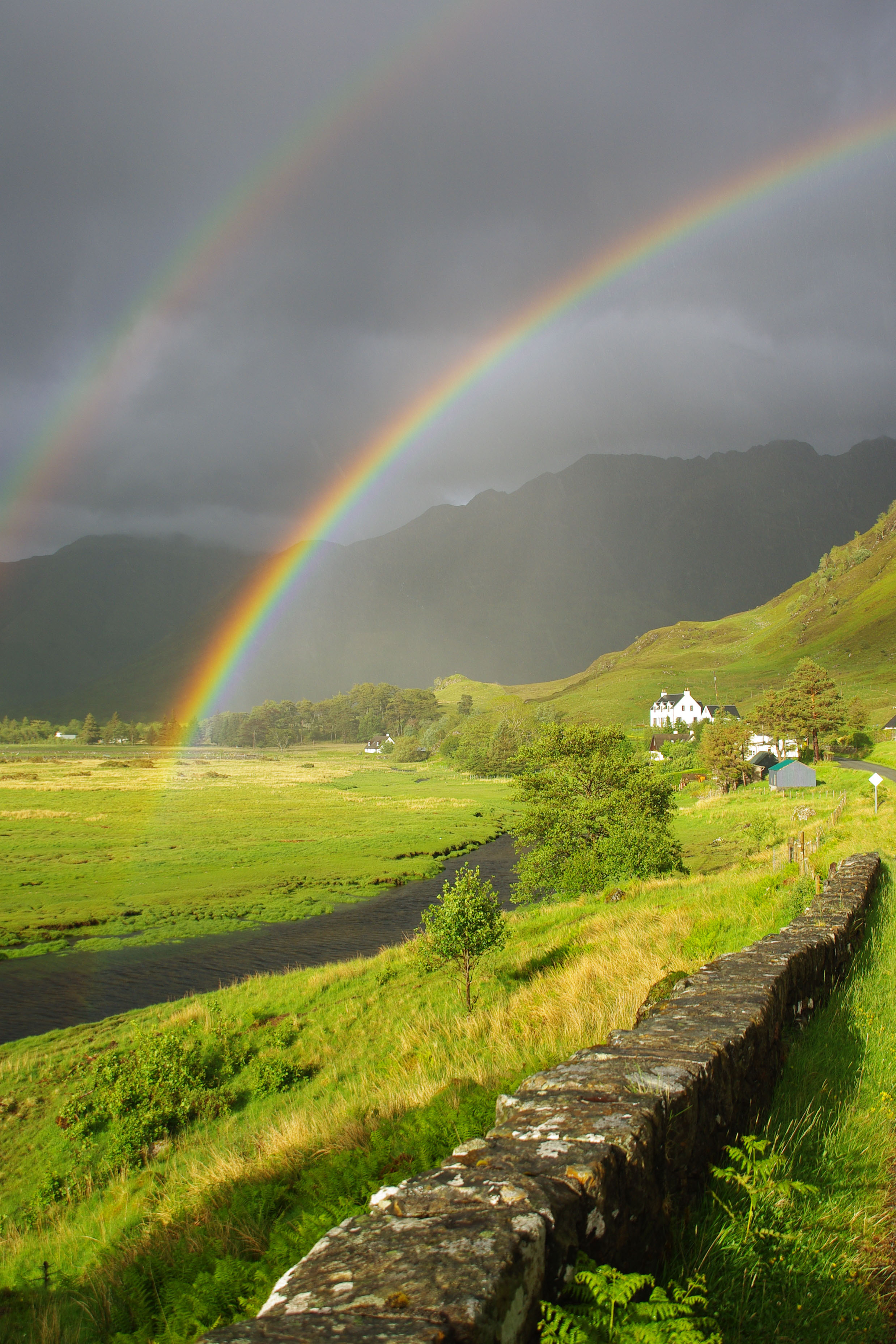
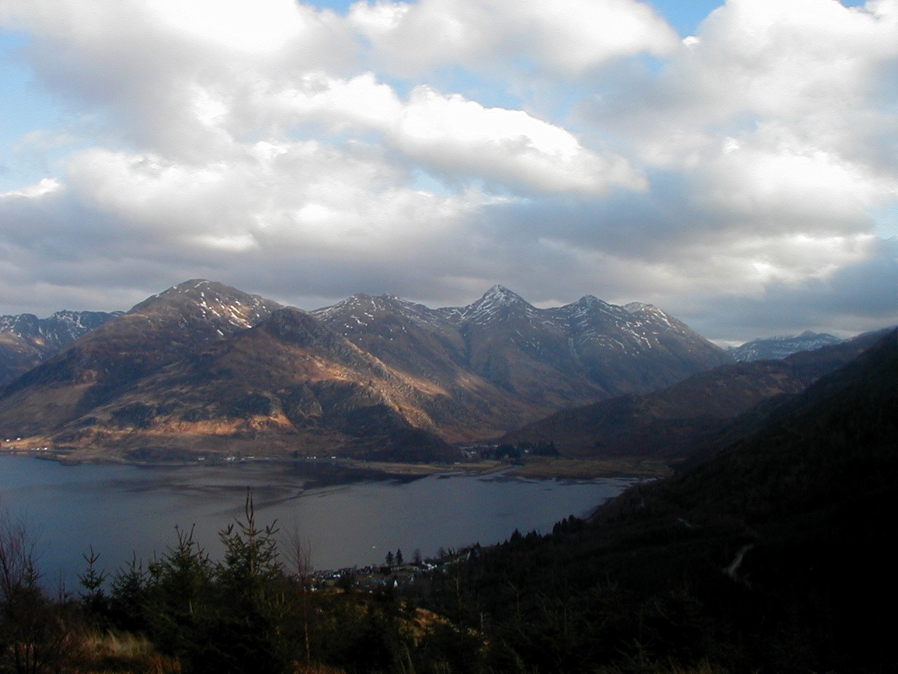
Morvich is a picturesque village located in the county of Ross-shire, Scotland. Situated in the western part of the county, Morvich is nestled within the stunning Highland landscape, offering breathtaking views of the surrounding mountains and glens. The village is situated close to the shores of Loch Duich, adding to its natural charm and scenic beauty.

With a population of approximately 500 residents, Morvich maintains a close-knit community atmosphere. The village is known for its tranquil and peaceful environment, attracting visitors seeking a retreat from the bustling cities. The local economy primarily relies on tourism, as visitors are drawn to Morvich for its natural beauty and outdoor recreational opportunities.

Morvich is a popular destination for hikers and outdoor enthusiasts, thanks to its proximity to the Five Sisters of Kintail and the nearby Glen Shiel. These majestic mountains and their surrounding glens provide ample opportunities for walking, climbing, and wildlife spotting. The area is also home to several well-marked trails, including the famous South Glen Shiel Ridge, which offers breathtaking panoramic views.

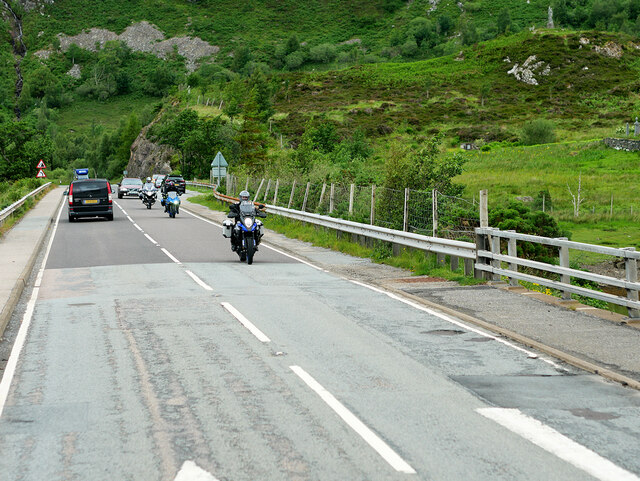
In terms of amenities, Morvich has a few local shops and services to cater to the needs of residents and tourists, including a small grocery store and a café. For a wider range of facilities, visitors can explore nearby larger towns such as Kyle of Lochalsh or Shiel Bridge.

Morvich is a hidden gem in the Scottish Highlands, offering a tranquil and idyllic setting for nature lovers and those seeking a peaceful getaway amidst stunning scenery.

If you have any feedback on the listing, please let us know in the comments section below.

Morvich Images

Images are sourced within 2km of 57.234597/-5.3716761 or Grid Reference NG9621. Thanks to Geograph Open Source API. All images are credited.

View from Lower Slopes of Sgùrr an Airgid Generally in Scotland the word 'strath' is used to signify a wide flat valley bottom, whereas a 'glen' signifies a narrow steep one. Strath Croe here follows the rules to the letter - there is a striking contrast between the brown autumn hillsides and the bright green pasture land below.
The path to the summit of Sgùrr an Airgid is very straightforward, though only the first part is indicated on the OS map. There is a gate directly opposite a parking area near to a burial ground which leads to a good path that takes you NorthEast up the lower slopes. The path than veers left (West) at an obvious cairn which leads to the top. The cairn is rather redundant now, as the path marked on the map disappears at this point, but it must have been built to alert hillwalkers of a junction once upon a time. It would appear that these days walking up hills is far more popular than shooting animals!
View from Lower Slopes of Sgùrr an Airgid
Generally in Scotland the word 'strath' is used to signify a wide flat valley bottom, whereas a 'glen' signifies a narrow steep one. Strath Croe here follows the rules to the letter - there is a striking contrast between the brown autumn hillsides and the bright green pasture land below. The path to the summit of Sgùrr an Airgid is very straightforward, though only the first part is indicated on the OS map. There is a gate directly opposite a parking area near to a burial ground which leads to a good path that takes you NorthEast up the lower slopes. The path than veers left (West) at an obvious cairn which leads to the top. The cairn is rather redundant now, as the path marked on the map disappears at this point, but it must have been built to alert hillwalkers of a junction once upon a time. It would appear that these days walking up hills is far more popular than shooting animals!
South slopes of Sgùrr an Airgid
Motorcyclists on the A87 Causeway near Ault a' Chruinn Crossing the causeway over the Croe estuary at the head of Loch Doich.
Motorcyclists on the A87 Causeway near Ault a' Chruinn
Crossing the causeway over the Croe estuary at the head of Loch Doich.
St Dubhthach's Church and Burial Ground A Scheduled Monument consisting of St. Duthae or Dubhthach's church and burial ground of Kintail. St. Dubhthach is thought to have died in 1065 and a dedication stone, probably Victorian, just inside the gates reads 'Dedicated to St. Dubhthach. C 1050 Though Probably In Use Three Centuries Earlier'. However nothing is known about the origins of the church. In 1719 it was used by the Jacobites as a hospital for the Battle of Glenshiel and burnt by Government forces. It was repaired and remained in use into the 1830s and probably until the present church was built in 1856. In the walls of the church are the burials of the chiefs of Clan Macrae.
St Dubhthach's Church and Burial Ground
A Scheduled Monument consisting of St. Duthae or Dubhthach's church and burial ground of Kintail. St. Dubhthach is thought to have died in 1065 and a dedication stone, probably Victorian, just inside the gates reads 'Dedicated to St. Dubhthach. C 1050 Though Probably In Use Three Centuries Earlier'. However nothing is known about the origins of the church. In 1719 it was used by the Jacobites as a hospital for the Battle of Glenshiel and burnt by Government forces. It was repaired and remained in use into the 1830s and probably until the present church was built in 1856. In the walls of the church are the burials of the chiefs of Clan Macrae.
St Dubhthach's Church A Scheduled Monument consisting of St. Duthae or Dubhthach's church and burial ground of Kintail. St. Dubhthach is thought to have died in 1065 and a dedication stone, probably Victorian, just inside the gates reads 'Dedicated to St. Dubhthach. C 1050 Though Probably In Use Three Centuries Earlier'. However nothing is known about the origins of the church. In 1719 it was used by the Jacobites as a hospital for the Battle of Glenshiel and burnt by Government forces. It was repaired and remained in use into the 1830s and probably until the present church was built in 1856. In the walls of the church are the burials of the chiefs of Clan Macrae.
St Dubhthach's Church
A Scheduled Monument consisting of St. Duthae or Dubhthach's church and burial ground of Kintail. St. Dubhthach is thought to have died in 1065 and a dedication stone, probably Victorian, just inside the gates reads 'Dedicated to St. Dubhthach. C 1050 Though Probably In Use Three Centuries Earlier'. However nothing is known about the origins of the church. In 1719 it was used by the Jacobites as a hospital for the Battle of Glenshiel and burnt by Government forces. It was repaired and remained in use into the 1830s and probably until the present church was built in 1856. In the walls of the church are the burials of the chiefs of Clan Macrae.
St Dubhthach's Church and Burial Ground A Scheduled Monument consisting of St. Duthae or Dubhthach's church and burial ground of Kintail. St. Dubhthach is thought to have died in 1065 and a dedication stone, probably Victorian, just inside the gates reads 'Dedicated to St. Dubhthach. C 1050 Though Probably In Use Three Centuries Earlier'. However nothing is known about the origins of the church. In 1719 it was used by the Jacobites as a hospital for the Battle of Glenshiel and burnt by Government forces. It was repaired and remained in use into the 1830s and probably until the present church was built in 1856. In the walls of the church are the burials of the chiefs of Clan Macrae.
St Dubhthach's Church and Burial Ground
A Scheduled Monument consisting of St. Duthae or Dubhthach's church and burial ground of Kintail. St. Dubhthach is thought to have died in 1065 and a dedication stone, probably Victorian, just inside the gates reads 'Dedicated to St. Dubhthach. C 1050 Though Probably In Use Three Centuries Earlier'. However nothing is known about the origins of the church. In 1719 it was used by the Jacobites as a hospital for the Battle of Glenshiel and burnt by Government forces. It was repaired and remained in use into the 1830s and probably until the present church was built in 1856. In the walls of the church are the burials of the chiefs of Clan Macrae.
Ruarach and Lienassie down Strath Croe from Macrae War Memorial Ruarach is on the 1880 OS map and Lienassie includes a Category B listed early 19th century farmhouse and barn.
Ruarach and Lienassie down Strath Croe from Macrae War Memorial
Ruarach is on the 1880 OS map and Lienassie includes a Category B listed early 19th century farmhouse and barn.
Clachan Duich Cemetery Showing the ruined church, destroyed in 1855.
The modern cemetery is to the right of the church.
Clachan Duich Cemetery
Showing the ruined church, destroyed in 1855. The modern cemetery is to the right of the church.
Strath Croe The glen behind the Five Sisters, a long straight trench leading to Glenlicht House and a pass into Affric.
Strath Croe
The glen behind the Five Sisters, a long straight trench leading to Glenlicht House and a pass into Affric.
Morvich Caravan Club Site
Tent area Morvich Caravan Club Site
Track towards Morvich The track in Gleann Lichd looking towards the western end of the new Affric Kintail Way, a cross country walking and cycling route covering almost 44 miles from Drumnadrochit on Loch Ness to Morvich in Kintail.
Track towards Morvich
The track in Gleann Lichd looking towards the western end of the new Affric Kintail Way, a cross country walking and cycling route covering almost 44 miles from Drumnadrochit on Loch Ness to Morvich in Kintail.
Old building en route to Falls of Glomach
Steep flank of Beinn Bhuidhe Looking down on Strath Croe.
Steep flank of Beinn Bhuidhe
Looking down on Strath Croe.
River Croe from Sgùrr a' Choire Ghairbh
Strath Croe Looking from the footpath by the Abhainn Chonaig. This is paradise for midges.
The distant mountain is A' Ghlas-bheinn.
Strath Croe
Looking from the footpath by the Abhainn Chonaig. This is paradise for midges. The distant mountain is A' Ghlas-bheinn.
Lower Gleann Chòinneachain Looking across the lower part of the glen to forestry on the slopes of Creag an Ruighe Mhoir.
Lower Gleann Chòinneachain
Looking across the lower part of the glen to forestry on the slopes of Creag an Ruighe Mhoir.
Strath Croe As the River Croe nears Loch Duich.
Strath Croe
As the River Croe nears Loch Duich.
Show me another place!

Morvich is located at Grid Ref: NG9621 (Lat: 57.234597, Lng: -5.3716761)

Unitary Authority: Highland

Police Authority: Highlands and Islands

What 3 Words

///research.journey.broadens. Near Glenelg, Highland

Related Wikis

Morvich, Highland

Morvich (Gaelic:A’ Mhormhaich) is a settlement in Glen Shiel near the southern end of Loch Duich, and to the north of Kintail, in Lochalsh, in the Highland...

Sgùrr an Airgid

Sgurr an Airgid (841 m) is a mountain in the Northwest Highlands, Scotland. It lies on the northern shore of Loch Duich in Kintail. Although the mountain...

Kintail

Kintail (Scottish Gaelic: Cinn t-Sàile) is a mountainous area sitting at the head of Loch Duich in the Northwest Highlands of Scotland, located in the...

Shiel Bridge

Shiel Bridge is a hamlet on the south east shore of Loch Duich at the foot of Glen Shiel, in the Lochalsh area of the Scottish Highlands. It is in the...

Nearby Amenities

Located within 500m of 57.234597,-5.3716761
Turning Circle
Source: survey
Lat/Long: 57.2352288/-5.3680356
Information: guidepost
Operator: Scottish Rights of Way Society
Tourism: information
Lat/Long: 57.234608/-5.3717579
Tourism: picnic_site
Lat/Long: 57.2353918/-5.3694981
Morvich
Name Gd: A' Mhormhaich
Place: hamlet
Wikidata: Q6915175
Wikipedia: en:Morvich, Highland
Lat/Long: 57.2347943/-5.3799706
Innis a' Chrotha
Place: hamlet
Lat/Long: 57.2358579/-5.367229
Power: pole
Lat/Long: 57.2371603/-5.3686628
Power: pole
Lat/Long: 57.2363763/-5.3690092
Power: pole
Lat/Long: 57.2356998/-5.3693339
Power: pole
Lat/Long: 57.2351792/-5.369564
Power: pole
Lat/Long: 57.2348187/-5.3701261
Power: pole
Lat/Long: 57.2342955/-5.3709522
Power: pole
Lat/Long: 57.2342431/-5.3726796
Power: pole
Lat/Long: 57.2341893/-5.3740702
Power: pole
Lat/Long: 57.2341474/-5.3754244
Power: pole
Lat/Long: 57.2341893/-5.3765728
Power: pole
Lat/Long: 57.23423/-5.3777017
Power: pole
Lat/Long: 57.2342824/-5.379119
The data included in this document is from www.openstreetmap.org. The data is made available under ODbL.

Have you been to Morvich?

Leave your review of Morvich below (or comments, questions and feedback).