Strath Croe

Valley in Ross-shire

Scotland

Strath Croe

View from Lower Slopes of Sgùrr an Airgid Generally in Scotland the word 'strath' is used to signify a wide flat valley bottom, whereas a 'glen' signifies a narrow steep one. Strath Croe here follows the rules to the letter - there is a striking contrast between the brown autumn hillsides and the bright green pasture land below.
The path to the summit of Sgùrr an Airgid is very straightforward, though only the first part is indicated on the OS map. There is a gate directly opposite a parking area near to a burial ground which leads to a good path that takes you NorthEast up the lower slopes. The path than veers left (West) at an obvious cairn which leads to the top. The cairn is rather redundant now, as the path marked on the map disappears at this point, but it must have been built to alert hillwalkers of a junction once upon a time. It would appear that these days walking up hills is far more popular than shooting animals!
View from Lower Slopes of Sgùrr an Airgid Credit: Ian Dodds

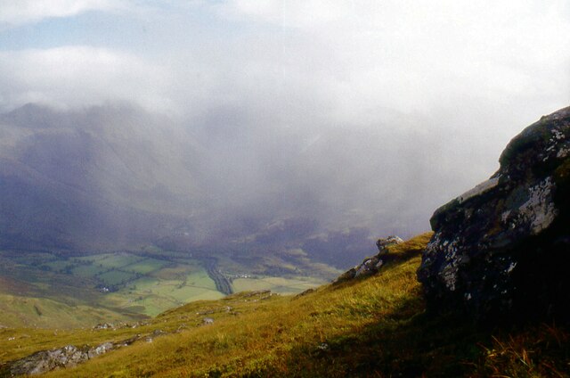
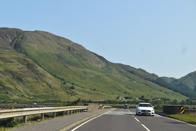
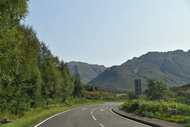
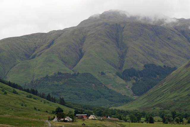
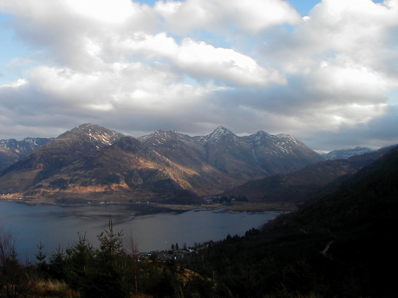
Strath Croe is a beautiful valley located in the county of Ross-shire in the Scottish Highlands. Situated in the northwest of Scotland, this picturesque valley is nestled between the towering mountains of the Torridon Hills and the Beinn Eighe National Nature Reserve.

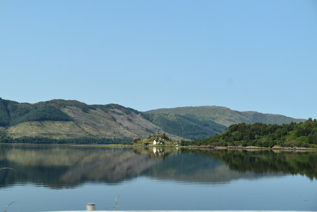
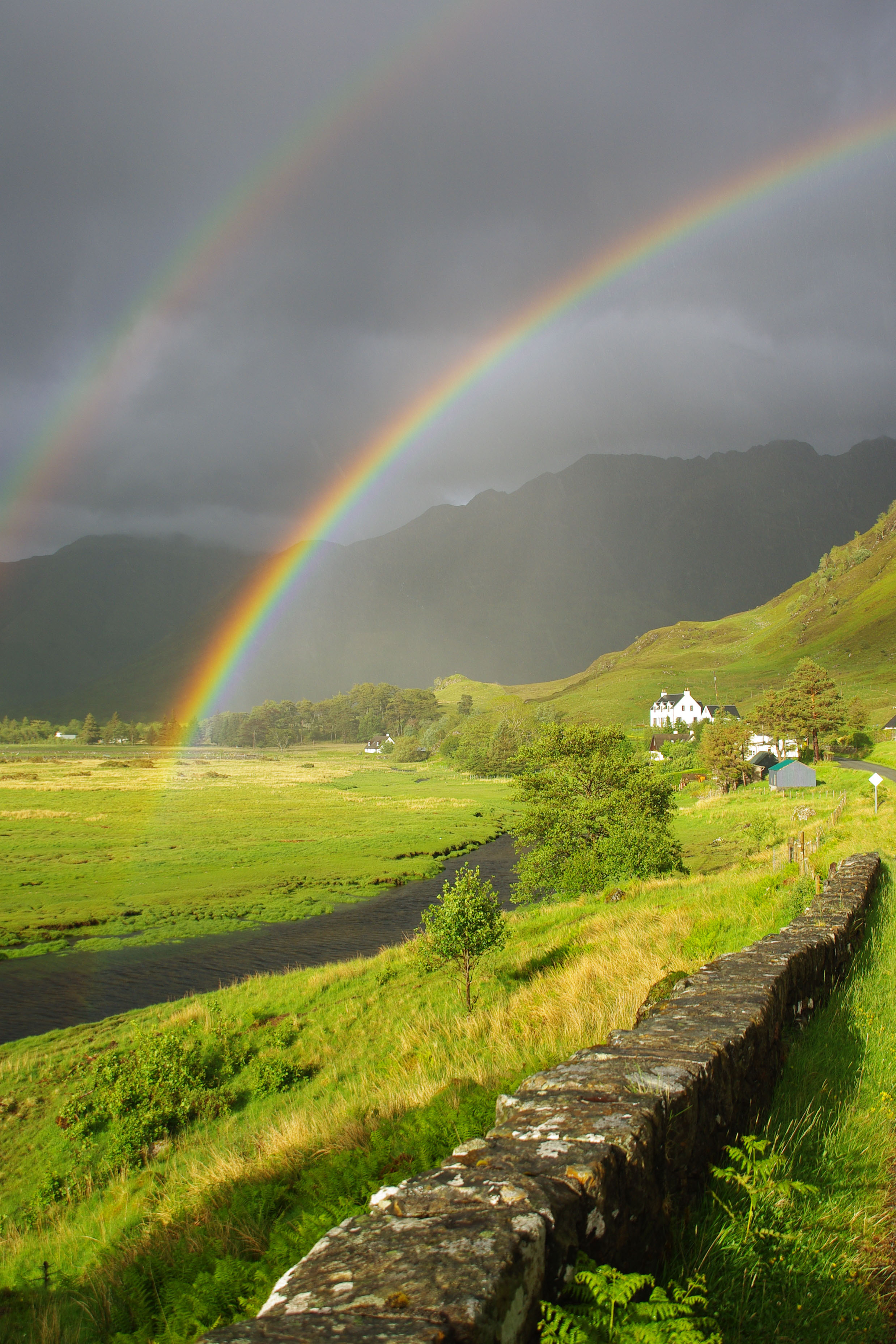
The valley is renowned for its stunning natural scenery, characterized by its rugged landscapes, cascading waterfalls, and crystal-clear rivers. The River Croe flows through the heart of the valley, adding to its charm and providing a habitat for various species of fish.

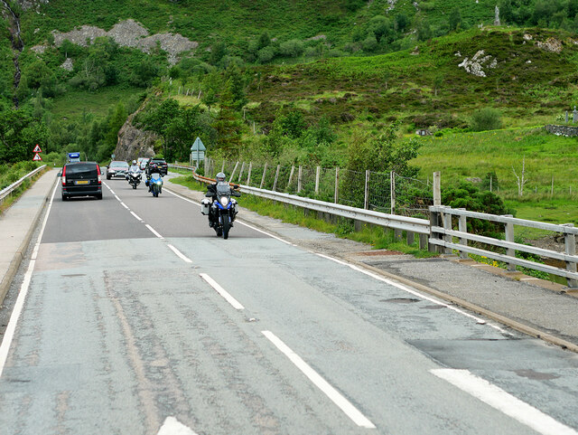
Strath Croe offers numerous outdoor activities for nature enthusiasts and adventure seekers. Hiking is a popular pastime in the region, with several trails winding through the valley and up the surrounding mountains. The Beinn Eighe Nature Reserve is a haven for wildlife, including golden eagles, red deer, and pine martens, making it a popular spot for birdwatching and wildlife photography.

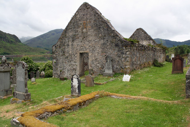
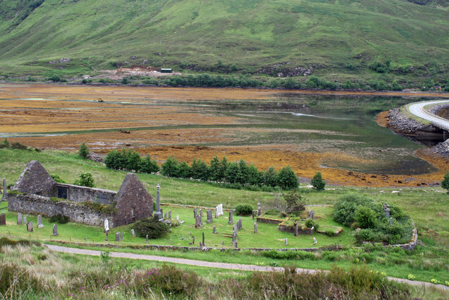
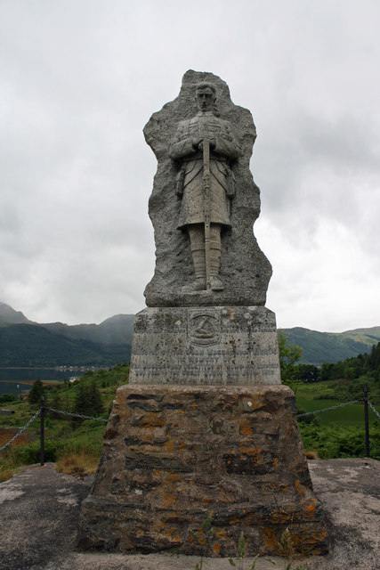
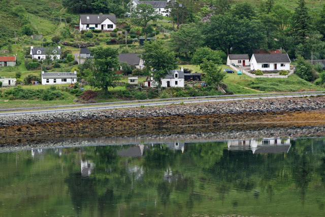
The valley is dotted with small villages and hamlets, providing a glimpse into the traditional Scottish Highland way of life. Visitors can explore the local history and culture by visiting the nearby Eilean Donan Castle or participating in traditional Highland games and festivals.

Strath Croe is also a perfect destination for those seeking tranquility and relaxation. The peaceful atmosphere and breathtaking vistas make it an ideal spot for artists, photographers, and anyone looking to escape the hustle and bustle of everyday life.

In summary, Strath Croe is a scenic valley in Ross-shire, Scotland, offering a wealth of natural beauty, outdoor activities, and cultural experiences for visitors to enjoy.

If you have any feedback on the listing, please let us know in the comments section below.

Strath Croe Images

Images are sourced within 2km of 57.237872/-5.3809113 or Grid Reference NG9621. Thanks to Geograph Open Source API. All images are credited.

View from Lower Slopes of Sgùrr an Airgid Generally in Scotland the word 'strath' is used to signify a wide flat valley bottom, whereas a 'glen' signifies a narrow steep one. Strath Croe here follows the rules to the letter - there is a striking contrast between the brown autumn hillsides and the bright green pasture land below.
The path to the summit of Sgùrr an Airgid is very straightforward, though only the first part is indicated on the OS map. There is a gate directly opposite a parking area near to a burial ground which leads to a good path that takes you NorthEast up the lower slopes. The path than veers left (West) at an obvious cairn which leads to the top. The cairn is rather redundant now, as the path marked on the map disappears at this point, but it must have been built to alert hillwalkers of a junction once upon a time. It would appear that these days walking up hills is far more popular than shooting animals!
View from Lower Slopes of Sgùrr an Airgid
Generally in Scotland the word 'strath' is used to signify a wide flat valley bottom, whereas a 'glen' signifies a narrow steep one. Strath Croe here follows the rules to the letter - there is a striking contrast between the brown autumn hillsides and the bright green pasture land below. The path to the summit of Sgùrr an Airgid is very straightforward, though only the first part is indicated on the OS map. There is a gate directly opposite a parking area near to a burial ground which leads to a good path that takes you NorthEast up the lower slopes. The path than veers left (West) at an obvious cairn which leads to the top. The cairn is rather redundant now, as the path marked on the map disappears at this point, but it must have been built to alert hillwalkers of a junction once upon a time. It would appear that these days walking up hills is far more popular than shooting animals!
South slopes of Sgùrr an Airgid
Striding across Màm na Dubharaiche
Motorcyclists on the A87 Causeway near Ault a' Chruinn Crossing the causeway over the Croe estuary at the head of Loch Doich.
Motorcyclists on the A87 Causeway near Ault a' Chruinn
Crossing the causeway over the Croe estuary at the head of Loch Doich.
Westbound A87 near Loch Doich The A87 is a primary route  in the Highland region of Scotland. It runs west for 99 miles from its junction with the A82 at Invergarry, along the north shores of Loch Garry and Loch Cluanie, then through Glen Shiel and along Loch Duich to Kyle of Lochalsh before crossing the Skye Bridge to Kyleakin, Broadford, and Portree, before terminating at Uig in the north of the Isle of Skye.
Westbound A87 near Loch Doich
The A87 is a primary route in the Highland region of Scotland. It runs west for 99 miles from its junction with the A82 at Invergarry, along the north shores of Loch Garry and Loch Cluanie, then through Glen Shiel and along Loch Duich to Kyle of Lochalsh before crossing the Skye Bridge to Kyleakin, Broadford, and Portree, before terminating at Uig in the north of the Isle of Skye.
A87, Allt a' Chruinn The A87 runs 99 miles from Invergarry to Uig on the Isle of Skye <a href="https://www.geograph.org.uk/photo/7374675">NG3863 : End of the A87, Uig</a>.
<span class="nowrap"><a title="https://www.sabre-roads.org.uk/wiki/index.php?title=A87" rel="nofollow ugc noopener" href="https://www.sabre-roads.org.uk/wiki/index.php?title=A87">Link</a><img style="margin-left:2px;" alt="External link" title="External link - shift click to open in new window" src="https://s1.geograph.org.uk/img/external.png" width="10" height="10"/></span>
A87, Allt a' Chruinn
The A87 runs 99 miles from Invergarry to Uig on the Isle of Skye NG3863 : End of the A87, Uig. LinkExternal link
Loch Duich
Loch Duich
A87 The A87 runs 99 miles from Invergarry to Uig on the Isle of Skye <a href="https://www.geograph.org.uk/photo/7374675">NG3863 : End of the A87, Uig</a>.
<span class="nowrap"><a title="https://www.sabre-roads.org.uk/wiki/index.php?title=A87" rel="nofollow ugc noopener" href="https://www.sabre-roads.org.uk/wiki/index.php?title=A87">Link</a><img style="margin-left:2px;" alt="External link" title="External link - shift click to open in new window" src="https://s1.geograph.org.uk/img/external.png" width="10" height="10"/></span>
A87
The A87 runs 99 miles from Invergarry to Uig on the Isle of Skye NG3863 : End of the A87, Uig. LinkExternal link
St Dubhthach's Church and Burial Ground A Scheduled Monument consisting of St. Duthae or Dubhthach's church and burial ground of Kintail. St. Dubhthach is thought to have died in 1065 and a dedication stone, probably Victorian, just inside the gates reads 'Dedicated to St. Dubhthach. C 1050 Though Probably In Use Three Centuries Earlier'. However nothing is known about the origins of the church. In 1719 it was used by the Jacobites as a hospital for the Battle of Glenshiel and burnt by Government forces. It was repaired and remained in use into the 1830s and probably until the present church was built in 1856. In the walls of the church are the burials of the chiefs of Clan Macrae.
St Dubhthach's Church and Burial Ground
A Scheduled Monument consisting of St. Duthae or Dubhthach's church and burial ground of Kintail. St. Dubhthach is thought to have died in 1065 and a dedication stone, probably Victorian, just inside the gates reads 'Dedicated to St. Dubhthach. C 1050 Though Probably In Use Three Centuries Earlier'. However nothing is known about the origins of the church. In 1719 it was used by the Jacobites as a hospital for the Battle of Glenshiel and burnt by Government forces. It was repaired and remained in use into the 1830s and probably until the present church was built in 1856. In the walls of the church are the burials of the chiefs of Clan Macrae.
St Dubhthach's Church A Scheduled Monument consisting of St. Duthae or Dubhthach's church and burial ground of Kintail. St. Dubhthach is thought to have died in 1065 and a dedication stone, probably Victorian, just inside the gates reads 'Dedicated to St. Dubhthach. C 1050 Though Probably In Use Three Centuries Earlier'. However nothing is known about the origins of the church. In 1719 it was used by the Jacobites as a hospital for the Battle of Glenshiel and burnt by Government forces. It was repaired and remained in use into the 1830s and probably until the present church was built in 1856. In the walls of the church are the burials of the chiefs of Clan Macrae.
St Dubhthach's Church
A Scheduled Monument consisting of St. Duthae or Dubhthach's church and burial ground of Kintail. St. Dubhthach is thought to have died in 1065 and a dedication stone, probably Victorian, just inside the gates reads 'Dedicated to St. Dubhthach. C 1050 Though Probably In Use Three Centuries Earlier'. However nothing is known about the origins of the church. In 1719 it was used by the Jacobites as a hospital for the Battle of Glenshiel and burnt by Government forces. It was repaired and remained in use into the 1830s and probably until the present church was built in 1856. In the walls of the church are the burials of the chiefs of Clan Macrae.
St Dubhthach's Church and Burial Ground A Scheduled Monument consisting of St. Duthae or Dubhthach's church and burial ground of Kintail. St. Dubhthach is thought to have died in 1065 and a dedication stone, probably Victorian, just inside the gates reads 'Dedicated to St. Dubhthach. C 1050 Though Probably In Use Three Centuries Earlier'. However nothing is known about the origins of the church. In 1719 it was used by the Jacobites as a hospital for the Battle of Glenshiel and burnt by Government forces. It was repaired and remained in use into the 1830s and probably until the present church was built in 1856. In the walls of the church are the burials of the chiefs of Clan Macrae.
St Dubhthach's Church and Burial Ground
A Scheduled Monument consisting of St. Duthae or Dubhthach's church and burial ground of Kintail. St. Dubhthach is thought to have died in 1065 and a dedication stone, probably Victorian, just inside the gates reads 'Dedicated to St. Dubhthach. C 1050 Though Probably In Use Three Centuries Earlier'. However nothing is known about the origins of the church. In 1719 it was used by the Jacobites as a hospital for the Battle of Glenshiel and burnt by Government forces. It was repaired and remained in use into the 1830s and probably until the present church was built in 1856. In the walls of the church are the burials of the chiefs of Clan Macrae.
Macrae War Memorial Category B Listed memorial unveiled by Sir Colin G Macrae Saturday 15th July 1922. The inscription reads 'Erected by the Clan Macrae and friends in memory of the Macraes and relatives at home and abroad who fell in the great world war 1914 -1918 "GUS AM BRIS AN LA."'  Sir Colin reported that '.... not less than five hundred Macraes, an unusual proportion of the number served, made the supreme sacrifice ...' The decision to promote a 'Lasting Memorial' was taken by the Clan Macrae Association at a meeting on 28th January 1920. It is believed that the memorial stands on land owned in 1539 by Duncan Macrae who slew Donald Gorm Macdonald at the siege of Ellandonan, saving the stronghold. The sculptor work was carried out by R Gray & Co. Glasgow. Robert Gray established the business at 44 York Street Glasgow in 1857. The firm moved to 335 St. Vincent Street in 1909, and eventually traded at 167 Clarence Drive in the late 20th century. The firm was purchased by J & G Mossman in the 1970s and is still trading.
Macrae War Memorial
Category B Listed memorial unveiled by Sir Colin G Macrae Saturday 15th July 1922. The inscription reads 'Erected by the Clan Macrae and friends in memory of the Macraes and relatives at home and abroad who fell in the great world war 1914 -1918 "GUS AM BRIS AN LA."' Sir Colin reported that '.... not less than five hundred Macraes, an unusual proportion of the number served, made the supreme sacrifice ...' The decision to promote a 'Lasting Memorial' was taken by the Clan Macrae Association at a meeting on 28th January 1920. It is believed that the memorial stands on land owned in 1539 by Duncan Macrae who slew Donald Gorm Macdonald at the siege of Ellandonan, saving the stronghold. The sculptor work was carried out by R Gray & Co. Glasgow. Robert Gray established the business at 44 York Street Glasgow in 1857. The firm moved to 335 St. Vincent Street in 1909, and eventually traded at 167 Clarence Drive in the late 20th century. The firm was purchased by J & G Mossman in the 1970s and is still trading.
Allt a' Chruinn from Macrae War Memorial The name Ault-a-chrinn does not appear on the 1st edition 1874 OS map, although it is used in the 1861 census. Roy's survey of around 1750 does not record a township here and it seems that this may be a settlement that developed during the 19th century following the displacement of cottars and crofters when sheep farming was introduced.
Allt a' Chruinn from Macrae War Memorial
The name Ault-a-chrinn does not appear on the 1st edition 1874 OS map, although it is used in the 1861 census. Roy's survey of around 1750 does not record a township here and it seems that this may be a settlement that developed during the 19th century following the displacement of cottars and crofters when sheep farming was introduced.
Ruarach and Lienassie down Strath Croe from Macrae War Memorial Ruarach is on the 1880 OS map and Lienassie includes a Category B listed early 19th century farmhouse and barn.
Ruarach and Lienassie down Strath Croe from Macrae War Memorial
Ruarach is on the 1880 OS map and Lienassie includes a Category B listed early 19th century farmhouse and barn.
Clachan Duich Cemetery Showing the ruined church, destroyed in 1855.
The modern cemetery is to the right of the church.
Clachan Duich Cemetery
Showing the ruined church, destroyed in 1855. The modern cemetery is to the right of the church.
Strath Croe The glen behind the Five Sisters, a long straight trench leading to Glenlicht House and a pass into Affric.
Strath Croe
The glen behind the Five Sisters, a long straight trench leading to Glenlicht House and a pass into Affric.
Slopes of Sgurr an Airgid A good path climbs out of Strath Croe to the col between Sgurr an Airgid and Beinn Bhuide.
Slopes of Sgurr an Airgid
A good path climbs out of Strath Croe to the col between Sgurr an Airgid and Beinn Bhuide.
Morvich Caravan Club Site
Show me another place!

Strath Croe is located at Grid Ref: NG9621 (Lat: 57.237872, Lng: -5.3809113)

Unitary Authority: Highland

Police Authority: Highlands and Islands

What 3 Words

///walled.love.professed. Near Glenelg, Highland

Related Wikis

Morvich, Highland

Morvich (Gaelic:A’ Mhormhaich) is a settlement in Glen Shiel near the southern end of Loch Duich, and to the north of Kintail, in Lochalsh, in the Highland...

Sgùrr an Airgid

Sgurr an Airgid (841 m) is a mountain in the Northwest Highlands, Scotland. It lies on the northern shore of Loch Duich in Kintail. Although the mountain...

Shiel Bridge

Shiel Bridge is a hamlet on the south east shore of Loch Duich at the foot of Glen Shiel, in the Lochalsh area of the Scottish Highlands. It is in the...

Kintail

Kintail (Scottish Gaelic: Cinn t-Sàile) is a mountainous area sitting at the head of Loch Duich in the Northwest Highlands of Scotland, located in the...

Nearby Amenities

Located within 500m of 57.237872,-5.3809113
Created By: Merkaartor 0.12
Lat/Long: 57.235433/-5.3843619
Created By: Merkaartor 0.12
Lat/Long: 57.2361889/-5.3841619
Created By: Merkaartor 0.12
Lat/Long: 57.237103/-5.384152
Created By: Merkaartor 0.12
Lat/Long: 57.237463/-5.384473
Created By: Merkaartor 0.12
Lat/Long: 57.2377819/-5.384918
Created By: Merkaartor 0.12
Lat/Long: 57.2382889/-5.388033
Parking
Capacity: 10
Fee: voluntary donations
Parking: surface
Lat/Long: 57.2346691/-5.3809251
Morvich Caravan Club Site
Addr Postcode: IV40 8HQ
Operator: The Caravan Club
Phone: +44 1599 511354
Was Tourism: camp_site
Lat/Long: 57.235234/-5.3799243
Barrier: cattle_grid
Lat/Long: 57.239461/-5.3815745
Morvich
Name Gd: A' Mhormhaich
Place: hamlet
Wikidata: Q6915175
Wikipedia: en:Morvich, Highland
Lat/Long: 57.2347943/-5.3799706
Lienassie
Place: locality
Lat/Long: 57.2408786/-5.3784299
Power: pole
Source: bing
Lat/Long: 57.2394787/-5.3813763
Power: pole
Source: bing
Lat/Long: 57.239343/-5.3813106
Power: pole
Source: bing
Lat/Long: 57.2387805/-5.3809337
Power: pole
Source: bing
Lat/Long: 57.2382747/-5.3806092
Power: pole
Source: bing
Lat/Long: 57.23576/-5.3822333
Power: pole
Source: bing
Lat/Long: 57.2364037/-5.381729
Power: pole
Source: bing
Lat/Long: 57.2370119/-5.3813401
Power: pole
Source: bing
Lat/Long: 57.2377101/-5.3809324
Bench
Source: survey
Lat/Long: 57.234611/-5.3809324
Power: pole
Lat/Long: 57.2410677/-5.3789094
Power: pole
Lat/Long: 57.2407727/-5.3800626
Power: pole
Lat/Long: 57.2405577/-5.3811407
Power: pole
Lat/Long: 57.2403873/-5.3819644
Power: pole
Lat/Long: 57.2401212/-5.3832678
Power: pole
Lat/Long: 57.2398157/-5.3846511
Power: pole
Lat/Long: 57.2395627/-5.3857607
Power: pole
Lat/Long: 57.2392048/-5.3874081
Power: pole
Lat/Long: 57.2388836/-5.3888375
Power: pole
Lat/Long: 57.2341893/-5.3765728
Power: pole
Lat/Long: 57.23423/-5.3777017
Power: pole
Lat/Long: 57.2342824/-5.379119
Power: pole
Lat/Long: 57.2343401/-5.3806065
Power: pole
Lat/Long: 57.2343847/-5.3818445
Power: pole
Lat/Long: 57.2344371/-5.3832157
Power: pole
Lat/Long: 57.235157/-5.3826464
Power: pole
Lat/Long: 57.2338196/-5.3836881
The data included in this document is from www.openstreetmap.org. The data is made available under ODbL.

Have you been to Strath Croe?

Leave your review of Strath Croe below (or comments, questions and feedback).