Milton

Settlement in Inverness-shire

Scotland

Milton

Shackleton Park, Smithton A small grassy area amongst the housing estates. 

As it says on the stone:
This park is named in memory of the Shackleton Bomber of 120 Sqn Coastal Command that crash landed near this site on 10th January 1964. It commemorates the heroism and skill that saved both the community and crew from disaster.

An article from the Press & Journal. <span class="nowrap"><a title="https://www.pressandjournal.co.uk/fp/news/inverness/1097472/crash-site-history-restored/" rel="nofollow ugc noopener" href="https://www.pressandjournal.co.uk/fp/news/inverness/1097472/crash-site-history-restored/">Link</a><img style="margin-left:2px;" alt="External link" title="External link - shift click to open in new window" src="https://s1.geograph.org.uk/img/external.png" width="10" height="10"/></span>
Shackleton Park, Smithton Credit: Craig Wallace

The requested URL returned error: 429 Too Many Requests

If you have any feedback on the listing, please let us know in the comments section below.

Milton Images

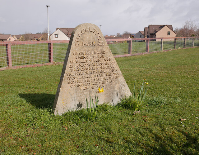
Images are sourced within 2km of 57.494327/-4.1570545 or Grid Reference NH7046. Thanks to Geograph Open Source API. All images are credited.

Shackleton Park, Smithton A small grassy area amongst the housing estates. 

As it says on the stone:
This park is named in memory of the Shackleton Bomber of 120 Sqn Coastal Command that crash landed near this site on 10th January 1964. It commemorates the heroism and skill that saved both the community and crew from disaster.

An article from the Press & Journal. <span class="nowrap"><a title="https://www.pressandjournal.co.uk/fp/news/inverness/1097472/crash-site-history-restored/" rel="nofollow ugc noopener" href="https://www.pressandjournal.co.uk/fp/news/inverness/1097472/crash-site-history-restored/">Link</a><img style="margin-left:2px;" alt="External link" title="External link - shift click to open in new window" src="https://s1.geograph.org.uk/img/external.png" width="10" height="10"/></span>
Shackleton Park, Smithton
A small grassy area amongst the housing estates. As it says on the stone: This park is named in memory of the Shackleton Bomber of 120 Sqn Coastal Command that crash landed near this site on 10th January 1964. It commemorates the heroism and skill that saved both the community and crew from disaster. An article from the Press & Journal. LinkExternal link
Former Stratton Lodge Hotel Dating from the late 18th century, Stratton Lodge is a Category B listed building. <span class="nowrap"><a title="https://portal.historicenvironment.scot/designation/LB8060" rel="nofollow ugc noopener" href="https://portal.historicenvironment.scot/designation/LB8060">Link</a><img style="margin-left:2px;" alt="External link" title="External link - shift click to open in new window" src="https://s1.geograph.org.uk/img/external.png" width="10" height="10"/></span>
It has been disused for a number of years, and damaged by several fires. It is now fenced off, with a sign saying "No unauthorised persons allowed near this building".

It is on the Buildings at Risk Register. <span class="nowrap"><a title="https://www.buildingsatrisk.org.uk/details/962581" rel="nofollow ugc noopener" href="https://www.buildingsatrisk.org.uk/details/962581">Link</a><img style="margin-left:2px;" alt="External link" title="External link - shift click to open in new window" src="https://s1.geograph.org.uk/img/external.png" width="10" height="10"/></span>
Former Stratton Lodge Hotel
Dating from the late 18th century, Stratton Lodge is a Category B listed building. LinkExternal link It has been disused for a number of years, and damaged by several fires. It is now fenced off, with a sign saying "No unauthorised persons allowed near this building". It is on the Buildings at Risk Register. LinkExternal link
Shore at Milton of Culloden A fine view of the Inner Moray Firth.
Shore at Milton of Culloden
A fine view of the Inner Moray Firth.
Culloden Doocot A tall octagonal dovecote, on a grassy mound next to Barn Church Road.
It dates from circa 1788, and is Category B listed. <span class="nowrap"><a title="https://portal.historicenvironment.scot/designation/LB10953" rel="nofollow ugc noopener" href="https://portal.historicenvironment.scot/designation/LB10953">Link</a><img style="margin-left:2px;" alt="External link" title="External link - shift click to open in new window" src="https://s1.geograph.org.uk/img/external.png" width="10" height="10"/></span>
Culloden Doocot
A tall octagonal dovecote, on a grassy mound next to Barn Church Road. It dates from circa 1788, and is Category B listed. LinkExternal link
New housing, by Barn Church Road Part of the expanding "Culloden West" development, off Barn Church Road. It includes several apartment blocks, as well as a range of houses.
New housing, by Barn Church Road
Part of the expanding "Culloden West" development, off Barn Church Road. It includes several apartment blocks, as well as a range of houses.
Track, by Ashton Farm A track from Ashton Farm towards the edge of the suburbs at Resaurie.
Track, by Ashton Farm
A track from Ashton Farm towards the edge of the suburbs at Resaurie.
Fields, by Ashton Farm Looking towards houses on the edge of the suburbs, around Resaurie and Smithton.
Fields, by Ashton Farm
Looking towards houses on the edge of the suburbs, around Resaurie and Smithton.
The Gruffalo One of a series of wood carvings alongside Culloden Avenue. It was carved by Iain Chalmers, of Chainsaw Creations <span class="nowrap"><a title="https://chainsawcreations.co.uk/" rel="nofollow ugc noopener" href="https://chainsawcreations.co.uk/">Link</a><img style="margin-left:2px;" alt="External link" title="External link - shift click to open in new window" src="https://s1.geograph.org.uk/img/external.png" width="10" height="10"/></span>

A similar view in 2012. <a href="https://www.geograph.org.uk/photo/2871598">NH7146 : The Gruffalo</a>
The Gruffalo
One of a series of wood carvings alongside Culloden Avenue. It was carved by Iain Chalmers, of Chainsaw Creations LinkExternal link A similar view in 2012. NH7146 : The Gruffalo
Evening at Culloden Taken after sunset.
Evening at Culloden
Taken after sunset.
Signage on A96 eastbound
Odd sky towards Kessock Bridge
Moray Firth towards the Kessock Bridge
Junction with A96
Junction with A96
Towards Alturlie Point
Culloden House Hotel
Track in Culloden Woods
Show me another place!

Milton is located at Grid Ref: NH7046 (Lat: 57.494327, Lng: -4.1570545)

Unitary Authority: Highland

Police Authority: Highlands and Islands

What 3 Words

///requested.seaweed.newlyweds. Near Culloden, Highland

Nearby Locations

Milton

Related Wikis

Allanfearn railway station

Allanfearn was a railway station located near Culloden, outside Inverness, Highland, Scotland. It was initially named Culloden when opened, but was renamed...

Allanfearn

Allanfearn (, Scottish Gaelic: An t-Àilean Feàrna) is a small settlement, it lies 4 miles (6.4 km) east of Inverness, Inverness-shire, Scotland, within...

Barn Church, Culloden

The Barn Church is a parish church of the Church of Scotland at Culloden, in the Presbytery of Inverness. Although the congregation is relatively young...

Culloden, Highland

Culloden ( ; from Scottish Gaelic Cùl Lodain, "back of the small pond"; modern Gaelic Cùil Lodair) is the name of a village three miles (five kilometres...

Nearby Amenities

Located within 500m of 57.494327,-4.1570545
Railway: crossing
Lat/Long: 57.4949785/-4.1545523
Bus Stop
Shelter: yes
Lat/Long: 57.4945109/-4.1546288
Power: pole
Lat/Long: 57.4941333/-4.1488264
Power: pole
Lat/Long: 57.4938784/-4.1499496
Power: pole
Lat/Long: 57.4936308/-4.1510592
Power: pole
Lat/Long: 57.493044/-4.1516167
Power: pole
Lat/Long: 57.4924601/-4.1521661
Power: pole
Lat/Long: 57.4918719/-4.1526909
Power: pole
Lat/Long: 57.4913085/-4.1532212
Power: pole
Lat/Long: 57.4907312/-4.1537555
Power: pole
Lat/Long: 57.492359/-4.1534556
Power: pole
Lat/Long: 57.4928865/-4.1542108
Power: pole
Lat/Long: 57.4934886/-4.1551078
Power: pole
Lat/Long: 57.4938198/-4.1556053
Power: pole
Lat/Long: 57.4942146/-4.1559747
The data included in this document is from www.openstreetmap.org. The data is made available under ODbL.

Have you been to Milton?

Leave your review of Milton below (or comments, questions and feedback).