Millend

Settlement in Staffordshire Newcastle-under-Lyme

England

Millend

Boundary field Looking SW from the A500 as it enters Cheshire.
Boundary field Credit: Adrian Bailey

Millend is a quaint village located in the county of Staffordshire, England. Situated in the West Midlands region, it is nestled amidst picturesque countryside, offering residents and visitors a serene and idyllic setting.

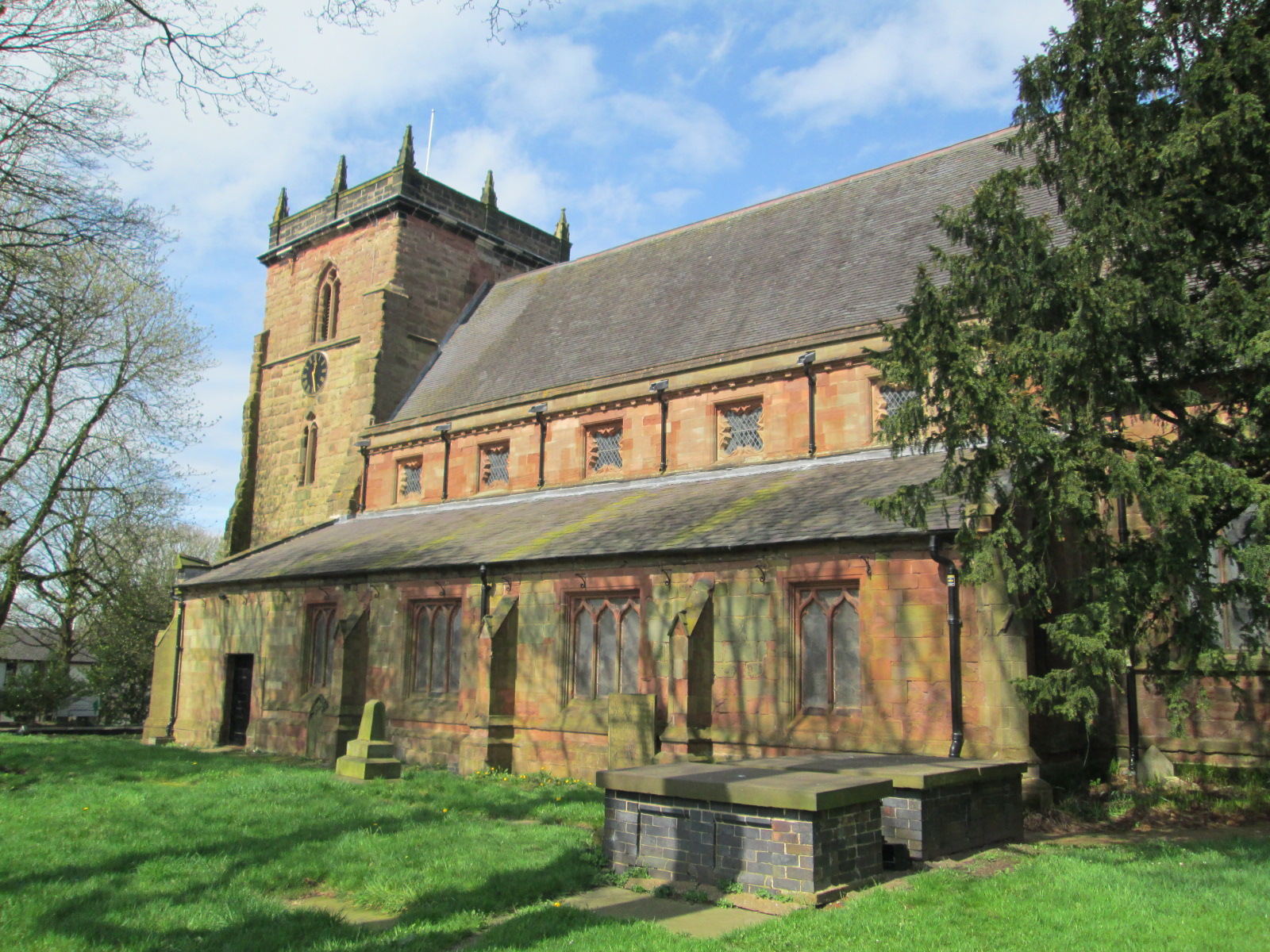
The village is characterized by its charming and well-preserved architecture, with many historic buildings dating back to the 16th and 17th centuries. These include traditional cottages, farmhouses, and a beautiful parish church, which serve as a reminder of Millend's rich heritage.

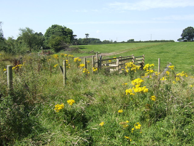
Nature enthusiasts and outdoor lovers will find much to explore in Millend, as it is surrounded by lush green fields and rolling hills. The village is also home to several nature reserves and parks, providing ample opportunities for walking, hiking, and wildlife spotting.

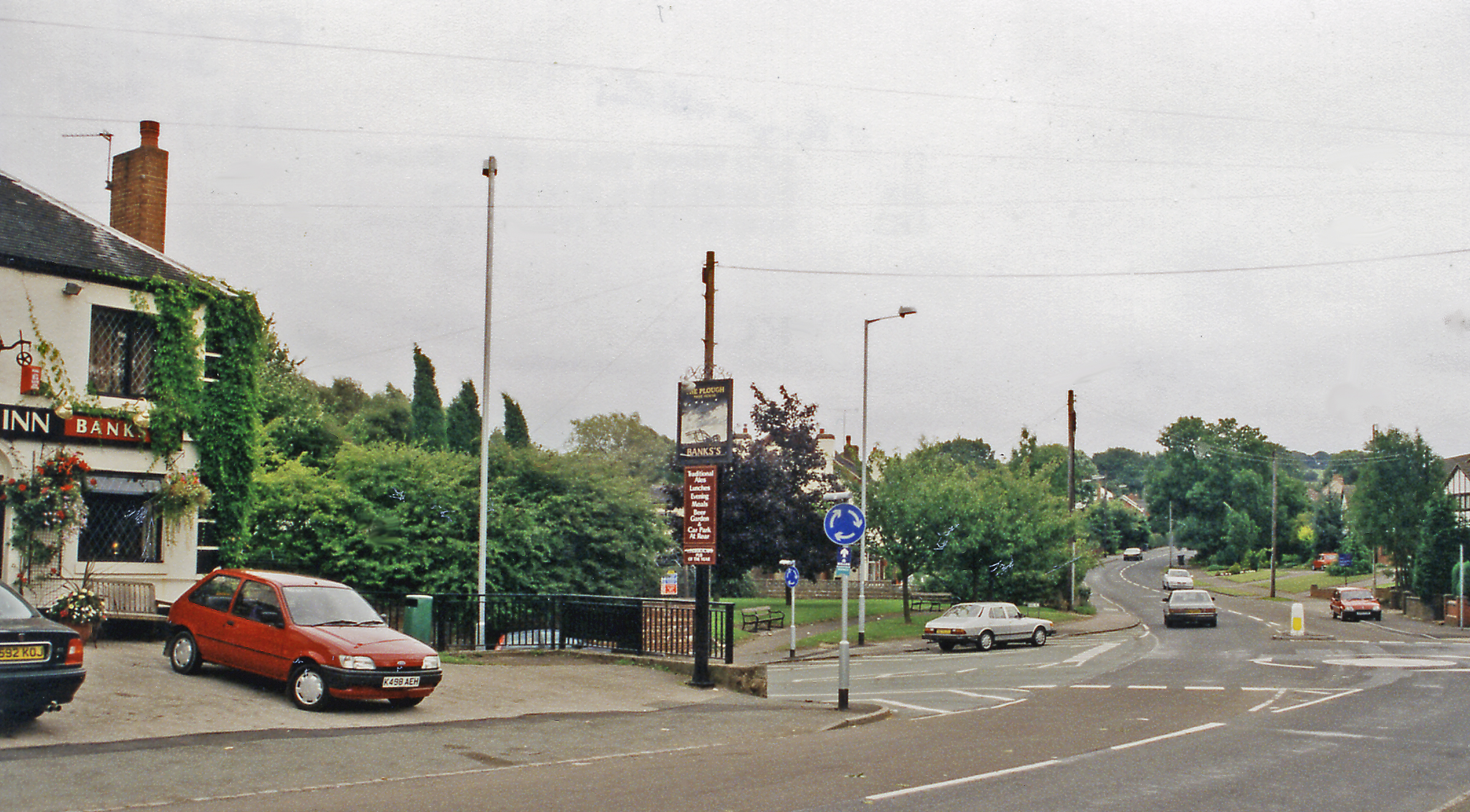
Although small in size, Millend boasts a close-knit and friendly community. The village has a primary school, a community center, and a local pub, which serves as a social hub for residents and visitors alike. The pub offers a warm and welcoming atmosphere, along with a selection of traditional food and drinks.

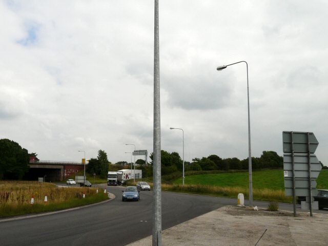
Despite its tranquil ambiance, Millend is conveniently located near major towns and cities. The bustling city of Stoke-on-Trent is just a short drive away, offering a range of amenities, shopping centers, and entertainment options.

In conclusion, Millend is a charming village in Staffordshire, offering a peaceful and scenic escape from the hustle and bustle of city life. With its historical buildings, natural beauty, and friendly community, it is a hidden gem waiting to be discovered.

If you have any feedback on the listing, please let us know in the comments section below.

Millend Images

Images are sourced within 2km of 53.067947/-2.3103901 or Grid Reference SJ7952. Thanks to Geograph Open Source API. All images are credited.

Boundary field Looking SW from the A500 as it enters Cheshire.
Boundary field
Looking SW from the A500 as it enters Cheshire.
A view across the south of Audley Looking from Cooper's Green across Wereton to Boon Hill.
A view across the south of Audley
Looking from Cooper's Green across Wereton to Boon Hill.
Audley Looking east from the main road. The parish church is hidden in the trees on the hill.
Audley
Looking east from the main road. The parish church is hidden in the trees on the hill.
Audley reservoir This grass covered mound with its concrete box on top is the local water storage tank.
Audley reservoir
This grass covered mound with its concrete box on top is the local water storage tank.
Townhouse Farm, Audley On the Alsager Road north of Audley. The gateposts provide access to the former outbuildings, now used by various businesses. The farmhouse is "probably late medieval in origin but substantially rebuilt
in the C18 and C19" <span class="nowrap"><a title="http://www.britishlistedbuildings.co.uk/en-273280-townhouse-farmhouse-and-attached-wall-an" rel="nofollow ugc noopener" href="http://www.britishlistedbuildings.co.uk/en-273280-townhouse-farmhouse-and-attached-wall-an">Link</a><img style="margin-left:2px;" alt="External link" title="External link - shift click to open in new window" src="https://s1.geograph.org.uk/img/external.png" width="10" height="10"/></span> .
Townhouse Farm, Audley
On the Alsager Road north of Audley. The gateposts provide access to the former outbuildings, now used by various businesses. The farmhouse is "probably late medieval in origin but substantially rebuilt in the C18 and C19" LinkExternal link .
A500 near Audley Looking west along the dual carriageway from the bridge at the junction with the road between Audley and Alsager.
A500 near Audley
Looking west along the dual carriageway from the bridge at the junction with the road between Audley and Alsager.
Lower Foxley A farm on the edge of Staffordshire; Cheshire is about 200 metres to the right of the camera, along Audley Road.
Lower Foxley
A farm on the edge of Staffordshire; Cheshire is about 200 metres to the right of the camera, along Audley Road.
Flash Farm The public footpath goes through the farm but walkers are encouraged to use a permissive path which bypasses all the farm buildings
Flash Farm
The public footpath goes through the farm but walkers are encouraged to use a permissive path which bypasses all the farm buildings
A500 Brockwood Hill Farm Bridge Eastbound on the A500 just after Junction 16 of the M6.
A500 Brockwood Hill Farm Bridge
Eastbound on the A500 just after Junction 16 of the M6.
The Foxley Drumble A stream in a shallow wooded valley to the east of Flash Farm. The county boundary of Staffordshire runs across the scene at the point where the trees take over. The camera is in Cheshire.
The Foxley Drumble
A stream in a shallow wooded valley to the east of Flash Farm. The county boundary of Staffordshire runs across the scene at the point where the trees take over. The camera is in Cheshire.
Track and footpath diverge This gate marks where the footpath progresses eastwards towards Alsager.
Track and footpath diverge
This gate marks where the footpath progresses eastwards towards Alsager.
Dairy pasture and stream Viewed from the permissive path which takes the walker around Flash Farm.
Dairy pasture and stream
Viewed from the permissive path which takes the walker around Flash Farm.
New footbridge For the permissive path circling Flash Farm.
New footbridge
For the permissive path circling Flash Farm.
Audley Millennium Green This raised area is part of the site of a Norman Motte, and has relics of Elizabethan habitation. It is known in the locality as Castle Hill. It is the place on which once stood the stockade of the Audley family.
Link to the Gatehouse website entry:
<span class="nowrap"><a title="http://www.gatehouse-gazetteer.info/English%20sites/3306.html" rel="nofollow ugc noopener" href="http://www.gatehouse-gazetteer.info/English%20sites/3306.html">Link</a><img style="margin-left:2px;" alt="External link" title="External link - shift click to open in new window" src="https://s1.geograph.org.uk/img/external.png" width="10" height="10"/></span>
Audley Millennium Green
This raised area is part of the site of a Norman Motte, and has relics of Elizabethan habitation. It is known in the locality as Castle Hill. It is the place on which once stood the stockade of the Audley family. Link to the Gatehouse website entry: LinkExternal link
"Leddy's Field" Wildlife Area footpath Not all the footpaths accessible through this gate are shown on 1:25,000 scale maps.
"Leddy's Field" Wildlife Area footpath
Not all the footpaths accessible through this gate are shown on 1:25,000 scale maps.
Children's Play Area This safe children's play area has recently been fenced to prevent dogs from entering; the two gates are sprung. The top of the tower of St James' Church can be seen in the distance.
Children's Play Area
This safe children's play area has recently been fenced to prevent dogs from entering; the two gates are sprung. The top of the tower of St James' Church can be seen in the distance.
M6 Junction 16 Lorries exiting the northbound carriageway of the M6 at Junction 16.
M6 Junction 16
Lorries exiting the northbound carriageway of the M6 at Junction 16.
Abnormal Loads stop here A layby designed for abnormal loads to stop in. It lies inside the roundabout of the A500 to the West of Junction 16 of the M6.
Abnormal Loads stop here
A layby designed for abnormal loads to stop in. It lies inside the roundabout of the A500 to the West of Junction 16 of the M6.
Show me another place!

Millend is located at Grid Ref: SJ7952 (Lat: 53.067947, Lng: -2.3103901)

Administrative County: Staffordshire

District: Newcastle-under-Lyme

Police Authority: Staffordshire

What 3 Words

///chop.frostbite.arriving. Near Audley, Staffordshire

Nearby Locations

Millend

Related Wikis

Audley Urban District

Audley Urban District is a former administrative unit in Staffordshire created by the Local Government Act 1894. It contained the civil parish of Audley...

Audley, Staffordshire

Audley is a large village and former civil parish, now in the parish of Audley Rural, in the Newcastle-under-Lyme district, in Staffordshire, England....

Bignall End

Bignall End is a village in Staffordshire, England, near Junction 16 of the M6 motorway. == History == It is a part of the parish of Audley Rural, which...

Audley and Bignall End railway station

Audley and Bignall End railway station was a station on the North Staffordshire Railway, which operated in the West Midlands county of Staffordshire, in...

Nearby Amenities

Located within 500m of 53.067947,-2.3103901
Motorway Junction
Alsager Road Junction
Lat/Long: 53.0686649/-2.3098931
Barrier: stile
Lat/Long: 53.0660635/-2.3151562
Barrier: stile
Lat/Long: 53.0665315/-2.312325
Power: pole
Lat/Long: 53.069562/-2.3079011
Power: pole
Lat/Long: 53.0698459/-2.3066458
Power: pole
Lat/Long: 53.0701298/-2.3053749
Power: pole
Lat/Long: 53.0706019/-2.3043933
Power: pole
Lat/Long: 53.0692719/-2.3091778
Power: pole
Lat/Long: 53.0683519/-2.3102712
Power: pole
Lat/Long: 53.0689272/-2.3095859
Power: pole
Lat/Long: 53.0678472/-2.3103312
Mill End
Place: hamlet
Lat/Long: 53.0675766/-2.3137395
The data included in this document is from www.openstreetmap.org. The data is made available under ODbL.

Have you been to Millend?

Leave your review of Millend below (or comments, questions and feedback).