Mill Hill

Settlement in Norfolk Norwich

England

Mill Hill

The Rosebery, New Catton Light is rapidly fading on this December afternoon but the fine old Victorian pub looks inviting. It was formerly known as the Lord Rosebery, named after Archibald Primrose who was Liberal Prime Minister between 1894 and 1895.
The Rosebery, New Catton Credit: Stephen McKay

Mill Hill is a small village located in the county of Norfolk, England. Situated approximately 12 miles south of Norwich, it forms part of the South Norfolk district. With a population of around 500 residents, Mill Hill is a quiet and close-knit community.

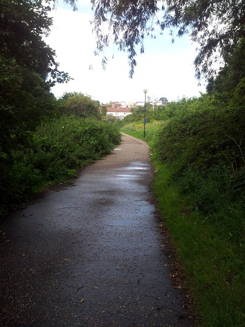
The village is characterized by its picturesque countryside setting, surrounded by lush green fields and rolling hills. Its rural charm is further enhanced by the presence of numerous traditional cottages and farmhouses that dot the landscape. The village is known for its tranquility and a strong sense of community spirit among its residents.

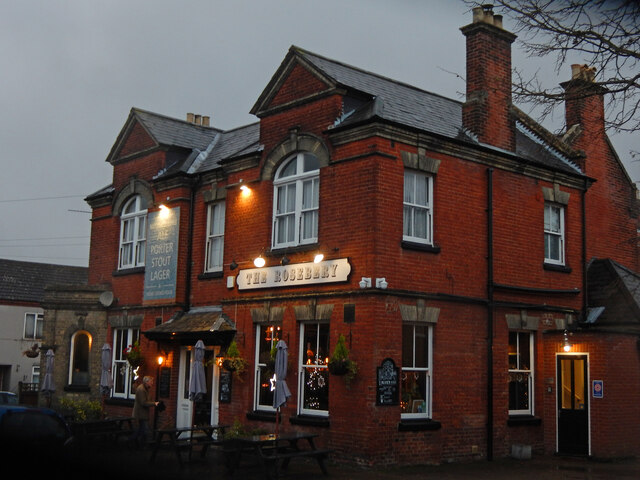
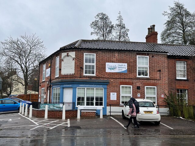
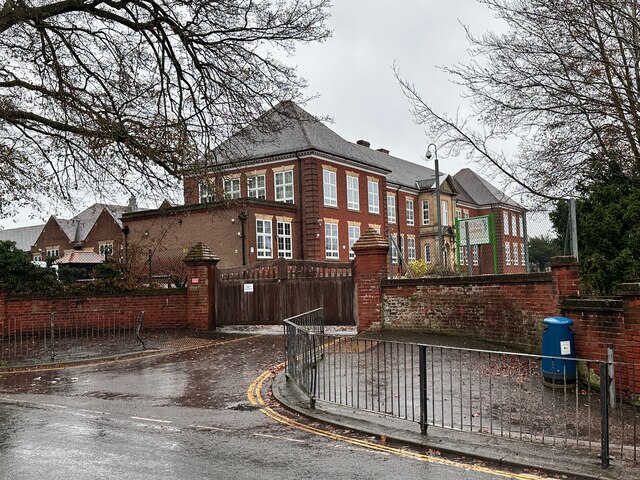
Despite its small size, Mill Hill boasts several amenities that cater to the needs of its inhabitants. These include a local village hall, a primary school, and a pub, which serves as a social hub for both locals and visitors alike. The village is well-connected to nearby towns and cities through a network of roads, making it easily accessible for commuting or leisure purposes.

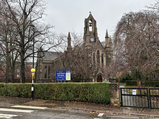
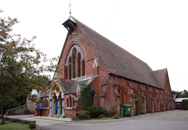
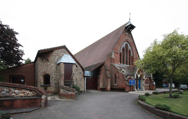
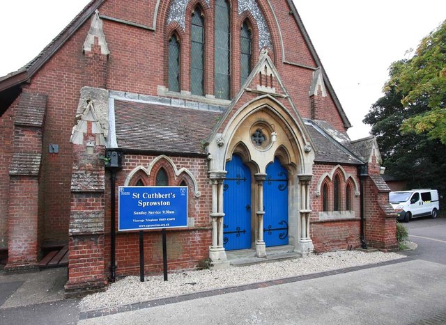
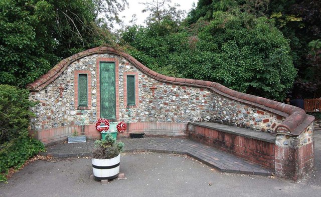
Mill Hill is also fortunate to be surrounded by a wealth of natural beauty and outdoor recreational opportunities. The nearby countryside provides ample opportunities for walking, cycling, and exploring the scenic surroundings. The village is also in close proximity to various historical sites and attractions, including medieval churches and stately homes, offering visitors a glimpse into the region's rich cultural heritage.

Overall, Mill Hill is a charming and idyllic village that offers a peaceful and rural lifestyle to its residents, while also providing easy access to amenities and recreational opportunities.

If you have any feedback on the listing, please let us know in the comments section below.
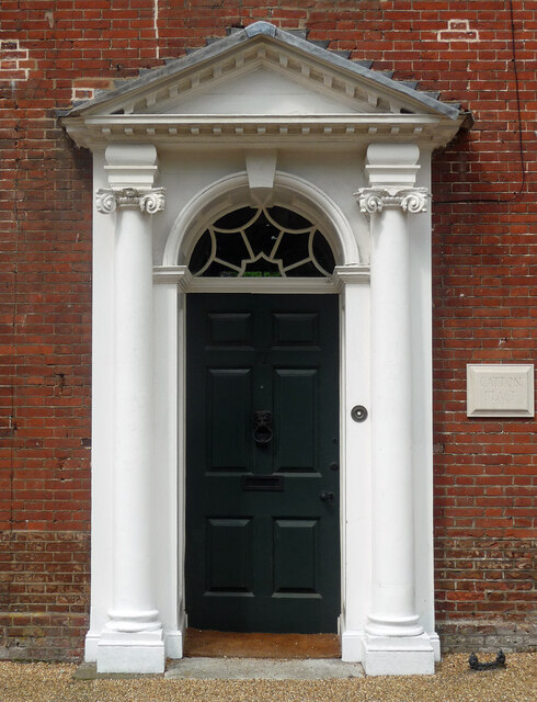
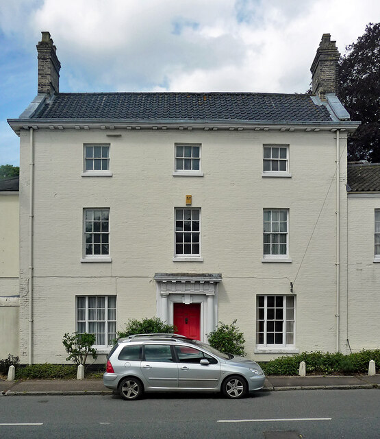
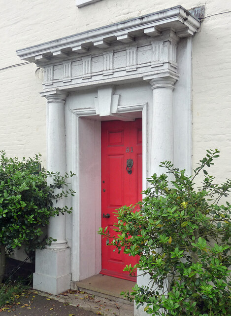
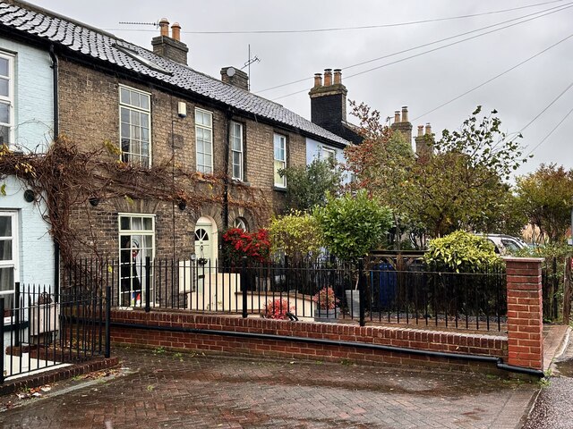
Mill Hill Images

Images are sourced within 2km of 52.647137/1.2971058 or Grid Reference TG2310. Thanks to Geograph Open Source API. All images are credited.

The Rosebery, New Catton Light is rapidly fading on this December afternoon but the fine old Victorian pub looks inviting. It was formerly known as the Lord Rosebery, named after Archibald Primrose who was Liberal Prime Minister between 1894 and 1895.
The Rosebery, New Catton
Light is rapidly fading on this December afternoon but the fine old Victorian pub looks inviting. It was formerly known as the Lord Rosebery, named after Archibald Primrose who was Liberal Prime Minister between 1894 and 1895.
Gurney Road through Mousehold Heath
Works at Sprowston Retail Park
The Firs, Old Catton A very fine mid/late C18th house in five bays and three storeys. Rusticated lintels to the windows and good Ionic doorcase (<a href="https://www.geograph.org.uk/photo/7454374">TG2311 : Detail of The Firs, Old Catton</a>). Grade II* listed.
The Firs, Old Catton
A very fine mid/late C18th house in five bays and three storeys. Rusticated lintels to the windows and good Ionic doorcase (TG2311 : Detail of The Firs, Old Catton). Grade II* listed.
Detail of The Firs, Old Catton Good Ionic doorcase to this house: <a href="https://www.geograph.org.uk/photo/7454371">TG2311 : The Firs, Old Catton</a>.
Detail of The Firs, Old Catton
Good Ionic doorcase to this house: TG2311 : The Firs, Old Catton.
81 Spixworth Road, Old Catton A well-proportioned late C18th house in three bays and storeys with a good doorcase (<a href="https://www.geograph.org.uk/photo/7454378">TG2311 : Detail of 81 Spixworth Road, Old Catton</a>). Grade II listed.
81 Spixworth Road, Old Catton
A well-proportioned late C18th house in three bays and storeys with a good doorcase (TG2311 : Detail of 81 Spixworth Road, Old Catton). Grade II listed.
Detail of 81 Spixworth Road, Old Catton Rather a grand Doric doorcase to this house: <a href="https://www.geograph.org.uk/photo/7454376">TG2311 : 81 Spixworth Road, Old Catton</a>.
Detail of 81 Spixworth Road, Old Catton
Rather a grand Doric doorcase to this house: TG2311 : 81 Spixworth Road, Old Catton.
Police station, Sprowston On Wroxham Road. A period piece, 1950s neo-Georgian.
This may no longer be operational as police forces increasingly centralise facilities in order to keep costs down.
Police station, Sprowston
On Wroxham Road. A period piece, 1950s neo-Georgian. This may no longer be operational as police forces increasingly centralise facilities in order to keep costs down.
Alderford Terrace, Magdalen Road, Norwich Some early 19th century cottages along Magdalen Road, Norwich. An OS Map from the 1880s tells me this row is called Alderford Terrace but I am not sure if the name is still in use today.
Alderford Terrace, Magdalen Road, Norwich
Some early 19th century cottages along Magdalen Road, Norwich. An OS Map from the 1880s tells me this row is called Alderford Terrace but I am not sure if the name is still in use today.
The Dyers Arms, Magdalen Road, Norwich Sadly no longer a PH having closed around 2019. The former Dyers Arms has become a "health and wellbeing clinic". In 1986 the Norwich Society described it as an "unremarkable local".

<span class="nowrap"><a title="https://www.norfolkpubs.co.uk/norwich/gnorwich/ncgld.htm" rel="nofollow ugc noopener" href="https://www.norfolkpubs.co.uk/norwich/gnorwich/ncgld.htm">Link</a><img style="margin-left:2px;" alt="External link" title="External link - shift click to open in new window" src="https://s1.geograph.org.uk/img/external.png" width="10" height="10"/></span>
The Dyers Arms, Magdalen Road, Norwich
Sadly no longer a PH having closed around 2019. The former Dyers Arms has become a "health and wellbeing clinic". In 1986 the Norwich Society described it as an "unremarkable local". LinkExternal link
Christ Church, New Catton, Norwich A view across to Christ Church, New Catton in Norwich on a wet December morning. A rather striking church dating from 1842 and, apparently, pre-dating all of the housing which surrounds it. Simon Knott's excellent Norfolk Churches site seems to suggest it has a similarly striking mint green interior which I sadly did not get to see.

<span class="nowrap"><a title="http://www.norfolkchurches.co.uk/newcatton/newcatton.htm" rel="nofollow ugc noopener" href="http://www.norfolkchurches.co.uk/newcatton/newcatton.htm">Link</a><img style="margin-left:2px;" alt="External link" title="External link - shift click to open in new window" src="https://s1.geograph.org.uk/img/external.png" width="10" height="10"/></span>
Christ Church, New Catton, Norwich
A view across to Christ Church, New Catton in Norwich on a wet December morning. A rather striking church dating from 1842 and, apparently, pre-dating all of the housing which surrounds it. Simon Knott's excellent Norfolk Churches site seems to suggest it has a similarly striking mint green interior which I sadly did not get to see. LinkExternal link
Sewell Park, New Catton, Norwich The southern entrance to Sewell Park in New Catton. The handsome triangular drinking trough here can be seen on an OS Map from the late-19th century. A final stopping place before heading into the city centre perhaps.

A similarly handsome bronze plaque can be seen behind it describing how this open space was once used and loved by Philip Edward Sewell and is now dedicated to his memory.
Sewell Park, New Catton, Norwich
The southern entrance to Sewell Park in New Catton. The handsome triangular drinking trough here can be seen on an OS Map from the late-19th century. A final stopping place before heading into the city centre perhaps. A similarly handsome bronze plaque can be seen behind it describing how this open space was once used and loved by Philip Edward Sewell and is now dedicated to his memory.
Sewell Park Academy, Norwich As with many schools in Norfolk, this one has a long history of changing with the educational winds. It was opened in 1929 as Blyth Grammar School, it became a comprehensive school in 1971 and merged with Alderman Jex School to become Blyth-Jex School in 1972. In 2008, it became Sewell Park College and, in 2015, it became Sewell Park Academy. 

Apparently a whalebone, donated by a former student, stands in the grounds.
<a href="https://www.geograph.org.uk/photo/166094">TG2310 : Whale's Jawbone Arch in the grounds of Blyth Jex School</a>
Sewell Park Academy, Norwich
As with many schools in Norfolk, this one has a long history of changing with the educational winds. It was opened in 1929 as Blyth Grammar School, it became a comprehensive school in 1971 and merged with Alderman Jex School to become Blyth-Jex School in 1972. In 2008, it became Sewell Park College and, in 2015, it became Sewell Park Academy. Apparently a whalebone, donated by a former student, stands in the grounds. TG2310 : Whale's Jawbone Arch in the grounds of Blyth Jex School
Footpath from Wensum Park to Drayton Road
St Cuthbert, Sprowston, Norwich
St Cuthbert, Sprowston, Norwich - War Memorial
Show me another place!

Mill Hill is located at Grid Ref: TG2310 (Lat: 52.647137, Lng: 1.2971058)

Administrative County: Norfolk

District: Norwich

Police Authority: Norfolk

What 3 Words

///listed.spine.storm. Near Norwich, Norfolk

Related Wikis

Sewell Park Academy

Sewell Park Academy is a secondary school located on the north-eastern edge of the city of Norwich, Norfolk, England. == Admissions == It has approximately...

Sewell Park, Norwich

Sewell Park is a triangular park between Constitution Hill and St. Clement's Hill in Norwich, Norfolk, England. The park was given to the Norwich Corporation...

Norwich North (UK Parliament constituency)

Norwich North is a constituency represented in the House of Commons of the UK Parliament since 2009 by Conservative Chloe Smith. The constituency includes...

Catton Grove Chalk Pit

Catton Grove Chalk Pit is a 0.6-hectare (1.5-acre) geological Site of Special Scientific Interest on the northern outskirts of Norwich in Norfolk. It is...

Nearby Amenities

Located within 500m of 52.647137,1.2971058
Mini Roundabout
Direction: clockwise
Lat/Long: 52.6501085/1.3006815
Traffic Calming: cushion
Lat/Long: 52.6492675/1.2980985
Traffic Calming: cushion
Lat/Long: 52.6498715/1.298391
Post Box
Collection Times: Mo-Fr 17:30; Sa 11:00
Operator: Royal Mail
Postal Code: NR3
Ref: NR3 318
Lat/Long: 52.6479549/1.2908426
Post Box
Collection Times: Mo-Fr 17:30; Sa 11:00
Operator: Royal Mail
Postal Code: NR3
Ref: NR3 319
Lat/Long: 52.6453071/1.2929937
Post Box
Collection Times: Mo-Fr 17:30; Sa 11:00
Operator: Royal Mail
Postal Code: NR3
Ref: NR3 323
Lat/Long: 52.6482348/1.2996268
Post Box
Collection Times: Mo-Fr 17:45; Sa 11:00
Operator: Royal Mail
Postal Code: NR3
Ref: NR3 326
Lat/Long: 52.6455757/1.2969446
Post Box
Collection Times: Mo-Fr 17:45; Sa 11:00
Operator: Royal Mail
Post Box Type: pillar
Postal Code: NR3
Ref: NR3 328
Lat/Long: 52.6448647/1.3011476
Crossing
Crossing: island
Tactile Paving: no
Lat/Long: 52.6448653/1.301884
Crossing
Crossing: traffic_signals
Crossing Island: yes
Crossing Ref: puffin
Tactile Paving: yes
Lat/Long: 52.6447021/1.301927
Crossing
Crossing: unmarked
Crossing Island: yes
Tactile Paving: no
Lat/Long: 52.6445441/1.3019587
Crossing
Crossing: unmarked
Lat/Long: 52.6462182/1.299186
Crossing
Crossing: unmarked
Lat/Long: 52.6455698/1.2988699
Crossing
Crossing: traffic_signals
Crossing Ref: pelican
Sensor: yes
Tactile Paving: yes
Lat/Long: 52.6481599/1.2995377
Traffic Calming: cushion
Lat/Long: 52.650776/1.2988527
Give Way
Lat/Long: 52.6510098/1.298916
Traffic Calming: choker
Lat/Long: 52.6485616/1.2943335
Give Way
Lat/Long: 52.6453682/1.2936084
Give Way
Lat/Long: 52.6481115/1.2909351
Give Way
Lat/Long: 52.648987/1.2978925
Turning Circle
Lat/Long: 52.647403/1.290392
Crossing
Crossing: unmarked
Lat/Long: 52.6489162/1.2978094
Crossing
Crossing: uncontrolled
Tactile Paving: yes
Traffic Calming: choker
Lat/Long: 52.6457803/1.2910842
Crossing
Crossing: uncontrolled
Crossing Ref: zebra
Traffic Calming: choker
Lat/Long: 52.6449944/1.2912843
Bus Stop
Sprowston Road
Naptan AtcoCode: 2900N12169
Naptan Bearing: SE
Naptan CommonName: Sprowston Road
Naptan Indicator: adj
Naptan Landmark: Sprowston Road
Naptan Locality: Norwich
Naptan NaptanCode: nfogpmdp
Naptan PlusbusZoneRef: NRCH
Naptan Street: Silver Road
Physically Present: no
Source: naptan_import;survey
Lat/Long: 52.6443481/1.3022989
Bus Stop
Elm Grove Lane, adj
Naptan AtcoCode: 2900N12269
Naptan Bearing: S
Naptan CommonName: Elm Grove Lane
Naptan Indicator: adj
Naptan Landmark: Elm Grove Lane
Naptan Locality: Norwich
Naptan NaptanCode: nfodjgdm
Naptan PlusbusZoneRef: NRCH
Naptan Street: Angel Road
Naptan Verified: no
Source: naptan_import
Lat/Long: 52.6478642/1.2910152
Bus Stop
Elm Grove Lane, opp
Naptan AtcoCode: 2900N12270
Naptan Bearing: N
Naptan CommonName: Elm Grove Lane
Naptan Indicator: opp
Naptan Landmark: Elm Grove Lane
Naptan Locality: Norwich
Naptan NaptanCode: nfodjgdt
Naptan PlusbusZoneRef: NRCH
Naptan Street: Angel Road
Naptan Verified: no
Source: naptan_import
Lat/Long: 52.6477153/1.2908709
Bus Stop
Lawson Road
Bench: no
Bin: no
Lit: yes
Naptan AtcoCode: 2900N12436
Naptan Bearing: NE
Naptan BusStopType: CUS
Naptan CommonName: Bell Road
Naptan Indicator: opp
Naptan Locality: Norwich
Naptan NaptanCode: nfodjtpa
Naptan PlusbusZoneRef: NRCH
Naptan Street: Sprowston Road
Public Transport: platform
Shelter: no
Source: naptan_import;survey
Tactile Paving: yes
Lat/Long: 52.6433359/1.3004855
Gertrude Road, adj
Bench: yes
Bin: yes
Naptan AtcoCode: 2900N12439
Naptan Bearing: SW
Naptan BusStopType: CUS
Naptan CommonName: Gertrude Road
Naptan Indicator: adj
Naptan Locality: Norwich
Naptan NaptanCode: nfodjtpj
Naptan PlusbusZoneRef: NRCH
Naptan Street: Sprowston Road
Naptan Verified: no
Public Transport: platform
Shelter: yes
Source: naptan_import
Tactile Paving: yes
Lat/Long: 52.645193/1.3023182
Elm Tavern, adj
Naptan AtcoCode: 2900N12572
Naptan Bearing: N
Naptan BusStopType: CUS
Naptan CommonName: Elm Tavern
Naptan Indicator: adj
Naptan Landmark: Elm Tavern
Naptan Locality: Norwich
Naptan NaptanCode: nfodmdpg
Naptan PlusbusZoneRef: NRCH
Naptan Street: Magdalen Road
Naptan Verified: no
Source: naptan_import
Lat/Long: 52.6431736/1.2970058
Elm Tavern, opp
Naptan AtcoCode: 2900N12573
Naptan Bearing: S
Naptan BusStopType: CUS
Naptan CommonName: Elm Tavern
Naptan Indicator: opp
Naptan Landmark: Elm Tavern
Naptan Locality: Norwich
Naptan NaptanCode: nfodmdpj
Naptan PlusbusZoneRef: NRCH
Naptan Street: Magdalen Road
Naptan Verified: no
Source: naptan_import
Lat/Long: 52.6430883/1.297162
Bus Stop
Sewell Road, opp
Bench: no
Naptan AtcoCode: 2900N12574
Naptan Bearing: NE
Naptan CommonName: Sewell Road
Naptan Indicator: opp
Naptan Landmark: Sewell Road
Naptan Locality: Norwich
Naptan NaptanCode: nfodmdpm
Naptan PlusbusZoneRef: NRCH
Naptan Street: Constitution Hill
Naptan Verified: no
Shelter: no
Source: naptan_import
Tactile Paving: yes
Lat/Long: 52.6463782/1.2985187
Bus Stop
Sewell Road, adj
Naptan AtcoCode: 2900N12575
Naptan Bearing: SW
Naptan CommonName: Sewell Road
Naptan Indicator: adj
Naptan Landmark: De Caux Road
Naptan Locality: Norwich
Naptan NaptanCode: nfodmdpt
Naptan PlusbusZoneRef: NRCH
Naptan Street: Constitution Hill
Naptan Verified: no
Source: naptan_import
Lat/Long: 52.6457443/1.2983526
Bus Stop
Constitution Opening, opp
Naptan AtcoCode: 2900N12576
Naptan Bearing: NE
Naptan CommonName: Constitution Opening
Naptan Indicator: opp
Naptan Landmark: Constitution Tavern
Naptan Locality: Norwich
Naptan NaptanCode: nfodmdpw
Naptan PlusbusZoneRef: NRCH
Naptan Street: Constitution Hill
Naptan Verified: no
Source: naptan_import
Lat/Long: 52.649163/1.2999263
Bus Stop
Constitution Opening, adj
Naptan AtcoCode: 2900N12577
Naptan Bearing: SW
Naptan CommonName: Constitution Opening
Naptan Indicator: adj
Naptan Landmark: Ash Grove
Naptan Locality: Norwich
Naptan NaptanCode: nfodmdta
Naptan PlusbusZoneRef: NRCH
Naptan Street: Constitution Hill
Naptan Verified: no
Source: naptan_import
Lat/Long: 52.6488395/1.2999167
Bus Stop
Wild Road, opp
Naptan AtcoCode: 2900N12583
Naptan Bearing: N
Naptan CommonName: Wild Road
Naptan Indicator: opp
Naptan Landmark: Wild Road
Naptan Locality: Norwich
Naptan NaptanCode: nfodmdtw
Naptan PlusbusZoneRef: NRCH
Naptan Street: Angel Road
Naptan Verified: no
Source: naptan_import
Lat/Long: 52.6454343/1.2910691
Bus Stop
Wild Road, adj
Naptan AtcoCode: 2900N12584
Naptan Bearing: S
Naptan CommonName: Wild Road
Naptan Indicator: adj
Naptan Landmark: Wild Road
Naptan Locality: Norwich
Naptan NaptanCode: nfodmdwa
Naptan PlusbusZoneRef: NRCH
Naptan Street: Angel Road
Naptan Verified: no
Source: naptan_import
Lat/Long: 52.6454306/1.2912019
Waterloo Park (Car Park) CCTV Camera
Man Made: surveillance
Note: Permanent CCTV camera.
Surveillance: public
Url: http://sites.google.com/site/norwichpolicecctv/
Lat/Long: 52.6460679/1.2902205
Waterloo Park (Car Park) CCTV Camera
Man Made: surveillance
Note: Permanent CCTV camera.
Surveillance: public
Url: http://sites.google.com/site/norwichpolicecctv/
Lat/Long: 52.6458469/1.2903505
Waterloo Park (Car Park) CCTV Camera
Man Made: surveillance
Note: Permanent CCTV camera.
Surveillance: public
Url: http://sites.google.com/site/norwichpolicecctv/
Lat/Long: 52.6461819/1.2906795
Waterloo Park (Car Park) CCTV Camera
Man Made: surveillance
Note: Permanent CCTV camera.
Surveillance: public
Url: http://sites.google.com/site/norwichpolicecctv/
Lat/Long: 52.6461709/1.2906955
Telephone
Booth: KX100
Check Date: 2022-11-11
Covered: booth
Lat/Long: 52.6445652/1.3020857
Leisure: playground
Lat/Long: 52.6458756/1.2976305
Crossing
Crossing: uncontrolled
Crossing Ref: zebra
Tactile Paving: yes
Lat/Long: 52.6439807/1.2973863
Traffic Calming: cushion
Lat/Long: 52.648736/1.2978306
Traffic Calming: cushion
Lat/Long: 52.6513439/1.2991512
Traffic Calming: cushion
Lat/Long: 52.64727/1.2971716
Traffic Calming: cushion
Lat/Long: 52.6463759/1.2910117
Traffic Calming: cushion
Lat/Long: 52.6469419/1.2909655
Traffic Calming: cushion
Lat/Long: 52.6477023/1.2909561
Parking
Access: yes
Parking: surface
Lat/Long: 52.6459555/1.2906878
Parking
Access: yes
Parking: surface
Lat/Long: 52.6459562/1.2904505
Tourism: artwork
Lat/Long: 52.6433325/1.2932964
Crossing
Crossing: uncontrolled
Tactile Paving: yes
Lat/Long: 52.64424/1.2915525
Historic: memorial
Memorial: war_memorial
Lat/Long: 52.6437706/1.2974247
Entrance: yes
Lat/Long: 52.6438398/1.2977647
Entrance: yes
Lat/Long: 52.6438623/1.2977288
New Catton
Place: suburb
Lat/Long: 52.6455499/1.2911845
Entrance: main
Lat/Long: 52.6459459/1.3034803
Crossing
Crossing: unmarked
Crossing Island: yes
Tactile Paving: yes
Lat/Long: 52.6457193/1.3027166
Entrance: yes
Lat/Long: 52.6461568/1.3036493
Barrier: cycle_barrier
Lat/Long: 52.6440709/1.2943395
Entrance: yes
Lat/Long: 52.6442049/1.2939778
Entrance: yes
Lat/Long: 52.6439999/1.2940088
Give Way
Lat/Long: 52.646552/1.2929213
Kerb: lowered
Lat/Long: 52.648207/1.2917422
Kerb: lowered
Lat/Long: 52.6465962/1.2928928
Atm
Operator: Cashzone
Lat/Long: 52.6449015/1.3023534
Traffic Calming: cushion
Lat/Long: 52.6502895/1.2990482
Traffic Calming: cushion
Lat/Long: 52.6501665/1.3002071
Traffic Calming: cushion
Lat/Long: 52.6500095/1.3011265
Traffic Calming: cushion
Lat/Long: 52.649726/1.302329
Traffic Calming: cushion
Lat/Long: 52.6493881/1.3032065
Give Way
Lat/Long: 52.6503359/1.2986709
Give Way
Lat/Long: 52.6503524/1.2985526
Give Way
Lat/Long: 52.6448634/1.301951
Bicycle Rental
Gertrude Road/ Sprowston Road
Capacity: 10
Email: support@beryl.cc
Fee: yes
Name Signed: no
Network: Beryl - Norwich
Official Name: Gertrude Road/ Sprowston Road
Operator: Beryl
Operator Wikidata: Q106575369
Payment App: yes
Payment App Android: cc.beryl.basis
Payment App Ios: 1386768364
Payment Cash: no
Payment Credit Cards: no
Payment Cryptocurrencies: no
Payment Debit Cards: no
Payment Electronic Purses: no
Phone: +44 20 3003 5044
Ref Gbfs: beryl_norwich:1925
Rental: city_bike;ebike;escooter
Website: https://beryl.cc/scheme/norwich
Lat/Long: 52.6451912/1.30235
Give Way
Lat/Long: 52.6507031/1.2946285
Waste Basket
Colour: green
Material: plastic
Lat/Long: 52.6489526/1.2997979
Waste Basket
Lat/Long: 52.6460465/1.2981474
Waste Basket
Lat/Long: 52.6459513/1.2977664
Waste Basket
Colour: green
Material: plastic
Lat/Long: 52.6503076/1.298274
Waste Basket
Colour: green
Material: plastic
Lat/Long: 52.6455344/1.2912163
Waste Basket
Colour: green
Material: plastic
Lat/Long: 52.6444977/1.3019011
Waste Basket
Colour: green
Material: plastic
Lat/Long: 52.6481826/1.2912362
Waste Basket
Colour: green
Material: plastic
Lat/Long: 52.6453226/1.3024527
Waste Basket
Colour: green
Material: plastic
Lat/Long: 52.6479242/1.2993132
Waste Basket
Lat/Long: 52.6460929/1.2972897
Waste Basket
Colour: green
Material: plastic
Lat/Long: 52.6495668/1.300424
Waste Basket
Colour: green
Material: plastic
Lat/Long: 52.6506762/1.295095
Waste Basket
Colour: green
Material: plastic
Lat/Long: 52.6439349/1.2942541
Waste Basket
Colour: green
Material: plastic
Lat/Long: 52.6500276/1.300457
Waste Basket
Colour: green
Material: plastic
Lat/Long: 52.6480598/1.2975206
Waste Basket
Colour: green
Material: plastic
Lat/Long: 52.6478925/1.2910383
Waste Basket
Colour: green
Material: plastic
Lat/Long: 52.6450555/1.3020536
Waste Basket
Lat/Long: 52.6450472/1.2973079
Waste Basket
Lat/Long: 52.6458057/1.2908575
Waste Basket
Colour: green
Material: plastic
Lat/Long: 52.646348/1.2971448
Leslie Terrance plant shop & cafe
Addr City: Norwich
Addr Housenumber: 128c
Addr Postcode: NR3 4AN
Addr Street: Magdalen Road
Drink Coffee: yes
Email: Sales@leslieterrance.com
Opening Hours: Mo-Sa 10:00-17:00, Su 10:00-16:00
Phone: +441603 291490
Shop: garden_centre
Website: https://www.leslieterrance.com/
Lat/Long: 52.6433098/1.2969811
Give Way
Lat/Long: 52.6481198/1.2910237
Give Way
Lat/Long: 52.6479916/1.2899131
Give Way
Lat/Long: 52.6447377/1.2939667
Give Way
Lat/Long: 52.6448857/1.2947836
Crossing
Crossing: unmarked
Lat/Long: 52.6510169/1.2988656
Crossing
Crossing: unmarked
Lat/Long: 52.6489911/1.2978391
Crossing
Crossing: unmarked
Lat/Long: 52.6503556/1.2985316
Give Way
Lat/Long: 52.6488041/1.2962194
Traffic Calming: hump
Lat/Long: 52.6487203/1.2957732
Crossing
Crossing: unmarked
Lat/Long: 52.6488647/1.2961968
Traffic Calming: hump
Lat/Long: 52.6488631/1.2967864
Traffic Calming: hump
Lat/Long: 52.6484624/1.2934121
Give Way
Lat/Long: 52.6452188/1.3021962
Give Way
Lat/Long: 52.6455862/1.3026635
Give Way
Lat/Long: 52.6478719/1.2994422
Traffic Calming: hump
Lat/Long: 52.6429664/1.2955781
Treat Norwich
Healthcare: health_and_wellbeing_clinic
Phone: 01603 514195
Website: https://www.treatnorwich.co.uk/
Lat/Long: 52.6431231/1.2973681
The data included in this document is from www.openstreetmap.org. The data is made available under ODbL.

Have you been to Mill Hill?

Leave your review of Mill Hill below (or comments, questions and feedback).