Mill End

Settlement in Huntingdonshire Huntingdonshire

England

Mill End

Pond, sign, flagpost and fancy streetlamp Lots of Street furniture in this village scene
Pond, sign, flagpost and fancy streetlamp Credit: Chris Stafford

Mill End is a small village located in Huntingdonshire, Cambridgeshire, England. Situated approximately 5 miles east of Huntingdon, the village is nestled amidst the picturesque countryside of the region. With a population of around 200 residents, Mill End exudes a tranquil and idyllic atmosphere.

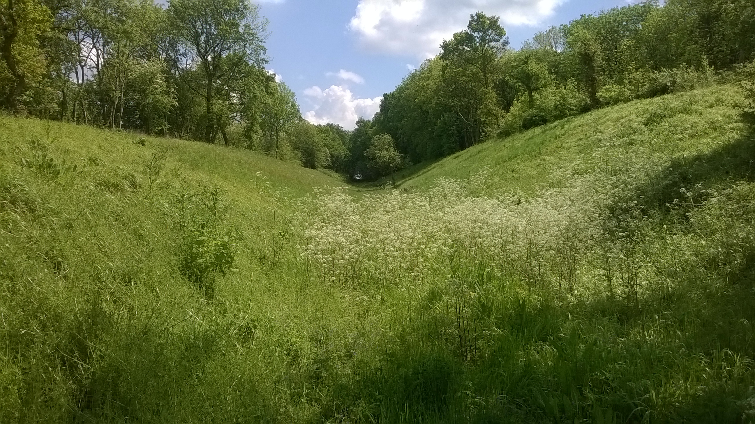
The village is renowned for its stunning natural beauty, surrounded by lush green fields and meadows, as well as the nearby Great Ouse River. This setting makes it a popular destination for nature lovers and outdoor enthusiasts. The area offers numerous walking and cycling trails, allowing visitors to explore the stunning countryside and enjoy the peaceful surroundings.

Despite its small size, Mill End has a rich history dating back centuries. The village is home to a few historic buildings, including a charming 16th-century church, St. Mary's, which serves as a reminder of the village's heritage.

While primarily a residential area, Mill End is conveniently located near Huntingdon, offering easy access to a range of amenities and services. The larger town provides a variety of shops, restaurants, and entertainment options, satisfying the daily needs of Mill End's residents.

Overall, Mill End is a delightful village that offers a serene and picturesque setting, making it an ideal place for those seeking a peaceful retreat or a base to explore the beautiful Cambridgeshire countryside.

If you have any feedback on the listing, please let us know in the comments section below.
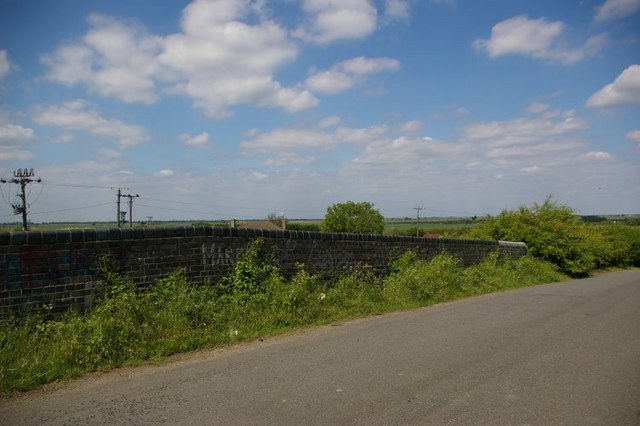
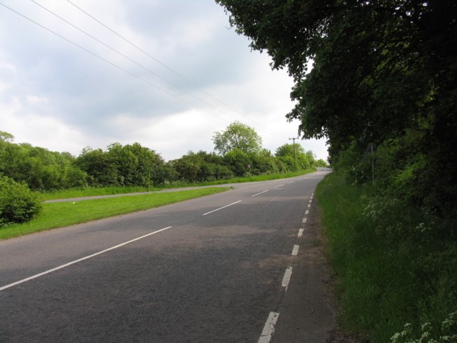
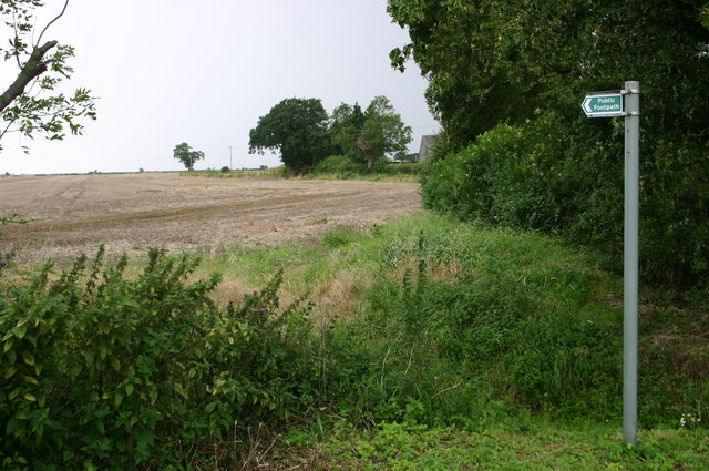
Mill End Images

Images are sourced within 2km of 52.405437/-0.072804782 or Grid Reference TL3180. Thanks to Geograph Open Source API. All images are credited.

Pond, sign, flagpost and fancy streetlamp Lots of Street furniture in this village scene
Pond, sign, flagpost and fancy streetlamp
Lots of Street furniture in this village scene
Grace Baptist Church High Street Red brick front with all the stonework picked out in fresh white paint
Grace Baptist Church High Street
Red brick front with all the stonework picked out in fresh white paint
Clock Tower built in 1887 Yellow and red brick tower with open arches at the bottom
Clock Tower built in 1887
Yellow and red brick tower with open arches at the bottom
Nature reserve and gate
Parapet of bridge over disused railway carrying minor road over Great Eastern Ramsey branch There was a station serving Warboys here - see <span class="nowrap"><a title="http://www.disused-stations.org.uk/w/warboys/index.shtml" rel="nofollow ugc noopener" href="http://www.disused-stations.org.uk/w/warboys/index.shtml">Link</a><img style="margin-left:2px;" alt="External link" title="External link - shift click to open in new window" src="https://s1.geograph.org.uk/img/external.png" width="10" height="10"/></span> for information on the station (which closed to passengers in 1930!) and the history of this branch line.
Parapet of bridge over disused railway carrying minor road over Great Eastern Ramsey branch
There was a station serving Warboys here - see LinkExternal link for information on the station (which closed to passengers in 1930!) and the history of this branch line.
Puddock Hill southwards
Houses on Puddock Hill
Footpath at Humbrills farm Footpath at Humbrills farm
Footpath at Humbrills farm
Across the A141 the hedged line of the dismantled railway Across the A141 the hedged line of the dismantled railway
Across the A141 the hedged line of the dismantled railway
Fenside road passes a bridleway Fenside road passes a bridleway
Fenside road passes a bridleway
The Clock Tower A very prominent feature in Warboys.
The Clock Tower
A very prominent feature in Warboys.
Warboys Village Sign
A141 southbound
A141 southbound
A141 southbound
A141 southbound
A141 heading north-east Passing Claygate House.
A141 heading north-east
Passing Claygate House.
A141 towards Chatteris Passing Warboys Boarding Kennels, Cattery and Pet Shop. Judging by the sign, it is also a bit of a farm produce shop.
A141 towards Chatteris
Passing Warboys Boarding Kennels, Cattery and Pet Shop. Judging by the sign, it is also a bit of a farm produce shop.
A141 towards Chatteris
Hallgate Allotments, Warboys
Show me another place!

Mill End is located at Grid Ref: TL3180 (Lat: 52.405437, Lng: -0.072804782)

Administrative County: Cambridgeshire

District: Huntingdonshire

Police Authority: Cambridgeshire

What 3 Words

///down.essential.crisps. Near Warboys, Cambridgeshire

Nearby Locations

Mill End Heath Pond

Related Wikis

Warboys Town F.C.

Warboys Town Football Club is a football club based in Warboys, near Ramsey in Cambridgeshire, England. The club are currently members of the Peterborough...
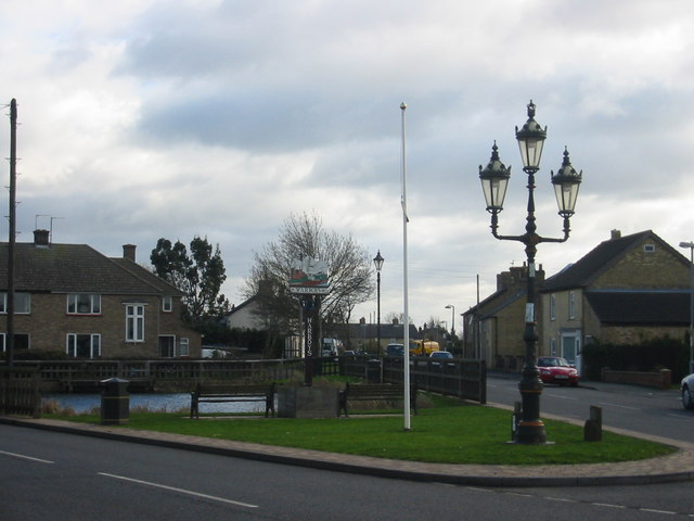
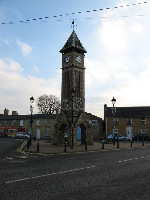
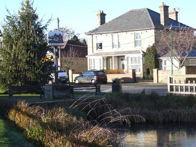
Warboys

Warboys is a large village and civil parish in the Huntingdonshire district of Cambridgeshire, England, 7 miles (11 km) north-east of Huntingdon. ��2...
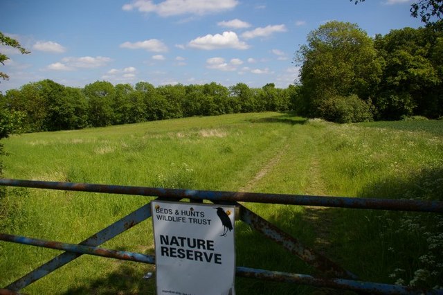
Pingle Cutting

Pingle Cutting is a 1.0-hectare (2.5-acre) nature reserve north of Warboys in Cambridgeshire. It is managed by the Wildlife Trust for Bedfordshire, Cambridgeshire...

Warboys railway station

Warboys railway station was a railway station in Warboys, Cambridgeshire, which opened in 1889 and closed completely in 1964. == References == == External... ==

Nearby Amenities

Located within 500m of 52.405437,-0.072804782
Warboys
Place: village
Wikidata: Q1926205
Lat/Long: 52.4041489/-0.0793559
Bus Stop
High Street
Bus: yes
Naptan AtcoCode: 0500HWARB004
Naptan Bearing: E
Naptan CommonName: High Street
Naptan Indicator: o/s No 49
Naptan Landmark: High Street
Naptan NaptanCode: cmbdtjpm
Naptan ShortCommonName: High Street
Naptan Street: High Street
Naptan Verified: no
Public Transport: platform
Source: naptan_import
Lat/Long: 52.4035247/-0.0793463
Bus Stop
Madecroft
Bus: yes
Naptan AtcoCode: 0500HWARB005
Naptan Bearing: W
Naptan CommonName: Madecroft
Naptan Indicator: near
Naptan Landmark: Madecroft
Naptan NaptanCode: cmbdtjpt
Naptan ShortCommonName: Madecroft
Naptan Street: Mill Green
Naptan Verified: no
Public Transport: platform
Source: naptan_import
Lat/Long: 52.4036044/-0.0743005
Shelter
Madecroft
Bench: yes
Bin: yes
Naptan AtcoCode: 0500HWARB009
Naptan Bearing: E
Naptan CommonName: Madecroft
Naptan Indicator: opp
Naptan Landmark: Madecroft
Naptan NaptanCode: cmbdtjtg
Naptan ShortCommonName: Madecroft
Naptan Street: Mill Green
Naptan Verified: no
Shelter Type: public_transport
Source: naptan_import
Lat/Long: 52.4037941/-0.0750137
Bus Stop
Goldpits
Bus: yes
Naptan AtcoCode: 0500HWARB033
Naptan Bearing: W
Naptan CommonName: Goldpits
Naptan Crossing: Goldpits
Naptan Indicator: opp
Naptan Landmark: Goldpits
Naptan NaptanCode: cmbgjmaj
Naptan ShortCommonName: Goldpits
Naptan Street: Statfold Green
Naptan Verified: no
Public Transport: platform
Source: naptan_import
Lat/Long: 52.4054492/-0.0766017
Bus Stop
Goldpits
Bus: yes
Naptan AtcoCode: 0500HWARB034
Naptan Bearing: E
Naptan CommonName: Goldpits
Naptan Crossing: Goldpits
Naptan Indicator: near
Naptan Landmark: Goldpits
Naptan NaptanCode: cmbgjmam
Naptan ShortCommonName: Goldpits
Naptan Street: Statfold Green
Naptan Verified: no
Public Transport: platform
Source: naptan_import
Lat/Long: 52.4055101/-0.0759228
Post Box
Collection Times: Mo-Fr 09:00; Sa 07:00
Operator: Royal Mail
Post Box Type: pillar
Ref: PE28 206
Lat/Long: 52.4056127/-0.072806
Post Box
Collection Times: Mo-Fr 09:00; Sa 07:00
Operator: Royal Mail
Post Box Type: lamp
Ref: PE28 28
Lat/Long: 52.4091336/-0.0740445
Fast Food
Kim's Fish & Chips and Chinese Takeaway
Addr City: Huntingdon
Addr Country: GB
Addr Housenumber: 107
Addr Postcode: PE28 2TB
Addr Street: High Street
Addr Suburb: Warboys
Cuisine: chinese
Phone: +44 1487 822364
Lat/Long: 52.4046804/-0.0743711
Crossing
Crossing: uncontrolled
Lat/Long: 52.4036353/-0.0779079
Barrier: cycle_barrier
Lat/Long: 52.4042621/-0.0779223
Barrier: bollard
Lat/Long: 52.406194/-0.0769288
Barrier: bollard
Lat/Long: 52.4053712/-0.0774155
Power: pole
Lat/Long: 52.4064805/-0.0683643
Power: pole
Lat/Long: 52.4069754/-0.066325
Power: pole
Lat/Long: 52.4067536/-0.0673154
Power: pole
Lat/Long: 52.4061988/-0.0694799
Power: pole
Lat/Long: 52.4029408/-0.0697991
Power: pole
Lat/Long: 52.4021553/-0.0693297
Power: pole
Lat/Long: 52.405397/-0.0699332
Power: pole
Lat/Long: 52.4036804/-0.0701076
Power: pole
Lat/Long: 52.4044872/-0.0704482
Barret Ivan
Addr City: Huntingdon
Addr Country: GB
Addr Postcode: PE28 2TD
Addr Street: Station Road
Addr Suburb: Warboys
Opening Hours: Mo-Fr 07:00-17:00; Sa 07:00-13:00
Phone: +44 1487 822474
Shop: car_repair
Lat/Long: 52.4069218/-0.0722755
David Wilson Homes
Office: estate_agent
Lat/Long: 52.4086063/-0.075763
Addr City: Huntingdon
Addr Country: GB
Addr Housename: Holbrow Court
Addr Housenumber: 10
Addr Postcode: PE28 2WF
Addr Street: Mahaddie Way
Addr Suburb: Warboys
Lat/Long: 52.4069033/-0.0730272
Addr City: Huntingdon
Addr Country: GB
Addr Housename: Holbrow Court
Addr Housenumber: 1
Addr Postcode: PE28 2WF
Addr Street: Mahaddie Way
Addr Suburb: Warboys
Lat/Long: 52.4072249/-0.0728636
Addr City: Huntingdon
Addr Housenumber: 52
Addr Postcode: PE28 2JJ
Addr Street: Fyson Way
Addr Village: Warboys
Lat/Long: 52.401919/-0.0766012
Addr City: Huntingdon
Addr Housenumber: 42
Addr Postcode: PE28 2JJ
Addr Street: Fyson Way
Addr Village: Warboys
Lat/Long: 52.4018306/-0.0768426
Barrier: block
Lat/Long: 52.4041142/-0.070673
Barrier: kissing_gate
Lat/Long: 52.4052931/-0.0704586
Barrier: kissing_gate
Lat/Long: 52.4052681/-0.0701771
Waste Basket
Lat/Long: 52.4036189/-0.0776945
Information: board
Tourism: information
Lat/Long: 52.403569/-0.077901
Bench
Lat/Long: 52.4035903/-0.0778018
Warboys
Man Made: village_sign
Lat/Long: 52.4035428/-0.077846
Street Lamp
Lat/Long: 52.4038818/-0.0764268
Bench
Lat/Long: 52.4039219/-0.0762645
Bench
Lat/Long: 52.4038781/-0.0762471
Warboys
Man Made: village_sign
Lat/Long: 52.4039022/-0.0762572
Man Made: flagpole
Lat/Long: 52.40389/-0.0763369
Waste Basket
Lat/Long: 52.403791/-0.0750314
Village Sign
Access: yes
Historic: monument
Lat/Long: 52.403884/-0.0763668
Fast Food
Ocean Fish Bar
Cuisine: fish_and_chips
Drive Through: no
Opening Hours: Mo-Sa 11:30-21:30
Phone: +44 1487 900090
Website: https://www.oceanfishbarwarboys.co.uk
Lat/Long: 52.4036579/-0.0733973
Shop: vacant
Lat/Long: 52.4036751/-0.0735113
The data included in this document is from www.openstreetmap.org. The data is made available under ODbL.

Have you been to Mill End?

Leave your review of Mill End below (or comments, questions and feedback).