Middle Town

Settlement in Cornwall

England

Middle Town

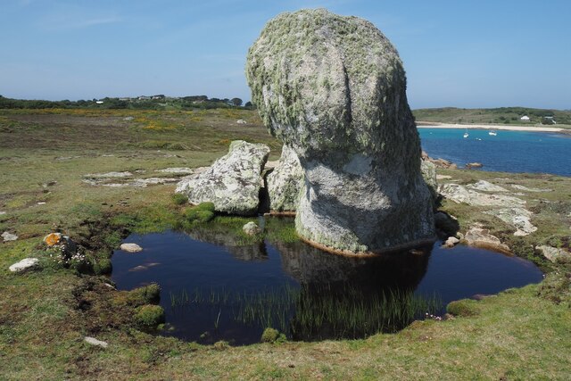
Big Pool, St Agnes A very gloomy day, so black and white looks best. This looks across the pool (part of an SSSI) towards St Agnes Lighthouse, grade II* listed <span class="nowrap"><a title="https://historicengland.org.uk/listing/the-list/list-entry/1328835?section=official-list-entry" rel="nofollow ugc noopener" href="https://historicengland.org.uk/listing/the-list/list-entry/1328835?section=official-list-entry">Link</a><img style="margin-left:2px;" alt="External link" title="External link - shift click to open in new window" src="https://s1.geograph.org.uk/img/external.png" width="10" height="10"/></span> . The gabled house, "quarters for lighthouse and coastguard staff", is also listed <span class="nowrap"><a title="https://historicengland.org.uk/listing/the-list/list-entry/1218288?section=official-list-entry" rel="nofollow ugc noopener" href="https://historicengland.org.uk/listing/the-list/list-entry/1218288?section=official-list-entry">Link</a><img style="margin-left:2px;" alt="External link" title="External link - shift click to open in new window" src="https://s1.geograph.org.uk/img/external.png" width="10" height="10"/></span> .
Big Pool, St Agnes Credit: Derek Harper

Middle Town is a charming village located in the county of Cornwall, England. Situated amidst rolling green hills and picturesque landscapes, it is a popular destination for both locals and tourists alike. The village is nestled in the heart of Cornwall, making it an ideal base for exploring the surrounding areas.

One of the standout features of Middle Town is its rich history. Dating back to the medieval era, the village is home to several well-preserved historic buildings, including a 13th-century church and a quaint village square. The architecture showcases the traditional Cornish style, with stone cottages and thatched roofs adding to its timeless appeal.

In terms of amenities, Middle Town offers a range of facilities to cater to residents and visitors. There are cozy pubs and tea rooms where one can relax and enjoy a traditional Cornish cream tea, as well as a handful of local shops selling locally sourced produce and crafts. The village also boasts a primary school, a community center, and a small library, providing a close-knit community atmosphere.

Nature enthusiasts will be delighted by the natural beauty that surrounds Middle Town. The village is located near the coast, offering easy access to stunning beaches and rugged cliffs. Additionally, there are plenty of walking trails and countryside paths for those looking to explore the area on foot.

Overall, Middle Town is a tranquil and idyllic village, perfect for those seeking a peaceful retreat in the heart of Cornwall. Its historical charm, natural beauty, and warm community spirit make it a place worth exploring.

If you have any feedback on the listing, please let us know in the comments section below.

Middle Town Images

Images are sourced within 2km of 49.892152/-6.3443622 or Grid Reference SV8808. Thanks to Geograph Open Source API. All images are credited.

Big Pool, St Agnes A very gloomy day, so black and white looks best. This looks across the pool (part of an SSSI) towards St Agnes Lighthouse, grade II* listed <span class="nowrap"><a title="https://historicengland.org.uk/listing/the-list/list-entry/1328835?section=official-list-entry" rel="nofollow ugc noopener" href="https://historicengland.org.uk/listing/the-list/list-entry/1328835?section=official-list-entry">Link</a><img style="margin-left:2px;" alt="External link" title="External link - shift click to open in new window" src="https://s1.geograph.org.uk/img/external.png" width="10" height="10"/></span> . The gabled house, "quarters for lighthouse and coastguard staff", is also listed <span class="nowrap"><a title="https://historicengland.org.uk/listing/the-list/list-entry/1218288?section=official-list-entry" rel="nofollow ugc noopener" href="https://historicengland.org.uk/listing/the-list/list-entry/1218288?section=official-list-entry">Link</a><img style="margin-left:2px;" alt="External link" title="External link - shift click to open in new window" src="https://s1.geograph.org.uk/img/external.png" width="10" height="10"/></span> .
Big Pool, St Agnes
A very gloomy day, so black and white looks best. This looks across the pool (part of an SSSI) towards St Agnes Lighthouse, grade II* listed LinkExternal link . The gabled house, "quarters for lighthouse and coastguard staff", is also listed LinkExternal link .
Troy Town Maze, St Agnes Part of a Schedule Monument; <span class="nowrap"><a title="https://historicengland.org.uk/listing/the-list/list-entry/1015697?section=official-list-entry" rel="nofollow ugc noopener" href="https://historicengland.org.uk/listing/the-list/list-entry/1015697?section=official-list-entry">Link</a><img style="margin-left:2px;" alt="External link" title="External link - shift click to open in new window" src="https://s1.geograph.org.uk/img/external.png" width="10" height="10"/></span> contains a long description and discussion of the maze. "Local tradition maintains that the maze was originally laid out in 1729 by Amor Clarke, a keeper of the St Agnes lighthouse ... no other pre-20th century British mazes share the cobble-defined construction of this type of pattern". The rocks shown at <a href="https://www.geograph.org.uk/photo/819497">SV8707 : Carn on Castella Down</a> feature beyond.
Troy Town Maze, St Agnes
Part of a Schedule Monument; LinkExternal link contains a long description and discussion of the maze. "Local tradition maintains that the maze was originally laid out in 1729 by Amor Clarke, a keeper of the St Agnes lighthouse ... no other pre-20th century British mazes share the cobble-defined construction of this type of pattern". The rocks shown at SV8707 : Carn on Castella Down feature beyond.
Porth Conger from St Agnes In the foreground is the slipway in front of the Turk's Head. On the left is Porthconger Quay. Gugh is across the bay, with Tol Tuppens <a href="https://www.geograph.org.uk/photo/3451948">SV8808 : Tol Tuppens</a> prominent, and St Mary's is in the distance.
Porth Conger from St Agnes
In the foreground is the slipway in front of the Turk's Head. On the left is Porthconger Quay. Gugh is across the bay, with Tol Tuppens SV8808 : Tol Tuppens prominent, and St Mary's is in the distance.
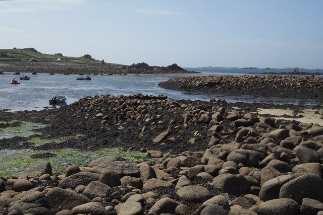
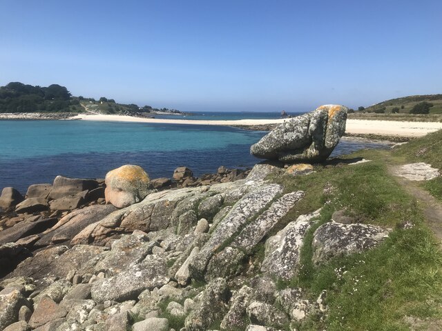
Isthmus connecting St Agnes to Gugh With the head of Porth Conger. The isthmus is covered at high tide.
Isthmus connecting St Agnes to Gugh
With the head of Porth Conger. The isthmus is covered at high tide.
Kittern Rock, Gugh An impressive granite rock pile, reminiscent of Dartmoor tors, at the northern end of the island.
Kittern Rock, Gugh
An impressive granite rock pile, reminiscent of Dartmoor tors, at the northern end of the island.
Towards Porth Conger from Gugh Looking left from <a href="https://www.geograph.org.uk/photo/7763308">SV8808 : Kittern Rock, Gugh</a>.  On the right is Tol Tuppens. Across the natural harbour of Porth Conger is St Agnes, its lighthouse prominent on the left. The Turk's Head pub is the white building.
Towards Porth Conger from Gugh
Looking left from SV8808 : Kittern Rock, Gugh. On the right is Tol Tuppens. Across the natural harbour of Porth Conger is St Agnes, its lighthouse prominent on the left. The Turk's Head pub is the white building.
Field with prehistoric cairn and field system To the east of Barnaby Lane, which runs just over the wall on the right.

Scheduled Monument List Entry Number:1015002  <span class="nowrap"><a title="https://historicengland.org.uk/listing/the-list/list-entry/1015002?section=official-list-entry" rel="nofollow ugc noopener" href="https://historicengland.org.uk/listing/the-list/list-entry/1015002?section=official-list-entry">Link</a><img style="margin-left:2px;" alt="External link" title="External link - shift click to open in new window" src="https://s1.geograph.org.uk/img/external.png" width="10" height="10"/></span>
Field with prehistoric cairn and field system
To the east of Barnaby Lane, which runs just over the wall on the right. Scheduled Monument List Entry Number:1015002 LinkExternal link
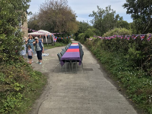
Table laid-out for the St Agnes Coronation Street Party The “street” in this case is Old Lane.  No traffic order is required to close the road here! The Island Hall on the left had tables groaning under the weight of many cakes and other treats.
Table laid-out for the St Agnes Coronation Street Party
The “street” in this case is Old Lane. No traffic order is required to close the road here! The Island Hall on the left had tables groaning under the weight of many cakes and other treats.
Remains of a 19th century gig-shed On the north east edge of Per Askin. 

Of all the islands St Agnes as it is the most south westerly was in the best-placed to spot incoming vessels and launch a pilot-gig . Per Askin at the south west of the island would further increase the chance of getting a pilot aboard first. St Agnes pilots (typically named Hicks)  would then guide the ships as far as Bristol or the south coast ports. A major source of income for the Island throughout the 19th century.

A Scheduled Monument List Entry Number:1009280 <span class="nowrap"><a title="https://historicengland.org.uk/listing/the-list/list-entry/1009280?section=official-list-entry" rel="nofollow ugc noopener" href="https://historicengland.org.uk/listing/the-list/list-entry/1009280?section=official-list-entry">Link</a><img style="margin-left:2px;" alt="External link" title="External link - shift click to open in new window" src="https://s1.geograph.org.uk/img/external.png" width="10" height="10"/></span>
Remains of a 19th century gig-shed
On the north east edge of Per Askin. Of all the islands St Agnes as it is the most south westerly was in the best-placed to spot incoming vessels and launch a pilot-gig . Per Askin at the south west of the island would further increase the chance of getting a pilot aboard first. St Agnes pilots (typically named Hicks) would then guide the ships as far as Bristol or the south coast ports. A major source of income for the Island throughout the 19th century. A Scheduled Monument List Entry Number:1009280 LinkExternal link
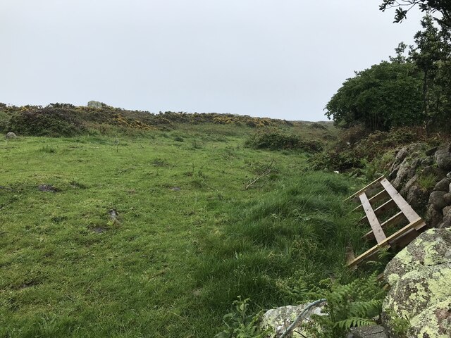
A stile to Browarth A tad more conventional than 15 years ago <a href="https://www.geograph.org.uk/photo/827432">SV8708 : Crate Based Stile</a>.
A stile to Browarth
A tad more conventional than 15 years ago SV8708 : Crate Based Stile.
Two post-medieval quays These quays are believed to have been built to land coal for the St Agnes lighthouse.

For more details see the details on their Historic England listing:
List Entry Number:1016512. <span class="nowrap"><a title="https://historicengland.org.uk/listing/the-list/list-entry/1016512?section=official-list-entry" rel="nofollow ugc noopener" href="https://historicengland.org.uk/listing/the-list/list-entry/1016512?section=official-list-entry">Link</a><img style="margin-left:2px;" alt="External link" title="External link - shift click to open in new window" src="https://s1.geograph.org.uk/img/external.png" width="10" height="10"/></span>

The named quay “Uncle Tom’s Quay” is the more eroded of the two but can still be discerned to the right of the picture surmounted by a herring gull.
Two post-medieval quays
These quays are believed to have been built to land coal for the St Agnes lighthouse. For more details see the details on their Historic England listing: List Entry Number:1016512. LinkExternal link The named quay “Uncle Tom’s Quay” is the more eroded of the two but can still be discerned to the right of the picture surmounted by a herring gull.
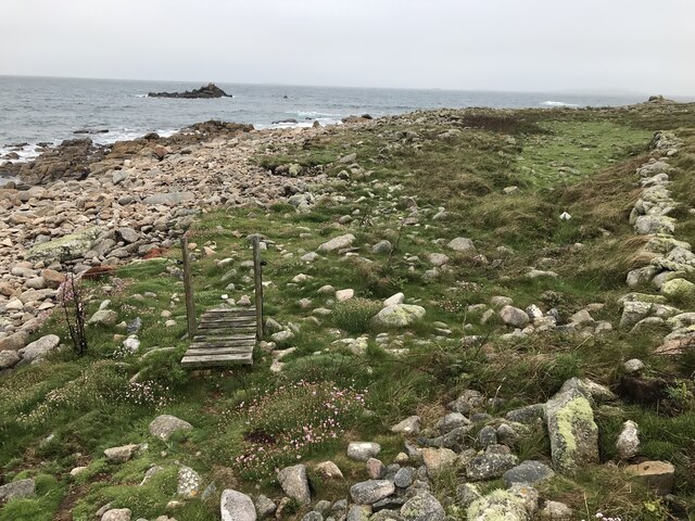
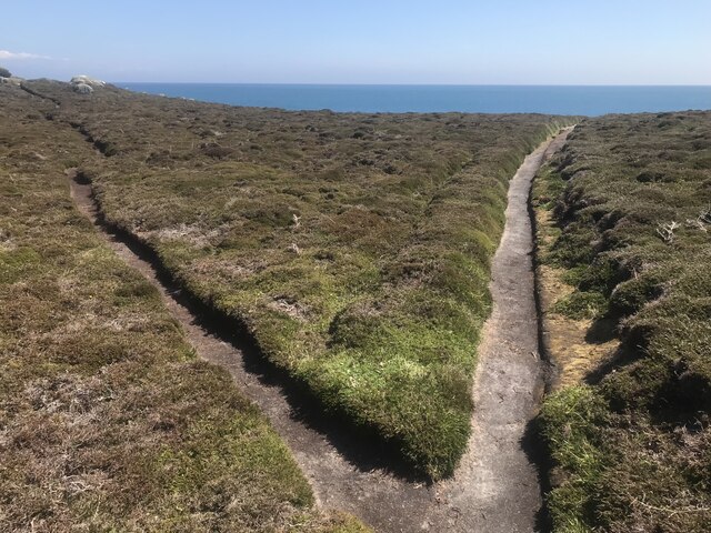
A fork in the path Compare with <a href="https://www.geograph.org.uk/photo/821812">SV8908 : A Fork in the Path</a> taken by me one day short of fifteen years ago.
A fork in the path
Compare with SV8908 : A Fork in the Path taken by me one day short of fifteen years ago.
The Bar from Gugh A picture postcard scene, but a must to take on a walk around Hoe point today
The Bar from Gugh
A picture postcard scene, but a must to take on a walk around Hoe point today
Sunrise over Gugh
Sunrise over Gugh
Sunrise over Penninis Glad I decided to walk this way this morning.
Sunrise over Penninis
Glad I decided to walk this way this morning.
Crooked Rock One of the named granite outcrops on Wingletang.
Crooked Rock
One of the named granite outcrops on Wingletang.
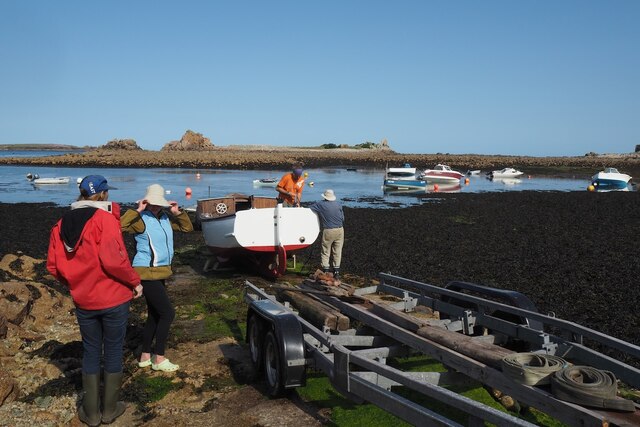
Refloating Elvera This small launch is probably about 90 years old now.

It's spent the winter in a nearby field undergoing "months of work" according to its owner (on the right of the picture standing on the slipway.)

I expressed surprise that they had towed it down at such a low tide "You are going to let the tide float her?" "Yes, she's full of leaks".
Refloating Elvera
This small launch is probably about 90 years old now. It's spent the winter in a nearby field undergoing "months of work" according to its owner (on the right of the picture standing on the slipway.) I expressed surprise that they had towed it down at such a low tide "You are going to let the tide float her?" "Yes, she's full of leaks".
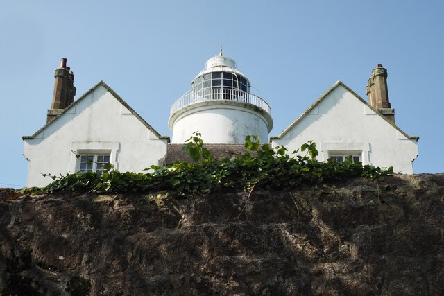
The St Agnes Lighthouse and attached house From Old lane.

The lighthouse is both a Grade II* listed building List Entry Number:1328835 <span class="nowrap"><a title="https://historicengland.org.uk/listing/the-list/list-entry/1328835" rel="nofollow ugc noopener" href="https://historicengland.org.uk/listing/the-list/list-entry/1328835">Link</a><img style="margin-left:2px;" alt="External link" title="External link - shift click to open in new window" src="https://s1.geograph.org.uk/img/external.png" width="10" height="10"/></span>

and a Scheduled Monument List Entry Number:1014999 <span class="nowrap"><a title="https://historicengland.org.uk/listing/the-list/list-entry/1014999?section=official-list-entry" rel="nofollow ugc noopener" href="https://historicengland.org.uk/listing/the-list/list-entry/1014999?section=official-list-entry">Link</a><img style="margin-left:2px;" alt="External link" title="External link - shift click to open in new window" src="https://s1.geograph.org.uk/img/external.png" width="10" height="10"/></span>

The house is Grade II List Entry Number:1218288 <span class="nowrap"><a title="https://historicengland.org.uk/listing/the-list/list-entry/1218288" rel="nofollow ugc noopener" href="https://historicengland.org.uk/listing/the-list/list-entry/1218288">Link</a><img style="margin-left:2px;" alt="External link" title="External link - shift click to open in new window" src="https://s1.geograph.org.uk/img/external.png" width="10" height="10"/></span>
The St Agnes Lighthouse and attached house
From Old lane. The lighthouse is both a Grade II* listed building List Entry Number:1328835 LinkExternal link and a Scheduled Monument List Entry Number:1014999 LinkExternal link The house is Grade II List Entry Number:1218288 LinkExternal link
Show me another place!

Middle Town is located at Grid Ref: SV8808 (Lat: 49.892152, Lng: -6.3443622)

Division: Isles of Scilly

Unitary Authority: Isles of Scilly

Police Authority: Devon and Cornwall

What 3 Words

///tortoises.clearly.generated. Near St Agnes, Isles of Scilly

Related Wikis

Middle Town, St Agnes

Middle Town (Cornish: Tregres) is a small settlement on the island of St Agnes. It includes the island's primary school, post office and general store...

St Agnes, Isles of Scilly

St Agnes (Cornish: Agenys) is the southernmost populated island of the Isles of Scilly. Thus the island's Troy Town Farm is the southernmost settlement...

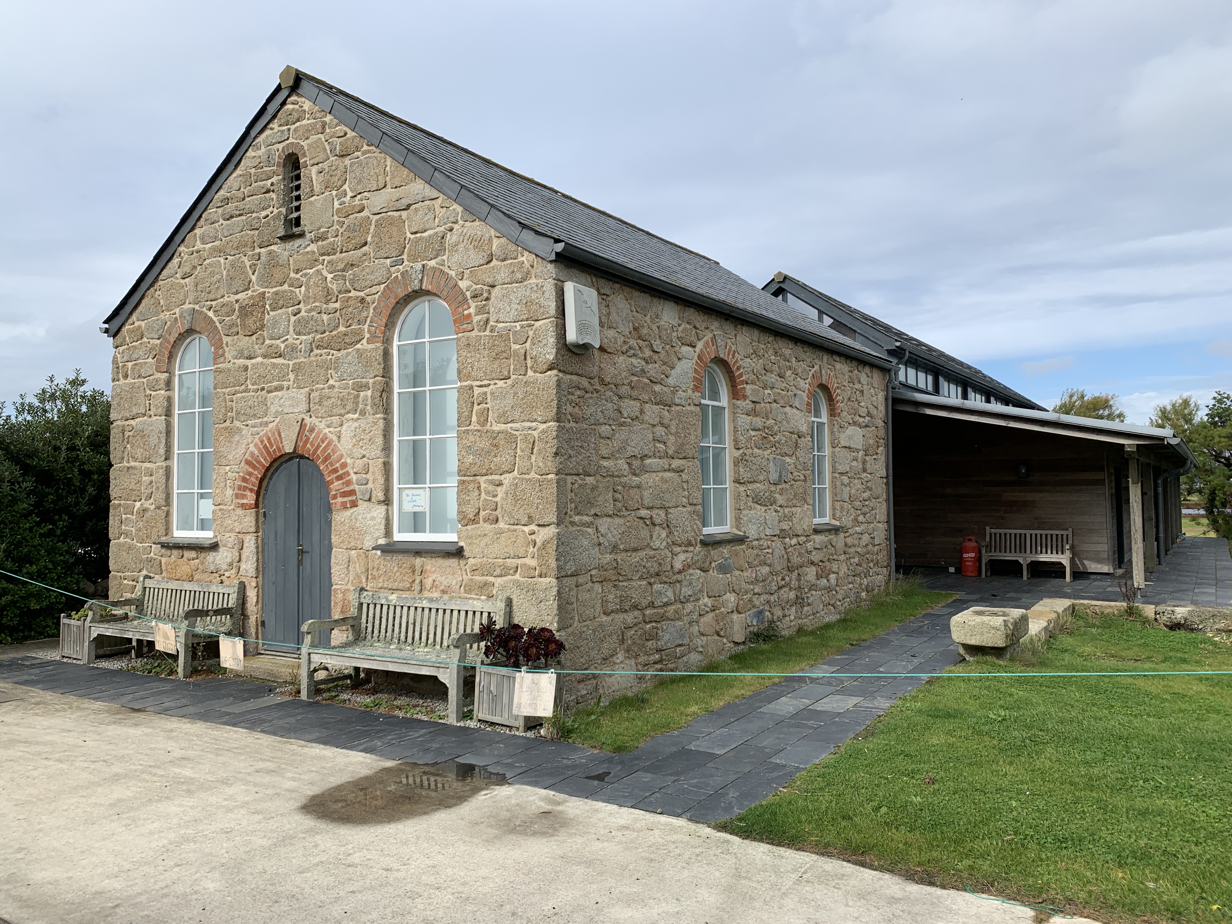
Bible Christian Chapel, St Agnes, Isles of Scilly

The Bible Christian Chapel, St Agnes was a Bible Christian chapel in St Agnes, Isles of Scilly. == History == Bible Christians arrived in St Agnes in the...

St Agnes Lifeboat Station, Isles of Scilly

St Agnes' Lifeboat Station was situated in St Agnes, Isles of Scilly and provided a service for the Royal National Lifeboat Institution from 1890 to 1920...

Nearby Amenities

Located within 500m of 49.892152,-6.3443622
Toilets
Fee: no
Lat/Long: 49.895688/-6.3411872
Cafe
Covean Cottage Tea Rooms
Lat/Long: 49.8932384/-6.3400941
Post Box
Collection Times: Mo-Fr 13:00
Operator: Royal Mail
Operator Wikidata: Q638098
Post Box Mounting: building
Post Box Type: lamp
Ref: TR22 227
Royal Cypher: EIIR
Royal Cypher Wikidata: Q33102113
Source: aerial imagery;survey
Lat/Long: 49.8920919/-6.3431299
Telephone
Booth: K6
Covered: booth
Listed Status: Grade II
Phone: +44 1720 422379
Wikidata: Q26580093
Lat/Long: 49.8921282/-6.3442963
Barrier: stile
Lat/Long: 49.8900645/-6.3454829
Source: PGS
Lat/Long: 49.8909082/-6.3392335
Leisure: slipway
Lat/Long: 49.8953618/-6.3406749
Higher Town
Name Kw: Trewartha
Place: hamlet
Lat/Long: 49.8930362/-6.3408489
Middle Town
Name Kw: Tregres
Place: hamlet
Wikidata: Q38250904
Wikipedia: en:Middle Town, St Agnes
Lat/Long: 49.8921676/-6.3444979
Lower Town
Name Kw: Trewoles
Place: hamlet
Lat/Long: 49.8936983/-6.3483912
Porth Killier
Natural: bay
Lat/Long: 49.8964004/-6.3445415
St Warna's Cove
Natural: bay
Lat/Long: 49.889341/-6.346621
Troy Town
Place: locality
Lat/Long: 49.8909518/-6.3509384
Post Office
St Agnes Post Office
Addr Postcode: TR22 0PL
Brand: Post Office
Brand Wikidata: Q1783168
Opening Hours: Mo-Fr 09:00-12:00,13:00-17:00; Sa 09:00-12:30
Ref Pol Id: 14061
Website: https://www.postoffice.co.uk/branch-finder/375555x/st-agnes
Lat/Long: 49.892019/-6.3431473
Downs
Place: hamlet
Lat/Long: 49.8916649/-6.3467758
Tourism: picnic_site
Lat/Long: 49.8959209/-6.3412625
Cafe
Coastguards Lookout
Addr Country: GB
Addr Hamlet: St Agnes
Addr Postcode: TR22 0PL
Addr State: Isles Of Scilly
Addr Suburb: Downs
Fhrs Id: 810772
Lat/Long: 49.8913418/-6.3470014
Generator Method: photovoltaic
Generator Output Electricity: yes
Generator Source: solar
Generator Type: solar_photovoltaic_panel
Location: roof
Power: generator
Lat/Long: 49.8909337/-6.3503521
Generator Method: photovoltaic
Generator Output Electricity: yes
Generator Source: solar
Generator Type: solar_photovoltaic_panel
Location: roof
Power: generator
Lat/Long: 49.8925842/-6.3439098
Generator Method: photovoltaic
Generator Output Electricity: yes
Generator Source: solar
Generator Type: solar_photovoltaic_panel
Location: roof
Power: generator
Lat/Long: 49.8908091/-6.3507817
Generator Method: photovoltaic
Generator Output Electricity: yes
Generator Source: solar
Generator Type: solar_photovoltaic_panel
Location: roof
Power: generator
Lat/Long: 49.8919656/-6.3468066
Generator Method: photovoltaic
Generator Output Electricity: yes
Generator Source: solar
Generator Type: solar_photovoltaic_panel
Location: roof
Power: generator
Lat/Long: 49.8916486/-6.3435128
Generator Method: photovoltaic
Generator Output Electricity: yes
Generator Source: solar
Generator Type: solar_photovoltaic_panel
Location: roof
Power: generator
Lat/Long: 49.891868/-6.3441412
Barrier: stile
Lat/Long: 49.888942/-6.3448969
St Warna's Well
Natural: spring
Lat/Long: 49.8888322/-6.344876
Generator Method: photovoltaic
Generator Output Electricity: yes
Generator Source: solar
Generator Type: solar_photovoltaic_panel
Location: outdoor
Power: generator
Lat/Long: 49.8920861/-6.3473596
The Nag's Head
Natural: rock
Lat/Long: 49.8899472/-6.3482662
Direction: S
Generator Method: photovoltaic
Generator Output Electricity: yes
Generator Source: solar
Generator Type: solar_photovoltaic_panel
Location: roof
Power: generator
Lat/Long: 49.8918423/-6.3435019
Leisure: slipway
Lat/Long: 49.8953011/-6.3405738
Blanket Bay
Natural: bay
Source: OS Open Names
Lat/Long: 49.8944165/-6.3503431
Barrier: cattle_grid
Foot: yes
Motor Vehicle: no
Wheelchair: no
Lat/Long: 49.8932929/-6.3493042
The data included in this document is from www.openstreetmap.org. The data is made available under ODbL.

Have you been to Middle Town?

Leave your review of Middle Town below (or comments, questions and feedback).