Middle Skyreholme

Settlement in Yorkshire Craven

England

Middle Skyreholme

Sheep dip below Howgill Lane The facility is variously referred to on maps as 'sheep dip' or 'sheep wash'; the water presumably comes from the stream causing the boggy surface in the foreground.
Sheep dip below Howgill Lane Credit: Stephen Craven

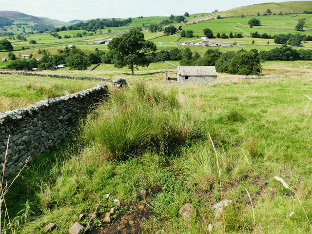
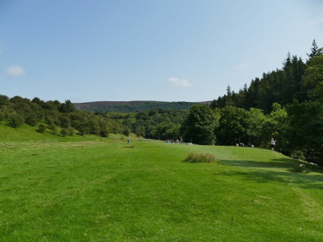
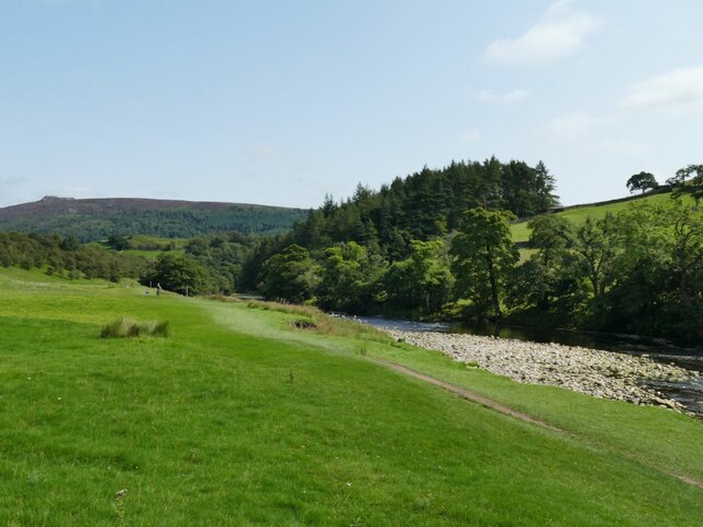
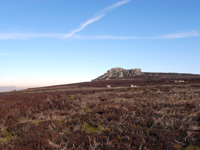
Middle Skyreholme is a small village located in the Yorkshire Dales National Park in Yorkshire, England. Situated in the Craven district, it is nestled amidst picturesque landscapes and is renowned for its natural beauty. The village is surrounded by rolling hills, green pastures, and meandering rivers, offering a tranquil and idyllic setting.

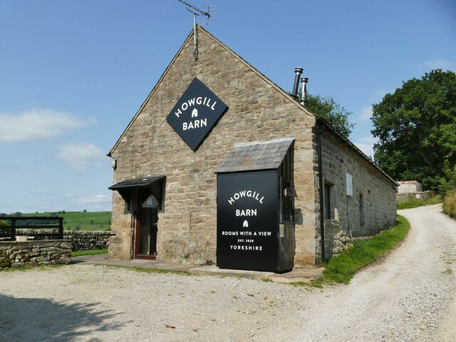
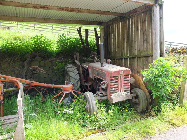
One of the notable features of Middle Skyreholme is its traditional stone-built houses and buildings, which add to the village's charm and character. The local community primarily relies on agriculture, with sheep farming being a prominent occupation in the area.

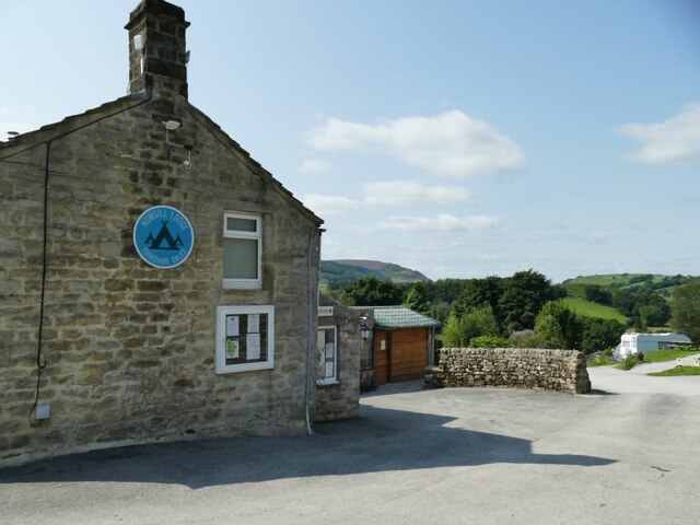
The village is also home to a small but tight-knit community, known for their friendliness and welcoming nature. There are a few amenities available in Middle Skyreholme, including a local pub and a village hall, where residents gather for social events and community activities.

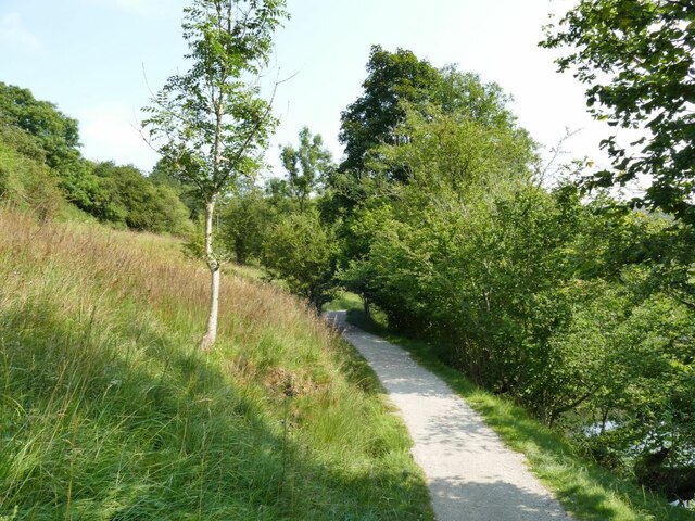
For outdoor enthusiasts, Middle Skyreholme offers ample opportunities for exploring the surrounding natural beauty. The village is situated near popular hiking trails, such as the Malham Cove and Gordale Scar, which attract visitors from all over the country. These natural landmarks provide breathtaking views and are perfect for avid walkers and nature lovers.

Overall, Middle Skyreholme is a quintessential Yorkshire village with its stunning landscapes, traditional architecture, and tight-knit community. It offers a peaceful retreat for those seeking a break from the hustle and bustle of city life, while also being a gateway to the magnificent Yorkshire Dales.

If you have any feedback on the listing, please let us know in the comments section below.

Middle Skyreholme Images

Images are sourced within 2km of 54.042481/-1.897009 or Grid Reference SE0660. Thanks to Geograph Open Source API. All images are credited.

Sheep dip below Howgill Lane The facility is variously referred to on maps as 'sheep dip' or 'sheep wash'; the water presumably comes from the stream causing the boggy surface in the foreground.
Sheep dip below Howgill Lane
The facility is variously referred to on maps as 'sheep dip' or 'sheep wash'; the water presumably comes from the stream causing the boggy surface in the foreground.
Howgill Barn Now holiday accommodation.
Howgill Barn
Now holiday accommodation.
Howgill Lodge Holiday accommodation with adjacent caravan and camp site.
Howgill Lodge
Holiday accommodation with adjacent caravan and camp site.
Bridge on Stangs Lane The bridge takes the lane over Fir Beck.
Bridge on Stangs Lane
The bridge takes the lane over Fir Beck.
New planting below Knowles Lodge Alongside the public footpath.
New planting below Knowles Lodge
Alongside the public footpath.
Rapids on the Wharfe below Haugh Wood There wasn't much water in the river at this time, it would be more impressive after heavy rain.
Rapids on the Wharfe below Haugh Wood
There wasn't much water in the river at this time, it would be more impressive after heavy rain.
Entering Haugh Wood from the west The path is part of the Dales Way.
Entering Haugh Wood from the west
The path is part of the Dales Way.
Picnic site by the Wharfe A fairly flat field, a short walk from Appletreewick village or the nearby caravan site, made a suitable picnic site for several families.
Picnic site by the Wharfe
A fairly flat field, a short walk from Appletreewick village or the nearby caravan site, made a suitable picnic site for several families.
Gravel bank in the Wharfe Fairly low flow in the river exposed this gravel bank. The path forms part of the Dales Way.
Gravel bank in the Wharfe
Fairly low flow in the river exposed this gravel bank. The path forms part of the Dales Way.
Simon's Seat
Simon's Seat
Barn at Haugh Mill Farm
Old tractor at Haugh Mill Farm
Former chapel near Howgill This former Primitive Methodist chapel was erected in 1836. It closed in the 1990s and was converted into a house: <span class="nowrap"><a title="https://www.myprimitivemethodists.org.uk/content/chapels/yorkshire/hi-hy/howgill_barden_pm_chapel_north_yorkshire" rel="nofollow ugc noopener" href="https://www.myprimitivemethodists.org.uk/content/chapels/yorkshire/hi-hy/howgill_barden_pm_chapel_north_yorkshire">Link</a><img style="margin-left:2px;" alt="External link" title="External link - shift click to open in new window" src="https://s1.geograph.org.uk/img/external.png" width="10" height="10"/></span>
Former chapel near Howgill
This former Primitive Methodist chapel was erected in 1836. It closed in the 1990s and was converted into a house: LinkExternal link
Rapids on the River Wharfe
Simon's Seat from Parcevall Hall A view from just over a mile away across the valley.
Simon's Seat from Parcevall Hall
A view from just over a mile away across the valley.
Troller's Ghyll Looking North, up the Ghyll which is an old dried up river gorge left over from the last ice age.
Troller's Ghyll
Looking North, up the Ghyll which is an old dried up river gorge left over from the last ice age.
Above Trollers Ghyll Looking north, the valley which will become Trollers Ghyll is beginning to form.
Above Trollers Ghyll
Looking north, the valley which will become Trollers Ghyll is beginning to form.
Skyreholme Beck This limestone gorge was thought to be the home of trolls and monsters!
Skyreholme Beck
This limestone gorge was thought to be the home of trolls and monsters!
Show me another place!

Middle Skyreholme is located at Grid Ref: SE0660 (Lat: 54.042481, Lng: -1.897009)

Division: West Riding

Administrative County: North Yorkshire

District: Craven

Police Authority: North Yorkshire

What 3 Words

///heave.adapt.shine. Near Grassington, North Yorkshire

Related Wikis

Skyreholme

Skyreholme is a hamlet in Wharfedale in the Yorkshire Dales, North Yorkshire, England. It lies 1-mile (1.6 km) east of Appletreewick, in the small side...

Parcevall Hall

Parcevall Hall -- also known as Parceval Hall -- and its gardens are located at Skyreholme near Appletreewick village, Wharfedale, North Yorkshire, England...
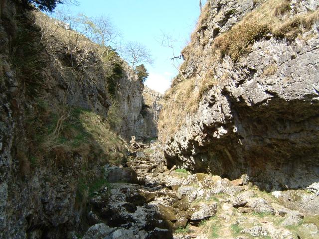
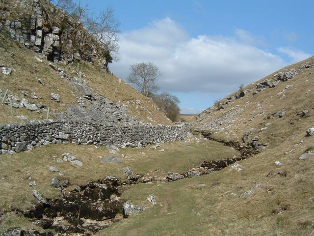
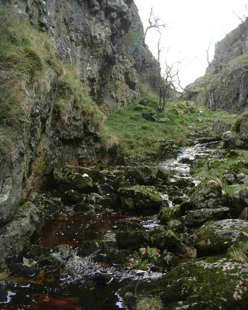
Trollers Gill

Trollers Gill is a limestone gill or gorge in North Yorkshire, England, close to the village of Skyreholme and 4.7 miles (7.5 km) south-east of Grassington...
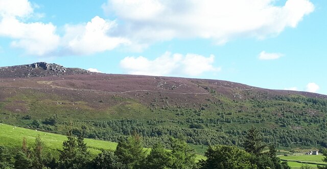
Simon's Seat

Simon's Seat is a peak in the Yorkshire Dales in northern England. It is a prominent outcrop of millstone grit on the eastern side of Wharfedale. Although...

Nearby Amenities

Located within 500m of 54.042481,-1.897009
Skyreholme
Is In: UK, England, North Yorkshire, Wharfedale, Yorkshire Dales
Is In County: North Yorkshire
Is In Historic County: Yorkshire
Is In Municipality: Craven
Place: village
Website: https://skyreholme.org/
Wikidata: Q55908973
Wikipedia: en:Skyreholme
Lat/Long: 54.0395376/-1.9009715
High Skyreholme
Is In: UK, England, North Yorkshire, Wharfedale, Yorkshire Dales
Place: hamlet
Lat/Long: 54.0432339/-1.8903646
Natural: spring
Source: OS 1:25k
Lat/Long: 54.0441549/-1.9039799
Skyreholme Mill
Archaeological Site: industrial
Description: Former C19th water-powered cotton/calico mill fed by aqueduct over the road
Historic: archaeological_site
Source: OS sheet 151,1853
Lat/Long: 54.0391822/-1.9011995
Shop: gift
Source: survey
Lat/Long: 54.0449086/-1.8970394
Cafe
Source: survey
Lat/Long: 54.0448826/-1.8970113
Power: pole
Lat/Long: 54.0386997/-1.9001393
Power: pole
Lat/Long: 54.0390681/-1.8992641
Power: pole
Lat/Long: 54.0401302/-1.8986443
Power: pole
Lat/Long: 54.0408447/-1.8977792
Power: pole
Lat/Long: 54.0415562/-1.8969065
Power: pole
Lat/Long: 54.0417537/-1.8957378
Power: pole
Lat/Long: 54.0419409/-1.8946324
Power: pole
Lat/Long: 54.0421429/-1.893527
Power: pole
Lat/Long: 54.0423627/-1.8922799
Power: pole
Lat/Long: 54.042541/-1.8912478
Power: pole
Lat/Long: 54.0427623/-1.8899805
Power: pole
Lat/Long: 54.0382511/-1.8987986
Power: pole
Lat/Long: 54.0423939/-1.8967699
Power: pole
Lat/Long: 54.04289/-1.8971215
Power: pole
Lat/Long: 54.043551/-1.8974807
Power: pole
Lat/Long: 54.0442491/-1.8978576
Power: pole
Lat/Long: 54.0450927/-1.8983256
The data included in this document is from www.openstreetmap.org. The data is made available under ODbL.

Have you been to Middle Skyreholme?

Leave your review of Middle Skyreholme below (or comments, questions and feedback).